#geospatialintelligence search results

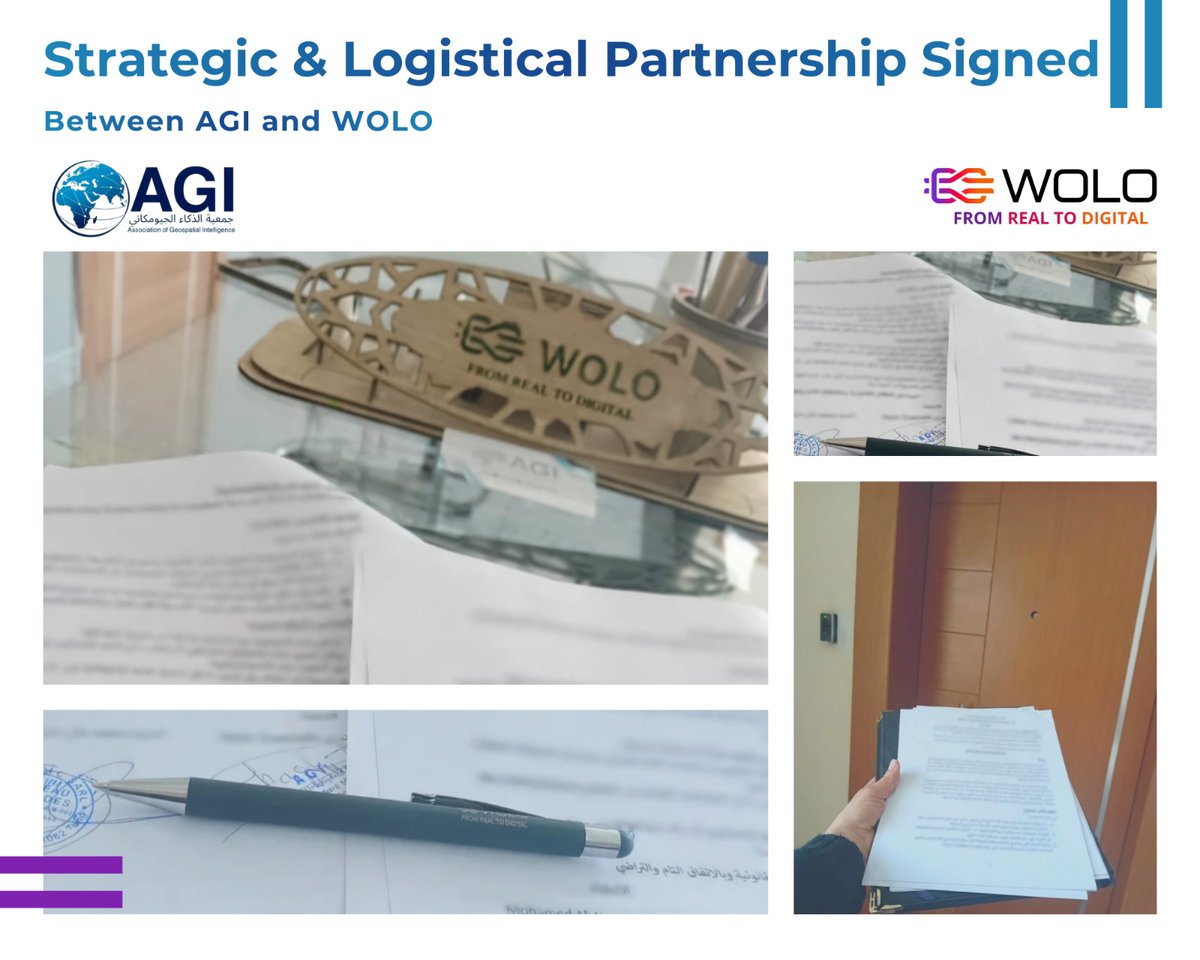
✨ Strategic & Logistical Partnership Officially Signed ✨ between AGI AND WOLO We look forward to launching our first joint activities in the coming period. #GeospatialIntelligence #GIS #DigitalGeography #Innovation #Partnership #SustainableDevelopment #GeoAI #BIM

Worldscape.ai Secures Seed Funding #AI #GeospatialIntelligence #AgenticAI #DataFabric #EnterpriseAI #SpatialAnalytics #SeedRound #Funding #Worldscape.ai thesaasnews.com/news/worldscap…


We’ve signed an MoU with @officialEFCC to deploy satellite data, geospatial analytics & spectrum monitoring in support of investigations, asset tracing, and enforcement—incl. action against illegal mining. @NASRDA_Official #NASRDA #EFCC #GeospatialIntelligence #NationalSecurity


Another massive fire is visible in satellite imagery south of Tehran. The impact appears evident in morning imagery and continues to show up in evening remote sensing datasets. #Iran #IsraeliranWar #Geospatialintelligence


Geospatial Intelligence Hackathon By @iit_tirupati & @mopr_goi bringing innovators together to build data-driven solutions for rural development & smarter governance. 📅 Apply by 24 Jan 2026 #GeospatialIntelligence #Hackathon #IITTirupati #RuralDevelopment


It’s launch day for the “Full Stream Ahead” mission. Watch $BKSY’s second Gen-3 #satellite fly to orbit via @RocketLab today at 7:57 p.m. EDT (11:57 a.m. NZT). Live feed: rocketlabcorp.com/missions/next-… #spacebasedintelligence #geospatialintelligence #GEOINT

Honoured to speak on a certificate programme of @RakshaUni on how geospatial intelligence decodes Tibet’s strategic infrastructure and its impact on India’s security. Kudos to @SICSSL_RRU & @ForFnva for a timely deep-dive and sharp exchange of ideas 🇮🇳 #GeospatialIntelligence


Heading to London for #DGI2026 next week? Connect with Jakub and Jaroslav at the QEII Centre from 23-25 February. Stop by to discuss air-gapped map servers or see @MapTiler's GeoSplats 3D tech in action. Details: dgi.wbresearch.com #GeospatialIntelligence #DigitalTwin


We were honored to host Director of National Intelligence @TulsiGabbard as a keynote speaker at the 2025 GEOINT Symposium! 📸 Picture Credit: @NGA_GEOINT #GEOINT2025 #NationalSecurity #GeospatialIntelligence #ArtificialIntelligence #Innovation #PublicService #DNI


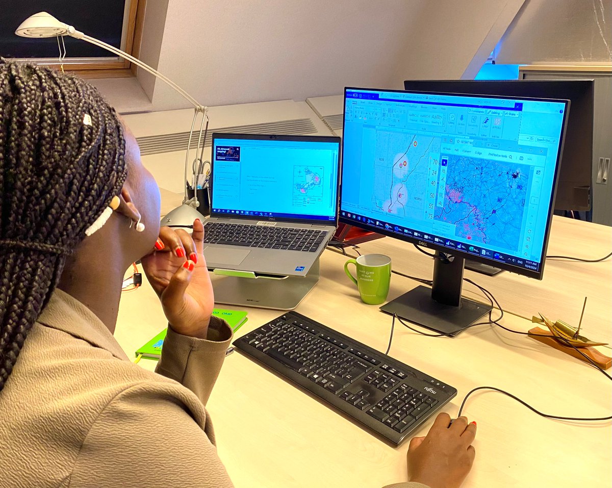
Powerline Mapping: The Foundation of Resilient Utilities Ankur Vatsal, Program Director at @Deepmatrixfly, shared how #geospatialintelligence and #AI-driven inspections are transforming the way utilities manage powerlines. Facing aging infrastructure, extreme weather, compliance


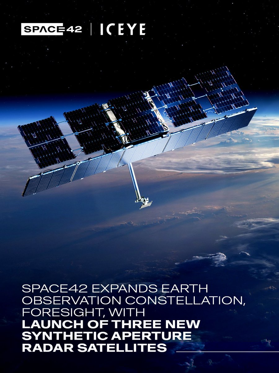
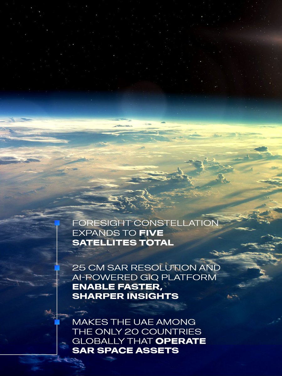
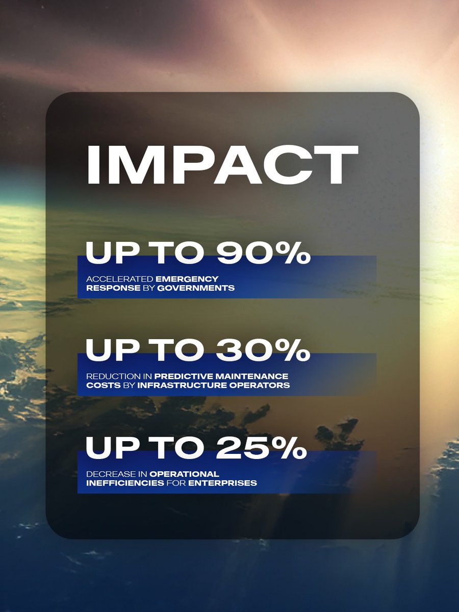
The launch of Foresight-3, Foresight-4, and Foresight-5 into Low Earth Orbit (LEO) marks another step forward in delivering decision-grade #geospatialintelligence to governments, industries, and partners worldwide.
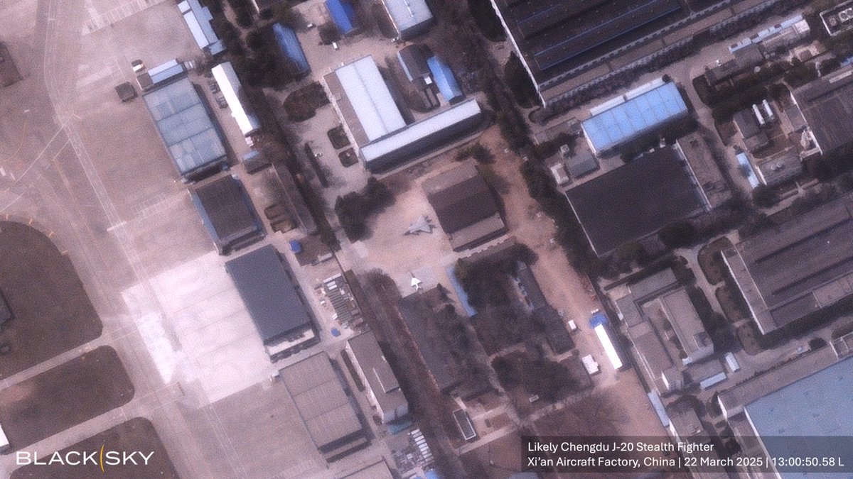
BlackSky's Gen-3 satellite captured what is likely a Chengdu J-20 Stealth Fighter at the Xi’an Aircraft Factory in China this weekend. Check out more images from the factory in the thread. #spacebasedintelligence #gen3 #geospatialintelligence

🔍🌏 Discover why Synthetic Aperture Radar (SAR) data is crucial for surveillance in the Asia-Pacific region! 🌧️🛰️ #GeospatialIntelligence #SAR #Taiwan #GlobalSecurity #Semiconductors #GeoOwl @NGA_GEOINT @umbraspace

Geospatial intelligence is rapidly becoming a core strategic asset for modern businesses — enabling smarter decision-making, real-time insights. Read this full article by: Amit Sharma, @MatrixGeoSol. #GeospatialIntelligence #electronicsnews #technologynews timestech.in/geospatial-int…


Geospatial Innovations Podcast - Episode 3 The Evolution of Geospatial Technologies #geoint #geospatialintelligence #evolution #technology #GIS #geospatial #intelligence youtu.be/dgXSZj0y1WM?si…

youtube.com
YouTube
Geospatial Innovations Podcast - Episode 3 The Evolution of Geospat...
Geospatial Innovations Podcast - Episode 5 - National Security and Defense #geoint #geospatialintelligence #security #defense #terrorism #operations #satellites #drones #science youtu.be/TCv5F55DMeI?si…

youtube.com
YouTube
Geospatial Innovations Podcast - Episode 5 - National Security and...

Next up at #nrf2023 we have Nextbillion talking about ##geospatialintelligence at the @msft4startups showcase #startups

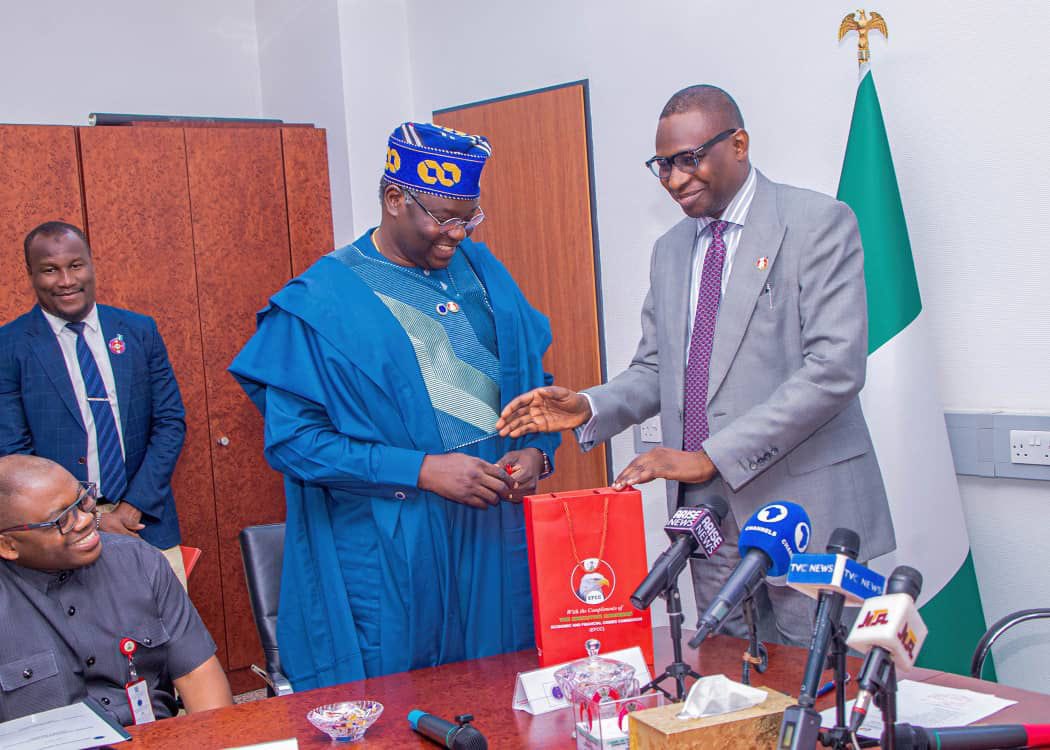
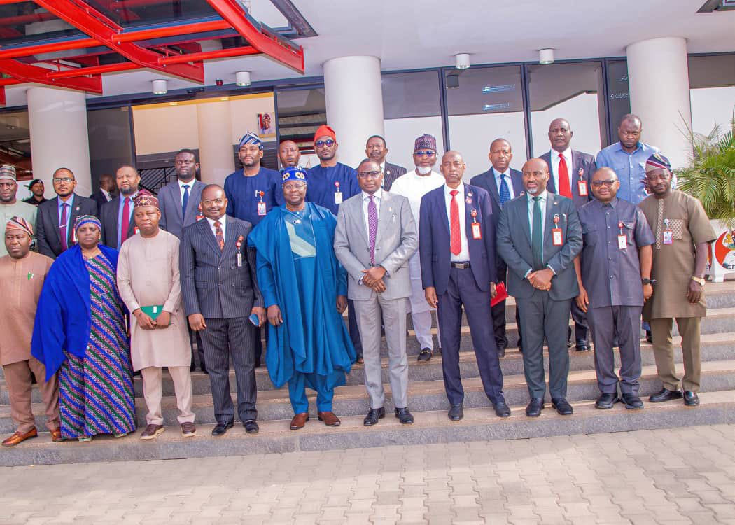
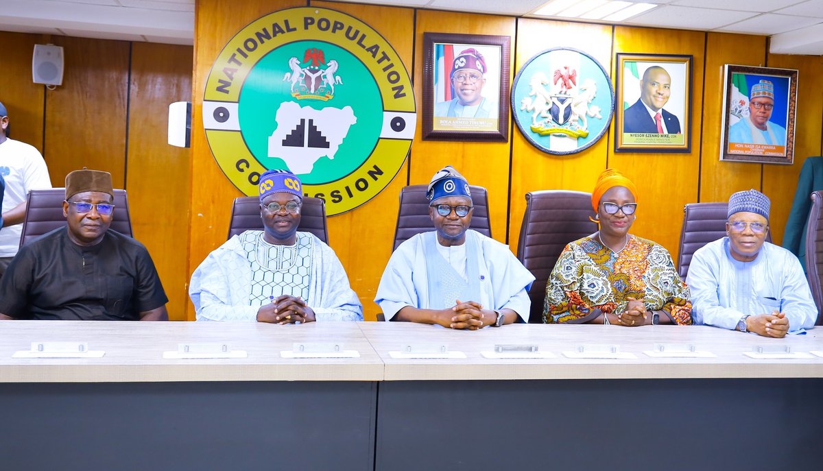
Accurate data builds nations. @NASRDA_Official stands ready to support @natpopcom with satellite data, geospatial intelligence & trained personnel for Nigeria’s most accurate census yet — targeting 98% precision. #NigeriaCensus #GeospatialIntelligence


NPC AND NASRDA FORGE PARTNERSHIP FOR UPCOMING CENSUS Today, the NPC Chairman, Hon. Nasir Isa Kwarra, received in audience the Director-General of National Space Research and Development Agency (NASRDA), Dr. Matthew Olumide Adepoju, and his management team at the NPC HQ in Abuja.


The GEOINT Symposium is just around the corner! Make sure to stop by BOOTH 737 to meet with our team! 🌎🦉 #geoint #geoint2024 #geospatialintelligence #geointsymposium @USGIF


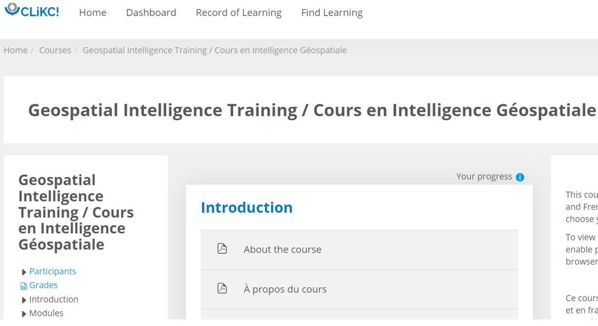
GEOINT e-learning launched on CLiKC! 🔗 wcoomd.org/en/media/newsr… #WCO #Customs #GeospatialIntelligence #GEOINT #eLearning #CLiKC #FragileBorders #WCOSecurityProgramme

Worldscape.ai Secures Seed Funding #AI #GeospatialIntelligence #AgenticAI #DataFabric #EnterpriseAI #SpatialAnalytics #SeedRound #Funding #Worldscape.ai thesaasnews.com/news/worldscap…
✨ Strategic & Logistical Partnership Officially Signed ✨ between AGI AND WOLO We look forward to launching our first joint activities in the coming period. #GeospatialIntelligence #GIS #DigitalGeography #Innovation #Partnership #SustainableDevelopment #GeoAI #BIM
Geospatial intelligence is rapidly becoming a core strategic asset for modern businesses — enabling smarter decision-making, real-time insights. Read this full article by: Amit Sharma, @MatrixGeoSol. #GeospatialIntelligence #electronicsnews #technologynews timestech.in/geospatial-int…

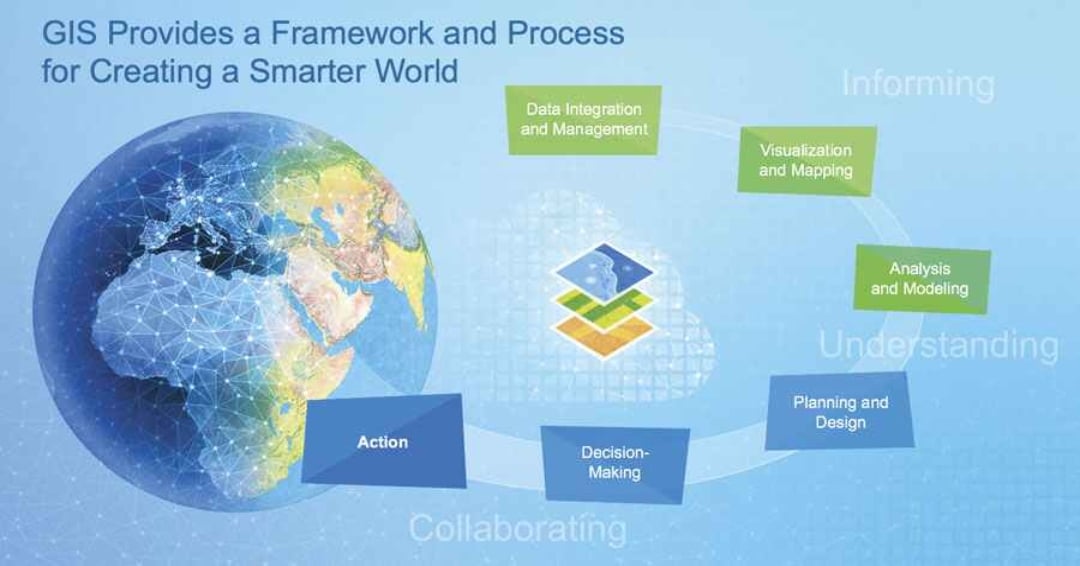
Come learn how Esri’s ArcGIS can swiftly analyze sensor and human data feeds. ArcGIS allows you to conduct enterprise analysis—correlating data while maintaining provenance—empowering confident decision-making. #JADC2 #AI #GeospatialIntelligence ow.ly/eFCp50YjEHM

Esri can deliver contextualized, decision-ready data to operations personnel to achieve desired outcomes based on your commander’s guidance and intent. ArcGIS enables integrated decision support at the speed of relevance. #JADC2 #AI #GeospatialIntelligence ow.ly/P2tj50YjEHr

Heading to London for #DGI2026 next week? Connect with Jakub and Jaroslav at the QEII Centre from 23-25 February. Stop by to discuss air-gapped map servers or see @MapTiler's GeoSplats 3D tech in action. Details: dgi.wbresearch.com #GeospatialIntelligence #DigitalTwin

Pakistan’s EO-2 satellite launch boosts indigenous space capability, strengthening disaster monitoring, agriculture intelligence and territorial observation. #GeospatialIntelligence #SpaceRace #LoveIslandAllStars #IranMassacre

solutions. Congratulations to Prof. Siddhartha Khare and Team Bhoomicam. #IITRoorkee #StartupAchievement #GeospatialIntelligence #ArtificialIntelligence #ResponsibleAI #NationalSecurity #StartupIndia #Bhoomicam #DPIIT #NCIIPC #NTRO #DeepTech #ResearchToImpact

✨ Strategic & Logistical Partnership Officially Signed ✨ between AGI AND WOLO We look forward to launching our first joint activities in the coming period. #GeospatialIntelligence #GIS #DigitalGeography #Innovation #Partnership #SustainableDevelopment #GeoAI #BIM
Another massive fire is visible in satellite imagery south of Tehran. The impact appears evident in morning imagery and continues to show up in evening remote sensing datasets. #Iran #IsraeliranWar #Geospatialintelligence
It’s launch day for the “Full Stream Ahead” mission. Watch $BKSY’s second Gen-3 #satellite fly to orbit via @RocketLab today at 7:57 p.m. EDT (11:57 a.m. NZT). Live feed: rocketlabcorp.com/missions/next-… #spacebasedintelligence #geospatialintelligence #GEOINT
Heading to London for #DGI2026 next week? Connect with Jakub and Jaroslav at the QEII Centre from 23-25 February. Stop by to discuss air-gapped map servers or see @MapTiler's GeoSplats 3D tech in action. Details: dgi.wbresearch.com #GeospatialIntelligence #DigitalTwin
Geospatial Intelligence Hackathon By @iit_tirupati & @mopr_goi bringing innovators together to build data-driven solutions for rural development & smarter governance. 📅 Apply by 24 Jan 2026 #GeospatialIntelligence #Hackathon #IITTirupati #RuralDevelopment
We’ve signed an MoU with @officialEFCC to deploy satellite data, geospatial analytics & spectrum monitoring in support of investigations, asset tracing, and enforcement—incl. action against illegal mining. @NASRDA_Official #NASRDA #EFCC #GeospatialIntelligence #NationalSecurity
Honoured to speak on a certificate programme of @RakshaUni on how geospatial intelligence decodes Tibet’s strategic infrastructure and its impact on India’s security. Kudos to @SICSSL_RRU & @ForFnva for a timely deep-dive and sharp exchange of ideas 🇮🇳 #GeospatialIntelligence
Powerline Mapping: The Foundation of Resilient Utilities Ankur Vatsal, Program Director at @Deepmatrixfly, shared how #geospatialintelligence and #AI-driven inspections are transforming the way utilities manage powerlines. Facing aging infrastructure, extreme weather, compliance

Get ready for a smarter future with #ArcGIS! 🌐📈 This advanced mapping technology helps you make informed decisions and solve complex problems. Join the smart revolution and discover the power of ArcGIS today! 👉hubs.li/Q01S7vT10 #smarterfuture #geospatialintelligence
GEOINT e-learning launched on CLiKC! 🔗 wcoomd.org/en/media/newsr… #WCO #Customs #GeospatialIntelligence #GEOINT #eLearning #CLiKC #FragileBorders #WCOSecurityProgramme
BlackSky's Gen-3 satellite captured what is likely a Chengdu J-20 Stealth Fighter at the Xi’an Aircraft Factory in China this weekend. Check out more images from the factory in the thread. #spacebasedintelligence #gen3 #geospatialintelligence
We were honored to host Director of National Intelligence @TulsiGabbard as a keynote speaker at the 2025 GEOINT Symposium! 📸 Picture Credit: @NGA_GEOINT #GEOINT2025 #NationalSecurity #GeospatialIntelligence #ArtificialIntelligence #Innovation #PublicService #DNI
🌐 We've talked a lot about real-time intelligence requiring a software-first mindset, but what does this mean in context? How is #AI fundamentally transforming the #geospatialintelligence industry? Get the primer on the shift to space-based #intelligence and why it's crucial


Connect with our team at the GEOINT Symposium as we explore the evolving landscape of #GeospatialIntelligence alongside industry leaders🛰️ #SidusSpace #GEOINT2024 #GEOINT #EdgeAI #FeatherEdge #Data #Technology #NewSpace

Get ready for a smarter future with #GIS! 🌐📈 With advanced mapping technology, GIS helps you make informed decisions and solve complex problems. Join the smart revolution and discover the power of GIS today! 👉hubs.li/Q01GfcRK0 #smarterfuture #geospatialintelligence


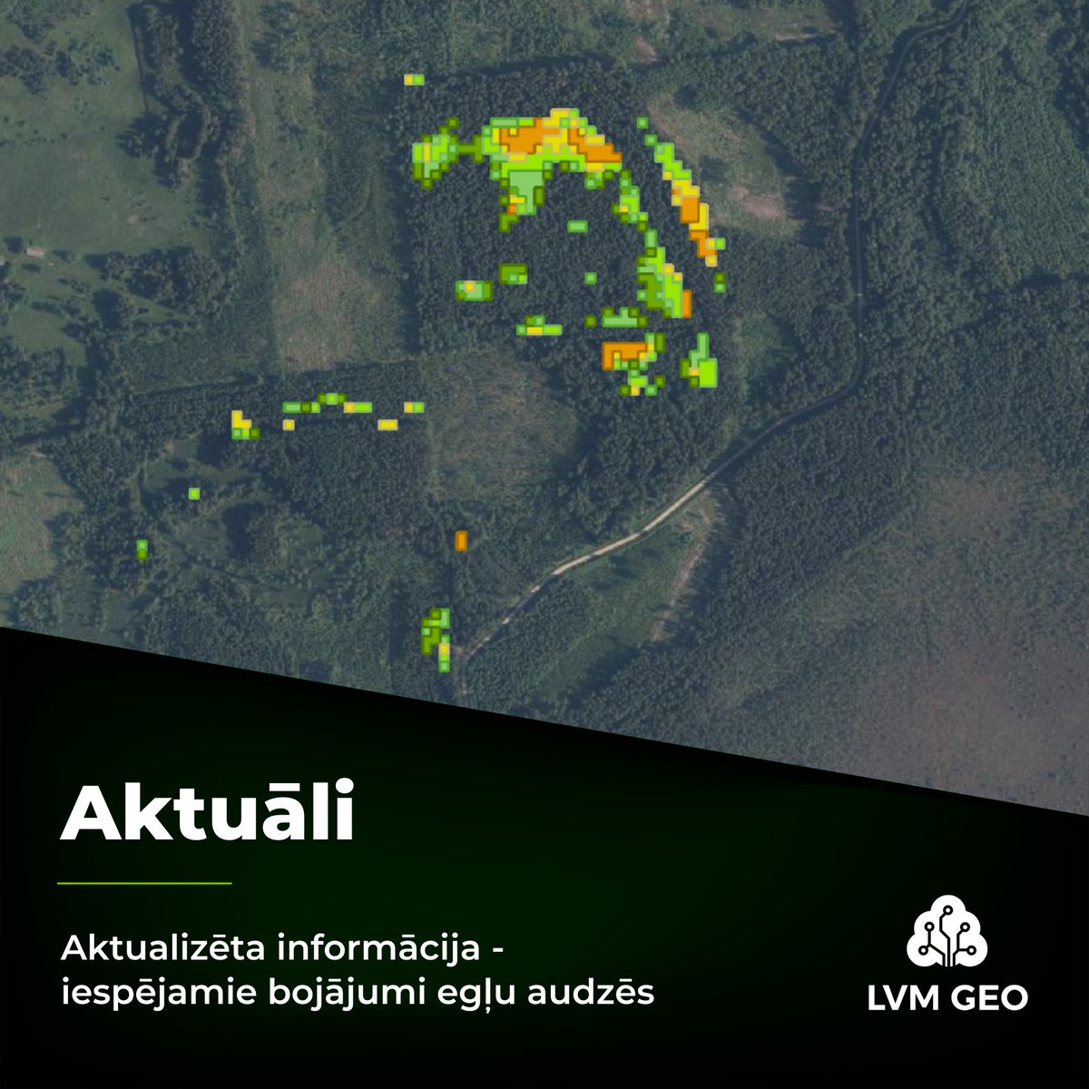
Esam pilnveidojuši mūsu izstrādāto algoritmu audžu vitalitātes izmaiņu apzināšanai egļu mežaudzēs (gan LVM, gan privātajās audzēs) un atjaunojuši datus visos LVM GEO risinājumos. #lvmgeo #geospatialintelligence #GIS #GIT #kartes #remotesensing

The Innovation’s Virtual Collection—Earth Science V2.0: Geospatial Intelligence is now online! Explore cutting-edge, high-quality studies at @Innov_Geosci the-innovation.org/geoscience/spe… #Geoscience #EarthScience #GeospatialIntelligence #ArtificialIntelligence

Strengthening fragile border controls with GEOINT 🔗 wcoomd.org/en/media/newsr… #WCO #Customs #GeospatialIntelligence #GEOINT #BorderSecurity #FragileBorders #WASP #WCO_JICAProject 🇧🇯 🇨🇮 🇬🇭 🇳🇬 🇹🇬

Ilgi gaidīts jaunums – fona karšu lejupielāde LVM GEO mobilajā lietotnē! Paplašinot lietotnes funkcionalitāti un iespējas, lietotājiem pieejama iespēja lejupielādēt fona (rastra) kartes lietošanai bezsaistes apstākļos. #lvmgeo #geospatialintelligence #GIS #GIT #kartes

LVM GEO risinājumi ir papildināti ar Valsts zemes dienesta uzturētās Kadastra informācijas sistēmas teksta datiem. Kadastra teksta dati skatāmi mobilajā lietotnē LVM GEO un karšu pārlūkā lvmgeo.lv/kartes. #lvmgeo #geospatialintelligence #GIS #GIT #kartes

Something went wrong.
Something went wrong.
United States Trends
- 1. Crenshaw N/A
- 2. #WWENXT N/A
- 3. Paxton N/A
- 4. Crockett N/A
- 5. Talarico N/A
- 6. Dallas County N/A
- 7. Sixers N/A
- 8. Bill Self N/A
- 9. Kurds N/A
- 10. Toth N/A
- 11. #kubball N/A
- 12. Eyepatch McCain N/A
- 13. 76ers N/A
- 14. Mark Pope N/A
- 15. Doug Sirmons N/A
- 16. Raptors N/A
- 17. Kyler N/A
- 18. Tillis N/A
- 19. Spain N/A
- 20. Bob Costas N/A