#geospatialintelligence نتائج البحث

Honoured to speak on a certificate programme of @RakshaUni on how geospatial intelligence decodes Tibet’s strategic infrastructure and its impact on India’s security. Kudos to @SICSSL_RRU & @ForFnva for a timely deep-dive and sharp exchange of ideas 🇮🇳 #GeospatialIntelligence…


Powerline Mapping: The Foundation of Resilient Utilities Ankur Vatsal, Program Director at @Deepmatrixfly, shared how #geospatialintelligence and #AI-driven inspections are transforming the way utilities manage powerlines. Facing aging infrastructure, extreme weather, compliance…


Join us for a complimentary webinar session, in collaboration with @Carahsoft on “UAV Mapping at Scale", to learn how our #Q6 UAV and #FlyghtCloud work together to deliver end-to-end #GeospatialIntelligence in the most demanding environments. carahevents.carahsoft.com/Event/Register…


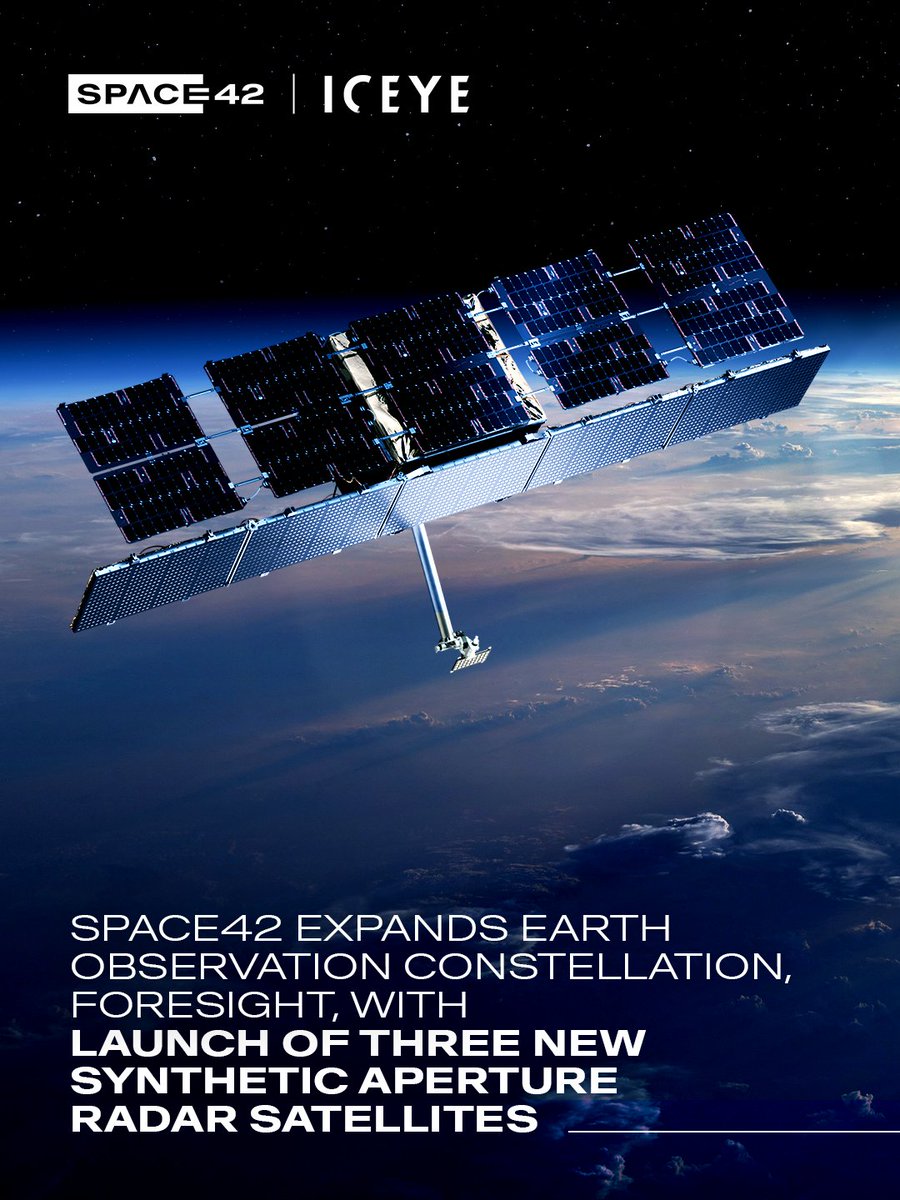
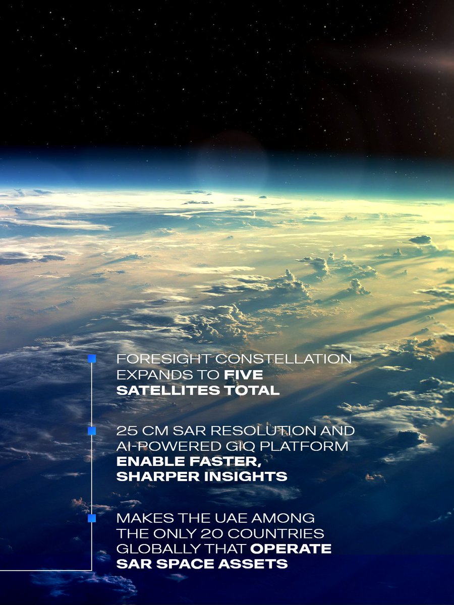
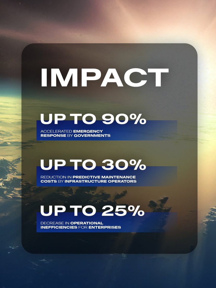
The launch of Foresight-3, Foresight-4, and Foresight-5 into Low Earth Orbit (LEO) marks another step forward in delivering decision-grade #geospatialintelligence to governments, industries, and partners worldwide.

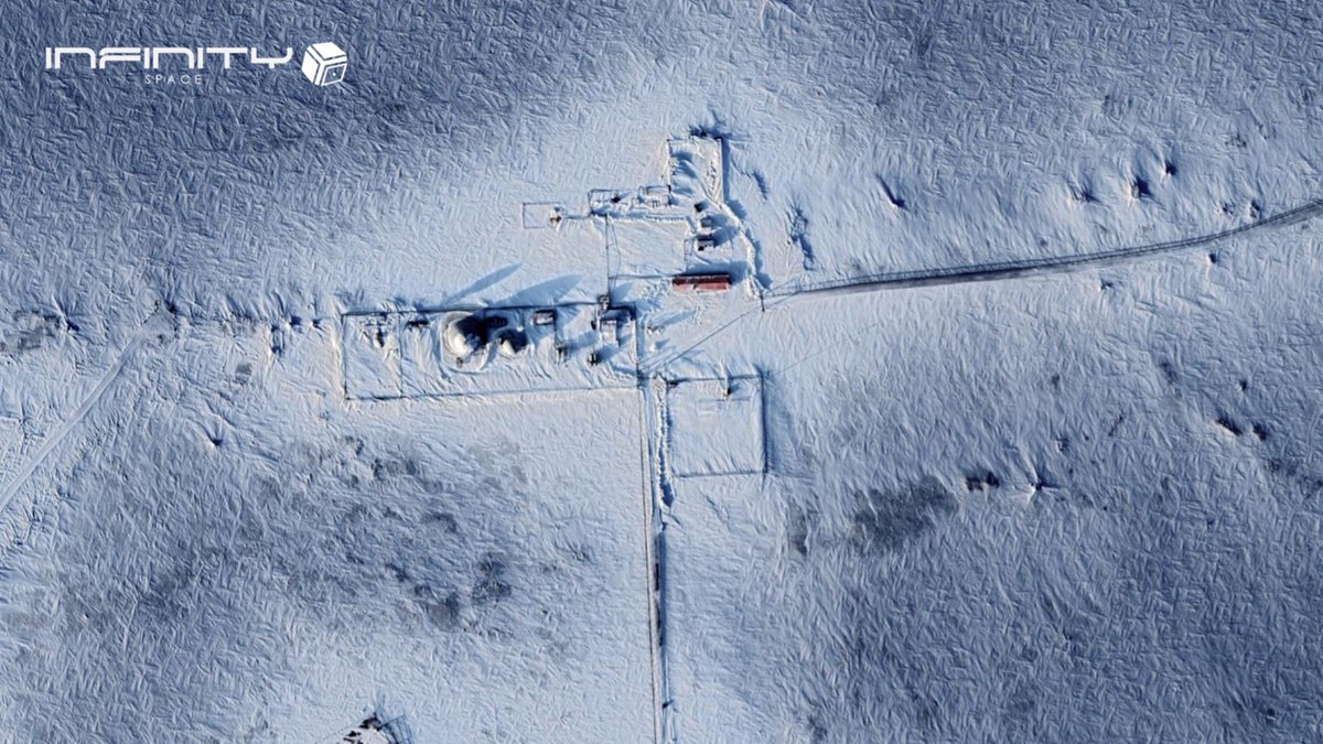
🚀 At Infinity Space, we transform 🌍 satellite data into powerful #GeospatialIntelligence (GEOINT) for defence & security. From terrain mapping 🗺️ to movement detection 👀 👉 Learn more: infinityspace.org.uk/military-geosp… #Satellites #DefenceTech
Another massive fire is visible in satellite imagery south of Tehran. The impact appears evident in morning imagery and continues to show up in evening remote sensing datasets. #Iran #IsraeliranWar #Geospatialintelligence


#AI-driven workflows is transforming the defense and intelligence landscape—freeing #geospatial analysts from routine tasks and empowering them to lead complex, multi-INT workflows. hubs.ly/Q03PmPq90 #GeospatialIntelligence #GEOINT #ArtificialIntelligence


We were honored to host Director of National Intelligence @TulsiGabbard as a keynote speaker at the 2025 GEOINT Symposium! 📸 Picture Credit: @NGA_GEOINT #GEOINT2025 #NationalSecurity #GeospatialIntelligence #ArtificialIntelligence #Innovation #PublicService #DNI


It’s launch day for the “Full Stream Ahead” mission. Watch $BKSY’s second Gen-3 #satellite fly to orbit via @RocketLab today at 7:57 p.m. EDT (11:57 a.m. NZT). Live feed: rocketlabcorp.com/missions/next-… #spacebasedintelligence #geospatialintelligence #GEOINT


Next up at #nrf2023 we have Nextbillion talking about ##geospatialintelligence at the @msft4startups showcase #startups


Come and visit GEOSAT's booth at DGI conference in London. We will be happy to welcome you and discuss our capabilities within the #DefenceandSecurity sector. For more information or book a meeting, contact us at [email protected]. See you there! #DGI2024 #GeospatialIntelligence
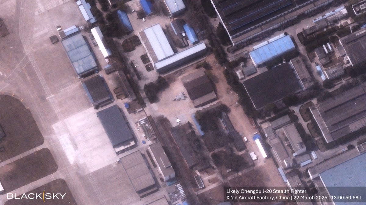
BlackSky's Gen-3 satellite captured what is likely a Chengdu J-20 Stealth Fighter at the Xi’an Aircraft Factory in China this weekend. Check out more images from the factory in the thread. #spacebasedintelligence #gen3 #geospatialintelligence

Geospatial intelligence in agriculture can help quickly incorporate aspects of geographic information systems (GIS), remote sensing/satellite imagery, local location data, global positioning systems (GPS), field & equipment sensors, & more! #AgTech #GeospatialIntelligence #GIS


Accurate data builds nations. @NASRDA_Official stands ready to support @natpopcom with satellite data, geospatial intelligence & trained personnel for Nigeria’s most accurate census yet — targeting 98% precision. #NigeriaCensus #GeospatialIntelligence


NPC AND NASRDA FORGE PARTNERSHIP FOR UPCOMING CENSUS Today, the NPC Chairman, Hon. Nasir Isa Kwarra, received in audience the Director-General of National Space Research and Development Agency (NASRDA), Dr. Matthew Olumide Adepoju, and his management team at the NPC HQ in Abuja.


🔍🌏 Discover why Synthetic Aperture Radar (SAR) data is crucial for surveillance in the Asia-Pacific region! 🌧️🛰️ #GeospatialIntelligence #SAR #Taiwan #GlobalSecurity #Semiconductors #GeoOwl @NGA_GEOINT @umbraspace

Check out this informative #video that breaks down what #GeospatialIntelligence (#GEOINT) is and how it's used by various organizations to gain insights for better decision-making. #mapping #technology #innovation #drones #earthobservation #geospatialdata #spatialanalysis

Ilgi gaidīts jaunums – fona karšu lejupielāde LVM GEO mobilajā lietotnē! Paplašinot lietotnes funkcionalitāti un iespējas, lietotājiem pieejama iespēja lejupielādēt fona (rastra) kartes lietošanai bezsaistes apstākļos. #lvmgeo #geospatialintelligence #GIS #GIT #kartes


Geospatial Innovations Podcast - Episode 5 - National Security and Defense #geoint #geospatialintelligence #security #defense #terrorism #operations #satellites #drones #science youtu.be/TCv5F55DMeI?si…
youtube.com
YouTube
Geospatial Innovations Podcast - Episode 5 - National Security and...

Day 26 of the #30DayMapChallenge: Transport Exploring global vessel activity in Graph: submarine cables, vessel traffic & reported hostile acts at sea. Seeing these layers together highlights the complexity of maritime logistics. #GeospatialIntelligence #LocationIntelligence

At ODRG, we identify emerging geospatial technologies that accelerate sensor-data fusion — from collection to intelligence exploitation. 🚀 Learn more at odrgllc.com/automation-int… #GeospatialIntelligence #AIForDefense #MachineLearning #ODRG #NextOctave

Powerline Mapping: The Foundation of Resilient Utilities Ankur Vatsal, Program Director at @Deepmatrixfly, shared how #geospatialintelligence and #AI-driven inspections are transforming the way utilities manage powerlines. Facing aging infrastructure, extreme weather, compliance…
Honoured to speak on a certificate programme of @RakshaUni on how geospatial intelligence decodes Tibet’s strategic infrastructure and its impact on India’s security. Kudos to @SICSSL_RRU & @ForFnva for a timely deep-dive and sharp exchange of ideas 🇮🇳 #GeospatialIntelligence…

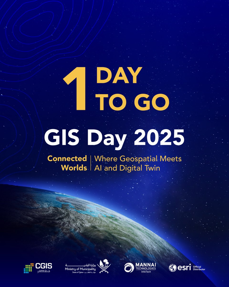
One day to go! Tomorrow, our maps come alive as Connected Worlds takes center stage—where #Geospatialintelligence meets #AI, #digitaltwins, & future of #cartography. Get ready for #GISDay2025! @Esri #GIS #Qatar #MannaiGIS #Esri #LocationIntelligence #MappingTheFuture

Data Processing in Aerial Surveys Aerial surveys transform raw imagery into actionable geospatial insights, supporting urban planning, environmental monitoring, and disaster response. Read More: tinyurl.com/2hwk5zj2 #aerialsurveys #geospatialintelligence #dataanalytics
Join us for a complimentary webinar session, in collaboration with @Carahsoft on “UAV Mapping at Scale", to learn how our #Q6 UAV and #FlyghtCloud work together to deliver end-to-end #GeospatialIntelligence in the most demanding environments. carahevents.carahsoft.com/Event/Register…

From digital twins to smart cities, GIS fuels the transformation of our world. Proud to celebrate the teams pushing geospatial innovation forward. ⚡ Happy GIS Day 2025! 🌏 #GTO #GISDay2025 #GeospatialIntelligence #DigitalTwins #GeoAI #SmartCity #SpatialData #AerialMapping #KSA


Unlock insights & boost efficiency with #GeospatialIntelligence! From disaster management to smart cities & retail analytics, geospatial tools transform industries. Explore how our solutions can make an impact. #Innovation #tech practicallogix.com/cross-platform…

The launch of Foresight-3, Foresight-4, and Foresight-5 into Low Earth Orbit (LEO) marks another step forward in delivering decision-grade #geospatialintelligence to governments, industries, and partners worldwide.

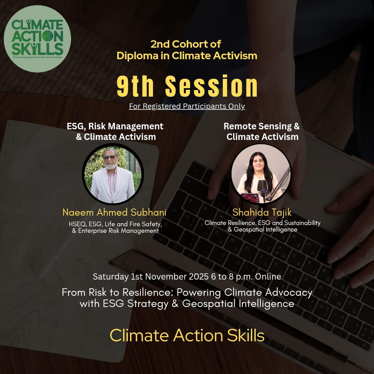
9th Session Alert: 2nd Cohort - Diploma in Climate Activism Registered participants: Don’t miss this powerhouse lineup. 1st Nov | 6–8 PM PKT Join via Google Meet (link shared with cohort) #ClimateActivism #ESG #GeospatialIntelligence #ClimateResilience #LastAcademicSession

Advancing Precision Agriculture through Geospatial Intelligence! TerrAqua UAV is redefining Indian agriculture with drones, satellite data & AI-driven insights — enabling smarter, data-backed farming for a sustainable future. #AgriTech #PrecisionFarming #GeospatialIntelligence

For two decades, we haven't just provided technology—we've been the trusted partner for organizations requiring large-scale, mission-critical solutions rooted in Geospatial Intelligence (GIS) and GPS-enabled IoT #IoT #GeospatialIntelligence #b2G #b2b #b2c

Parcel-level precision beats guesswork. Discover how geospatial intelligence + Placekey bring real-world accuracy to title searches — where every parcel, lien, and boundary truly aligns. Read more 👉 samedaytitleupdates.com/resource-artic… #GeospatialIntelligence #TitleSearch #Placekey…
#AI-driven workflows is transforming the defense and intelligence landscape—freeing #geospatial analysts from routine tasks and empowering them to lead complex, multi-INT workflows. hubs.ly/Q03PmPq90 #GeospatialIntelligence #GEOINT #ArtificialIntelligence

Explore the world of GEOINT and its intersection with open-source intelligence (OSINT) in our latest NeedleStack episode! 🌏 📍 Watch or listen: bit.ly/3KNLLyx #GEOINT #OSINT #geospatialintelligence


🌌 Space42's GIQ is now on Azure Marketplace! Get ready for satellite insights that are out of this world—perfect for governments and enterprises looking to elevate their analytics game! 🚀 #SpaceTech #AI #GeospatialIntelligence windowsforum.com/threads/space4…

Honoured to speak on a certificate programme of @RakshaUni on how geospatial intelligence decodes Tibet’s strategic infrastructure and its impact on India’s security. Kudos to @SICSSL_RRU & @ForFnva for a timely deep-dive and sharp exchange of ideas 🇮🇳 #GeospatialIntelligence…
#AI-driven workflows is transforming the defense and intelligence landscape—freeing #geospatial analysts from routine tasks and empowering them to lead complex, multi-INT workflows. hubs.ly/Q03PmPq90 #GeospatialIntelligence #GEOINT #ArtificialIntelligence
The launch of Foresight-3, Foresight-4, and Foresight-5 into Low Earth Orbit (LEO) marks another step forward in delivering decision-grade #geospatialintelligence to governments, industries, and partners worldwide.
🚀 At Infinity Space, we transform 🌍 satellite data into powerful #GeospatialIntelligence (GEOINT) for defence & security. From terrain mapping 🗺️ to movement detection 👀 👉 Learn more: infinityspace.org.uk/military-geosp… #Satellites #DefenceTech
It’s launch day for the “Full Stream Ahead” mission. Watch $BKSY’s second Gen-3 #satellite fly to orbit via @RocketLab today at 7:57 p.m. EDT (11:57 a.m. NZT). Live feed: rocketlabcorp.com/missions/next-… #spacebasedintelligence #geospatialintelligence #GEOINT
Join us for a complimentary webinar session, in collaboration with @Carahsoft on “UAV Mapping at Scale", to learn how our #Q6 UAV and #FlyghtCloud work together to deliver end-to-end #GeospatialIntelligence in the most demanding environments. carahevents.carahsoft.com/Event/Register…
Powerline Mapping: The Foundation of Resilient Utilities Ankur Vatsal, Program Director at @Deepmatrixfly, shared how #geospatialintelligence and #AI-driven inspections are transforming the way utilities manage powerlines. Facing aging infrastructure, extreme weather, compliance…
BlackSky's Gen-3 satellite captured what is likely a Chengdu J-20 Stealth Fighter at the Xi’an Aircraft Factory in China this weekend. Check out more images from the factory in the thread. #spacebasedintelligence #gen3 #geospatialintelligence
We were honored to host Director of National Intelligence @TulsiGabbard as a keynote speaker at the 2025 GEOINT Symposium! 📸 Picture Credit: @NGA_GEOINT #GEOINT2025 #NationalSecurity #GeospatialIntelligence #ArtificialIntelligence #Innovation #PublicService #DNI

Get ready for a smarter future with #ArcGIS! 🌐📈 This advanced mapping technology helps you make informed decisions and solve complex problems. Join the smart revolution and discover the power of ArcGIS today! 👉hubs.li/Q01S7vT10 #smarterfuture #geospatialintelligence

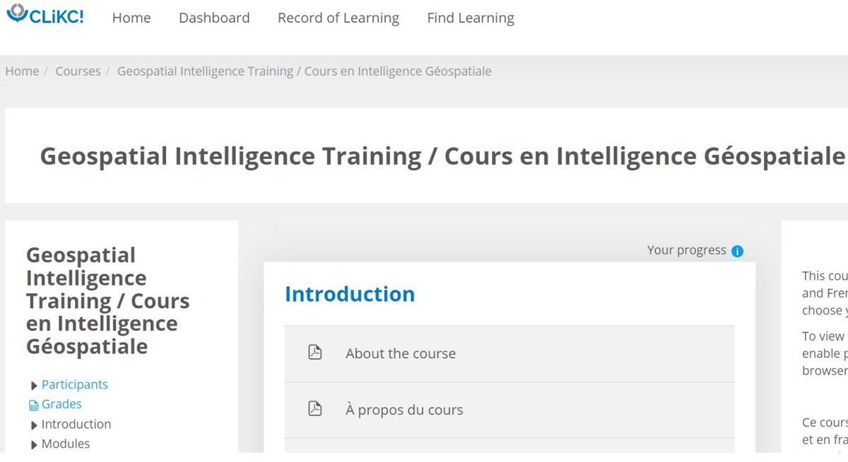
GEOINT e-learning launched on CLiKC! 🔗 wcoomd.org/en/media/newsr… #WCO #Customs #GeospatialIntelligence #GEOINT #eLearning #CLiKC #FragileBorders #WCOSecurityProgramme

Another massive fire is visible in satellite imagery south of Tehran. The impact appears evident in morning imagery and continues to show up in evening remote sensing datasets. #Iran #IsraeliranWar #Geospatialintelligence
🌐 We've talked a lot about real-time intelligence requiring a software-first mindset, but what does this mean in context? How is #AI fundamentally transforming the #geospatialintelligence industry? Get the primer on the shift to space-based #intelligence and why it's crucial…


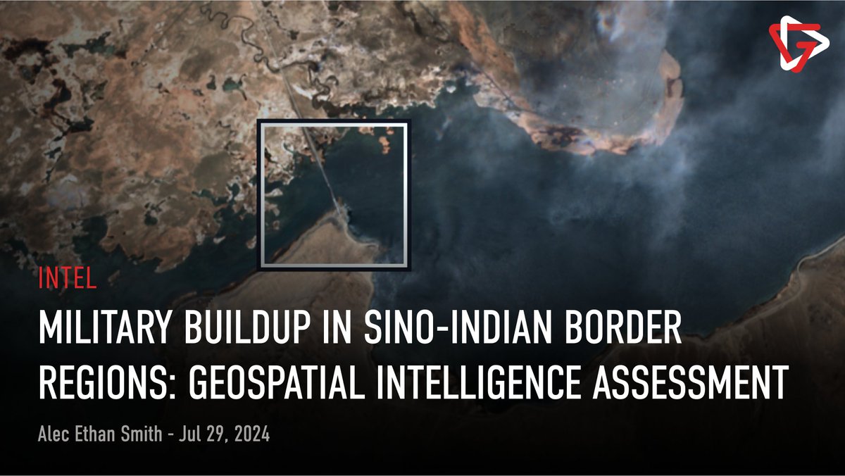
Military Buildup in Sino-Indian Border Regions: Geospatial Intelligence Assessment Click on the link to find out more. #India #China #GeospatialIntelligence #GEOINT #Intelligence #Military #Defence #Security #Himalayas greydynamics.com/insight/milita…

Connect with our team at the GEOINT Symposium as we explore the evolving landscape of #GeospatialIntelligence alongside industry leaders🛰️ #SidusSpace #GEOINT2024 #GEOINT #EdgeAI #FeatherEdge #Data #Technology #NewSpace


Join @alteryx and @SnowflakeDB on March 28th, 3pm GMT (11am ET) in an exclusive webinar, 'Supply Chain Intelligence: A Geospatial Approach to Optimal Decision-Making'. Discover more and register now ➡️ bit.ly/491QqmN #GeospatialIntelligence #CustomerCentricity

Next up at #nrf2023 we have Nextbillion talking about ##geospatialintelligence at the @msft4startups showcase #startups
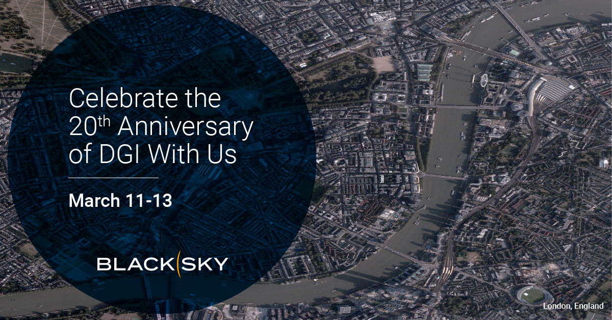
The BlackSky team will be attending this year’s #DGI2024 conference, celebrating 20 years of bringing together the international defence and #geospatialintelligence community. 📅 March 11-13 🤝 Booth 29, 30 📍 London, UK

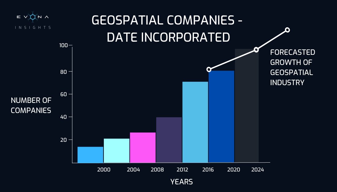
𝐄𝐗𝐏𝐋𝐎𝐑𝐈𝐍𝐆 𝐓𝐇𝐄 𝐆𝐄𝐎𝐒𝐏𝐀𝐓𝐈𝐀𝐋 𝐑𝐄𝐕𝐎𝐋𝐔𝐓𝐈𝐎𝐍: 𝐓𝐇𝐄 𝐁𝐎𝐎𝐌 𝐎𝐅 𝐋𝐎𝐂𝐀𝐓𝐈𝐎𝐍-𝐁𝐀𝐒𝐄𝐃 𝐓𝐄𝐂𝐇𝐍𝐎𝐋𝐎𝐆𝐘! 🛰 #spaceindustry #geospatial #geospatialintelligence Check out our insights!👇 evona.com/blog/geospatia…
Get ready for a smarter future with #GIS! 🌐📈 With advanced mapping technology, GIS helps you make informed decisions and solve complex problems. Join the smart revolution and discover the power of GIS today! 👉hubs.li/Q01GfcRK0 #smarterfuture #geospatialintelligence

Something went wrong.
Something went wrong.
United States Trends
- 1. #StrangerThings5 158K posts
- 2. Thanksgiving 634K posts
- 3. Reed Sheppard 3,498 posts
- 4. Afghan 256K posts
- 5. Podz 3,228 posts
- 6. robin 71.6K posts
- 7. BYERS 29.3K posts
- 8. holly 52.1K posts
- 9. National Guard 629K posts
- 10. Gonzaga 8,044 posts
- 11. Dustin 84.8K posts
- 12. #AEWDynamite 21K posts
- 13. Michigan 76.7K posts
- 14. Amen Thompson 1,410 posts
- 15. Tini 8,143 posts
- 16. Erica 13.4K posts
- 17. Rahmanullah Lakanwal 97K posts
- 18. Will Richard 2,074 posts
- 19. #Survivor49 3,042 posts
- 20. Jardine 6,507 posts