#geologicmap wyniki wyszukiwania

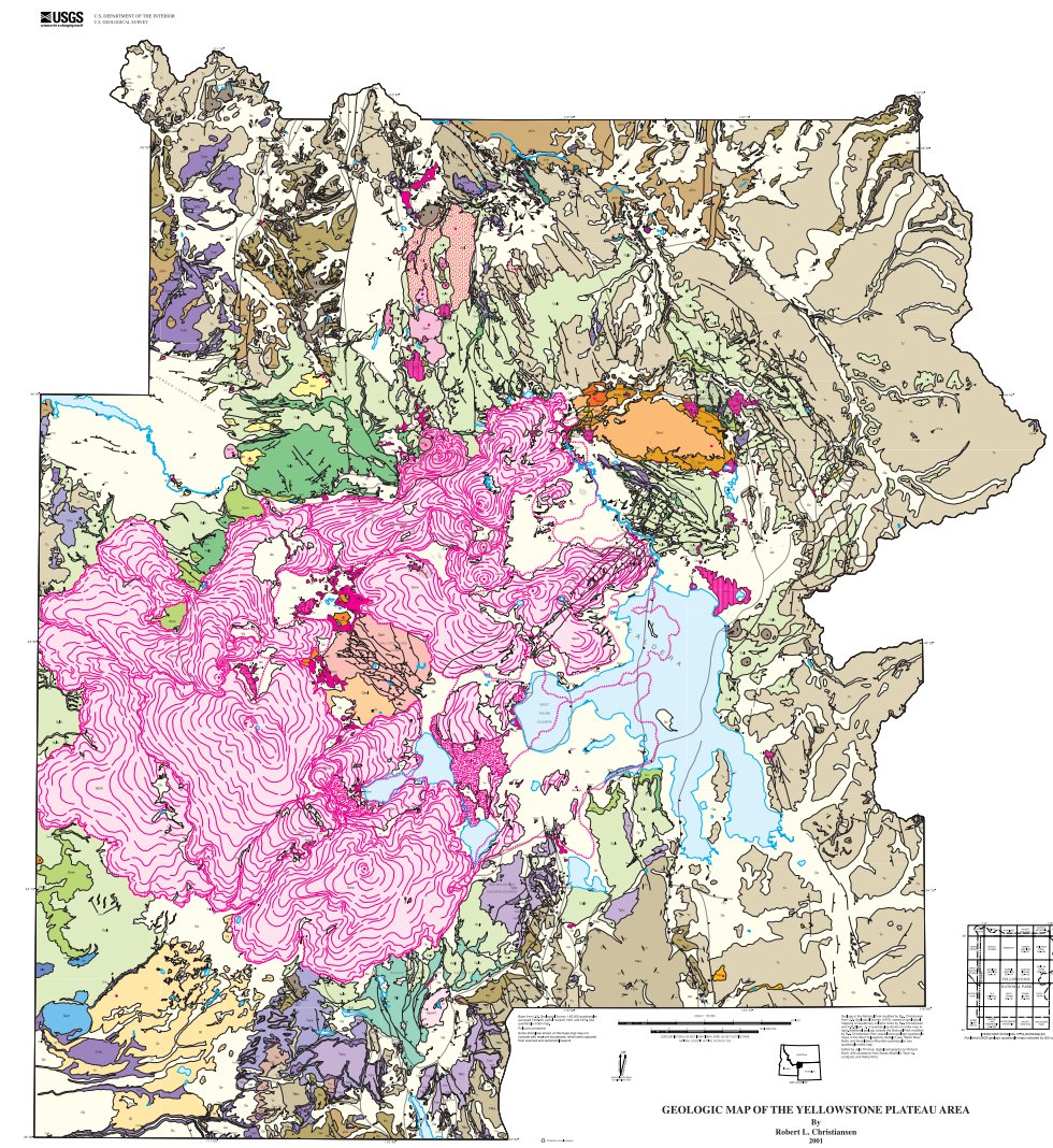
@YellowstoneNPS celebrates 145 years today! The 2001 #geologicmap includes #volcanic #rocks older than 2 mil years. pubs.usgs.gov/pp/pp729g/
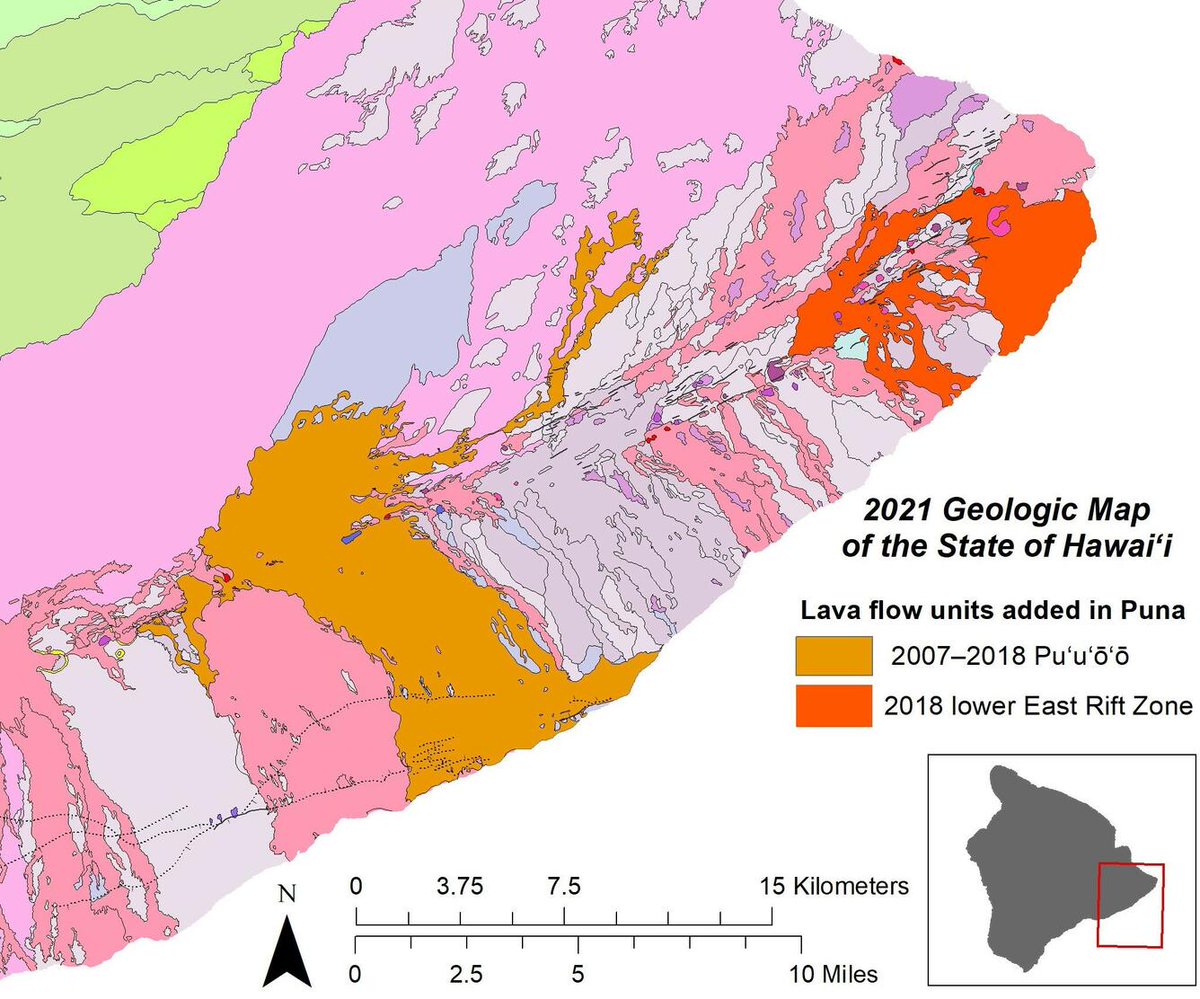
Something old, something new, something borrowed, something.....researched! The newest #geologicmap of the State of #Hawaii has it all. #VolcanoWatch #HVO ow.ly/XMu850HYJt0

A geologic globe, not something you see everyday #geology #geologicmap #globe #geologicalmap #geologicalmapping #map
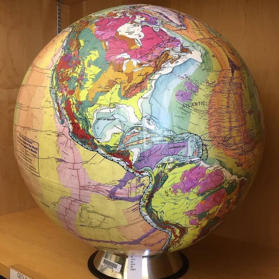
A geologic globe, not something you see everyday⠀ ⠀ #geology #geologicmap #globe #geologicalmap #geologicalmapping #cartography #geography #topography #geomorphology #geospatial

A geologic globe! not something you see everyday #geology #geologicmap #globe #berkeley #geologicalmap #geologicalmapping #map #maps #cartography #geography #topography #mapping #mappe #carte #mapa #karta #cable #cables #globe #worldmap #geography


First ever digital geologic map of Alaska published. #geologicmap #alaska #resources #tectonicplates sulc.us/6q3g5

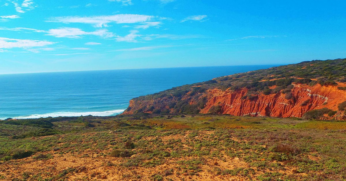
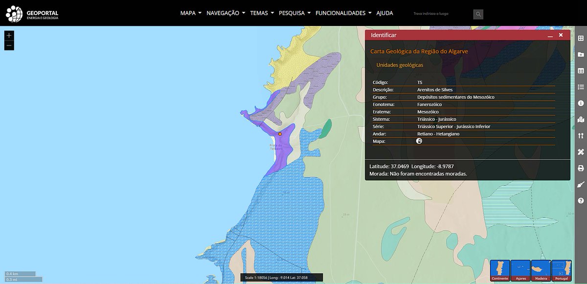
What are those red #rocks in #Algarve? The pictured #geologicmap gives the answer... they formed between the #Triassic and #Jurassic in a semi-arid terrestrial environment! --- #TuesdayThoughts #tuesdayvibes #geology #naturephotography #geotourism #traveltuesday

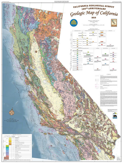
On the last day of #EarthScienceWeek, @CaGeoSurvey shares the #GeologicMap of California with a special feature where users can ID different rock types! 🪨⛏️😎 Check it out below ⬇️⬇️⬇️ @earthsciweek @AGI_Updates #GeologicMapDay

It's #GeologicMapDay! Do you love maps? California Geological Survey has an interactive geological map of California that allows users to identify the different rock types across the state! ⛏️🪨 Click➡️maps.conservation.ca.gov/cgs/gmc/ @CalConservation #EarthScienceWeek

NASA unveils first global geologic map of Titan dlvr.it/RKB5zK #GeologicMap #Titan #Saturn
Publication 188: Geologic Map of the White Gate Quadrangle is now available through the DGMR web store! The map includes geologic and structural information for portions of Bland, Giles, and Pulaski counties. tinyurl.com/y4yng58o #GeologicMap


The #geologicmap in @RockdApp is available in your browser, nearly 2 million polygons from 75 sources! #geology #map macrostrat.org/burwell/

Very old #Rock with nice (NOT #GNEISS) #GeologicMap for source area in Canadian Shield? @RockDoc1952

Giant alien formations in Siberia! #geology #geologicmap #globe #berkeley #geologicalmap #geologicalmapping #map #maps #mudfossils #ancientaliens #eksopolitiikka youtu.be/pscjzcxROW4


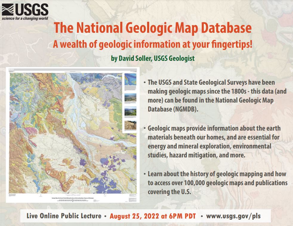
Tune in TONIGHT! August 25, 2022 at 6:00 PM (PT) for the August USGS Virtual Public Lecture The National Geologic Map Database - A wealth of geologic information at your fingertips! by David Soller, USGS Geologist ow.ly/pSxT50Krscn #GeologicMap…
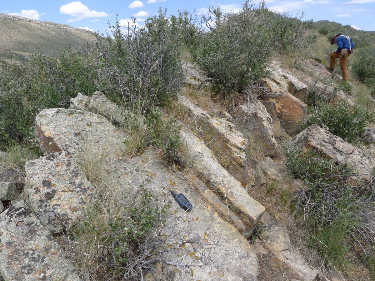
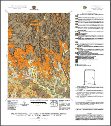
Earlier this year, we published a surficial #geologicmap of the west half of The Ramshorn 30' x 60' quad, Fremont & Park counties. A report w/the #map includes this📸of basalt boulders that are up to 1.5 m in diameter & rest directly on claystone of the Tepee Trail Formation. 1/2


One more reason not to let geologists name things... #geologicmap #geology #WesternAustralia @… instagram.com/p/BGOMtBwEwie/

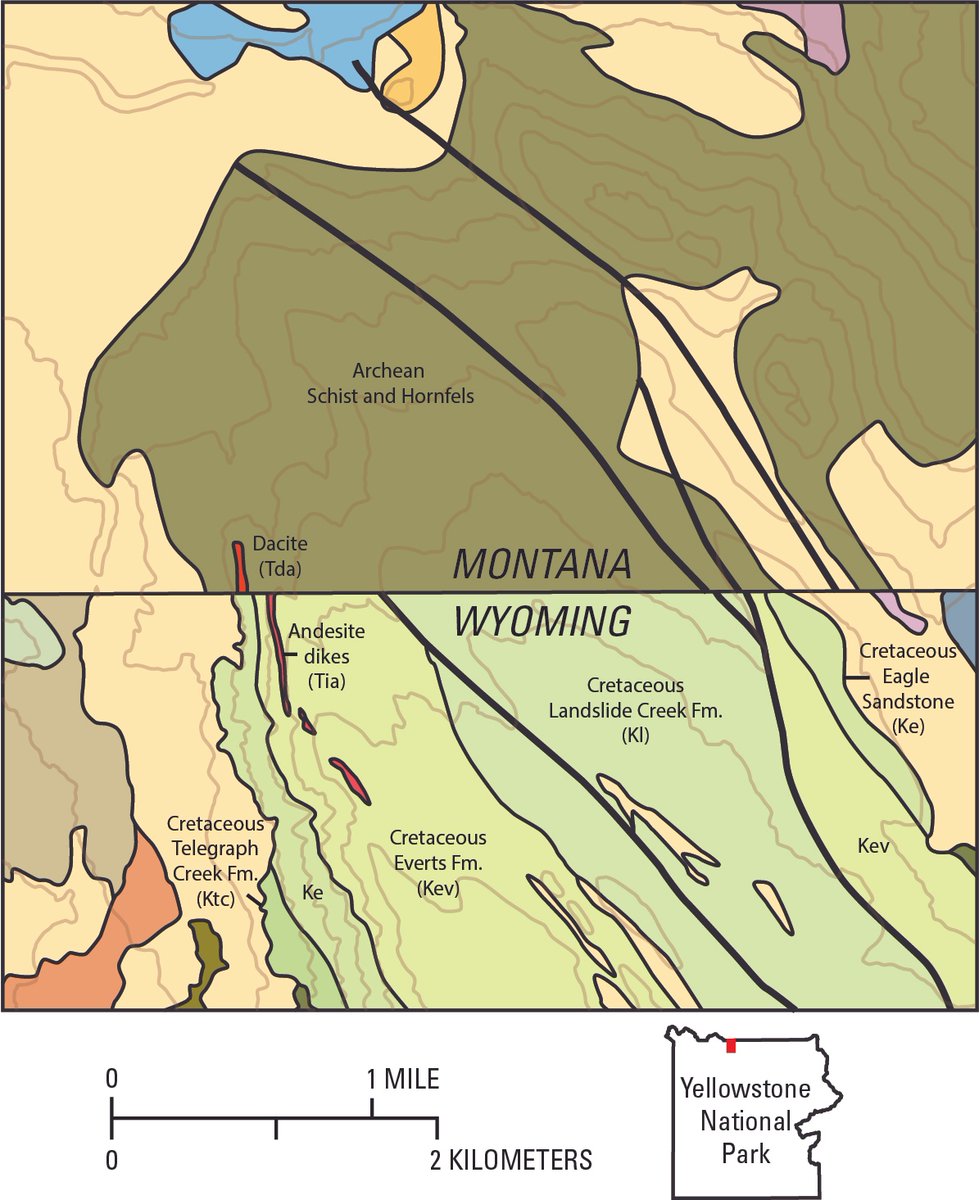
What goes into making a geologic map? Follow along as geologists investigate a perplexing incongruity in adjoining geologic maps in the north part of Yellowstone National Park. usgs.gov/observatories/… #GIS #geologicmap #yellowstone #mapping

Neale, Shannon; Bedrock Geologic Map of Parts of the Stamford... #GeologicMap #BedrockofConnecticut rave.ohiolink.edu/etdc/view?acc_…
The NEW issue of the Indiana Journal of Earth Sciences is live! Read & download geologic maps & reports for free in our open-access journal at scholarworks.iu.edu/journals/index…. #FAIRdata #OpenAccess #GeologicMap

The Moon isn’t just grey dust… 🌓 This detailed #GeologicMap by the United States Geological Survey reveals billions of years of impact & volcanic history: 👇 👇 astrogeology.usgs.gov/search/map/uni…

Publication of first comprehensive geologic map of Saipan and Tinian guided urban planners and emergency managers in zoning and hazard mitigation. #GeologicMap #Planning

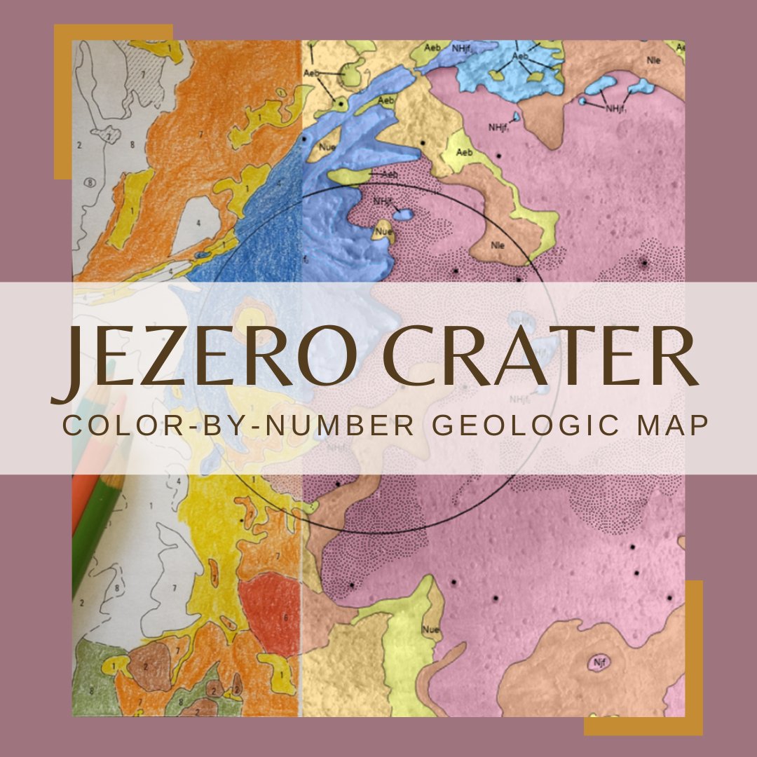
Hey #Teachers! Looking for a fun, easy way to teach about the #Mars2020 Perseverance rover? Check out this #GeologicMap coloring sheet activity! Students color their own geologic map and learn about the geology of #Mars! usgs.gov/news/coloring-…

On the last day of #EarthScienceWeek, @CaGeoSurvey shares the #GeologicMap of California with a special feature where users can ID different rock types! 🪨⛏️😎 Check it out below ⬇️⬇️⬇️ @earthsciweek @AGI_Updates #GeologicMapDay
It's #GeologicMapDay! Do you love maps? California Geological Survey has an interactive geological map of California that allows users to identify the different rock types across the state! ⛏️🪨 Click➡️maps.conservation.ca.gov/cgs/gmc/ @CalConservation #EarthScienceWeek
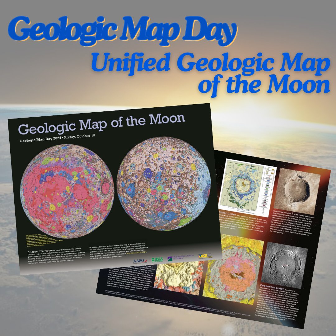
Happy #GeologicMapDay! Enjoy this downloadable poster for the Unified #GeologicMap of the Moon! americangeosciences.org/static/files/e… Find more Earth Science Week resources and a back page to the poster on the Earth Science Week webpage: earthsciweek.org/resources/2024… #EarthScienceWeek

I think this would be a GREAT Adult Coloring Book! #jezero #geologicmap #mars #USGS_AstroGeo! Thanks for sharing...
Hey #Teachers! Looking for a fun, easy way to teach about the #Mars2020 Perseverance rover? Check out this #GeologicMap coloring sheet activity! Students color their own geologic map and learn about the geology of #Mars! usgs.gov/news/coloring-…
Hey #Teachers! Looking for a fun, easy way to teach about the #Mars2020 Perseverance rover? Check out this #GeologicMap coloring sheet activity! Students color their own geologic map and learn about the geology of #Mars! usgs.gov/news/coloring-…
This annotated photograph is of the Mowry Shale and the Frontier Formation (Belle Fourche Member, Emigrant Gap Member & Wall Creek Member), Oil Mountain quadrangle in Natrona County. 2022 geologic map report: wsgs.wyo.gov/wyoming-geolog… #Wyoming #geology #geologicmap #map

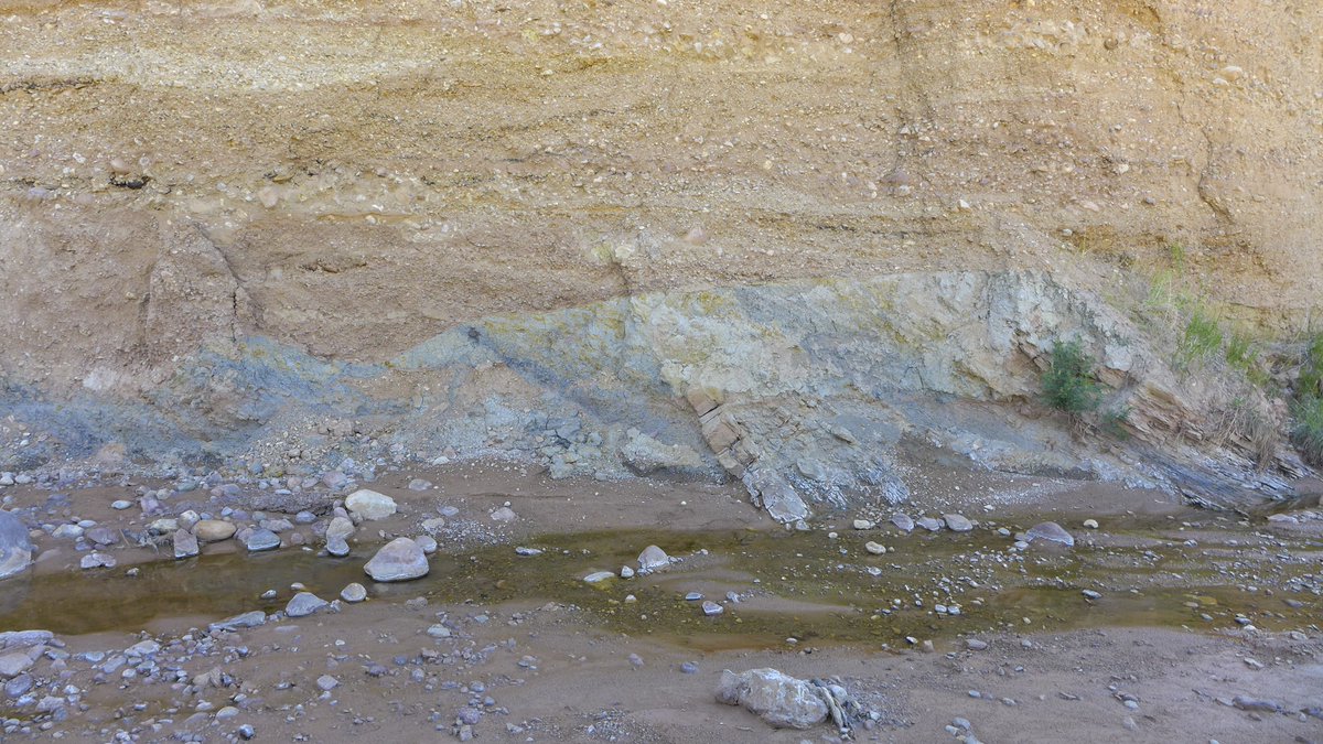
This cut bank exposure is in an active channel of Red Creek revealing older alluvial deposits overlying Fort Union Formation bedrock, Richards Gap quadrangle in southern Wyoming. Preliminary geologic map of the quad➡️ wsgs.wyo.gov/wyoming-geolog…. #Wyoming #geology #geologicmap #map

[PUB] #OTD in 1908, Teddy Roosevelt proclaimed the @GrandCanyonNPS a national monument. Check out this geologic map of the area and order a hard copy or download a PDF through the USGS Store: ow.ly/ikSs50Qq6xi 🗺️ #TBT #GeologicMap #GrandCanyon
![USGS's tweet image. [PUB] #OTD in 1908, Teddy Roosevelt proclaimed the @GrandCanyonNPS a national monument. Check out this geologic map of the area and order a hard copy or download a PDF through the USGS Store: ow.ly/ikSs50Qq6xi 🗺️
#TBT #GeologicMap #GrandCanyon](https://pbs.twimg.com/media/GDmNHMgXYAAkaM5.jpg)
Link to the Oil Mountain quadrangle geologic map: wsgs.wyo.gov/wyoming-geolog… #Wyoming #geology #geologicmap #map 3/3
Geo-Note! A rusty yellow and orange conglomerate layer of the White River Formation and underlying Pierre Shale, Goat Mountain quadrangle in southeast Wyoming. A minor slump can be seen just right of center. #geologicmap: wsgs.wyo.gov/wyoming-geolog… #Wyoming #geology

Earlier this year, we published a surficial #geologicmap of the west half of The Ramshorn 30' x 60' quad, Fremont & Park counties. A report w/the #map includes this📸of basalt boulders that are up to 1.5 m in diameter & rest directly on claystone of the Tepee Trail Formation. 1/2
Geo-Note! The Cloverly Formation on the Goat Mountain quadrangle in southeast #Wyoming forms prominent ridges like this sandstone ridge in the northwestern Iron Mountain syncline area of the quadrangle. Goat Mountain #geologicmap: sales.wsgs.wyo.gov/preliminary-ge… #geology #geologic #map
Bridger Pass quadrangle geologic map mentioned in previous post can be found here: sales.wsgs.wyo.gov/preliminary-ge… #Wyoming #geology #geologicmap #map
Find the geologic map of the King Mountain quadrangle (mentioned in the previous post) at: sales.wsgs.wyo.gov/geologic-map-o… #Wyoming #geology #geologicmap #map
Cliffs in the Wiggins Formation (above) & underlying slope in the Tepee Formation (below) on the south ridge of Ramshorn Peak on The Ramshorn quadrangle, NW #Wyoming. The @WyGeoSurvey recently mapped the west half of the quad: sales.wsgs.wyo.gov/preliminary-su… #geology #geologicmap #map

Upper Fort Union Formation ferruginous pebble conglomerate #outcrop, on the Oil Mountain quadrangle in central #Wyoming. The Oil Mountain quadrangle #geologicmap can be found here: sales.wsgs.wyo.gov/preliminary-ge…. #geology #map
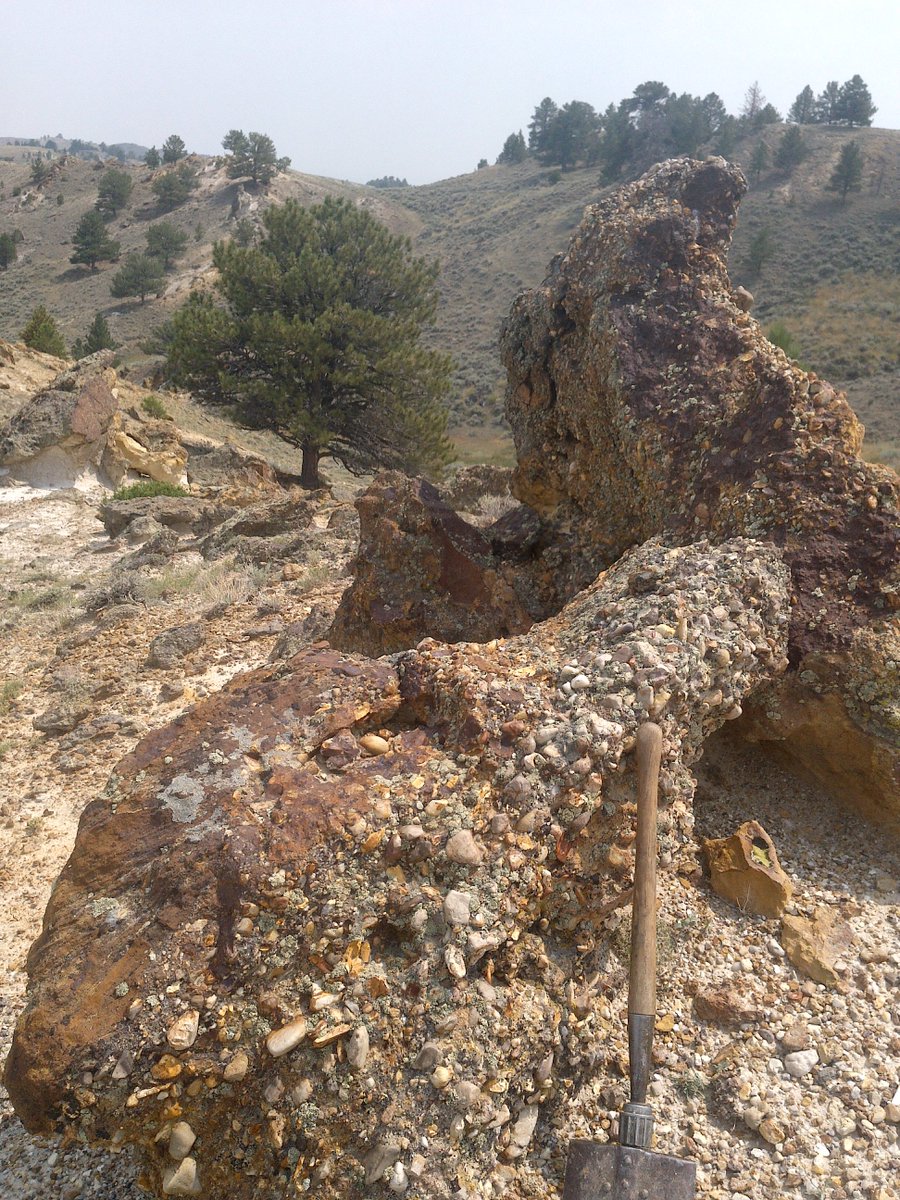
The cliffs in the photograph are part of the Wiggins Formation, which is prone to multiple types of mass wasting along the steep valley sides and headwalls of the Absaroka Range. NEW surficial #geologicmap of the west half of the quad ➡️ sales.wsgs.wyo.gov/preliminary-su… 1/2
Hey #Teachers! Looking for a fun, easy way to teach about the #Mars2020 Perseverance rover? Check out this #GeologicMap coloring sheet activity! Students color their own geologic map and learn about the geology of #Mars! usgs.gov/news/coloring-…


Data in @RockdApp are always improving behind the scenes. New in the mix: a #geologicmap from #Spain check it out!

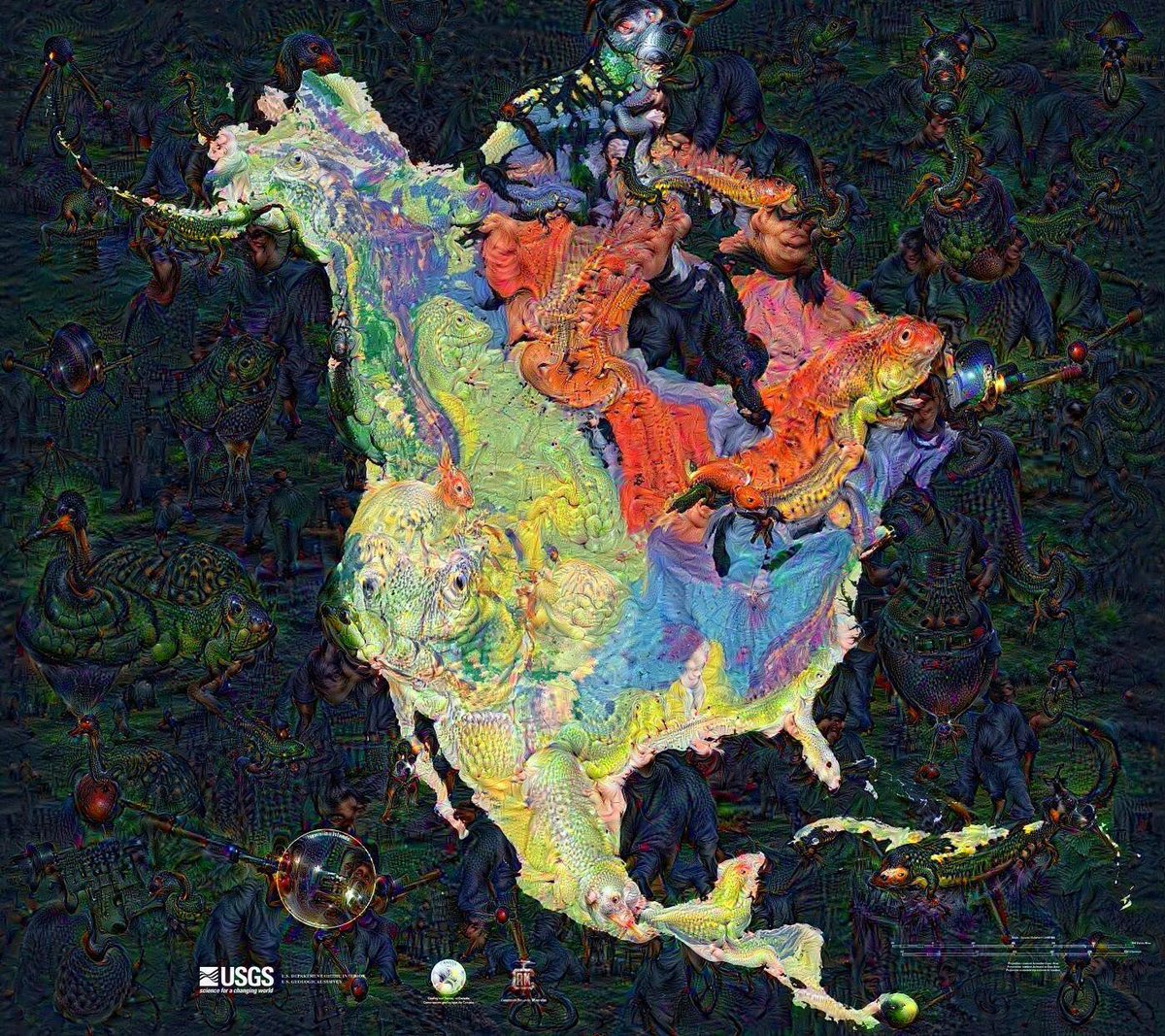
Running the #GeologicMap of North America through #GoogleDeepDream yields some pretty amazing results!
A geologic globe, not something you see everyday⠀ ⠀ #geology #geologicmap #globe #geologicalmap #geologicalmapping #cartography #geography #topography #geomorphology #geospatial
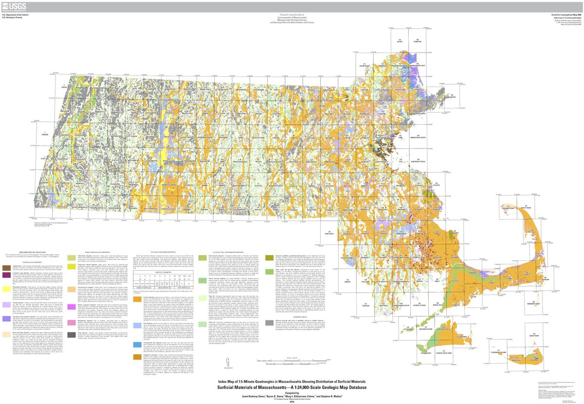
The @USGS, in conjunction with State Geologist Steve Mabee (@MassGeol) release new surficial materials geologic map database for Massachusetts: buff.ly/2NLvSqN #pleistocene #geology #geologicmap #geosciences
What goes into making a geologic map? Follow along as geologists investigate a perplexing incongruity in adjoining geologic maps in the north part of Yellowstone National Park. usgs.gov/observatories/… #GIS #geologicmap #yellowstone #mapping
Geo-Note! A rusty yellow and orange conglomerate layer of the White River Formation and underlying Pierre Shale, Goat Mountain quadrangle in southeast Wyoming. A minor slump can be seen just right of center. #geologicmap: wsgs.wyo.gov/wyoming-geolog… #Wyoming #geology
A geologic globe, not something you see everyday #geology #geologicmap #globe #geologicalmap #geologicalmapping #map
Tune in TONIGHT! August 25, 2022 at 6:00 PM (PT) for the August USGS Virtual Public Lecture The National Geologic Map Database - A wealth of geologic information at your fingertips! by David Soller, USGS Geologist ow.ly/pSxT50Krscn #GeologicMap #Geology

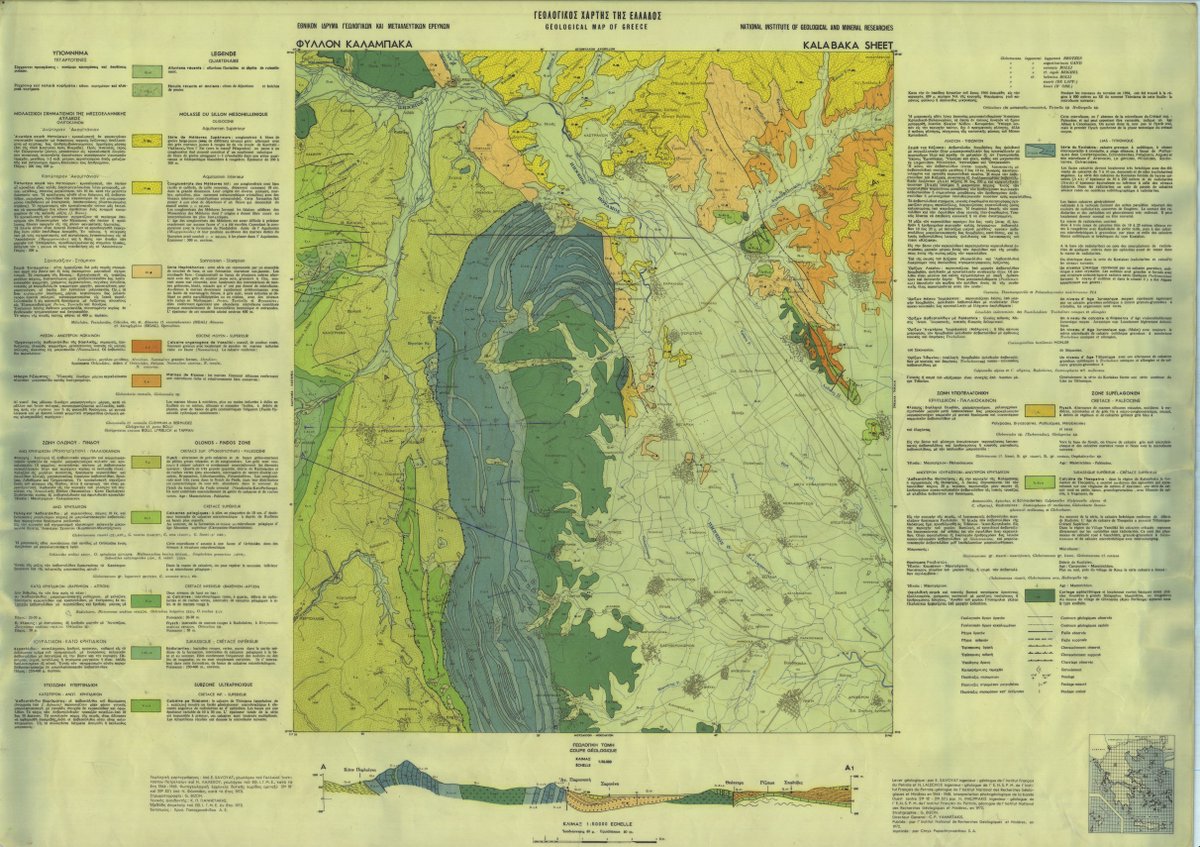
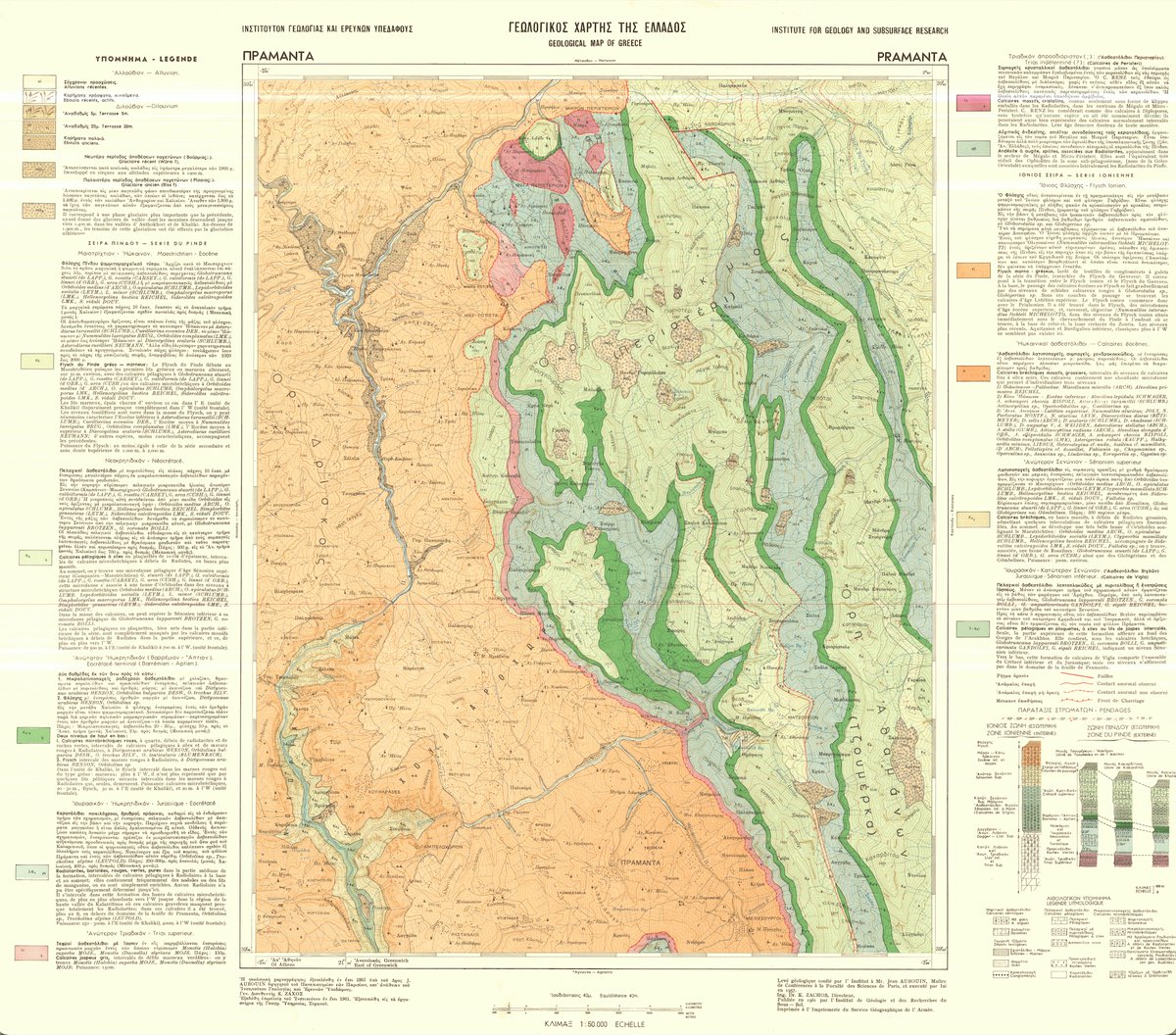
I have geologic maps that I'm using for my thesis that are in Greek. Does anybody know a way to translate them to English?😅 #geology #geologicmap #geology #geologyhelp

The First Day #Hikes event at Curt Gowdy State Park on New Year's Day will be 2 miles on easy to moderate terrain. Meet at 11 am at the visitor center. More about the First Day Hikes event: wyoparks.wyo.gov/index.php/news…. #geologicmap #CurtGowdyStatePark

[PUB] #OTD in 1908, Teddy Roosevelt proclaimed the @GrandCanyonNPS a national monument. Check out this geologic map of the area and order a hard copy or download a PDF through the USGS Store: ow.ly/ikSs50Qq6xi 🗺️ #TBT #GeologicMap #GrandCanyon
A geologic globe! not something you see everyday #geology #geologicmap #globe #berkeley #geologicalmap #geologicalmapping #map #maps #cartography #geography #topography #mapping #mappe #carte #mapa #karta #cable #cables #globe #worldmap #geography
This cut bank exposure is in an active channel of Red Creek revealing older alluvial deposits overlying Fort Union Formation bedrock, Richards Gap quadrangle in southern Wyoming. Preliminary geologic map of the quad➡️ wsgs.wyo.gov/wyoming-geolog…. #Wyoming #geology #geologicmap #map
What are those red #rocks in #Algarve? The pictured #geologicmap gives the answer... they formed between the #Triassic and #Jurassic in a semi-arid terrestrial environment! --- #TuesdayThoughts #tuesdayvibes #geology #naturephotography #geotourism #traveltuesday
Cliffs in the Wiggins Formation (above) & underlying slope in the Tepee Formation (below) on the south ridge of Ramshorn Peak on The Ramshorn quadrangle, NW #Wyoming. The @WyGeoSurvey recently mapped the west half of the quad: sales.wsgs.wyo.gov/preliminary-su… #geology #geologicmap #map
It's not our fault! Well kinda...Faults, fold axes, dikes and other #geologicmap lines are working their way into @RockdApp, new version out
SAVE THE DATE. Thursday August 25, 2022 at 6:00 PM (PT) USGS Virtual Public Lecture The National Geologic Map Database - A wealth of geologic information at your fingertips! by David Soller, USGS Geologist ow.ly/tgW350K8S3W #GeologicMap #Geology

Our London shop has a great selection of linen-backed geological and topographic maps. Come in to hunt for an area of your interest! @BritGeoSurvey @OrdnanceSurvey #maps #GeologicMap #TopographicMap

The NEW issue of the Indiana Journal of Earth Sciences is live! Read & download geologic maps & reports for free in our open-access journal at scholarworks.iu.edu/journals/index…. #FAIRdata #OpenAccess #GeologicMap
Giant alien formations in Siberia! #geology #geologicmap #globe #berkeley #geologicalmap #geologicalmapping #map #maps #mudfossils #ancientaliens #eksopolitiikka youtu.be/pscjzcxROW4
Something went wrong.
Something went wrong.
United States Trends
- 1. #euphoria N/A
- 2. #WrestleMania N/A
- 3. Roman N/A
- 4. Wemby N/A
- 5. Buffalo N/A
- 6. Night 2 N/A
- 7. Bruins N/A
- 8. Tage Thompson N/A
- 9. Rhea N/A
- 10. Pistons N/A
- 11. Spurs N/A
- 12. Summerslam N/A
- 13. Swayman N/A
- 14. Brock N/A
- 15. #bucciovertimechallenge N/A
- 16. Cade N/A
- 17. #PorVida N/A
- 18. #BaddiesUSAReunion N/A
- 19. Duren N/A
- 20. Detroit N/A