#geospatialmapping search results

Every mission starts long before takeoff. Preparation, setup, and final checks, because quality results begin on the ground. Terralynx, Aerial insights. Clear results. 📩 [email protected] #DroneSetup #AerialData #GeospatialMapping #PrecisionAgriculture #AgriTech


Transform how you manage land resources with satellite intelligence 🛰️ Actionable insights for agriculture, mining, forestry & more. 🔗 planeteyefarm.ai [email protected] #SatelliteData #GeospatialMapping #Innovation #ClimateAction #PlaneteyeFarmAI


Preserve history with FiOR CARTOgraph! Map sites, track changes, & compare historical data with precision. #HistoricalPreservation #GeospatialMapping

When heat tells a story, our thermal drones listen. 🚁 🔥 The Parrot ANAFI USA is redefining infrastructure inspections in Nigeria from power lines to search & rescue. 👉 Available now at Geoinfostore.com #ThermalDroneNigeria #DroneInspectionLagos #GeospatialMapping

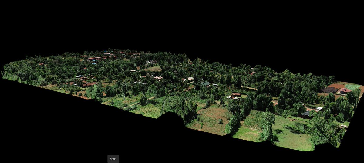
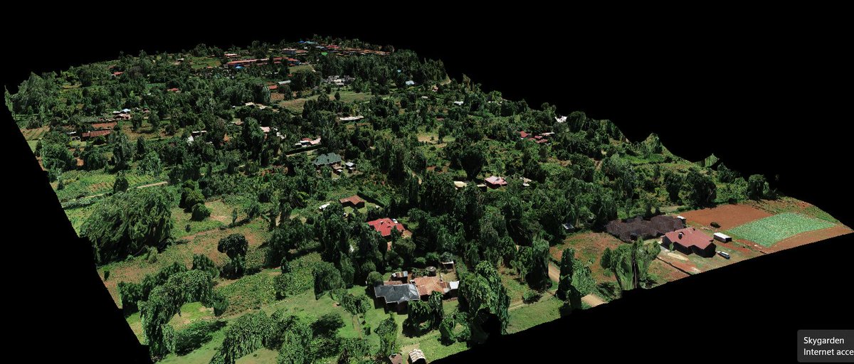
✨ Perfectly stitched 3D model of a rural neighborhood, reconstructed from high-resolution drone images taken by DJI ZENMUSE p1, using #DroneDeploy. This 3D orthomosaic is a high-resolution, distortion-free map, created by seamlessly combining multiple images.📡#GeospatialMapping

Arch Aerial is soaring to new heights in efficiency with their cutting-edge drone LiDAR technology, pushing the boundaries of geospatial mapping and redefining what's possible. #GeospatialMapping #DroneLiDAR #InnovationInFlight #DroneServices #DronePilots

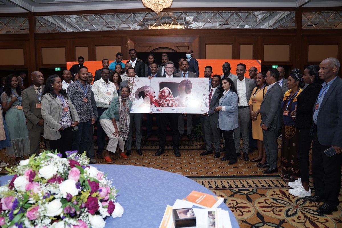
@FHI360 & our partners are excited to announce the launch of the @USAID Healthy Behaviors Activity in #Ethiopia 🇪🇹 . The Activity will increase healthy behaviors using social and behavior change & innovative community engagement and data use approaches, like #geospatialmapping.

Empowering Indigenous rangers with cloud-based geospatial tech, Winyama Digital Solutions, co-founded by Andrew Morumburri Dowding, bridges cultural heritage and modern innovation. #IndigenousTech #GeospatialMapping techbusinessnews.com.au/indigenous-it-…


#LoadSpring makes #GeospatialMapping easy with cloud-based/hosted applications so you can access and view anywhere in the world. hubs.ly/Q025hWP_0


Attention all mapping enthusiasts in India, APAC, Europe, and North America! Nebula Cloud Workbench for Photogrammetry is now live and tailored for your region! 🌍 Sign up now for a free trial at nebulacloud.ai #NebulaCloud #Photogrammetry #GeospatialMapping


Excited to share my new 3D elevation map of Germany, with scaled river systems. Visual learners, rejoice! I've put together a YouTube video that takes you through the process of crafting 3D elevation maps and scaling rivers. Access it here: youtu.be/piswxAEwnYo


Exciting times for #Malawi! MUBAS trains its first-ever geospatial experts, promising significant advancements in mapping and sustainable development. #GeospatialMapping #YouthInvolvement #Malawi2063 nyasatimes.com/mubas-hails-th…

Fascinating! #geospatialmapping #R #DataVisualization #Maps
My new map shows the seismic landscape of Italy and its environs, with over 16,000 earthquakes, each with a magnitude surpassing 2.5, from 1923 to 2023. 🌋 Can you spot the hotspots? 📍 Discover how to map earthquakes with my video tutorial. Click here: youtu.be/olNYYynSJfI


📢 ISA is seeking an organization with expertise in scientific and technical aspects of geospatial mapping and analyses. For more information, and how to send your proposal: bit.ly/4e336gz #GeospatialMapping #GIS #DataAnalysis #GeospatialData #ISAat30


Working in GIS and geospatial mapping? KELYN3D delivers greater accuracy and insights with our ultra high-resolution 3D stereo monitors. Learn more at kelyn3d.com #GIS #geospatial #geospatialmapping #kelyn3d #3dmonitor #3dstereo #pluraview #schneiderdigital


Every mission starts long before takeoff. Preparation, setup, and final checks, because quality results begin on the ground. Terralynx, Aerial insights. Clear results. 📩 [email protected] #DroneSetup #AerialData #GeospatialMapping #PrecisionAgriculture #AgriTech
When heat tells a story, our thermal drones listen. 🚁 🔥 The Parrot ANAFI USA is redefining infrastructure inspections in Nigeria from power lines to search & rescue. 👉 Available now at Geoinfostore.com #ThermalDroneNigeria #DroneInspectionLagos #GeospatialMapping
Register Now 👉 calendly.com/ideaforge-mzc/… Know More 👉 ideaforgetech.com/lp/aayam-2025 #AAYAM2025 #GeospatialMapping #DroneSurveying #FutureReadyMapping #ideaForge #SurveyofIndia
✨ Perfectly stitched 3D model of a rural neighborhood, reconstructed from high-resolution drone images taken by DJI ZENMUSE p1, using #DroneDeploy. This 3D orthomosaic is a high-resolution, distortion-free map, created by seamlessly combining multiple images.📡#GeospatialMapping

Discover the bustling Oakland Shipyard from above! Dive deeper with our Image Hunter tool and explore geospatial wonders like never before! imagehunter.apollomapping.com #SatelliteImagery #GeospatialMapping #OaklandShipyard #ExploreMore


Mapping the future of intermodal freight transport - where drones, AI, and real-time data converge to optimize the flow of goods across land, air, and sea. #IntermodalTransportation #GeospatialMapping #SupplyChainLogistics #DroneDelivery #AI4Logistics
Preserve history with FiOR CARTOgraph! Map sites, track changes, & compare historical data with precision. #HistoricalPreservation #GeospatialMapping

MOCCAE and MBRSC ink MoU to leverage geospatial capabilities satelliteprome.com/news/moccae-an… #MOCCAE #MBRSC #geospatialmapping @MoCCaEUAE @MBRSpaceCentre


Every mission starts long before takeoff. Preparation, setup, and final checks, because quality results begin on the ground. Terralynx, Aerial insights. Clear results. 📩 [email protected] #DroneSetup #AerialData #GeospatialMapping #PrecisionAgriculture #AgriTech

RT aboudjumbe: The #OpenDataInitiative for #geospatialmapping using #SenseFly #EBees #Drones with WorldBank suppor…


soil@depth-do you have subsoil constraints holding up yield potential? #knowyoursoil #PrecisionAg #geospatialmapping


GeoSLAM has expanded its mining offering to provide advanced underground mining solutions for production progress mapping, convergence analysis and vertical mine shaft inspection monitoring | bit.ly/3zNXz93 @GeoSLAMLtd #geospatialmapping #GeoSLAMConnect #minesurveying


@yves_barthelemy @edwardcanderson @Deo76em @FUFUJID @khastylez1 @SaidYusahaha @Ibrakhaleed @suza4GIS @ZmiDrone @WBTanzania @GFDRR @sensefly Congrats and Good luck to all of you on your big #ZMIDataRelease event today!! Wish I were there! #Zanzibar #GeospatialMapping Initiative.


We're starting the week off with some humor at Tarin😁. tarin.ca #geojoke #geospatialmapping #mapping#alberta #gis #geospatial #MappingMonday

The #OpenDataInitiative for #geospatialmapping using #SenseFly #EBees #Drones with @WorldBank support in #Zanzibar
Preserve history with FiOR CARTOgraph! Map sites, track changes, & compare historical data with precision. #HistoricalPreservation #GeospatialMapping
A bird’s eye view of #Glasgow during a recent #aerialsurvey @Glasgow @GlasgowCC #geospatialmapping ow.ly/SOky30daHwD

✨ Perfectly stitched 3D model of a rural neighborhood, reconstructed from high-resolution drone images taken by DJI ZENMUSE p1, using #DroneDeploy. This 3D orthomosaic is a high-resolution, distortion-free map, created by seamlessly combining multiple images.📡#GeospatialMapping
@FHI360 & our partners are excited to announce the launch of the @USAID Healthy Behaviors Activity in #Ethiopia 🇪🇹 . The Activity will increase healthy behaviors using social and behavior change & innovative community engagement and data use approaches, like #geospatialmapping.


A training on the tools and features of the Pacific Islands Protected Area Portal (PIPAP) and GIS by @SprepChannel and Nauru DCIE has improved the skills of Nauru practitioners to access #protectedareainformation and #geospatialmapping. Read more: shar.es/af3ScS


Applying #GIS on various infrastructure and urban planning projects through storage, analysis, display, and management of complex and voluminous data. Visit repl.global/services/urban… or mail:[email protected] #RemoteSensing #GeospatialMapping #SmartCity #AMRUT #UrbanPlanning #REPL

Transform how you manage land resources with satellite intelligence 🛰️ Actionable insights for agriculture, mining, forestry & more. 🔗 planeteyefarm.ai [email protected] #SatelliteData #GeospatialMapping #Innovation #ClimateAction #PlaneteyeFarmAI
#LoadSpring makes #GeospatialMapping easy with cloud-based/hosted applications so you can access and view anywhere in the world. hubs.ly/Q025hWP_0


@FHI360 & our partners are excited to announce the launch of the @USAID Healthy Behaviors Activity in #Ethiopia 🇪🇹 . The Activity will increase healthy behaviors using social and behavior change & innovative community engagement and data use approaches, like #geospatialmapping.
Target your audience with @Complete_MC's #GeospatialMapping application bit.ly/2bf4i4F #InnovationShowcase

Target your audience with @Complete_hv's #GeospatialMapping application bit.ly/2bf4i4F #InnovationShowcase

📢 ISA is seeking an organization with expertise in scientific and technical aspects of geospatial mapping and analyses. For more information, and how to send your proposal: bit.ly/4e336gz #GeospatialMapping #GIS #DataAnalysis #GeospatialData #ISAat30
Something went wrong.
Something went wrong.
United States Trends
- 1. Penn State 23.6K posts
- 2. Indiana 39.4K posts
- 3. Mendoza 20.8K posts
- 4. Gus Johnson 6,983 posts
- 5. Heisman 9,085 posts
- 6. #UFCVegas111 5,493 posts
- 7. #iufb 4,300 posts
- 8. Sayin 70.7K posts
- 9. Iowa 20.3K posts
- 10. Mizzou 4,013 posts
- 11. Omar Cooper 9,773 posts
- 12. Josh Hokit N/A
- 13. Estevao 41.7K posts
- 14. Kirby Moore N/A
- 15. Oregon 34.3K posts
- 16. Sunderland 156K posts
- 17. Beck 7,610 posts
- 18. Texas Tech 14.2K posts
- 19. Happy Valley 1,940 posts
- 20. Preston Howard N/A