#mapdesign 搜索结果

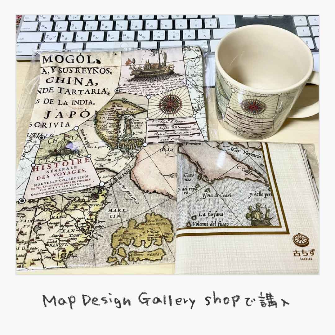
先週北九州の小倉にある #ゼンリンミュージアム にいってきたよ。地図の説明をしてくれるZキュレーターさんの説明がおもしろくてめちゃ楽しめた。 #MapDesign Gallery で古地図グッズをいくつか購入〜 #イラスト #ハナゲコ #猫 #Illustration #芸術同盟 #イラスト好きな人と繋がりたい


I'm so excited to be designing for Ponderosa Zoo today - Look at this little guy. 😭 Happy as Larry 😍 #illustrator #design #mapdesign #zoo #playfuldesign #westyorkshire


Papua New Guinea Vector Outline Maps vectoroutlinemaps.com/papua-new-guin… #VectorOutlineMaps #MapDesign #VectorInfographics #vector #GraphicDesign #cartography #PapuaNewGuineaIllustration #VectorGraphics #OutlineMaps


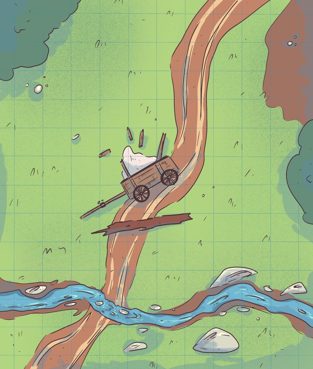
A broken cart and a fallen tree - absolutely nothing is happening, for sure 👀 #dndmap #mapdesign #rpgmap


Grand Canyon map, work in progress. Decided to ditch my exaggerated style and attempting to make a 'real' informative map as well as I can with what I have. Will probably take weeks to finish though. #mapping #cartography #mapdesign #GrandCanyon


Diving deeper into this aesthetic. Getting full on Enemy of the State vibes with this map interaction. Built with @mapbox #uidesign #mapdesign


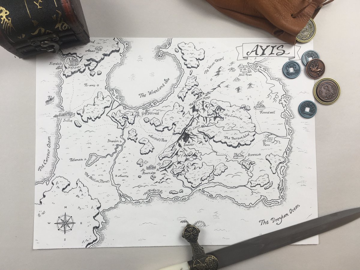
Hey this isn't new but its still one of my favorite things I've ever done. #ttrpg world #mapdesign is something I do and hopefully get to keep doing cause it is pretty. This is for my group's home #dnd game and we got to explore pretty much most of this map and beyond
Was reading about Dave Imus of Oregon and I was in awe of his map of America. So now I just have to start a project of new maps with lot more details and meaning. But where to start..? #mapping #cartography #mapdesign #GIS

Waimakariri Vector Outline Maps vectoroutlinemaps.com/new-zealand/wa… #VectorGraphics #MapDesign #New Zealand #VectorOutlineMap #WaimakaririVectorMaps #geographic #VectorIllustration #cartography #infographics #VectorInfographics


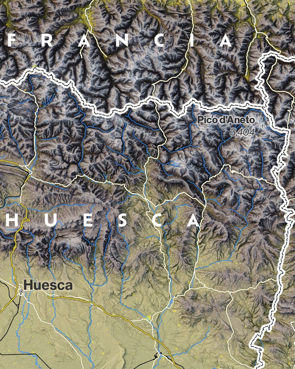
An update of the map of Alps. We have glaciers and lakes. Time to add relevant peaks and river labels! #cartography #mapdesign


Factory (Blockout) Version 3 A deeper explanation can be seen here (youtu.be/BHvvn-N8dwI) #leveldesign #mapdesign #blockout #gamedesign #gamedevelopment #counterstrike

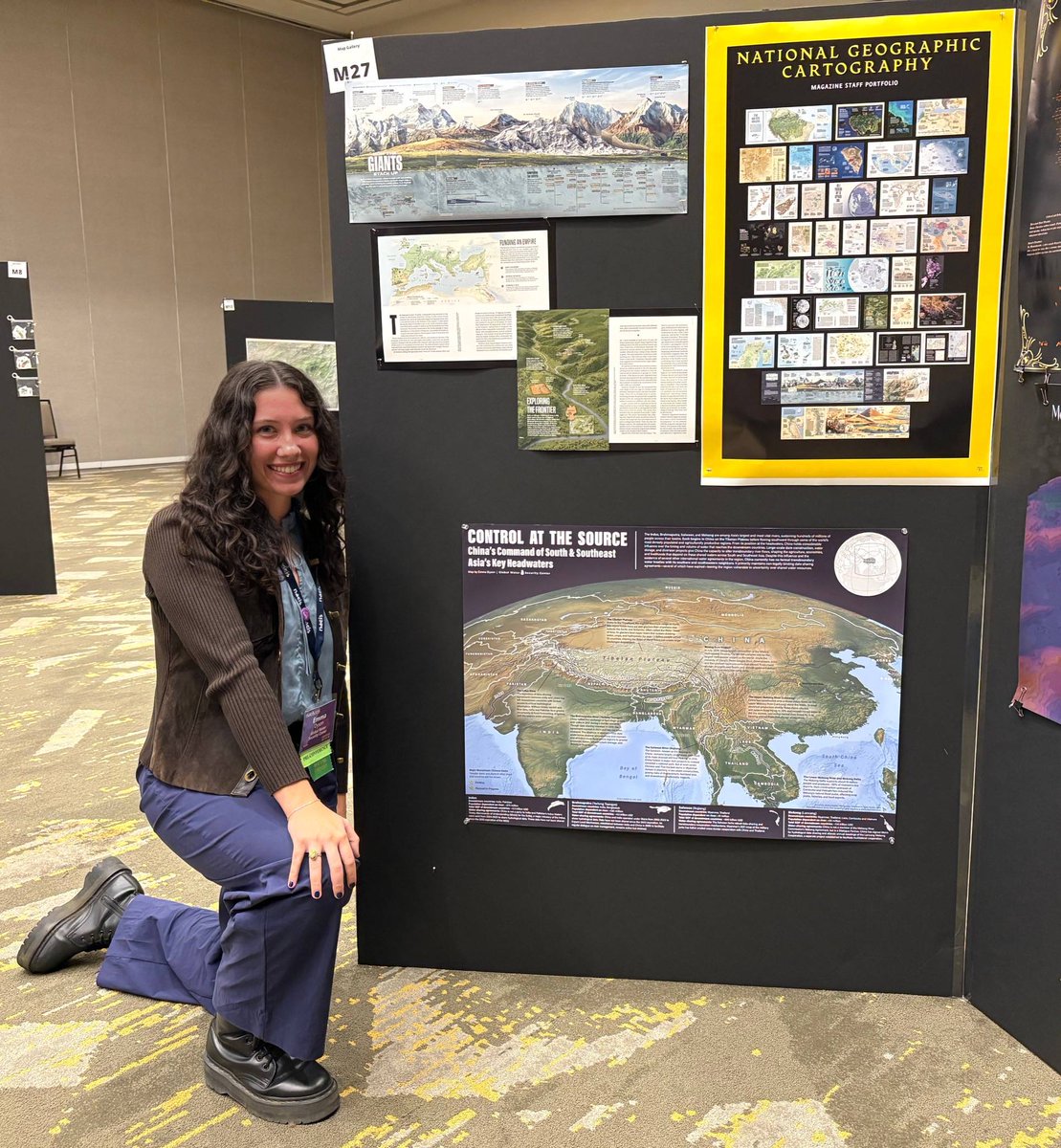
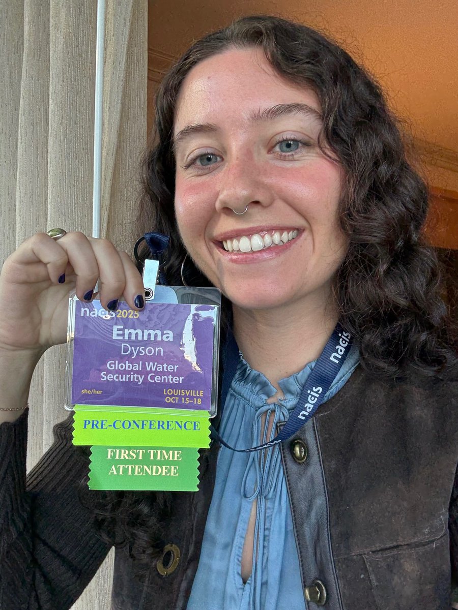
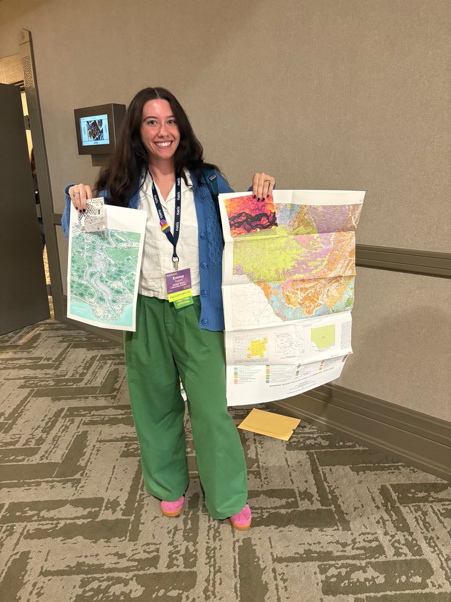
GWSC Cartographer Emma Dyson showcased her map “Control at the Source” at the NACIS Annual Meeting in Louisville, learning new 3D mapping and design techniques while connecting with cartographers from across the U.S. and abroad. 🗺️ 💦 #GWSC #Cartography #MapDesign #DataViz
Just a map update: I found in an old atlas this solution for indicating mountains, where the height is placed where the mountain is located. For the cities I used the wonderful font created by Sarah Bell, "High Alpine". #mapdesign #Qgis

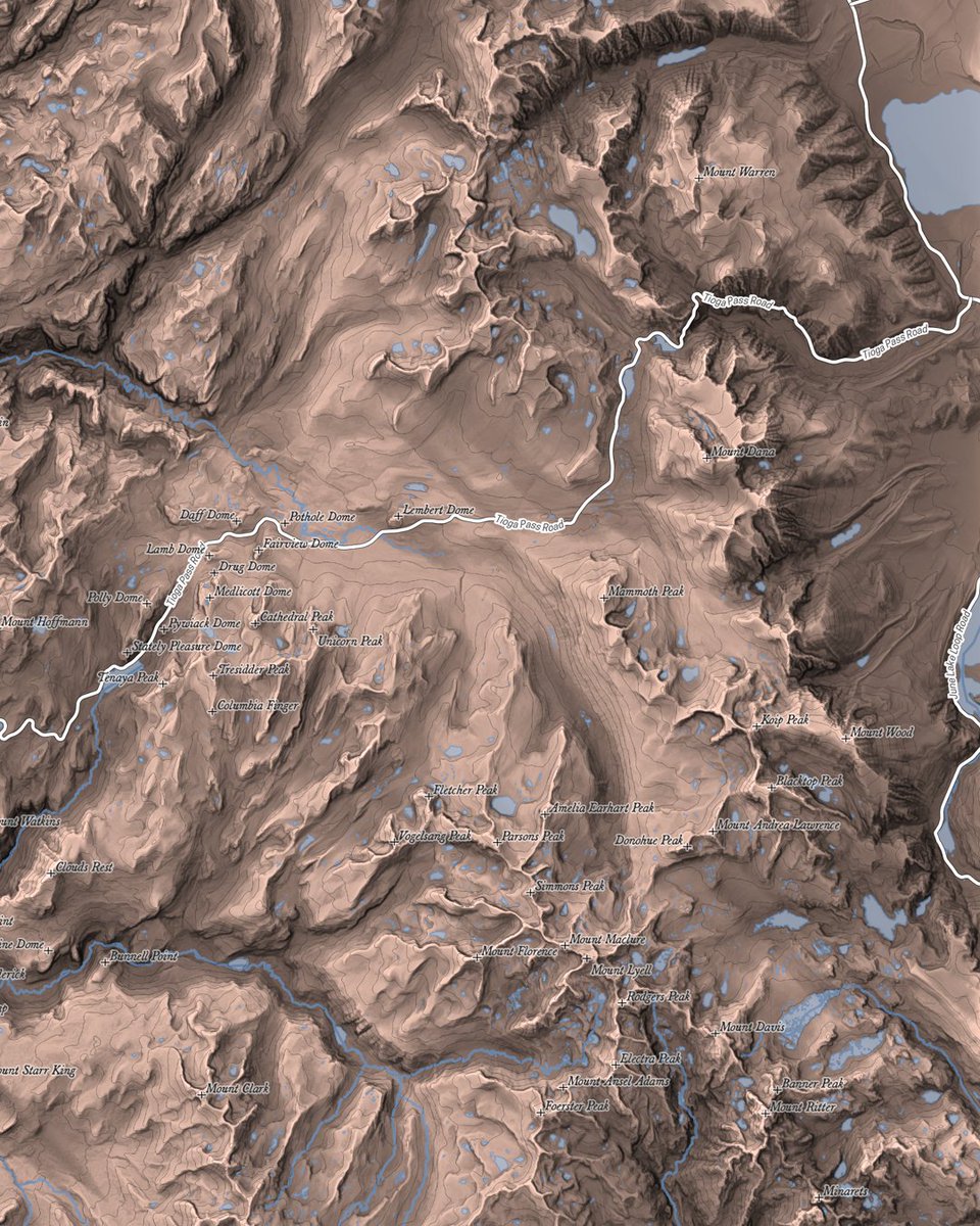
While doing map of Grand Canyon, I just have to do Yosemite. Work in progress, looking ok so far. Map is currently pretty dark, it will get brighter and probably less contrasty. And way less labels! #mapping #cartography #mapdesign #Yosemite


Waimakariri Vector Outline Maps vectoroutlinemaps.com/new-zealand/wa… #VectorGraphics #MapDesign #New Zealand #VectorOutlineMap #WaimakaririVectorMaps #geographic #VectorIllustration #cartography #infographics #VectorInfographics
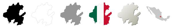
Hidalgo Vector Outline Maps vectoroutlinemaps.com/mexico/hidalgo… #infographics #MapDesign #VectorGraphics #Hidalgo #VectorMaps #infographic #HidalgoMaps #OutlineMaps

Love this! Nothing better than watching a map get created from scratch #MapDesign #DnD #DrakenMemoria
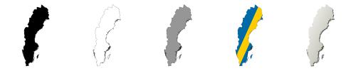
Sweden Vector Outline Maps vectoroutlinemaps.com/sweden-vector-… #SwedenIllustration #MapDesign #map #geographic #VectorMaps # #VectorDesign #OutlineMap #SwedenOutlineMap #SwedenMap
Saskatchewan Vector Outline Maps vectoroutlinemaps.com/canada/saskatc… #Canada #MapDesign #cartography #OutlineMaps #geographic #VectorOutlineMaps #vector #infographic


Map of island of Tenerife, Canary Islands. So many finnish people have visited this island. I haven't. Map data from OpenStreetMap. Elevation data: COP30 #mapping #cartography #mapdesign #Tenerife


Map of São Miguel island in Azores. This map was fun to make. Reminds me old my old geography books from school #mapping #cartography #mapdesign #Azores


先週北九州の小倉にある #ゼンリンミュージアム にいってきたよ。地図の説明をしてくれるZキュレーターさんの説明がおもしろくてめちゃ楽しめた。 #MapDesign Gallery で古地図グッズをいくつか購入〜 #イラスト #ハナゲコ #猫 #Illustration #芸術同盟 #イラスト好きな人と繋がりたい
Map of Isle of Skye, Scotland. Talisker, anyone? Map data from OpenStreetMap. Elevation data: COP30 #mapping #cartography #mapdesign #IsleofSkye #Scotland


Grand Canyon map, work in progress. Decided to ditch my exaggerated style and attempting to make a 'real' informative map as well as I can with what I have. Will probably take weeks to finish though. #mapping #cartography #mapdesign #GrandCanyon
Map of Elba island, Italy. Retro experiments continue. Map data from OpenStreetMap. Elevation data from tinitaly.pi.ingv.it #mapping #cartography #mapdesign #Madeira


I'm so excited to be designing for Ponderosa Zoo today - Look at this little guy. 😭 Happy as Larry 😍 #illustrator #design #mapdesign #zoo #playfuldesign #westyorkshire
A broken cart and a fallen tree - absolutely nothing is happening, for sure 👀 #dndmap #mapdesign #rpgmap

Wrapping up a property map illustration for Historic Savage Mill - A MD based shopping and event market space #illustration #mapdesign #Procreate

GWSC Cartographer Emma Dyson showcased her map “Control at the Source” at the NACIS Annual Meeting in Louisville, learning new 3D mapping and design techniques while connecting with cartographers from across the U.S. and abroad. 🗺️ 💦 #GWSC #Cartography #MapDesign #DataViz

地図がデザインされた文具・雑貨の専門店 「Map Design GALLERY成田空港」期間限定オープン ofmaga.com/news.html?eid=… #MapDesign #地図 #文具 #雑貨 #成田空港 #旅行 #観光


Was reading about Dave Imus of Oregon and I was in awe of his map of America. So now I just have to start a project of new maps with lot more details and meaning. But where to start..? #mapping #cartography #mapdesign #GIS
An update of the map of Alps. We have glaciers and lakes. Time to add relevant peaks and river labels! #cartography #mapdesign
While doing map of Grand Canyon, I just have to do Yosemite. Work in progress, looking ok so far. Map is currently pretty dark, it will get brighter and probably less contrasty. And way less labels! #mapping #cartography #mapdesign #Yosemite

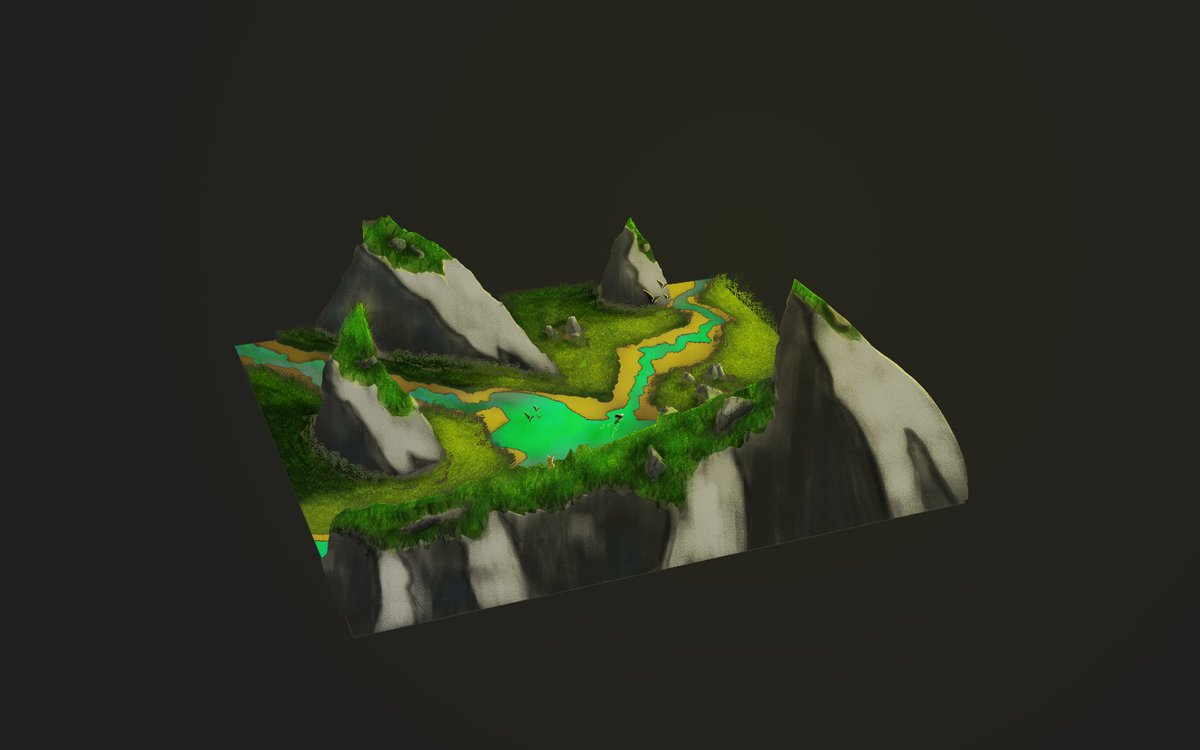
🌄 Petit paysage digital réalisé sur #Photoshop pour m’entraîner ! J’attends vos retours 👇 🔍 Détails, compo, couleurs… tout m’intéresse pour progresser. 🔁 RT & 💬 critiques bienvenus ! #DigitalArt #MapDesign #ConceptArt #PhotoshopArt #ArtCommunity #EnviroArt #WIP
Something went wrong.
Something went wrong.
United States Trends
- 1. Klay 23.3K posts
- 2. Good Sunday 53.2K posts
- 3. McLaren 93.4K posts
- 4. Lando 131K posts
- 5. #FelizCumpleañosNico 2,653 posts
- 6. #FelizCumpleañosPresidente 2,607 posts
- 7. #AEWFullGear 72K posts
- 8. Ja Morant 10.5K posts
- 9. #LasVegasGP 224K posts
- 10. Oscar 123K posts
- 11. Piastri 68.7K posts
- 12. Verstappen 99.7K posts
- 13. Gambino 3,167 posts
- 14. LAFC 16.6K posts
- 15. Kimi 54K posts
- 16. Hangman 10.6K posts
- 17. Samoa Joe 5,350 posts
- 18. Tottenham 37.1K posts
- 19. Swerve 6,692 posts
- 20. South Asia 37K posts