#mappingtech search results

NEW: Mobileye’s long-standing relationship with @Ford deepens into strategic collaboration. Ford will add REM™ #mappingtech to a future version of Ford BlueCruise & bring L2+ hands-free ADAS solutions across multiple makes and models. #CES2022


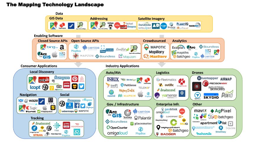
Looked at #mappingtech @greycroftvc. Market map finally seeing light of day. Thanks to @MaximSirenko @MapAnything for help w/ this!

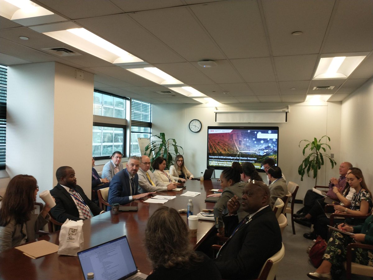
This morning I presented how Canada utilizes #AI and automated mapping technology for disaster response. Exploring its immense potential!#MappingTech J'ai présenté la façon dont le Canada utilise l'IA et la technologie de cartographie automatisée pour répondre aux catastrophes

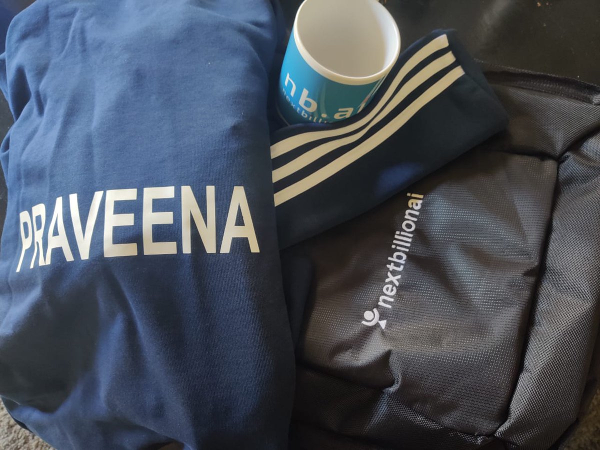
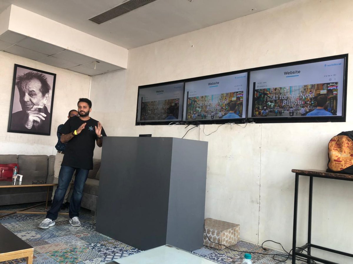
We believe it’s important to put our best minds together, to forge the way ahead - and after a long year of working remotely, we recently held a safe, in-person Town Hall meeting, discussing the many facets of Nextbillion.ai. #nextbillion #mappingtech #AI #ML #TeamMeet


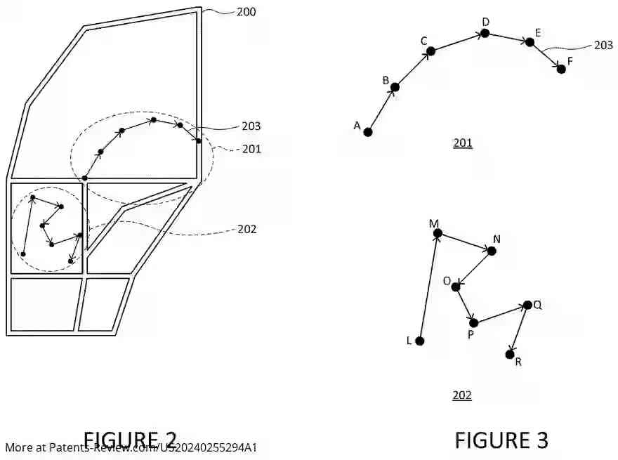
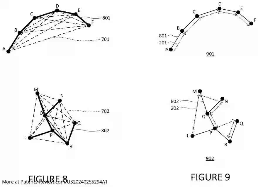
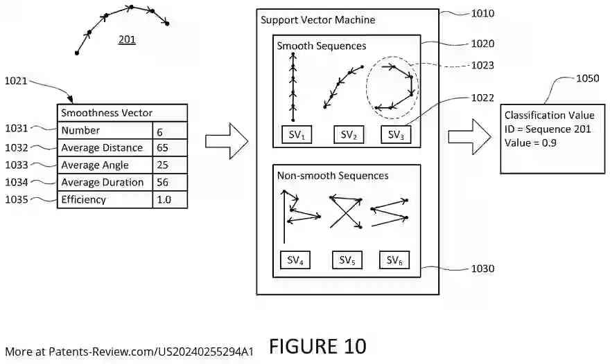
#Google's new patent app #US20240255294A1 outlines a method to identify and display smooth and demarked paths using user-captured images and geographic data. It uses time-stamped images to determine path confidence and mark routes. #MappingTech #privacy

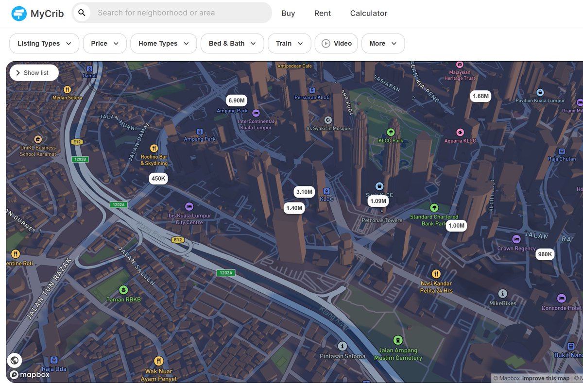
"Using 3D maps with dynamic lighting to visualize evening shadows on buildings, you can gauge how much sunlight a property gets. 🌇🏢 #MappingTech #RealEstateInsights" crib.my/buy/101.72688,…

Nobody Wants to Let Google Win the War for Maps All Over Again buff.ly/2HTecWz #SelfDrivingCars #mappingtech


Recently, SaaS Cast sat down with our CEO, Hongwei Liu, about mapping the future and how we're innovating on indoor navigation. Listen here hubs.li/Q02k6hBV0 or watch here hubs.li/Q02k6dhx0 #indoormapping #indoormaps #mappingtech #kwtech

Build your mapping camera smarter and faster! 🚀 Whether it's for drone mapping, surveying, or smart imaging, FSM:GO has you covered. Save time, save costs, and focus on creating! 👉 Learn more: bit.ly/4hk2Vzv?utm_ca… #MappingTech #OpticalSensors #Innovation

#Chinese investors buy stake in mapping firm #HERE | Reuters #MappingTech #MapTech #M&A #Tencent reut.rs/2hoVdER


Exciting news! Velodyne Lidar's Intelligent Infrastructure Solution wins the GeoBuiz Summit Award for innovation in Mapping Technology! A leap forward for smart cities and sustainable futures! #SmartCity #Innovation #MappingTech easternherald.com/2022/06/03/vel…


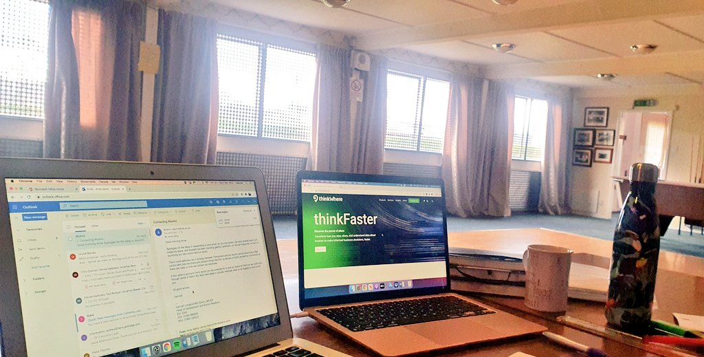
Back on the @thinkWhere1 horse today working from the best garden shed in history... All you #geospatial chaps out there hateful of your current #mappingtech #gis systems, give @owl_barnes a tinkle. 🗺📍🌏

🚀 Elevating Orlando's commercial buildings with advanced mapping! Dive into our latest roof inspections through orthophotos, DTM, & DSM images. 🏢💼 Ready to transform your property management? Let's chat! #RoofInspection #MappingTech #Orlando #Innovation


Wishing everyone a joyous Makar Sankranti ✨ #lifeatGenesysInternational #GenesysInternational #mappingtech #geospatialdata #GIS #mapsarecool #mappingmadeeasy #team #share #holiday #event

How @Microsoft trained algorithms and used #mappingtech to enable #AI to help predict, plan and prepare for natural disasters. wired.com/story/how-arti…


🌱#MappingTech gives #farmers real-time insights through drones, GPS, sensors and satellites, helping boost yields, cut waste and farm smarter. But barriers like high costs and poor connectivity persist. 🔎Explore more in the latest #4Growth blog: 4growth-project.eu/agriculture/dr…

Unlock precision with Skyland Pixels' Digital Surface Model (DSM)! 🌍✨ Our cutting-edge mapping technology offers unmatched detail and accuracy. Ready to elevate your projects? Visit our website to learn more! 📸🚀 #SkylandPixels #MappingTech #DSM #Innovation


🚀 Precision mapping made simple! 🛰️ Drone Survey📡 DGPS Correction🗺️ GIS Integration📊 Smart Outputs View the full workflow in our latest infographic👇 🔗shorturl.at/F26qy #DroneSurvey #GIS #MappingTech #DGPS


🌍 LogicSpatial.com is for sale! Perfect for: • Geospatial SaaS platforms • Location intelligence tools • AI logistics or mapping apps DM to acquire. #GeoAI #MappingTech #DomainForSale #LogicSpatial


"What lies beneath 🛰️. The underground utility mapping market is surging with smarter infrastructure planning & urban safety needs. 👉 wkinformation.com/market-reports… #SmartCities #Infrastructure #MappingTech"
wkinformation.com
Underground Utility Mapping Market Set to Reach $1.12 Billion by 2025 as Infrastructure Projects...
The Underground Utility Mapping Market is set to reach $1.12 billion by 2025, driven by advancing infrastructure projects in the U.S., U.K., and Australia.

The Mapping Revolution Is Here 🗺️✈️ Survey drones are taking modern mapping to new heights—precision, speed, and smart data collection all in one. 🔗 Read full blog: mavdrones.com/the-rise-of-su… #SurveyDrones #MappingTech #DroneMapping #GeospatialData #Innovation #MaverickDrones

🌱#MappingTech gives #farmers real-time insights through drones, GPS, sensors and satellites, helping boost yields, cut waste and farm smarter. But barriers like high costs and poor connectivity persist. 🔎Explore more in the latest #4Growth blog: 4growth-project.eu/agriculture/dr…
High-res images & geospatial data—our aerial solutions are redefining precision in surveying! Proud to collaborate with a survey company to streamline boundary determination. 📍 Orlando, FL #DroneImagery #SurveyingSolutions #MappingTech #GeospatialData #PrecisionMapping


GIS Controller Market Size, Share, Trends and Growth Report 2032 marketresearchfuture.com/reports/gis-co… #GISController #MappingTech #GeospatialTech #SurveyInnovation #FutureOfMapping
marketresearchfuture.com
GIS Controller Market Size, Share, Trends and Growth Report 2032
GIS Controller Market is predicted to hit USD 3.5 Billion at a CAGR of 7.3% by 2032, Global GIS Controller Industry Growth by Type, Application, and Product

LiDAR in Mapping Market Size Report, Share, Trends and Growth 2032 | LinkedIn #LiDAR #MappingTech #GeospatialInnovation #RemoteSensing #TechInMapping linkedin.com/pulse/lidar-ma…
linkedin.com
LiDAR in Mapping Market Size Report, Share, Trends and Growth 2032
The LiDAR in Mapping Market has emerged as a pivotal force in revolutionizing geospatial data collection and analysis across a wide range of industries. With applications spanning from urban planning...
Build your mapping camera smarter and faster! 🚀 Whether it's for drone mapping, surveying, or smart imaging, FSM:GO has you covered. Save time, save costs, and focus on creating! 👉 Learn more: bit.ly/4hk2Vzv?utm_ca… #MappingTech #OpticalSensors #Innovation
NEW: Mobileye’s long-standing relationship with @Ford deepens into strategic collaboration. Ford will add REM™ #mappingtech to a future version of Ford BlueCruise & bring L2+ hands-free ADAS solutions across multiple makes and models. #CES2022
Looked at #mappingtech @greycroftvc. Market map finally seeing light of day. Thanks to @MaximSirenko @MapAnything for help w/ this!
Nobody Wants to Let Google Win the War for Maps All Over Again buff.ly/2HTecWz #SelfDrivingCars #mappingtech
We believe it’s important to put our best minds together, to forge the way ahead - and after a long year of working remotely, we recently held a safe, in-person Town Hall meeting, discussing the many facets of Nextbillion.ai. #nextbillion #mappingtech #AI #ML #TeamMeet
This morning I presented how Canada utilizes #AI and automated mapping technology for disaster response. Exploring its immense potential!#MappingTech J'ai présenté la façon dont le Canada utilise l'IA et la technologie de cartographie automatisée pour répondre aux catastrophes
How @Microsoft trained algorithms and used #mappingtech to enable #AI to help predict, plan and prepare for natural disasters. wired.com/story/how-arti…
"Using 3D maps with dynamic lighting to visualize evening shadows on buildings, you can gauge how much sunlight a property gets. 🌇🏢 #MappingTech #RealEstateInsights" crib.my/buy/101.72688,…
#Google's new patent app #US20240255294A1 outlines a method to identify and display smooth and demarked paths using user-captured images and geographic data. It uses time-stamped images to determine path confidence and mark routes. #MappingTech #privacy

.@streetcredlabs upping the ante and now launching #MapCES @CES, to crowdsource mapping indoor spaces in Vegas, incentivized with USDC stablecoin prizes. Wowie, love it! events.streetcred.co/ces/ cc @BoweryCapital #Crytpo #MappingTech

#Chinese investors buy stake in mapping firm #HERE | Reuters #MappingTech #MapTech #M&A #Tencent reut.rs/2hoVdER
Back on the @thinkWhere1 horse today working from the best garden shed in history... All you #geospatial chaps out there hateful of your current #mappingtech #gis systems, give @owl_barnes a tinkle. 🗺📍🌏
Exciting news! Velodyne Lidar's Intelligent Infrastructure Solution wins the GeoBuiz Summit Award for innovation in Mapping Technology! A leap forward for smart cities and sustainable futures! #SmartCity #Innovation #MappingTech easternherald.com/2022/06/03/vel…
🌱#MappingTech gives #farmers real-time insights through drones, GPS, sensors and satellites, helping boost yields, cut waste and farm smarter. But barriers like high costs and poor connectivity persist. 🔎Explore more in the latest #4Growth blog: 4growth-project.eu/agriculture/dr…
🌍 LogicSpatial.com is for sale! Perfect for: • Geospatial SaaS platforms • Location intelligence tools • AI logistics or mapping apps DM to acquire. #GeoAI #MappingTech #DomainForSale #LogicSpatial
🚀 Elevating Orlando's commercial buildings with advanced mapping! Dive into our latest roof inspections through orthophotos, DTM, & DSM images. 🏢💼 Ready to transform your property management? Let's chat! #RoofInspection #MappingTech #Orlando #Innovation

🏗️ Unlock the potential of DXF files in #AEC projects with Pix4Dcloud Advanced. Discover how to elevate your planning and execution with precise mapping tools. 🌍 Read the blog 👉 t.ly/Q4np4 - #MappingTech #ConTech - @pix4d

Unlock precision with Skyland Pixels' Digital Surface Model (DSM)! 🌍✨ Our cutting-edge mapping technology offers unmatched detail and accuracy. Ready to elevate your projects? Visit our website to learn more! 📸🚀 #SkylandPixels #MappingTech #DSM #Innovation

🏗️ Unlock the potential of DXF files in #AEC projects with Pix4Dcloud Advanced. Discover how to elevate your planning and execution with precise mapping tools. 🌍 Read the blog 👉 t.ly/Q4np4 - #MappingTech #ConTech

Something went wrong.
Something went wrong.
United States Trends
- 1. Raindotgg 1,073 posts
- 2. Louisville 13.9K posts
- 3. Ortiz 15.7K posts
- 4. #GoAvsGo 1,408 posts
- 5. Nuss 5,476 posts
- 6. Batum N/A
- 7. Miller Moss 1,151 posts
- 8. UCLA 7,406 posts
- 9. Emmett Johnson 1,968 posts
- 10. #Huskers 1,029 posts
- 11. #FlyTogether 1,500 posts
- 12. Bama 13.5K posts
- 13. Oilers 4,291 posts
- 14. Brohm 1,127 posts
- 15. #MASHLE N/A
- 16. #Toonami 1,280 posts
- 17. Nikki Glaser N/A
- 18. Lateef 2,110 posts
- 19. Ty Simpson 3,521 posts
- 20. The ACC 19.6K posts