#mastermap 搜尋結果

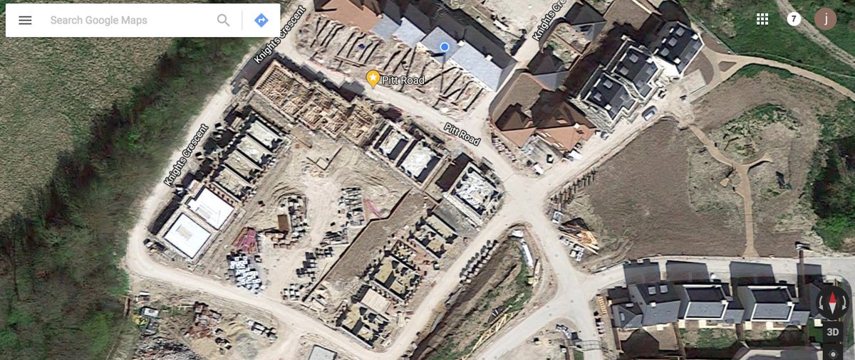
This is my house on @googlemaps. We've lived here for almost a year and I think this image is about 14 months old. Shows how awesome the @OrdnanceSurvey #Mastermap is and how valuable making it more available is going to be.

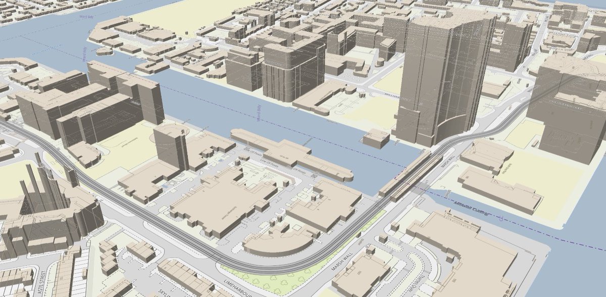
Experimenting with a blend of Mastermap vector and aerial photography as new baselayers. #ordnancesurvey #QGIS #Mastermap

Our popular speed datasets are now available from @OrdnanceSurvey as part of their OS #MasterMap #Highways Network product - find out more & how you can add these datasets ow.ly/qzqt30laBWJ #speeddata #speedlimits #averagespeeds ow.ly/d/7Ym0


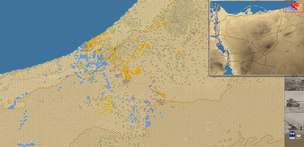
#CampaignSeries #MiddleEast #MasterMap #Sinai #CanalZone Just a reminder about the sheer scale of the maps included within the game. 👇

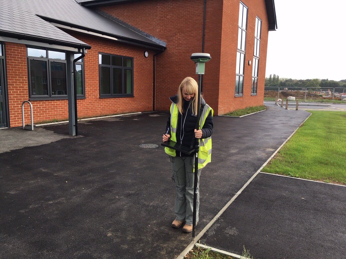
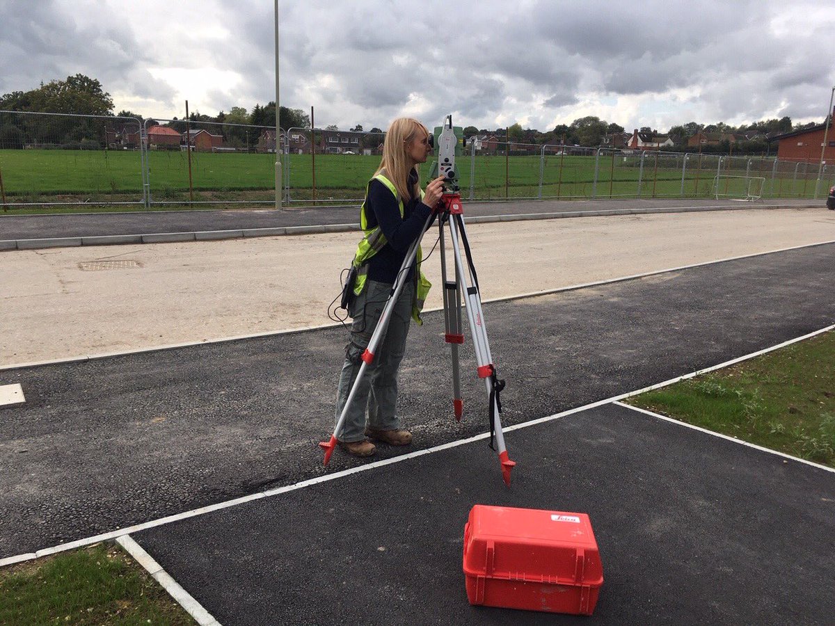
Brilliant day out with an @OrdnanceSurvey surveyor. Got to see the detailed work that goes into making our data and maps so detailed and trusted! Proud to contribute to #MasterMap

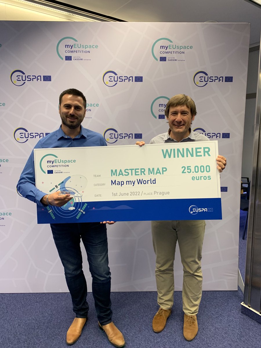
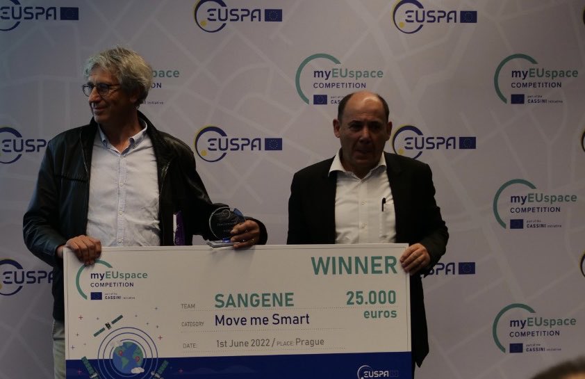
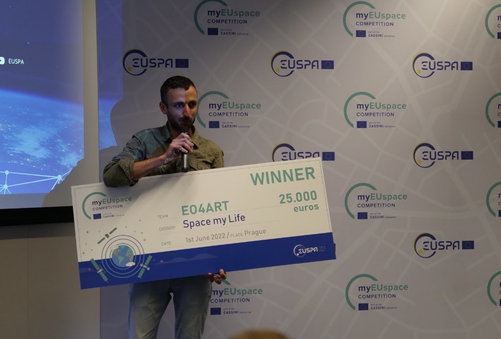
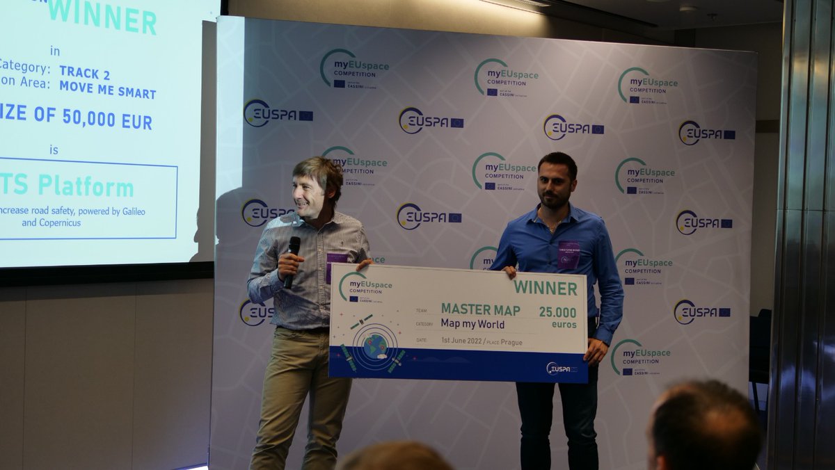
🇪🇺 #MyEUSpace : +200 ideas submitted | 43 selected | 11 winner🏆 3 🇫🇷 awarded 👍 #MasterMap a solution of road status #SaNGENE an integrated GNSS-based radar for detection of obstacles #EO4ART an application for artistic products @France_CZ @EU4Space

Next week is going to be huge!! 🎮 Who's ready for the very 1st @Mastermind_MGT medium article release?! On top of that, the #MasterPlan could be out any moment! 😍 Oh, and I hear there's a #MasterMap and it leads to #TReaSuRe!!🏴☠️ @BubbleTea1110 @loopeyRV


Its #OutdoorClassroomDay tomorrow! Don’t forget @Digimap4Schools is fantastic for mapping your activities with our amazing @OrdnanceSurvey #mastermap data.

With a full range of maps including #MasterMap, City, Street, Town and Aerial Edozo can provide all the #mapping solutions you’ll need.

'Europa Technologies is pleased to announce a new vector tile service for OS #MasterMap #Topography Layer as the latest addition to the viaEuropa platform of web services for @OrdnanceSurvey digital map data.' Find out more here: bit.ly/2RALbnz @europatech

Trying the perfect the transition between data (#Zoomstack and #Mastermap) ....strangely hypnotic.... #GIS #GEO #mappydreams

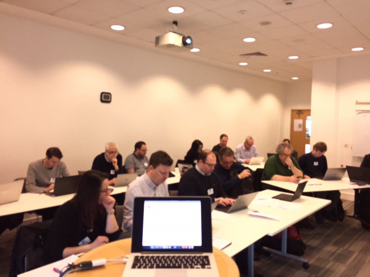
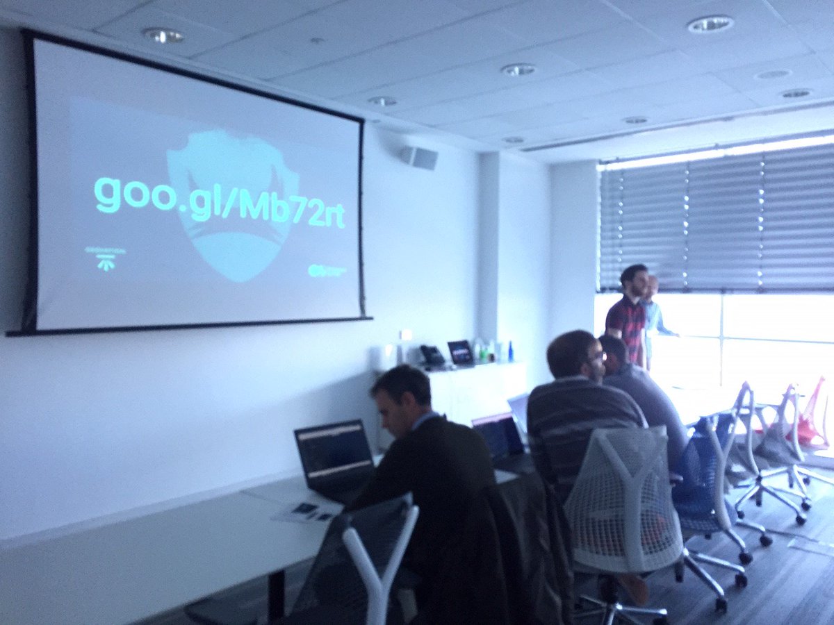
Can you help us gather data user needs to inform UK government plans to make #MasterMap more open for small businesses? Join our workshop Tuesday 27th 6pm at @wshed eventbrite.co.uk/e/geospatial-u… #opendata #geospatial

Upcoming events: @OrdnanceSurvey are running 3 OS #MasterMap Highways workshops in #Wales this September. Find out more and book your place here: agi.org.uk/events/calendar


Interested in serving @OrdnanceSurvey #MasterMap in @GeoserverO ? Our team is preparing a read-to-use data dir plus other instructions which we will release shortly for free. Stay tuned! @OSGeo @foss4g @planetosgeo #geoserver @GeoNode @mapstore2 @foss4guk #sld #mapping #maps

We have added data for average speed times and legal speed limits to our OS #MasterMap #Highways Network product. Find out more here: social.os.uk/highways_ChnMK


Here at @emapsite we love staring at the detail on OS maps and don't half find some strange things! Like these floral clocks. Guess how many floral clocks there are in @OrdnanceSurvey #MasterMap? #geodata


The @GOVUK is making @OrdnanceSurvey #MasterMap #data FREE to use, estimating it will boost the #UK #economy by £130M: buff.ly/2JQeT3L
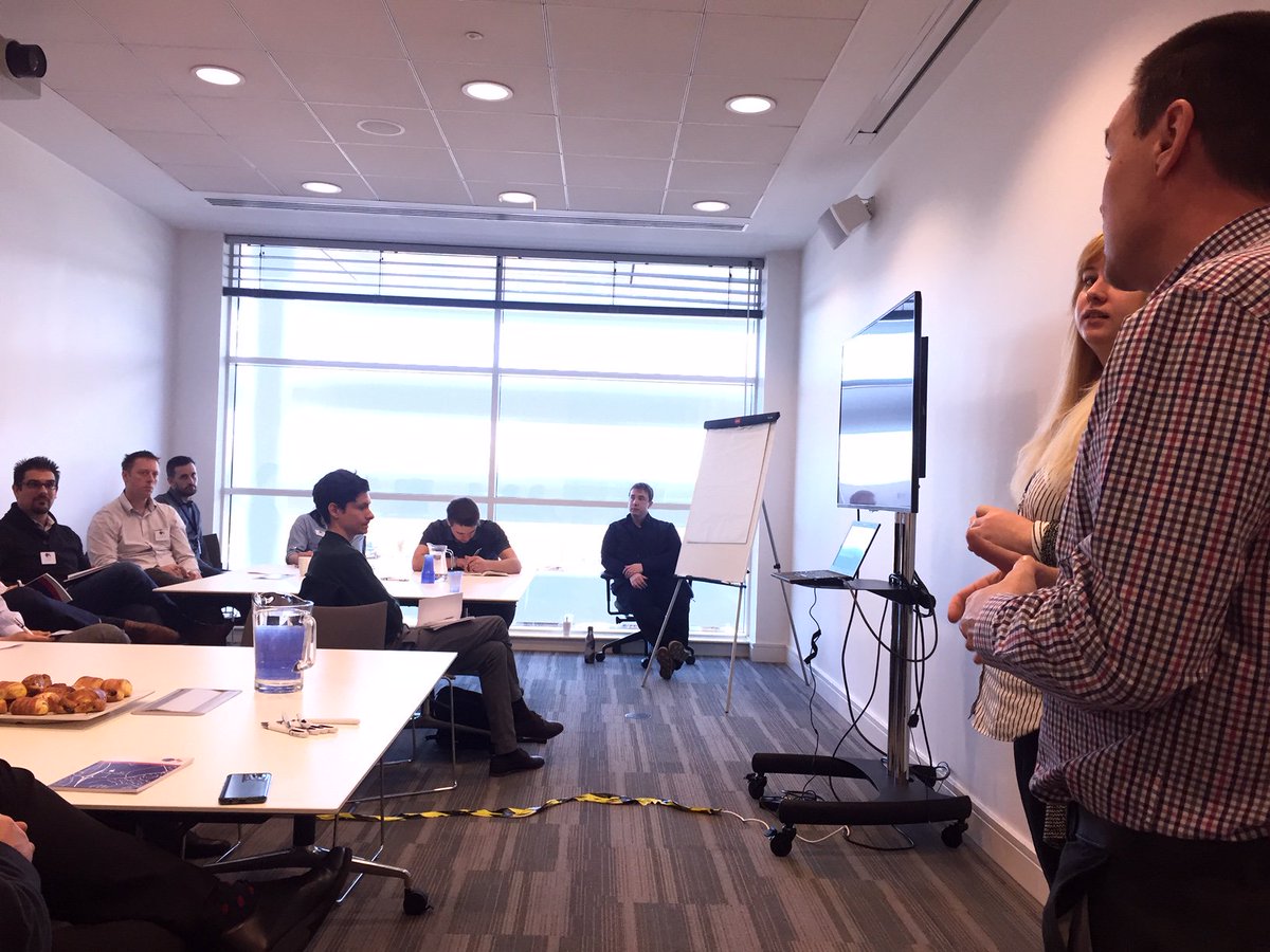
Lead by our product and consultancy teams, the workshops for our technical showcase are in progress and focus on #AddressBase Premium, OS #MasterMap Highways, OS Open #Zoomstack and API


The latest twist in Open #MasterMap #openaddresses #opendata #geospatial #geospatialcommission #IoT


The latest #MasterMap® Topography Layer update is now live on mapserve.co.uk #mapping #maps #ordnancesurvey
Calling all #architects, urban planners, and GIS enthusiasts! Test our latest sample and share your feedback. Our new Land Use layer of OS #MasterMap can save you time creating a Site Analysis and architectural reports. We'd love to hear your feedback! #SiteAnalysis #Feedback
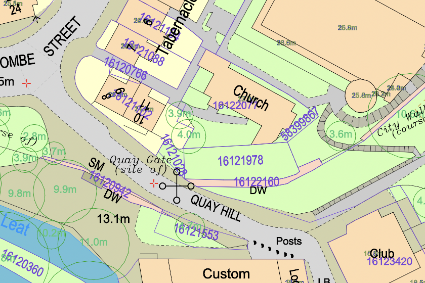
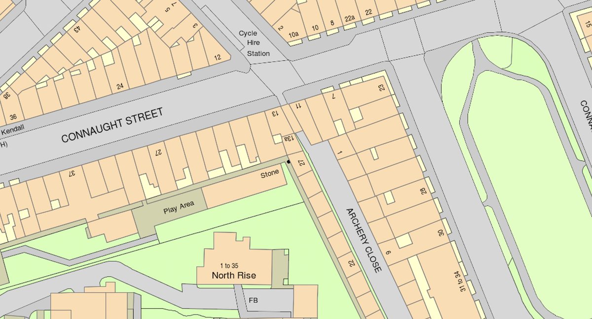
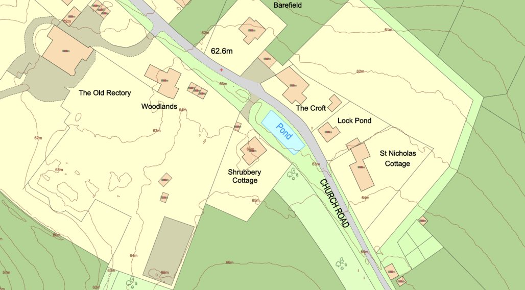
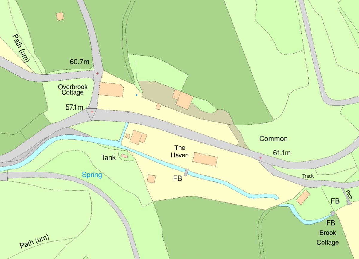
OS #MasterMap® is the most detailed and updated map of the UK and contains tons of information about the landscape of the UK. Did you know that it contains several key layers of information? They include topography, address, land use layers and much more. tinyurl.com/mway69w5
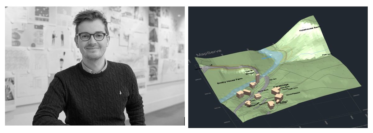
Ceri at Atelier Two #architectural studio saved over £1500 and 3 weeks of project time with MapServe's 3D #MasterMap®. Here's how: shorturl.at/djEK4 #mapping #architecture #3dmodel


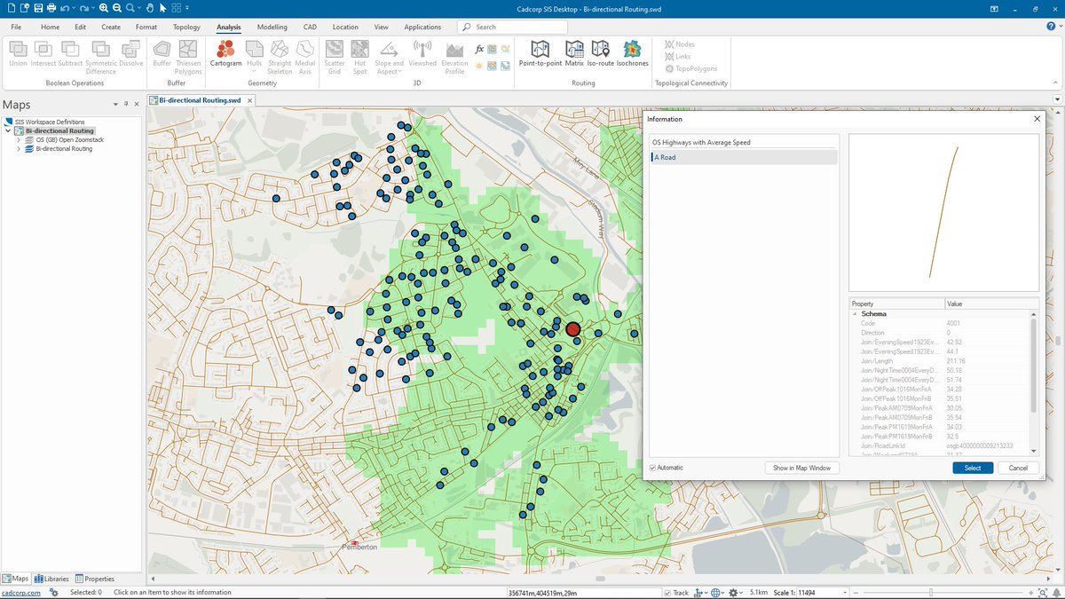
Cadcorp SIS 9.1 is here | #SISDesktop free route-finding tools now include bi-directional route costs and can be used with @ordnancesurvey #MasterMap Highways Network with speed data. What else is new? cdcp.io/sis9-1 #SIS9.1 #MakingSenseofPlace #spatialinsight #GIS
Today's tip: OS #MasterMap® is designed for display at 1:1250 scale, which means that one metre on the plan corresponds to 1,250 metres on the ground. You can read more about @OrdnanceSurvey's #map scales here: shorturl.at/irHI4 #mapping #scale #tipoftheday #os @theNBS
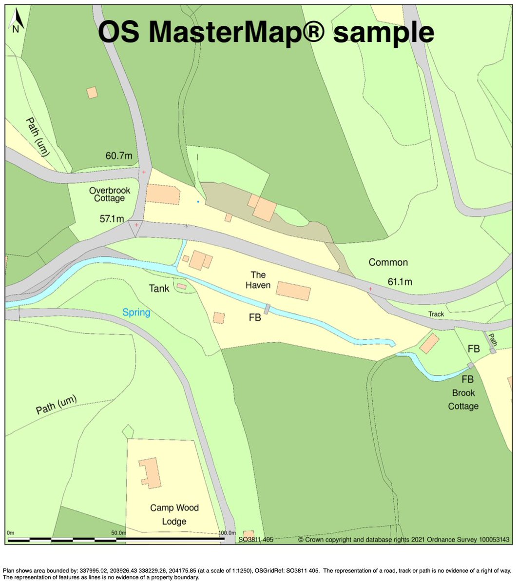
OS #MasterMap®, the @OrdnanceSurvey's flagship product, is the most updated and detailed map of the #UK. Updates take place every 6 weeks. #maps #mapping #gis
Thought I'd try moving my @OrdnanceSurvey #Mastermap upload to @PostGIS processes to @SafeSoftware....but it doesn't like the feature collection format of the changehistory field. Surely there are #FME models for this somewhere? Any ideas #gischat? #gis #geo #geoautomation
Nick, director of Aubrey Architects, saved over £250 and significant drafting and modelling time using MapServe®'s 3D #MasterMap®. Here is how: shorturl.at/gMOT3 And download a sample here: shorturl.at/qEKT1 #mapping #architecture #maps @theNBS

Did you know? OS #MasterMap® Topography Layer is generated and displayed at 1:1250, 1:2500, and 1:10 000 scales in urban, country, and mountain/moorland areas, respectively. Read more: shorturl.at/ciUYZ #mapping #ordnancesurvey @theNBS #architecture
Ceri at Atelier Two #architectural studio saved over £1500 and 3 weeks of project time with Mapserve's 3D #MasterMap®. Here is how: shorturl.at/cmnoC @theNBS #mapping #architecture @mapserve
OS #MasterMap® is the #Ordnance Survey's flagship digital product that records every fixed feature greater than a few metres in the UK. Every day, a crew of #surveyors, pilots & analysts search & record changes of the land's topography. #mapping Read more:rb.gy/8gx6wr
The latest #OS #MasterMap® update is now live on #MapServe®! OS MasterMap® Topography layer gets updated every 6 weeks. #architecturenews #mapping #uk #theNBS @theNBS
Happy days, we've just launched 3D #MasterMap® on MapServe.co.uk for the #architects and other property professionals out there. Call 0330 133 3850 to learn more or get a sample (bit.ly/3UOm0yt). #mapping #maps

Quand le spatial est au service des trajets urbains buff.ly/3nYAbBT #MyEUSpace, #spatial #Mastermap #Nice06

🇪🇺 #MyEUSpace : +200 ideas submitted | 43 selected | 11 winner🏆 3 🇫🇷 awarded 👍 #MasterMap a solution of road status #SaNGENE an integrated GNSS-based radar for detection of obstacles #EO4ART an application for artistic products @France_CZ @EU4Space

#MasterMap, a solution for automatic mapping of road status for maintenance optimization, is the winner of the "Surveying Solutions to shape the future of geomatics" area from #myEUspace Track 1! Well done, congratulations!

𝐂𝐨𝐧𝐠𝐫𝐚𝐭𝐮𝐥𝐚𝐭𝐢𝐨𝐧𝐬 Supreme Villas Block & Supreme Vista B Block Master Map Revealed 𝐂𝐥𝐢𝐜𝐤 𝐇𝐞𝐫𝐞 𝐁𝐞𝐥𝐨𝐰 𝐭𝐨 𝐕𝐢𝐞𝐰 𝐌𝐚𝐩 newmetrocity.com.pk/storage/downlo… #NewMetroCity #MasterMap #GrandMap #Luxurylifestyle #BSMDevelopers #Realestate #Investment

Next week is going to be huge!! 🎮 Who's ready for the very 1st @Mastermind_MGT medium article release?! On top of that, the #MasterPlan could be out any moment! 😍 Oh, and I hear there's a #MasterMap and it leads to #TReaSuRe!!🏴☠️ @BubbleTea1110 @loopeyRV

Chegou a hora de navegar por águas mais profundas.🌊 Faltam 03 dias. Vem aí, MASTER MAP 03. Você merece mais! #mastermap #proximonivel em Vitoria Grand Hall instagram.com/lucasfonsecaof…


Our popular speed datasets are now available from @OrdnanceSurvey as part of their OS #MasterMap #Highways Network product - find out more & how you can add these datasets ow.ly/qzqt30laBWJ #speeddata #speedlimits #averagespeeds ow.ly/d/7Ym0
This is my house on @googlemaps. We've lived here for almost a year and I think this image is about 14 months old. Shows how awesome the @OrdnanceSurvey #Mastermap is and how valuable making it more available is going to be.
'Europa Technologies is pleased to announce a new vector tile service for OS #MasterMap #Topography Layer as the latest addition to the viaEuropa platform of web services for @OrdnanceSurvey digital map data.' Find out more here: bit.ly/2RALbnz @europatech
Upcoming events: @OrdnanceSurvey are running 3 OS #MasterMap Highways workshops in #Wales this September. Find out more and book your place here: agi.org.uk/events/calendar
Experimenting with a blend of Mastermap vector and aerial photography as new baselayers. #ordnancesurvey #QGIS #Mastermap

@OrdnanceSurvey on the stage talking #Maps and #MasterMap at the #RoSFutureFocus event in #Inverness. @RegistersOfScot
Next week is going to be huge!! 🎮 Who's ready for the very 1st @Mastermind_MGT medium article release?! On top of that, the #MasterPlan could be out any moment! 😍 Oh, and I hear there's a #MasterMap and it leads to #TReaSuRe!!🏴☠️ @BubbleTea1110 @loopeyRV
We have added data for average speed times and legal speed limits to our OS #MasterMap #Highways Network product. Find out more here: social.os.uk/highways_ChnMK
Here at @emapsite we love staring at the detail on OS maps and don't half find some strange things! Like these floral clocks. Guess how many floral clocks there are in @OrdnanceSurvey #MasterMap? #geodata

Trying the perfect the transition between data (#Zoomstack and #Mastermap) ....strangely hypnotic.... #GIS #GEO #mappydreams
The @GOVUK is making @OrdnanceSurvey #MasterMap #data FREE to use, estimating it will boost the #UK #economy by £130M: buff.ly/2JQeT3L
🇪🇺 #MyEUSpace : +200 ideas submitted | 43 selected | 11 winner🏆 3 🇫🇷 awarded 👍 #MasterMap a solution of road status #SaNGENE an integrated GNSS-based radar for detection of obstacles #EO4ART an application for artistic products @France_CZ @EU4Space
For no extra charge, #CadcorpSIS provides full support for @OrdnanceSurvey #MasterMap data #Topo #Greenspace #ImageryLayer #HighwaysNetwork #WaterNetwork #Schema9 #GIS Read the latest here: cdcp.io/sr5
16 April live #webinar: Migrating from ITN to OS #MasterMap Highways Network. Sign up and register now social.os.uk/highways_iXltN

Its #OutdoorClassroomDay tomorrow! Don’t forget @Digimap4Schools is fantastic for mapping your activities with our amazing @OrdnanceSurvey #mastermap data.
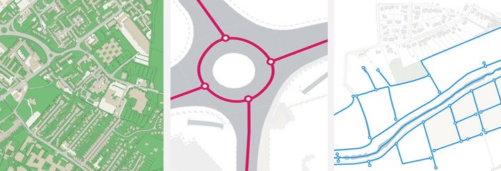
Draw freehand, select an existing feature or an @OrdnanceSurvey #MasterMap polygon (say a building outline). FindIT offers a number of options for defining the search area: cdcp.io/FindIT #GIS

Lead by our product and consultancy teams, the workshops for our technical showcase are in progress and focus on #AddressBase Premium, OS #MasterMap Highways, OS Open #Zoomstack and API

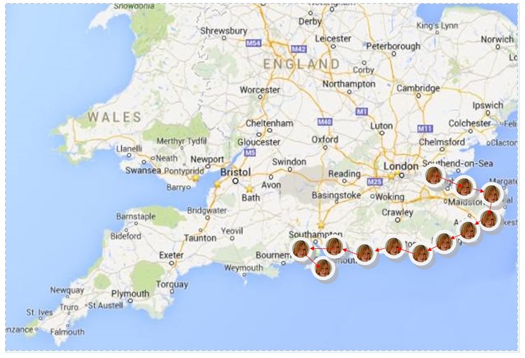
Whilst @BethFootForward has been away navigating the IOW coastline it's given us chance to work on our Master Map which will allow us to highlight Beth's Progress for the next few months! #mastermap
.@OrdnanceSurvey are running 3 OS #MasterMap Highways Workshops in #Wales this September More info here: Welsh Government Offices, Cardiff - bit.ly/2mkP69T Royal Welsh Showground, Powys - bit.ly/2mgFoVT Natural Resources Wales, Bangor - bit.ly/2mgfUrL

Something went wrong.
Something went wrong.
United States Trends
- 1. Spotify 1.08M posts
- 2. Chris Paul 29.3K posts
- 3. Clippers 42.2K posts
- 4. Hartline 10.4K posts
- 5. Henry Cuellar 5,707 posts
- 6. #HappyBirthdayJin 103K posts
- 7. ethan hawke 4,160 posts
- 8. GreetEat Corp 1,168 posts
- 9. David Corenswet 7,227 posts
- 10. Jonathan Bailey 8,405 posts
- 11. South Florida 6,179 posts
- 12. #NSD26 25.4K posts
- 13. Apple Music 248K posts
- 14. Chris Henry 2,262 posts
- 15. Klein 16.5K posts
- 16. Ty Lue 1,579 posts
- 17. #JINDAY 81.1K posts
- 18. Nashville 33.5K posts
- 19. Adam Sandler 4,883 posts
- 20. #OurSuperMoonJin 81.7K posts