#mobilemapping search results
In an industry where few survey firms offered mobile mapping services, @Castlesurv made it their leading advantage. Read how via our latest customer story. hxgn.biz/4muZ1Gi #MobileMapping #WhenItHasToBeRight #surveying #LeicaGeosystems #gemoatics #SmartSurveying
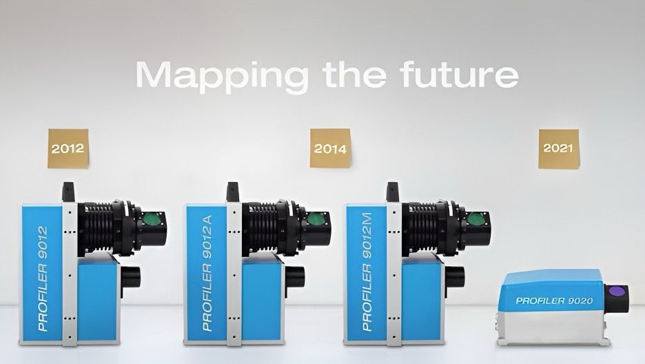
From prototype to SLAM solution: the Z+F PROFILER® series delivers fast, accurate mobile mapping—2M+ pts/sec, 360° view, sub-mm precision. Ideal for roads, rails, tunnels & cities, with models like the 9020 & 9020C pushing performance further. #LaserScanning #MobileMapping

Back from a successful deployment in the Caribbean. Using the NavVisMLX, our team captured high-accuracy engineering data across multiple sites. Great conditions at ~31°C and smooth workflows throughout. More projects coming soon.#NavVis #MobileMapping #LaserScanning #PointCloud


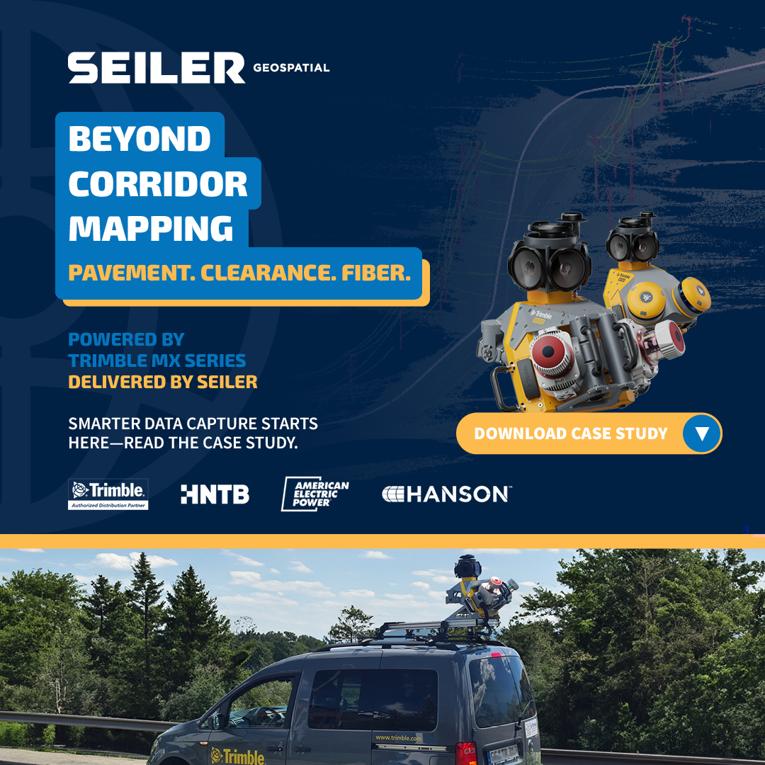
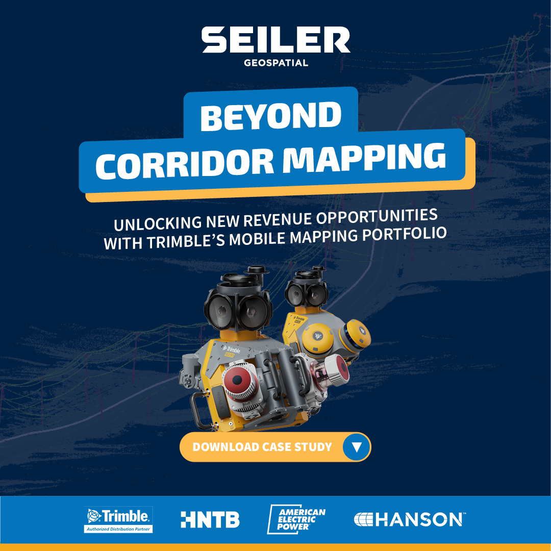
🚗💨 Smarter, faster, safer. See how the Trimble MX60 & MX90 redefine how infrastructure data is captured — from pavement to fiber workflows. 📥 Download the case study ➡️ gotoseiler.com/mxcapture #SeilerGeospatial #TrimbleMXSeries #MobileMapping #LiDAR
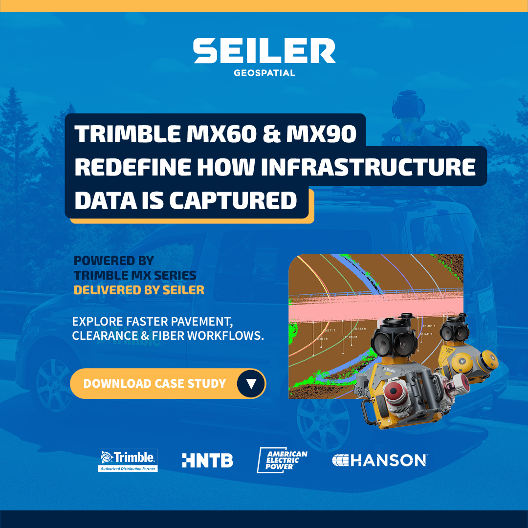
🌐 Beyond Corridor Mapping. Faster pavement, clearance, and fiber workflows—powered by Trimble MX Series and delivered by Seiler. 📥 Read the case study → gotoseiler.com/mxcapture #SeilerGeospatial #TrimbleMXSeries #MobileMapping #LiDAR
“Mobile mapping opened doors to infrastructure, rail, marine & renewables.” – Paul Jackson, @CastleSurveys. ▪️ 80 km highway scanned in 1 day ▪️ No closures, no drones, no delays Read more: hxgn.biz/4mQy0wr #MobileMapping #SurveyLife #LeicaGeosystems #Geomatics

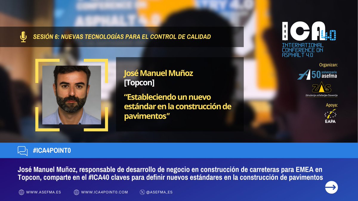
📡 Un nuevo estándar en la ejecución de firmes: el #MobileMapping transforma la construcción y gestión de carreteras. José Manuel Muñoz, responsable de desarrollo de negocio en construcción de carreteras para EMEA en #TopCon, lo presenta en #ICA4point0: itafec.com/eventos/4th-in…

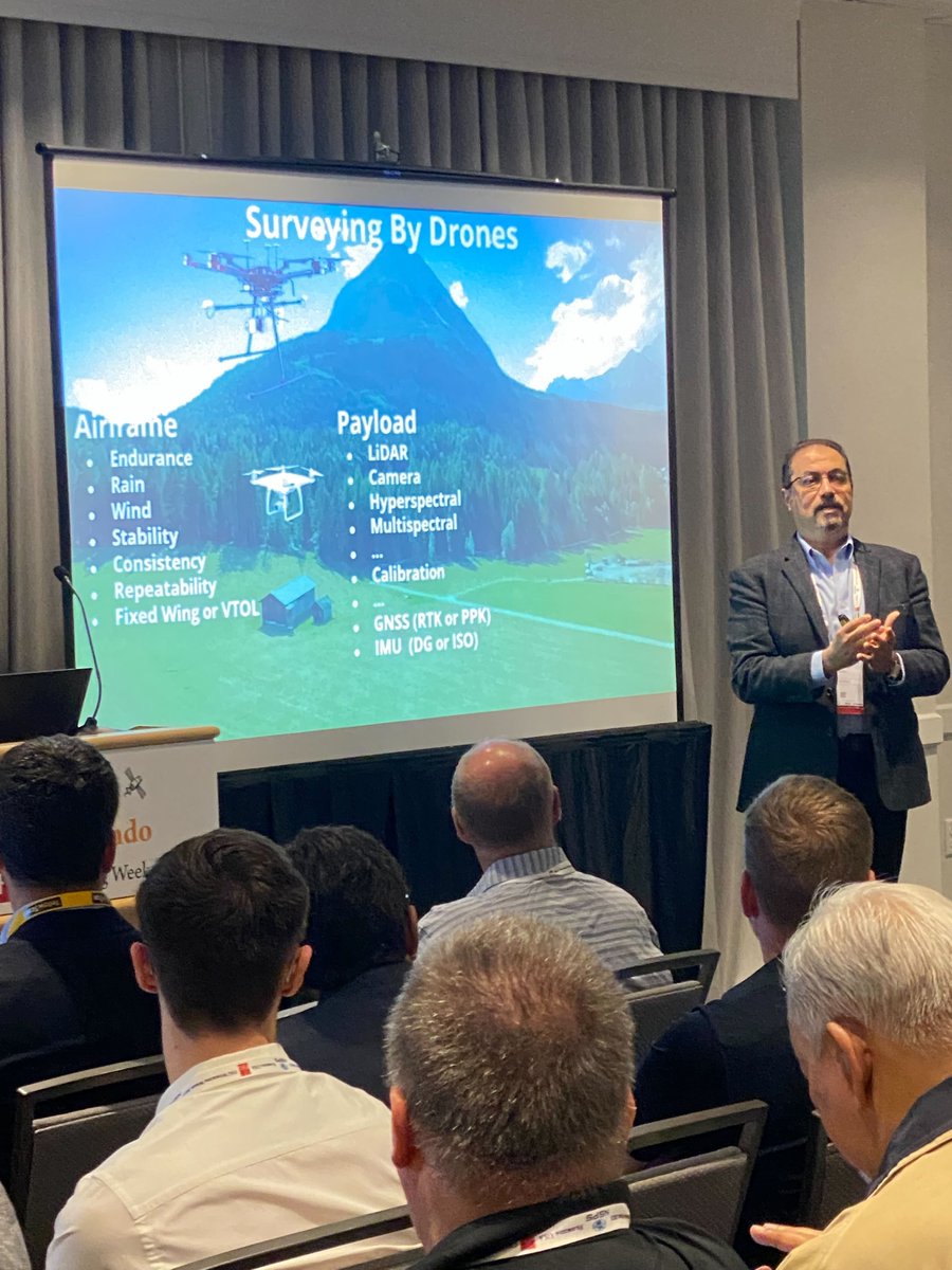
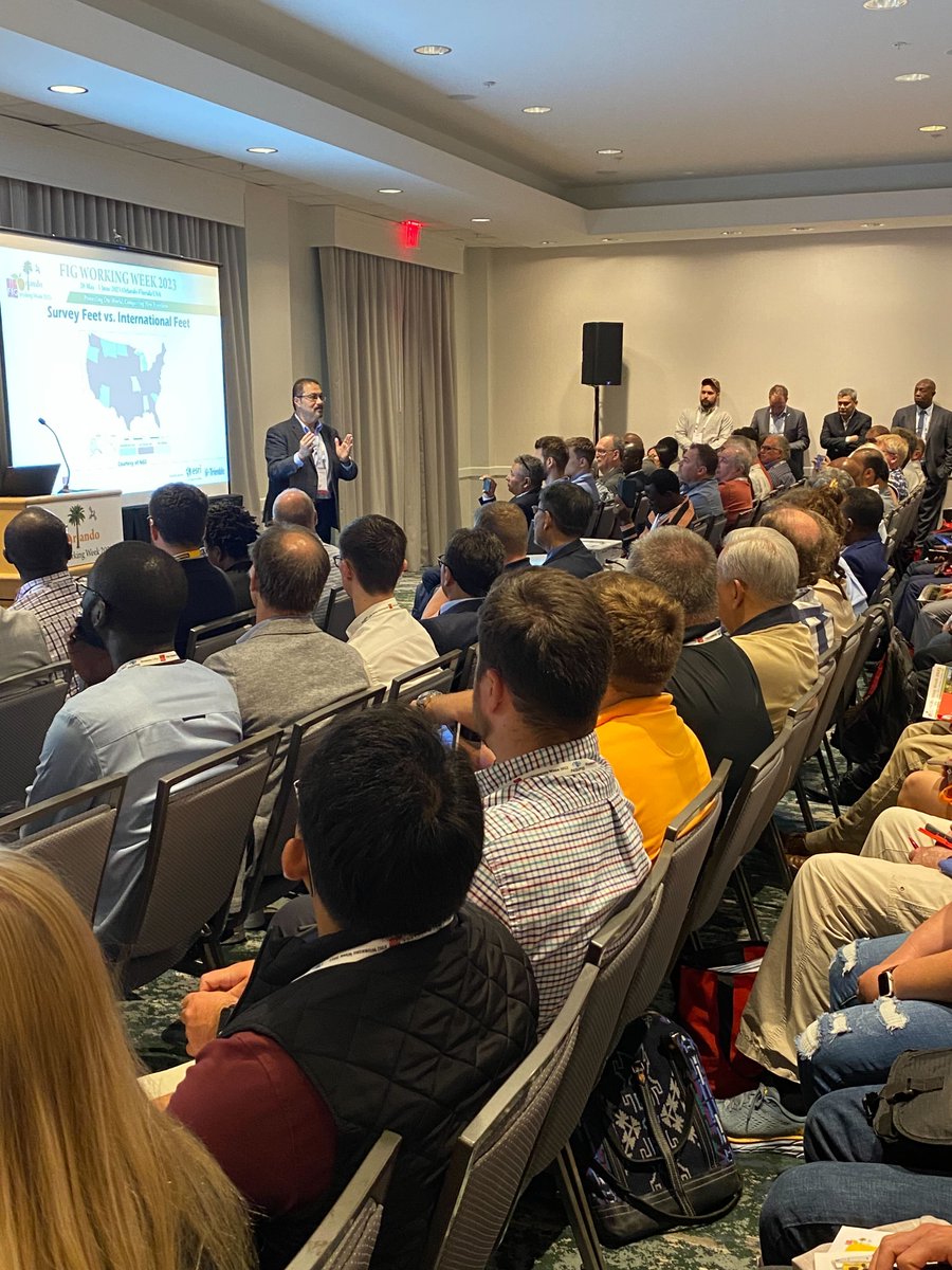
Great content still rolling out at #FIG2023! We hope that you caught many of our sessions, including Mohamed Mostafa's "Surveying By Drones" industry panel discussion. Want more? Chat with us about POSPac 9 and #mobilemapping at Booth 609!


🔍✨ Discover the World Up Close! 🌎✨ Excited to share how the Zoom In feature on Geosearch.io enhances exploration on mobile devices. Seamlessly navigate every detail! #GeoSearch #MobileMapping #ZoomInExploration #GeospatialExploration #GeoSearchMagic #ZoomInTech"
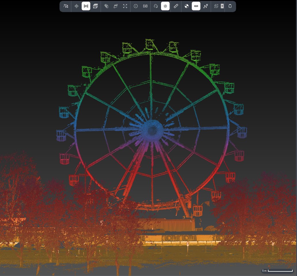
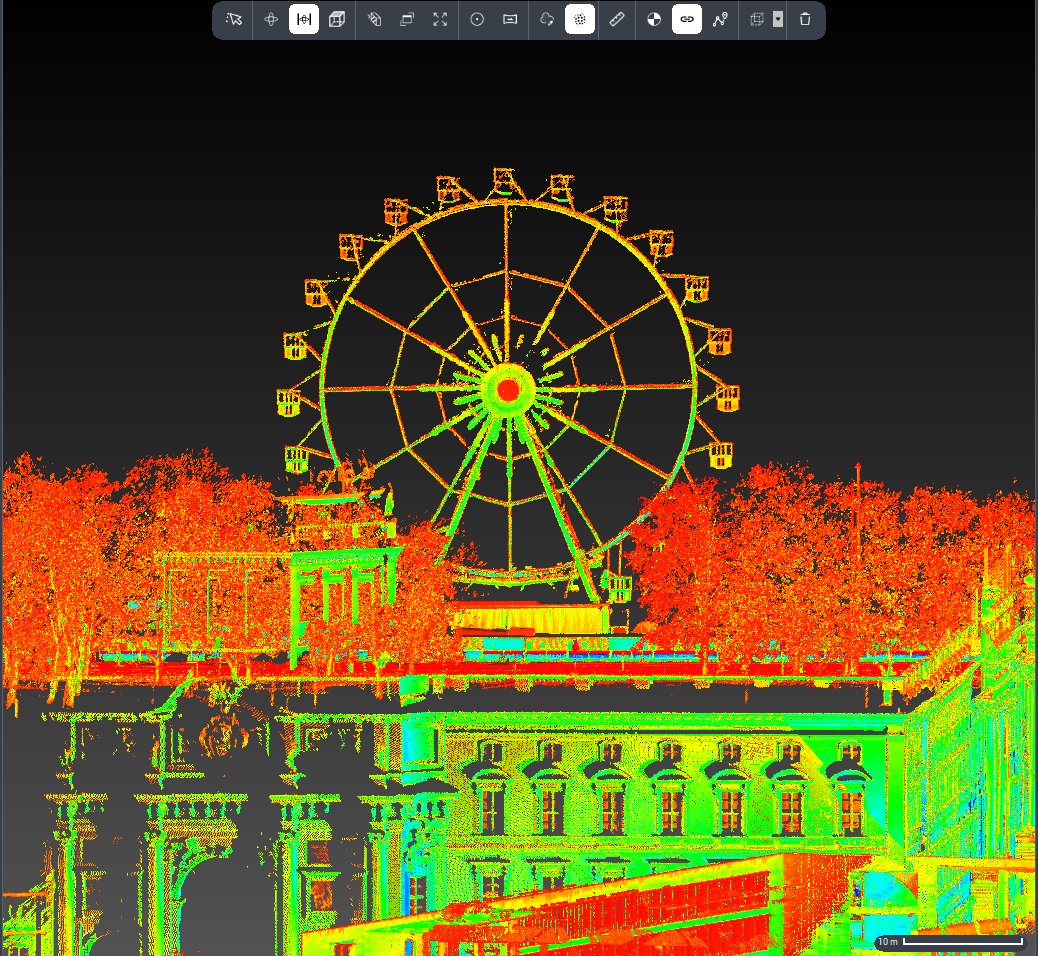
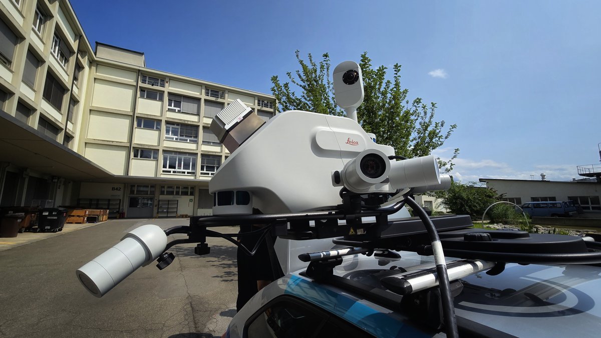
🎄✨ Our #MobileMapping Solutions Manager, Antonio, mapped this beautiful Christmas market with the Leica Pegasus #TRK700Evo!🎡With 4M points/sec, it captures everything from Ferris wheels to festive lights in stunning detail. Check out the TRK range >> hxgn.biz/40yI5X1

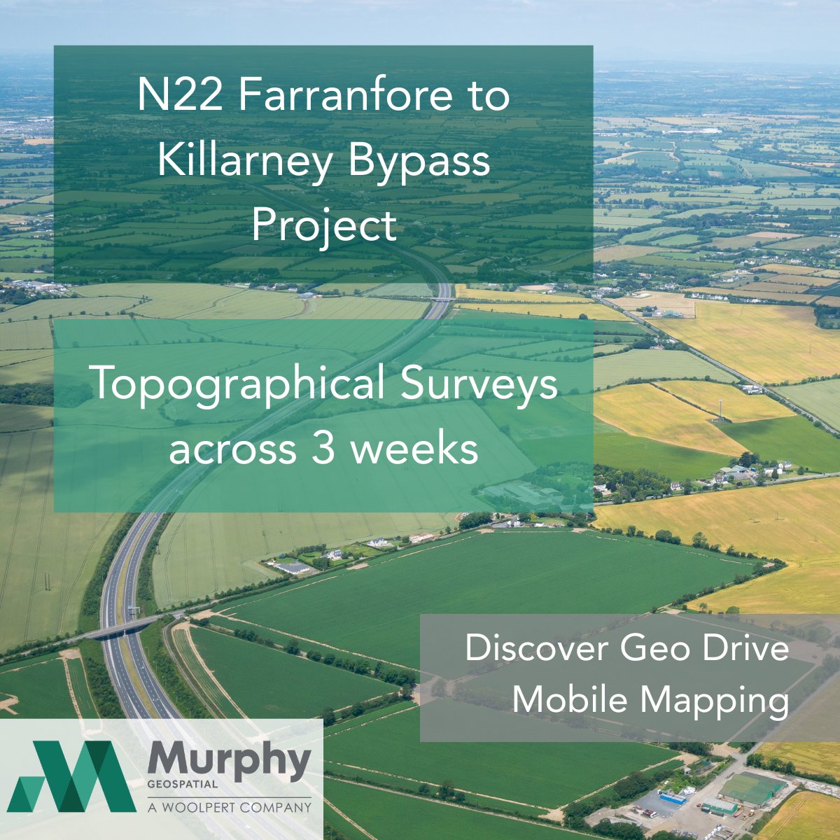
Murphy Geospatial is supporting the N22 Farranfore–Killarney Bypass with advanced Mobile Mapping, delivering precision data for smarter infrastructure. Discover more here: murphygs.com/geo-drive/ Read more on the project here: tinyurl.com/49fzatpn #MobileMapping

Heading to @GEOBusinessShow? Stop by Booth G255 and say hello to Brian Thacker, as well as the @GexcelSrl team! Discover the latest advancements in #mobilemapping tech and learn how you can use mobile scan data in #Verity to perform digital QA at scale 👷♂️🔍🏗


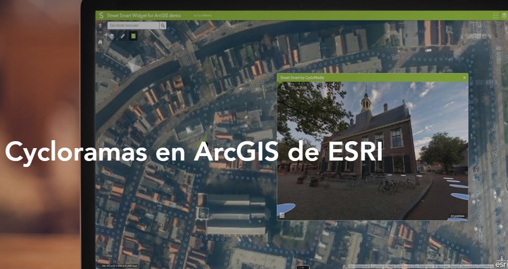
🌐 Nos unimos a Cyclomedia como partner oficial. Con nuestra alianza con el líder internacional en #MobileMapping, ampliamos nuestra propuesta de valor para ayuntamientos, ingenierías y utilities. seystic.com/seys-es-partne… #cesri25


"When the art of data collection meets the art of Banksy." Thank you for sharing this mid-mapping photo, Getmapping! #MobileMapping #Pegasus


How is AI reshaping the world of mapping? At #highwaysUK, @PeterJHaddock caught up with Helen Wattie from @GetmappingLtd on the @LeicaGeosystems stand to talk about what’s new in the world of geospatial data and imagery. youtu.be/hfUflLzgR0M #mobilemapping
youtube.com
YouTube
Learn how AI is reshaping the world of mapping with Helen Wattie
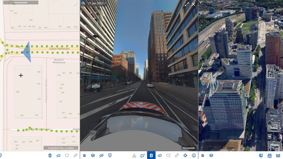
Experience Geo Drive Mobile Mapping - a revolutionary system for accurate data on the move. 🌍 Capture up to 100 km of survey data daily, making it faster and more precise. 📊 Boost your planning with data, not guesswork. Discover more: tinyurl.com/uvemxrxt #MobileMapping


Meet & Greet an der INTERGEO 2024 📍 𝗛𝗮𝗹𝗹𝗲 𝟭, 𝗦𝘁𝗮𝗻𝗱 𝗛𝟭.𝟬𝟭𝟵 Besuchen Sie uns am Stand und entdecken Sie, wie infra3D bei der Digitalisierung unterstützt. Wir freuen uns auf den Austausch! #INTERGEO2024 #MobileMapping #DigitalTwin #KI #SmartCity #infra3D #iNovitas
📌 Save the date for ERPUG Cologne, "The Right Way to Good Roads - Harmonized Data" conference in Cologne, Germany, from October 16-18. Our #MobileMapping experts will present on streamlining infrastructure projects with #RealityCapture technologies.
#MobileMapping isn’t just about capturing data; it’s about enabling smarter, faster, and more precise decisions on and off site. Curious about how this could revolutionise your work? Explore more on our website: hxgn.biz/40yI5X1 #RealityCapture #PegasusTRK

🚧 Go Beyond Corridor Mapping with Trimble’s Mobile Mapping Portfolio. Smarter, safer, and faster data capture—powered by Trimble, delivered by Seiler. 📥 Read the case study → gotoseiler.com/mxcapture #SeilerGeospatial #TrimbleMXSeries #MobileMapping #LiDAR
Back from a successful deployment in the Caribbean. Using the NavVisMLX, our team captured high-accuracy engineering data across multiple sites. Great conditions at ~31°C and smooth workflows throughout. More projects coming soon.#NavVis #MobileMapping #LaserScanning #PointCloud
🌐 Beyond Corridor Mapping. Faster pavement, clearance, and fiber workflows—powered by Trimble MX Series and delivered by Seiler. 📥 Read the case study → gotoseiler.com/mxcapture #SeilerGeospatial #TrimbleMXSeries #MobileMapping #LiDAR

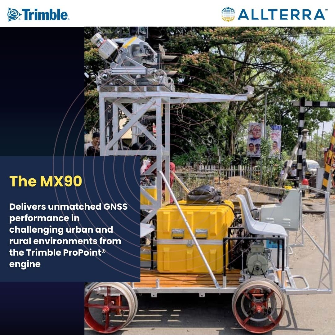
With the #TrimbleMX90, capture millions of points per second, precise imagery, and complete geospatial context, all in a single drive. Efficiency, accuracy, and reliability, wherever the road takes you. #MobileMapping #GIS #SurveyingInnovation #AllTerraIndia #TrimbleGeospatial

How is AI reshaping the world of mapping? At #highwaysUK, @PeterJHaddock caught up with Helen Wattie from @GetmappingLtd on the @LeicaGeosystems stand to talk about what’s new in the world of geospatial data and imagery. youtu.be/hfUflLzgR0M #mobilemapping
youtube.com
YouTube
Learn how AI is reshaping the world of mapping with Helen Wattie
🚗💨 Smarter, faster, safer. See how the Trimble MX60 & MX90 redefine how infrastructure data is captured — from pavement to fiber workflows. 📥 Download the case study ➡️ gotoseiler.com/mxcapture #SeilerGeospatial #TrimbleMXSeries #MobileMapping #LiDAR
Murphy Geospatial is supporting the N22 Farranfore–Killarney Bypass with advanced Mobile Mapping, delivering precision data for smarter infrastructure. Discover more here: murphygs.com/geo-drive/ Read more on the project here: tinyurl.com/49fzatpn #MobileMapping

Precision on the move. The Leica Pegasus TRK300 fuses LiDAR, imaging & GNSS for real-time 3D mapping at highway speed, redefining mobile surveying efficiency. Learn more: sitml.com/product/leica-… #LeicaGeosystems #MobileMapping #RealityCapture
Precision on the move. The Leica Pegasus TRK300 fuses LiDAR, imaging & GNSS for real-time 3D mapping at highway speed — redefining mobile surveying efficiency. Learn more: sitml.com/product/leica-… #LeicaGeosystems #MobileMapping #RealityCapture

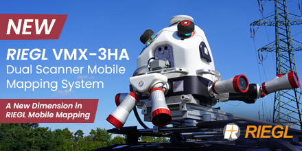
Explore the NEW @RIEGL VMX-3HA Dual Scanner Mobile Mapping System — equipped with two VUX-3HA sensors providing up to 6 MHz PRR, and 800 lines/sec. Perfect for city & infrastructure mapping and pavement analysis. ➡️ riegl.com/vmx-3ha/ #RIEGL #LiDAR #MobileMapping #VMX3HA
The Leica Pegasus TRK300 redefines mobile mapping in Saudi Arabia. AI automation, LiDAR precision, and seamless data fusion empower professionals to design smarter, data-driven infrastructure. #LeicaGeosystems #MobileMapping #Surveying #SmartCities sitml.com/product/leica-…


🚀 Exciting news from Trimble! They've launched the Applanix POS LVX+ and POS AVX RTX, revolutionizing mobile mapping and direct georeferencing. 🗺️ These solutions offer unmatched accuracy and efficiency for diverse applications! 🌍 #Geospatial #MobileMapping #TrimbleInnovation…
From prototype to SLAM solution: the Z+F PROFILER® series delivers fast, accurate mobile mapping—2M+ pts/sec, 360° view, sub-mm precision. Ideal for roads, rails, tunnels & cities, with models like the 9020 & 9020C pushing performance further. #LaserScanning #MobileMapping
🌐 Nos unimos a Cyclomedia como partner oficial. Con nuestra alianza con el líder internacional en #MobileMapping, ampliamos nuestra propuesta de valor para ayuntamientos, ingenierías y utilities. seystic.com/seys-es-partne… #cesri25
Experience Geo Drive Mobile Mapping - a revolutionary system for accurate data on the move. 🌍 Capture up to 100 km of survey data daily, making it faster and more precise. 📊 Boost your planning with data, not guesswork. Discover more: tinyurl.com/uvemxrxt #MobileMapping
The Leica Pegasus TRK is transforming #RealityCapture with LiDAR precision, 360° imaging and AI automation for faster, smarter mapping. Book your demo today 👉 sitml.com/product-catego… #MobileMapping #Surveying

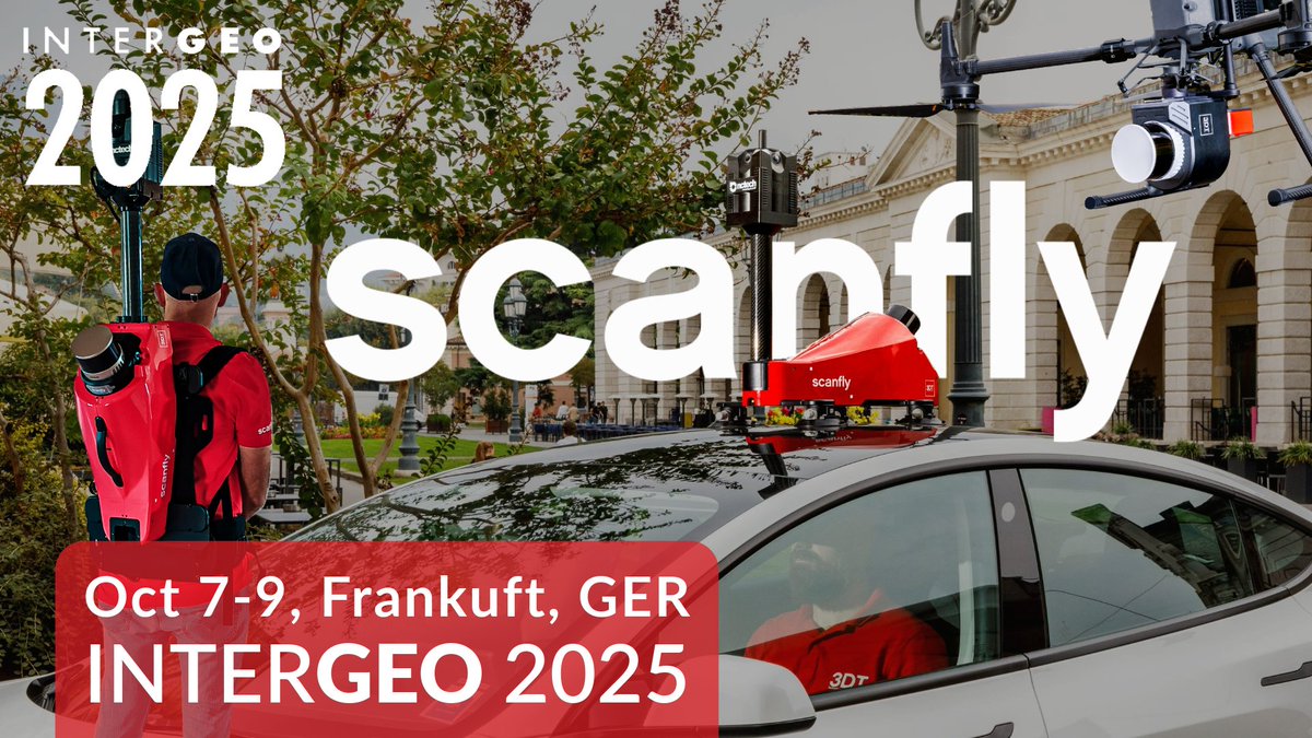
If you're seeking a faster, more precise, and efficient way to gather geospatial data, Scanfly is the answer. See Scanfly at INTERGEO in Frankfurt, Oct 7-9, Hall 12, Booth 1D001. #MobileMapping #LiDAR #Interget Request your ticket: scanfly.it/scanfly-at-int…
The Leica Pegasus TRK Mobile Mapping Solution delivers ultra-high-resolution 3D point clouds & panoramic imagery for rapid, AI-powered digital twins of roads & cities. Learn more 👉 sitml.com/product-catego… #MobileMapping #RealityCapture #DigitalTwin

“Mobile mapping opened doors to infrastructure, rail, marine & renewables.” – Paul Jackson, @CastleSurveys. ▪️ 80 km highway scanned in 1 day ▪️ No closures, no drones, no delays Read more: hxgn.biz/4mQy0wr #MobileMapping #SurveyLife #LeicaGeosystems #Geomatics


🚗💨 Smarter, faster, safer. See how the Trimble MX60 & MX90 redefine how infrastructure data is captured — from pavement to fiber workflows. 📥 Download the case study ➡️ gotoseiler.com/mxcapture #SeilerGeospatial #TrimbleMXSeries #MobileMapping #LiDAR
🌐 Beyond Corridor Mapping. Faster pavement, clearance, and fiber workflows—powered by Trimble MX Series and delivered by Seiler. 📥 Read the case study → gotoseiler.com/mxcapture #SeilerGeospatial #TrimbleMXSeries #MobileMapping #LiDAR
From prototype to SLAM solution: the Z+F PROFILER® series delivers fast, accurate mobile mapping—2M+ pts/sec, 360° view, sub-mm precision. Ideal for roads, rails, tunnels & cities, with models like the 9020 & 9020C pushing performance further. #LaserScanning #MobileMapping
Murphy Geospatial is supporting the N22 Farranfore–Killarney Bypass with advanced Mobile Mapping, delivering precision data for smarter infrastructure. Discover more here: murphygs.com/geo-drive/ Read more on the project here: tinyurl.com/49fzatpn #MobileMapping
📡 Un nuevo estándar en la ejecución de firmes: el #MobileMapping transforma la construcción y gestión de carreteras. José Manuel Muñoz, responsable de desarrollo de negocio en construcción de carreteras para EMEA en #TopCon, lo presenta en #ICA4point0: itafec.com/eventos/4th-in…
🌐 Nos unimos a Cyclomedia como partner oficial. Con nuestra alianza con el líder internacional en #MobileMapping, ampliamos nuestra propuesta de valor para ayuntamientos, ingenierías y utilities. seystic.com/seys-es-partne… #cesri25
“Mobile mapping opened doors to infrastructure, rail, marine & renewables.” – Paul Jackson, @CastleSurveys. ▪️ 80 km highway scanned in 1 day ▪️ No closures, no drones, no delays Read more: hxgn.biz/4mQy0wr #MobileMapping #SurveyLife #LeicaGeosystems #Geomatics
🎄✨ Our #MobileMapping Solutions Manager, Antonio, mapped this beautiful Christmas market with the Leica Pegasus #TRK700Evo!🎡With 4M points/sec, it captures everything from Ferris wheels to festive lights in stunning detail. Check out the TRK range >> hxgn.biz/40yI5X1


Sending you #MobileMapping summer greetings from our HQ in Heerbrugg. Another advantage our #LeicaPegasusTRK comes with? Data collection is a lot cooler in the car!😉 Check out our new #PegasusTRK range -> hxgn.biz/3WhYOKI
Hey #surveyors! 👋 Rev up your mobile mapping with our #LeicaPegasusTRK Evo: now scanning at 2 million pts/s per scanner, and up to 4 million with the TRK700 Evo's dual mode!🚀 Tap 👉🏼 hxgn.biz/3VG5CCB to supercharge your #MobileMapping game!
Experience Geo Drive Mobile Mapping - a revolutionary system for accurate data on the move. 🌍 Capture up to 100 km of survey data daily, making it faster and more precise. 📊 Boost your planning with data, not guesswork. Discover more: tinyurl.com/uvemxrxt #MobileMapping
📌 Save the date for ERPUG Cologne, "The Right Way to Good Roads - Harmonized Data" conference in Cologne, Germany, from October 16-18. Our #MobileMapping experts will present on streamlining infrastructure projects with #RealityCapture technologies.
Our young #forestry #mobilemapping scientist Tamás Faitli got an award from his first international professional conference. Congratulations!


We are proud to offer many opportunities for early career scientists. Today we get to congratulate Tamas Faitli, who gave the "best young author presentation" in his first professional conference, the International Symposium on Mobile Mapping Technology linkedin.com/pulse/tamas-fa…
linkedin.com
Tamas Faitli gave the "best young author presentation" in the 12th International Symposium on...
Researcher Tamas Faitli from the FGI department of remote sensing and photogrammetry took part in the 12th International Symposium on Mobile Mapping Technology, in Padova, Italy on May 24-26. He...

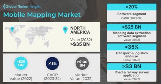
Mobile Mapping Market is slated to hit $100 Bn by 2032, witnessing 15% CAGR. Find more insights @ bit.ly/2xxaoWG #mobilemapping #mobilemappingsoftware #mobilemappinghardware #gmi
Back from a successful deployment in the Caribbean. Using the NavVisMLX, our team captured high-accuracy engineering data across multiple sites. Great conditions at ~31°C and smooth workflows throughout. More projects coming soon.#NavVis #MobileMapping #LaserScanning #PointCloud

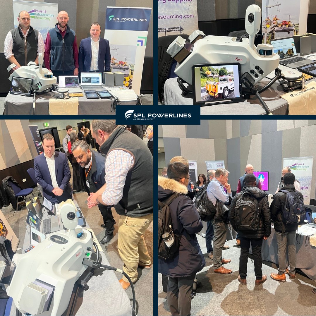
We had an amazing day exhibiting at the @railindustry Unlocking Innovation event yesterday! It was a great opportunity to highlight how @splpowerlinesuk is utilising Mobile Mapping with RRVs to save both time and costs. #RIA #Innovation #MobileMapping
#MobileMapping isn’t just about capturing data; it’s about enabling smarter, faster, and more precise decisions on and off site. Curious about how this could revolutionise your work? Explore more on our website: hxgn.biz/40yI5X1 #RealityCapture #PegasusTRK
Great content still rolling out at #FIG2023! We hope that you caught many of our sessions, including Mohamed Mostafa's "Surveying By Drones" industry panel discussion. Want more? Chat with us about POSPac 9 and #mobilemapping at Booth 609!

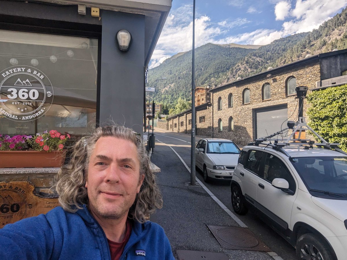
Visiting our customers is always a special treat. Such an incredible day to scan with the Mosaic 51! Guess where we are? #mobilemapping #3dmapping #topography #mapping #surveying #landsurvey #landsurveying #digitaltwins #road #smartcities #digitalcity #geospatial #geomatics

Something went wrong.
Something went wrong.
United States Trends
- 1. #BaddiesUSA 30.3K posts
- 2. Rams 23.5K posts
- 3. Cowboys 91.2K posts
- 4. Eagles 130K posts
- 5. Stafford 10.5K posts
- 6. Bucs 10.4K posts
- 7. Baker 18.7K posts
- 8. Scotty 7,261 posts
- 9. #RHOP 8,399 posts
- 10. Raiders 57.3K posts
- 11. Stacey 29.4K posts
- 12. Todd Bowles 1,357 posts
- 13. Pickens 28.9K posts
- 14. Teddy Bridgewater N/A
- 15. #ITWelcomeToDerry 8,744 posts
- 16. Browns 103K posts
- 17. Shedeur 118K posts
- 18. Nimmo 19.2K posts
- 19. Davante Adams 2,326 posts
- 20. Ahna 3,887 posts