#terraexplorer search results

Our stunning digital twin of London lets you soar over the River Thames! Image data provided by @Bluesky_int and produced with #PhotoMesh and #TerraExplorer #gis #3Dmap #geospatialdata
Join us today at 2:00 - 3:00 for a live stream interview with Adam Simmons from @ProjectGeoMedia. We will be discussing PhotoMesh processing from UAV datasets, and how to create 3D Projects from the outputs in TerraExplorer. #TerraExplorer #PhotoMesh bit.ly/2KlZgTI
Congratulations to our technology partner, @WaldoAir for issuance of their Efficient Airborne Oblique Image Collection patent! Below is an example of data collected after Hurricane Florence - Mexico Beach. Read more about the patent here: bit.ly/35W9W4H #TerraExplorer
Skyline announces it's latest updates to TerraExplorer for Web 7.2.1. Learn more about new features and functionality, and download the release notes. #TerraExplorer #Skyline bit.ly/32okbge


Looking for secure & flexible hosting solutions for your geospatial data? Skyline provides cloud-based & on-prem hosting solutions designed to help you effectively manage your geospatial data. #TerraExplorer included. contact us to learn more: bit.ly/345xe71

Our #3DImageoftheWeek demonstrates #TerraExplorer for Desktop capabilities including damage assessment and detection to evaluate storm damage to properties after Hurricane Florence. Credit to FEMA, WaldoAir, Dewberry, and Civil Air Patrol bit.ly/2VTWKsw #Skyline

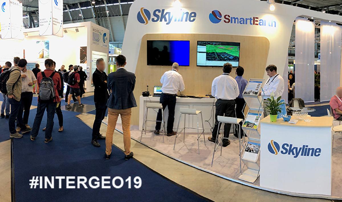
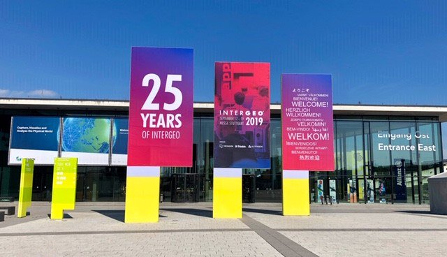
A few hours left for #INTERGEO 2019! Visit us at booth F1.024 in Hall 1. We'll be showcasing amazing new features like #obliquo pentaview plugin for #TerraExplorer lnkd.in/dHQynmk

#TerraExplorer's animation effects simulate natural phenomena such as fire, smoke, explosions, or fireworks, by modeling the underlying physical processes of these phenomena. Use our Knowledge Base to find out how: bit.ly/354C9rJ #3D #gis #3DMapping
Skyline Software Systems TerraExplorer is one of our preferred platforms for urban planning and change simulation. Learn more about our products for government 👉 aerometrex.com.au/3d-for-governm… #skylinesoftware #terraexplorer #gis #spatialdata #aerometrex #townplanning #urbanplanning
Did you know, Skyline offers a secure, cloud environment to build, store, and disseminate your geospatial data? Learn more about Skyline's hosting options. bit.ly/2qrJdNn #skyline #SGS #TerraExplorer

PhotoMesh® - 3D mesh creator automatically converts oblique and nadir photographs from street view, drones, UAV and planes to high-resolution, textured, 3D mesh models (3DML). Request Your Free Trial bit.ly/2EgakhZ #PhotoMesh #TerraExplorer #Skyline #DigitalTwin
There's still time to register! Skyline and NGIS will be teaming up to discuss the benefits of VR + digital twins. Learn how this advanced technology is helping to improve business operations and processes. bit.ly/2KJmh3r #TerraExplorer #OculusRift #DigitalTwin #3dGIS


The new enhancements include: A New and improved 3D using @skylinesoft3D #TerraExplorer @what3words integration as an additional positional format Travel Time (See Previous Posts) Improvements to Drones including Drone Camera sensors (See Previous Posts) And much much more.


We think this is pretty cool! @skylinesoft3D's #TerraExplorer and #PhotoMesh products provided 3D data to plan and manage security for the G7 summit in Cornwall this year. Learn more here: bit.ly/3jQi4vm
#PhotoMesh & #TerraExplorer allow you to develop customized 3D geospatial web or desktop applications that enable more accurate emergency preparedness and speed up detection and response times. Save lives and resources. bit.ly/2Joom49
youtube.com
YouTube
Disaster Management - Pilot Project by Skyline
Skyline is working with its partner @ngis_australia & @nearmap to provide 3D geospatial solutions featuring intelligent #DigitalTwins. This video demonstrates key tools within #TerraExplorer. Imagine the possibilities for #SmartCity & Urban Planning. bit.ly/2qpos5n
youtube.com
YouTube
Skyline, NGIS and Nearmap - Intelligent Digital Twin
If you missed the live stream last week, view the recording of Skyline's interview with @ProjectGeoMedia where we present an overview of #PhotoMesh #TerraExplorer & #SkylineGlobeServer bit.ly/2CWjPCo #Skyline
youtube.com
YouTube
Project Geospatial - Skyline Software Systems
Skyline's advanced 3D processing and visualization capabilities are military proven and have been used to develop in-depth mission plans for Military Defense Operations. bit.ly/2PqKJcn #PhotoMesh #TerraExplorer #SGS #Skyline
In case you missed us at #INTERGEO19, view this short fact video where our CEO, Bob Peters gives a quick overview of the new tools & features we rolled out at the show. Video courtesy of INTERGEO Expo & Conference bit.ly/2D1gS3v #TerraExplorer #OculusRift #DigitalTwins
youtube.com
YouTube
Skyline | INTERGEO TV 2019 | Shortfact
Skyline Software Systems TerraExplorer is one of our preferred platforms for urban planning and change simulation. Learn more about our products for government 👉 aerometrex.com.au/3d-for-governm… #skylinesoftware #terraexplorer #gis #spatialdata #aerometrex #townplanning #urbanplanning
We think this is pretty cool! @skylinesoft3D's #TerraExplorer and #PhotoMesh products provided 3D data to plan and manage security for the G7 summit in Cornwall this year. Learn more here: bit.ly/3jQi4vm
The new enhancements include: A New and improved 3D using @skylinesoft3D #TerraExplorer @what3words integration as an additional positional format Travel Time (See Previous Posts) Improvements to Drones including Drone Camera sensors (See Previous Posts) And much much more.
#TerraExplorer's animation effects simulate natural phenomena such as fire, smoke, explosions, or fireworks, by modeling the underlying physical processes of these phenomena. Use our Knowledge Base to find out how: bit.ly/354C9rJ #3D #gis #3DMapping
Our stunning digital twin of London lets you soar over the River Thames! Image data provided by @Bluesky_int and produced with #PhotoMesh and #TerraExplorer #gis #3Dmap #geospatialdata
Skyline's advanced 3D processing and visualization capabilities are military proven and have been used to develop in-depth mission plans for Military Defense Operations. bit.ly/2PqKJcn #PhotoMesh #TerraExplorer #SGS #Skyline
PhotoMesh® - 3D mesh creator automatically converts oblique and nadir photographs from street view, drones, UAV and planes to high-resolution, textured, 3D mesh models (3DML). Request Your Free Trial bit.ly/2EgakhZ #PhotoMesh #TerraExplorer #Skyline #DigitalTwin
Skyline's 3D Geospatial visualization tools can help first responders prepare for the best in response to the worst. Create 3D models and actionable #DigitalTwin environments using #PhotoMesh. And #TerraExplorer allows you to edit, analyze, & share data. bit.ly/2OEi6rT
youtube.com
YouTube
Disaster Management - Pilot Project by Skyline
In case you missed us at #INTERGEO19, view this short fact video where our CEO, Bob Peters gives a quick overview of the new tools & features we rolled out at the show. Video courtesy of INTERGEO Expo & Conference bit.ly/2D1gS3v #TerraExplorer #OculusRift #DigitalTwins
youtube.com
YouTube
Skyline | INTERGEO TV 2019 | Shortfact
There's still time to register! Skyline and NGIS will be teaming up to discuss the benefits of VR + digital twins. Learn how this advanced technology is helping to improve business operations and processes. bit.ly/2KJmh3r #TerraExplorer #OculusRift #DigitalTwin #3dGIS
Skyline is working with its partner @ngis_australia & @nearmap to provide 3D geospatial solutions featuring intelligent #DigitalTwins. This video demonstrates key tools within #TerraExplorer. Imagine the possibilities for #SmartCity & Urban Planning. bit.ly/2qpos5n
youtube.com
YouTube
Skyline, NGIS and Nearmap - Intelligent Digital Twin
Looking for secure & flexible hosting solutions for your geospatial data? Skyline provides cloud-based & on-prem hosting solutions designed to help you effectively manage your geospatial data. #TerraExplorer included. contact us to learn more: bit.ly/345xe71
If you missed the live stream last week, view the recording of Skyline's interview with @ProjectGeoMedia where we present an overview of #PhotoMesh #TerraExplorer & #SkylineGlobeServer bit.ly/2CWjPCo #Skyline
youtube.com
YouTube
Project Geospatial - Skyline Software Systems
In our most recent segment, we interviewed Eatay Shechter from @skylinesoft3D discussing their #3DVisualization suite including #Photomesh and #TerraExplorer. youtu.be/moJZCXg_KvI
youtube.com
YouTube
Project Geospatial - Skyline Software Systems
Join us today at 2:00 - 3:00 for a live stream interview with Adam Simmons from @ProjectGeoMedia. We will be discussing PhotoMesh processing from UAV datasets, and how to create 3D Projects from the outputs in TerraExplorer. #TerraExplorer #PhotoMesh bit.ly/2KlZgTI
Did you know, Skyline offers a secure, cloud environment to build, store, and disseminate your geospatial data? Learn more about Skyline's hosting options. bit.ly/2qrJdNn #skyline #SGS #TerraExplorer
#PhotoMesh & #TerraExplorer allow you to develop customized 3D geospatial web or desktop applications that enable more accurate emergency preparedness and speed up detection and response times. Save lives and resources. bit.ly/2Joom49
youtube.com
YouTube
Disaster Management - Pilot Project by Skyline
Congratulations to our technology partner, @WaldoAir for issuance of their Efficient Airborne Oblique Image Collection patent! Below is an example of data collected after Hurricane Florence - Mexico Beach. Read more about the patent here: bit.ly/35W9W4H #TerraExplorer
Our #3DImageoftheWeek demonstrates #TerraExplorer for Desktop capabilities including damage assessment and detection to evaluate storm damage to properties after Hurricane Florence. Credit to FEMA, WaldoAir, Dewberry, and Civil Air Patrol bit.ly/2VTWKsw #Skyline
Skyline announces it's latest updates to TerraExplorer for Web 7.2.1. Learn more about new features and functionality, and download the release notes. #TerraExplorer #Skyline bit.ly/32okbge

Congratulations to our winners of our software giveaway representing Technische Universiteit Delft, Netherlands, The University of Edinburgh School of GeoSciences, UK. @ Airbus, Chile, and Cloud Ararat, GmbH. #Skyline #geospatialsoftware #TerraExplorer #PhotoMesh
Be sure to stop by the Skyline stand D1.062 Hall 1 today and enter to win a full SkylineGlobe software suite worth € 9,000! #INTERGEO19 #TerraExplorer #Skyline

Join us today at 2:00 - 3:00 for a live stream interview with Adam Simmons from @ProjectGeoMedia. We will be discussing PhotoMesh processing from UAV datasets, and how to create 3D Projects from the outputs in TerraExplorer. #TerraExplorer #PhotoMesh bit.ly/2KlZgTI
Skyline #INTERGEO19 Giveaway - Education Package. Visit us in booth D1.062, Sept 17 - 19, 2019 and enter to win an education package for your students! #skyline #TerraExplorer #PhotoMesh #3Dgeospatial

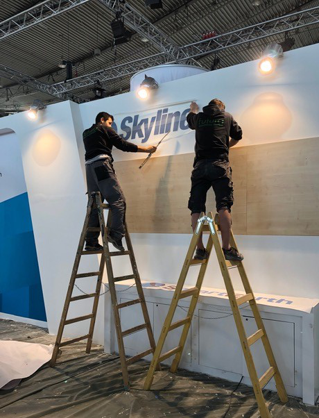
#INTERGEO19 preparations are underway! Visit the Skyline booth D1.062 located in Hall 1 starting tomorrow at 9:00 AM, and enter to win a full SkylineGlobe Suite worth $10K. #Skyline #TerraExplorer #PhotoMesh

Skyline's #INTERGEO19 Giveaway! Attendees plan to visit the Skyline booth D1.062, watch a demo, and enter to win a complete SkylineGlobe Software Suite including #PhotoMesh, #TerraExplorer & #Skyline Hosting package worth over $10,000!

Skyline announces it's latest updates to TerraExplorer for Web 7.2.1. Learn more about new features and functionality, and download the release notes. #TerraExplorer #Skyline bit.ly/32okbge
Case Study - Managing the Worlds Biggest Rail Concession Contract "Skyline’s software has played a critical role in the efficient management of this rather massive project..." Philippe Bour - Project Integrator, IGO SAS. Read more: bit.ly/2M7Rwr8 #skyline #terraexplorer

Want to learn how to get the most from your aerial imagery? Discover how the latest aerial imagery processing advancements can help you reduce the risks of uninformed decisions, unrealistic estimates & unanticipated consequences. bit.ly/2Nr8WQW #TerraExplorer #Skyline

#TerraExplorer's animation effects simulate natural phenomena such as fire, smoke, explosions, or fireworks, by modeling the underlying physical processes of these phenomena. Use our Knowledge Base to find out how: bit.ly/354C9rJ #3D #gis #3DMapping
This Skyline Tutorial demonstrates the wide range of options offered by TerraExplorer for exporting polygonal areas of a mesh layer; buildings, to individual OBJ models to enable you to easily extract precisely the areas that you need. bit.ly/2JN3Cn6 #TerraExplorer

Looking for secure & flexible hosting solutions for your geospatial data? Skyline provides cloud-based & on-prem hosting solutions designed to help you effectively manage your geospatial data. #TerraExplorer included. contact us to learn more: bit.ly/345xe71
TerraExplorer’s presentation tools enable you to create custom presentations. Flight route, display, layer and object visibility, system time, popup messages and captions are just some of the information you can customize. bit.ly/30CEzcj #Skyline #TerraExplorer

Did you know, Skyline offers a secure, cloud environment to build, store, and disseminate your geospatial data? Learn more about Skyline's hosting options. bit.ly/2qrJdNn #skyline #SGS #TerraExplorer
PhotoMesh® - 3D mesh creator automatically converts oblique and nadir photographs from street view, drones, UAV and planes to high-resolution, textured, 3D mesh models (3DML). Request Your Free Trial bit.ly/2EgakhZ #PhotoMesh #TerraExplorer #Skyline #DigitalTwin
There's still time to register! Skyline and NGIS will be teaming up to discuss the benefits of VR + digital twins. Learn how this advanced technology is helping to improve business operations and processes. bit.ly/2KJmh3r #TerraExplorer #OculusRift #DigitalTwin #3dGIS
Our Latest Release of TerraExplorer 7.1 contains powerful new capabilities for BIM and other classified 3DML; IFC support, Display by Attribute, & Colorize by Attribute. Improve your workflow. Learn more: bit.ly/32rpJqz #TerraExplorer #Skyline #Geospatialsoftware

Looking for a cost-sensitive performance based approach to geospatial data production? Request a free trial and find out how Skyline can help you get the most out of your data. bit.ly/322VVQj #PhotoMesh #Skyline #TerraExplorer #Geospatialsoftware

A few hours left for #INTERGEO 2019! Visit us at booth F1.024 in Hall 1. We'll be showcasing amazing new features like #obliquo pentaview plugin for #TerraExplorer lnkd.in/dHQynmk
Something went wrong.
Something went wrong.
United States Trends
- 1. #WWERaw 60.6K posts
- 2. Purdy 25.5K posts
- 3. Panthers 34.4K posts
- 4. Bryce 18.9K posts
- 5. 49ers 36.2K posts
- 6. Canales 12.7K posts
- 7. Mac Jones 4,649 posts
- 8. #FTTB 5,145 posts
- 9. Penta 9,286 posts
- 10. #KeepPounding 5,177 posts
- 11. Niners 5,159 posts
- 12. Gunther 13.7K posts
- 13. Jaycee Horn 2,584 posts
- 14. #RawOnNetflix 2,043 posts
- 15. Jennings 7,753 posts
- 16. Ji'Ayir Brown 1,220 posts
- 17. Melo 18.2K posts
- 18. Rico Dowdle 1,577 posts
- 19. Moehrig N/A
- 20. #CARvsSF 1,261 posts