#spatialdata search results

📢 Missed the #RMedicine 2024 session on "An Introduction to Tidy R Spatial Packages"? 🌍 The recording is now available on YouTube! 🎥 Explore how to work with spatial data in R. Watch it here: youtube.com/watch?v=PXCzcs… #RStats #SpatialData #DataScience #HealthTech

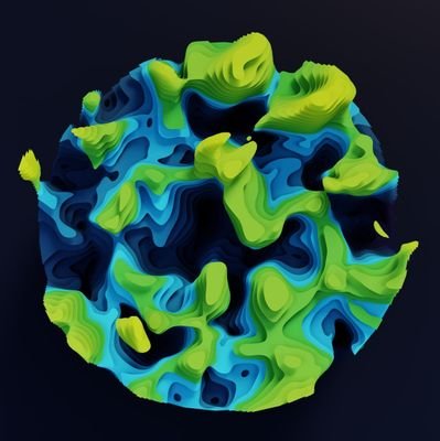
What map have you found geoaweseome recently? Spilhaus Ocean Currents map shows how ocean water moves around the world. We love this project! Check it by yourself: arcgis.com/apps/mapviewer… #Geospatial #Geoawesome #SpatialData #cartography #maps #map

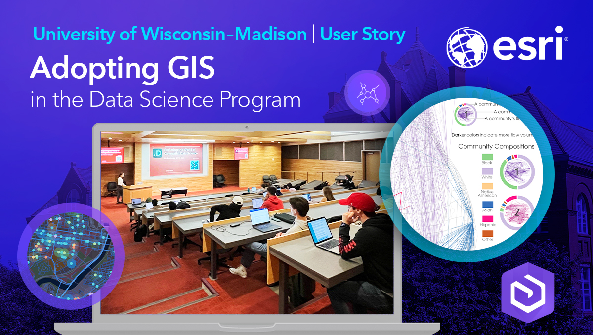
Education Success Story Spotlight 💡 Dr. Song Gao is leading the charge at @UWMadison, integrating #GIS and #spatialdata into the university’s Data Science program resulting in students' marketability in the workforce 🌍 ow.ly/yZbi50VCuE9

🚀Now live: English poster of #JoRAS, the Joint-Use Spatial Data Platform for Researchers Worldwide by @CSISut with 1K+ Japan-focused dataset, supporting 200+ projects/year. Join us today! 👉csis.u-tokyo.ac.jp/news/joras_eng… 🔗Follow us linktr.ee/CSISut #CSIS_UTokyo #SpatialData

Join Charlene Nielsen at Misa Prairies 2025 for a GIS Workshop, where you'll learn how to manage, edit, and visualize LiDAR-derived 2D and 3D information products using ArcGIS Pro. 📅 Sign up today: ow.ly/9Mcg50V8Jio #GIS #Mapping #SpatialData #MISA2025


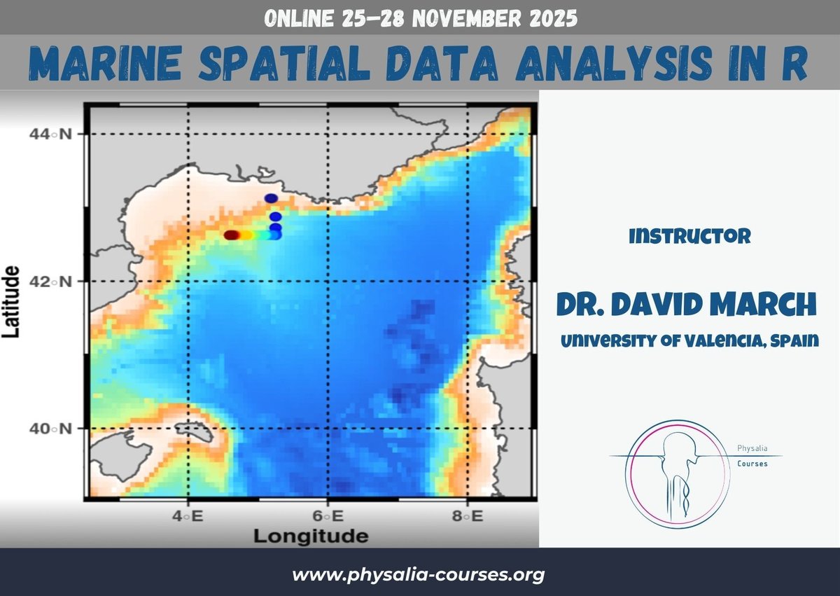
🌊 Dive into spatial marine data! Our hands-on course will equip you with the skills to process, analyze, and visualize marine spatial data using R. 🐟📊 🔗 physalia-courses.org/courses-worksh… #MarineScience #SpatialData #Rstats

"Overcoming challenges in spatial data collection for effective disaster management! 🌐📊 Accurate data, better decisions, safer communities! #SpatialData #DisasterManagement #DataCollection"


A well-designed and comprehensive summary graph about geospatial data tools a couple of times already, circulating on socials by CARTO and their article titled 'What is Spatial Data Science?' lnkd.in/d458sxG6 #datascience #spatialdata #spatialdatascience #gis #python

🚀JoRAS英語版ポスター初公開!🌎研究者の皆さま、共同研究に参加しませんか?#JoRAS は@CSISutが運用する共同研究利用システムです。1,000件以上の空間データで毎年200+の共同研究を支援中! 👉csis.u-tokyo.ac.jp/news/joras_eng… 🔗SNS linktr.ee/CSISut #CSIS_UTokyo #SpatialData

🤝 Although Apache Sedona-powered Wherobots and #PostgreSQL with #PostGIS have some overlapping features, learn how these tools leverage each other’s unique strengths, making them more powerful for enhancing #SpatialData processing and analysis. bit.ly/4gvMK1q

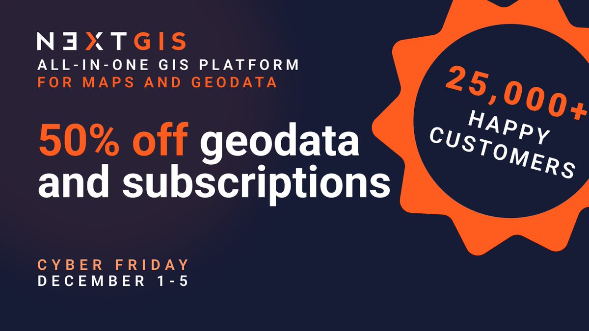
Data prep shouldn't take longer than the actual analysis. @nextgis geodata: pre-validated, pre-styled, ready to use. Basemaps, buildings, elevation, satellite imagery, landcover, POIs. 50% off Dec 1-5 | Works in any GIS tool linkly.link/2Rlit⚡ #Geodata #GIS #SpatialData
🗺️ Fun fact: MiraMon GIS has been shaping geospatial science for 30 years, downloaded in 42 countries! It helps visualize, analyze, and digitize maps with tools like dynamic topology & full OGC API support. 👉 creaf.cat/en/articles/wh… #Geoawesome #GIS #SpatialData #OpenSource
What is @ApacheSedona and what are its common use cases? Discover how this clustering computing system, designed for processing large-scale spatial data, treats spatial data as a first-class citizen. bit.ly/3ZRL24U #ApacheSeonda #SpatialData

Satellites generate tons of data, but most workflows can’t keep up! 🌍 Spatial Data Cubes organize observations across space & time, making long-term environmental analysis faster and smarter. Learn how: geoawesome.com/spatial-data-c… #EarthObservation #SpatialData #Geoawesome


2 WEEKS AWAY! 🥳 Prevent yourself from future FOMO & sign up for Esri's popular course today: esri.social/xJq350SWk38 #SpatialDataScience #ArcGIS #SpatialData

🌐 Introducing PA statistical methods: Geographic Information Systems (GIS). This integrates spatial data, ideal for exploring environmental influences on physical activity. GIS requires extensive data handling skills. #SpatialData #PhysicalActivityResearch


The Lands Department announces the extension of the #3DIndoorMap and #3DIndoorNetwork to all Mass Transit Railway stations, providing comprehensive #SpatialData for the benefit of travellers news.gov.hk/eng/2025/10/20…

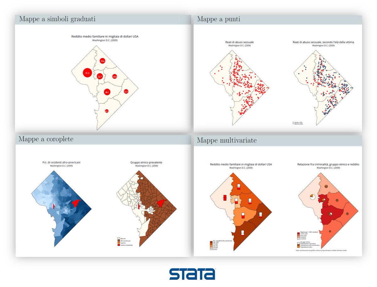
Working with spatial data or simply want to update your data visualization skills in #Stata to be able to create spatial maps in Stata 18. Then join us ONLINE 22/11/24 to acquire the latest @Stata’s mapping capabilities. Course info bit.ly/3ZXJeY2 #Spatialdata, #Mappe

Smart cities run on smart data 📊🚦 On THE BENCHMARK, Mike James speaks with Surv. Agwu Ogonna Roberts, MNIS on how spatial data is transforming traffic and logistics management in Lagos and beyond. Data. Decisions. Development. #TheBenchmark #SpatialData #TrafficAndLogistics


#PublicHealth #DevelopmentData #SpatialData #EvidenceBasedPolicy #DataForImpact #PublicInterestTech #CivicDataLab @paul_meekha @giz_gmbh @MoRD_GoI @sat_sure @gggodhwani @saurabhlevin @ahsin_ahmed @daytimedesigner @eopoxf

AI can reason about almost anything. Except where things actually are. BigGeo AI fixes that. Ask a real question. Get a governed answer in seconds. Data licensed at query time. Raw data never moves. Ask. Resolve. Answer in seconds. #BigGeoAI #SpatialData #MCP #AIAgents


Suddenly you don’t see “coastal cities are at risk.” You see which blocks, which neighborhoods, which ports get hit first. That’s not just data. It’s the map of who gets protected, who gets ignored, and who gets to decide. #ClimateJustice #AIforClimate #SpatialData

Our advanced #GIS course will show you how to prepare and conduct spatial analysis on a variety of spatial data in R. The course will be held online on 19-20 May 2026 with @NickBearmanUK. Find out more and register: ncrm.ac.uk/training/show.… #SpatialData #Statistics

Visibility in geospatial work is inherently uneven. Some places are over-measured while others are barely represented, and these data gaps are not random; they mirror the same structural inequalities that shape access and power. What we measure is never neutral. #SpatialData
Learn how to use R to import, manage and process #SpatialData on our course, Introduction to Spatial Data and Using R as a GIS. The course will be delivered online on 28-29 April 2026 and led by @NickBearmanUK. Book a place: ncrm.ac.uk/training/show.…


Most teams don’t lack data – they lack efficient ways to view it. Our new Views feature lets you save, switch, and share map setups instantly. Less setup – more insight. How much time are you spending rebuilding views? #GIS #3Dvisualization #SpatialData #DigitalTwin
Updating annotations one by one? That doesn’t scale. Bulk updates + CSV imports turn hours of manual edits into minutes—while reducing errors and improving consistency. How are you handling large annotation workflows today? #GIS #SpatialData #DataOps intercom.help/skandio/en/art…
Our advanced #GIS course will show you how to prepare and conduct spatial analysis on a variety of spatial data in R. The course will be held online on 19-20 May 2026 with @NickBearmanUK. Find out more and register: ncrm.ac.uk/training/show.… #SpatialData #Statistics


#Canada startup Mappedin (Provides a digital indoor mapping platform using AI and LiDAR for navigation and spatial intelligence) Raises $24.5M from Edison Partners #SpatialData #AI #LiDAR #Mapping #SaaS parsers.vc/startup/mapped…

🌍 Struggling to align your geographic data due to different datums? Discover how our Datum Converter tool can make it simple and accurate. Find out more here: geoprocesamiento.online/tools/datum-co… #GIS #Geoprocessing #SpatialData
geoprocesamiento.online
Online Geoprocessing - GIS Tools
Explore advanced tools such as Technical Writing of Boundaries (RTL) for geospatial analysis.
Learn how to use R to import, manage and process #SpatialData on our course, Introduction to Spatial Data and Using R as a GIS. The course will be delivered online on 28-29 April 2026 and led by @NickBearmanUK. Book a place: ncrm.ac.uk/training/show.…

What if site visits weren’t a bottleneck? Skip travel, scheduling, and rushed capture. A #GaussianSplat of a temple in Chengdu lets you explore and share it without being there. Less logistics. Better decisions. Where could this change the way you work? #SpatialData #OmniSLAM

Researchers integrate transcriptomic, single‑cell, and #SpatialData to identify basement membrane‑associated genes driving #PDAC #metastasis, highlighting #ITGA3 as a key prognostic and therapeutic target. @SiChuanUniv Read: doi.org/10.1016/j.gend…


Theme: How do housing and labor markets interact? Submit here 👉 umf.li/u136034 Accepted presenters receive accommodation and travel allowance. More info: rwi-essen.de/forschung-bera… #EconTwitter #CausalInference #SpatialData #LaborEconomics #HousingEconomics #economics 2/2

Geo Connect Asia 2026 is LIVE! Discover mapping innovations and capture every new lead instantly. magneticonemobile.short.gy/multi #SpatialData

Our advanced #GIS course will show you how to prepare and conduct spatial analysis on a variety of spatial data in R. The course will be held online on 19-20 May 2026 with @NickBearmanUK. Find out more and register: ncrm.ac.uk/training/show.… #SpatialData #Statistics


📘POI Data Fusion Method Based on Multi-Feature Matching and Optimization By Yue Wang, Cailin Li, Hongjun Zhang, Baoyun Guo, Xianlong Wei and Zhao Hai 👉See the paper: mdpi.com/2220-9964/14/1… #GIS #MachineLearning #spatialdata

Learn how to use R to import, manage and process #SpatialData on our course, Introduction to Spatial Data and Using R as a GIS. The course will be delivered online on 28-29 April 2026 and led by @NickBearmanUK. Book a place: ncrm.ac.uk/training/show.…


Real world perception coming online. #robotics #spatialdata

From Perception to Action — Seamless Embodied Navigation Co-developed by LimX Dynamics and @RealSenseai , powered by NVIDIA cuVSLAM, this system enables robots to move with greater awareness and autonomy. ✅ Robust Real-Time 3D Perception ✅ Intelligent Planning and Dynamic


Applied #SpatialData! #BigData #Analytics #DataScience #AI #MachineLearning #IoT #IIoT #GeoSpatial #Python #RStats #TensorFlow #Java #JavaScript #ReactJS #GoLang #CloudComputing #Serverless #DataScientist #Linux #Programming #Coding #100DaysofCode geni.us/Applied-Spatia…
Education Success Story Spotlight 💡 Dr. Song Gao is leading the charge at @UWMadison, integrating #GIS and #spatialdata into the university’s Data Science program resulting in students' marketability in the workforce 🌍 ow.ly/yZbi50VCuE9
My recent article, 𝐄𝐱𝐩𝐥𝐨𝐫𝐢𝐧𝐠 𝐋𝐚𝐫𝐠𝐞-𝐬𝐜𝐚𝐥𝐞 𝐑𝐚𝐬𝐭𝐞𝐫 𝐏𝐨𝐩𝐮𝐥𝐚𝐭𝐢𝐨𝐧 𝐃𝐚𝐭𝐚, published on @TDataScience: towardsdatascience.com/exploring-larg… @WorldPopProject #geosptaialdata #geodata #spatialdata #gis #geography #datascience #datavisualizatiom #ai


University's are incorporating #GIS into #datascience programs around the globe. Here's how @UWMadison introduced a GIS track into their #spatialdata science curriculum: esri.social/o8T950QA0Cz
"Overcoming challenges in spatial data collection for effective disaster management! 🌐📊 Accurate data, better decisions, safer communities! #SpatialData #DisasterManagement #DataCollection"
A well-designed and comprehensive summary graph about geospatial data tools a couple of times already, circulating on socials by CARTO and their article titled 'What is Spatial Data Science?' lnkd.in/d458sxG6 #datascience #spatialdata #spatialdatascience #gis #python

Gain a deeper understanding of spatial data analysis with this online course. Includes free access to the full analytical capabilities of #ArcGIS Online, Esri's cloud-based mapping and analytics platform. #SpatialData #DataAnalysis @Esri esri.social/IGZv50QpYZB
🗺️ Fun fact: MiraMon GIS has been shaping geospatial science for 30 years, downloaded in 42 countries! It helps visualize, analyze, and digitize maps with tools like dynamic topology & full OGC API support. 👉 creaf.cat/en/articles/wh… #Geoawesome #GIS #SpatialData #OpenSource
As the #30daymapchallenge is almost here, it is timely to recap on geospatial data viz tools for Python: ow.ly/KjBi50Q2w27 #gis #datascience #maps #geospatialdata #datavisualization #spatialanalytics #spatialdata#geospatial #data #ai

Data prep shouldn't take longer than the actual analysis. @nextgis geodata: pre-validated, pre-styled, ready to use. Basemaps, buildings, elevation, satellite imagery, landcover, POIs. 50% off Dec 1-5 | Works in any GIS tool linkly.link/2Rlit⚡ #Geodata #GIS #SpatialData

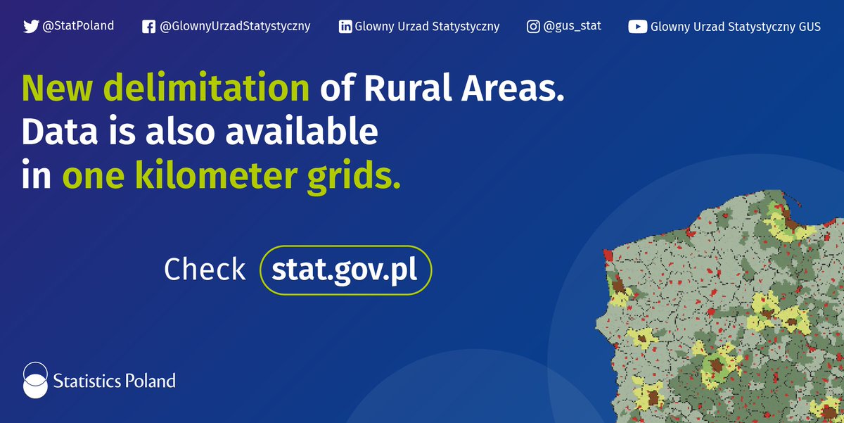
Innovative approach to #SpatialData, new delimitations of rural areas, greater possibilities of #DataVisualization, use of remote sensing for analyzes - only in #StatisticsPoland. tinyurl.com/564zbccw #ExperimentalStatistics #StatisticsOfTheFutureIsAlreadyHere #innovation
My latest article, 𝐄𝐱𝐩𝐥𝐨𝐫𝐢𝐧𝐠 𝐋𝐚𝐫𝐠𝐞-𝐬𝐜𝐚𝐥𝐞 𝐑𝐚𝐬𝐭𝐞𝐫 𝐏𝐨𝐩𝐮𝐥𝐚𝐭𝐢𝐨𝐧 𝐃𝐚𝐭𝐚, is out on @TDataScience: towardsdatascience.com/exploring-larg… #geosptaialdata #geodata #spatialdata #datavisualization #datascience #data #datafam #visualization #gis #geography


More oblique views. Now I'll have to find out how to bring point data to Blender so I can overlay precise locations. I've managed to bring in shapefile but haven't been able to convert that into object. #gis #blender #spatialdata


Only two days to go to the LokateMyKasi challenge happening at UNISA and virtual. Join other developers, geoscientists, data scientists, etc. as we map and Lokate key points of development ko kasi. REGISTER: gklink.co/lokatemykasi #LokateMyKasi #SpatialData

Happy to share earlier this month, Avipsa Roy, Asst Prof in Urban Planning & Public Policy was invited as a guest lecturer to discuss Spatial Data Science's influence on policy making at IIT Kharagpur, Visva Bharati University, ISI Kolkata, and IISc Bengaluru. #spatialdata #up3


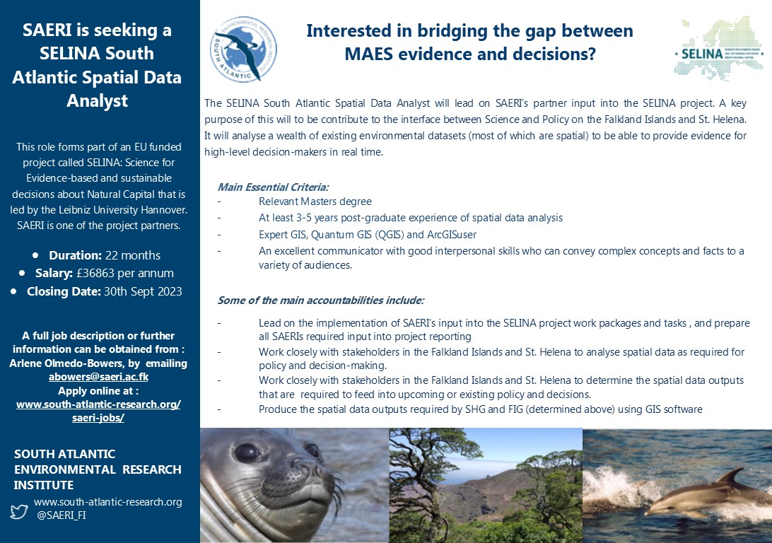
📢 Don't miss out on this opportunity to join @SELINAHorizonEU & @SAERI_FI teams! We are looking to fill the #position for #SpatialData Analyst - working in #StHelenasIsland and the #FalklandIslands More details below 👇👇& APPLY online NOW - hr.breathehr.com/v/selina-south…
🌐 Introducing PA statistical methods: Geographic Information Systems (GIS). This integrates spatial data, ideal for exploring environmental influences on physical activity. GIS requires extensive data handling skills. #SpatialData #PhysicalActivityResearch

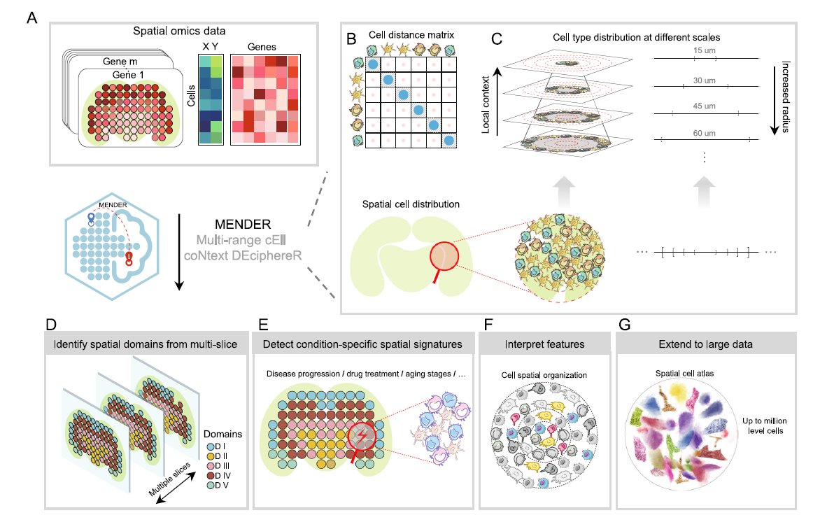
We love learning about new #ComputationalTools for analyzing #SpatialData! MENDER is a novel tissue structure identification tool utilizing cellular neighborhood structures observed across spatial technologies now published in @NatureComms. Learn more: hubs.ly/Q02fCYP20
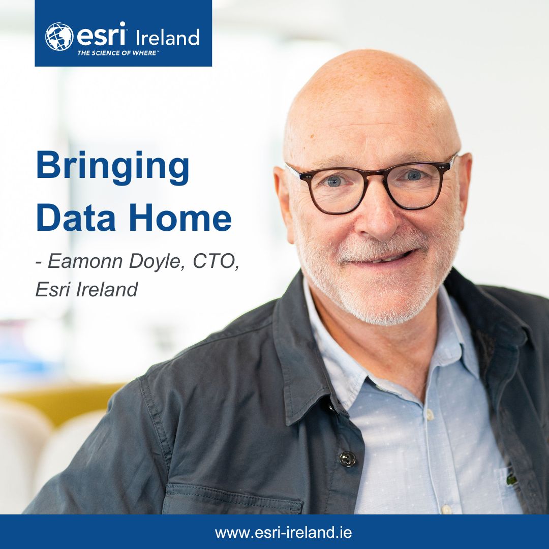
Unlock a new dimension of insights; Take spatial data to the next level by integrating it into existing data lakes 📊 Learn more from Eamonn Doyle, CTO, Esri Ireland, in this Business Post article: esri.social/ey5H50PzqPc #SpatialData #DataAnalyses

🌐 Introducing PA statistical methods: Geographic Information Systems (GIS). This integrates spatial data, ideal for exploring environmental influences on physical activity. GIS requires extensive data handling skills. #SpatialData #PhysicalActivityResearch

Something went wrong.
Something went wrong.
United States Trends
- 1. Jokic N/A
- 2. Jaden McDaniels N/A
- 3. Nuggets N/A
- 4. Wolves N/A
- 5. Oilers N/A
- 6. Adelman N/A
- 7. #FlyTogether N/A
- 8. Ducks N/A
- 9. McDavid N/A
- 10. Christian Braun N/A
- 11. Celtics N/A
- 12. Rudy Gobert N/A
- 13. Scott Jennings N/A
- 14. Knicks N/A
- 15. Cam Johnson N/A
- 16. Game 7 N/A
- 17. Chris Finch N/A
- 18. Hawks N/A
- 19. Spurs in 5 N/A
- 20. Tatum N/A