#contourlines search results

🌟 Exciting project alert! Nick Lim is working on creating contour lines, a fascinating blend of art and science. Stay tuned for insights into how these lines can enhance our understanding of landscapes! #ContourLines #ArtAndScience #NickLim 🌍✨ ift.tt/al3PhYB

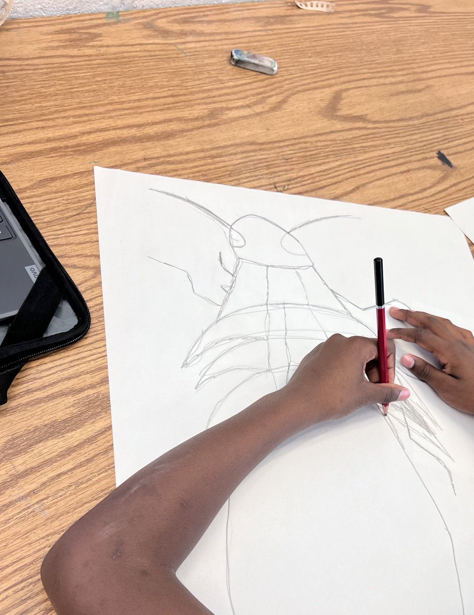
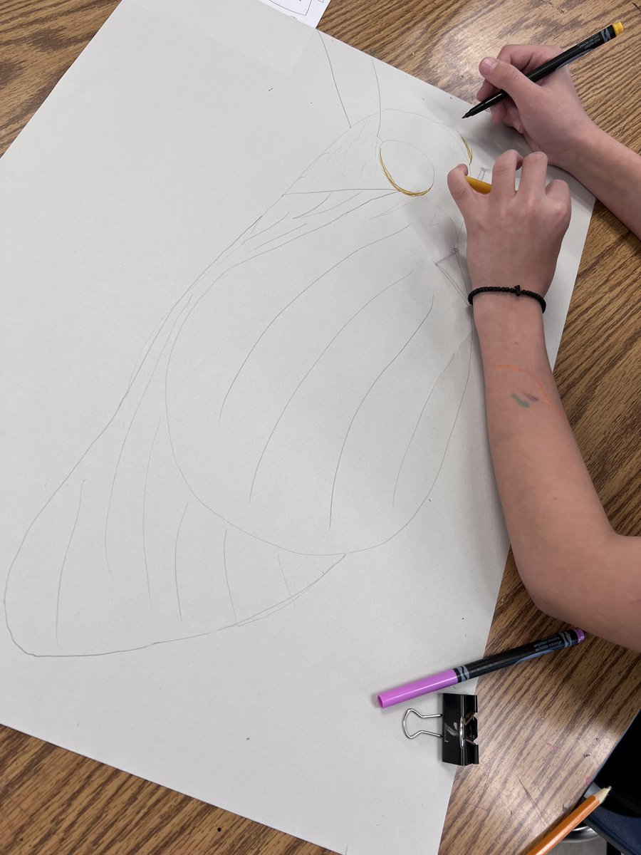
Contour lines in art #contourlines #arttheory #arttechniques #drawingclasses #drawingtechniques #artclasses


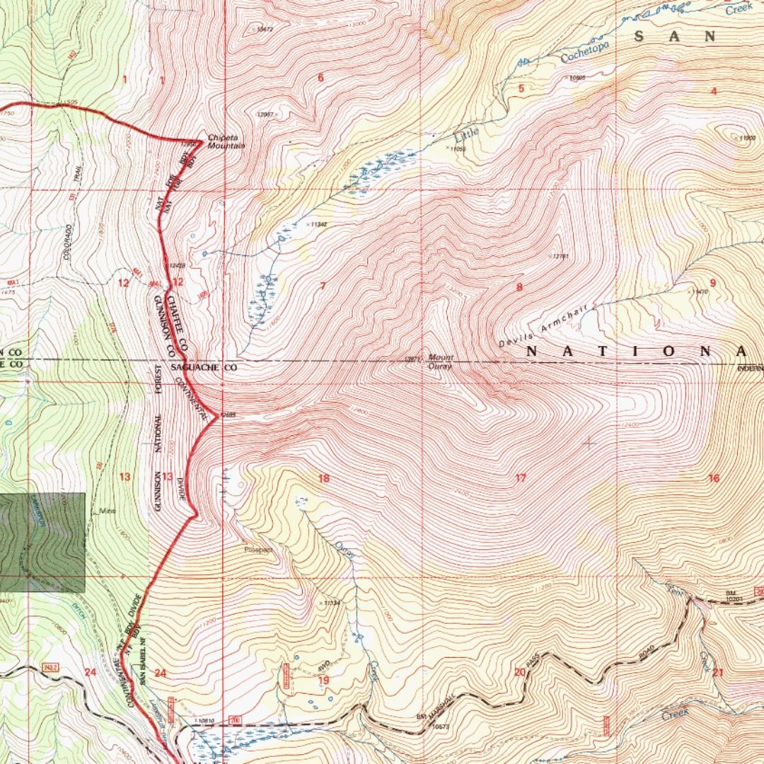
Understanding the contours of the landscape is essential for any hiker or climber. Contour lines on a topographic map connect points that share the same elevation, illustrating the 3D terrain on a 2D surface, like ridges and valleys. #TopographicMap #ContourLines #MountainSkills


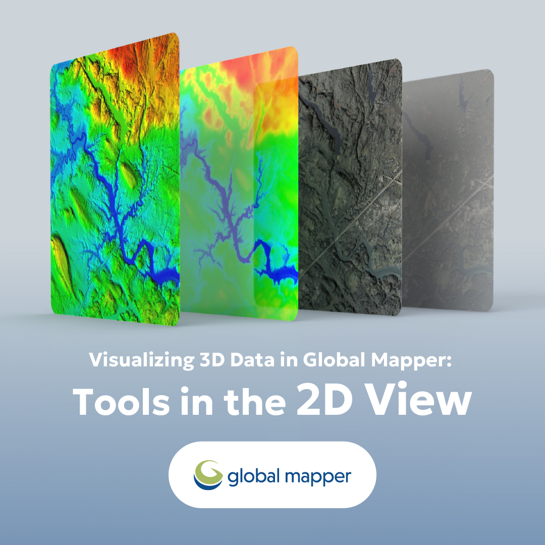
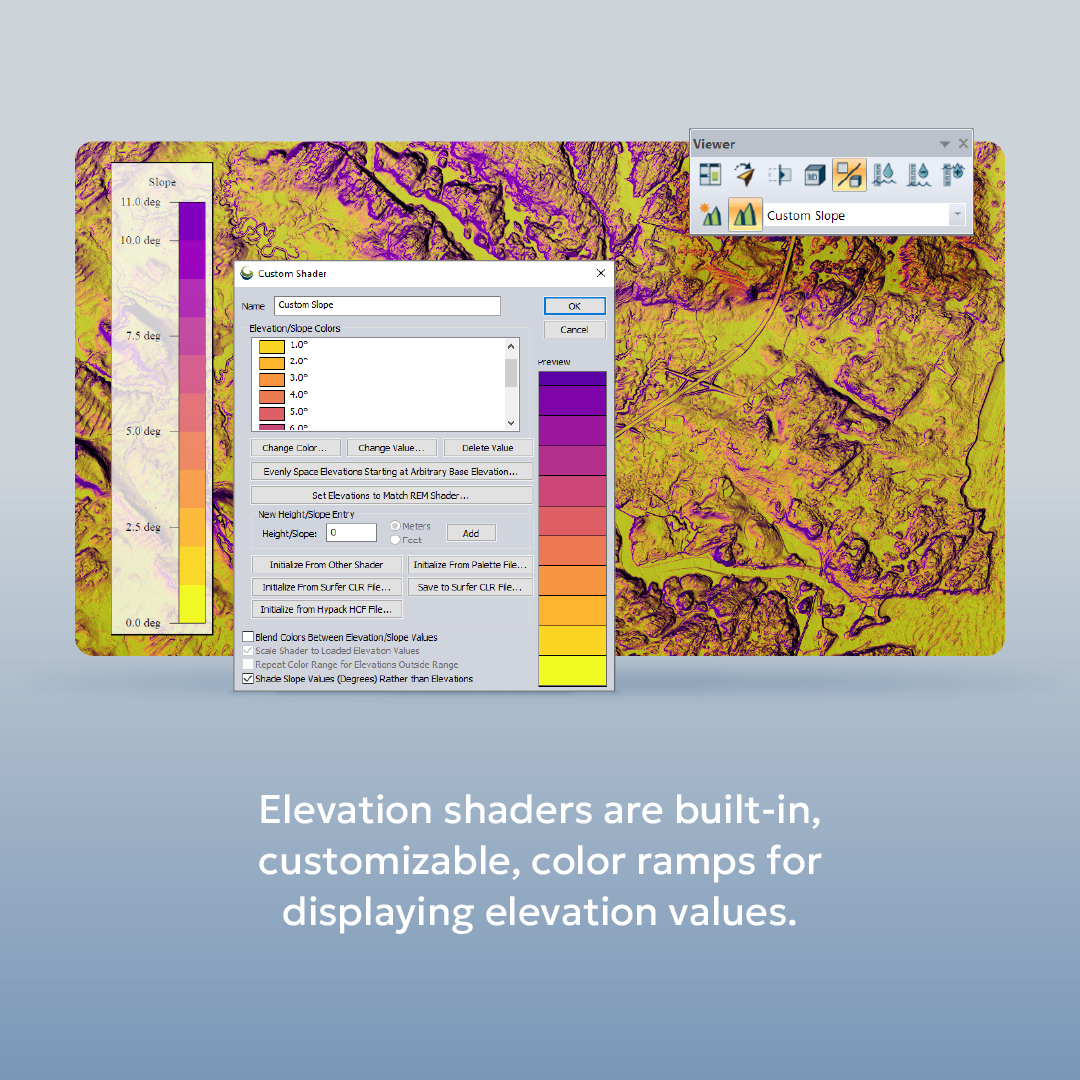
The 2D view is a classic top-down view of any data in Global Mapper, and it can be used to visualize 3D Data. 🔎 In this infographic, we dive into the tools for visualizing 3D data from the 2D view in this infographic! #GlobalMapper #2DView #ContourLines


🔍🌍 Contour surveying is your key to understanding land features! From designing landscapes to effective environmental management, learn how contour lines shape our world. #Surveying #ContourLines #LandManagement Learn more- kpstructures.in/2025/06/what-i…
kpstructures.in
What is Contour in Surveying? - KPSTRUCTURES.IN
What is Contour in Surveying? Contour surveying is a crucial aspect of land surveyance, allowing ... Read more

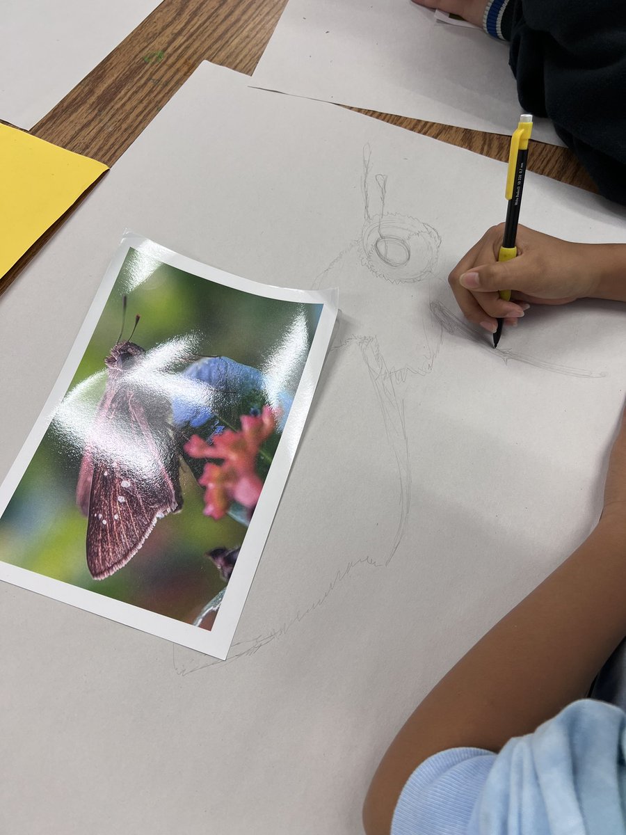
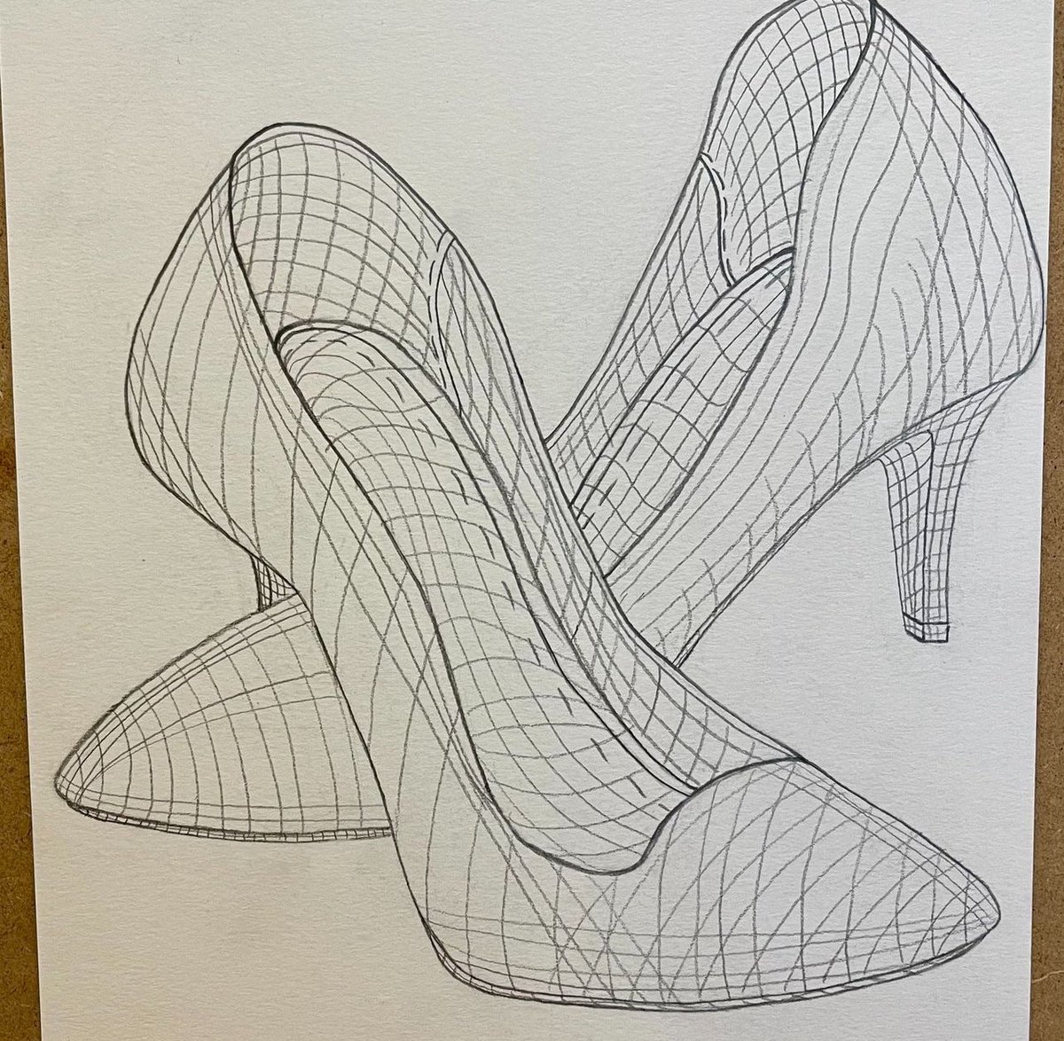
Seeing beyond the surface 👠✨ It’s all about breaking down the volume and understanding how light and shadow shape our perception of objects. Every line is a layer, a glimpse into how the object exists in space. #VolumetricDrawing #RISDart #ContourLines #ObjectStudy #Artist


Wanting to learn a little more about topographic maps and contour lines?? Here's a great article that we've found to help you do just that! 🗺️ #contourlines #topographic #maps #geology #learn #education #classroom #themoreyouknow #article #greenbelly buff.ly/498J7e2
Exploring the types of contour lines in surveying is crucial for project accuracy! 🏞️✨ Understand how these lines help in representation and planning. Learn more- kpstructures.in/2025/06/types-… #Surveying #ContourLines #Engineering
kpstructures.in
Types of Contour Lines in Surveying - KPSTRUCTURES.IN
Types of Contour Lines in Surveying Surveying is a crucial aspect of land development and ... Read more

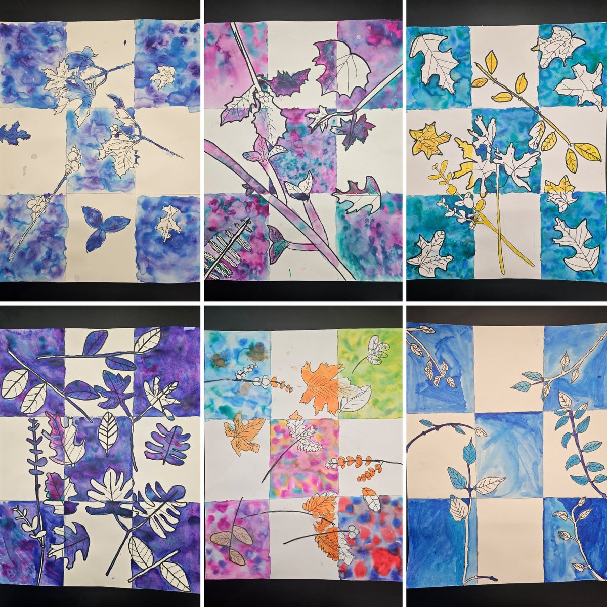
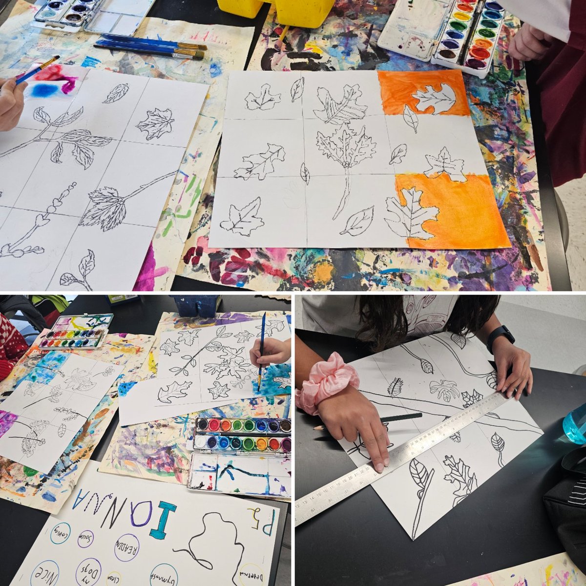
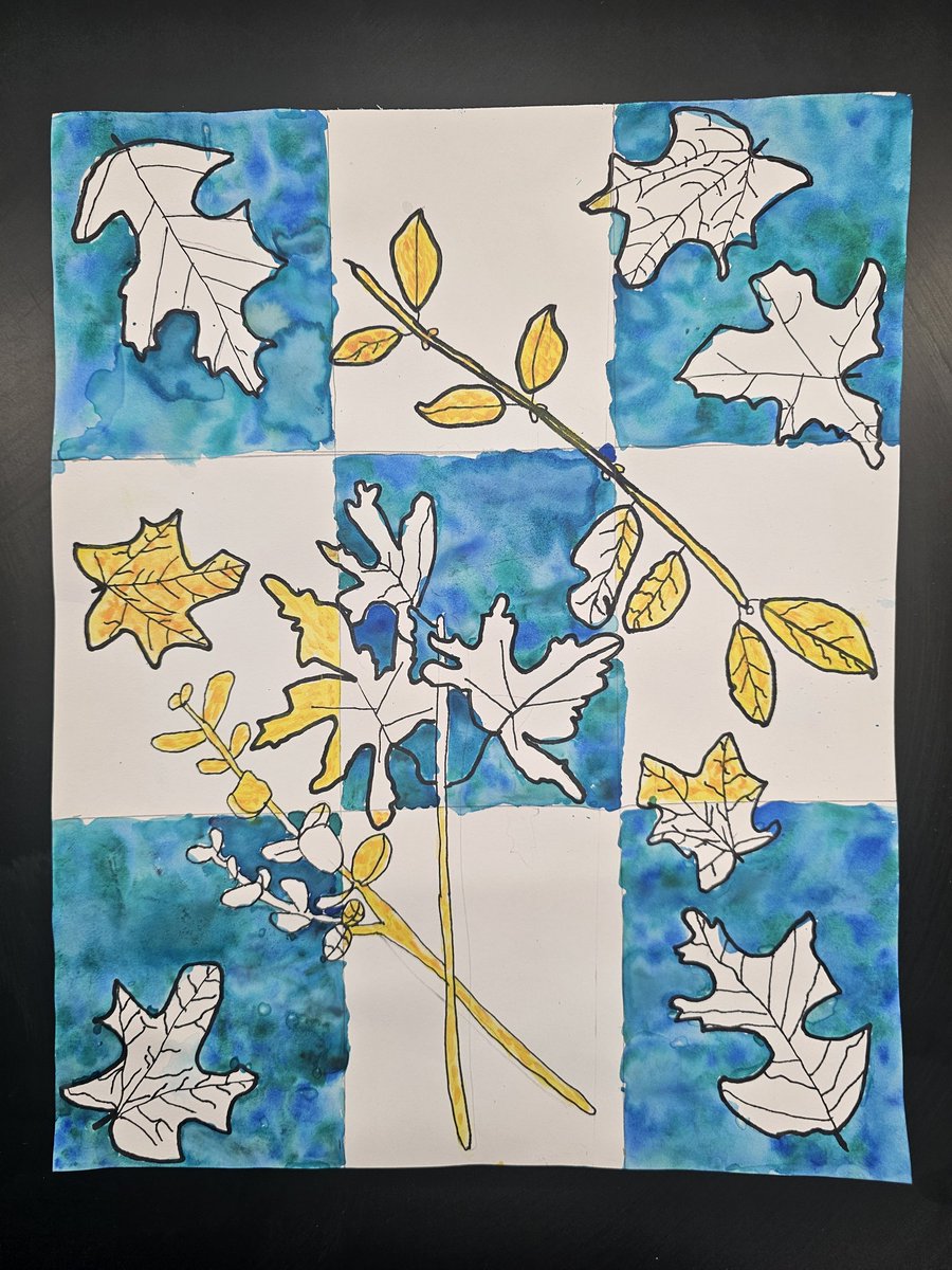
Check out these beautiful #watercolor leaves from #6thgrade students! They practiced drawing #contourlines from observation & then painted them in using alternating #positiveandnegativespaces. Excellent work & beautiful results! So proud of them! @northcolonieart

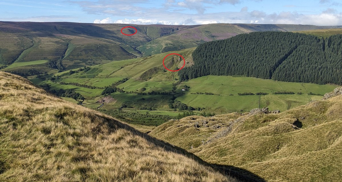
Navigation Task Photo taken at 10am Identify the features circled. Where was the photo taken from? Video answer for Patreon subscribers this evening #mapreading #contourlines
Contour lines are lines on a map that connect points of equal elevation. The closer they are together, the steeper the slope. The farther apart they are, the more gradual the slope. This image serves as an excellent visual representation of this concept. #ContourLines #Map

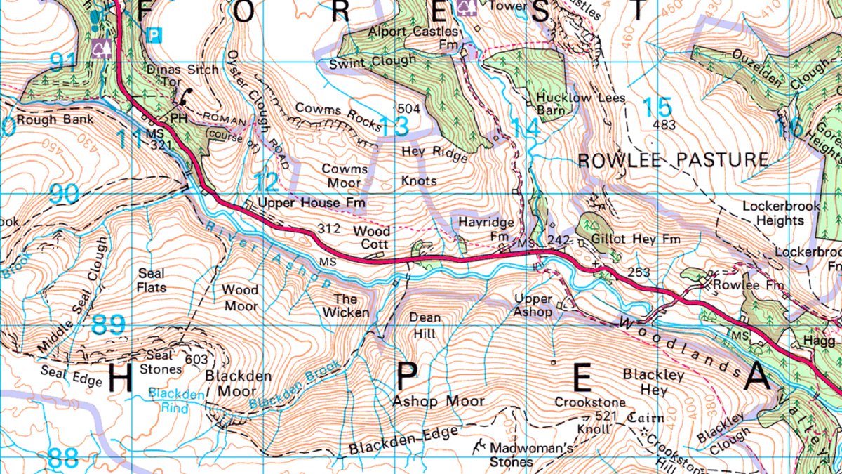
Navigation Task: Locate the feature shown in the photo on the correct map. Where was the photo taken from and what are we looking at? (video answer tonight for Patreon subscribers) #mapreading #peakdistrict #contourlines

Video explaining contour intervals and spot heights on Ordnance Survey and Harvey Maps @harveymaps #mapreading #contourlines youtu.be/lOj41sG3q54?si…
youtube.com
YouTube
Contour Intervals, Index Contours and Spot Heights explained....

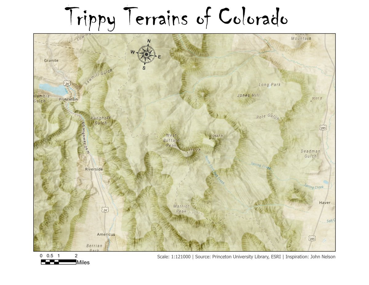
#30DayMapChallenge Day 2: Line Showing contour lines of Colorado using terraced elevation effect P.S.: I could not complete it yesterday due to school works unfortunately. I am optimistic about maintaining this daily commitment. #contourlines #cartography #arcgispro #linemap

Absolutely no idea but reminds me of learning about #contourlines in primary school!! 😅
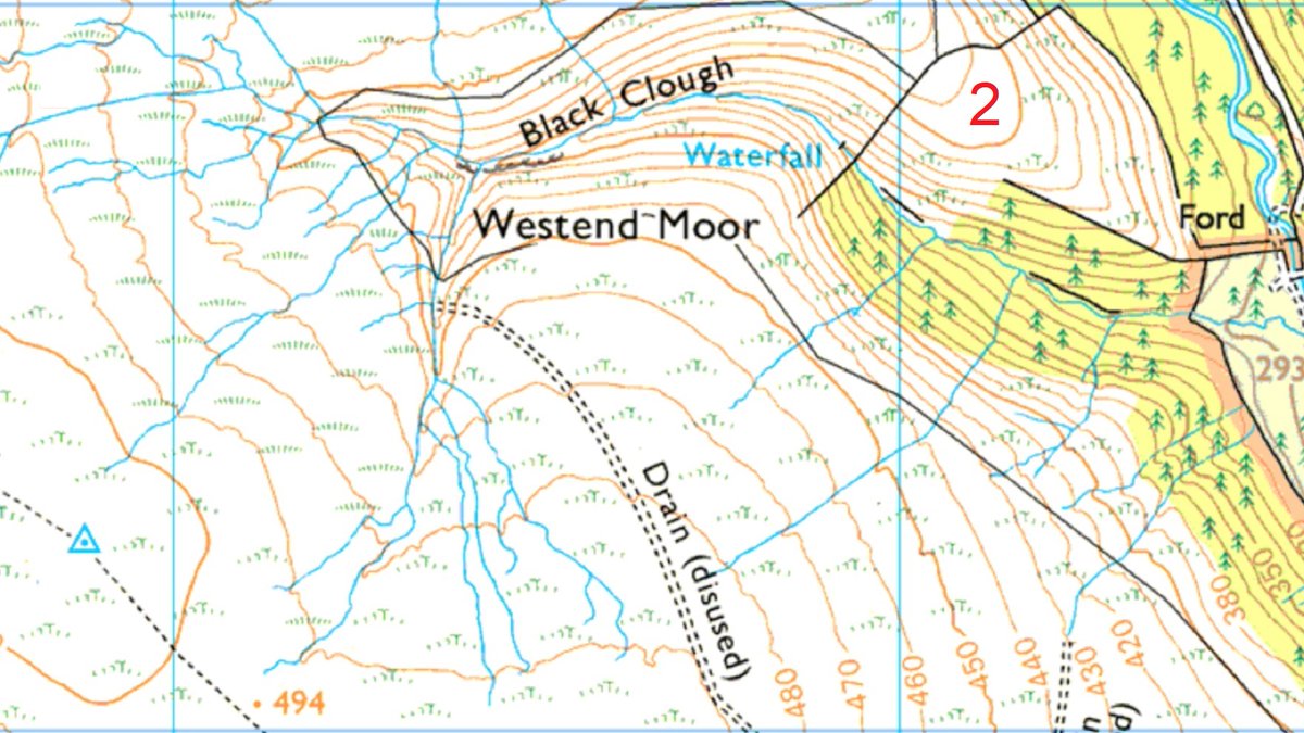
Navigation Task Identify the trig point and the feature circled (video answer for Patreon subscribers this evening) #mapreading #trigpoint #contourlines


Exploring the types of contour lines in surveying is crucial for project accuracy! 🏞️✨ Understand how these lines help in representation and planning. Learn more- kpstructures.in/2025/06/types-… #Surveying #ContourLines #Engineering
kpstructures.in
Types of Contour Lines in Surveying - KPSTRUCTURES.IN
Types of Contour Lines in Surveying Surveying is a crucial aspect of land development and ... Read more
🔍🌍 Contour surveying is your key to understanding land features! From designing landscapes to effective environmental management, learn how contour lines shape our world. #Surveying #ContourLines #LandManagement Learn more- kpstructures.in/2025/06/what-i…
kpstructures.in
What is Contour in Surveying? - KPSTRUCTURES.IN
What is Contour in Surveying? Contour surveying is a crucial aspect of land surveyance, allowing ... Read more
Absolutely no idea but reminds me of learning about #contourlines in primary school!! 😅
Seeing beyond the surface 👠✨ It’s all about breaking down the volume and understanding how light and shadow shape our perception of objects. Every line is a layer, a glimpse into how the object exists in space. #VolumetricDrawing #RISDart #ContourLines #ObjectStudy #Artist
Map Reading Task Chart shows elevation profile of my run. Work out my route and the precise location of the areas highlighted. You'll need to look closely at the contour lines on the map. Video answer for Patreon subscribers this evening #mapreading #contourlines

Understanding the contours of the landscape is essential for any hiker or climber. Contour lines on a topographic map connect points that share the same elevation, illustrating the 3D terrain on a 2D surface, like ridges and valleys. #TopographicMap #ContourLines #MountainSkills
The 2D view is a classic top-down view of any data in Global Mapper, and it can be used to visualize 3D Data. 🔎 In this infographic, we dive into the tools for visualizing 3D data from the 2D view in this infographic! #GlobalMapper #2DView #ContourLines
Navigation Task Identify the trig point and the feature circled (video answer for Patreon subscribers this evening) #mapreading #trigpoint #contourlines
Wanting to learn a little more about topographic maps and contour lines?? Here's a great article that we've found to help you do just that! 🗺️ #contourlines #topographic #maps #geology #learn #education #classroom #themoreyouknow #article #greenbelly buff.ly/498J7e2
Check out these beautiful #watercolor leaves from #6thgrade students! They practiced drawing #contourlines from observation & then painted them in using alternating #positiveandnegativespaces. Excellent work & beautiful results! So proud of them! @northcolonieart
Video explaining contour intervals and spot heights on Ordnance Survey and Harvey Maps @harveymaps #mapreading #contourlines youtu.be/lOj41sG3q54?si…
youtube.com
YouTube
Contour Intervals, Index Contours and Spot Heights explained....
#30DayMapChallenge Day 2: Line Showing contour lines of Colorado using terraced elevation effect P.S.: I could not complete it yesterday due to school works unfortunately. I am optimistic about maintaining this daily commitment. #contourlines #cartography #arcgispro #linemap
Contour lines in art #contourlines #arttheory #arttechniques #drawingclasses #drawingtechniques #artclasses
Navigation Task Photo taken at 10am Identify the features circled. Where was the photo taken from? Video answer for Patreon subscribers this evening #mapreading #contourlines
Contour lines are lines on a map that connect points of equal elevation. The closer they are together, the steeper the slope. The farther apart they are, the more gradual the slope. This image serves as an excellent visual representation of this concept. #ContourLines #Map
Yr7 having fun with play-do whilst at the same time hopefully learning about #contourlines 🌍🗻 #geography #mapskills

Navigation Task: Locate the feature shown in the photo on the correct map. Where was the photo taken from and what are we looking at? (video answer tonight for Patreon subscribers) #mapreading #peakdistrict #contourlines
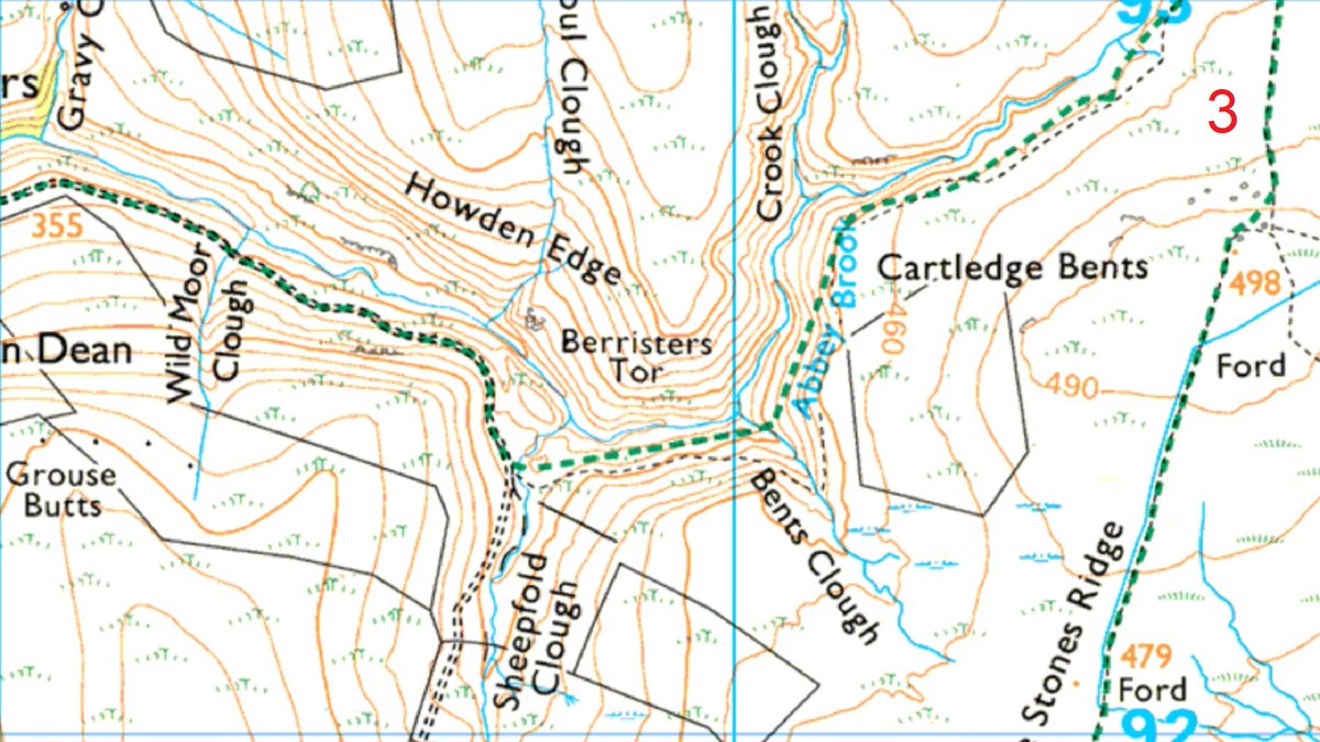
Navigation Task From A to B which route is quicker? Don't just guess! - use Naismith's Rule (show your workings) Answer for Patreon subscribers this evening @harveymaps Superwalker 1:25k #peakdistrict extract used with licensing agreement #mapreading #contourlines


Navigation Task: Locate the feature shown in the photo on the correct map. Where was the photo taken from and what are we looking at? (video answer tonight for Patreon subscribers) #mapreading #peakdistrict #contourlines
Understanding the contours of the landscape is essential for any hiker or climber. Contour lines on a topographic map connect points that share the same elevation, illustrating the 3D terrain on a 2D surface, like ridges and valleys. #TopographicMap #ContourLines #MountainSkills
Navigation Task Identify the trig point and the feature circled (video answer for Patreon subscribers this evening) #mapreading #trigpoint #contourlines
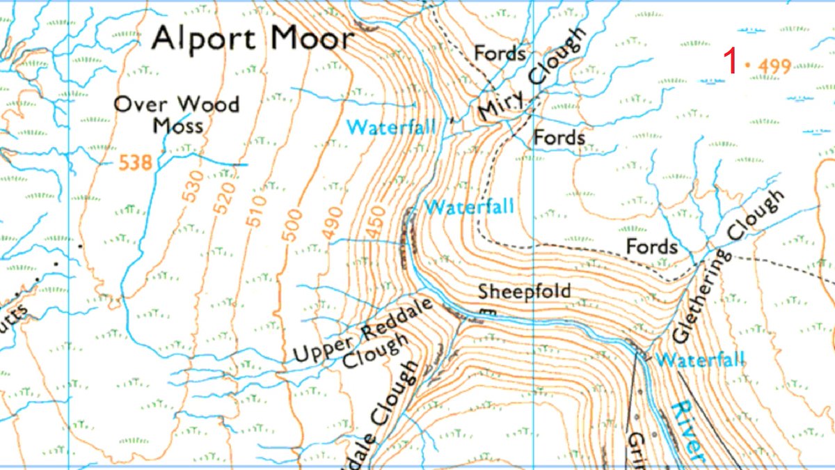
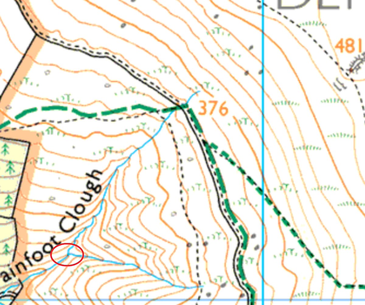
Navigation Task: What is the elevation of the stream junction circled? (video answer for Patreon subscribers this evening) #mapreading #contourlines
Yr7 having fun with play-do whilst at the same time hopefully learning about #contourlines 🌍🗻 #geography #mapskills
Map Reading Task Chart shows elevation profile of my run. Work out my route and the precise location of the areas highlighted. You'll need to look closely at the contour lines on the map. Video answer for Patreon subscribers this evening #mapreading #contourlines
The 2D view is a classic top-down view of any data in Global Mapper, and it can be used to visualize 3D Data. 🔎 In this infographic, we dive into the tools for visualizing 3D data from the 2D view in this infographic! #GlobalMapper #2DView #ContourLines
Contour lines are lines on a map that connect points of equal elevation. The closer they are together, the steeper the slope. The farther apart they are, the more gradual the slope. This image serves as an excellent visual representation of this concept. #ContourLines #Map
Navigation Task Photo taken at 10am Identify the features circled. Where was the photo taken from? Video answer for Patreon subscribers this evening #mapreading #contourlines
Check out these beautiful #watercolor leaves from #6thgrade students! They practiced drawing #contourlines from observation & then painted them in using alternating #positiveandnegativespaces. Excellent work & beautiful results! So proud of them! @northcolonieart
#30DayMapChallenge Day 2: Line Showing contour lines of Colorado using terraced elevation effect P.S.: I could not complete it yesterday due to school works unfortunately. I am optimistic about maintaining this daily commitment. #contourlines #cartography #arcgispro #linemap
Seeing beyond the surface 👠✨ It’s all about breaking down the volume and understanding how light and shadow shape our perception of objects. Every line is a layer, a glimpse into how the object exists in space. #VolumetricDrawing #RISDart #ContourLines #ObjectStudy #Artist
Navigation Task: What elevation is the stream end, circled? Or is there not enough information on the map to work it out? Video answer for Patreon subscribers this evening #mapreading #contourlines

Navigation Task From A to B which route is quicker? Don't just guess! - use Naismith's Rule (show your workings) Answer for Patreon subscribers this evening @harveymaps Superwalker 1:25k #peakdistrict extract used with licensing agreement #mapreading #contourlines
Something went wrong.
Something went wrong.
United States Trends
- 1. OPEC N/A
- 2. Good Tuesday N/A
- 3. #PutThatInYourPipe N/A
- 4. Golda N/A
- 5. National Superhero Day N/A
- 6. Zambia N/A
- 7. Clooney N/A
- 8. $PROS N/A
- 9. Kid Rock N/A
- 10. Runner N/A
- 11. Lee Zeldin N/A
- 12. #LenaMiuxChanelCruise N/A
- 13. OpenAI N/A
- 14. #TuesdayVibes N/A
- 15. #TuesdayMotivation N/A
- 16. World War Eleven N/A
- 17. Roseanne N/A
- 18. Nadler N/A
- 19. #PatHeads N/A
- 20. NextNRG Inc N/A