おすすめツイート


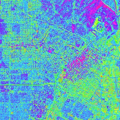
Hi #gischat, I need help with performing zonation on #NDVI (and other indices) over a farmland. I've done manual classification of the pixel values(see image alt), but I can't justify that's the right way. Please kindly help with a helpful resource. 🙏 Thank you.

#MaptimeSF invites you to bring some Oakland datasets you’d like to map to a Mapping Party using #Felt next Tuesday! #webmapping #geospatial #OSM #opendata meetup.com/maptime-sf/eve…?


buckle up #gischat for a wild ride of a thread... Via - @MorningBrew


Ohio cryptic lineage update. We’ve made no progress identifying the individual, but we have learned a few things. 1/


Lets close the day with this NDVI chart for every county and the country at large for the whole of year 2022 time series. Yes am proud since the hustle of using software is now done with simple clicking even for those with less #GIS knowledge @gischatbot
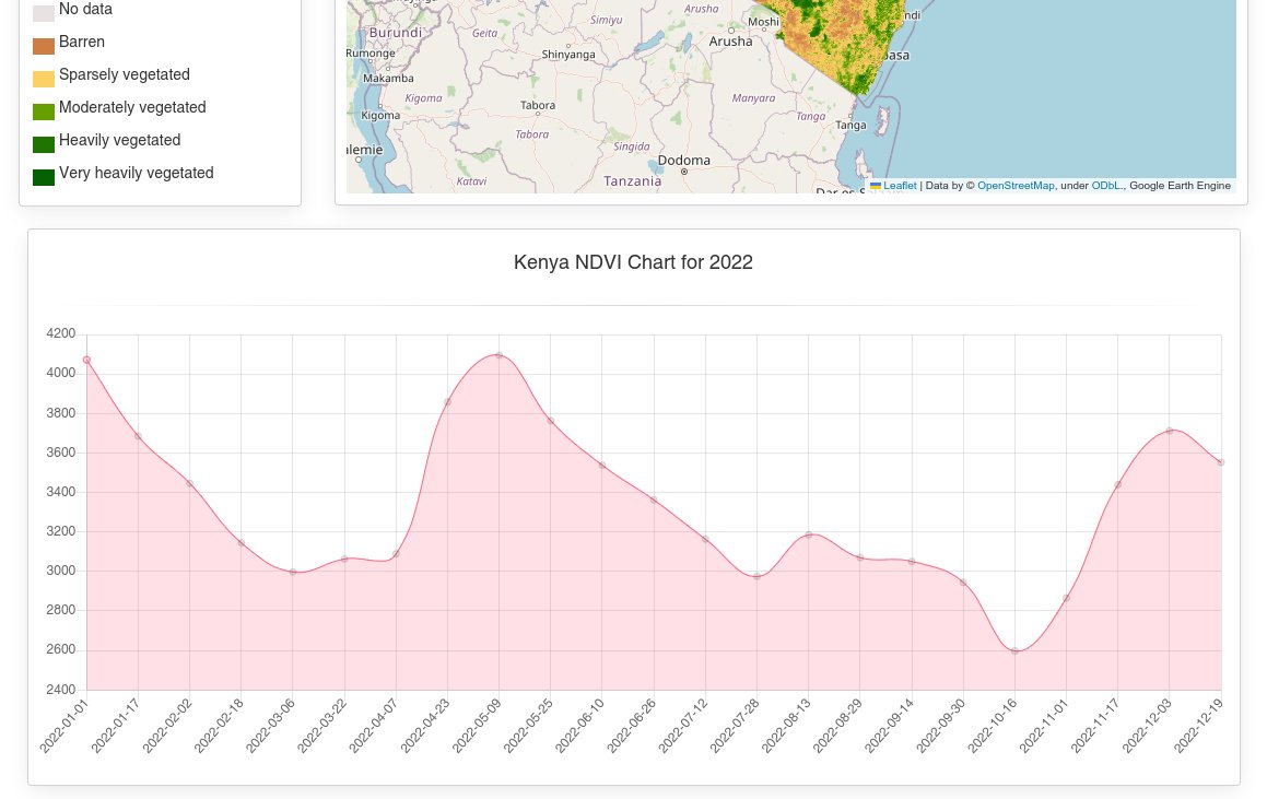
I have created a web application that visualizes Kenya NDVI in any month selected from 2000 upto this year (2023) January also one can select any county and get results of the month he/ she needs #mapping @gischatbot @FridaMwangi1 @lucychepkosgei


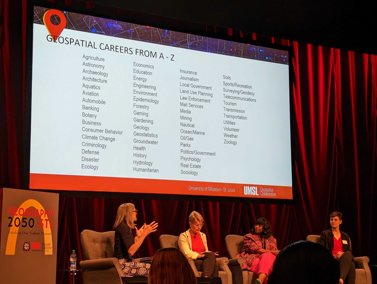
At the intersection of #climate and food system research, #GEOINT has a place where YOU belong! For the first time in St. Louis, @umsl hosted #geospatial experts at @AmericanGeo's #AGS2050. NGA is grateful to be part of this important conversation! #NGAinSTL #Geocareers


Back at #MapPromptMonday with this "gem". Crash data can be quite interesting, especially when looking up the point for the crash that involved my house. Much like that incident though, I like to take the less serious approach to things. #QGIS #gischat

Nice work bro! Keep it up, this will help so many students doing GIS projects.

#mappymeme - there are times when others want to put labels on the map that aren't backed up by the real world...
let me such for a resource that I can share with you


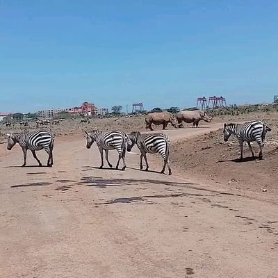
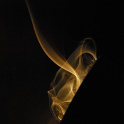
Wildfire smoke from Canada is affecting parts of the United States #geography #geospatial bit.ly/3Njz6SJ


Very proud that last night we received for @NRCan the very first OGC Community Impact Award. It recognizes our leadership, volunteerism, collaboration, and investment, that have had a positive impact on #geospatial. Thank you @opengeospatial!


I'd love a tutorial or resources on how you did this. Been thinking of doing something similar for a project.

📷Y1 can reach an working range of 15KM just by using the built-in radio mode. #SingularXYZ #RTK #geospatial #surveying #surveyor #surveyingequipment #gnssreceiver

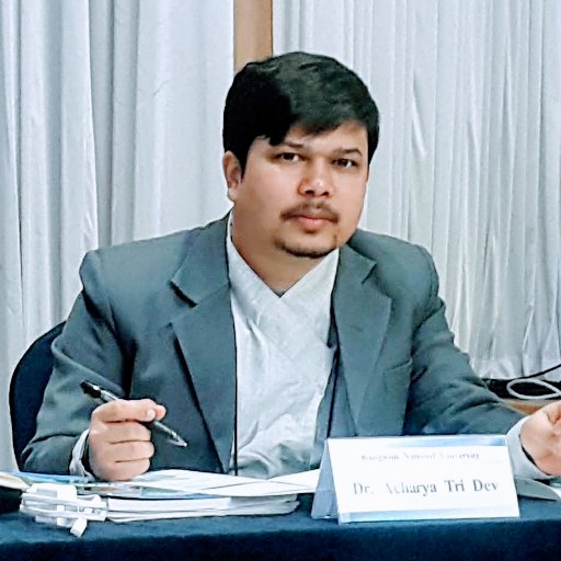
Recent Special #Training on "#Graduate #Thesis #Writing for #Masters’ #Degree" for #Geomatics #Engineering, IOE Pashchimanchal Campus, Pokhara, #Nepal. #M4N #Mentor4Nepal #GISChat #EOChat #Geospatial #GE👉linkedin.com/posts/tridev_m… 👈


United States トレンド
- 1. #IDontWantToOverreactBUT N/A
- 2. Howie 7,822 posts
- 3. #MondayMotivation 35.6K posts
- 4. Hobi 52.8K posts
- 5. Phillips 506K posts
- 6. Victory Monday 2,910 posts
- 7. Good Monday 51K posts
- 8. Winthrop 1,572 posts
- 9. #MondayVibes 3,137 posts
- 10. $IREN 16K posts
- 11. #maddiekowalski N/A
- 12. 60 Minutes 119K posts
- 13. Happy Birthday Kim 1,009 posts
- 14. #Talus_Labs N/A
- 15. Kimberly-Clark 1,836 posts
- 16. Tomorrow is Election Day N/A
- 17. $QURE 2,114 posts
- 18. Kenvue 2,653 posts
- 19. Bradley 7,305 posts
- 20. Queens 38.7K posts
おすすめツイート
-
 Helen McKenzie
@helenmakesmaps -
 GeoTraverse_Group of Companies Ltd.
@Geo_Traverse -
 AWiGIS
@africwomeningis -
 YouthMappers
@youthmappers -
 UN Mappers
@UN_Mappers -
 YouthMappersFUTA
@YouthMapperFUTA -
 Ana Leticia📍@analeticia.bsky.social
@AnaLeticiaGIS -
 Matt Malone
@MatthewHMalone -
 SuperMap
@SuperMap__GIS -
 Digital Earth Africa
@DEarthAfrica -
 Christoph sang
@christophsang -
 Ujaval Gandhi
@spatialthoughts -
 Juliana McMillan-Wilhoit
@JulianaMapper -
 Geography with Justin
@GeoWithJustin -
 🥔🗺️ ᴘᴏᴋᴀᴛᴇᴏ ᴍᴀᴘs
@pokateo_maps
Something went wrong.
Something went wrong.