
You might like


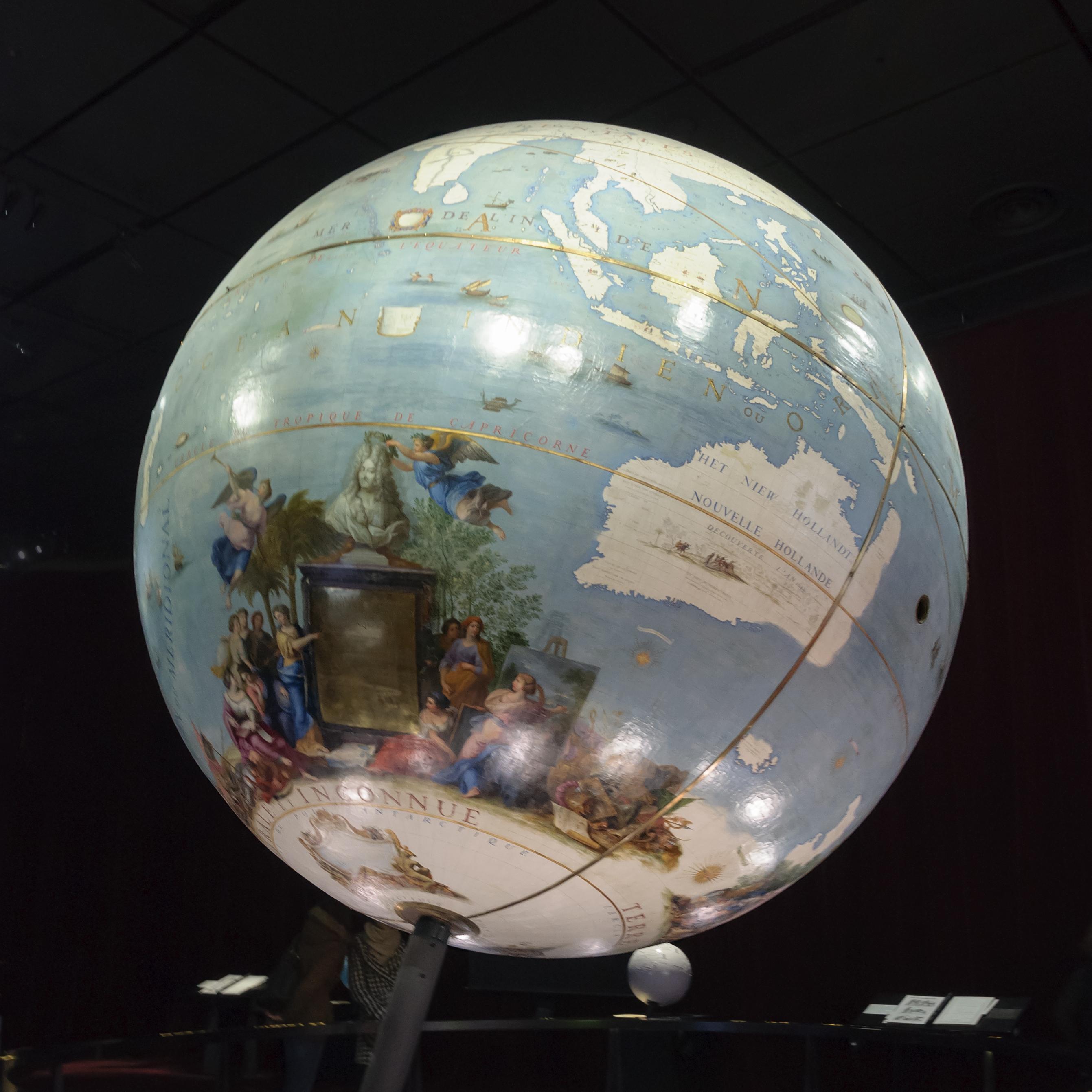
Büszke vagyok. Még mindig találkozok egy-egy régi térképemmel. Most az Oktogonon. I am proud. Still finding my #maps in #Budapest. #cartographer #terkep @ Budapest, Hungary instagram.com/p/BpXOKo_n0TC/…
If the #HERE #maps punctuality is like their spelling on the car drive schedule of #Hungary for "Szabolcs-Szamir-Bereg, Hajdi-Bihar, Borsod-Adaij-Zemplin (the correct is Szabolcs-Szatmár-Bereg, Hajdú-Bihar, Borsod-Abaúj-Zemplén) how can you trust their maps? #GIS #cartography
Hungarian #map robbing gang face jail time in France (maybe they just love maps... :-D) thelocal.fr/20180517/hunga… … … via @TheLocalFrance #cartography #gis #mapping
thelocal.fr
Hungarian map-robbing gang face jail time in France
French prosecutors on Thursday sought prison terms of up to seven years for a group of Hungarians on trial over accusations they stole rare maps worth millions of euros from a string of French...

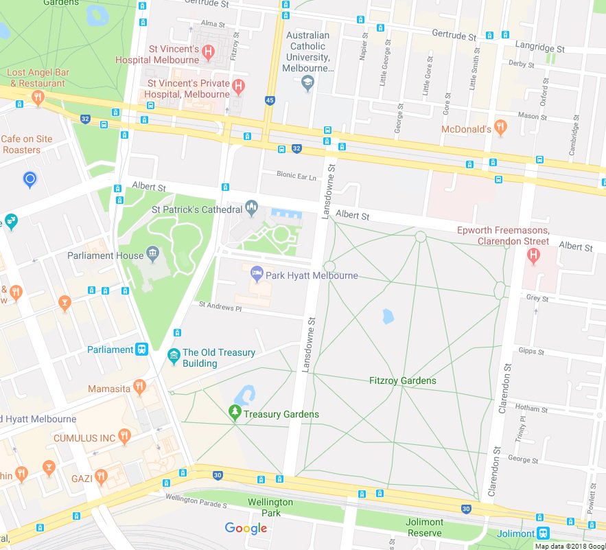
missing park colour behind Fitzroy and Treasury Gardens (Melbourne) in the #googleMaps #cartography #GIS #Map @googlemaps

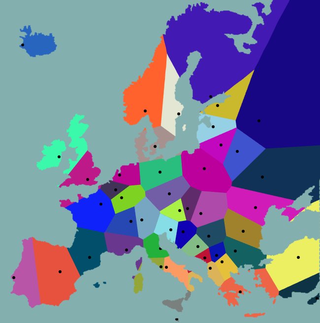
If Victorian Department of Education mapped European countries the same way they mapped school zones... reddit.com/r/MapPorn/comm… @henriettacook
Proud dad!!! My daughter just received today the orienteer of the year 2017 badge / Büszke apuka… instagram.com/p/Bh85knYntgr/
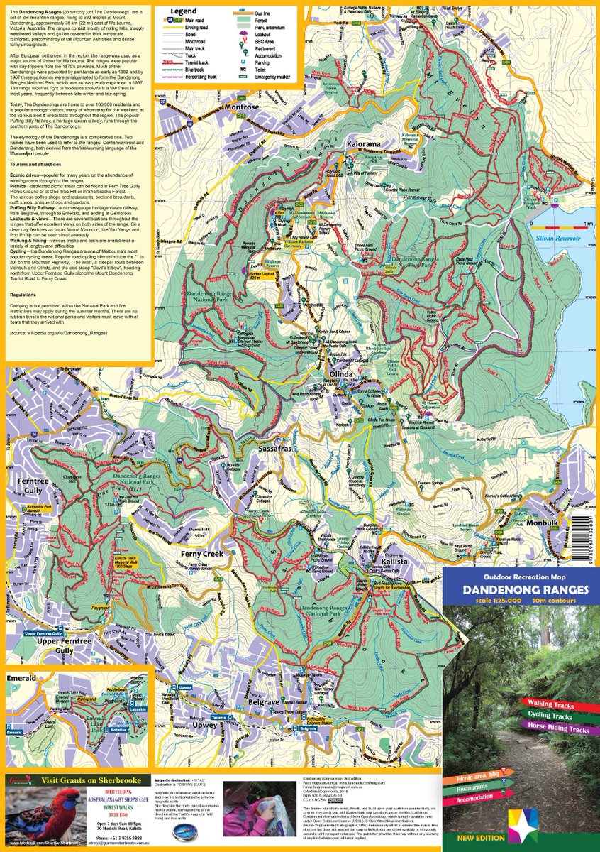
Delivering my first order of the new edition of the #dandenongranges #map and #running 6km/200m… instagram.com/p/Bh3hOIaH0Uq/
Published the Dandenong Ranges tourist map designed with @OCADAG OCAD for #Cartography #tourist #map #cartography #mapping #GIS #dandenongranges #térkep
Ready with another school #orienteeringmap project. #orienteering #mapping #cartography… instagram.com/p/Bhxvlpdngv3/
Proudly my newest map, the fresh #newedition of the #dandenongranges #map has arrived from… instagram.com/p/Bhv1QbenBC8/

How to create a 3D Terrain with Google Maps and height maps in Photoshop – 3D Map Generator Terrain ift.tt/2qBCa0I #gis


Try Google Pay and we’ll both get a $10 Google Play credit after your first purchase. Use my code GB6Y8ENE: g.co/paypromo/GB6Y8…

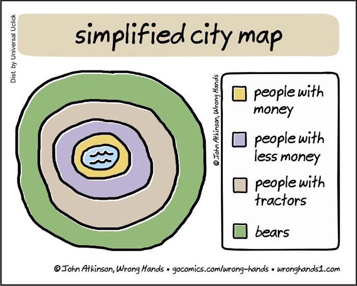
Simplified #city map! Urban planning 101 by John Atkinson 😉 🔎 wronghands1.com | #urbanism
just finished another #school #orienteeringmap #orienteering #map #cartography #térkép… instagram.com/p/Bg7VVI3nmEB/
New post: OCAD 2018 IS HERE! Efficient and Carefree Team Work ocad.com/blog/2018/03/o…

You can now build real-world games using Google Maps APIs. Learn how #GameDevelopers can bring the richness of Google Maps to @unity3d—one of the most popular mobile game engines. goo.gl/XAWR4x #GameDev


![GoldenEyeLabs's profile picture. Mappy Nerd [ #NerdAlert ] | Cartographer | Analyst | Designer | Graphic | Golden Eyed](https://pbs.twimg.com/profile_images/747157828465496065/zphtVQI4.jpg)


United States Trends
- 1. #WWERaw N/A
- 2. Finn N/A
- 3. Bovino N/A
- 4. Jaxson Hayes N/A
- 5. Arizona N/A
- 6. #TheRookie N/A
- 7. Punk N/A
- 8. Homan N/A
- 9. #RawOnNetflix N/A
- 10. El Centro N/A
- 11. Jaden Bradley N/A
- 12. #90dayfiancetheotherway N/A
- 13. #AmericanIdol N/A
- 14. Schwartz N/A
- 15. Gunther N/A
- 16. Rumble N/A
- 17. Nattie N/A
- 18. Jrue N/A
- 19. The Atlantic N/A
- 20. Tozawa N/A
You might like


Something went wrong.
Something went wrong.