#arcgisblog 검색 결과

I haven’t said anything until now, but .... have you seen the new redesign of @esri_blogs? It’s available since last week! improving UX/UI 👏🏻 bit.ly/2GM7ocA #esri #ArcGISblog


Aprende sobre el uso de datos #SIG en #videojuegos y como esto podría cambiar los SIG en el futuro, en este artículo de #ArcGISBlog 👾 buff.ly/2TzR0U4 #GIS #gaming #locationtechnology #tecnologia #localizacion


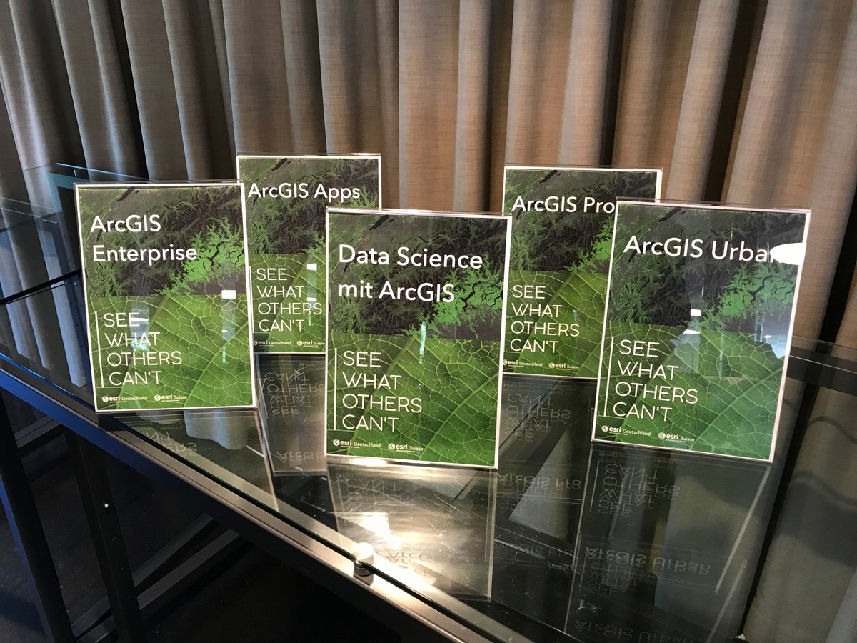
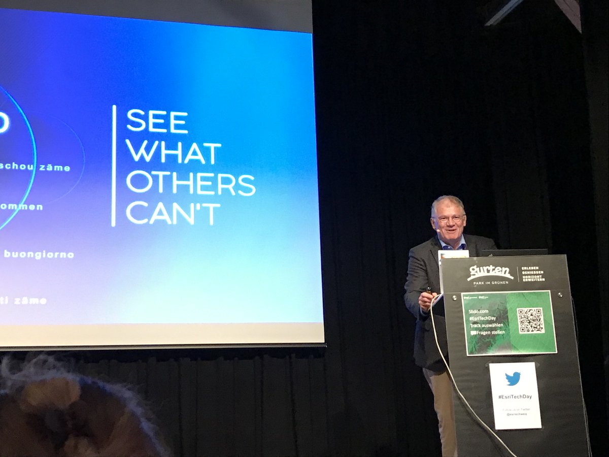
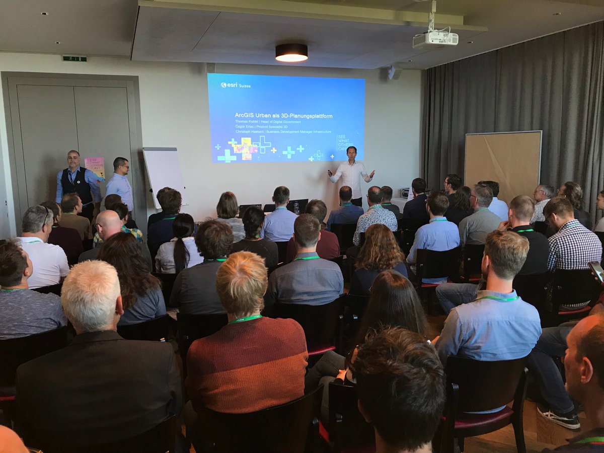
"GIS auf dem Gurten: Das war der #EsriTechDay 2019." - Am 3. September kam die Schweizer GIS-Welt auf dem Berner Hausberg zusammen. Eindrücke und Bilder vom TechDay finden Sie in unserem Nachklapp auf dem #ArcGISBlog: bit.ly/2ZyKMd8

#EsriTechDay 2020: Am 1. September trifft sich die GIS-Community aus Österreich, der Schweiz und Deutschland im virtuellen Raum. Welche Gipfel wir dort erklimmen, lesen Sie im #ArcGISBlog: ow.ly/6EFq50A3FJA


There are lots of ways to do things in the varied landscape of GIS features. This #ArcGISBlog covers two methods: hacking the Tessellation geoprocessing tool and using the Layout’s measured grid tool. Check it out: esri.social/kiHF50KcBg0 #EsriWater
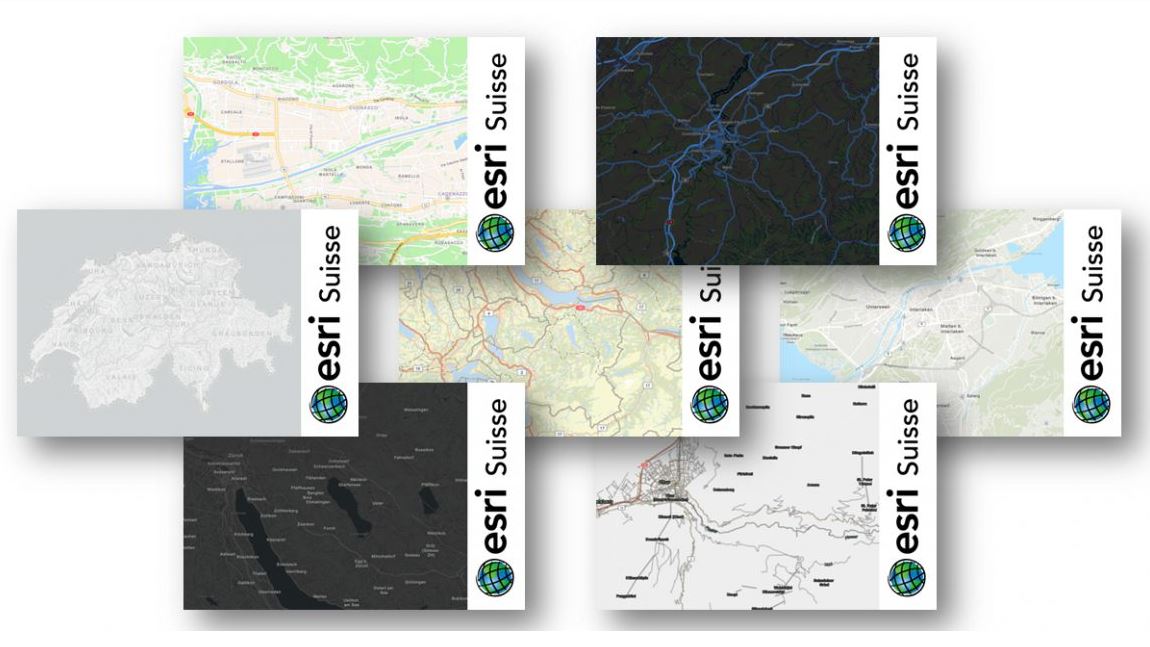
Jetzt neu: #Grundkarten für die #Schweiz im Vektor-Kachelformat – mit swisstopo-Daten in CH1903+ LV95. Alle Infos im #ArcGISBlog: arcgis.esri.de/neue-vektor-gr… @ArcGISPro #arcgisonline
#ArcGISOnline includes time-saving capabilities for managing members. Check out this #ArcGISBlog to learn about managing app licenses, allocating credits and more. esri.social/afFZ50OT152 #EsriWater


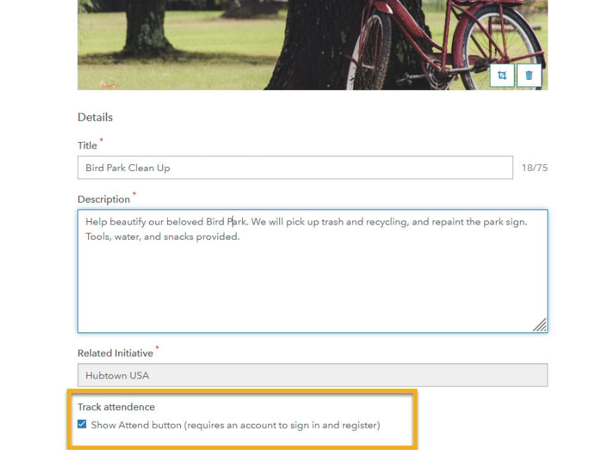
Peruse a summary of recent updates to #ArcGISHub, in this part 2 #ArcGISBlog article. Hub releases updates every week, so there are always fresh new things to discover. See what's new in collaboration, events, exploring and downloading data, and more esri.social/MHyE50MZAtt
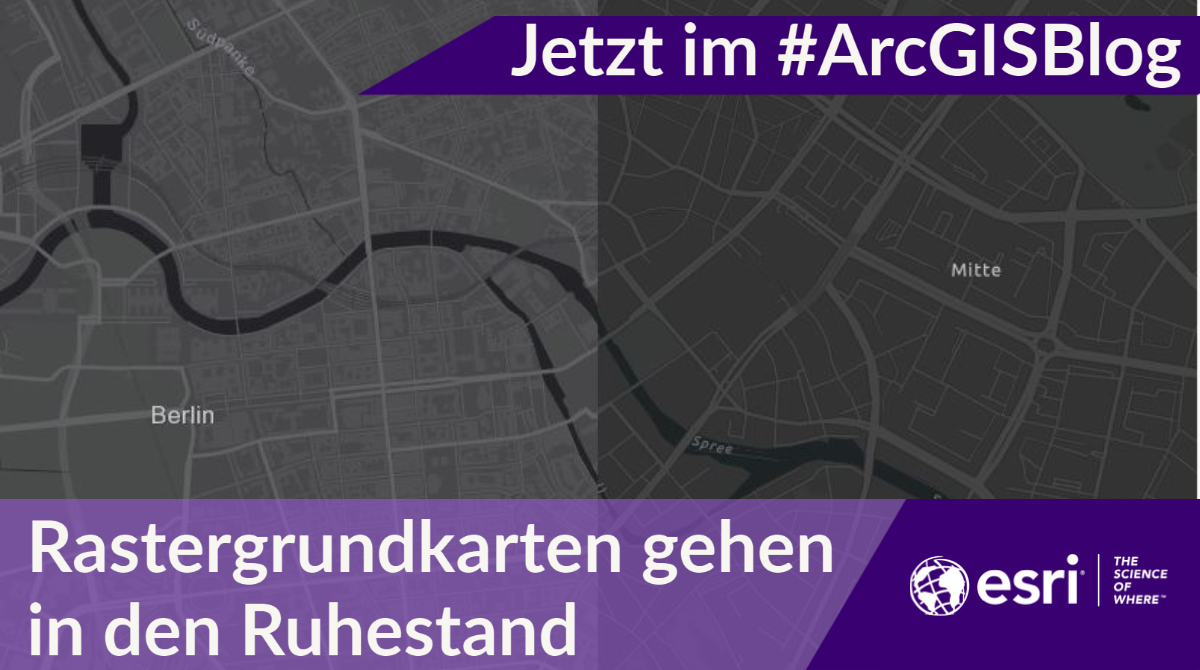
Schritt für Schritt von der Raster- zur Vektor Tile-Version: Mehr zur Migration der Grundkarten der Webkarten und Apps lest ihr im #ArcGISBlog - arcgis.esri.de/rastergrundkar…
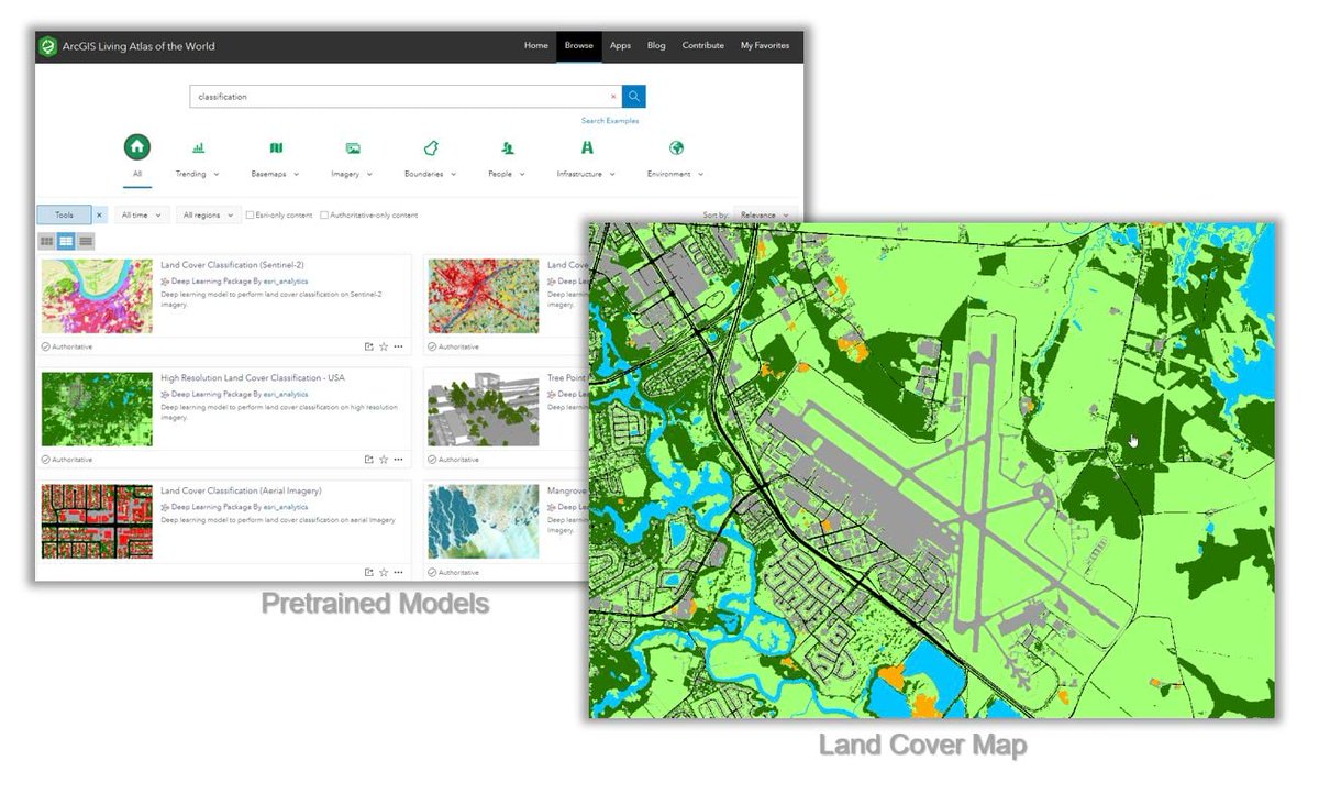
Esri customers can take advantage of a collection of pretrained models for deriving land cover maps from high- to low-resolution imagery. Learn more by reading this #ArcGISBlog esri.social/4v1N50Q49kY #EsriWater
Zeitreihen in @ArcGISPro analysieren und einen Blick in die Zukunft werfen. Mehr im #ArcGISBlog: arcgis.esri.de/predictive-ana…

𝘼𝙇𝙀𝙍𝙏! Recent Microsoft cumulative updates result in a crash for ArcGIS Pro 2.8.x and 2.9.x users when changing symbology. This #ArcGISBlog provides information about the crash and what Esri recommends that customers do. esri.social/xQeo50LafFG #EsriWater

Are you using ArcGIS QuickCapture? If so, be sure to check out the June updates. One of the updates include device variables that help to better understand how mobile crews manage the battery life of their devices. Learn more in this #ArcGISBlog esri.social/uSlC50JymrM #EsriWater

Whether you’re a novice or a seasoned user, there’s always more to learn! If you're hungry for helpful tips, check out this #ArcGISblog article filled with timesavers and learning resources for #ArcGISHub and #ArcGISEnterprise Sites users esri.social/bKRt50Lv8k7

𝗪𝗵𝗮𝘁'𝘀 𝗻𝗲𝘄 𝗶𝗻 𝗔𝗿𝗰𝗚𝗜𝗦 𝗤𝘂𝗶𝗰𝗸 𝗖𝗮𝗽𝘁𝘂𝗿𝗲 #ArcGISBlog is now available. If you're not familiar with #ArcGISQuickCapture don't worry, the blog includes a two minute introduction video. esri.social/wzFt50KCGtT #EsriWater #ArcGIS

Wie sich Vektorgrundkarten von Esri individuell anpassen lassen erklärt der folgende Blogartikel von @Esri_de : arcgis.esri.de/anpassen-von-e… #Karten #ArcGISOnline #ArcGISBlog

Die Gewinner der ArcGIS StoryMaps Competition 2022 stehen fest. Sehen Sie die prämierten #ArcGISStoryMaps im #ArcGISBlog: ow.ly/APvQ50LJpbG

This #ArcGISBlog describes enhancements to #ArcGISQuickCapture provided in the latest update. esri.com/arcgis-blog/pr… #EsriWater

To deal with the variability of water quality and report accurate findings, the Kentucky Division of Water uses GIS to record, visualize, monitor contamination levels, and communicate results. Learn more about their work in this #ArcGISBlog esri.social/xbzs50JZi9m

ArcGIS Enterprise 10.9.x ist die letzte Version, mit der sich aus ArcMap heraus Dienste veröffentlicht lassen. Mehr im #ArcGISBlog - arcgis.esri.de/arcmap-runtime… @jmoosmeier

Esri's new 𝙈𝙞𝙜𝙧𝙖𝙩𝙚 𝙩𝙤 𝙐𝙩𝙞𝙡𝙞𝙩𝙮 𝙉𝙚𝙩𝙬𝙤𝙧𝙠 tool creates and loads data to a utility network based on the classes and fields of your existing GIS features. Learn more about the tool in this #ArcGISBlog ow.ly/ZGKR50VaxiO #EsriWater #ArcGISUtilityNetwork

Esri's #StoryMaps team has published a list of their favorite stories. For every favorite story on the list, there are hundreds more that deserve recognition. Check out this #ArcGISBlog to brouse the fifteen standout stories. #EsriWater esri.social/OyEr50UAsqr

Esri's #ArcGISSolutions has created a step-by-step data migration tutorial for the sewer industry (more industries to follow). Check out this #ArcGISBlog to learn more. #EsriWater #Wastewater esri.social/Scs150UsGIF
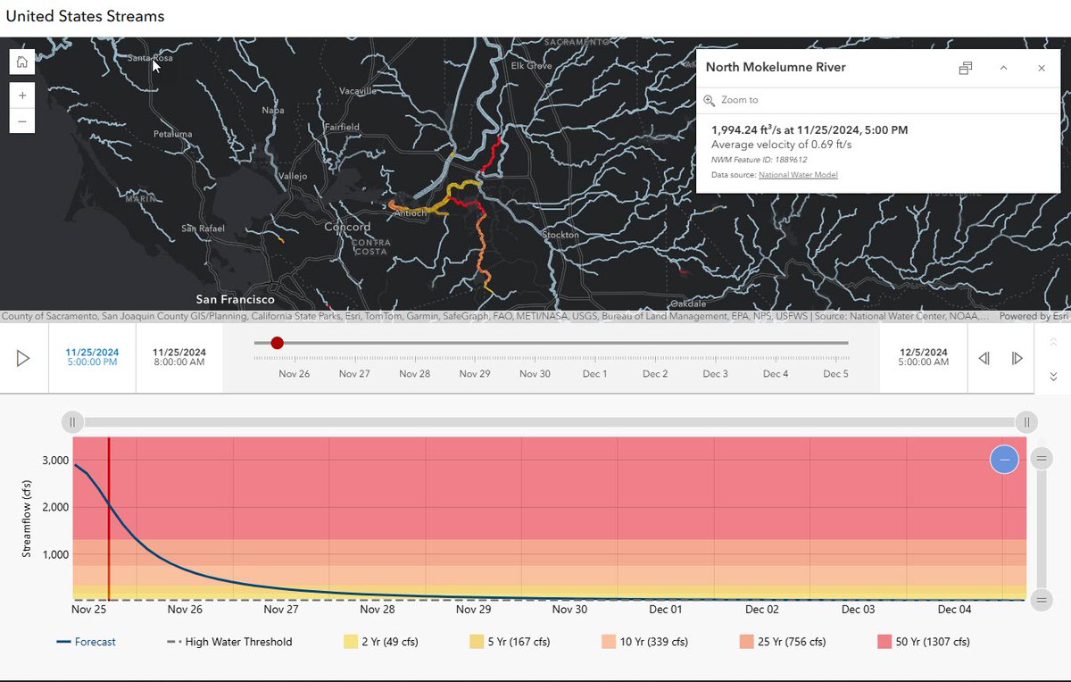
Esri's new Streamflow Viewer incorporates two streamflow services: the GEOGLOWS Streamflow forecast service or the United States National Water Model. Learn more about the app. #ArcGISBlog #EsriWater #WaterResources esri.social/xmL850Uj5nS
Explore Esri's new pretrained geospatial AI models specifically designed to help first responders and analysts quickly identify areas at risk, assess the extent of damage, and manage emergency operations. Read this #ArcGISBlog to learn more. esri.social/EhUr50TL2cw
esri.com
New Pretrained Geospatial AI Models for Disaster Response
New Pretrained Geospatial AI Models for Disaster Response
When taking maps offline for use in #ArcGISFieldMaps, there are a number of things to consider that can cause issues with syncing your offline data. This #ArcGISBlog provides a list of items to consider before taking data offline. #EsriWater esri.social/QTgU50TkEmW

Sharing information via #ArcGIS has gotten easier and easier! Collaboration across your organization and beyond is what we need in to manage water at a regional level and focus on a #OneWater strategy. #ArcGISBlog. #EsriWater esri.social/Jcvg50Thspg

Last week @jeffshaner posted "𝗪𝗵𝗮𝘁'𝘀 𝗻𝗲𝘄 𝗶𝗻 𝗔𝗿𝗰𝗚𝗜𝗦 𝗙𝗶𝗲𝗹𝗱 𝗠𝗮𝗽𝘀". Get the full list of key usability improvements in this #ArcGISBlog: esri.social/pqUb50SrmzV
#ArcGISDashboards keep getting better. 😍 Seven new themes are available in the Theme panel of Esri's Dashbaords appication! You can also create custom themes to meet organizational brand guidelines. Learn more in this #ArcGISBlog esri.social/yOAn50Sraqg #EsriWater
The development of a digital nationwide hydrography dataset began in the 1970s. This #ArcGISBlog provides a brief history of the NHD and stakeholder articles focused on development of 3DHP. #EsriWater #WaterResources esri.social/2Xsw50Rlr9G
Meta AI’s Segment Anything Model has been added to our library of pretrained models, allowing you to use it seamlessly with #ArcGIS. Learn more in this #ArcGISBlog #EsriWater esri.social/V6Bi50QVHxF
esri.com
Dev Summit 2024: Extending the Segment Anything Model (SAM)
Discover how you can extend the Segment Anything Model (SAM) to improve your geospatial wokflows.
Check out this #ArcGISBlog to learn how Scientists, Tribal leaders, historical experts, and agency officials collaborated to create a previously untold narrative around the increasing water risks to the Grand Canyon and Colorado River Basin. esri.social/B0Io50QzGpn #EsriWater

Amp up your storytelling with #ArcGISStoryMaps. This #ArcGISBlog shares the newest updates and invites you to learn about Briefings (a new slide-based format). Check out the blog to learn more: esri.social/TO0e50Qv2ta #EsriWater

Are you needing to create sales regions, service areas, franchise zones, or voting districts? Check out this #ArcGISBlog to learn about the latest #ArcGISBusinessAnalyst Pro release and what's new to help you manage your territory solutions. ➡️ esri.social/icrB50QjQPm

𝟮𝟬𝟮𝟯 𝗦𝘁𝗼𝗿𝘆𝘁𝗲𝗹𝗹𝗲𝗿𝘀 𝗼𝗳 𝘁𝗵𝗲 𝗬𝗲𝗮𝗿 🎉 Have you had time to take a look at the winners of the ArcGIS #StoryMaps Competition? If not, check out this #ArcGISBlog post sharing winners, runners-up, and student winners. #EsriWater esri.social/K3ih50QgXwM


There are new filtering options in @ArcGISPro 3.2 to help users choose an appropriate coordinate system... Check out this #ArcGISBlog by Heather Smith: esri.com/arcgis-blog/pr… #ArcGISPro #coordinatesystem #stateplane #GIS #gischat #spatial #mapping #mapprojectionsarehard
esri.com
Find the right projection with filters in ArcGIS Pro
Learn how to filter coordinate systems based on a spatial extent, GCS, or projection property.
How to create and use a custom vertical transformation in @ArcGISPro (new GP tool in #ArcGISPro 3.2) #ArcGISBlog #coordinatesystem #stateplane #GIS #gischat #spatial #mapping esri.com/arcgis-blog/pr…
esri.com
How to create and use a custom vertical transformation in ArcGIS Pro
How to create and use a custom vertical transformation in ArcGIS Pro
Esri customers can take advantage of a collection of pretrained models for deriving land cover maps from high- to low-resolution imagery. Learn more by reading this #ArcGISBlog esri.social/4v1N50Q49kY #EsriWater
Here is some light reading... The new US datums of 2022 will soon be released. This #ArcGISBlog article covers what is coming and how you should prepare your data. #coordinatesystem #mapprojection #stateplane #GIS #gischat #spatial #mapping #NAD83 #NAVD88 esri.com/arcgis-blog/pr…

Looking for something new this fine Thursday morning? Well, we've got you! Read our "What's new and soon to be for #ArcGISHub in quarter three" #ArcGISBlog article to see what's new and coming in the latter part of this year. esri.social/zIew50PTnm4
Aprende sobre el uso de datos #SIG en #videojuegos y como esto podría cambiar los SIG en el futuro, en este artículo de #ArcGISBlog 👾 buff.ly/2TzR0U4 #GIS #gaming #locationtechnology #tecnologia #localizacion
I haven’t said anything until now, but .... have you seen the new redesign of @esri_blogs? It’s available since last week! improving UX/UI 👏🏻 bit.ly/2GM7ocA #esri #ArcGISblog
"GIS auf dem Gurten: Das war der #EsriTechDay 2019." - Am 3. September kam die Schweizer GIS-Welt auf dem Berner Hausberg zusammen. Eindrücke und Bilder vom TechDay finden Sie in unserem Nachklapp auf dem #ArcGISBlog: bit.ly/2ZyKMd8
#EsriTechDay 2020: Am 1. September trifft sich die GIS-Community aus Österreich, der Schweiz und Deutschland im virtuellen Raum. Welche Gipfel wir dort erklimmen, lesen Sie im #ArcGISBlog: ow.ly/6EFq50A3FJA
There are lots of ways to do things in the varied landscape of GIS features. This #ArcGISBlog covers two methods: hacking the Tessellation geoprocessing tool and using the Layout’s measured grid tool. Check it out: esri.social/kiHF50KcBg0 #EsriWater
Peruse a summary of recent updates to #ArcGISHub, in this part 2 #ArcGISBlog article. Hub releases updates every week, so there are always fresh new things to discover. See what's new in collaboration, events, exploring and downloading data, and more esri.social/MHyE50MZAtt
Jetzt neu: #Grundkarten für die #Schweiz im Vektor-Kachelformat – mit swisstopo-Daten in CH1903+ LV95. Alle Infos im #ArcGISBlog: arcgis.esri.de/neue-vektor-gr… @ArcGISPro #arcgisonline
Whether you’re a novice or a seasoned user, there’s always more to learn! If you're hungry for helpful tips, check out this #ArcGISblog article filled with timesavers and learning resources for #ArcGISHub and #ArcGISEnterprise Sites users esri.social/bKRt50Lv8k7
#ArcGISOnline includes time-saving capabilities for managing members. Check out this #ArcGISBlog to learn about managing app licenses, allocating credits and more. esri.social/afFZ50OT152 #EsriWater
Esri customers can take advantage of a collection of pretrained models for deriving land cover maps from high- to low-resolution imagery. Learn more by reading this #ArcGISBlog esri.social/4v1N50Q49kY #EsriWater
𝘼𝙇𝙀𝙍𝙏! Recent Microsoft cumulative updates result in a crash for ArcGIS Pro 2.8.x and 2.9.x users when changing symbology. This #ArcGISBlog provides information about the crash and what Esri recommends that customers do. esri.social/xQeo50LafFG #EsriWater
Are you using ArcGIS QuickCapture? If so, be sure to check out the June updates. One of the updates include device variables that help to better understand how mobile crews manage the battery life of their devices. Learn more in this #ArcGISBlog esri.social/uSlC50JymrM #EsriWater
Schritt für Schritt von der Raster- zur Vektor Tile-Version: Mehr zur Migration der Grundkarten der Webkarten und Apps lest ihr im #ArcGISBlog - arcgis.esri.de/rastergrundkar…
𝗪𝗵𝗮𝘁'𝘀 𝗻𝗲𝘄 𝗶𝗻 𝗔𝗿𝗰𝗚𝗜𝗦 𝗤𝘂𝗶𝗰𝗸 𝗖𝗮𝗽𝘁𝘂𝗿𝗲 #ArcGISBlog is now available. If you're not familiar with #ArcGISQuickCapture don't worry, the blog includes a two minute introduction video. esri.social/wzFt50KCGtT #EsriWater #ArcGIS
Zeitreihen in @ArcGISPro analysieren und einen Blick in die Zukunft werfen. Mehr im #ArcGISBlog: arcgis.esri.de/predictive-ana…
Wie sich Vektorgrundkarten von Esri individuell anpassen lassen erklärt der folgende Blogartikel von @Esri_de : arcgis.esri.de/anpassen-von-e… #Karten #ArcGISOnline #ArcGISBlog
Are you needing to create sales regions, service areas, franchise zones, or voting districts? Check out this #ArcGISBlog to learn about the latest #ArcGISBusinessAnalyst Pro release and what's new to help you manage your territory solutions. ➡️ esri.social/icrB50QjQPm
This #ArcGISBlog describes enhancements to #ArcGISQuickCapture provided in the latest update. esri.com/arcgis-blog/pr… #EsriWater
Was Euch erwartet: Der neue Map Viewer, eine neue Version von ArcGIS Dashboards und neue Kollaborationsformen. Ausserdem ist es jetzt möglich, die Ausführung von ArcGIS Notebooks zu planen. Mehr im #ArcGISBlog: arcgis.esri.de/das-neue-relea… #LocationIntelligence #GIS @ArcGISOnline

Last week @jeffshaner posted "𝗪𝗵𝗮𝘁'𝘀 𝗻𝗲𝘄 𝗶𝗻 𝗔𝗿𝗰𝗚𝗜𝗦 𝗙𝗶𝗲𝗹𝗱 𝗠𝗮𝗽𝘀". Get the full list of key usability improvements in this #ArcGISBlog: esri.social/pqUb50SrmzV
Something went wrong.
Something went wrong.
United States Trends
- 1. Happy Halloween 834K posts
- 2. YouTube TV 49.2K posts
- 3. Dolphins 41.5K posts
- 4. #SinisterMinds 6,907 posts
- 5. Ryan Rollins 12.6K posts
- 6. Ravens 56.3K posts
- 7. Mike McDaniel 5,212 posts
- 8. Lamar 53.2K posts
- 9. #T1WIN 7,924 posts
- 10. Talbot 1,102 posts
- 11. Mary Ann N/A
- 12. YTTV N/A
- 13. Fiala 1,776 posts
- 14. Hulu 19.1K posts
- 15. #RUNSEOKJIN_epTOUR_ENCORE 102K posts
- 16. #Jin_TOUR_ENCORE 98.7K posts
- 17. #DBX4 1,848 posts
- 18. frank iero 1,843 posts
- 19. Henry 57.4K posts
- 20. Mindy 3,750 posts