#geospatialsolutions search results
We successfully wrapped up our #GISDay2025 participation, showcasing our #DigitalTwin platform and advanced geospatial solutions. Thanks to all who visited—excited to drive smarter, data-driven development. #GeospatialSolutions #AssetManagement #DutcoTennantLLC


PARTNERSHIP! 🛰️ #AWiSC2025 is excited to partner with @OakarServices! Boosting our focus on #GeospatialSolutions and #GIS. Network with industry experts! Register FREE NOW! 👇 womeninspace.ke/awisc-2025/


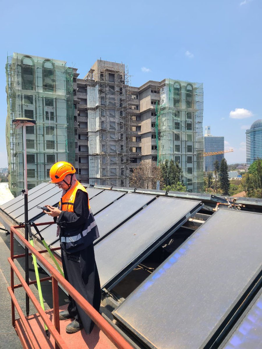
📍 Skymap Africa recently carried out a rooftop survey project, providing accurate measurements and geospatial data to support planning and construction needs. #SkymapAfrica #Surveying #GeospatialSolutions


Every map made is evaluated and graded according to some sort of prescribed criteria to determine it quality. The WORST map is one that doesn't get be made. #CartoMOOC #GeospatialSolutions


💬 "GEOBIRO is one of the largest providers of Scan-to-BIM and Scan-to-CAD services in Europe, with a production team of over 100 staff," said Enes Jahic, Business Owner of #GEOBIRO. Watch the full podcast: youtube.com/watch?v=lAj6qe… #wgic #geospatialsolutions #BIM #CAD #Surveying

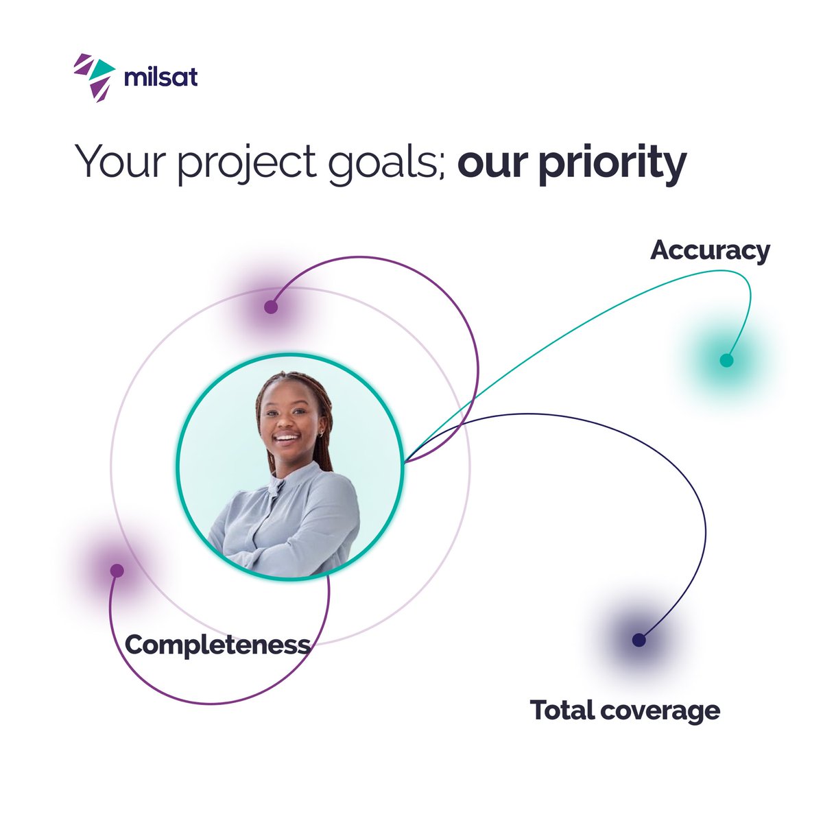
At Milsat, your project success is our utmost priority. Whether it's accuracy, completeness, or total coverage, we deliver with precision every time. Let us help you turn data into smart business decisions. Visit milsat.africa to get started #GeospatialSolutions #GIS

Looking for expert guidance? Ideal Solutions offers GIS Consultancy Solutions to help you navigate the geospatial landscape. Discover how we can support your GIS initiatives. Get in touch for a consultation! #GISExperts #GeospatialSolutions


Quickly discover, visualize, and extract critical info from geospatial data. NV5 will be at Modern Day Marine (April 29-May 1, Washington, DC) showcasing our mission-proven technology. 👉Visit booth #929 for live demos! #ModernDayMarine #GeospatialSolutions #DefenseTechnology


We're just a few days away from #EsriUC2024 in San Diego! If you're attending and are interested in learning about how Silvacom CS can empower your organization through #GeospatialSolutions, book a meeting on-site with Matt 👉hubs.la/Q02y8R5Z0


Intermap’s CEO visited our exceptional team in Jakarta, Indonesia! Our global talent delivers cutting-edge geospatial solutions as we innovate and execute around the clock and around the world. We’ll be growing the Jakarta team soon! #GeospatialSolutions #Teamwork #FutureGrowth

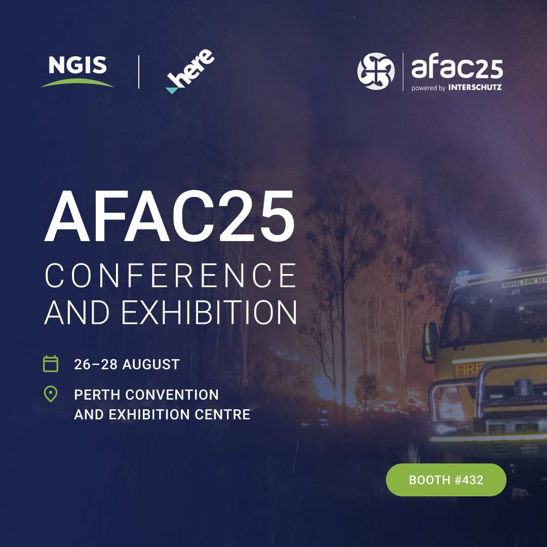
Meet NGIS and @HERE at AFAC, 26–28 August, Perth Convention and Exhibition Centre, Booth #432. Explore how advanced geospatial solutions are transforming emergency management. #LocationIntelligence #EmergencyManagement #GeospatialSolutions

🌙🐑 Eid Mubarak from AZ NavTeq! 🐐🌙 May this Eid bring joy & prosperity. As your geospatial partner, we're committed to innovation & excellence. #EidMubarak #AZNavTeq #GeospatialSolutions #Innovation #Eid2023


New month, real sites, ready projects. Geospatial data captured. Teams aligned. Work starts here. 📧 [email protected] | 📞 0798 740614 #GeospatialSolutions #SurveyingMadeSimple #SiteReady #ProjectAlignment #WorkStartsHere


Did you know that satellite imagery and aerial data can revolutionize how we understand our environment? 🌍 #JapakGIS #GeospatialSolutions #MappingTheFuture #DigitalMapping #DroneMapping #DroneSurveys #AerialMapping #LocationIntelligence #SpatialAnalytics #DataVisualization

We successfully wrapped up our #GISDay2025 participation, showcasing our #DigitalTwin platform and advanced geospatial solutions. Thanks to all who visited—excited to drive smarter, data-driven development. #GeospatialSolutions #AssetManagement #DutcoTennantLLC
PARTNERSHIP! 🛰️ #AWiSC2025 is excited to partner with @OakarServices! Boosting our focus on #GeospatialSolutions and #GIS. Network with industry experts! Register FREE NOW! 👇 womeninspace.ke/awisc-2025/

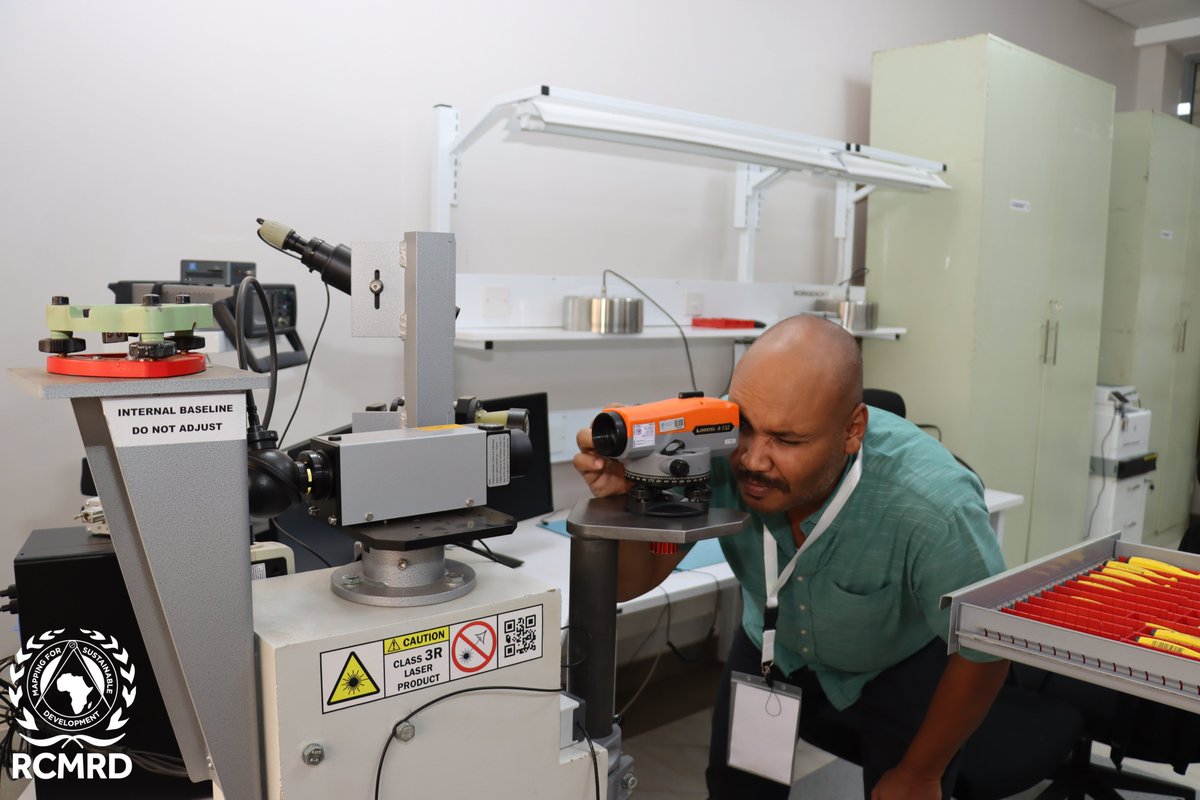
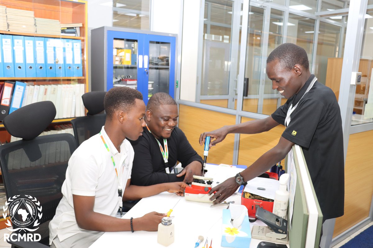
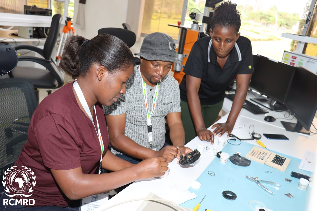
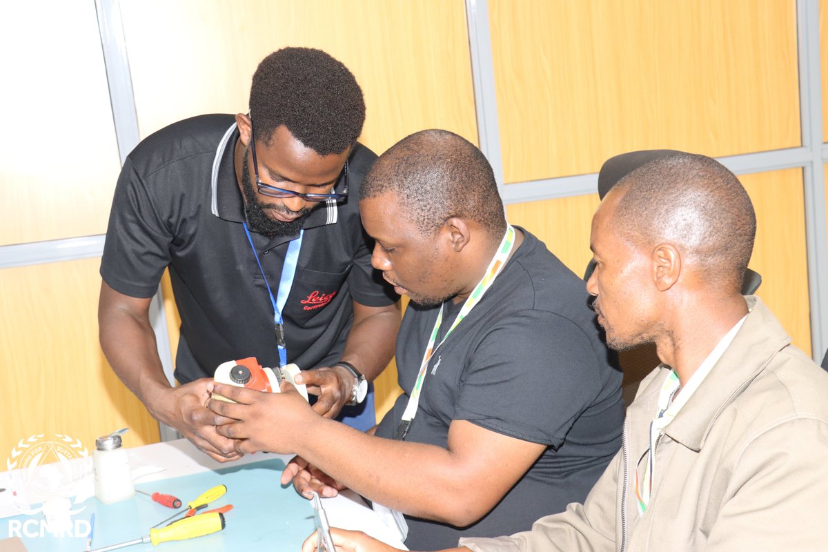
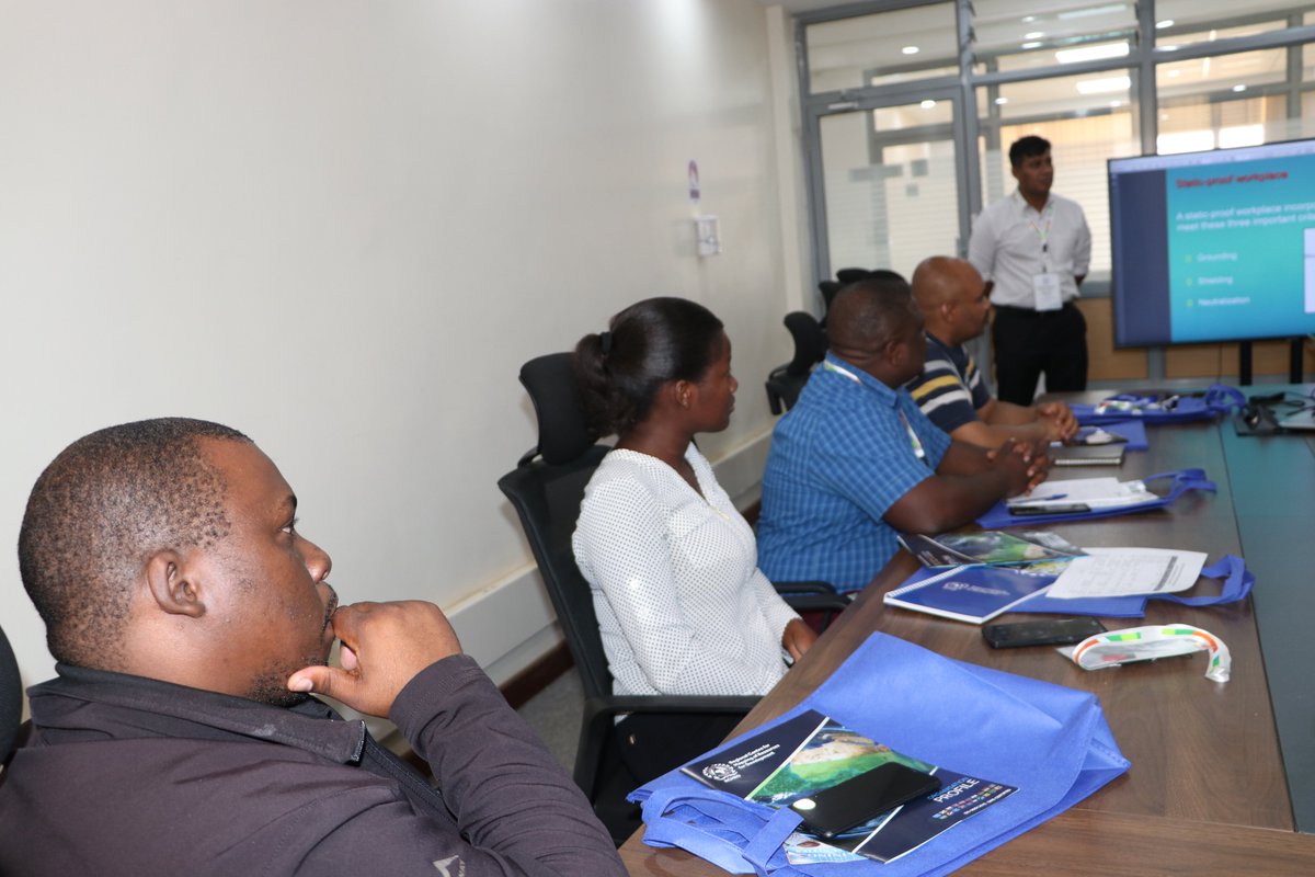
Day 2 of our #RCMRD Geospatial training is underway! Today, participants are learning about basic survey instrument maintenance and calibration techniques. These skills are essential in ensuring accurate data collection and analysis. #BuildingCapacity #GeospatialSolutions
Every map made is evaluated and graded according to some sort of prescribed criteria to determine it quality. The WORST map is one that doesn't get be made. #CartoMOOC #GeospatialSolutions
Exciting discussions on Day 1 of #RCMRD's Geospatial Training on service, repair, and calibration of surveying instruments! Looking forward to the next 4 days of learning, sharing, and building capacity!" #GeospatialSolutions #BuildingCapacity


📍 Skymap Africa recently carried out a rooftop survey project, providing accurate measurements and geospatial data to support planning and construction needs. #SkymapAfrica #Surveying #GeospatialSolutions

Elevate your Geospatial game with #AllTerraIndia! We're here to guide you through the diverse terrain of Geospatial needs. Our expertise in India's landscapes, challenges, and industry dynamics ensures tailor-made #GeospatialSolutions that leave a lasting impression. 📷

Spatialox harnesses GIS technology to create customized mapping solutions that turn complex geospatial data into actionable insights. #GISMapping #GeospatialSolutions #MappingTechnology #SpatialData #CustomMapping #GeospatialAnalysis #GISServices #DataVisualization

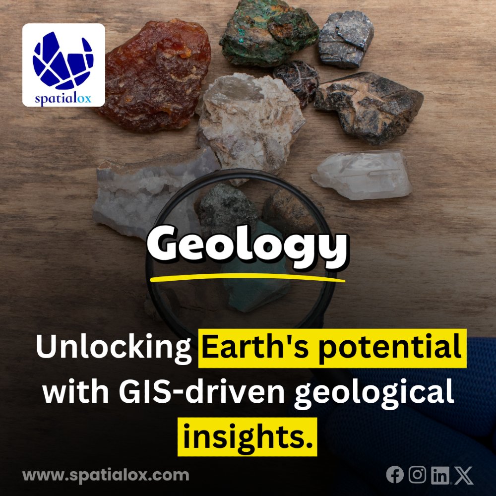
At Spatialox, we use GIS technology to deliver precise geological insights. From resource mapping to terrain analysis, we help you unlock the Earth's potential for smarter decision-making. #GeospatialSolutions #GeologicalInsights #GISinGeology #EarthExploration #SpatialoxGeolog
Celebrating #WorldStatisticsDay! At #AllTerraIndia, we're proud of our accurate #geospatialsolutions, empowering professionals in various industries. With data and statistics, we map the physical world to create precise digital impressions, making a real difference! #GIS #GeoData

Need near real-time data visualization and analysis? This week at SOF Week (May 5-9, Tampa, FL), NV5 is showcasing our mission-proven geospatial technology and solutions. 👉Visit NV5 booth #3107 for live demos! #SOFWeek #GeospatialSolutions #DefenseTechnology


A full house today at the @bussynet Drone and Unmanned Aviation Conference with COO Heico Kühn taking the stage to bring iGlobes Solutions and Technologies to the industry leaders. #Drones #Geospatial #GeospatialSolutions #DataAcquisition


Quickly discover, visualize, and extract critical info from geospatial data. NV5 will be at Modern Day Marine (April 29-May 1, Washington, DC) showcasing our mission-proven technology. 👉Visit booth #929 for live demos! #ModernDayMarine #GeospatialSolutions #DefenseTechnology
Trimble S7 Total Station combines high-speed 3D scanning, advanced imaging, and precise surveying into a single, powerful solution, designed to simplify workflows and enhance field productivity. #TrimbleS7 #3DScanning #GeospatialSolutions #AllTerraIndia

Something went wrong.
Something went wrong.
United States Trends
- 1. Brian Cole 41K posts
- 2. #TrumpAffordabilityCrisis 6,752 posts
- 3. Dalot 7,801 posts
- 4. Eurovision 127K posts
- 5. #EndRevivalInParis 18.1K posts
- 6. Capitol 24.6K posts
- 7. Tong 19.1K posts
- 8. #OlandriaxHarvard 2,899 posts
- 9. Wray 16.8K posts
- 10. Cunha 11.8K posts
- 11. Rwanda 37.3K posts
- 12. #MUNWHU 4,536 posts
- 13. #NationalCookieDay 1,804 posts
- 14. $SMX 2,184 posts
- 15. Sadie 19.3K posts
- 16. West Ham 33.9K posts
- 17. Sidwell N/A
- 18. Woodbridge 6,395 posts
- 19. Legend Bey 1,606 posts
- 20. Chadwick 1,225 posts