#geospatialtech 검색 결과

Geospatial tech is transforming EUDR compliance. Manual data management is still too time-consuming and unscalable. Learn about scalable EUDR compliance in our recent webinar. hubs.la/Q03SsdkK0 #EUDR #Sustainability #GeospatialTech #Compliance

[PARTNERED] GIS Day 2025 showed how GIS is moving from maps to enterprise intelligence, driving utilities, sustainability, engineering and environmental planning. #GISDay2025 #GeospatialTech #Infrastructure
![livemint's tweet image. [PARTNERED]
GIS Day 2025 showed how GIS is moving from maps to enterprise intelligence, driving utilities, sustainability, engineering and environmental planning.
#GISDay2025 #GeospatialTech #Infrastructure](https://pbs.twimg.com/media/G6zhmafa0AAC6kC.jpg)
Ms. Tania D’Cunha, Project Manager at Fluxatic Global, shares how attending the 16th edition of First Fridays gave her new insights into the role of geospatial technology in our daily lives #BuildInGoa #EmpoweredInGoa #GeospatialTech #CreativeCommunityofGoa

Our experience with various stakeholders highlights an important observation: #Africa needs #GeospatialTech #Data #Innovations rooted in local realities, guided by on-the-ground data, created to transform. Ready to co-create useful innovation? Contact us: africangeospace.com/contact


Intergeo 2025 = geospatial heaven! AI, drones, digital twins, and smarter mapping tools everywhere. 🔗 Learn more about the highlights from this event: geoawesome.com/intergeo-2025-… #Intergeo2025 #GeospatialTech #DigitalTwins #MappingInnovation #Geoawesome


Congrats to Alexander Arnold (M.S. Integrated Geospatial Tech, advised by Dr. Jae Sung Kim) for presenting “An Application of Neural Radiance Fields for Visualizing Mars Perseverance Rover Data” at #ASPRS2025! 🌍 🔗 community.asprs.org/2025symposium/… #GeospatialTech #MTUresearch


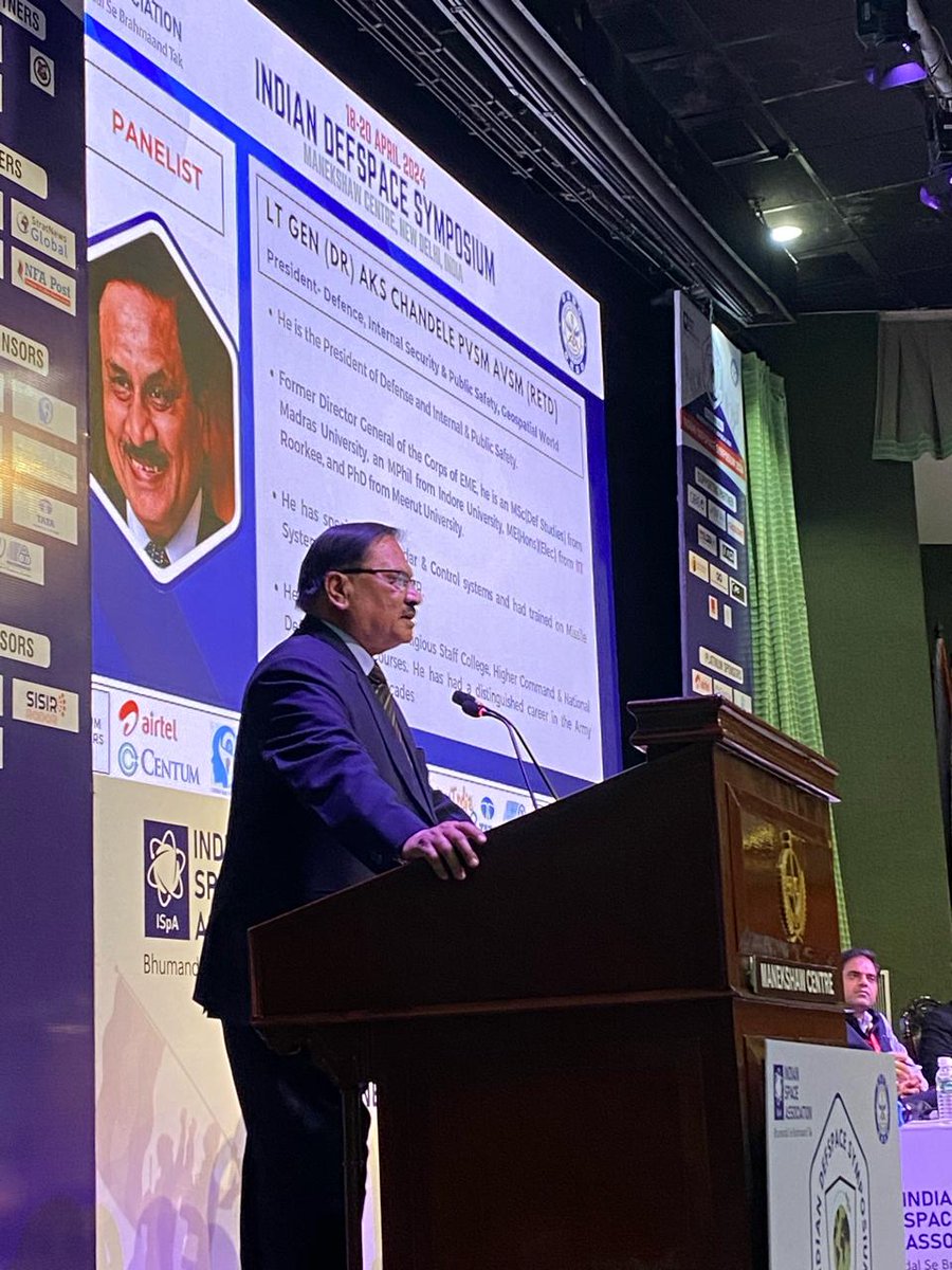
Lt. Gen (Dr.) AKS Chandele PVSM AVSM (Retd.), President of Defense, Internal Security & Public Safety at Geospatial World, emphasizes the critical role of geospatial technologies in space exploration and security. #GeospatialTech #SpaceSecurity
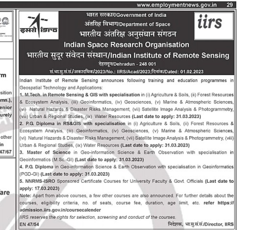
🌎🛰️ Ready to explore the world from a new perspective? Indian Institute of Remote Sensing, #ISRO, is now accepting applications for Geospatial Technology and Applications training programs! Interested candidates may apply by March 31st! 🚀 @isro #GeospatialTech #ExploreTheWorld

🌍 Just wrapped up @geobuiz in Denver! 3 epic days of geospatial innovation with global experts discussing cutting-edge tech from space sensors to smart mobility. #GeospatialTech 📡

Experience unparalleled accuracy with CORS networks! 🌍 Boost efficiency in surveying, agriculture, & infrastructure while driving innovation across industries. #GeospatialTech #PrecisionPositioning. noonuatoll.gov.mv/progress/226


National Authority, CAMPA, MoEF&CC signs MoU with @BisagN_Official to integrate #GeospatialTech & #DigitalTools for monitoring & evaluation of afforestation efforts This marks a major step in using #Al, #GIS, & #RemoteSensing for restoring India's ecosystems. #MoEFCC…


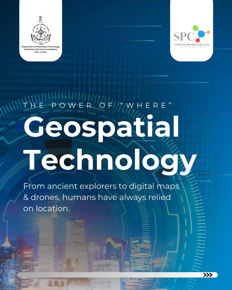
Maps have evolved, and so has innovation🗺️📍 #GeospatialTech #InnovationInGoa #BuildInGoa #EmpoweredInGoa


#Infographic: This is how an airborne and mobile LIDAR works! #LiDAR #GeospatialTech #RemoteSensing #AirborneLiDAR #MobileLiDAR #3DMapping #SurveyingTech #MappingSolutions cc: @antgrasso @FrRonconi @ramonvidall

Day 2 of the NAKSHA Master Trainer Training! The MPSeDC team conducted a hands-on session on Web GIS, empowering trainers with real-time mapping & spatial data integration skills. #NAKSHA 🌍 #GIS 🗺️ #GeospatialTech 📡 #DoLR #EoDB #WorldBank #EaseOfDoingBusiness #LandReforms…


We’re at #GWF2025 in Madrid this week — and tomorrow’s your last chance to catch us! Come see how GMV is driving the future of #GeospatialTech with Earth Observation, AI-powered analytics, and smart digital ecosystems 🌍


#GeospatialTech and #GIS were crucial in tracking the #COVID19 pandemic, with Johns Hopkins Medical Centre's dashboard as a key resource for #global stakeholders: @Shravishtha_ajaykumar or-f.org/35082

Great to be back at #INTERGEO2024. Join us in reliving some of the best moments from the first day of the event! #INTERGEO #GeospatialTech #Innovation


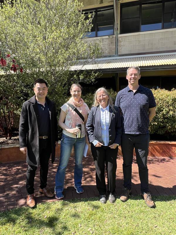
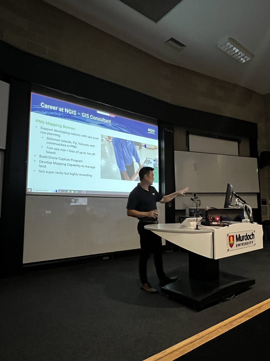
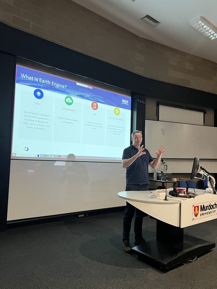
Enjoyed speaking with GIS students at Murdoch University about NGIS career paths. Thanks, Murdoch! #NGISCareers #GeospatialTech #MurdochUniversity

🔍 Is your geospatial analysis truly cloud-native? We break down what makes our platform unique and how we leverage a 100% cloud-native approach for scalable and secure analytics. hubs.ly/Q02LjXkz0 #GeospatialTech #CloudComputing

[PARTNERED] GIS Day 2025 showed how GIS is moving from maps to enterprise intelligence, driving utilities, sustainability, engineering and environmental planning. #GISDay2025 #GeospatialTech #Infrastructure
Intergeo 2025 = geospatial heaven! AI, drones, digital twins, and smarter mapping tools everywhere. 🔗 Learn more about the highlights from this event: geoawesome.com/intergeo-2025-… #Intergeo2025 #GeospatialTech #DigitalTwins #MappingInnovation #Geoawesome

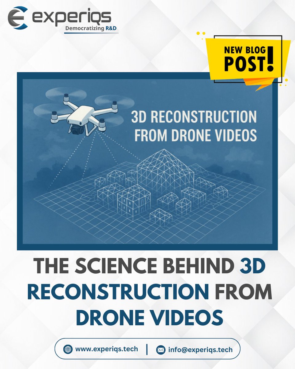
Drones don’t just film the world — they help rebuild it in 3D. From parallax to AI-powered NeRFs, here’s the science behind turning video into digital twins 👉 Read the full breakdown: experiqs.tech/blog/the-scien… #DigitalTwin #DroneTechnology #GeospatialTech #EngineeringInnovation
#GeospatialTech and #GIS were crucial in tracking the #COVID19 pandemic, with Johns Hopkins Medical Centre's dashboard as a key resource for #global stakeholders: @Shravishtha_ajaykumar or-f.org/35082

#GeospatialTech and #GIS were crucial in tracking the #COVID19 pandemic, with Johns Hopkins Medical Centre's dashboard as a key resource for #global stakeholders: @Shravishtha_ajaykumar or-f.org/35082

#GeospatialTech and #GIS were crucial in tracking the #COVID19 pandemic, with Johns Hopkins Medical Centre's dashboard as a key resource for #global stakeholders: @Shravishtha_ajaykumar or-f.org/35082
#GeospatialTech and #GIS were crucial in tracking the #COVID19 pandemic, with Johns Hopkins Medical Centre's dashboard as a key resource for #global stakeholders: @Shravishtha_ajaykumar or-f.org/35082


Last Wednesday, we kicked off @foss4g with a pre-conference gathering at @PRNHackerspace!🎉 It was amazing to see our supporters, geo-enthusiasts, and ambassadors of FOSS4G gather and share their passion for #geospatialtech.🌐 Excited for the conference!🤗 #Prizren2023


Congrats to Alexander Arnold (M.S. Integrated Geospatial Tech, advised by Dr. Jae Sung Kim) for presenting “An Application of Neural Radiance Fields for Visualizing Mars Perseverance Rover Data” at #ASPRS2025! 🌍 🔗 community.asprs.org/2025symposium/… #GeospatialTech #MTUresearch
🌎🛰️ Ready to explore the world from a new perspective? Indian Institute of Remote Sensing, #ISRO, is now accepting applications for Geospatial Technology and Applications training programs! Interested candidates may apply by March 31st! 🚀 @isro #GeospatialTech #ExploreTheWorld
Our experience with various stakeholders highlights an important observation: #Africa needs #GeospatialTech #Data #Innovations rooted in local realities, guided by on-the-ground data, created to transform. Ready to co-create useful innovation? Contact us: africangeospace.com/contact

Foursquare Studio often releases new updates. See a few recent updates to our platform: 1️⃣ Directly upload/download PMTiles files 2️⃣ JSON Editor in Export Image Modal 🌟 Learn more: location.foursquare.com/studio/docs/re… #FoursquareStudio #geospatialtech #datavisualization

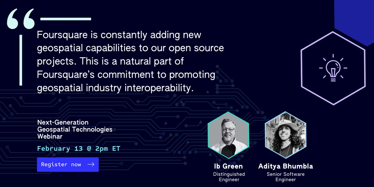
Secure your spot for our Next Gen Geospatial Webinar. Distinguished Engineer Ib Green + Sr. Software Engineer Aditya Bhumbla are the experts bringing you insights you won't want to miss. 📅 Feb 13th, 2024 Register today: location.foursquare.com/resources/even… #geospatialtech #FSQstudio

Congratulations to Prof. Siddhartha Khare from IIT Roorkee’s Civil Engineering Dept. on receiving the National Geospatial Emerging Faculty Fellow Award & National Geospatial Startup Award for his startup Bhoomicam! #IITRoorkee #GeospatialTech #NationalAwards, @EduMinOfIndia


Through the Life of Litter project, students are using LoneStar GPS tech to trace litter through Louisiana’s waterways. Trackers update locations every 5 minutes. A public map shows the journey. 🛰️ Follow the tracker map: ow.ly/CmYy50VFKo8 #GIS #GeospatialTech #GPS

Lt. Gen (Dr.) AKS Chandele PVSM AVSM (Retd.), President of Defense, Internal Security & Public Safety at Geospatial World, emphasizes the critical role of geospatial technologies in space exploration and security. #GeospatialTech #SpaceSecurity
Great to be back at #INTERGEO2024. Join us in reliving some of the best moments from the first day of the event! #INTERGEO #GeospatialTech #Innovation
National Authority, CAMPA, MoEF&CC signs MoU with @BisagN_Official to integrate #GeospatialTech & #DigitalTools for monitoring & evaluation of afforestation efforts This marks a major step in using #Al, #GIS, & #RemoteSensing for restoring India's ecosystems. #MoEFCC…
🌍✨ Join us this Wednesday for our monthly OpenStreetMap meetup! 🚀🗺️ Let’s collaborate, discuss, and learn together. Don’t miss out on the fun and networking! See you there! 👥🗓️ #OSM #Meetup #GeospatialTech #Community

Intergeo 2025 = geospatial heaven! AI, drones, digital twins, and smarter mapping tools everywhere. 🔗 Learn more about the highlights from this event: geoawesome.com/intergeo-2025-… #Intergeo2025 #GeospatialTech #DigitalTwins #MappingInnovation #Geoawesome

Harnessing satellite technology 🛰️ to monitor Earth’s shifting landscapes! From landslides to subsidence, our imaging helps detect risks early, protecting communities & infrastructure. 🌍🔬 🔗 Learn more: infinityspace.org.uk #GeospatialTech #EarthObservation


[PARTNERED] GIS Day 2025 showed how GIS is moving from maps to enterprise intelligence, driving utilities, sustainability, engineering and environmental planning. #GISDay2025 #GeospatialTech #Infrastructure
Day 2 of the NAKSHA Master Trainer Training! The MPSeDC team conducted a hands-on session on Web GIS, empowering trainers with real-time mapping & spatial data integration skills. #NAKSHA 🌍 #GIS 🗺️ #GeospatialTech 📡 #DoLR #EoDB #WorldBank #EaseOfDoingBusiness #LandReforms…
Maps have evolved, and so has innovation🗺️📍 #GeospatialTech #InnovationInGoa #BuildInGoa #EmpoweredInGoa

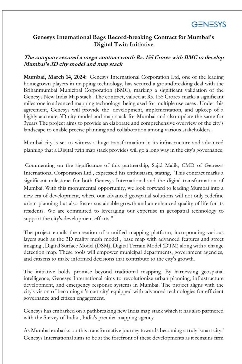
Genesys International has just clinched a whopping Rs. 155 Crore deal with BMC for Mumbai's 3D city modeling, setting the stage for a smart city revolution with its advanced geospatial tech! 🏙️🌐 #Mumbai3DModel #SmartCity #GeospatialTech
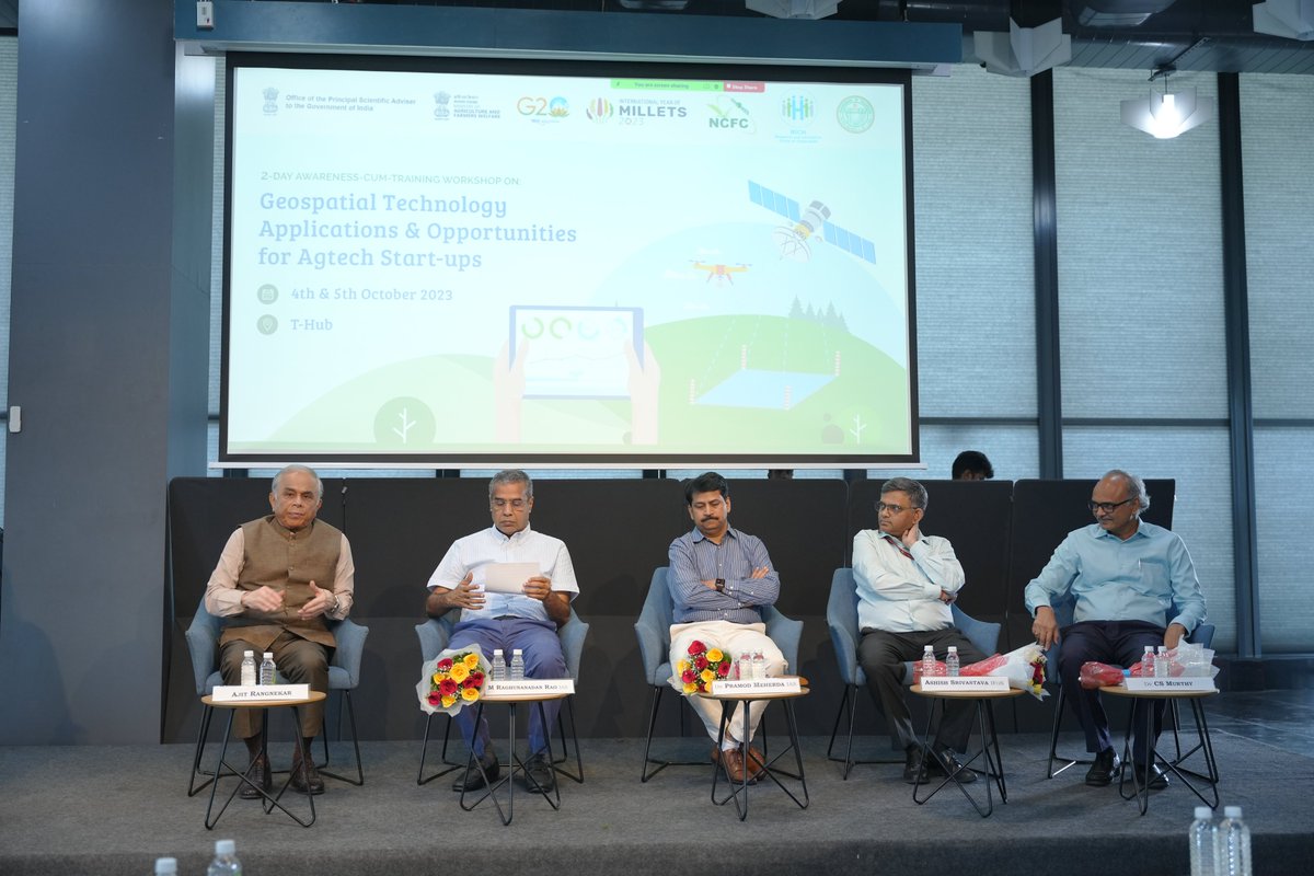
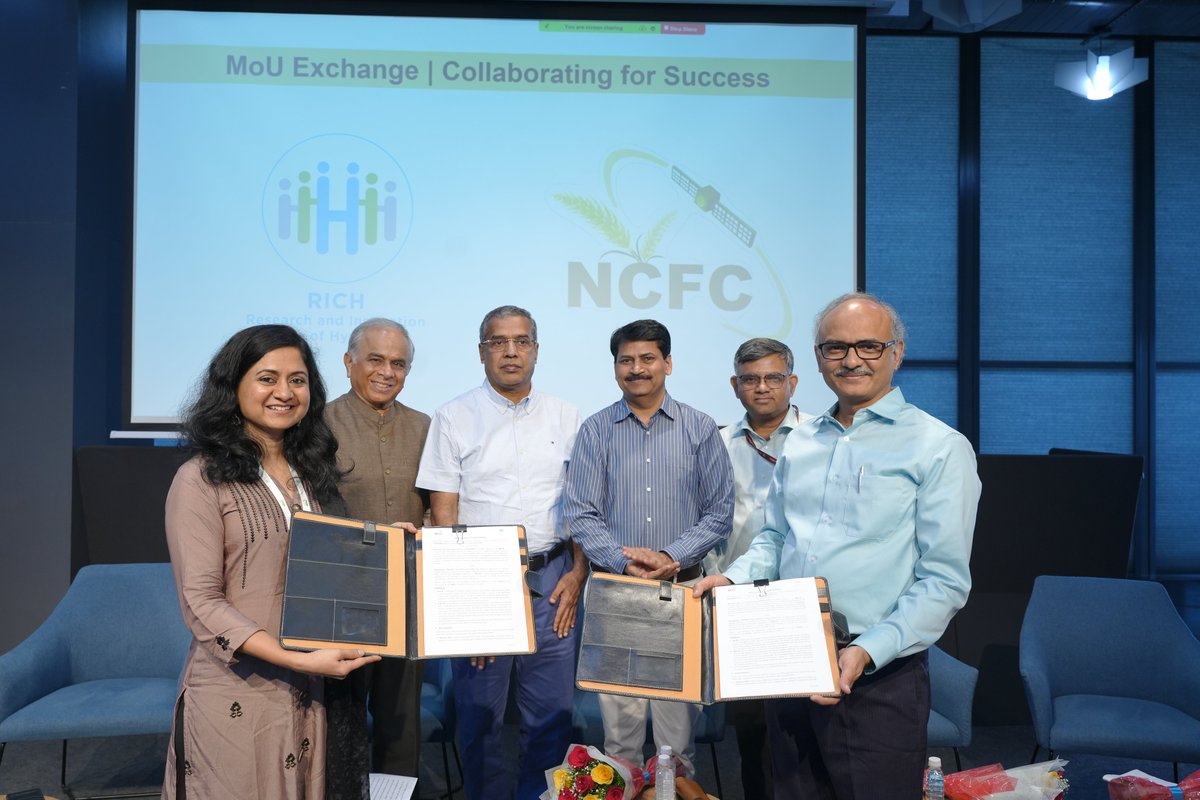
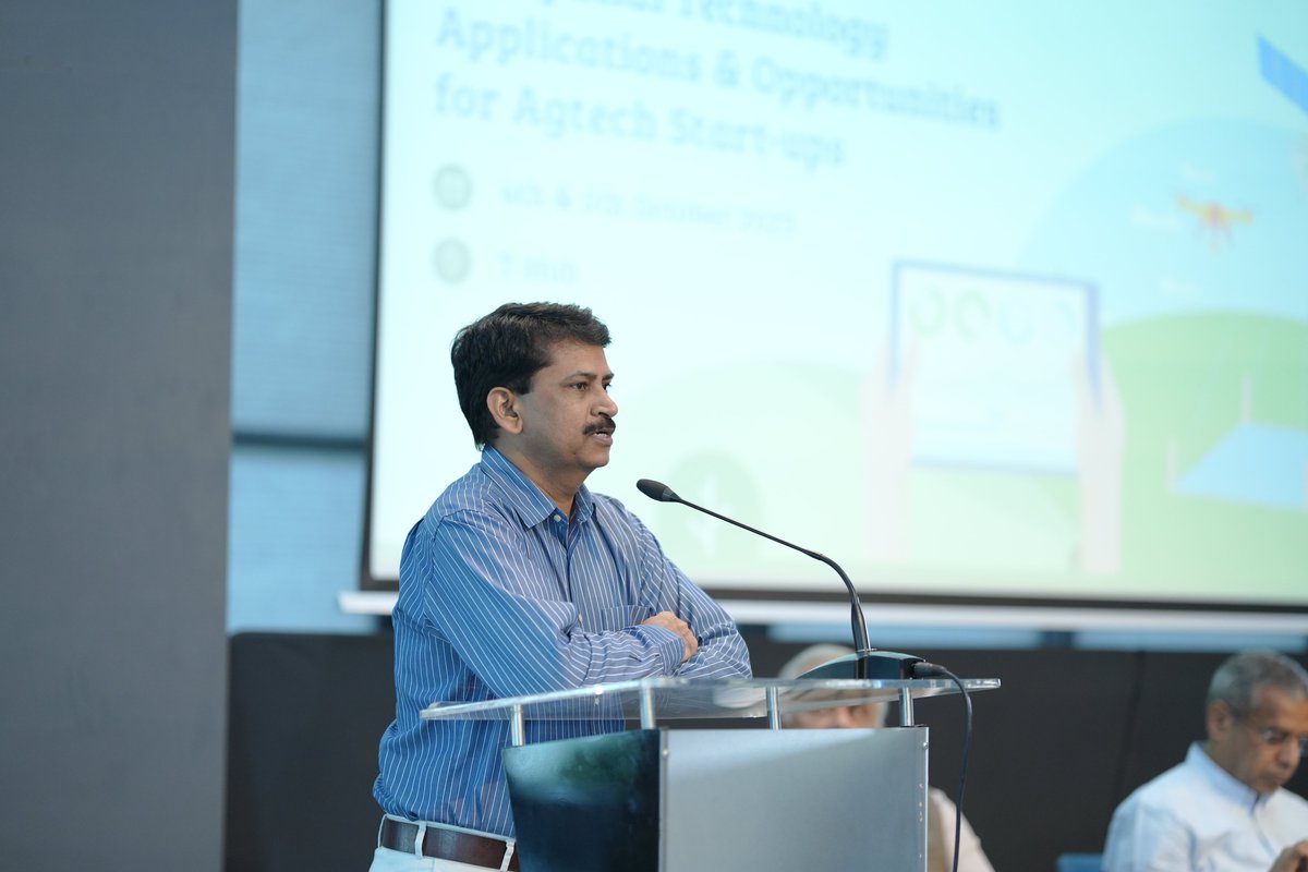
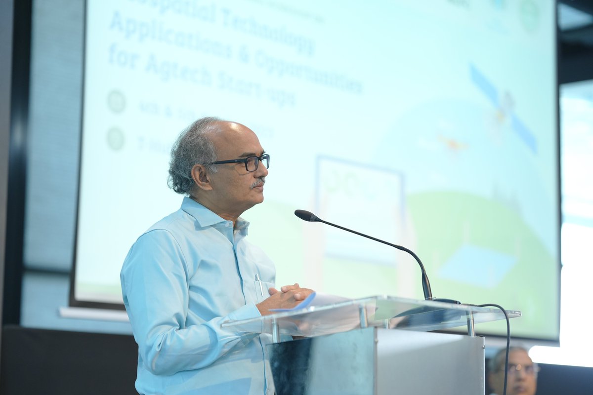
Our two-day workshop on Geospatial Technology Applications & Opportunities for Agtech startups, in collaboration with MNCFC DACFW, is off to a promising start. 🌱🗺️ #Agtech #GeospatialTech
We’re at #GWF2025 in Madrid this week — and tomorrow’s your last chance to catch us! Come see how GMV is driving the future of #GeospatialTech with Earth Observation, AI-powered analytics, and smart digital ecosystems 🌍
Something went wrong.
Something went wrong.
United States Trends
- 1. Black Friday 411K posts
- 2. Egg Bowl 5,847 posts
- 3. Mississippi State 3,339 posts
- 4. Emmett Johnson N/A
- 5. Sumrall 1,679 posts
- 6. Scott Stricklin N/A
- 7. #releafcannabis N/A
- 8. NextNRG Inc 1,801 posts
- 9. Kamario Taylor N/A
- 10. #SkylineSweeps N/A
- 11. Black Ops 7 XP 3,053 posts
- 12. Chambliss 1,358 posts
- 13. #Huskers N/A
- 14. #HMxCODSweepstakes N/A
- 15. #Rashmer 24.9K posts
- 16. Carson Soucy N/A
- 17. Porsha N/A
- 18. Black Ops 7 Blueprint N/A
- 19. Solo Ball N/A
- 20. Fisch 1,251 posts