#mapgeeks search results


Fun at Acreage Days tonight showing people how to use #DiscoverParkland 😊 maps.parklandcounty.com/discoverparkla… #mapgeeks @Parkland_County


We WILL learn the difference between a mile and a kilometer and we WILL have some context. Me thinks we succeeded. We used Google maps to plan, Strava to record (led by an attendee of @HovePromparkrun in my class with my watch) and inhalers if we needed. #primaryrocks #mapgeeks


As a reward for reading regularly 20 Year 5 children visited the John Rylands Library today to learn about Victorian Manchester. We all had a great time! #mapgeeks #readingforpleasure @TheJohnRylands


"Fiber Networking: The Musical" is clearly the only logical next step here. Wait, no - it def needs to be a rock opera. Watch out Broadway, the network engineers are coming in hot! #mapgeeks #ftth #fttx #fiberoptic #broadband #insidebaseball


Here is a 'fun' Friday fact: The United Nations flag features an azimuthal equidistant projection map of the world #funwithflags #mapgeeks


One for my fellow #geogeeks #mapgeeks out there, an absolute bargain from that online site beginning with A. A superb and beautifully presented book about all things cartography from the excellent @kennethfield even if he does support the team at the other end of the A52 😉


wow, @MatthewBlackett's transit-style map of Canada!! PDF available through link in article #mapgeeks thestar.com/news/canada/20…


Too much fun making a map cake, we didn’t quite make it to the pub. Happy GIS Day!#gisday2019 #mapgeeks @esriuk @OrdnanceSurvey @GeoPlaceLLP


This beautifully-designed map shows the literal translations of country names (h/t @openculture) bit.ly/2IH4eIt #MapGeeks #Cartographilia


For those #MapGeeks out there, i'm on the case of finding some of these 1:20000 French trench maps. #FWW #GrandeGuerre


What do you call the night before Halloween? Many thanks to Joshua Katz for his awesome book "Speaking American”, where this map is from – it's a GREAT coffee table book, conversation starter and gift for #MapGeeks! Search for it on bookshop.org #MapGeek

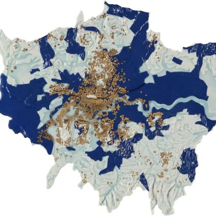
This is a photo of Clocha na hÉireann (Stones of Ireland), a map of Ireland's 32 counties made up of each county’s local stone – how cool is that?!? The map is on the list of many #mapgeeks to visit! More info at Atlas Obscura: atlasobscura.com/places/clocha-… #mapgeek
atlasobscura.com
Clocha na hÉireann (Stones of Ireland)
A map made up of 32 different materials, representing Ireland's 32 counties.

Please excuse us while we gleefully peruse the incredible map collection on @OculiMundiMaps — should only take a few days. ✌️ #MapGeeks #Cartography oculi-mundi.com


Obviously to do more #GIS. And also see if I can come up with #mappymemes near as good as you and other fellow #mapgeeks in #GISchat.
Did you know that almost all of South America is east of almost all of North America? Or have you always envisioned South America was <<directly south>> of North America? For you #mapgeeks, the red line of longitude on the map is 71 degrees west.


#MapNerds #MapGeeks unite for #IranRevoIution2022 updates from #Iran in English. The #maps are brilliant as is the commentary from @NewsoutofIran and @ShawnRocki expertly moderated by @backgroundN015e

Set a reminder for our upcoming report of current events inside Iran in English. As always, with maps! #IranRevoIution #IR_GTFO
Happy World Chocolate Day! Some of us at HipMaps Headquarters believe every day is chocolate day – but it’s nice to recognize it annually! Cocoa is grown in the hot & humid tropical regions around the Equator, or for us #mapgeeks about 20 degrees of latitude north and south.


#MapNerds #MapGeeks, check this out. #DigitalResistance #OSINT #OSINTUkraine #StandWithUkraine️ #Ukraine #Russia

One for my fellow #geogeeks #mapgeeks out there, an absolute bargain from that online site beginning with A. A superb and beautifully presented book about all things cartography from the excellent @kennethfield even if he does support the team at the other end of the A52 😉

Mir ist gesagt worden, dass die @marhei-Zugreisekarte Leute begeistern hat. #mapgeeks #traingeeks

#MapGeeks ... any ideas on where it's best to download customisable SVG icons for QGIS?

Strong thread for fellow #mapgeeks

Found a glorious collection of maps from Reddit. Some could def change how you look at the world. Here are 12 of them 🧵

This is your last day to tag @sjanzen showing off some mappy accessory or clothing. The competition is slim so don't be shy! Register for GIS Days @westernulibs #mapgeeks #GISdays @BrockUniversity lib.uwo.ca/madgic/gisday.…

Get your map on! Literally. Register for GIS Days and submit your map fashion photo to @sjanzen A scarf? Necklace? T-shirt? Hat? Mask? Put it on and snap a photo. Winner will be announced Friday. #GISday #mapgeeks #loveofmaps

Dig out your #mapfashion and snap a selfie! Register for GIS Days @westernulibs and submit your map fashion to @sjanzen #mapgeeks #GISday lib.uwo.ca/madgic/gisday.…

Dig out your #mapfashion and snap a selfie! Register for GIS Days @westernulibs and submit your map fashion to @sjanzen #mapgeeks #GISdays lib.uwo.ca/madgic/gisday.…
Are you registered for the most awesome, action packed, GIS-filled, mappy conference this year!? lib.uwo.ca/madgic/gisday.… Register, then submit your map fashion photo contest to @sjanzen before 4:30PM EST on Nov. 18th to win prizes! @westernulibs #GISday #mapgeeks #mapfashion
Are you registered for the most awesome, action packed, GIS-filled, mappy conference this year!? lib.uwo.ca/madgic/gisday.… Submit your map fashion photo contest to @sjanzen before 4:30PM EST on Nov. 18th to win prizes! #GISday #mapgeeks #mapfashion #loveofmaps
Get ready for GIS Day, Nov. 17th... Map fashion.... splash-maps.com @splashmaps #GISday #mapgeeks #loveofmaps


@Peckhampeculiar @themaphouse Found in French brocante. When did Georama make globes in Peckham? #mapgeeks #globes


This beautifully-designed map shows the literal translations of country names (h/t @openculture) bit.ly/2IH4eIt #MapGeeks #Cartographilia
Happy World Chocolate Day! Some of us at HipMaps Headquarters believe every day is chocolate day – but it’s nice to recognize it annually! Cocoa is grown in the hot & humid tropical regions around the Equator, or for us #mapgeeks about 20 degrees of latitude north and south.
Did you know that almost all of South America is east of almost all of North America? Or have you always envisioned South America was <<directly south>> of North America? For you #mapgeeks, the red line of longitude on the map is 71 degrees west.
Something went wrong.
Something went wrong.
United States Trends
- 1. #BUNCHITA 1,296 posts
- 2. #SmackDown 43.5K posts
- 3. Tulane 4,026 posts
- 4. Aaron Gordon 2,881 posts
- 5. Supreme Court 183K posts
- 6. Giulia 14.1K posts
- 7. Russ 13.2K posts
- 8. #OPLive 2,229 posts
- 9. Connor Bedard 2,497 posts
- 10. #TheLastDriveIn 3,331 posts
- 11. Podz 2,734 posts
- 12. Caleb Wilson 5,512 posts
- 13. Northwestern 4,946 posts
- 14. #TheFutureIsTeal N/A
- 15. Memphis 16.1K posts
- 16. Scott Frost N/A
- 17. Frankenstein 74.2K posts
- 18. Rockets 20.4K posts
- 19. Justice Jackson 5,049 posts
- 20. Isaiah Hartenstein 1,014 posts