#qgis2web search results

Es un proceso automatizable que podría ser implementado en #QGIS como #plugin similar a #QGIS2web @tati_para @totofiandaca @DielAb1 @geotribu

Do you have a map you have created in QGIS and would like to visualise on the web for interactivity? Transform your static maps to interactive maps seamlessly using the power of QGIS2Web. linkedin.com/pulse/qgis2web… #locationintelligence #qgis2web #geospatialnewsletter

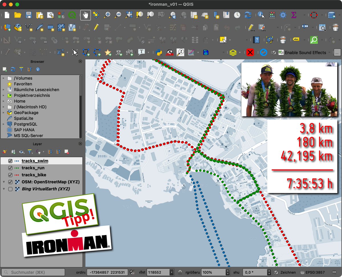
Ironman 2024: Die unglaublichen Strecken auf Hawaii / The incredible courses in Hawaii geoobserver.de/2024/10/28/iro… #qgis #switch2qgis #qgis2web #gistribe #gischat #fossgis #foss4g #OSGeo #spatial #geospatial #opensource #mapping #osm #openstreetmap #gis #geo #geoObserver pls RT

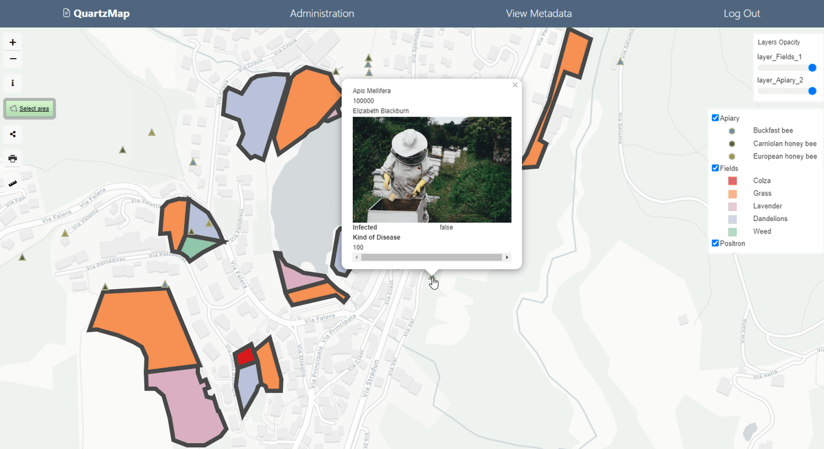
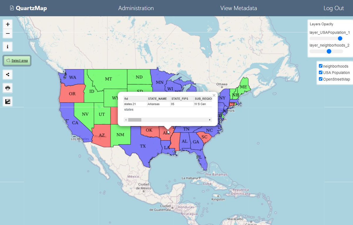
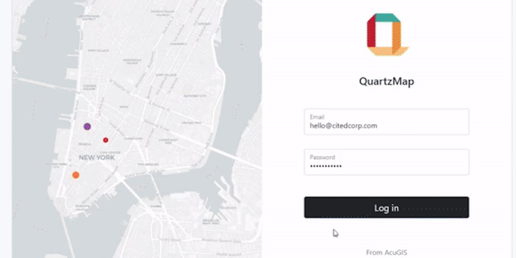
QuartzMap Web Client is now #opensource to transform your #qgis2web maps into secure and dynamic maps. Download on @github .

QuartzMap Web Client is now #OpenSource with the release of version 2.1.0. QuartzMap Web Client transforms your #qgis2web projects into secure, dynamic maps. Try it today: github.com/AcuGIS/quartzm…
QuartzMap Web Client is now #OpenSource with the release of version 2.1.0. QuartzMap Web Client transforms your #qgis2web projects into secure, dynamic maps. Try it today: github.com/AcuGIS/quartzm…
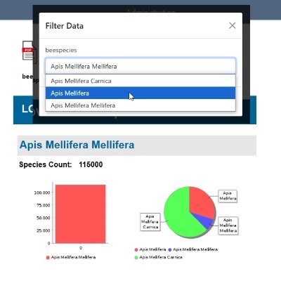
QuartzMap transforms your #qgis2web maps into secure and dynamic maps with no additional plugins to install. Includes many additional features such as support for #qgis2threejs Get started today at quartzmap.com
Connect your #qgis2web maps to PostGIS or GeoServer with QuartzMap. Try it today on our free Public Cloud. quartzmap.com

Connect your #qgis2web maps to #PostGIS or #GeoServer with QuartzMap. Try it on our free Public Cloud. quartzmap.com
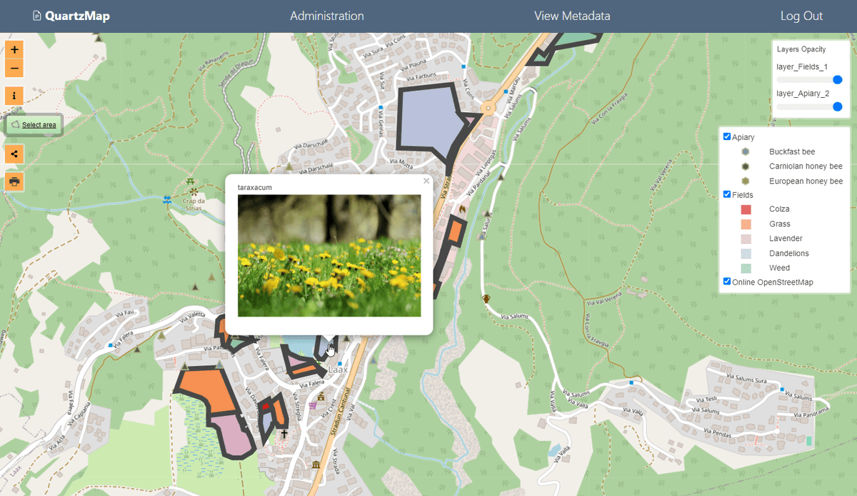
Turn your #qgis2web maps into secure, dynamic maps. Connect your maps to #PostGIS and #GeoServer. Try it for yourself on our free Public Cloud quartzmap.com
Check it out @quartzmap is live on @ProductHunt QuartzMap: Turn your #qgis2web maps into dynamic maps producthunt.com/posts/quartzmap #GIS #QGIS #geospatial
Check out @quartzmap the latest release from AcuGIS at quartzmap.com Transform #qgis2web maps into dynamic and secure maps with no additional plugins to install. Free Public Cloud version along with dedicated options. #QGIS #gis #geospatial

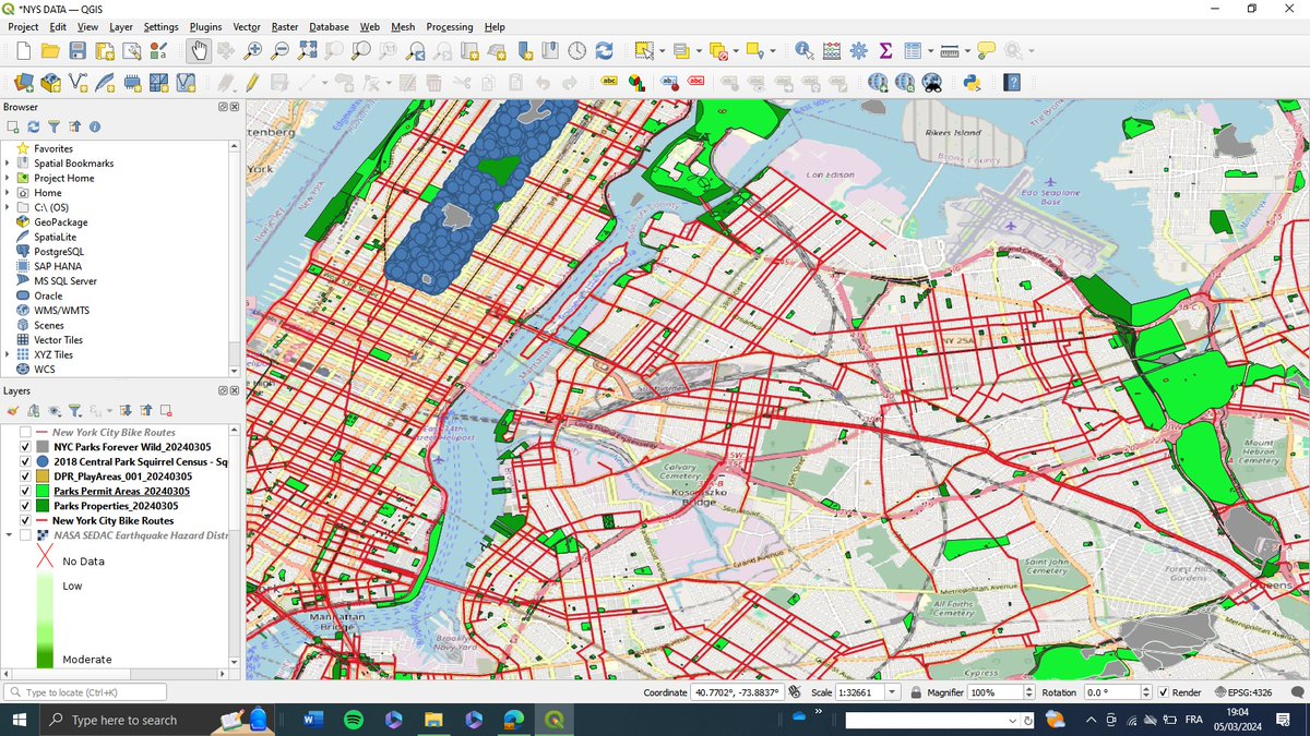
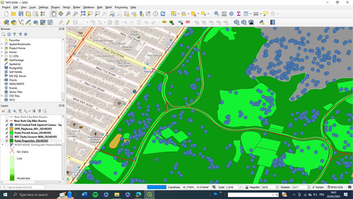
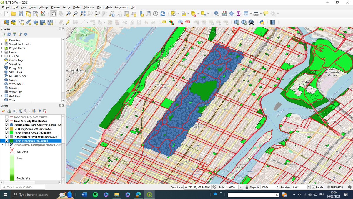
information they're looking for. I'm excited to share this project with the world, and I hope it will be a valuable resource for New Yorkers and visitors alike. #NYCparks #QGIS2WEB #webmapping Data Source: opendata.cityofnewyork.us
I'm excited to announce that I'm working on a project to create a web map of New York City parks using #QGIS2WEB This map will allow users to explore the city's parks and green spaces and learn more about the amenities and activities available in each park #NYCparks #webmapping

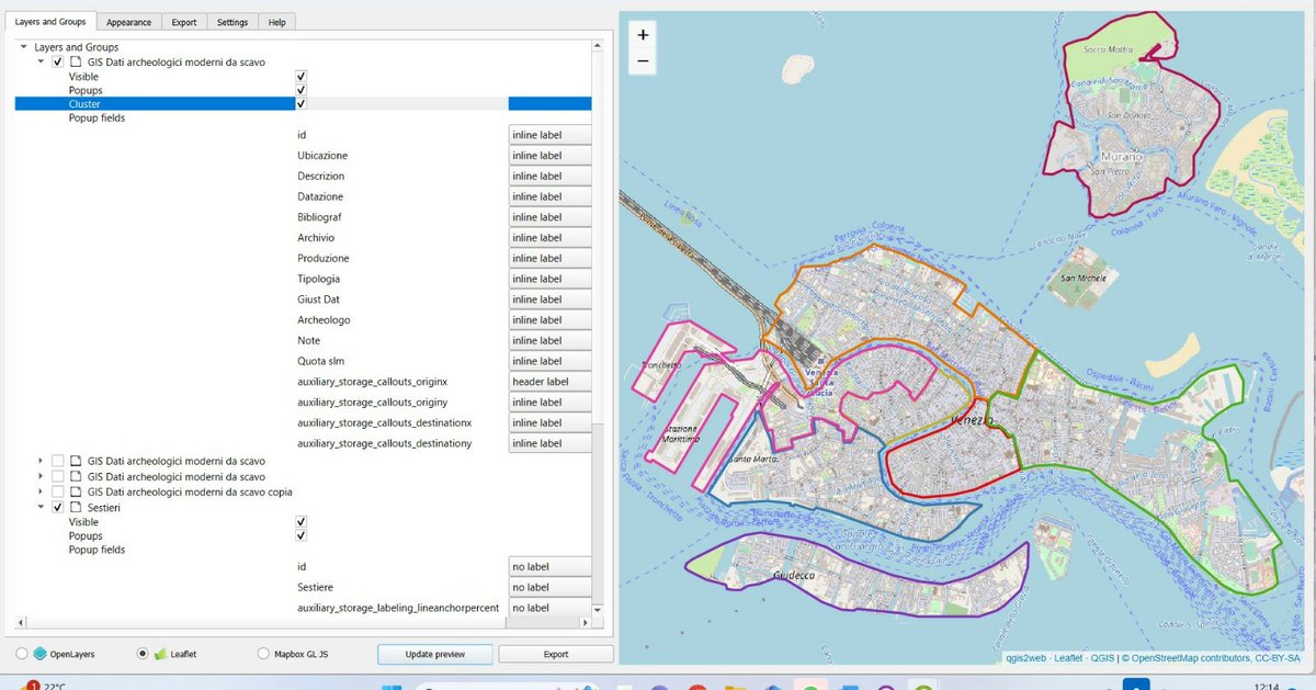
I'm developing a webGiS of the evidence from productive sites discovered in archaeological excavations in Venice. #QGIS #qgis2web #Venice #Venicearchaeology #RENAISSANCE #History #archaeology #archeologia #cartografia

📊 Cyprus Population - Latest Update for 2021 📊🇨🇾 🗺️ Interactive Map: cypruspopulation-map.netlify.app 📊 Detailed Table: Find results for 2021 and 2011, cypruspopulation-table.netlify.app @OpenDataCy @CYSTAT_EN #opendata #QGIS #qgis2web #Cyprus #QGISCyprus


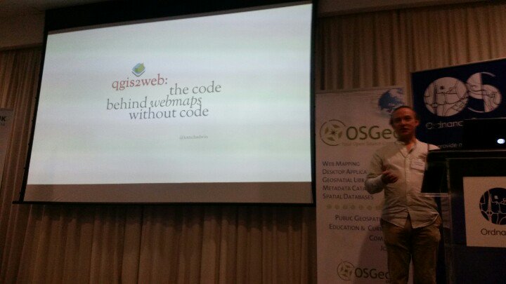
Had a lot of fun talking in the QGIS open day today about #qgis2web and how we can extend it. All the links I'm playing around with are available at the QOD wiki - github.com/qgis/QGIS/wiki… And the talk is available at YouTube - youtu.be/-_wTqHOmbzo

📢 Vous avez manqué le dernier GNU/Linux Magazine ainsi que son hors-série ? Pas de panique, vous pouvez toujours les obtenir sur notre boutique : bit.ly/3ih6Hwp #django #elasticAPM #QGIS2WEB #QFIELD #namespace #BigData #Hadhoop #Python #Spark


I created a #GIS #dataviz about Finnish municipalities ordered by size and colored by population: tjukanovt.github.io/municipalities… #qgis2web #QGIS


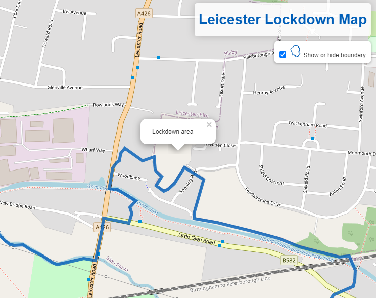
Now that I've been able to check its accuracy, I can share my simple interactive map of the Leicester lockdown area alasdairrae.github.io/llm/index.html (made in QGIS with #qgis2web by @tomchadwin, I was alerted to the official boundary by @owenboswarva -source: data.leicester.gov.uk/explore/datase…)


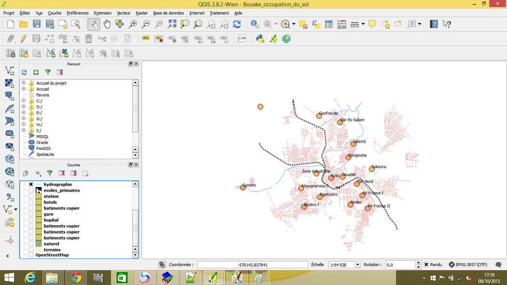
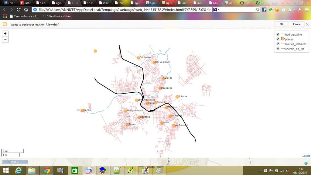
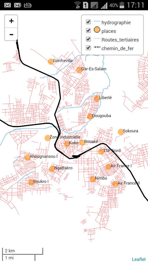
@OSM_Ml Day9 à #IPR De Bouake #Extensionsqgis #qgis2web #qgis2leaf @ProjetEOF #map4ci @Tidianeball @NathalieSidibe

Demoing the impressive #qgis2web #qgis plugin at @mapaction training. Appreciative murmurings... cc. @tomchadwin
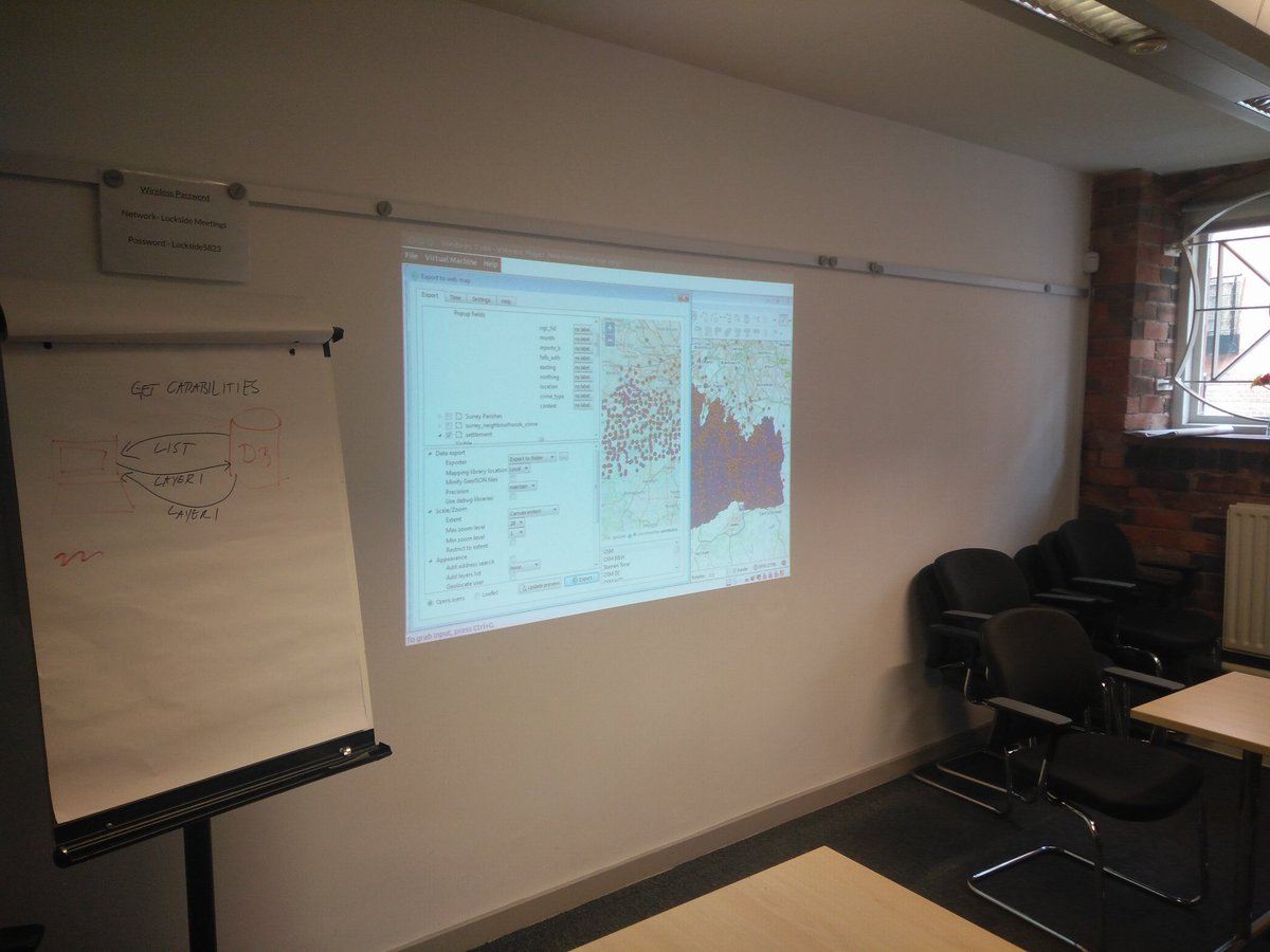
#qgis training on the excellent #qgis2web inter alia for @astuntech in Birmingham this month, thanks to @groundworkuk for the nice facilities too
I'm excited to announce that I'm working on a project to create a web map of New York City parks using #QGIS2WEB This map will allow users to explore the city's parks and green spaces and learn more about the amenities and activities available in each park #NYCparks #webmapping

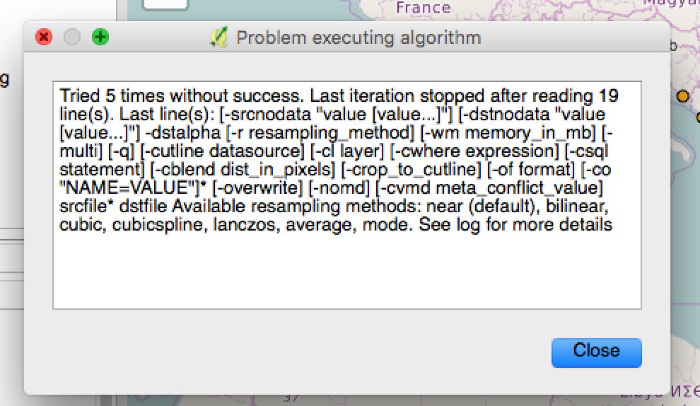
Error that I get when trying to include raster layers into webmap (openlayers or leaflet) using #qgis2web plugin. Any ideas? @tomchadwin

Cartographie via @qgis @LeafletJS & #qgis2web pr #webmapping #dataviz avec #osm @humdata @OCHAROWCA #data #opendata

Cartography via @qgis @LeafletJS & #qgis2web 4 #webmapping #dataviz with #osm @humdata @OCHAROWCA #data #opendata

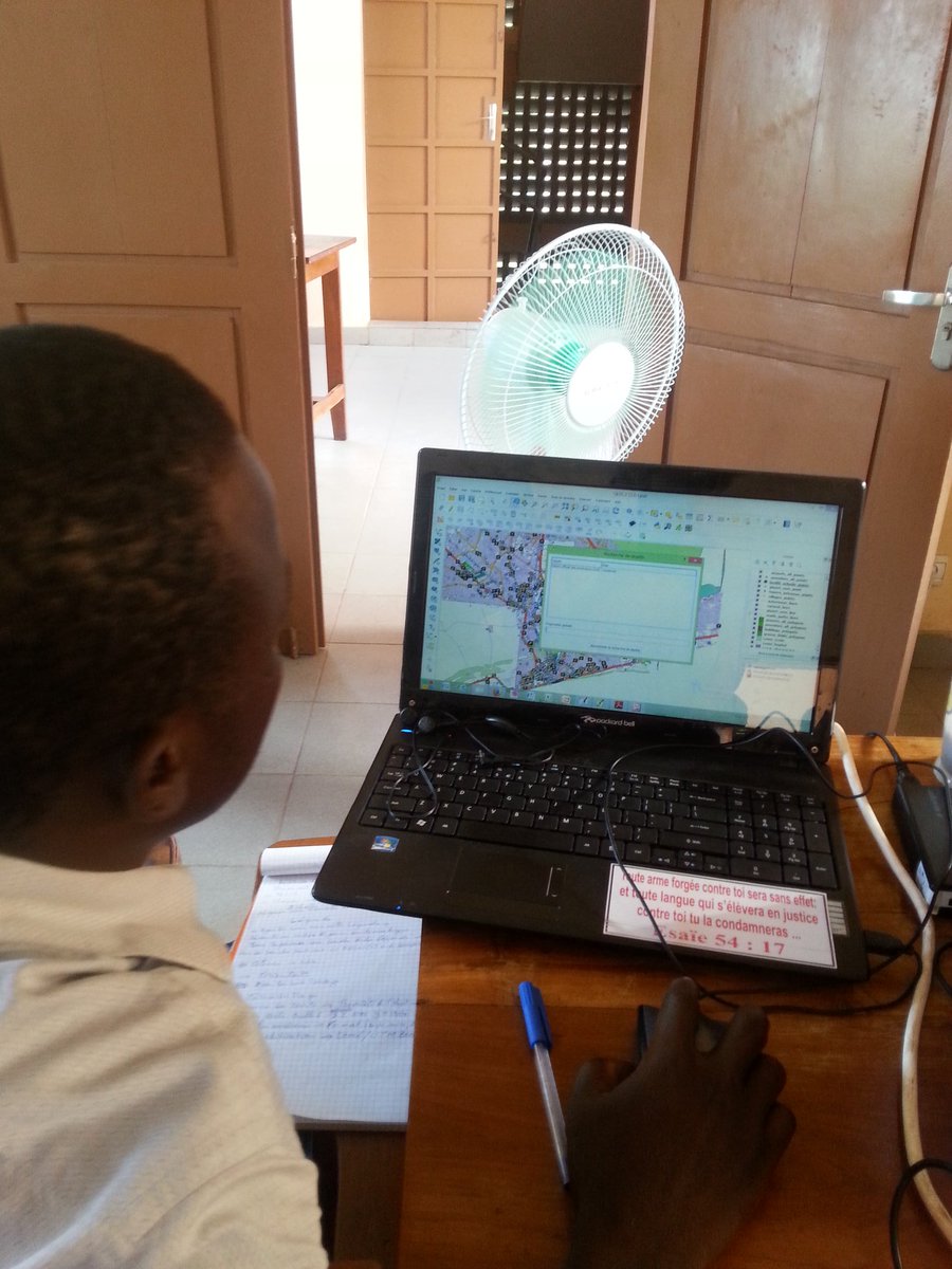

Bouaké fin atelier @qgis #qgis2leaf #qgis2web & @LeafletJS sur #data @ird_fr @openstreetmap @humdata @OCHAROWCA

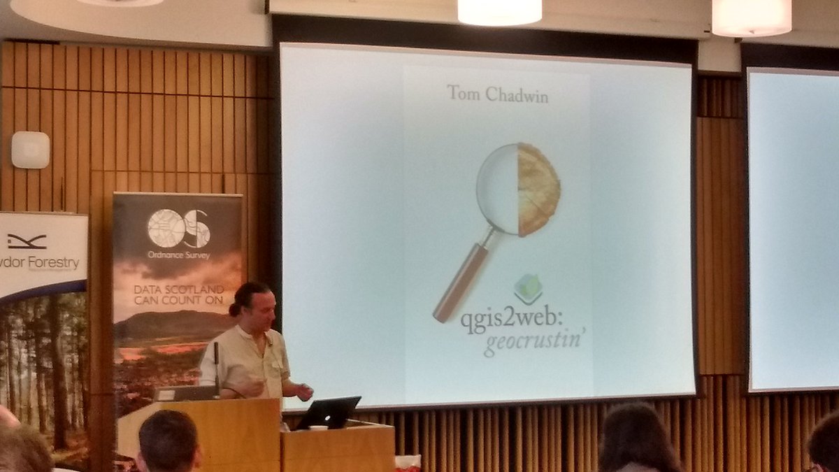
None other than the king of Northumberland himself, @tomchadwin talking about #qgis2web, frikkin' awesome #QGIS plugin
Something went wrong.
Something went wrong.
United States Trends
- 1. Happy Thanksgiving Eve 2,162 posts
- 2. Good Wednesday 23.5K posts
- 3. Luka 67.3K posts
- 4. #DWTS 98.5K posts
- 5. Lakers 52.5K posts
- 6. #wednesdaymotivation 3,721 posts
- 7. Clippers 19.4K posts
- 8. Jim Mora 1,165 posts
- 9. Colorado State 2,821 posts
- 10. Robert 145K posts
- 11. Nuns 6,629 posts
- 12. Kris Dunn 3,003 posts
- 13. #LakeShow 3,644 posts
- 14. Collar 47.5K posts
- 15. Karoline Leavitt 25.6K posts
- 16. Kawhi 6,707 posts
- 17. Jaxson Hayes 2,704 posts
- 18. TOP CALL 15.1K posts
- 19. Reaves 14.2K posts
- 20. Witkoff 169K posts