#spatialanalytics risultati di ricerca
Do you want to join a professional body? Join the Spatial and Data Science Society of Nigeria! Be part of the revolution in GeoAI, Data Science & Spatial Analytics. 🌍 Follow the video to register Join now: sdssn.org #GeoAI #DataScience #SpatialAnalytics #SDSSN
Our Spatial Data Science free MOOC starts tomorrow! Gain hands-on experience performing suitability analysis, predictive modeling, and more. 🔹Register: esri.social/nVfr50PCA0P #SpatialAnalytics

🌍Mapping Moments, Connecting Worlds At #EsriUC2025, it’s not just about maps, it’s about integrating everything, everywhere. Day1 inspired us with keynotes from Jack Dangermond & Dr. Kirk Johnson. Our team is here! Let’s connect! @Esri @EsriUC #MannaiGIS #SpatialAnalytics

Spatial analytics and data science were hot topics at this year's #EsriUC2023! For an overview of the important topics discussed at UC, check out this blog for a recap of the top #spatialanalytics trends. ow.ly/XNuV104SHPe

Unlock the Power of #SpatialAnalytics ! From smarter urban planning to optimised supply chains, spatial data is reshaping industries. This article by @ciarankirk, IMGS & DataBuilders, explores the tools & insights driving this revolution: zurl.co/eMDwO #GIS

Join the Spatial and Data Science Society of Nigeria and be part of the revolution in GeoAI, Data Science, and Spatial Analytics! 🌍 Mapping the future, one data point at a time. Become a member today: (sdssn.org) #GeoAI #DataScience #SpatialAnalytics #SDSSN

Did You Know 💡 R-ArcGIS combines the power of open-source R packages with mapping, visualization and #spatialanalytics of #ArcGIS 🙌 . Learn how this powerful tool can enhance your research and teaching: esri.social/xlQi50TLenf

Join Esri upcoming webinar series and unleash the power of #GeoAI! Learn how advanced techniques can help you detect clusters, calculate change, find patterns, and forecast future events. #GIS #SpatialAnalytics Register here: shorturl.at/qNQU7

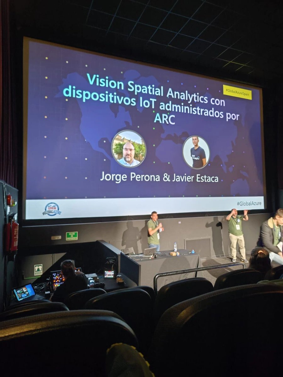
.@JrgPerona y Javier Estaca también fueron ponentes en el #globalazure Madrid. 💻 En su sesión, mostraron cómo desplegar #SpatialAnalytics en un dispositivo #IoT con #AzureDevOps. ¡Una charla muy interesante! 🚀 @GlobalAzureES

#SpatialAnalytics leads the way across the world. Alteryx #LocationIntelligence lowers the barrier of entry to #GeospatialAnalytics. Listen to this latest episode of #AlteryxAlterEverything to hear what makes Location Intelligence so special. 👂 Listen: ow.ly/giUY10506Ai
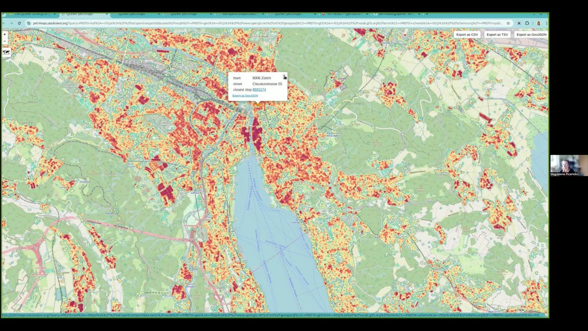
How close is every building 🏠 in Switzerland to the nearest public transport stop? 🚆 With QLever and some clean RDF data, this is easy. Magdalena and I show it in our new demo, crazy fast, super visual. 🎥 youtu.be/gnocVIoHVKk?si… #SpatialAnalytics #KnowledgeGraphs #OpenData
Get an inside look at what spatial thinking brings to some of the world’s biggest brands like @amazon, @FedEx, and @Marriott. 🔹Register for our WhereNext Webcast: esri.social/oQRA50PYKMx #SpatialAnalytics #Business

Unlock the power of your graph databases with #ArcGISKnowledge! The latest update allows seamless integration with #Neo4j, enabling you to connect and analyze your existing graph databases without data duplication. #spatialanalytics Learn more ➡️ ow.ly/fAWr50QKxSO

Join us at Trust '23 on May 16th and explore how organizations can unlock valuable location-based insights through #dataenrichment and business-friendly #spatialanalytics to deliver trusted, contextualized data when and where it’s needed: okt.to/k0Sd6w #Trust23
A very interesting project by Google on #solarpower with apparently every US roof process and and analyzed using remote sensing - can't wait to see something similar in Europe! Also, any recommendations for nice solar data sets? lnkd.in/dMzB7atQ #spatialanalytics

Our SVP of Product, Andy Bell, joined Mike Loder on Ticker to talk about the power of trusted data—how enrichment & spatial analytics boost AI, insights & smarter decisions. Watch the full interview: okt.to/uGqJrN #DataIntegrity #AI #SpatialAnalytics

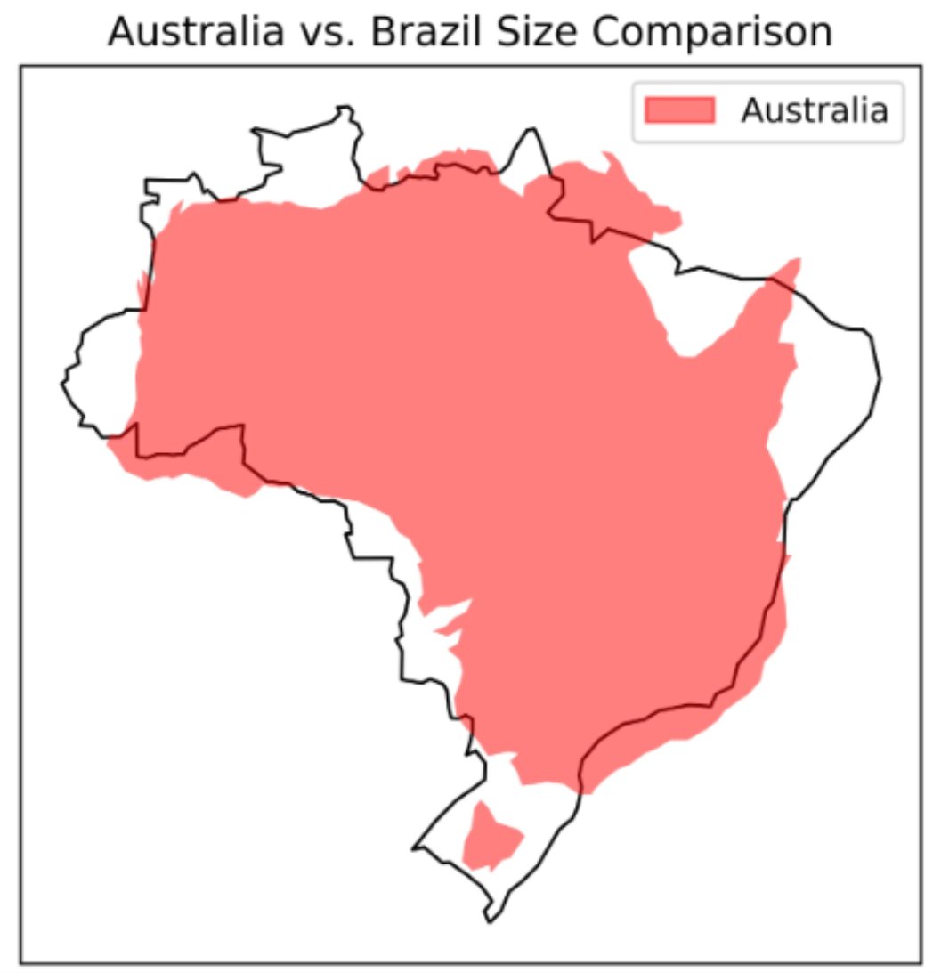
A great piece by Lee Vaughan titled 𝐂𝐨𝐦𝐩𝐚𝐫𝐢𝐧𝐠 𝐂𝐨𝐮𝐧𝐭𝐫𝐲 𝐒𝐢𝐳𝐞𝐬 𝐰𝐢𝐭𝐡 𝐆𝐞𝐨𝐏𝐚𝐧𝐝𝐚𝐬 on @TDataScience . Read it here: towardsdatascience.com/comparing-coun… #GIS #spatialanalytics #geospatialdata #geospatial #datascience #datavisualization


Interested in Generative AI for GIS? come talk to me #GeoAgents #MCP #SpatialAnalytics #EsriUC2025 #GeoLLM
Something went wrong.
Something went wrong.
United States Trends
- 1. Jalen 35.8K posts
- 2. Eagles 71.6K posts
- 3. Eagles 71.6K posts
- 4. #WWERaw 37.3K posts
- 5. Saquon 5,720 posts
- 6. LA Knight 6,559 posts
- 7. Derik Queen 1,876 posts
- 8. #PHIvsLAC 2,206 posts
- 9. Bozeman 3,213 posts
- 10. Tanner McKee 1,008 posts
- 11. Philip Rivers 13.9K posts
- 12. Raquel 7,778 posts
- 13. Patullo 3,996 posts
- 14. Nakobe Dean 1,359 posts
- 15. Greg Roman N/A
- 16. AJ Brown 3,335 posts
- 17. Sirianni 3,099 posts
- 18. Jake Elliot N/A
- 19. #MondayNightFootball N/A
- 20. Adoree 1,472 posts


