#spatialanalytics kết quả tìm kiếm

Slow maps? Missed insights? We’re scaling geospatial analysis with PostGIS, DuckDB, GeoArrow & deck.gl. See how we turn massive datasets into fast, interactive maps in the video below. 📽️ Watch now: bit.ly/HPGDTLL #DataViz #Geospatial #SpatialAnalytics

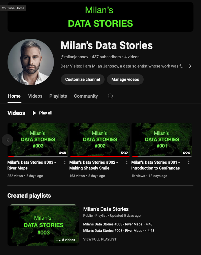
In Milan's Data Stories #006 - Public Transport Stops, we dive into working with public transport data using GTFS files and GeoPandas. Check the tutorial on YouTube: youtu.be/QQ5xpZ88bA4 #GIS #spatialanalytics #geospatialdata #geospatial #datascience #datavisualization


Our Spatial Data Science free MOOC starts tomorrow! Gain hands-on experience performing suitability analysis, predictive modeling, and more. 🔹Register: esri.social/nVfr50PCA0P #SpatialAnalytics


Did You Know 💡 R-ArcGIS combines the power of open-source R packages with mapping, visualization and #spatialanalytics of #ArcGIS 🙌 . Learn how this powerful tool can enhance your research and teaching: esri.social/xlQi50TLenf


Do you want to join a professional body? Join the Spatial and Data Science Society of Nigeria! Be part of the revolution in GeoAI, Data Science & Spatial Analytics. 🌍 Follow the video to register Join now: sdssn.org #GeoAI #DataScience #SpatialAnalytics #SDSSN

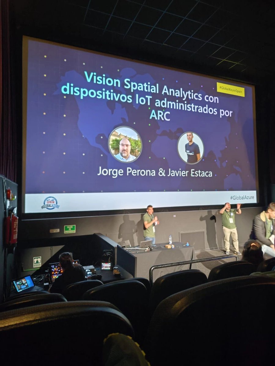
.@JrgPerona y Javier Estaca también fueron ponentes en el #globalazure Madrid. 💻 En su sesión, mostraron cómo desplegar #SpatialAnalytics en un dispositivo #IoT con #AzureDevOps. ¡Una charla muy interesante! 🚀 @GlobalAzureES


🌐🏠 How to use crime data & spatial analysis for to scale your insurance risk assessments! Learn how you can scale your spatial analysis to generate hyper-local, building-level insights to drive decision making 👇 #SpatialAnalytics #Insurtech hubs.ly/Q02zHrzz0


#SpatialAnalytics leads the way across the world. Alteryx #LocationIntelligence lowers the barrier of entry to #GeospatialAnalytics. Listen to this latest episode of #AlteryxAlterEverything to hear what makes Location Intelligence so special. 👂 Listen: ow.ly/giUY10506Ai
A very interesting project by Google on #solarpower with apparently every US roof process and and analyzed using remote sensing - can't wait to see something similar in Europe! Also, any recommendations for nice solar data sets? lnkd.in/dMzB7atQ #spatialanalytics


Interested in Generative AI for GIS? come talk to me #GeoAgents #MCP #SpatialAnalytics #EsriUC2025 #GeoLLM
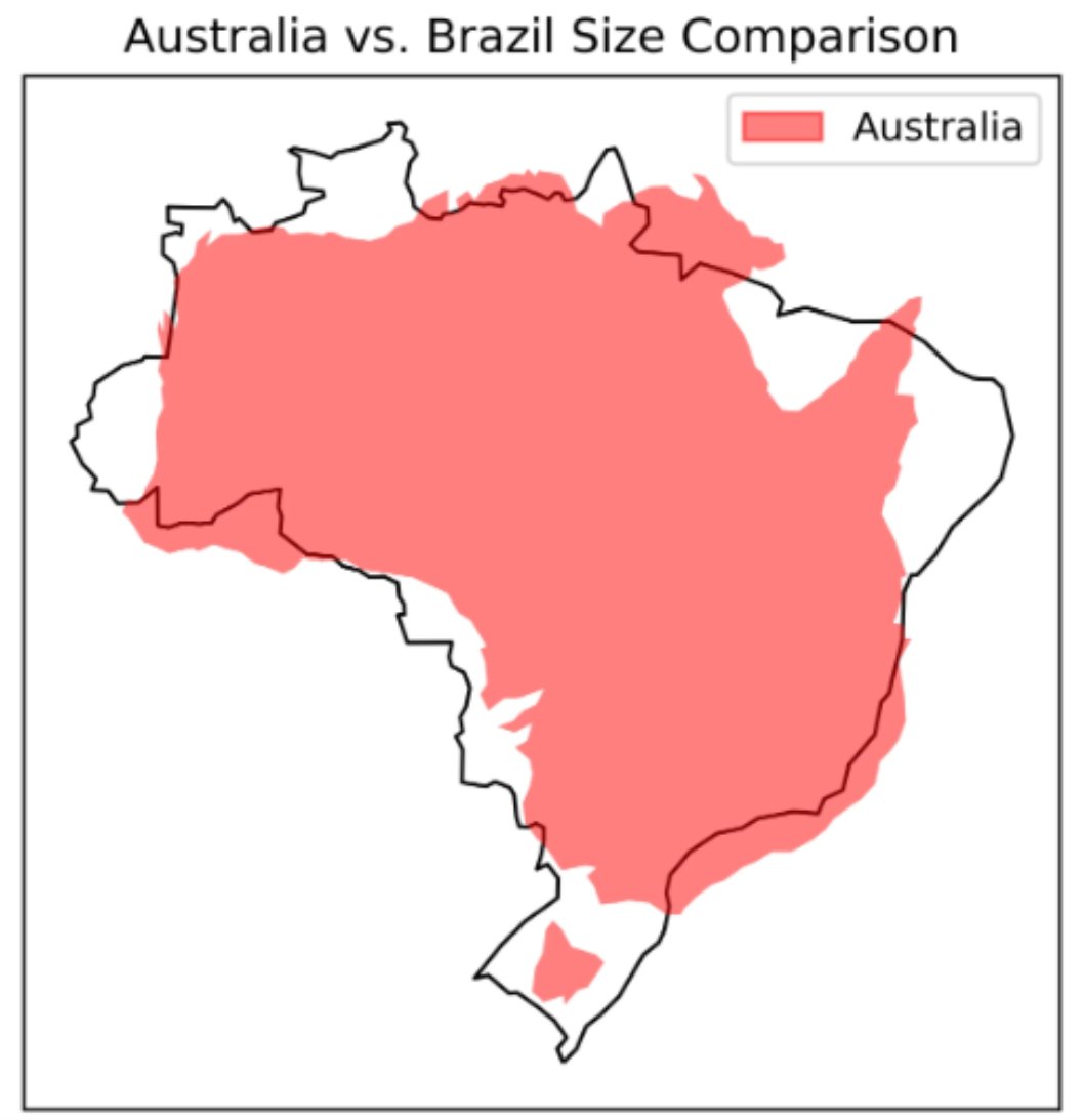
A great piece by Lee Vaughan titled 𝐂𝐨𝐦𝐩𝐚𝐫𝐢𝐧𝐠 𝐂𝐨𝐮𝐧𝐭𝐫𝐲 𝐒𝐢𝐳𝐞𝐬 𝐰𝐢𝐭𝐡 𝐆𝐞𝐨𝐏𝐚𝐧𝐝𝐚𝐬 on @TDataScience . Read it here: towardsdatascience.com/comparing-coun… #GIS #spatialanalytics #geospatialdata #geospatial #datascience #datavisualization


A Graduate Certificate in #SpatialAnalytics unlocked new research/analysis methods for Michael R. Pfonner that enhanced his studies — and give him a competitive edge in the migration space. Current @USC PhD students: What could it do for you? Learn more: dornsife.usc.edu/spatial/gradua…

Join us at Trust '23 on May 16th and explore how organizations can unlock valuable location-based insights through #dataenrichment and business-friendly #spatialanalytics to deliver trusted, contextualized data when and where it’s needed: okt.to/k0Sd6w #Trust23
In 𝐌𝐢𝐥𝐚𝐧'𝐬 𝐃𝐚𝐭𝐚 𝐒𝐭𝐨𝐫𝐢𝐞𝐬 #005 - 𝐑𝐚𝐬𝐭𝐞𝐫 𝐏𝐨𝐩𝐮𝐥𝐚𝐭𝐢𝐨𝐧 𝐌𝐚𝐩𝐬, we dive into raster population maps in Python one-liners. Check the tutorial on YouTube: youtu.be/OGejs3vPMes #GIS #spatialanalytics #geospatialdata #datascience #datavisualization

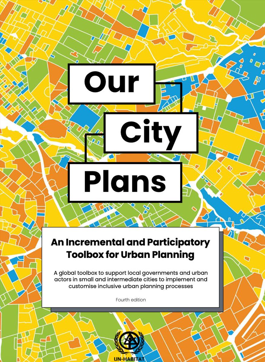
Oldie but goodie - a global toolbox on urban planning guidelines by the United Nations from 2022 Pdf here: lnkd.in/dgXDX3Ew #GIS #spatialanalytics #geospatialdata #geospatial #datascience #datavisualization
Have you signed up for my weekly Python and geospatial data bits yet? New episodes every Tuesday and Thursday - join here: youtube.com/channel/UCmpJA… #youtube #GIS #spatialanalytics #geospatialdata #geospatial #datascience #datavisualization
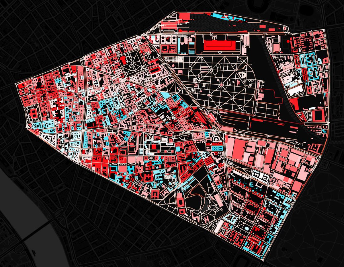
Which of Budapest's districts do you recognize here? More on how to create maps like these in Python: udemy.com/course/urban-a… #GIS #spatialanalytics #geospatialdata #geospatial #datascience #datavisualization


In today’s episode of 𝐌𝐢𝐥𝐚𝐧'𝐬 𝐃𝐚𝐭𝐚 𝐒𝐭𝐨𝐫𝐢𝐞𝐬, we drift away from coding a bit, and I introduce you to network science. 𝐖𝐚𝐭𝐜𝐡 𝐢𝐭 𝐨𝐧 𝐘𝐨𝐮𝐓𝐮𝐛𝐞: youtu.be/tL7K7kARseA #GIS #spatialanalytics #geospatialdata #geodatascience101 #geospatialessentials

Have you tried @giscartamap yet? Check their awesome map gallery from a cool Lord of the Rings map to COVID-19 and earthquake, wildfire, and urban maps: giscarta.com/map-gallery #GIS #spatialanalytics #geospatialdata #geospatial #datascience #datavisualization


AI-powered GIS is transforming spatial data analysis from predictive modeling to automated feature extraction. It’s enabling smarter & faster decisions. Are you using AI to elevate your spatial insights? 👉 12thwonder.com/Geospatial-Sol… #AI #GIS #SpatialAnalytics

In Milan's Data Stories #006 - Public Transport Stops, we dive into working with public transport data using GTFS files and GeoPandas. Check the tutorial on YouTube: youtu.be/QQ5xpZ88bA4 #GIS #spatialanalytics #geospatialdata #geospatial #datascience #datavisualization
Our Spatial Data Science free MOOC starts tomorrow! Gain hands-on experience performing suitability analysis, predictive modeling, and more. 🔹Register: esri.social/nVfr50PCA0P #SpatialAnalytics
Did You Know 💡 R-ArcGIS combines the power of open-source R packages with mapping, visualization and #spatialanalytics of #ArcGIS 🙌 . Learn how this powerful tool can enhance your research and teaching: esri.social/xlQi50TLenf

At JapakGIS, we develop custom project geo-apps to enhance user experiences by integrating location-based services for project maps visualization. #JapakGIS #DigitalMapping #SpatialAnalytics #DataVisualization #GeoAnalytics #SmartCities #UrbanPlanning #InfrastructureMapping

Tourism infographic map with hotel, restaurant, and attraction icons. 🌍 JapakGIS specializes in creating custom maps that enhance travel experience. 📊 #JapakGIS #LocationIntelligence #SpatialAnalytics #DataVisualization #GeoAnalytics #SmartCities #UrbanPlanning

.@JrgPerona y Javier Estaca también fueron ponentes en el #globalazure Madrid. 💻 En su sesión, mostraron cómo desplegar #SpatialAnalytics en un dispositivo #IoT con #AzureDevOps. ¡Una charla muy interesante! 🚀 @GlobalAzureES

🌍Mapping Moments, Connecting Worlds At #EsriUC2025, it’s not just about maps, it’s about integrating everything, everywhere. Day1 inspired us with keynotes from Jack Dangermond & Dr. Kirk Johnson. Our team is here! Let’s connect! @Esri @EsriUC #MannaiGIS #SpatialAnalytics

🌐🏠 How to use crime data & spatial analysis for to scale your insurance risk assessments! Learn how you can scale your spatial analysis to generate hyper-local, building-level insights to drive decision making 👇 #SpatialAnalytics #Insurtech hubs.ly/Q02zHrzz0


A great piece by Lee Vaughan titled 𝐂𝐨𝐦𝐩𝐚𝐫𝐢𝐧𝐠 𝐂𝐨𝐮𝐧𝐭𝐫𝐲 𝐒𝐢𝐳𝐞𝐬 𝐰𝐢𝐭𝐡 𝐆𝐞𝐨𝐏𝐚𝐧𝐝𝐚𝐬 on @TDataScience . Read it here: towardsdatascience.com/comparing-coun… #GIS #spatialanalytics #geospatialdata #geospatial #datascience #datavisualization
At JapakGIS, we assist Public health agencies use Web Maps dashboards to track epidemic spread, visualize hotspots, and allocate medical resources effectively. #JapakGIS #SpatialData #SpatialAnalytics #GISForDevelopment #GeospatialSolutions

Get an inside look at what spatial thinking brings to some of the world’s biggest brands like @amazon, @FedEx, and @Marriott. 🔹Register for our WhereNext Webcast: esri.social/oQRA50PYKMx #SpatialAnalytics #Business

A very interesting project by Google on #solarpower with apparently every US roof process and and analyzed using remote sensing - can't wait to see something similar in Europe! Also, any recommendations for nice solar data sets? lnkd.in/dMzB7atQ #spatialanalytics
In 𝐌𝐢𝐥𝐚𝐧'𝐬 𝐃𝐚𝐭𝐚 𝐒𝐭𝐨𝐫𝐢𝐞𝐬 #005 - 𝐑𝐚𝐬𝐭𝐞𝐫 𝐏𝐨𝐩𝐮𝐥𝐚𝐭𝐢𝐨𝐧 𝐌𝐚𝐩𝐬, we dive into raster population maps in Python one-liners. Check the tutorial on YouTube: youtu.be/OGejs3vPMes #GIS #spatialanalytics #geospatialdata #datascience #datavisualization
A Graduate Certificate in #SpatialAnalytics unlocked new research/analysis methods for Michael R. Pfonner that enhanced his studies — and give him a competitive edge in the migration space. Current @USC PhD students: What could it do for you? Learn more: dornsife.usc.edu/spatial/gradua…
Are you following the UEFA European Championship? Well, here comes its data aspect - 𝐔𝐄𝐅𝐀 𝐄𝐮𝐫𝐨 2024 𝐌𝐚𝐩 on @TDataScience : medium.com/towards-data-s… #GIS #spatialanalytics #geospatialdata #geospatial #datascience #datavisualization


📍 Pin maps ≠ spatial strategy. Gen BI uses geospatial intelligence for KPIs, coverage, and action. Explore mapping in Tableau 2025 → [landing.packtpub.com/learning-table…] #GenBI #Tableau2025 #SpatialAnalytics #BIPro
![PacktDataML's tweet image. 📍 Pin maps ≠ spatial strategy.
Gen BI uses geospatial intelligence for KPIs, coverage, and action.
Explore mapping in Tableau 2025 → [landing.packtpub.com/learning-table…] #GenBI #Tableau2025 #SpatialAnalytics #BIPro](https://pbs.twimg.com/media/Gx0G1ZYbsAMTNZk.jpg)

Must-Attend December Talks🎙️ Join us this December for two insightful sessions that will elevate your data expertise, packed with insights, innovation, and practical takeaways. RSVP now: hubs.la/Q02Zfx6s0 #DataScience #NetworkScience #SpatialAnalytics #MicrosoftFabric

Oldie but goodie - a global toolbox on urban planning guidelines by the United Nations from 2022 Pdf here: lnkd.in/dgXDX3Ew #GIS #spatialanalytics #geospatialdata #geospatial #datascience #datavisualization
Something went wrong.
Something went wrong.
United States Trends
- 1. Jake Paul 235K posts
- 2. Bama 40.8K posts
- 3. Oklahoma 67.9K posts
- 4. #GMMTVStarlympics2025 2.05M posts
- 5. #RollTide 18.9K posts
- 6. Clinton 251K posts
- 7. Mateer 12.5K posts
- 8. Dave Chappelle 3,166 posts
- 9. Rose Bowl 5,809 posts
- 10. Ryan Williams 3,832 posts
- 11. #boxing 9,362 posts
- 12. WILLIAMEST NO LIMITS 225K posts
- 13. 6ix9ine 5,428 posts
- 14. Wolves 21.8K posts
- 15. Tyson 27.2K posts
- 16. #JennieRubyOwnsMMA 51.1K posts
- 17. KO'd 9,502 posts
- 18. Ty Simpson 6,967 posts
- 19. PERTHSANTA DOMIIA WEWILLWIN 321K posts
- 20. #CFBPlayoff 16.3K posts