#spatialanalytics 搜尋結果

AI-powered GIS is transforming spatial data analysis from predictive modeling to automated feature extraction. It’s enabling smarter & faster decisions. Are you using AI to elevate your spatial insights? 👉 12thwonder.com/Geospatial-Sol… #AI #GIS #SpatialAnalytics


At JapakGIS, we develop custom project geo-apps to enhance user experiences by integrating location-based services for project maps visualization. #JapakGIS #DigitalMapping #SpatialAnalytics #DataVisualization #GeoAnalytics #SmartCities #UrbanPlanning #InfrastructureMapping

Tourism infographic map with hotel, restaurant, and attraction icons. 🌍 JapakGIS specializes in creating custom maps that enhance travel experience. 📊 #JapakGIS #LocationIntelligence #SpatialAnalytics #DataVisualization #GeoAnalytics #SmartCities #UrbanPlanning


Our Spatial Data Science free MOOC starts tomorrow! Gain hands-on experience performing suitability analysis, predictive modeling, and more. 🔹Register: esri.social/nVfr50PCA0P #SpatialAnalytics


🌍Mapping Moments, Connecting Worlds At #EsriUC2025, it’s not just about maps, it’s about integrating everything, everywhere. Day1 inspired us with keynotes from Jack Dangermond & Dr. Kirk Johnson. Our team is here! Let’s connect! @Esri @EsriUC #MannaiGIS #SpatialAnalytics

At JapakGIS, we assist Public health agencies use Web Maps dashboards to track epidemic spread, visualize hotspots, and allocate medical resources effectively. #JapakGIS #SpatialData #SpatialAnalytics #GISForDevelopment #GeospatialSolutions


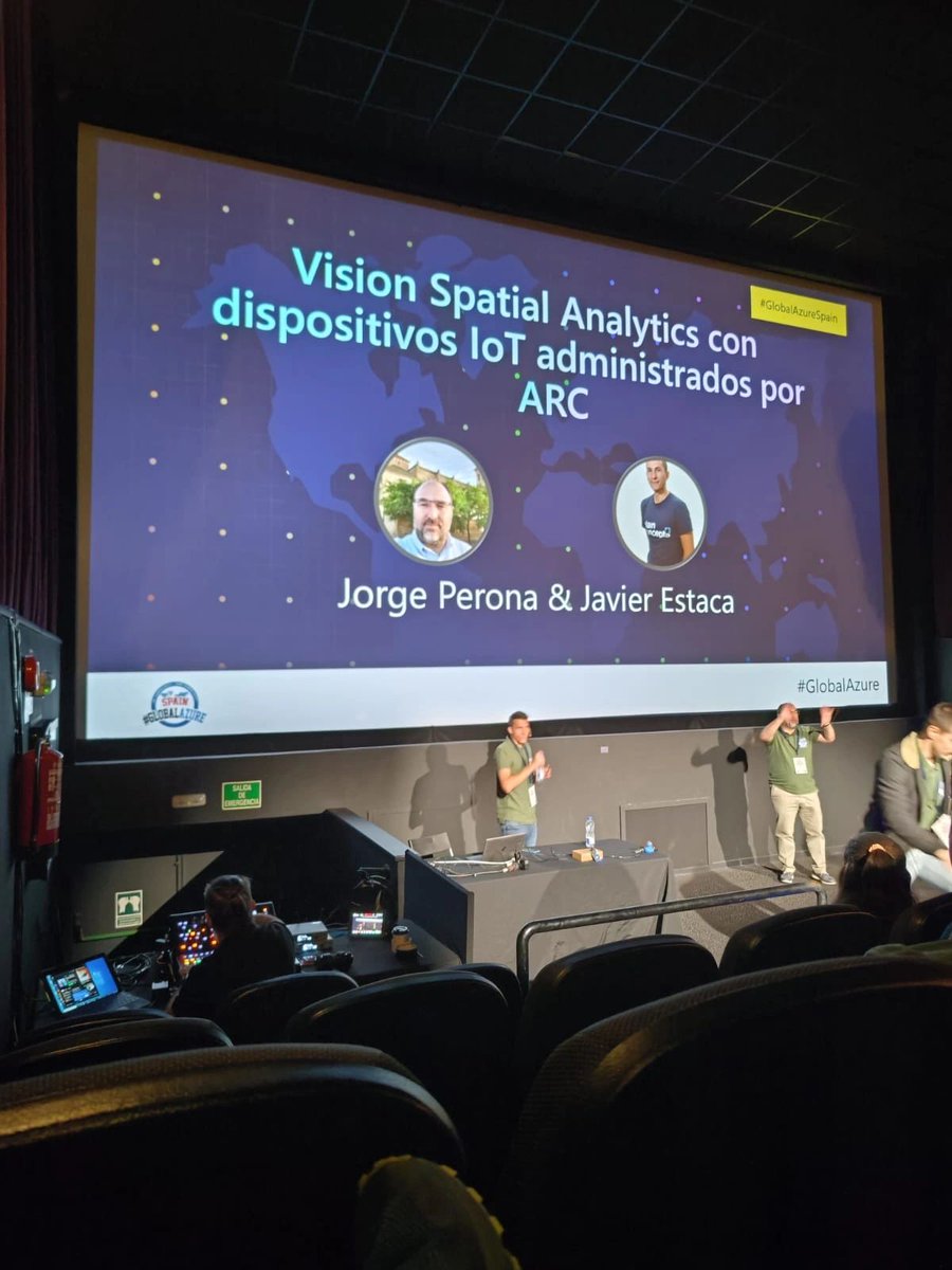
.@JrgPerona y Javier Estaca también fueron ponentes en el #globalazure Madrid. 💻 En su sesión, mostraron cómo desplegar #SpatialAnalytics en un dispositivo #IoT con #AzureDevOps. ¡Una charla muy interesante! 🚀 @GlobalAzureES

Get an inside look at what spatial thinking brings to some of the world’s biggest brands like @amazon, @FedEx, and @Marriott. 🔹Register for our WhereNext Webcast: esri.social/oQRA50PYKMx #SpatialAnalytics #Business


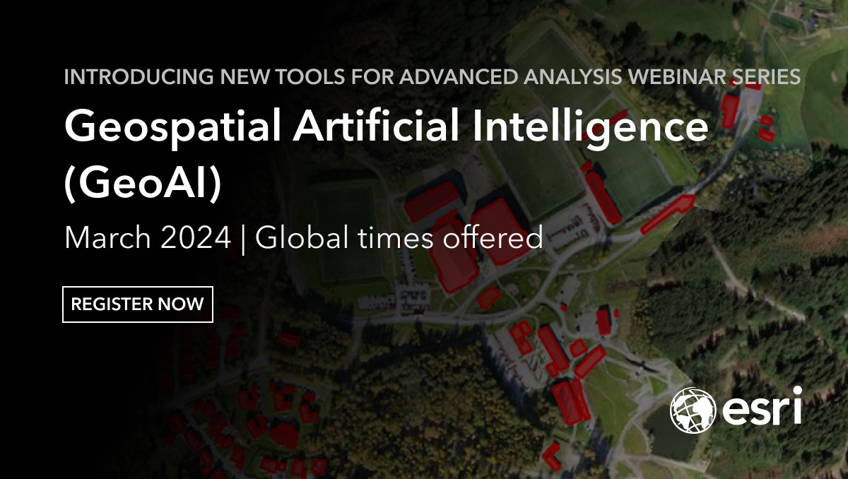
Join Esri upcoming webinar series and unleash the power of #GeoAI! Learn how advanced techniques can help you detect clusters, calculate change, find patterns, and forecast future events. #GIS #SpatialAnalytics Register here: shorturl.at/qNQU7

Did You Know 💡 R-ArcGIS combines the power of open-source R packages with mapping, visualization and #spatialanalytics of #ArcGIS 🙌 . Learn how this powerful tool can enhance your research and teaching: esri.social/xlQi50TLenf


Join the Spatial and Data Science Society of Nigeria and be part of the revolution in GeoAI, Data Science, and Spatial Analytics! 🌍 Mapping the future, one data point at a time. Become a member today: (sdssn.org) #GeoAI #DataScience #SpatialAnalytics #SDSSN


Spatial analytics and data science were hot topics at this year's #EsriUC2023! For an overview of the important topics discussed at UC, check out this blog for a recap of the top #spatialanalytics trends. ow.ly/XNuV104SHPe


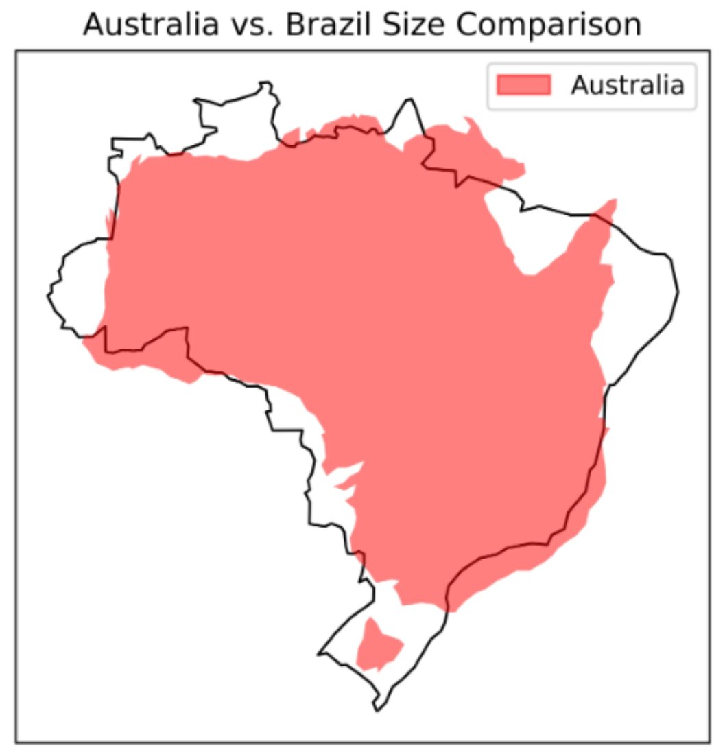
A great piece by Lee Vaughan titled 𝐂𝐨𝐦𝐩𝐚𝐫𝐢𝐧𝐠 𝐂𝐨𝐮𝐧𝐭𝐫𝐲 𝐒𝐢𝐳𝐞𝐬 𝐰𝐢𝐭𝐡 𝐆𝐞𝐨𝐏𝐚𝐧𝐝𝐚𝐬 on @TDataScience . Read it here: towardsdatascience.com/comparing-coun… #GIS #spatialanalytics #geospatialdata #geospatial #datascience #datavisualization


Spatial Analytics with ArcGIS onlineprogrammingbooks.com/spatial-analyt… #SpatialAnalytics #ArcGIS #free #freebook #ebook #freeebook #onlinebook #freeprogrammingbooks #onlineprogrammingbooks #packt

Our SVP of Product, Andy Bell, joined Mike Loder on Ticker to talk about the power of trusted data—how enrichment & spatial analytics boost AI, insights & smarter decisions. Watch the full interview: okt.to/uGqJrN #DataIntegrity #AI #SpatialAnalytics


🌐🏠 How to use crime data & spatial analysis for to scale your insurance risk assessments! Learn how you can scale your spatial analysis to generate hyper-local, building-level insights to drive decision making 👇 #SpatialAnalytics #Insurtech hubs.ly/Q02zHrzz0

In 𝐌𝐢𝐥𝐚𝐧'𝐬 𝐃𝐚𝐭𝐚 𝐒𝐭𝐨𝐫𝐢𝐞𝐬 #005 - 𝐑𝐚𝐬𝐭𝐞𝐫 𝐏𝐨𝐩𝐮𝐥𝐚𝐭𝐢𝐨𝐧 𝐌𝐚𝐩𝐬, we dive into raster population maps in Python one-liners. Check the tutorial on YouTube: youtu.be/OGejs3vPMes #GIS #spatialanalytics #geospatialdata #datascience #datavisualization

Transform spatial data into strategic insights with JapakGIS's tailored mapping solutions. 🌍✨ #LocationIntelligence #SpatialAnalytics #DataVisualization #GeoAnalytics #SmartCities #UrbanPlanning #InfrastructureMapping

Unlock the power of your graph databases with #ArcGISKnowledge! The latest update allows seamless integration with #Neo4j, enabling you to connect and analyze your existing graph databases without data duplication. #spatialanalytics Learn more ➡️ ow.ly/fAWr50QKxSO

Something went wrong.
Something went wrong.
United States Trends
- 1. Good Friday 46K posts
- 2. #heatedrivalry 68.4K posts
- 3. DataHaven 30.6K posts
- 4. Happy Friyay N/A
- 5. Expedition 33 248K posts
- 6. Shane 88.3K posts
- 7. Ilya 72K posts
- 8. #FridayMotivation 3,018 posts
- 9. Our Lady of Guadalupe 9,848 posts
- 10. #TheGameAwards 482K posts
- 11. #FridayVibes 3,119 posts
- 12. YOONMIN 28.2K posts
- 13. GOTY 81.8K posts
- 14. Mega Man 43.6K posts
- 15. Falcons 40.3K posts
- 16. 21 Savage 22.7K posts
- 17. Kyle Pitts 21.3K posts
- 18. Bucs 25.6K posts
- 19. Deadpool 41.5K posts
- 20. #TheEndOfAnEra N/A