#spatialdataanalysis نتائج البحث
Mastering Spatial Data Analysis for Smarter Decision Making Learn to analyze spatial data and make smarter, data-driven decisions with expert guidance datamites.com/blog/mastering… #DataAnalyticsCourse #SpatialDataAnalysis #DatamitesDataAnalyticsCourse #DatamitesInstitute
datamites.com
Mastering Spatial Data Analysis for Smarter Decision Making
Master spatial data analysis for smarter decisions using GIS spatial analysis, spatial databases, and advanced tools. Explore applications, challenges, and essential skills to unlock location-based...

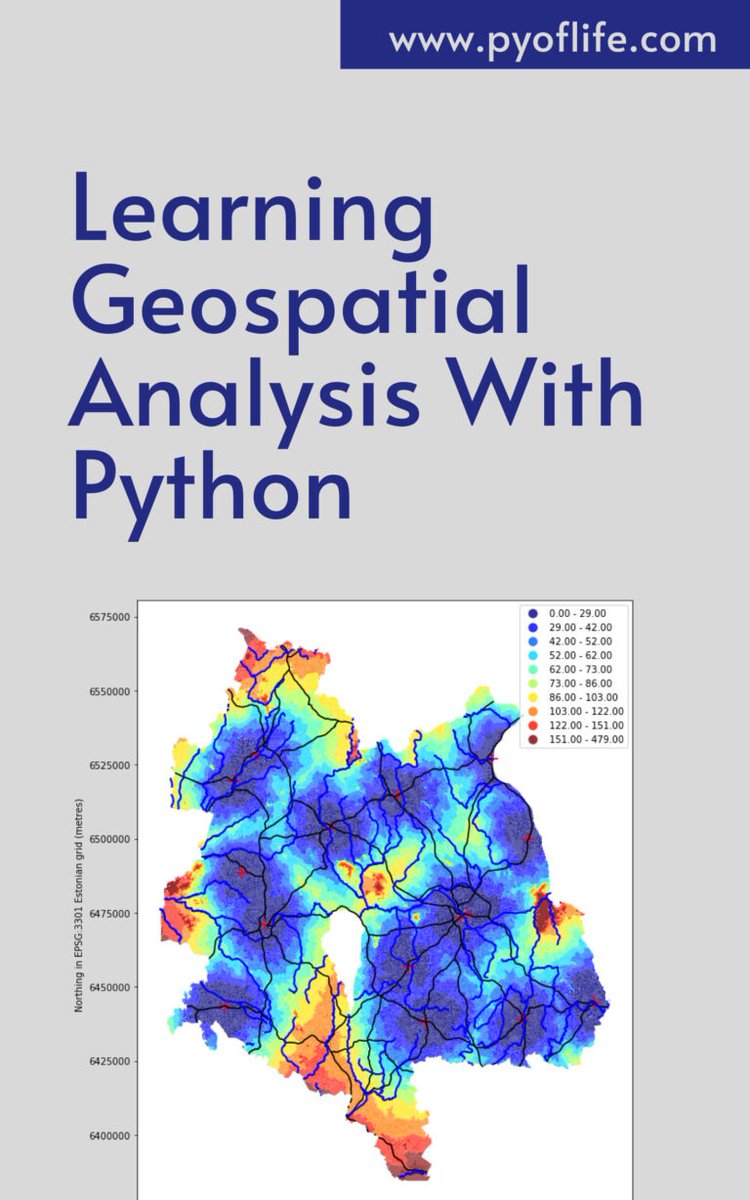
Amidst this digital landscape, Python emerges as a powerful tool, enabling enthusiasts and professionals alike to unlock the secrets hidden within geographical data. pyoflife.com/learning-geosp… #DataScience #pythonprogramming #SpatialDataAnalysis #datavisualizations #DataScientist

In a world increasingly reliant on data-driven decision-making, the realm of geospatial analysis stands as a beacon of insight, offering a unique perspective on our surroundings. pyoflife.com/learning-geosp… #DataScience #pythonprogramming #SpatialDataAnalysis #datavisualization

🚀 Call for Papers: Special Issue on "Algorithms and Application for Spatiotemporal Data Processing" 🧠 📚 Guest Editor: Prof. Dr. Di Zhang 🔍 Explore the full details and submission guidelines here: mdpi.com/journal/algori… #spatialdataanalysis #geodesyandsurveyingengineering


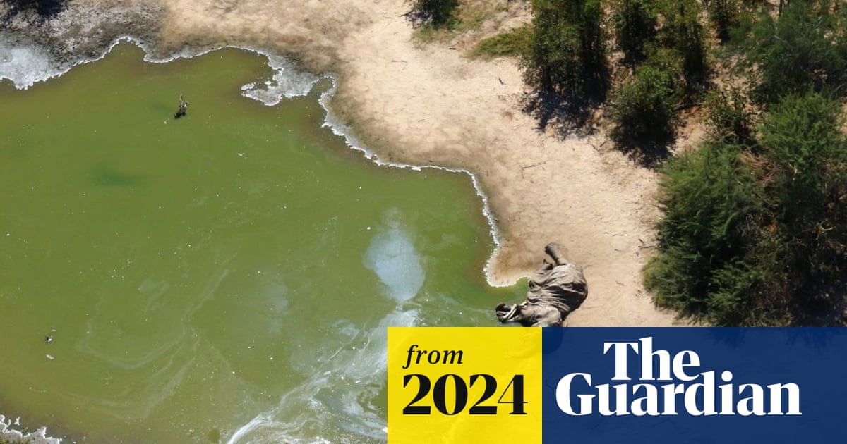
PhD researcher @davidelomeo used #satellite #RemoteSensing & #SpatialDataAnalysis to discover extreme #cyanobacteria blooms across 20 waterholes in #Botswana, where 350 African elephants died in 2020, sparking global concern. Follow Davide for more & read coverage in @guardian 👇

Our article has featured in The Guardian! #conservation #cyanobacteria #kcl #esa #elephants theguardian.com/environment/20…

Daha fazla bilgi: [intechopen.com/welcome/36b039…] #Geoinformatics #AdvancedGeoinformatics #SpatialDataAnalysis #EarthSciences

🏢 A data center is a facility housing computer systems and related components for data storage and management. GIBS services raise its capabilities with spatial data analysis, supporting advanced decision-making and operations. #DataCenter #SpatialDataAnalysis #ITService


𝗩𝗮𝗹𝗲𝗿𝗶𝗲𝗽𝗶𝗲𝗿𝗶𝘀 𝗰𝗶𝗿𝗰𝗹𝗲 #SpatialDataAnalysis | #GeoSpatial A figure drawn on the Earth's surface such that the majority of the human population lives within its interior i.e., more people living INSIDE THE CIRCLE than outside of it. [Pic:1] — Ken Myers' version
![Thetaofzeta's tweet image. 𝗩𝗮𝗹𝗲𝗿𝗶𝗲𝗽𝗶𝗲𝗿𝗶𝘀 𝗰𝗶𝗿𝗰𝗹𝗲
#SpatialDataAnalysis | #GeoSpatial
A figure drawn on the Earth's surface such that the majority of the human population lives within its interior i.e., more people living INSIDE THE CIRCLE than outside of it.
[Pic:1] — Ken Myers' version](https://pbs.twimg.com/media/GOOu0dLasAAUbsR.jpg)

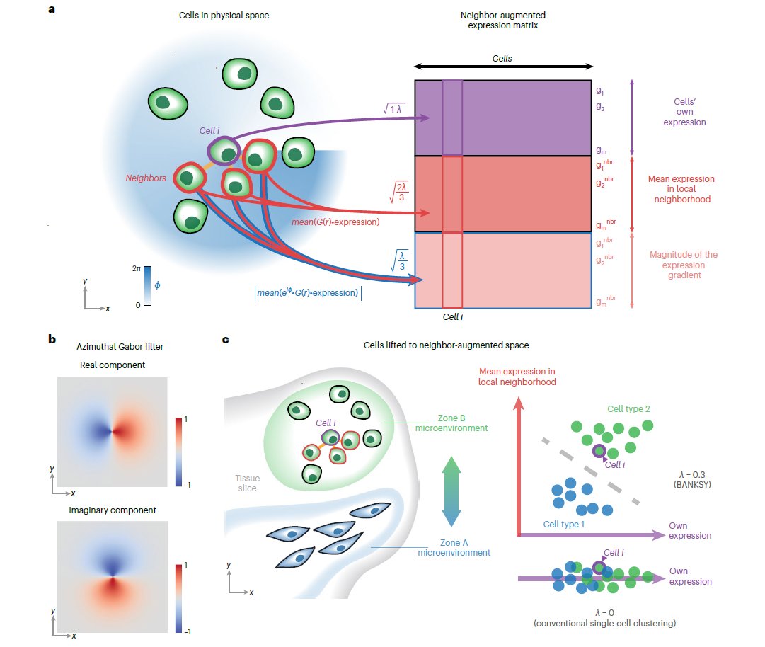
🎨Check out the new #Publication in @NatureGenet from researchers at @ASTARsg showcasing #SpatialDataAnalysis of #MERSCOPE data releases with the #BANKSY #Algorithm!💻 Learn more today: hubs.ly/Q02n09s40 #ComputationalBiology #Bioinformatics #MERFISH #AcademicTwitter
Something went wrong.
Something went wrong.
United States Trends
- 1. Seahawks 34.4K posts
- 2. Rams 42.5K posts
- 3. Cooper Kupp 1,703 posts
- 4. Kenneth Walker 2,505 posts
- 5. Sam Darnold 2,742 posts
- 6. Salem 32K posts
- 7. Portuguese 11.3K posts
- 8. #TNFonPrime 2,687 posts
- 9. Puka 29.2K posts
- 10. New Hampshire 15.1K posts
- 11. Kennedy Center 101K posts
- 12. Brunson 12.3K posts
- 13. Jalen Johnson 2,488 posts
- 14. Hornets 6,187 posts
- 15. McVay 2,878 posts
- 16. Pacers 4,585 posts
- 17. #LARvsSEA 1,113 posts
- 18. Kubiak N/A
- 19. Ben Shapiro 18.2K posts
- 20. Hunger Games 57.5K posts