#gisgeek نتائج البحث

For those who think I’m at a #GISgeek conference this week, I give you empirical bayesian kriging regression prediction analysis #EsriUC


I should be sleeping but instead being a #GISGeek! In a few days, @DataCapable is going to kick off an awesome (and much needed) initiative!


My first go at using the 'glow lines' technique in flow maps using QGIS, love it! #QGIS #gisgeek #maps


When your sister just came from the #ESRI IndianOcean User Conference and share some goodies with you...#GISGEEK


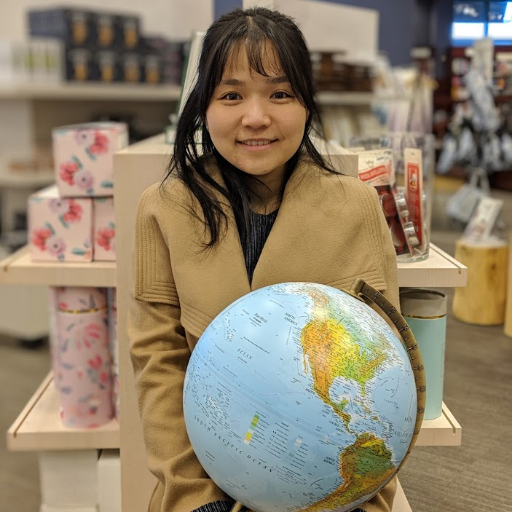
Sweet GIS presentation by the St. Joan of Arc school at #EsriCanadaUC leveraging ArcGIS online! #cssd_edu #gisgeek


Very cool dataset for planning... (ie.) for northwest #Valemount, you can easily define potential flood zones previously created by Swift Creek... #GISGeek


This is an e.g. of how to catalyze community economic development in rural/remote BC: free access to data that enables great minds across the province to build better businesses and plans with quality data. Presser: news.gov.bc.ca/releases/2021F… Cool site: governmentofbc.maps.arcgis.com/apps/MapSeries…
news.gov.bc.ca
High-tech data open to public
British Columbians will soon have free access to high-tech data about the province.

France, but make it rivers 🇫🇷🌊 A 3D map so detailed it practically flows off the screen! Qui a besoin de frontières quand la nature trace les siennes ? 🗺️✨ #RiverArt #FranceIn3D #GISGeek #R #Dataviz #30DayMapChallenge


While I am loving my time with limno friends at #NALMS2019 this week, my #GISgeek side is quietly celebrating #GISDay2019


*GEONERD ALERT* - of course we had to stop here on our summer vacation! #gisgeek #gisrocks #geonerd #manitoba


Morning coffee walked turned into map projections talk for the @MapDataServices team #GISgeek #spring #projections #map #sydney


Thx @geographx and @LINZLDS just bringing in the tifs for the first time is v. exciting #gisninja #gisgeek


France, but make it rivers 🇫🇷🌊 A 3D map so detailed it practically flows off the screen! Qui a besoin de frontières quand la nature trace les siennes ? 🗺️✨ #RiverArt #FranceIn3D #GISGeek #R #Dataviz #30DayMapChallenge


p.s. @dave__whiteside this is my partner who went on a special cycling trip with Reed to the intersection of Stephen and Drew in Cambridge because that is his first and last name respectively 😜 #GISgeek #datageek
Very cool dataset for planning... (ie.) for northwest #Valemount, you can easily define potential flood zones previously created by Swift Creek... #GISGeek
This is an e.g. of how to catalyze community economic development in rural/remote BC: free access to data that enables great minds across the province to build better businesses and plans with quality data. Presser: news.gov.bc.ca/releases/2021F… Cool site: governmentofbc.maps.arcgis.com/apps/MapSeries…
news.gov.bc.ca
High-tech data open to public
British Columbians will soon have free access to high-tech data about the province.

The #gisgeek in me is loving that @iainslyon and I are featured as part of the global @EsriUC this year! Our ‘Design with Nature; Design with Data’ presentation is streaming live on Tuesday 13th July, 11.15am PDT / 7.15pm BST. Lots of other very cool stuff to check out too👇🌍

Attend technical workshops and sessions, watch the Plenary Session, network virtually with thousands of your peers, and much more! 🔹Start planning your schedule here: ow.ly/YwIg50FbZzd #EsriUC #ArcGIS


A huge shout out to Soar user Nathan Lu who is now the Guinness World Record holder for "Youngest Drone Cartographer" thanks to his outstanding work uploading aerial maps on the Soar platform. Way to go, Nathan! Full article and feature video: guinnessworldrecords.com/news/2020/10/y…


Cómo me jode cuando les mando un .SHP y me responden que necesitan un .DWG para hacer un puto zoom en el Open Street View... Coman mierda y tomen su .KML #gisgeek

Missing being in San Diego for #esriuc, but watching with kai.aussiedoodle on the couch is convenient. @Esri #gis #gisgeek #thenewnormal #virtualconference #notfightingforaseat @ Brandon, Florida instagram.com/p/CClziBYASdM/…

Hello my friend the scribble and thinking book. 😁😁 . . . . . . #gis #gisgeek #geogeek #esri #florida #nerd #geospatial #maps #notebook #pink #latenight #couch


Much learning and fun at the Esri NYC Geodata Academy! #geospatialanalytics #healthcaregis #gisgeek #datadrivennyc lnkd.in/fUdXtg4
While I am loving my time with limno friends at #NALMS2019 this week, my #GISgeek side is quietly celebrating #GISDay2019
ABSOLUTLEY "Totes Awesome" :-) The entity framework provider for #efcore 3 now supports GIS Data types DIRECTLY in your ef models, along with dozens of GIS based comparison and selection operations too: npgsql.org/efcore/mapping… this is great news #happyshawty #gisgeek


For those who think I’m at a #GISgeek conference this week, I give you empirical bayesian kriging regression prediction analysis #EsriUC
My first go at using the 'glow lines' technique in flow maps using QGIS, love it! #QGIS #gisgeek #maps
Morning coffee walked turned into map projections talk for the @MapDataServices team #GISgeek #spring #projections #map #sydney
Very cool dataset for planning... (ie.) for northwest #Valemount, you can easily define potential flood zones previously created by Swift Creek... #GISGeek
This is an e.g. of how to catalyze community economic development in rural/remote BC: free access to data that enables great minds across the province to build better businesses and plans with quality data. Presser: news.gov.bc.ca/releases/2021F… Cool site: governmentofbc.maps.arcgis.com/apps/MapSeries…
news.gov.bc.ca
High-tech data open to public
British Columbians will soon have free access to high-tech data about the province.

Inspired #CaseStudy from Claire Jakeman Stefan Kowalczyk @WinchesterCity demonstrating the intelligent application of #GIS & the necessity of having 1) a #GISGeek, 2) Reliable land ownership boundaries 3) the knowledge that “GIS can do more-or-less anything” #TreeOfficerUK #NTOC


While I am loving my time with limno friends at #NALMS2019 this week, my #GISgeek side is quietly celebrating #GISDay2019
*GEONERD ALERT* - of course we had to stop here on our summer vacation! #gisgeek #gisrocks #geonerd #manitoba
I should be sleeping but instead being a #GISGeek! In a few days, @DataCapable is going to kick off an awesome (and much needed) initiative!
Sweet GIS presentation by the St. Joan of Arc school at #EsriCanadaUC leveraging ArcGIS online! #cssd_edu #gisgeek
France, but make it rivers 🇫🇷🌊 A 3D map so detailed it practically flows off the screen! Qui a besoin de frontières quand la nature trace les siennes ? 🗺️✨ #RiverArt #FranceIn3D #GISGeek #R #Dataviz #30DayMapChallenge
When your sister just came from the #ESRI IndianOcean User Conference and share some goodies with you...#GISGEEK

To celebrate @gisday on 15 Nov, we’ve asked local #GISGeek and PSMA #geospatial analyst, Maria Atkins, to take over our Twitter account. Think of it as a satellite view of #GIS life – for one day only! May the force be with you @matkins1987 on #gisday.

Something went wrong.
Something went wrong.
United States Trends
- 1. New York 31.1K posts
- 2. New York 31.1K posts
- 3. Good Wednesday 23.3K posts
- 4. Virginia 588K posts
- 5. #wednesdaymotivation 1,634 posts
- 6. Hump Day 9,119 posts
- 7. Alastor 28.9K posts
- 8. #questpit 10.5K posts
- 9. #hazbinhotelseason2 38.5K posts
- 10. Van Jones 3,695 posts
- 11. AND SO IT BEGINS 17.1K posts
- 12. #Wednesdayvibe 1,288 posts
- 13. 5th of November 17.1K posts
- 14. Talus 22.4K posts
- 15. Enhanced 11.4K posts
- 16. The GOP 261K posts
- 17. Nueva York 117K posts
- 18. Mayor 970K posts
- 19. #airdrops 1,950 posts
- 20. Proverbs 7,365 posts