#geospatialdata search results

Discover the secrets to maximizing your geospatial data with ArcGIS hosted services! 🚀📈 This blog series covers the differences between hosted feature services, vector tile services, and map tile services. #GeospatialData #ArcGIS Dive in ➡️ ow.ly/TCQA50X0Xqe


Get started with geospatial data for developers! 🌐💡 Understand the differences between discrete and continuous data, and learn how to optimize performance. #GeospatialData #DeveloperTips Read the blog article ➡️ow.ly/F2me30sQoP0


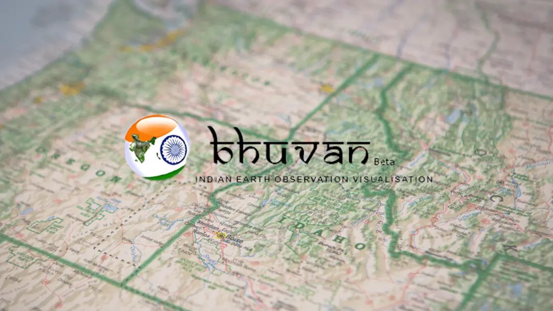
🛰️ ISRO’s Bhuvan is 10x Better Than Google Maps ISRO Chief S. Somanath unveils Geoportal-Bhuvan. This game-changer will revolutionize sectors like agriculture, urban planning, and disaster management. 🌍 #ISRO #GeoportalBhuvan #GeospatialData #Innovation #India #Google #Maps
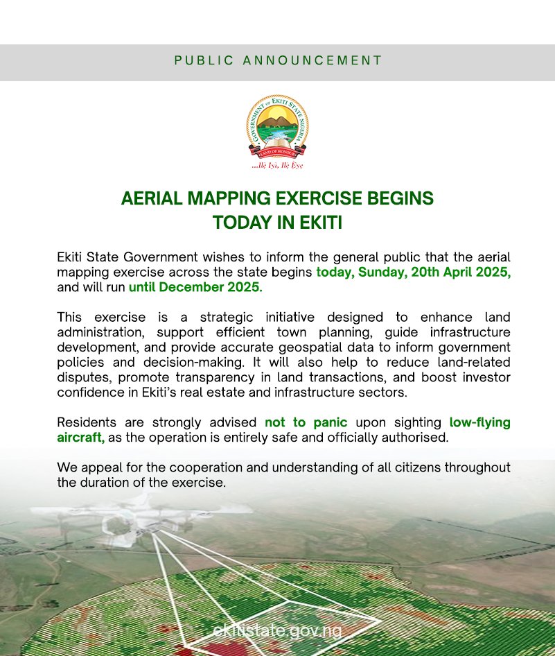
Aerial Mapping Begins in Ekiti Today! Residents are advised not to panic at the sight of low-flying aircraft, as it is a planned and harmless operation. The exercise runs till December 2025. #AerialMapping #EkitiDevelopment #GeospatialData #TownPlanning #BAOGovernance…

💡In the complex world of geospatial data, analytics, and AI, it’s easy to feel overwhelmed. 🤔 How can you stay informed and navigate these buzzwords? Let’s unpack some key concepts and FAQ's to clarify their meanings. 🌍💡 #GeospatialData #AI #Analytics #IndustryInsights

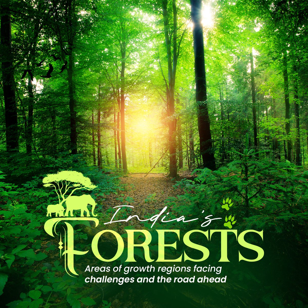
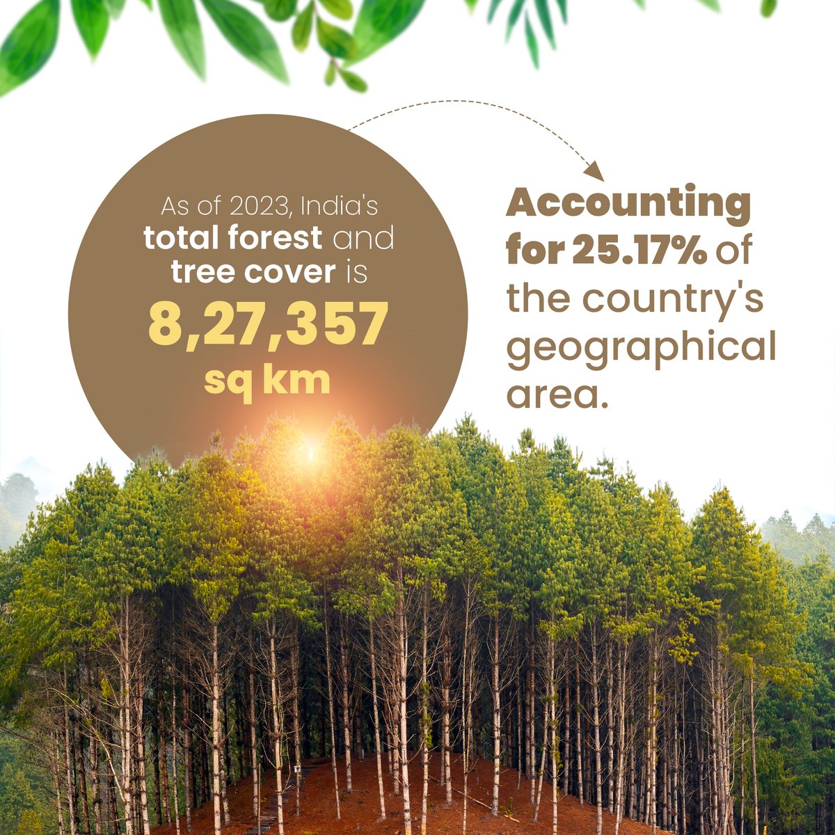
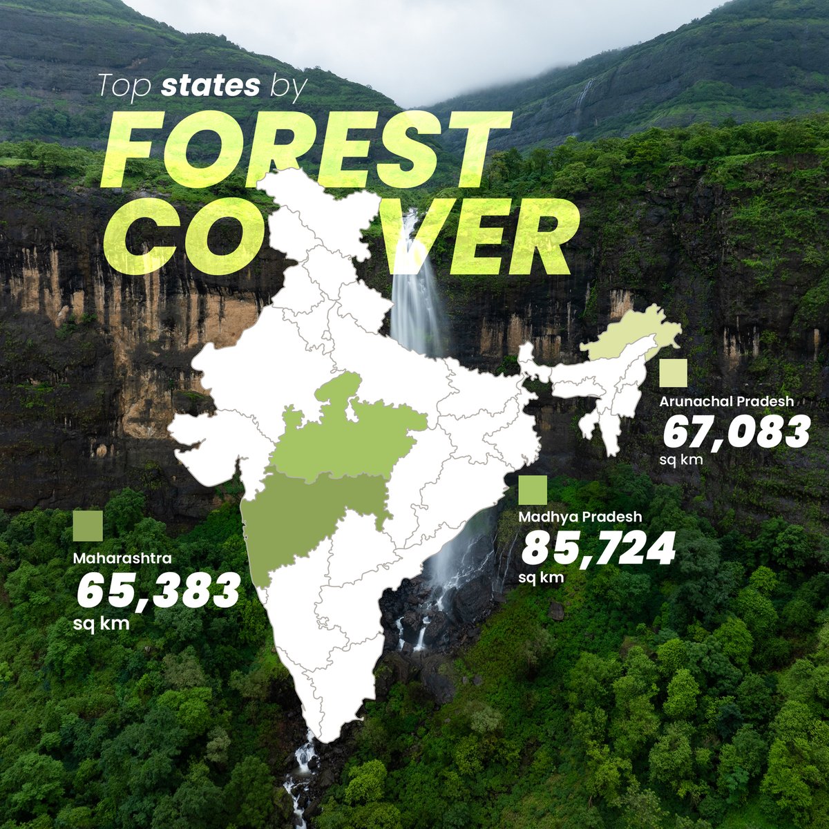
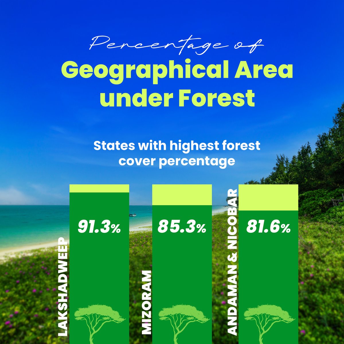
🌳 India’s Forest Cover: Growth vs Loss! In 2023, India has 25.17% of its area covered by forests, but tree cover loss is a growing challenge. Check out which states are making progress and which are losing out. 👇 #ForestCover #LatlongAI #GeospatialData #Sustainability

Data-driven infrastructure is key to tackling climate risks, urban growth and system failures before they happen, says Alan Browne, co-founder of @SoarvoHQ. #geospatialdata theengineer.co.uk/content/opinio…

Geospatial data isn't just for techies! The power of #GeospatialData transcends tech! It's the backbone of impactful storytelling. Today, storytelling is in everyone's pockets. With just a phone with a camera, you can; - Document your journey - Share moments - Share local…


🛰️ How can space technology drive sustainable development? This #WorldSpaceWeek, @UNESCAP spotlights geospatial tools driving sustainable development: 📊 Dashboards & databases 📘 Regional compendiums 🤖 AI-powered tools Learn more 👉 buff.ly/C9b5ji4 #GeospatialData


It's the first ever @OrdnanceSurvey Innovation Festival today,are ready to talk big ideas and geospatial solutions with everyone who's attending! They can't wait to get stuck in to show how we can help solve big challenges through the use of #geospatialdata!


How can global organizations gear up for predictive asset intelligence while navigating the complexities of #GeospatialData and regulatory demands? Join Altavec’s solution experts- David Mathew, Daniel Pendlebury, and Anthony Wilson- in a LIVE discussion with Ujjval Sonawane as…


🌍 Geospatial Data Support for East African Humanitarians! 🛰 Caribou Space and UKHIH offer #support to integrate geospatial data into your operations. 📅 Deadline: 4 Sep 2024 🔗 Visit: shorturl.at/XCno5 #HumanitarianSupport #GeospatialData #EastAfrica #CrisisPreparedness


✨ A huge thanks to everyone who attended our meetup yesterday! Special thanks to @Hivemapper for joining us and Silas Toms for revitalizing the GeoMeetup group. See you at the next event! #Meetup #GeospatialAI #GeospatialData


5G enables high-speed data transfer and precise positioning in satellite coverage, while Beidou provides accurate timing and positioning in open areas. Their integration delivers unified communication and vast high-precision geographic data. 🌐🚀 #5G #Beidou #GeospatialData


🌍 MAP OF THE MONTH In the Mediterranean, dense coastal populations face growing flood risks this map highlights the urgent need for coastal adaptation. #MapX_GRIDgva #GeospatialData #SustainableDevelopment

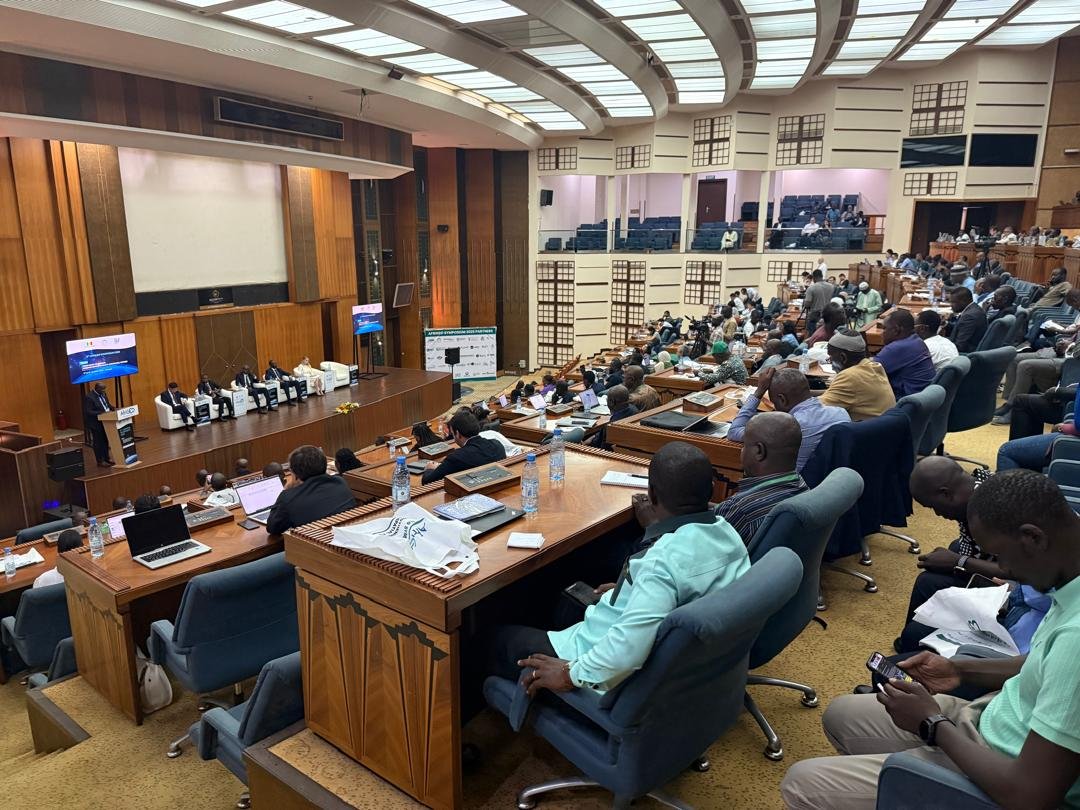
9th AfriGEO Symposium in Dakar (Oct 7–9, 2025), Experts and innovators explore how #GeospatialData can drive Africa’s sustainable future and the @OSS_Comms presents tools turning data into action for a resilient continent. #AfriGEO2025 #EarthObservation #Innovation #SDGs


Last week I represented @WorldPopProject in a @PopDevUNFPA technical workshop on Learning and Adapting lessons on Baseline Population, displacement and refugee data interoperability in South Africa. #interoperability #opendata #geospatialData #GriddedPopulation


#Geospatialdata helps us understand how Nigeria’s land is changing and what it means for people and the planet. A continuation of my geospatial analysis on Nigeria’s land sector highlights two critical layers:

🌐 #SatCenInsights is back! This week, we explore how our RTDI team is using #geospatialdata to estimate flood-affected houses across Sahel ecoregions — a key SDG indicator for resilience. The present study addresses the knowledge gap in standardized methods for assessing…


#India's Digital Personal Data Protection Act (#DPDPA) and associated Rules do not explicitly address #geospatialdata, highlighting a need for specific consideration of sensitive #personal information: @Shravishtha_ajaykumar or-f.org/35082


Discover how BASF Digital Farming leverages AWS to build a scalable geospatial data platform for farmers worldwide! 🌱🛰️ #AWS #GeospatialData #DigitalFarming #STAC #OpenSource #Innovation aws.amazon.com/blogs/architec…


Discover the secrets to maximizing your geospatial data with ArcGIS hosted services! 🚀📈 This blog series covers the differences between hosted feature services, vector tile services, and map tile services. #GeospatialData #ArcGIS Dive in ➡️ow.ly/wxAf30sQXPR


Day 5 of the #30-Day Map Challenge: Exploring the Wildland-Urban Interface (WUI) from SILVIS Labs at UW-Madison. We're examining #geospatialdata showing where homes meet wildland vegetation across the U.S., a challenge for wildfire management, urban planning, and conservation.

Are you looking for accurate and reliable geospatial data? Look no further than KWGIS! Our team of experts is dedicated to delivering high-quality services to support development projects. #KWGIS #GeospatialSolutions #GeospatialData

The Game Changer in Geospatial Ecosystem!! #ViksitBharat #publicdata #GeospatialData #DataRegistry

Survey of India’s National Geo Platform – Spatially Enabling Digital India In a major initiative to strengthen India’s National Geospatial Ecosystem and implement the vision of the National Geospatial Policy, 2022, Survey of India (SoI), Government of India, has entered into an…

How Does Geospatial Data Apply to Cybersecurity Read More:- buff.ly/tDM5PRv #cybersecurity #geospatialdata #securityexperts #TheTechTrend
#Geospatialdata helps us understand how Nigeria’s land is changing and what it means for people and the planet. A continuation of my geospatial analysis on Nigeria’s land sector highlights two critical layers:
#India's Digital Personal Data Protection Act (#DPDPA) and associated Rules do not explicitly address #geospatialdata, highlighting a need for specific consideration of sensitive #personal information: @Shravishtha_ajaykumar or-f.org/35082

It’s TopoDOT Tuesday! We prioritize accurate data for your geospatial projects. Ensure your point cloud meets specs before using tools. Learn more on our website or check out Technote 1021 by President Ted Knaak. #TopoDOTTuesday #GeospatialData #DataAssessment #LiDAR

#India's Digital Personal Data Protection Act (#DPDPA) and associated Rules do not explicitly address #geospatialdata, highlighting a need for specific consideration of sensitive #personal information: @Shravishtha_ajaykumar or-f.org/35082

Flooding is rising, insurers need faster insights. Join our webinar Fighting the Rising Tide with FloodCast to see how rapid modelling transforms flood response. 5 Nov, 11am (GMT) Don’t miss it, register now: bit.ly/47jurc2 #GeospatialData #InsuranceTech

Discover the secrets to maximizing your geospatial data with ArcGIS hosted services! 🚀📈 This blog series covers the differences between hosted feature services, vector tile services, and map tile services. #GeospatialData #ArcGIS Dive in ➡️ ow.ly/TCQA50X0Xqe

What is a Building Footprint? It’s more than just an outline of a building. It’s the foundation of how we understand cities, plan infrastructure, and shape the built environment. Want to know more? Check out the video! #BuildingFootprint #UrbanPlanning #GeospatialData
Get started with geospatial data for developers! 🌐💡 Understand the differences between discrete and continuous data, and learn how to optimize performance. #GeospatialData #DeveloperTips Read the blog article ➡️ow.ly/jyEK30sQz7l


EMP-N wrapped on a high note — the first country-based Energy Modelling Platform in Africa.🇳🇬✨ Huge congratulations to every participant, especially the Geospatial Data Management track cohort.🌍 @Energygovng @ResearchCcg @SEforALLorg #EMPN #EnergyModelling #GeospatialData


🌐 Turn complex #GeospatialData into clarity with Dashtera #Maps. #Dashtera Maps lets you explore “where” with clarity. Visualize #RealTimeData, discover patterns, unlock insights across regions. Sign up free: hubs.la/Q03P3BZ10 #DataVisualization #GIS #Dashboarding #WebGL


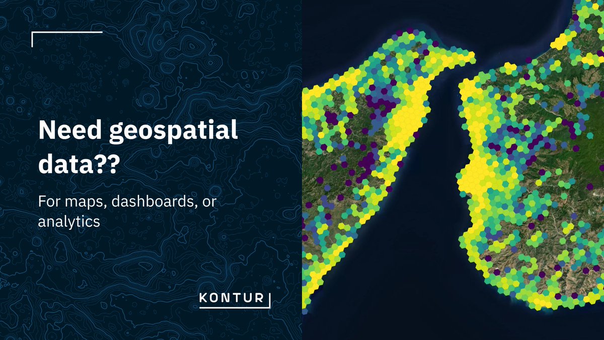
🚀 We’ve updated our datasets page! To make it easier for you to find the data you need, we’ve added categories on kontur.io/datasets 🔍 You can also download the full list of datasets as a table for easier browsing and planning. #GeospatialData #Kontur #OpenData

🛰️ ISRO’s Bhuvan is 10x Better Than Google Maps ISRO Chief S. Somanath unveils Geoportal-Bhuvan. This game-changer will revolutionize sectors like agriculture, urban planning, and disaster management. 🌍 #ISRO #GeoportalBhuvan #GeospatialData #Innovation #India #Google #Maps
Need geospatial data for maps, dashboards, or analytics? Choose the method that best fits your use case: - API access - Embedded map - File download Need a specific layer? Contact us at [email protected] #GeospatialData #GIS #KonturAtlas
🌳 India’s Forest Cover: Growth vs Loss! In 2023, India has 25.17% of its area covered by forests, but tree cover loss is a growing challenge. Check out which states are making progress and which are losing out. 👇 #ForestCover #LatlongAI #GeospatialData #Sustainability

Education being a necessity in urban development, it makes access to schools a vital aspect. Using geospatial data, we were able to map the distribution of schools in Jinja City, providing valuable insights for education planning and accessibility. #GeospatialData #DataCitiesUg

Geospatial data isn't just for techies! The power of #GeospatialData transcends tech! It's the backbone of impactful storytelling. Today, storytelling is in everyone's pockets. With just a phone with a camera, you can; - Document your journey - Share moments - Share local…
Aerial Mapping Begins in Ekiti Today! Residents are advised not to panic at the sight of low-flying aircraft, as it is a planned and harmless operation. The exercise runs till December 2025. #AerialMapping #EkitiDevelopment #GeospatialData #TownPlanning #BAOGovernance…
✨ A huge thanks to everyone who attended our meetup yesterday! Special thanks to @Hivemapper for joining us and Silas Toms for revitalizing the GeoMeetup group. See you at the next event! #Meetup #GeospatialAI #GeospatialData
Discover the secrets to maximizing your geospatial data with ArcGIS hosted services! 🚀📈 This blog series covers the differences between hosted feature services, vector tile services, and map tile services. #GeospatialData #ArcGIS Dive in ➡️ ow.ly/TCQA50X0Xqe
🌍 Geospatial Data Support for East African Humanitarians! 🛰 Caribou Space and UKHIH offer #support to integrate geospatial data into your operations. 📅 Deadline: 4 Sep 2024 🔗 Visit: shorturl.at/XCno5 #HumanitarianSupport #GeospatialData #EastAfrica #CrisisPreparedness
How can global organizations gear up for predictive asset intelligence while navigating the complexities of #GeospatialData and regulatory demands? Join Altavec’s solution experts- David Mathew, Daniel Pendlebury, and Anthony Wilson- in a LIVE discussion with Ujjval Sonawane as…
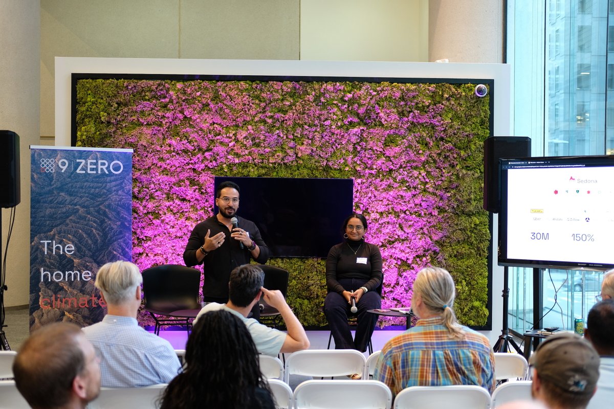
🎉 We had a blast at the Apache Sedona meetup yesterday! Big thanks to everyone who joined us. Today is the last day at #FOSS4GNA. Swing by table 34 to chat about #GeospatialData, #ApacheSeona, Wherobots, or just say hello! 👋


Learn how to use layer renderers to define rules and symbols within your geospatial structured data! 🌏 🧮This will allow you to build powerful geospatial data exploration apps. #EsriDeveloper #geospatialdata Learn More ➡️ ow.ly/yhaZ50V7mTj


📹New video: Professor Andy Tatem speaking on 'Small area population estimation and mapping' 👨👨👧👦 #PopulationData 🗺️ #GeospatialData 📊 #PopulationEstimation 🏫 #CapacityBuilding 🤝 #CoDevelopment worldpop.org/webinars/"

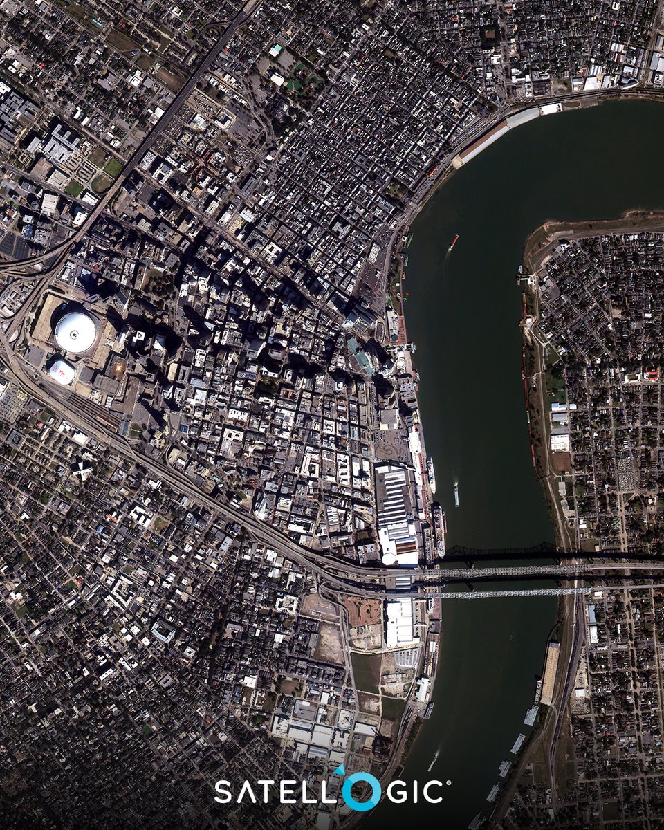
This #satepicoftheweek showcases New Orleans, Lousiana, which sits at, and in some areas below, sea level with mostly flat terrain and is prone to flooding. #geospatialdata helps governments and emergency responders identify high-risk areas and support recovery.

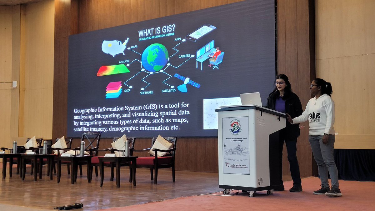
Accessible and rich datasets for Remote Sensing and GIS are transforming how we understand and interact with our environment. Here’s a glimpse of session on Data availability for RS and GIS Analysis #GeospatialData #RS #Gisday2023 @wii_india @himani_khati @harithajagannivasan

Great catching up with the Deputy Head of Mission for Italy in Kenya after the successful hosting of the #G7 Summit. We explored ways to strengthen our collaboration in #GeospatialData and Earth Observations, emphasizing their potential for informed development decisions and…

🌍 MAP OF THE MONTH In the Mediterranean, dense coastal populations face growing flood risks this map highlights the urgent need for coastal adaptation. #MapX_GRIDgva #GeospatialData #SustainableDevelopment

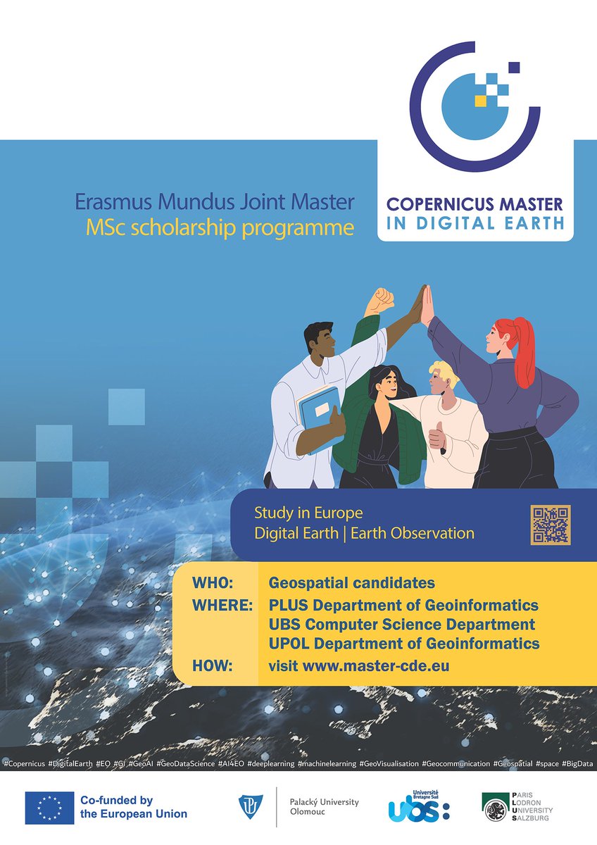
Are you #passionate about #GeospatialData? #ReadyToMove & study abroad #ApplyNow master-cde.eu postgrad #study #Europe #ErasmusPlus #EMJM #Copernicus #DigitalEarth #EO #GI #GeoDataScience #AI4EO #Geovisualisation #Geocommunication @PLUS_1622 @UPOlomouc @UBS_universite

📣Call for Proposals! ISA is looking for a consultancy organization to provide geospatial mapping. If you have expertise in GIS tools, this is your chance to contribute to sustainable ocean governance! Apply by 13 October 👉 bit.ly/4e336gz #GIS #GeospatialData

Something went wrong.
Something went wrong.
United States Trends
- 1. #Worlds2025 37.5K posts
- 2. #TalusLabs N/A
- 3. Raindotgg 1,921 posts
- 4. Doran 15.7K posts
- 5. #T1WIN 25.5K posts
- 6. Sam Houston 1,518 posts
- 7. Oregon State 4,802 posts
- 8. Boots 29K posts
- 9. Lubin 5,646 posts
- 10. Faker 30.7K posts
- 11. #GoAvsGo 1,566 posts
- 12. Louisville 14.3K posts
- 13. #T1fighting 3,259 posts
- 14. Keria 9,353 posts
- 15. Batum N/A
- 16. UCLA 7,827 posts
- 17. Miller Moss 1,237 posts
- 18. Emmett Johnson 2,532 posts
- 19. Oilers 5,187 posts
- 20. Hyan 1,342 posts