#leafmap نتائج البحث
🚀 New Tutorial Alert! I just published a step-by-step guide on building an interactive dashboard with Python and Leafmap. 🌍📊 Explore the Jupyter Notebook: leafmap.org/maplibre/dashb… Watch the full video tutorial: youtu.be/DEPdsJdTQN8 #leafmap #geospatial #python #dataviz
🌍 Intro to GIS Programming | Week 10: Dive into interactive visualization of raster datasets using #Leafmap! 🌟 This week, we explore how to visualize Cloud Optimized GeoTIFFs (COGs), STAC, and both local and remote datasets, including those stored in AWS S3. 📹 Watch here:…
🚀 New features from Leafmap! You can now edit vector data (points, lines, polygons) interactively and save your changes effortlessly with just one line of code. 🎉 Notebook: leafmap.org/notebooks/95_e… #geospatial #opensource #leafmap #python
I just presented at the Fifth NASA OPERA Stakeholder Engagement Workshop today 🌍 You can view my slides here: tinyurl.com/OPERA-Leafmap Learn more about the workshop: jpl.nasa.gov/go/opera/opera… #leafmap #geospatial #nasa #opera

🚀 Excited to share a sneak peek of the latest #Leafmap feature: a new sidebar widget and layer manager for #MapLibre! 🌍 Now you can easily control layer visibility, opacity, style, and more with the interactive GUI. github.com/opengeos/leafm… #geospatial #mapping #python
🚀 Leafmap now supports creating layer groups! 🎉 Easily manage the visibility of multiple layers at once—perfect for toggling them on or off with just a click. Check it out! 👉 github.com/opengeos/leafm… #geospatial #Leafmap #MapLibre #opensource

🌍 MapLibre Tutorial 16: Dive into creating vector data and adding attributes interactively with #Leafmap and #MapLibre! 🎥 Watch the tutorial: youtu.be/EzkE5UlDKuE 📓 Explore the notebook: leafmap.org/maplibre/creat… 📚 Check out the playlist: bit.ly/maplibre…
🌄 Visualizing hiking GPS traces on stunning 3D terrain using Leafmap and MapLibre! 🌐 Explore the demo here: maps.gishub.org/maplibre/gps_t… 📚 Check out the notebook: leafmap.org/maplibre/gps_t… #DataViz #GIS #Leafmap #MapLibre
🌍✨Visualizing Agricultural Field Boundary Dataset (Fields of The World) with #Leafmap and #MapLibre 🔍 Check out the interactive demo: maps.gishub.org/maplibre/field… 📓 Explore the notebook: leafmap.org/maplibre/field… #geospatial #opensource #dataviz
Leafmap now supports creating 3D maps with Mapbox and a few lines of python code 🌎 Notebook: leafmap.org/notebooks/94_m… #geospatial #leafmap #python
🌍✨ Leafmap Tutorial: Learn how to effortlessly plot tens of thousands of points with custom styles using just a few lines of code! 🎥 Watch here: youtu.be/F3NzZMIhff4 📓 Explore the Notebook: leafmap.org/notebooks/104_… #geospatial #leafmap #mapping
The recording of my 3-hour workshop at the Houston Area GIS Day Title: 3D Mapping with MapLibre and Leafmap Video: youtu.be/QwrH0ikg_RE Notebook: leafmap.org/workshops/HGAC… #geospatial #leafmap #maplibre

🛑#هام_للطلاب_للباحثين مجموعات بيانات البناء المفتوحة من Google-Microsoft باستخدام #PMTiles و #leafmap apps.opengeos.org/buildings.html

🚀 New features from Leafmap! You can now edit vector data interactively and save your changes effortlessly with just one line of code. 🎉 Notebook: leafmap.org/notebooks/95_e… #geospatial #opensource #leafmap #python
🌍 Visualizing the Annual National Land Cover Database (NLCD) using #leafmap on Py.Cafe! 🚀 Create, run, edit, and share Python applications seamlessly in your browser. Check it out here: py.cafe/giswqs/leafmap… #geospatial #opensource #python #dataviz
MapLibre Tutorial 14: Create 3D Choropleth Maps 🗺️ Video: youtu.be/RIUAph8TEA0 Playlist: bit.ly/maplibre Notebook: leafmap.org/maplibre/3d_ch… Demo: maps.gishub.org/maplibre/3d_ch… #geospatial #leafmap #maplibre #python

#Leafmap now supports developing interactive web apps for #geospatial applications with @Gradio
I just presented at the Fifth NASA OPERA Stakeholder Engagement Workshop today 🌍 You can view my slides here: tinyurl.com/OPERA-Leafmap Learn more about the workshop: jpl.nasa.gov/go/opera/opera… #leafmap #geospatial #nasa #opera


✨ Visualiser la Terre autrement avec Leafmap + AlphaEarth 🛰️ Pixels 10 m, 2017–2024 🏞️ 3D immersive 🔍 Analyse fine des changements environnementaux #GeoAI #AlphaEarth #Leafmap #DeepLearning #RemoteSensing
🚀 New Tutorial Alert! I just published a step-by-step guide on building an interactive dashboard with Python and Leafmap. 🌍📊 Explore the Jupyter Notebook: leafmap.org/maplibre/dashb… Watch the full video tutorial: youtu.be/DEPdsJdTQN8 #leafmap #geospatial #python #dataviz
🚀 Leafmap now supports creating layer groups! 🎉 Easily manage the visibility of multiple layers at once—perfect for toggling them on or off with just a click. Check it out! 👉 github.com/opengeos/leafm… #geospatial #Leafmap #MapLibre #opensource
🚀 Excited to share a sneak peek of the latest #Leafmap feature: a new sidebar widget and layer manager for #MapLibre! 🌍 Now you can easily control layer visibility, opacity, style, and more with the interactive GUI. github.com/opengeos/leafm… #geospatial #mapping #python
🌍✨ Leafmap Tutorial: Learn how to effortlessly plot tens of thousands of points with custom styles using just a few lines of code! 🎥 Watch here: youtu.be/F3NzZMIhff4 📓 Explore the Notebook: leafmap.org/notebooks/104_… #geospatial #leafmap #mapping
Oooh, interactive vector data creation? Now we're talking! #Leafmap and #MapLibre are the perfect combo for building custom geospatial apps. Can't wait to dive into this tutorial and see what kind of location-based magic we can create.
🌍 MapLibre Tutorial 16: Dive into creating vector data and adding attributes interactively with #Leafmap and #MapLibre! 🎥 Watch the tutorial: youtu.be/EzkE5UlDKuE 📓 Explore the notebook: leafmap.org/maplibre/creat… 📚 Check out the playlist: bit.ly/maplibre…
🌍 Leafmap Tutorial 103: Adding a custom colormap to a raster image! 📹 Watch the Video: youtu.be/FIOmNsf_A5o 📓 Explore the Notebook: leafmap.org/notebooks/103_… #Geospatial #Leafmap #Python #DataViz

#OSM è sempre la base cartografica, è un modo diverso di visualizzare la mappa. In questo caso ho usato le librerie #MapLibre e #leafmap, per i volumi degli edifici ho usato #opendata del @ComunePalermo ma trovi tanti dataset su @OvertureMaps un tutorial bertt.wordpress.com/2022/05/24/cus…
Cosa fare in vacanza...? Cazzaggiare 😀 Approfitto del tempo libero per giocare con dati di @OvertureMaps per realizzare una mappa demo con @maplibre #Leafmap #QGIS grazie ai tutorial di @giswqs e Bert palermohub.opendatasicilia.it/pmtiles_pa.html by @opendatasicilia

I will be presenting at the Fused webinar this Thursday. You are welcome to join. Register here: streamyard.com/watch/63fXCHiZ… #leafmap #geospatial #overture

The recording of my 3-hour workshop at the Houston Area GIS Day Title: 3D Mapping with MapLibre and Leafmap Video: youtu.be/QwrH0ikg_RE Notebook: leafmap.org/workshops/HGAC… #geospatial #leafmap #maplibre

🌄 Visualizing hiking GPS traces on stunning 3D terrain using Leafmap and MapLibre! 🌐 Explore the demo here: maps.gishub.org/maplibre/gps_t… 📚 Check out the notebook: leafmap.org/maplibre/gps_t… #DataViz #GIS #Leafmap #MapLibre
🌍✨Visualizing Agricultural Field Boundary Dataset (Fields of The World) with #Leafmap and #MapLibre 🔍 Check out the interactive demo: maps.gishub.org/maplibre/field… 📓 Explore the notebook: leafmap.org/maplibre/field… #geospatial #opensource #dataviz
🌎Visualizing the Agricultural Field Boundary dataset - Fields of The World (FTW, fieldsofthe.world) - using #leafmap on @py_cafe ☕️ Check it out: py.cafe/giswqs/leafmap… @opencholmes
Try FTW! fieldsofthe.world We just did a chunk of work to make it easier to run, output geoparquet/fiboa, and even train your own models. Would be awesome for it to be part of your journey, to teach it, and see if there’s ways to bring into leafmap.
fieldsofthe.world
Fields of The World: A Global Field Boundary Ecosystem
FTW is a comprehensive ecosystem for agricultural field boundary detection, featuring benchmark datasets, baseline models, inference tools, web applications, and community-driven development spanning...
🌍 Visualizing the Annual National Land Cover Database (NLCD) using #leafmap on Py.Cafe! 🚀 Create, run, edit, and share Python applications seamlessly in your browser. Check it out here: py.cafe/giswqs/leafmap… #geospatial #opensource #python #dataviz
Continuing the exploration of #Leafmap library, you will learn how to download and visualize #OpenStreetMap data in Ana interactive map. Check out the video for Day 18 of the #PythonDatavizChallenge youtu.be/55OHUxcx-YE
youtube.com
YouTube
Downloading and Visualizing OSM Data with LeafMap - Mapping and Data...
It's Day 17 of #PythonDatavizChallenge and today you will learn about a very important and versatile interactive visualization library #Leafmap created by @giswqs youtube.com/watch?v=Zpl7mz…
youtube.com
YouTube
Leafmap Basics - Mapping and Data Visualization with Python
🛑#هام_للطلاب_للباحثين مجموعات بيانات البناء المفتوحة من Google-Microsoft باستخدام #PMTiles و #leafmap apps.opengeos.org/buildings.html

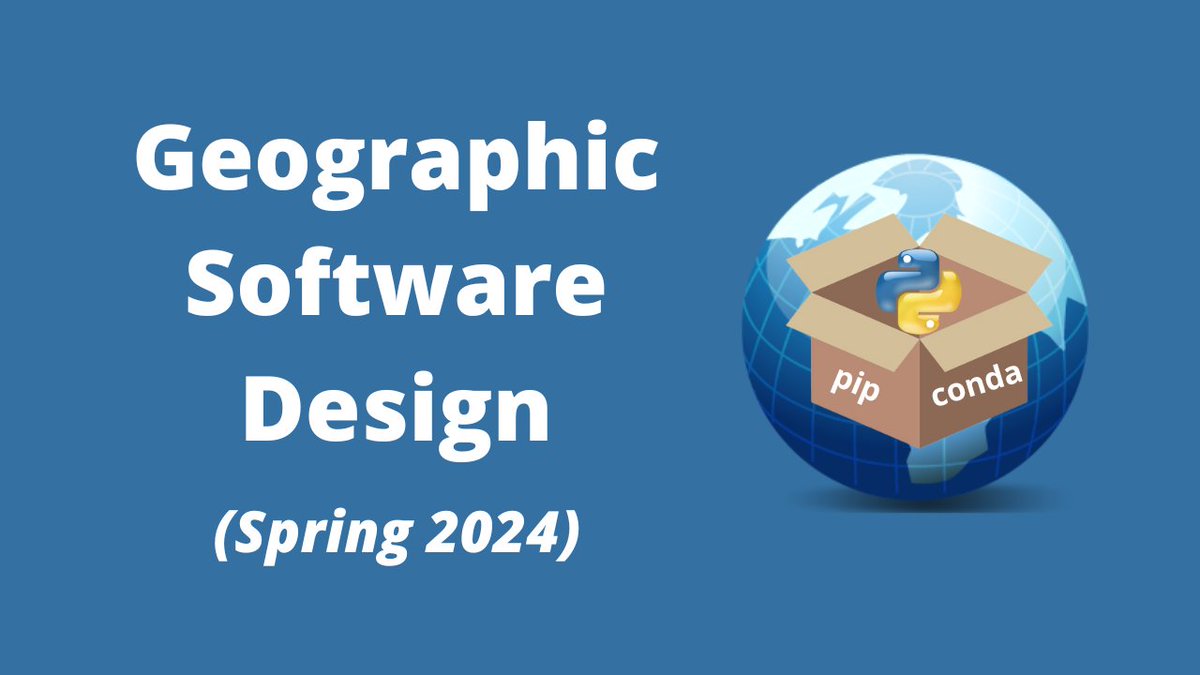
The complete video recordings of my Geographic Software Design course are now accessible on YouTube! 33 videos with a total duration of 24 hours. You'll learn how to develop open-source #geospatial Python packages like #geemap 🌎and #leafmap🌿, starting from scratch. 🛠️🔥 📺…
I just presented at the Fifth NASA OPERA Stakeholder Engagement Workshop today 🌍 You can view my slides here: tinyurl.com/OPERA-Leafmap Learn more about the workshop: jpl.nasa.gov/go/opera/opera… #leafmap #geospatial #nasa #opera

📢I just launched a new video tutorial series - "3D Mapping with #MapLibre and #Leafmap"! 🗺️ Learn how to create stunning 3D maps with just a few lines of Python code! The first video is out. More to come 👋 YouTube playlist: bit.ly/maplibre Notebooks:…


Delighted to see my open-source packages #leafmap and #geemap being acknowledged as part of the fastest-growing #geospatial packages in 2023! Many thanks to Matt Forrest for compiling this impressive list 👇 linkedin.com/posts/mbforr_g…

Visualizing #geospatial data in #DuckDB 🦆with #leafmap 🍀 and #lonboard 🗺️🌎 Video: youtu.be/r3A_OLT-JBM Notebook: geog-414.gishub.org/book/duckdb/08… Playlist: youtube.com/playlist?list=… #dataviz #geopython

The recording of my 3-hour workshop at the Houston Area GIS Day Title: 3D Mapping with MapLibre and Leafmap Video: youtu.be/QwrH0ikg_RE Notebook: leafmap.org/workshops/HGAC… #geospatial #leafmap #maplibre

Visualizing Maxar Open Data for the 2023 #Morocco Earthquake with #leafmap Notebook: share.gishub.org/morocco_earthq… #Morrocoearthquake #opendata

Visualizing @Maxar Open Data for the 2023 #Morocco Earthquake GitHub: github.com/opengeos/maxar… Web App: huggingface.co/spaces/giswqs/… #moroccoearthquake #geospatial #opendata #aws

Check out the latest tutorial on the @Streamlit YouTube Channel! 🎥 Title: Building Interactive #Geospatial Web Apps with #Leafmap and #Streamlit 🔗 Video: youtu.be/hn2WqRX75DI 💻 Web App: map-template.streamlit.app 📦 GitHub: github.com/opengeos/strea…

Great to see #leafmap and #geemap being highlighted in the State of Spatial Data Science report produced by @CARTO go.carto.com/state-spatial-… #geospatial #opensource #python

🚨 🚀 Hot off the press - the State of Spatial Data Science 2024 has JUST landed! Explore the results of our survey of over 250 industry experts, including their thoughts on #AI, interoperability, talent - and more! Get your FREE copy 👉 hubs.ly/Q02GWLSk0
📢 The US non-floodplain #wetlands dataset is now accessible on @source_coop in the highly efficient cloud-native GeoParquet format. Check out the links below on how to explore and analyze this valuable dataset with #leafmap 🌿 and #DuckDB 🦆 🗺️ Dataset: beta.source.coop/repositories/g……

I will be presenting at the Fused webinar this Thursday. You are welcome to join. Register here: streamyard.com/watch/63fXCHiZ… #leafmap #geospatial #overture

🌿 The popularity of #leafmap on GitHub is soaring! 🚀 🌐 GitHub: github.com/opengeos/leafm… 📚 Documentation: leafmap.org 🌍 Explore the power of #geospatial analysis and mapping with this #opensource Python package. 🐍💻 #python #GIS #dataviz #mapping

e.g. I want to make sure tools like #leafmap could easily deal with that. I believe it would be great to share access to @giswqs to get an honest opinion about data, metadata and ways to access it.

#30DayMapChallenge | Day 3 | Polygons | Countries are shown as regular polygons (from triangles to decagons and circles) of equivalent areas for emphasizing distortion due to the Web Mercator projection: …countries-as-geometries.streamlit.app. Deployed with @streamlit with the help of #leafmap.


Cosa fare in vacanza...? Cazzaggiare 😀 Approfitto del tempo libero per giocare con dati di @OvertureMaps per realizzare una mappa demo con @maplibre #Leafmap #QGIS grazie ai tutorial di @giswqs e Bert palermohub.opendatasicilia.it/pmtiles_pa.html by @opendatasicilia

Something went wrong.
Something went wrong.
United States Trends
- 1. Zeraora 8,631 posts
- 2. Peggy 27.2K posts
- 3. Berseria 2,535 posts
- 4. #FaithFreedomNigeria 1,370 posts
- 5. Good Wednesday 33.9K posts
- 6. Dearborn 332K posts
- 7. #wednesdaymotivation 7,139 posts
- 8. Luxray 1,458 posts
- 9. #Wednesdayvibe 2,426 posts
- 10. Cory Mills 19.4K posts
- 11. #LosVolvieronAEngañar 1,935 posts
- 12. Hump Day 16.9K posts
- 13. #MissUniverse 25.5K posts
- 14. $NVDA 42K posts
- 15. Tom Steyer N/A
- 16. Happy Hump 11K posts
- 17. International Men's Day 63.5K posts
- 18. Jessica Tisch N/A
- 19. Semrush N/A
- 20. Sonic 06 1,236 posts


