#mapviewer wyniki wyszukiwania

I've just prepared a lite version of my #mapviewer built with #Construct3 and a bit of #javascript #JavaScript #JS #NodeJS #Node #Construct2 #Construct3 #gamedev #indiedev #Demo #100DaysOfCode

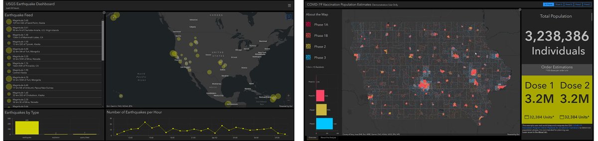
Exciting news 📢 Spatial analysis is coming to #MapViewer with an updated user experience in the next release of #ArcGISOnline. Stay on the lookout for more sneak peeks in the coming weeks 👀 Join the Early Adopter Community to learn more: esri.social/H9Th50ML6Ue

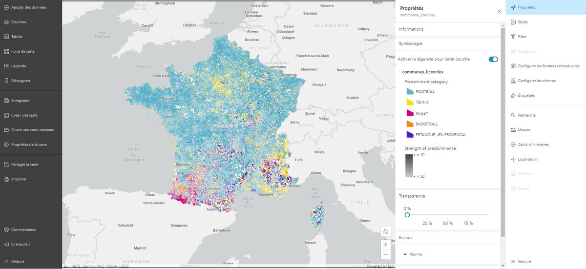
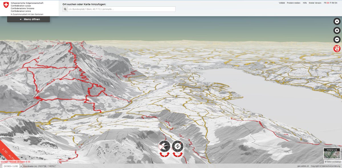
#SIG2020, démo de Julie Rasselet : très simple de concevoir une belle carte, claire et pertinente avec le nouveau #MapViewer, la visionneuse de carte totalement repensée d’@ArcGISOnline !

ArcGIS #MapViewer es el nuevo visor de #ArcGISOnline que proporciona una experiencia totalmente diferente. Más flexible, intuitivo y rápido. Juega con #datos temporales o haz filtrados dinámicos. Nos lo cuenta Marta Pérez García, Técnico GIS, en Esriblog. blog.esri.es/entrada-de-blo…
#SIG2020, démo de Julie Rasselet : utilisation du #MapViewer, la visionneuse de carte totalement repensée d’@ArcGISOnline !
The June 2022 release of #ArcGISOnline delivered many powerful enhancements to #MapViewer. Explore these new features: esri.social/MPrK50JEfVR
The latest release of #ArcGISOnline introduces the Calculate Composite Index tool in #MapViewer! Unlock the power to combine multiple numeric variables and create a single index variable, known as a composite indicator. To learn more, read the blog post: esri.social/wi1H50QL7qA
Do you have questions regarding the analysis tools released last month in #ArcGISOnline #MapViewer? Check out this blog that answers some of your most frequently asked questions! esri.social/xb9k50Nn2HV


🌍¡Te presentamos el nuevo #MapViewer para la creación de #mapas online! Sí, hemos vuelto a rediseñarlo para trabajar con nuestros #datos de forma más rápida e intuitiva. Nos lo cuenta Alba Page. #CEsri20 #DataScience #GeoDevelopers


Turno ahora de algunas de las novedades de #ArcGISOnline con Luis Íñigo: #analisis en el nuevo #MapViewer, efectos de #visualización, capas multidimensionales... 🌍 @Esri_Spain Esri #TechDay


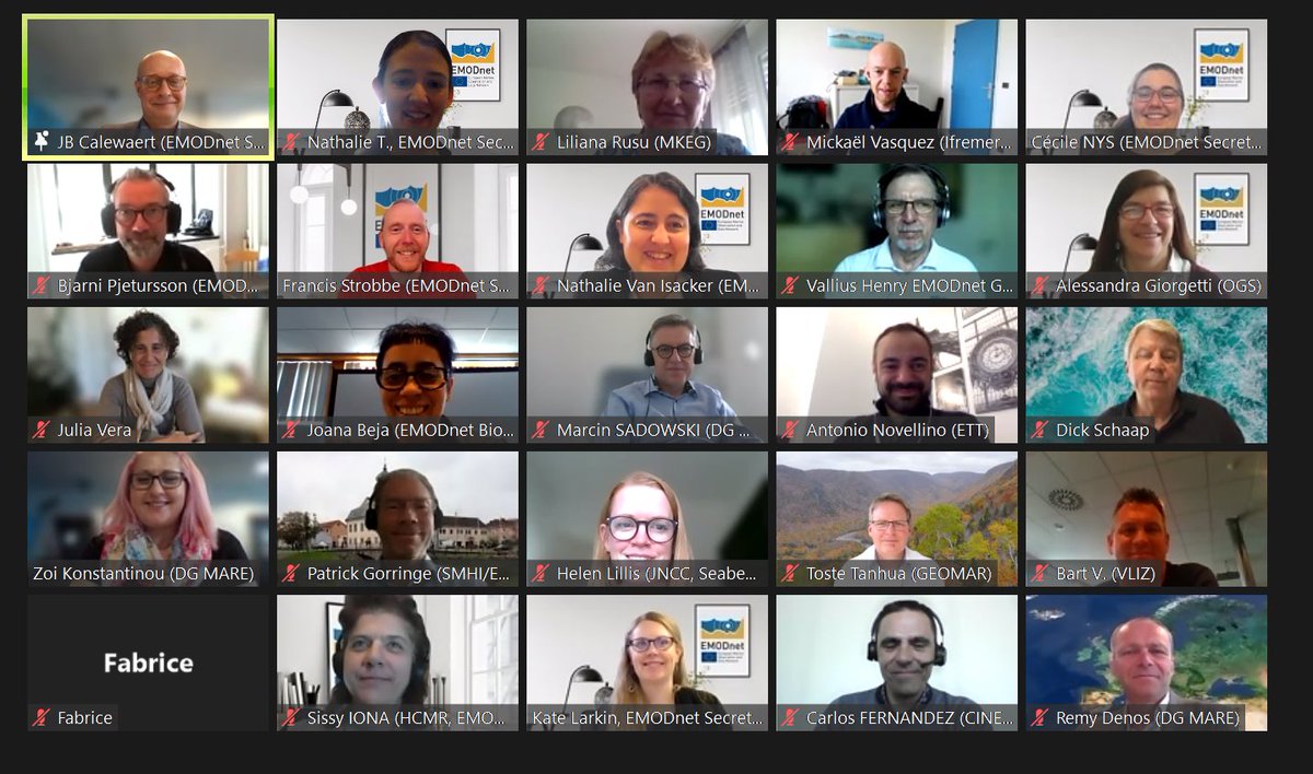
DYK #EMODnet services are evolving to simplify user data discovery, access & visualisation with a common #MapViewer by end 2022? Experts are in dialogue at the #EMODnet Steering Committee open session w/ Technical WG & EC MKEG @EU_MARE @defis_eu @EUScienceInnov @EU_ENV


What's the state-of-play of EU #energy infrastructure works? Check it out w/ updated #PCIList #MapViewer 👉goo.gl/41n49f #CEFenergy


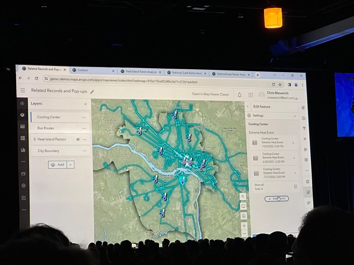
Coining the term ✨”Cloud Cartography”✨ for the new #mapviewer visualization tools #EsriUC2023 (Also SO STOKED to finally have related record editing supported after asking for it 4 years ago)

🌐💻➡️ En esta entrada se va a mostrar cómo incluir imágenes en datos de tipo punto en un visor de 𝗔𝗿𝗰𝗚𝗜𝗦 𝗼𝗻𝗹𝗶𝗻𝗲. Enlace: bit.ly/iconos_ArcGIS-… #ArcGISOnline #mapviewer #ArcGIS

💥Anoche se produjo la última actualización de #ArcGISOnline y estas son las novedades con las que ya puedes trabajar. #ArcGISDashboards #MapViewer #Apps blog.esri.es/entrada-de-blo…


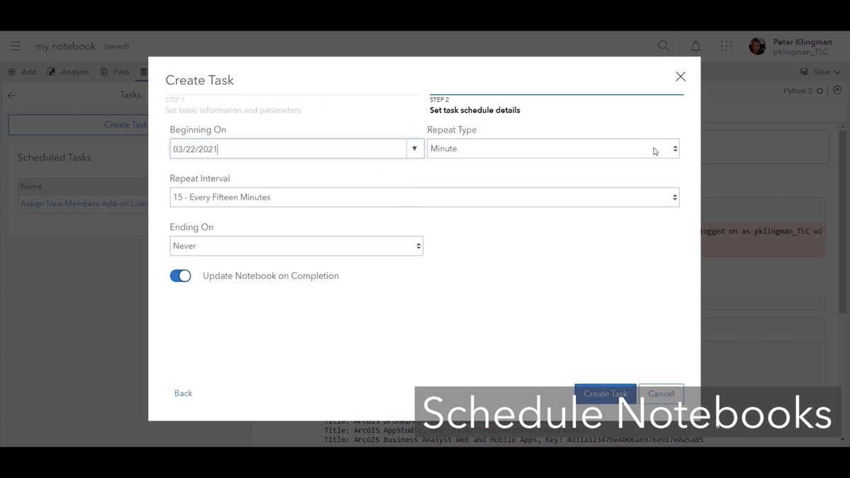
Un entrante a modo noticiero, de lo que viene en la próxima update de @ArcGISOnline en abril. Tendremos primera realease fuera de beta del nuevo #MapViewer y de #ArcGISDashboards ambos utilizando la última versión del api js, Notebooks programados..👌🏻-> youtu.be/Ngf8OmsClxc


Why not spend the weekend brushing up on your #mapping skills? Check out @LearnArcGIS' lesson on #MapViewer using #ArcGIS Enterprise or @ArcGISOnline Bonus? Your lesson is "on" Hawaii p.ctx.ly/r/888h


📣 Join our 45-min webinar Fri, 21 Nov! See how MetroMap aerial imagery helps SMBs plan smarter, make informed decisions & streamline workflows. 🎥 Demo of MapViewer + real-world examples. 👉 Register: us06web.zoom.us/webinar/regist… #AerialImagery #SMB #MapViewer #BusinessInsights
We’re thrilled to introduce the latest evolution of our intuitive web-based mapping interface, MetroMap MapViewer! Not a MetroMap user yet? Start a Free Trial Today: metromap.com.au/trial/ #MetroMap #MapViewer #AerialImagery #GIS #Geospatial #Innovation


🌐💻➡️ En esta entrada se va a mostrar cómo incluir imágenes en datos de tipo punto en un visor de 𝗔𝗿𝗰𝗚𝗜𝗦 𝗼𝗻𝗹𝗶𝗻𝗲. Enlace: cursosgis.com/como-incluir-i… #ArcGISOnline #mapviewer #ArcGIS
cursosgis.com
Cómo incluir iconos en la simbología en un “Map Viewer” de ArcGIS online
La simbología es uno de los pilares del desarrollo de un visor web, es muy importante incluir unos símbolos que de manera rápida e intuitiva permitan al usuario reconocer la información que se...
Take your maps to the next level with #MapViewer! Join our sessions at #EsriUC2025 to learn how to create stunning, informative maps and enhance decision-making. Check out more details on Map Viewer and our sessions below 🗺️💫 Learn more ➡️ ow.ly/PTvo50WopwZ


🚀𝗔𝗿𝗰𝗚𝗜𝗦 𝗢𝗻𝗹𝗶𝗻𝗲-𝘂𝗽𝗱𝗮𝘁𝗲 𝗷𝘂𝗻𝗶 𝟮𝟬𝟮𝟱 𝗯𝗲𝘀𝗰𝗵𝗶𝗸𝗯𝗮𝗮𝗿 De update brengt krachtige verbeteringen die uw ArcGIS-ervaring naar een hoger niveau tillen. Ontdek hier de nieuwste mogelijkheden: okt.to/HYQ0ys #ArcGISOnline #MapViewer #release
esri.nl
What's new in ArcGIS Online juni 2025
What's new in ArcGIS Online juni 2025
🌐💻➡️ En esta entrada se va a mostrar cómo incluir imágenes en datos de tipo punto en un visor de 𝗔𝗿𝗰𝗚𝗜𝗦 𝗼𝗻𝗹𝗶𝗻𝗲. Enlace: cursosgis.com/como-incluir-i… #ArcGISOnline #mapviewer #ArcGIS
cursosgis.com
Cómo incluir iconos en la simbología en un “Map Viewer” de ArcGIS online
La simbología es uno de los pilares del desarrollo de un visor web, es muy importante incluir unos símbolos que de manera rápida e intuitiva permitan al usuario reconocer la información que se...

Разбрахте ли за всички полезни и вълнуващи новости, които вече са налични в Map Viewer, част от #ArcGISOnline? От по-лесно редактиране и анимирани символи до подобрени маршрути и разширени анализи, сега #MapViewer е по-мощен и интуитивен от всякога 👉 bit.ly/3DjTPUm
🌐💻➡️ En esta entrada se va a mostrar cómo incluir imágenes en datos de tipo punto en un visor de 𝗔𝗿𝗰𝗚𝗜𝗦 𝗼𝗻𝗹𝗶𝗻𝗲. Enlace: cursosgis.com/como-incluir-i… #ArcGISOnline #mapviewer #ArcGIS
cursosgis.com
Cómo incluir iconos en la simbología en un “Map Viewer” de ArcGIS online
La simbología es uno de los pilares del desarrollo de un visor web, es muy importante incluir unos símbolos que de manera rápida e intuitiva permitan al usuario reconocer la información que se...

Great news! #ModelBuilder (Beta) is now available in #MapViewer! Build #models that connect #analysistools and #data together. Read more about the update in the #ArcGIS blog post. Happy Modelling! #GIS #ArcGISOnline #STEAM #GISSkills #mapping esri.com/arcgis-blog/pr…

🌐💻➡️ En esta entrada se va a mostrar cómo incluir imágenes en datos de tipo punto en un visor de 𝗔𝗿𝗰𝗚𝗜𝗦 𝗼𝗻𝗹𝗶𝗻𝗲. Enlace: bit.ly/iconos_ArcGIS-… #ArcGISOnline #mapviewer #ArcGIS
cursosgis.com
Cómo incluir iconos en la simbología en un “Map Viewer” de ArcGIS online
La simbología es uno de los pilares del desarrollo de un visor web, es muy importante incluir unos símbolos que de manera rápida e intuitiva permitan al usuario reconocer la información que se...
🌐💻➡️ En esta entrada se va a mostrar cómo incluir imágenes en datos de tipo punto en un visor de 𝗔𝗿𝗰𝗚𝗜𝗦 𝗼𝗻𝗹𝗶𝗻𝗲. Enlace: cursosgis.com/como-incluir-i… #ArcGISOnline #mapviewer #ArcGIS


🚗 🗺️ Use the Network Analyst 𝘳𝘰𝘶𝘵𝘦 𝘴𝘰𝘭𝘷𝘦𝘳 to calculate the travel time or distance between origin/destination pairs across Esri products: #MapViewer, #ArcGISPro, #REST, & #Python API. ow.ly/M7XL50T6iu0


🚗 🗺️ Use the Network Analyst 𝘳𝘰𝘶𝘵𝘦 𝘴𝘰𝘭𝘷𝘦𝘳 to calculate the travel time or distance between origin/destination pairs across Esri products: #MapViewer, #ArcGISPro, #REST, & #Python API. ow.ly/J5CO50T4pgb


Saviez-vous qu'il était possible de publier un #Notebook en tant qu'outil web sur votre plateforme #ArcGIS afin de l'utiliser dans des applications comme le #MapViewer ou #ExperienceBuilder ? Apprenez comment faire dans #tutoriel : codethemap.fr/2024/08/api-py… @Esri_France


In this webinar, we will cover the basic tools in Map Viewer and app builders as well as some of the more advanced tools available with the new ArcGIS Web Editor. @esriuk #SweetForArcGIS #MapViewer #ArcGIS #WebEditor esri.social/QKkM50SPZK5

🎓 Learn to track temporal data in ArcGIS. Follow along and learn to configure temporal data in this public dataset from Boston bike rideshare BlueBikes using ArcGIS Expression Builder, #Arcade, #ArcGISPro, and #MapViewer. ow.ly/liSk50SSAAi

🌐💻➡️ En esta entrada se va a mostrar cómo incluir imágenes en datos de tipo punto en un visor de 𝗔𝗿𝗰𝗚𝗜𝗦 𝗼𝗻𝗹𝗶𝗻𝗲. Enlace: cursosgis.com/como-incluir-i… #ArcGISOnline #mapviewer #ArcGIS


Estan geniales las nuevas guias al momento de editar en #mapviewer de #ArcGIS Online? Cómo las estas utilizando?
ArcGIS #MapViewer es el nuevo visor de #ArcGISOnline que proporciona una experiencia totalmente diferente. Más flexible, intuitivo y rápido. Juega con #datos temporales o haz filtrados dinámicos. Nos lo cuenta Marta Pérez García, Técnico GIS, en Esriblog. blog.esri.es/entrada-de-blo…
Turno ahora de algunas de las novedades de #ArcGISOnline con Luis Íñigo: #analisis en el nuevo #MapViewer, efectos de #visualización, capas multidimensionales... 🌍 @Esri_Spain Esri #TechDay


JAVA ?? You can install OC4J 10.1.3.5 on Win7 & JDK6_48 and then Oracle #MapViewer 11.1.1.6 (Feb. 2012!) and it works always fine ! Thanks.

The June 2022 release of #ArcGISOnline delivered many powerful enhancements to #MapViewer. Explore these new features: esri.social/MPrK50JEfVR
#SIG2020, démo de Julie Rasselet : très simple de concevoir une belle carte, claire et pertinente avec le nouveau #MapViewer, la visionneuse de carte totalement repensée d’@ArcGISOnline !
#SIG2020, démo de Julie Rasselet : utilisation du #MapViewer, la visionneuse de carte totalement repensée d’@ArcGISOnline !
Coining the term ✨”Cloud Cartography”✨ for the new #mapviewer visualization tools #EsriUC2023 (Also SO STOKED to finally have related record editing supported after asking for it 4 years ago)
I've just prepared a lite version of my #mapviewer built with #Construct3 and a bit of #javascript #JavaScript #JS #NodeJS #Node #Construct2 #Construct3 #gamedev #indiedev #Demo #100DaysOfCode
The latest release of #ArcGISOnline introduces the Calculate Composite Index tool in #MapViewer! Unlock the power to combine multiple numeric variables and create a single index variable, known as a composite indicator. To learn more, read the blog post: esri.social/wi1H50QL7qA
Do you have questions regarding the analysis tools released last month in #ArcGISOnline #MapViewer? Check out this blog that answers some of your most frequently asked questions! esri.social/xb9k50Nn2HV
🌐💻➡️ En esta entrada se va a mostrar cómo incluir imágenes en datos de tipo punto en un visor de 𝗔𝗿𝗰𝗚𝗜𝗦 𝗼𝗻𝗹𝗶𝗻𝗲. Enlace: bit.ly/iconos_ArcGIS-… #ArcGISOnline #mapviewer #ArcGIS

Great review of the New #MapViewer at #esriEDUC session Day 2 2021educ.hub.arcgis.com/pages/new-map-… #arcgisonline Thank you @kylie_donia @josephkerski @GIS4Teachers @GISAmbassador


🌍¡Te presentamos el nuevo #MapViewer para la creación de #mapas online! Sí, hemos vuelto a rediseñarlo para trabajar con nuestros #datos de forma más rápida e intuitiva. Nos lo cuenta Alba Page. #CEsri20 #DataScience #GeoDevelopers
Why not spend the weekend brushing up on your #mapping skills? Check out @LearnArcGIS' lesson on #MapViewer using #ArcGIS Enterprise or @ArcGISOnline Bonus? Your lesson is "on" Hawaii p.ctx.ly/r/888h
💥Anoche se produjo la última actualización de #ArcGISOnline y estas son las novedades con las que ya puedes trabajar. #ArcGISDashboards #MapViewer #Apps blog.esri.es/entrada-de-blo…

Navigate, measure, sketch, explore layers, and interrogate data in this new, multimedia StoryMap introducing Map Viewer. esriurl.com/ago5x5sm #arcgis @GISEd #mapviewer #storymap
¿Has probado ya el nuevo #MapViewer de #ArcGISOnline? Ofrece rendimiento mejorado gracias a la última versión de API JavaScript de #ArcGIS, leyenda #DotDensity, #Arcade integrado... ¡Nos lo ha mostrado Alba Page en #CEsri20!

Something went wrong.
Something went wrong.
United States Trends
- 1. #FanCashDropPromotion 2,045 posts
- 2. Good Friday 61.8K posts
- 3. #FridayVibes 5,171 posts
- 4. #FursuitFriday 11.4K posts
- 5. Kenyon 1,108 posts
- 6. #FridayFeeling 2,733 posts
- 7. Happy Friyay 1,408 posts
- 8. Sedition 365K posts
- 9. LINGORM DIOR AT MACAU 623K posts
- 10. RED Friday 3,883 posts
- 11. #FridayMotivation 3,756 posts
- 12. Ja Rule 1,280 posts
- 13. Eric Swalwell 4,119 posts
- 14. Maggie 31K posts
- 15. ON SALE NOW 11.9K posts
- 16. Traitor 135K posts
- 17. Knox 6,427 posts
- 18. woozi 39.8K posts
- 19. Mark Kelly 76.9K posts
- 20. Dubai Air Show 50.5K posts