#openstreetmap search results

Read the latest newsletter covering project updates and #maplibre's #FOSS4G talks & workshops 🌍 🙏 Thanks to @radarlabs for their continued sponsorship! maplibre.org/news/2025-11-0… #OpenStreetMap #OpenSource #SoTMEU2025 #foss4g2025 #foss4gna


Creando mapas con 𝙘𝙖𝙧𝙩𝙤𝙜𝙧𝙖𝙥𝙝𝙧 en #R 𝙘𝙖𝙧𝙩𝙤𝙜𝙧𝙖𝙥𝙝𝙧 facilita enormemente la creación de mapas atractivos y funcionales en R, evitando la necesidad de realizar consultas complejas a #OpenStreetMap mappinggis.com/2025/10/creand…


ISTANBUL - My first RStudio experience with the training of @milosmakesmaps. For some unknown reason, I couldn't get a complete printout, but I closed it skillfully. 🤭😎 #OpenStreetMap #RStudio


地域を歩きながらウィキペディア記事を確認できるマップアプリ「WikiWalk」を作成しました! ウィキペディアタウンの役に立てばと思って作りました。 ↓から利用できます。 wiki-walk.vercel.app 足りていないことも多いと思うので指摘いただけると助かります #wikipediatown #OpenStreetMap

🗺️A Minimalistic 3D Map of Central Park 🏞️ in Manhattan, New York City 🇺🇸 made using the Highest Hit DSM (2017) from the New York GIS Clearinghouse, overlaid with #OpenStreetMap #centralpark #nyc #USA #America #gischat #Cartography #dataviz #b3d #blender #NYCOpenData


Now I started crafting 3D city maps and my first one is from Caracas🇻🇪. Thanks to @openstreetmap for the buildings, roads, parks, and water layers. Which city should I do next? #OpenStreetMap🗺 #CityMaps🏙 #R📊 #RStudio💻


Here is Barcelona🇻🇪, the capitol of Anzoategui state. The city was established in 1671 by settlers from the Spanish region of Catalonia, and they named it after their home city of Barcelona, Spain. Which city should I do next? #OpenStreetMap🗺 #CityMaps🏙 #R📊 #RStudio💻


We play a role in inclusive planning by making underserved areas visible, ensuring no community is overlooked. Mapping these gaps makes it easier to identify where clinics, outreach programs, or new health facilities are most urgently needed. #OpenStreetMap #HealthForAll


Lo que pienso cuando alguien me pregunta "¿cómo se hace para que Google muestre el nombre correcto de mi calle?" Usen mapas buenos, usen #OpenStreetMap

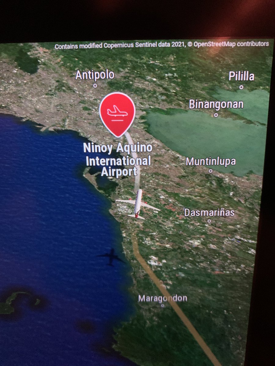
How cool to see #OpenStreetMap on my @airindia flight to attend the OpenStreetMap conference in Manila #sotm2025 Bonus: We got a water cannon salute as it was also the first ever direct flight between India and the Philippines. AI crew and inflight service was fantastic ❤️

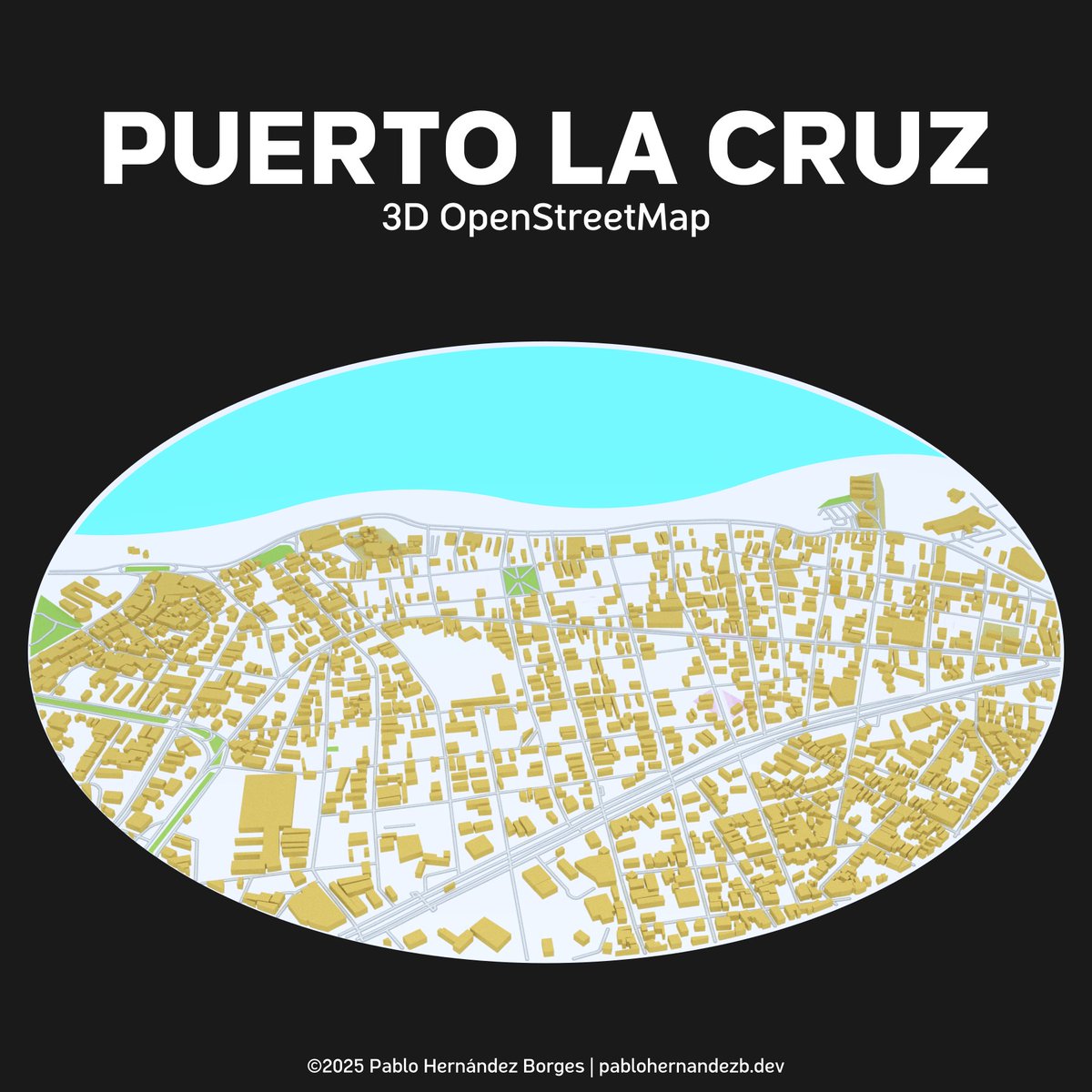
Puerto La Cruz is the main maritime hub for accessing the spectacular islands and beaches of Mochima National Park, a vast coastal and marine reserve; is also the location of one of Venezuela's largest oil refineries. #OpenStreetMap🗺 #CityMaps🏙 #R📊 #RStudio💻
Lechería is the smallest municipality in all of Venezuela by area, covering only about 12 square kilometers; It is simultaneously considered one of the wealthiest cities known for its elaborate canal systems for boat access. #OpenStreetMap🗺 #CityMaps🏙 #R📊 #RStudio💻

Trials maps of my local town using the new #openstreetmap vector tiles shortbread-tiles.org/schema/1.0/ in #qgis. It's possible to generate this for any other location. Feel free to request. © OpenStreetMap Contributors. Contours using NASADEM


みんなで「あさけ」界隈を歩いてウィキペディアと世界地図に足跡を残そう。 申込は logoform.jp/form/7p72/1172… #あさけプラザ #Wikipedia #openstreetmap

Maracay is known as the Garden City🌷🌻 due to its many parks, green spaces, and tree-lined avenues. It is also often called the "Cradle of Venezuelan Aviation" as it is home to important air facilities. Which city should I do next? #OpenStreetMap🗺 #CityMaps🏙 #R📊 #RStudio💻


満場で万博入れないからOSMの万博マッピング中。今でもそこそこ精度はあるけど、将来に渡って活用されるので、もう一段階精度を上げたり情報追加を行っておきたい所。まぁ、体力と気力的に限界あるので、無理しない範囲で頑張ろうー。 #OpenStreetMap

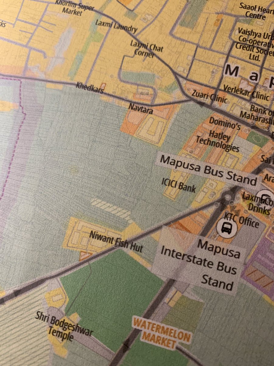
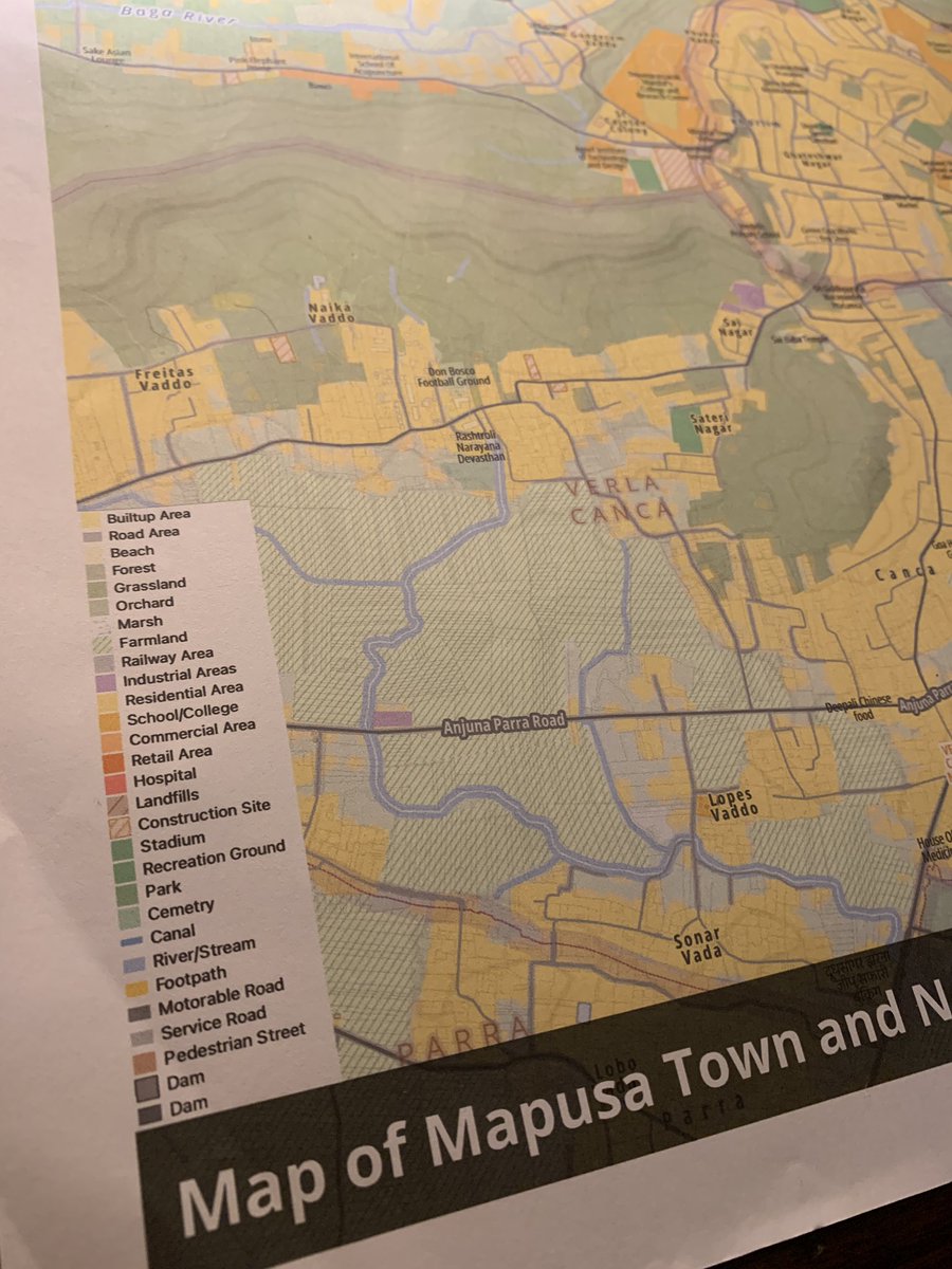
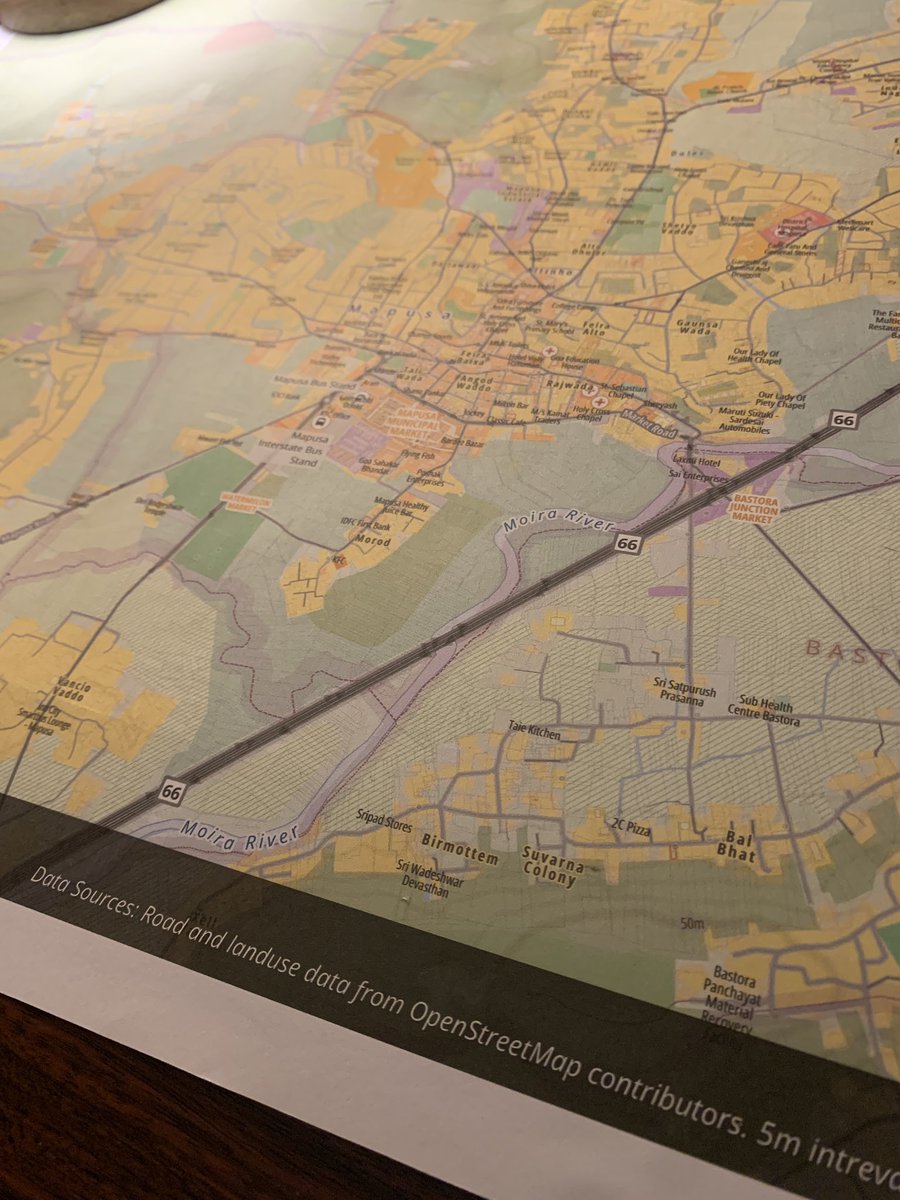
Being next door to a good printer has been fun. First trial of an A2 size color print. Costed Rs150 ($2) at Mapusa, #Goa. Tried including individual parcel boundaries with 0.1mm width and it printed fine 🤯 Map designed in #qgis using #openstreetmap data.


OSM Daily Stats 📊 Users: 10,064,518 👥 Users that... edited nodes: 5,877 ✏️ uploaded GPX: 203 🗺️ Top 3 editors: 1. KingVik - 79,842 🥇 2. s1kk4z - 78,484 🥈 3. okadatsuneo_import - 60,401 🥉 Report run at 2025-11-07 00:00:14 UTC #OSMstats #OSM #OpenStreetMap


Ya está abierto el proceso de inscripción del State of the Map España que estamos preparando para el 13 de diciembre en #Zaragoza, ¡si quieres estar al tanto de todas las novedades de #OpenStreetMap en España apúntate! 2025.geocamp.es

Angers: Rencontre mensuelle OpenStreetMap, Le jeudi 6 novembre 2025 de 18h00 à 19h00. agendadulibre.org/events/33862 #openstreetmap #osm #cartographie #rencontreMensuelle #openstreetmapAngers #rencontre

#FEED #THEPEOPLE #OpenStreetMap #OPENUPGOVERNMENTNOW #SNAP #MERCILESS #Felon47President #Felon47 @BerniceKing YOUR MOTHER HELD MY HAND LEAVING CHURCH EYE WAS 13 IAM.BLESSED SO VERY SORRY BERNICE IAM HORRIFIED ADMINISTRATION MY GREAT UNCLE #RANDOLPHEPAUL #CONGRESS Murdered Him♡


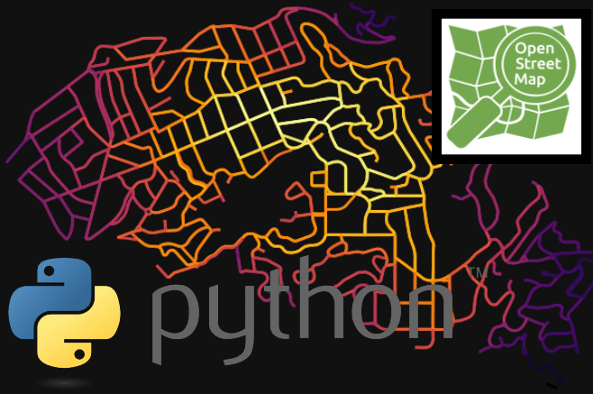
Migrating from ##Google Maps to #OpenStreetMap with #Leaflet, in few minutes with GitHub Copilot Coding Agent! 1. Ask to Generate plan & Doc 2. Review 3. Implement 4. Review, Test 5. Done ✅ This is wild. (Will do a video soon!) #Coding #Agentic #GitHub #Copilot


We’re joining #StateoftheMap Kerala pre-event tomorrow! Catch us as we share how crowdsourced geodata helps UN operations and impact communities! 💙 Thank you #OpenStreetMap Kerala for inviting us 🙌🏼 #UNMaps #UNMappers #opendata #volunteering #UNVolunteering #openmapping


Nu tal for 18 måneders geodata-produtktion overvågning m. #openstreetmap DK og GeoFA. Målt på 38 rekreative typer. OSM har i alt 149,9K og GeoFA har i alt 14,4K objekter - KL mener stadigvæk at GeoFa for turismedata er en samfundsmæssig økonomisk god ide docs.google.com/spreadsheets/d…


OSM Daily Stats 📊 Users: 10,061,512 👥 Users that... edited nodes: 6,046 ✏️ uploaded GPX: 218 🗺️ Top 3 editors: 1. dmich9 - 322,311 🥇 2. CasGroenigen - 68,742 🥈 3. mzve - 41,197 🥉 Report run at 2025-11-06 00:00:15 UTC #OSMstats #OSM #OpenStreetMap

In 2019, I was vilified in Vienna as a "couch potato" – because I added house numbers to #OpenStreetMap on the ground. Today, the official city map of #Vienna opens its doors to OSM data. community.openstreetmap.org/t/braucht-irge… Reality has prevailed. Crowds > bureaucratic inertia.…
2019 wurde ich in Wien als „Sesselmapper“ diffamiert – weil ich in #OpenStreetMap Hausnummern vor Ort ergänzt habe. Heute öffnet der amtliche Stadtplan #Wien seine Türen für OSM-Daten. community.openstreetmap.org/t/braucht-irge… Die Realität hat gesiegt. Crowd > Amtsträgheit. openstreetmap.home.blog/2019/10/04/exp…
Thank you for joining our Mappy H🕙ur in September & October! 💙 The recording of the October #MappyHour is on Youtube🎥 youtu.be/1QcfwhYhdM0 We hope to see you again for this month! 📍Register: eventbrite.com/e/un-mappers-m… #OpenStreetMap #opendata #volunteering #events #gischat


Leafletで地図に線を描く!GeoJSONとCSSで自在カスタム! #OpenStreetMap #高槻 #プログラミング教室 #AI広報 #Gemini saitodev.co/programming/ja…
少しお手伝いさせて頂いています! 家島の魅力発信をしつつ、デジタルアーカイブが進む仕組みを作れたらと考えています。 #OpenStreetMap #wikimedia

/ 辻本ゼミの3年生が 『Open Street Map』で家島の魅力発信に挑戦! \ 2023年度から『家島活性化プロジェクト』に取り組んでいる辻本ゼミ。4年生は改修に取り組んだ空き家『家島BASE』の整備・ルール作りに、3年生は家島の魅力発見と情報発信を軸に活動しています ▼詳細 umds.ac.jp/251023-3/

Universidad Santa María — where Caracas turns into countryside. Sitting in La Urbina, right on the city’s edge, is surrounded by green slopes, open spaces, and that unmistakable view of El Ávila. Which university should I do next? #OpenStreetMap🗺 #CityMaps🏙 #R📊 #RStudio💻


#30DayMapChallenge Day.1 - Points お題の'Point'に岬という意味があるらしいので、 岬に関連する地名(岬・崎/埼)を地図上で色分けしてみました。 データ元は #OpenStreetMap です。

Creando mapas con 𝙘𝙖𝙧𝙩𝙤𝙜𝙧𝙖𝙥𝙝𝙧 en #R 𝙘𝙖𝙧𝙩𝙤𝙜𝙧𝙖𝙥𝙝𝙧 facilita enormemente la creación de mapas atractivos y funcionales en R, evitando la necesidad de realizar consultas complejas a #OpenStreetMap mappinggis.com/2025/10/creand…
🗺️A Minimalistic 3D Map of Central Park 🏞️ in Manhattan, New York City 🇺🇸 made using the Highest Hit DSM (2017) from the New York GIS Clearinghouse, overlaid with #OpenStreetMap #centralpark #nyc #USA #America #gischat #Cartography #dataviz #b3d #blender #NYCOpenData
満場で万博入れないからOSMの万博マッピング中。今でもそこそこ精度はあるけど、将来に渡って活用されるので、もう一段階精度を上げたり情報追加を行っておきたい所。まぁ、体力と気力的に限界あるので、無理しない範囲で頑張ろうー。 #OpenStreetMap
Lo que pienso cuando alguien me pregunta "¿cómo se hace para que Google muestre el nombre correcto de mi calle?" Usen mapas buenos, usen #OpenStreetMap
と言う訳で、万博の大規模マッピングはこれで最後。 ドイツとルクセンブルク館の形状を修正、大屋根リングの通路を整えて正確性を向上。まだまだ描ける所は山積みだけど、この半年間頑張ったと思う。誰か褒めてください(笑) #OpenStreetMap #EXPO2025 #大阪・関西万博

ISTANBUL - My first RStudio experience with the training of @milosmakesmaps. For some unknown reason, I couldn't get a complete printout, but I closed it skillfully. 🤭😎 #OpenStreetMap #RStudio

#30DayMapChallenge Day 30: 👔 Corporate map edits in #OpenStreetMap 👔 Companies like Apple, Microsoft, Meta and Amazon have started editing OSM. In many countries, an increase in corporate contributions led to a decrease in other contributions. 🗺️ by L. Tockner & B. Herfort


機関誌『地図』62-4🗺️ なんと切り絵の地図、 カレンダーが添付地図です!! ポスターサイズでデザインしました。 会員の皆さまへお届けできて嬉しい限りです🥰 表紙も切り絵の地図、感激です😭✨ ありがとうございます! 今年もよろしくお願いします🙇♀️ #日本地図学会 #openstreetmap


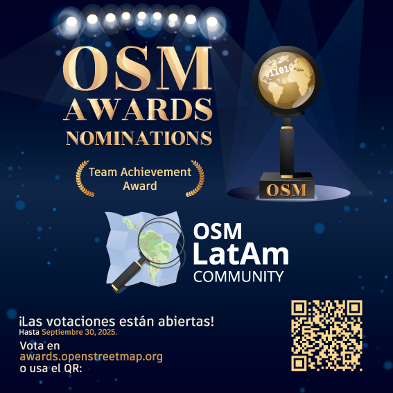
¡Estamos honrados y emocionados! Un agradecimiento enorme a todos los que contribuyen día a día. ¡Esta nominación es de tod@s y para tod@s! Vota: awards.openstreetmap.org ¡Sigamos mapeando en comunidad! 🌎💚 #OpenStreetMap #OSMLatam #OSMAwards2025
Being next door to a good printer has been fun. First trial of an A2 size color print. Costed Rs150 ($2) at Mapusa, #Goa. Tried including individual parcel boundaries with 0.1mm width and it printed fine 🤯 Map designed in #qgis using #openstreetmap data.
🎉 Our Mapper of the Month for October is Rubi Shrestha from Nepal🇳🇵 Rubi is our top mapper for the @FAO #AgriculturalWaterways Project 4 - she completed 204 tasks & mapped 323 km of waterways. Read our blog👉 tinyurl.com/MOTM1025 #UNMappers #OpenStreetMap #MapperoftheMonth


¿Qué tanto es tantito? #OpenStreetMap es una increíble herramienta donde miles de mapeadores voluntarios alrededor de mundo plasman cada detalle. Aquí un excelente ejemplo en la #CDMX. Hospital General de México: ⬅️Mayo 2025 ➡️Octubre 2025


Hace un rato en el @flisol_bogota hablando de mapeo abierto, proyectos colaborativos, el valor de la comunidad #OpenStreetMap y la importancia del mapa como herramienta de transformación social.


Blenderを3年ぶりに。登戸から和泉多摩川の地図を3Dでミニチュアっぽいライティングで表示してみた。影の付け方とか、構図をどうするかで時間が溶けていく。#openstreetmap #GIS SRTMデータ提供: NASA/JPL/NGA データアクセス: OpenTopography


Geofrey Kateregga Community project lead from the @hotosm Team elaborated on their impactful projects. He addressed the challenges mappers face and proposed solutions to overcome them for more effective humanitarian efforts. #HumanitarianMapping #OpenStreetMap #SOTMRW2024
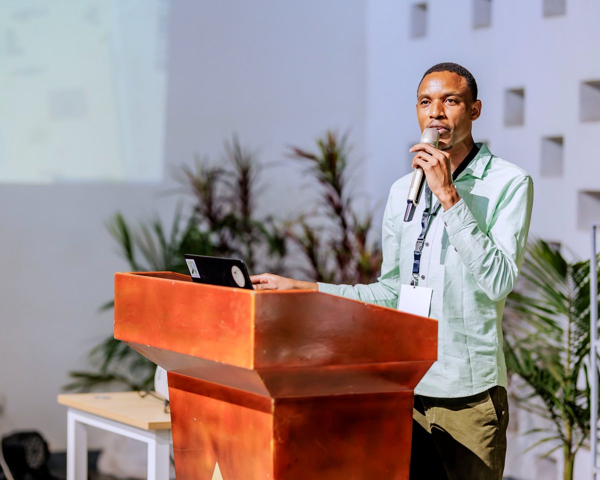
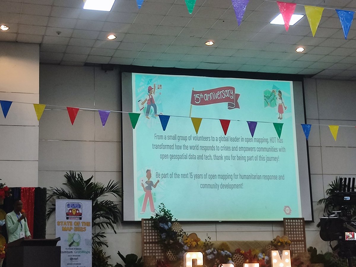
CELEBRATING 15 YEARS OF MAPPING A BETTER WORLD! 🎉🎉🎉 @kateregga1 takes the stage to share an exciting overview of Humanitarian OpenStreetMap Team's (HOT) remarkable 15-year journey and impactful activities! 🌎💻 #sotm2025 #OpenStreetMap #SOTM #sotmManila


Something went wrong.
Something went wrong.
United States Trends
- 1. $APDN $0.20 Applied DNA N/A
- 2. $SENS $0.70 Senseonics CGM N/A
- 3. $LMT $450.50 Lockheed F-35 N/A
- 4. #CARTMANCOIN 1,968 posts
- 5. yeonjun 269K posts
- 6. Broncos 68K posts
- 7. Raiders 66.6K posts
- 8. #iQIYIiJOYTH2026 1.4M posts
- 9. Bo Nix 18.7K posts
- 10. Geno 19.5K posts
- 11. daniela 56.7K posts
- 12. Tammy Faye 1,750 posts
- 13. Kehlani 11.7K posts
- 14. MIND-BLOWING 22.4K posts
- 15. #Pluribus 3,157 posts
- 16. John Wayne 1,102 posts
- 17. Danny Brown 3,359 posts
- 18. Sean Payton 4,896 posts
- 19. #NOLABELS_PART01 1,322 posts
- 20. Kenny Pickett 1,529 posts