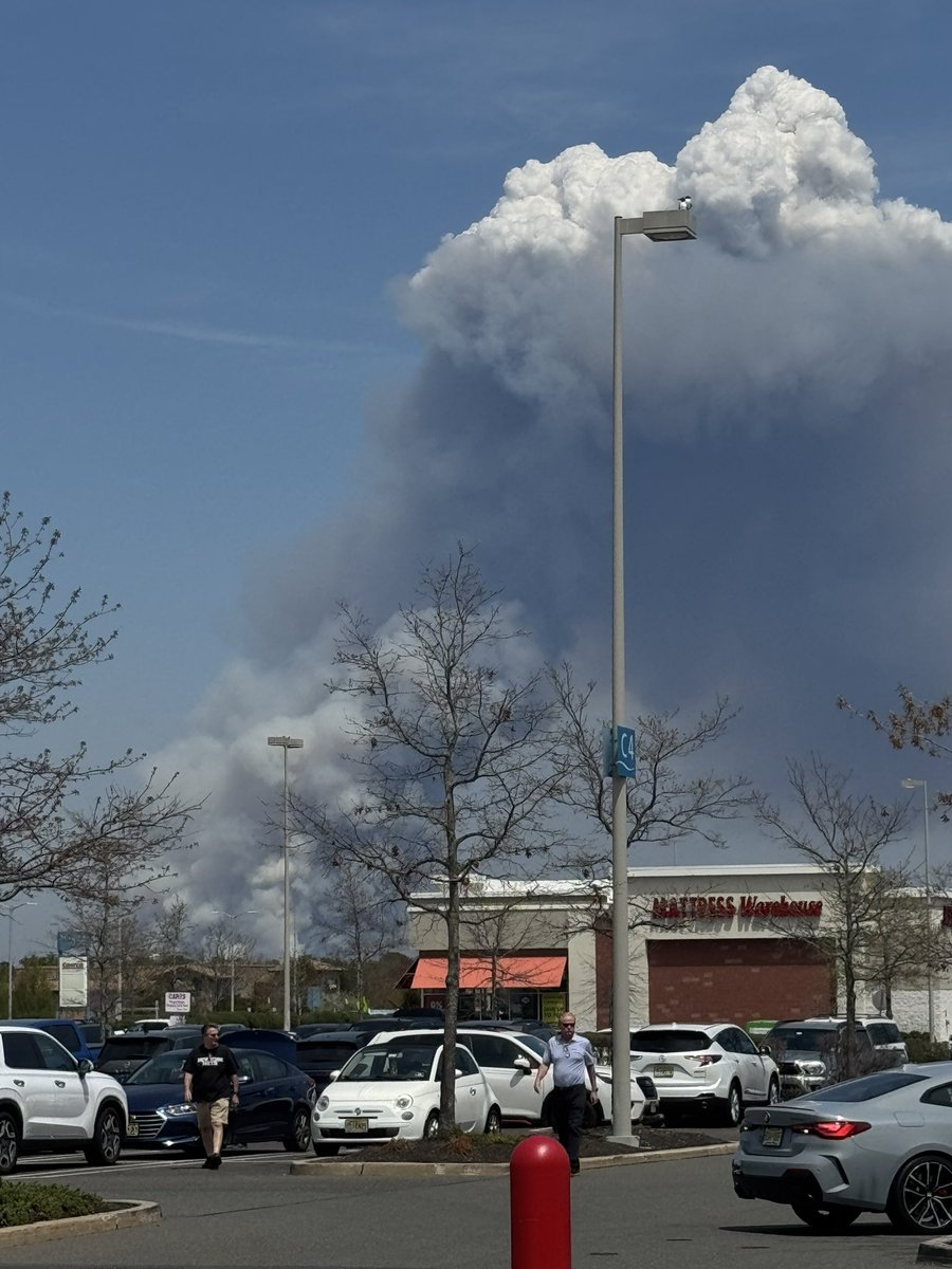
#pyrocumulus search results

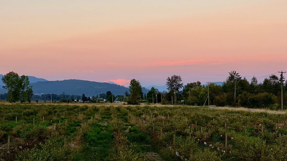
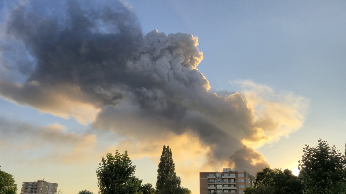
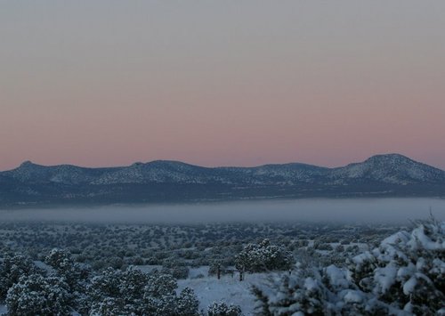
Rare #pyrocumulus cloud formed briefly above a field fire this afternoon just 2 miles north of NIU! #ilwx

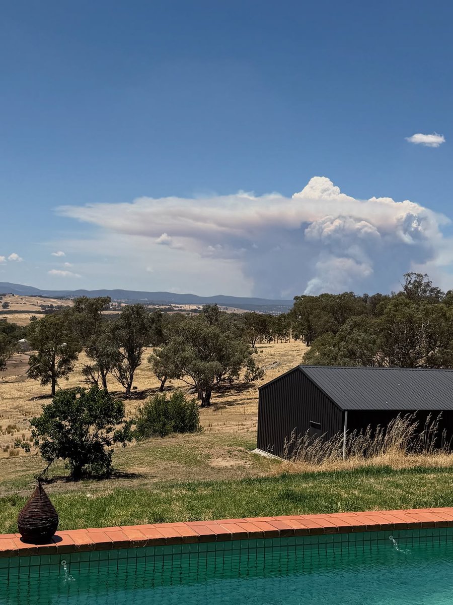
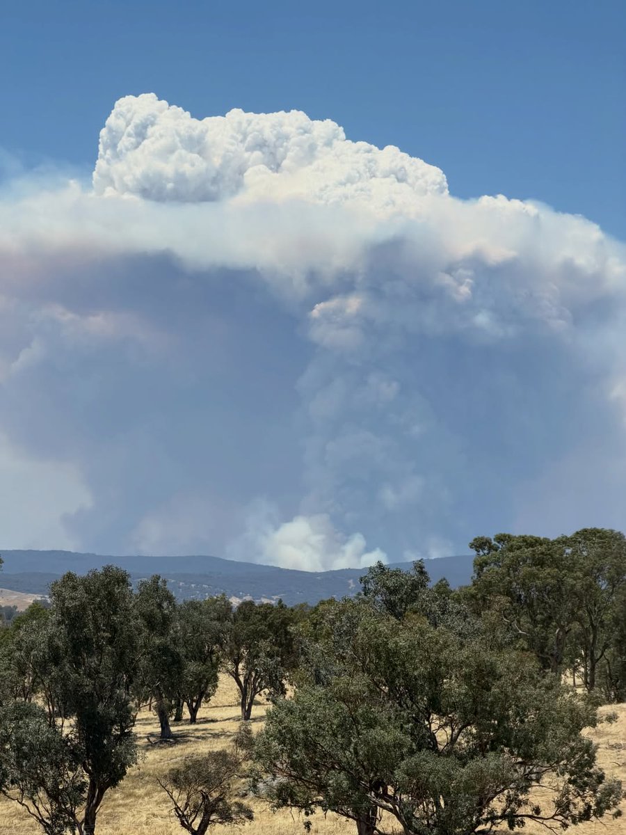
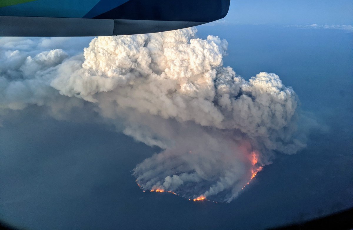
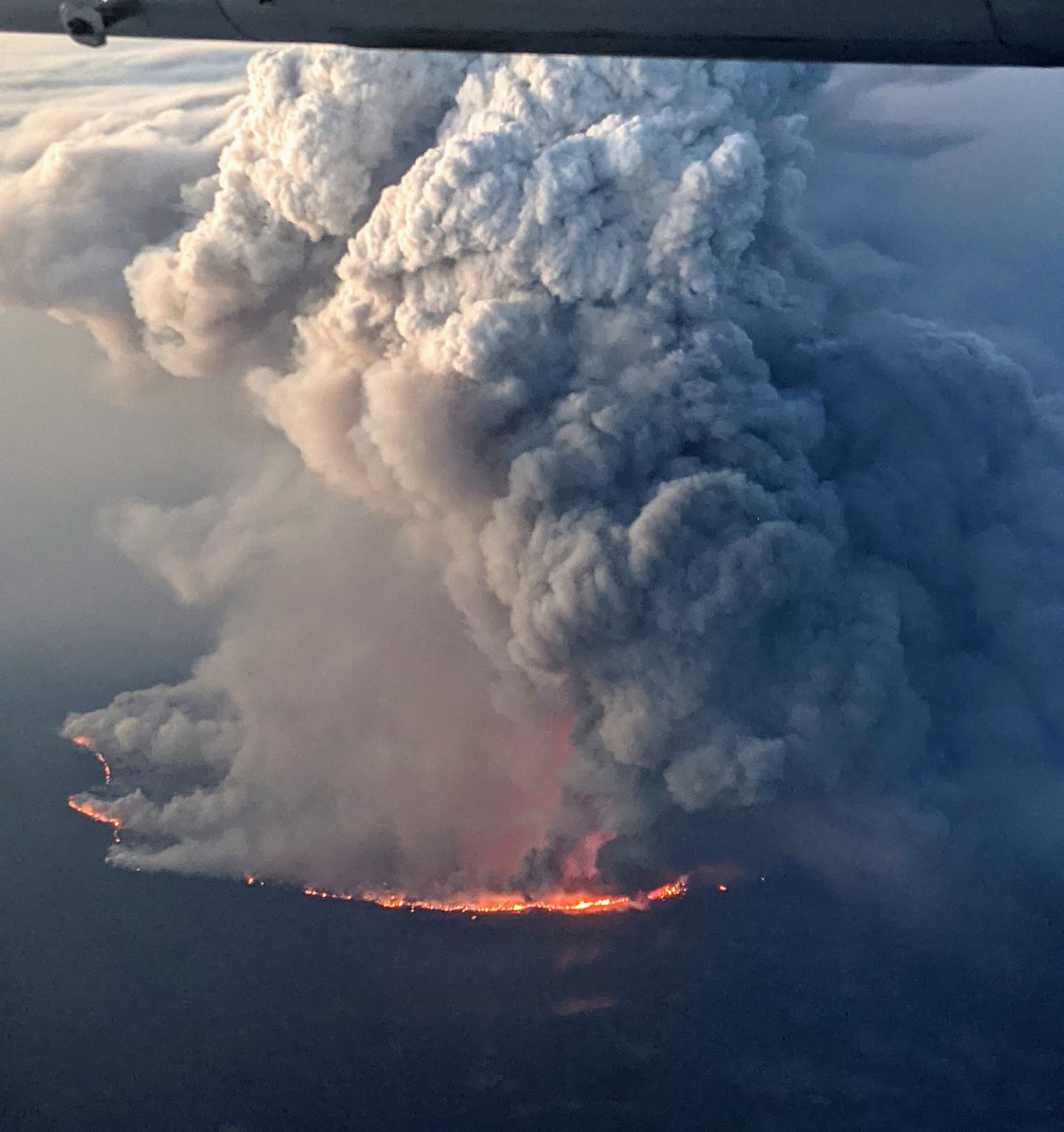
Two fires too many 😢. View of the #AlexanderMountainFire (left vertical plume with #Pyrocumulus), and #StoneCanyonFire (smoke plume tilted to the right). #COwx


Really cool view from Manahawkin of a recent smoke plume flare up (shown on radar) from the Jones Road fire. You can see it become a pyrocumulus cloud with the interaction from a sea breeze. #NJwx #JonesRoadFire #pyrocumulus #meteorology 📸 Taken by WeatherWorks Meteorologist
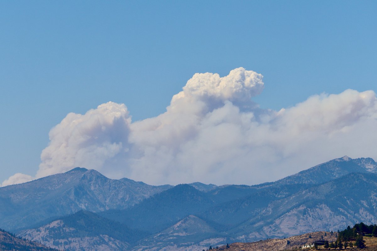
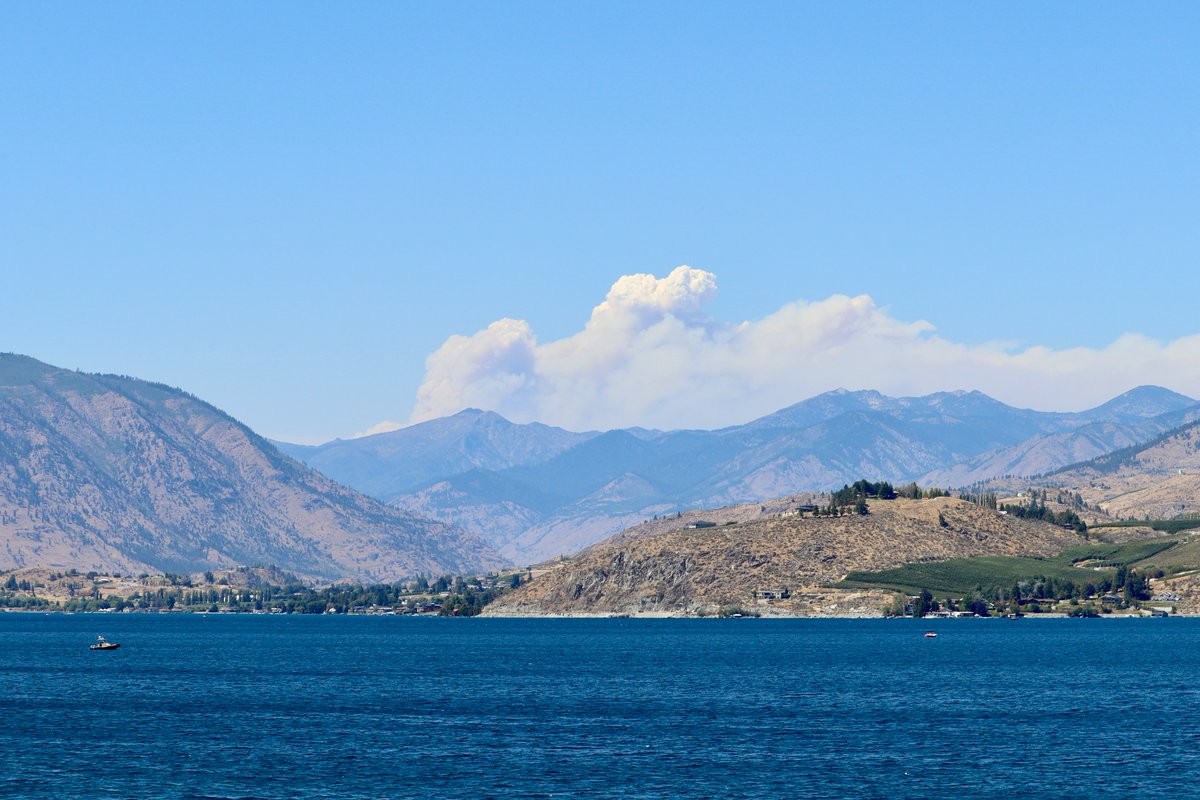
Saw my first #pyrocumulus cloud today, viewing the #PioneerFire from Chelan, WA, about 40 miles SE of the fire. The Pioneer Fire has burned over 30,000 acres, and continues to threaten the town of Stehekin. #wawx @HotshotWake @Wa_fire_watch @weatherchannel @JimCantore

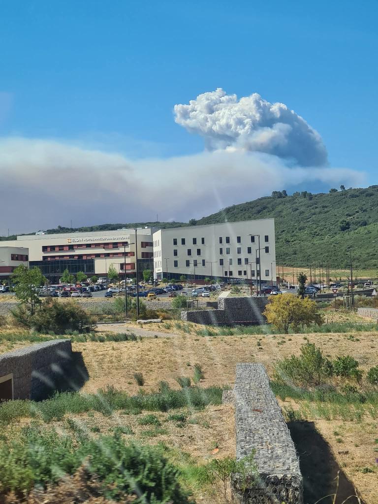
🔴 DIRECT 11h45 : l’incendie de l’Aude regagne en intensité depuis quelques minutes. Un #pyrocumulus se forme et est visible depuis Narbonne 🔥 #Aude #incendie #feu

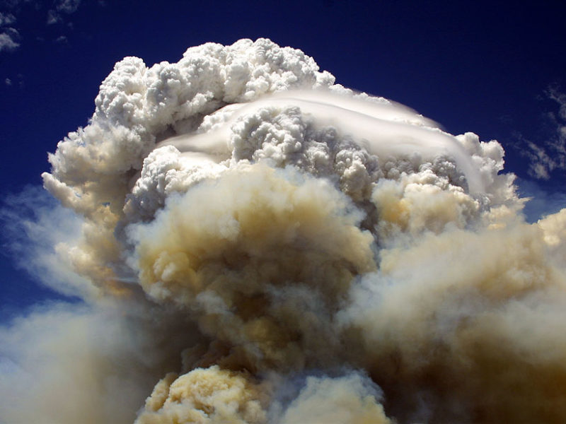
1-minute #GOESWest True Color RGB images showed impressive sustained #pyrocumulus jumps associated with the #LineFire, #BridgeFire and #AirportFire in #SoCal: geosphere.ssec.wisc.edu/#playing:true;…; #CAwx @NWSSanDiego

Notable PyroCu plumes already on three significant SoCal fires this afternoon, as labeled, including #LineFire, #BridgeFire, and new #AirportFire. PyroCb possible later this PM, with lightning/outflow & downdraft winds as hazards. #CAwx #CAfire


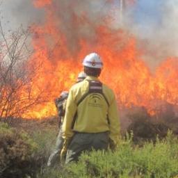
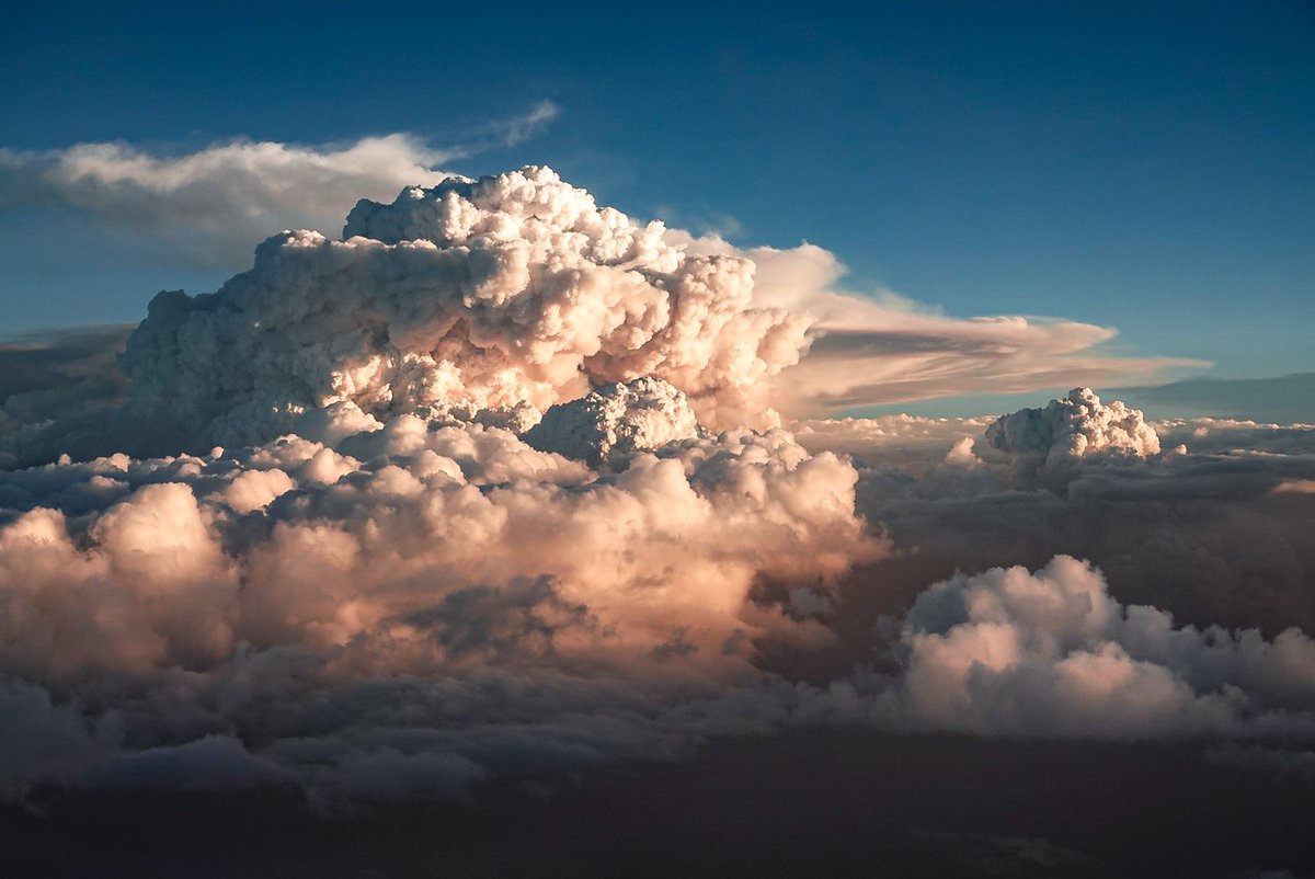
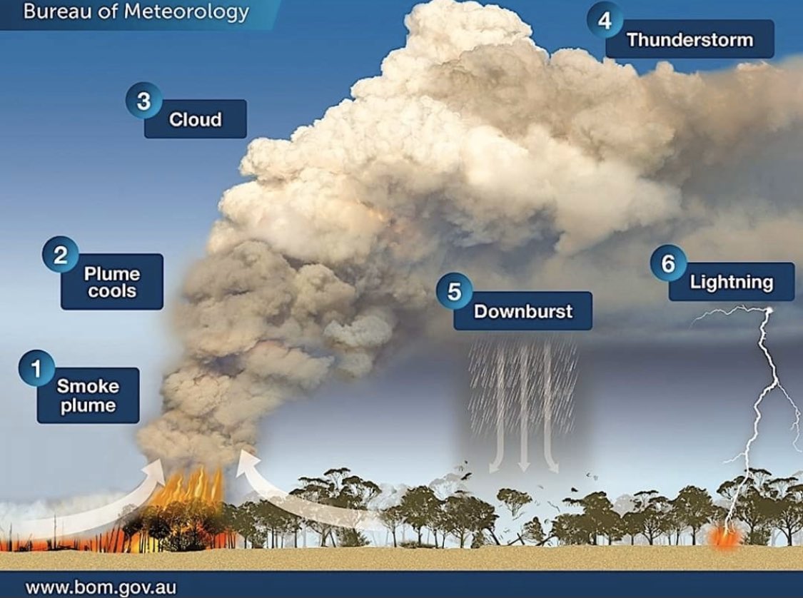
A major bushfire in the Mount Lawson State Park near the NSW-Vic border has been seen producing pyrocumulus clouds. 📷 These photos by @satchcogallery show the smoke and pyrocumulus clouds, seen from Holbrook, NSW. So, how did the #pyrocumulus cloud form?


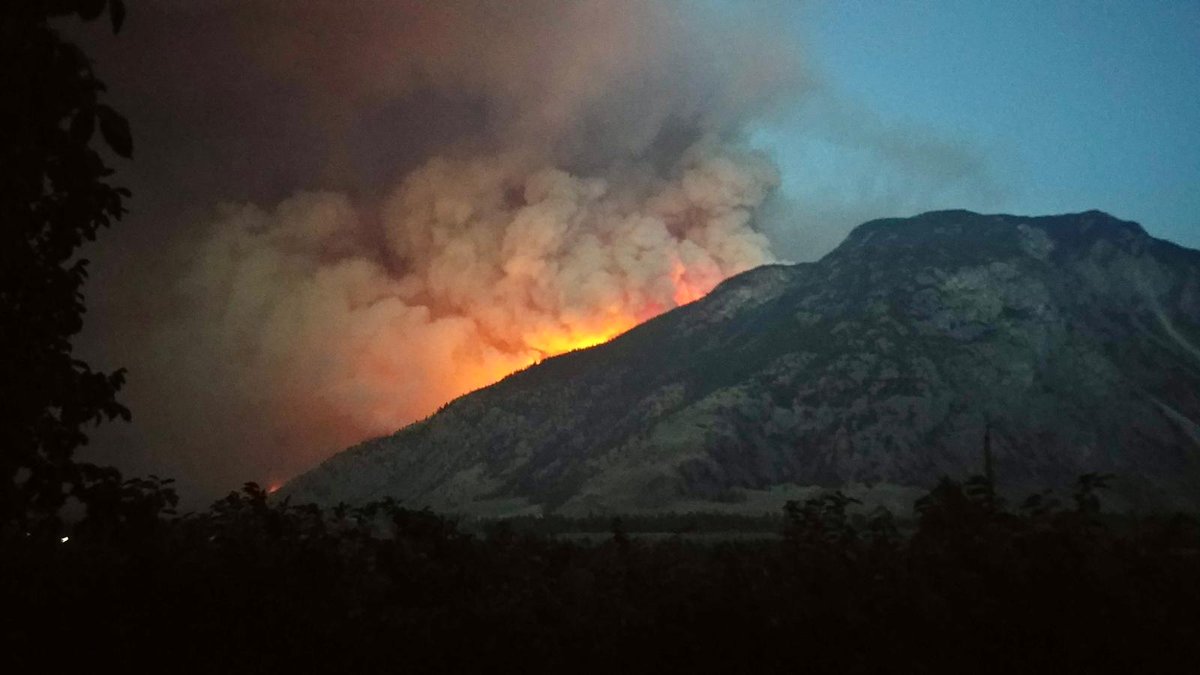
Huge #pyrocumulus #flammagenitus clouds visible from the #CathedralProvincialParkFire south of Keremeos. @CastanetNews @BCGovFireInfo @CBCVancouver @GlobalBC @CTVNews

The #pyrocumulus clouds created by the #LineFire from my house. At first they looked like enchanting mammulus clouds until a friend corrected me. This photo makes them look as ominous as the fire itself.

7/15/24 - Another afternoon of #pyrocumulus from the #MillerPeakFire southeast of #Missoula. Latest estimate has the #fire around 500 acres with cause still under investigation. View from 8 mile/Florence. Credit: Brady & Ashley Nelson #mtwx #montana #mtfires

A peak of the #pyrocumulus associated w/ the #KookipiCreek #wildfire to the W of #BostonBar which has #BChwy1 closed. Thinking of all my fellow #BC’ers this eve living/waiting under the threat of evacuation as explosive/erratic #BCwildfire behaviour is seen across S BC! #BCstorm
Looking at this #pyrocumulus Cloud in #Chilliwack right now. No other clouds in the sky. #Wildfire #bcstorm
Qu’est-ce qu’un « #pyrocumulus », ce nuage dangereux aperçu au-dessus de l’#incendie qui ravage l’#Aude ? lefigaro.fr/meteo/qu-est-c…
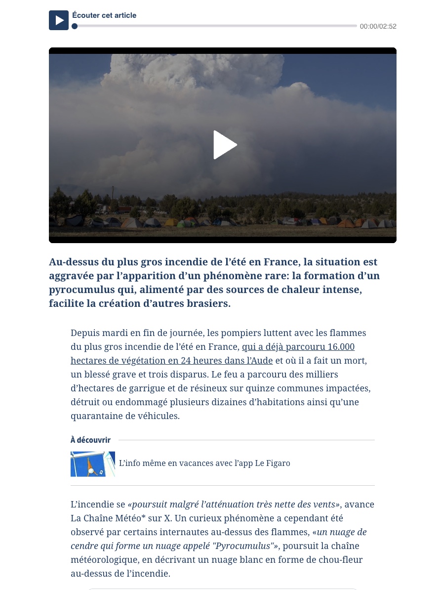

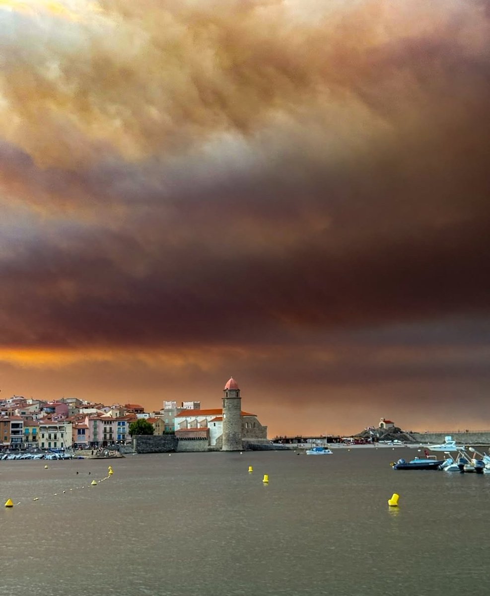
Hier mardi, début de l'#incendie à Ribaute, le feu a pris la végétation sèche très rapidement. Catastrophique pour les #Corbières, les flammes ont parcouru +13 000 hectares, fumées épaisses sur Collioure et tte la région #Aude Soutien aux habitants et aux pompiers.


Black smoke from a local fire & haze didn’t help but #pyrocumulus likely from the #CraterCreekWildfire easily visible from #DeltaBC as extreme #BCwildfire behaviour seen in the #BC interior today. Thurs likely worse w/ gusty winds & dry lightning. #BCstorm #BCdry #BCdrought
#Pyrocumulus cloud from the #ShetlandCreek #wildfire as @BadWeatherKyle makes his way in to get a closer look. ⛰️🌲🔥 View from #BChwy97C near Logan Lake. #BCwildfire #ShareYourWeather #BCwx #BCdry #BCheat #BCfire #BCwx #BCstorm
Rare #pyrocumulus cloud formed briefly above a field fire this afternoon just 2 miles north of NIU! #ilwx
A major bushfire in the Mount Lawson State Park near the NSW-Vic border has been seen producing pyrocumulus clouds. 📷 These photos by @satchcogallery show the smoke and pyrocumulus clouds, seen from Holbrook, NSW. So, how did the #pyrocumulus cloud form?
#Salt14dash2Fire near Coalinga is capping out periodically this afternoon as viewed from Atascadero. #Pyrocumulus

En route to Lytton, I wasn’t sure which #BCwildfire this #pyrocumulus was associated to… Now certain this is from the #MineCreekWildfire—44km NE of #HopeBC. Now #BChwy5 / #Coquihalla Hwy closed as a result. The wildfire caused by lightning. Stay tuned to @DriveBC #BCstorm #BCwx


Sorry for the typo.🙈 Obviously, I meant #pyrocumulus. Therefore, I reposted this later.😁
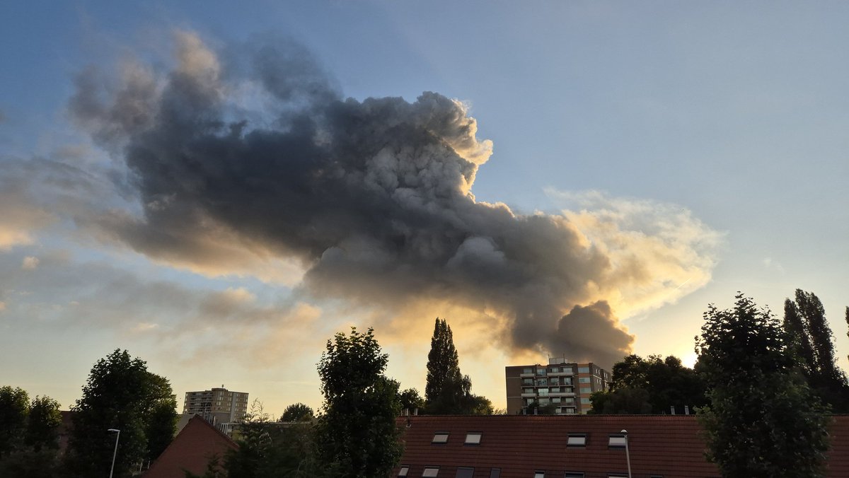
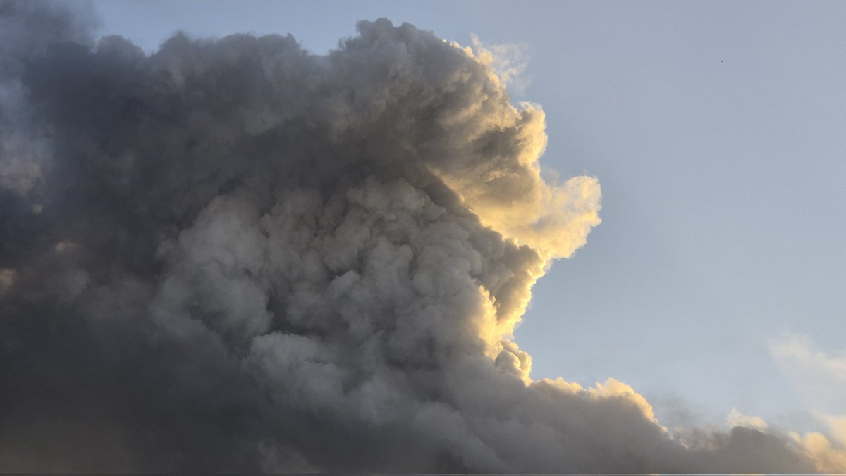
🇬🇧🇺🇲: I've made a short time-lapse of yesterday's #Aalsmeer (NL🇳🇱) fire's smoke cloud (#pyrocumulus🔥). Clearly recognizable between regular cumuli.☁️ 🇳🇱: Dit is mijn #timelapse⏱️ van de #brand (#rookwolk) van gisteren, gezien vanaf IJmuiden tijdens #SAIL-Out Parade. #smokecloud
🇬🇧🇺🇲: I've made a short time-lapse of yesterday's #Aalsmeer (NL🇳🇱) fire's smoke cloud (#pyroculumus🔥). Clearly recognizable between regular cumuli.☁️ 🇳🇱: Dit is mijn #timelapse⏱️ van de #brand (#rookwolk) van gisteren, gezien vanaf IJmuiden tijdens #SAIL-Out Parade. #smokecloud
🇳🇱: Grote brand in #Aalsmeer gezien vanaf Sluizen IJmuiden tijdens #Sail-Out Parade. De #pyrocumulus steekt duidelijk uit boven reguliere bewolking. #brandaalsmeer #brand #rookwolk 🇬🇧🇺🇲: Large #fire #smoke cloud 25km from IJmuiden during #SailOutParade #SailAmsterdam. #Amsterdam

Jemig. Ik dacht een mooie cumulus te zien, maar dit is een andere soort Cumulus, sterkte aan iedereen #aalsmeer #oosteinderweg @BrandweerAA #pyrocumulus @helgavanleur @WilliamHuizinga @mrmiddendorp @weermanrobert @StormchaserNL

Desde 99 estoy en #IIFF; he podido trabajar en muchos #GIF, algunos gigantescos; nunca hasta ahora experimenté la interacción entre #pyrocumulus separados 20km: #IFBarniedodelaReina #IFCanalejas #IFAcebedo #IFCain, funcionando a la vez #6ªgeneraciónIIFF. Mucho ánimo compañer@s.


"Un jour où on apprend un mot nouveau ne peut être un jour perdu." Un #Pyrocumulus x.com/asso_psfdf/sta…


Un "pyrocumulus" : qu'est-ce que ce phénomène qui est apparu au-dessus de l'incendie de l'Aude ? ➡️ l.tf1info.fr/j4c
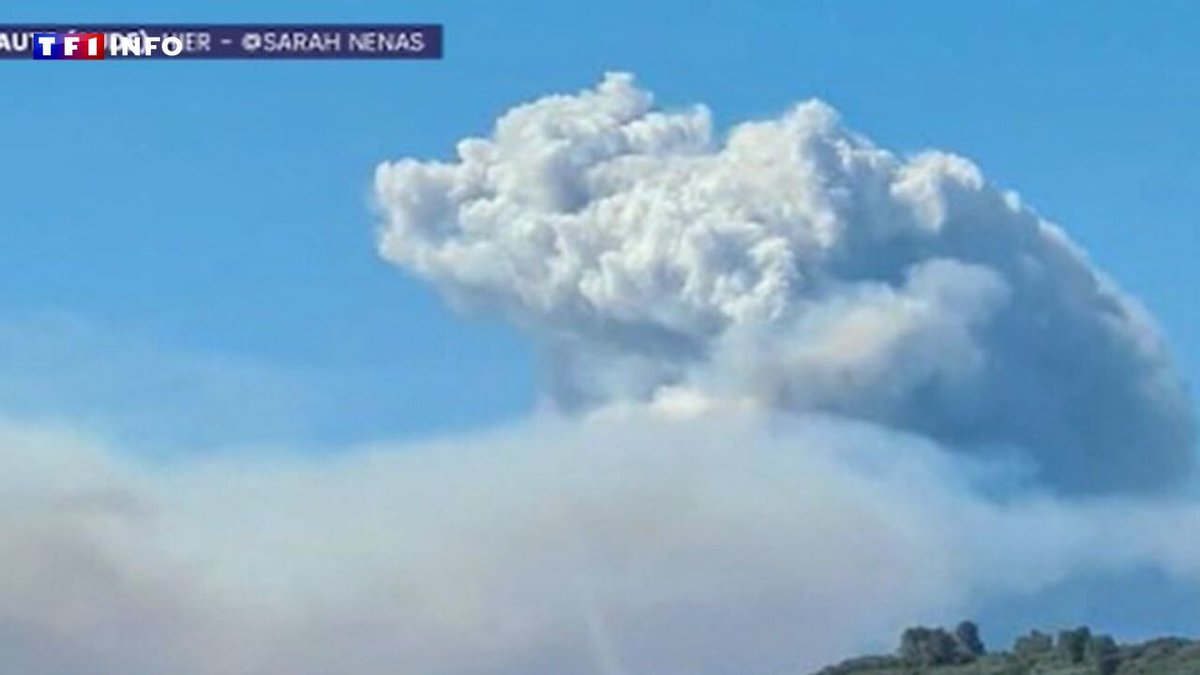

Un #pyrocumulus, c’est un signe que le #feu est hors de contrôle. #incendie
Qu’est-ce qu’un « #pyrocumulus », ce nuage dangereux aperçu au-dessus de l’#incendie qui ravage l’#Aude ? lefigaro.fr/meteo/qu-est-c…
Hier mardi, début de l'#incendie à Ribaute, le feu a pris la végétation sèche très rapidement. Catastrophique pour les #Corbières, les flammes ont parcouru +13 000 hectares, fumées épaisses sur Collioure et tte la région #Aude Soutien aux habitants et aux pompiers.
🔴 DIRECT 11h45 : l’incendie de l’Aude regagne en intensité depuis quelques minutes. Un #pyrocumulus se forme et est visible depuis Narbonne 🔥 #Aude #incendie #feu
"Como se fosse uma trovoada": fenómeno visto no #incêndio de Sabrosa pode repetir-se nos próximos dias. #Pyrocumulus #Portugal cnnportugal.iol.pt/pirocumulo/inc…
cnnportugal.iol.pt
"Como se fosse uma trovoada": fenómeno visto no incêndio de Sabrosa pode repetir-se nos próximos...
Aconteceu exatamente a mesma coisa em Espanha há umas semanas. Uma espécie de tsunami de cinzas e pós a levantar-se no ar

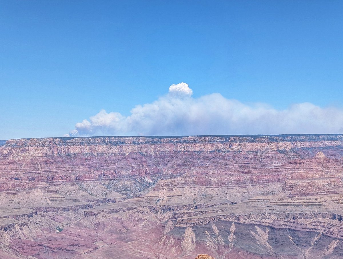
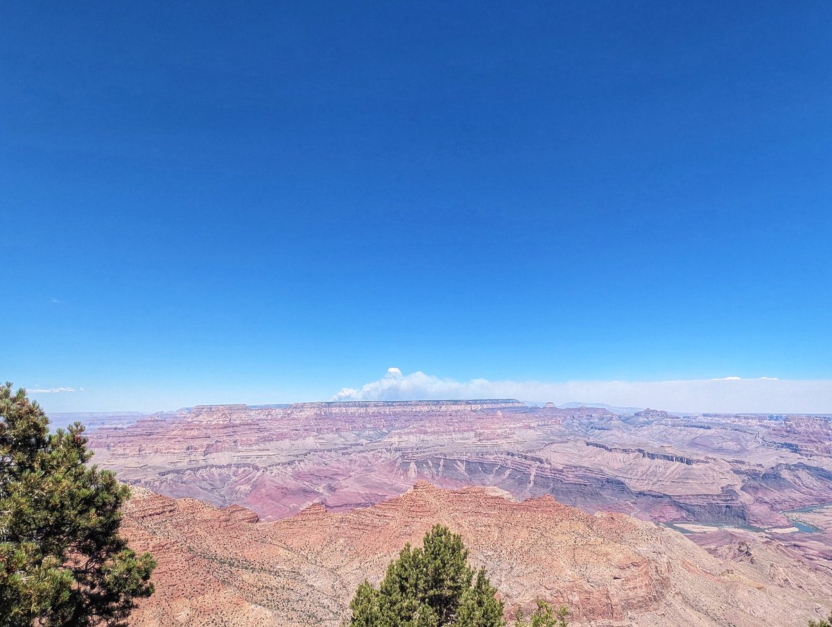
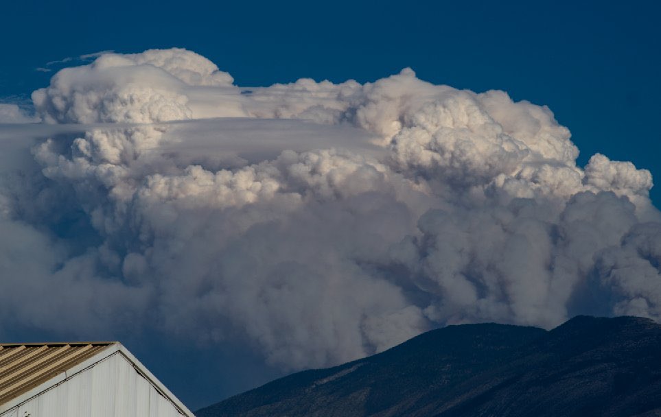
The #wildfires around the north rim of the #Grandcanyon are producing impressive #pyrocumulus clouds at times.


Highly visible #pyrocumulus coming off the #BootlegFire this evening, depicting extreme fire behavior. Smoke from several other fires across WA, OR, and CA can also be seen. #orwx #wawx
A major bushfire in the Mount Lawson State Park near the NSW-Vic border has been seen producing pyrocumulus clouds. 📷 These photos by @satchcogallery show the smoke and pyrocumulus clouds, seen from Holbrook, NSW. So, how did the #pyrocumulus cloud form?

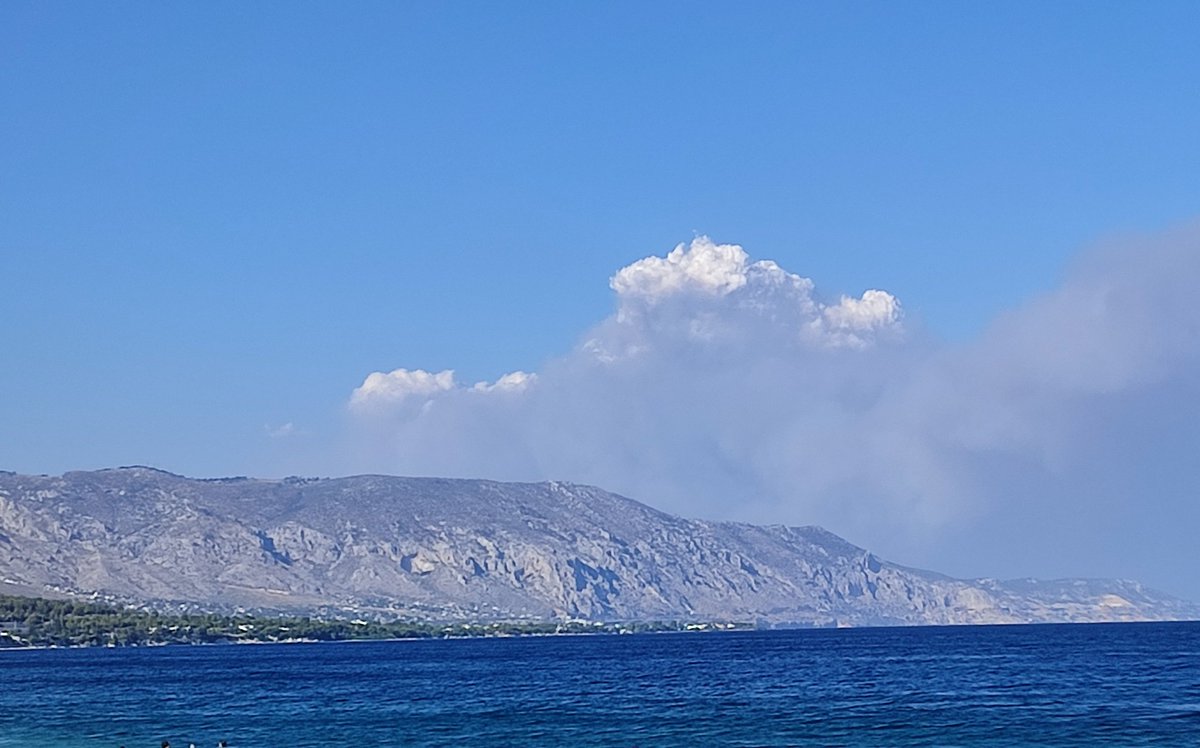
Fires south of #Broome show up nicely on satellite imagery. As the smoke plumes develop, they form cloud called #pyrocumulus
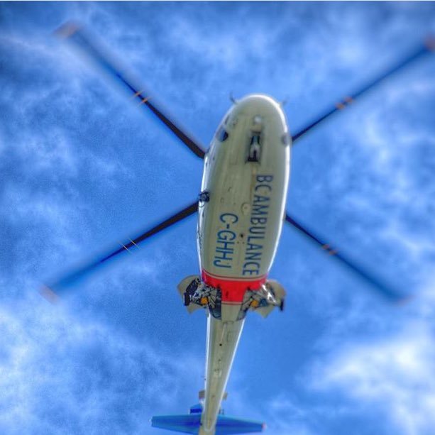
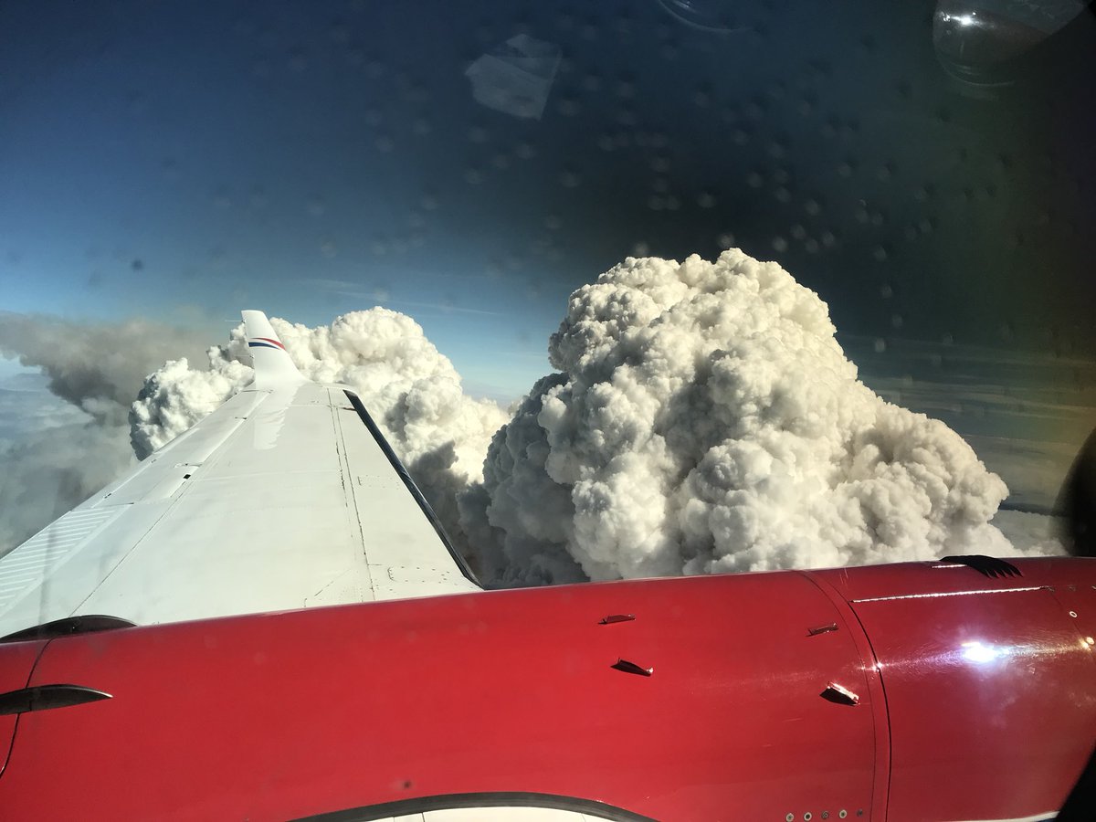
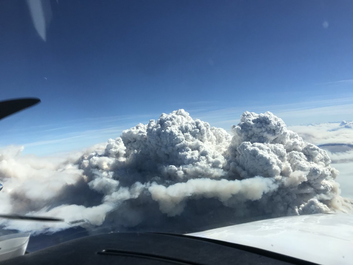
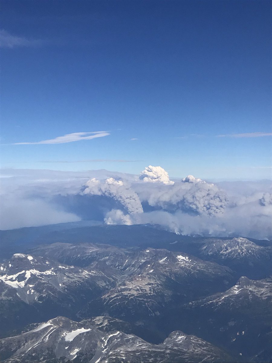
Our views above the #BCwildfire smoke. Pic credits: Mathieu Defosses #pyrocumulus #forestfire #britishcolumbia #bcairambulance #bcehs #criticalcare
A fire to the southeast of #PortHedland interacted with an unstable atmosphere to create a #PyroCumulus cloud. It was short-lived though - the sea breeze moved through and altered the environment. Learn more about when fires create their own weather: ow.ly/7ICp50HoeI8

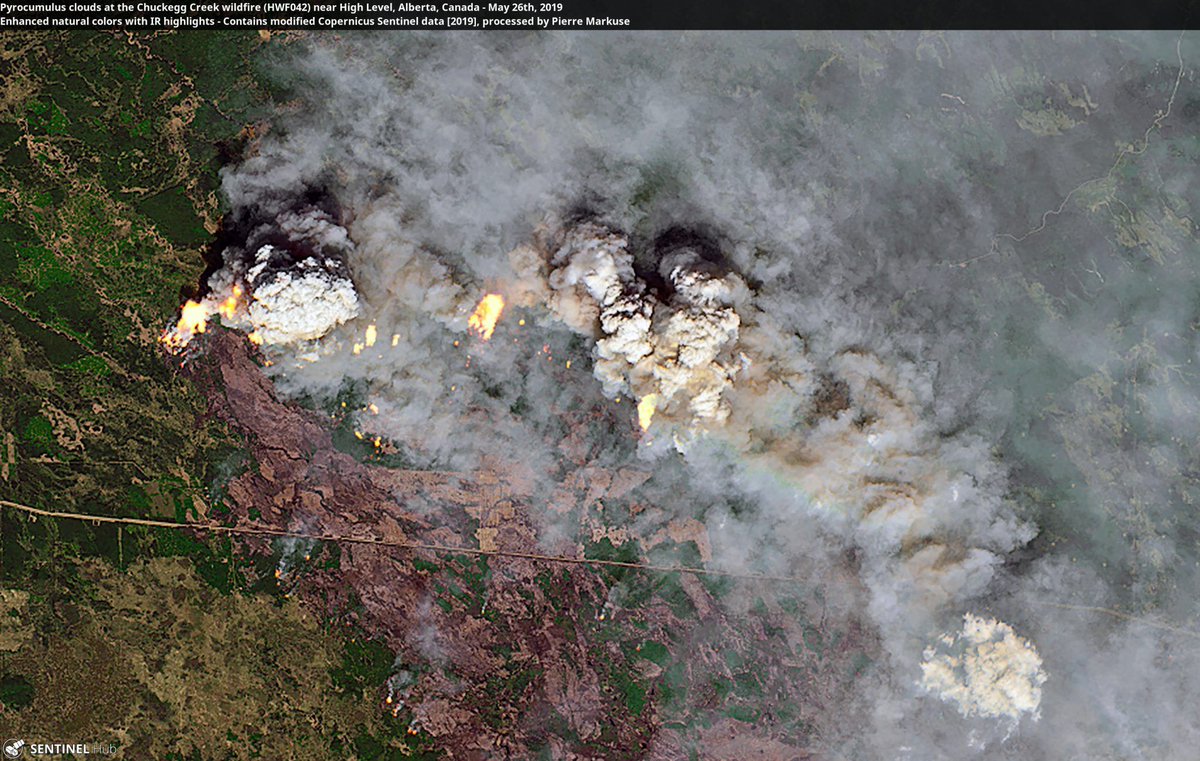
#Pyrocumulus #clouds at the #HWF042 #wildfire near High Level, #Alberta, #Canada 🛰️ 60 more images: Some of the best #satellite images of 2019 👉 bit.ly/sat-images-of-… (clickable link in @windy_forecast bio) Credits: @CopernicusEU/@Pierre_Markuse
Two fires too many 😢. View of the #AlexanderMountainFire (left vertical plume with #Pyrocumulus), and #StoneCanyonFire (smoke plume tilted to the right). #COwx

Last night, @NOAA's #GOESEast 🛰️ captured this imagery of a #wildfire in southeastern Colorado, which created #pyrocumulus clouds due to the hot air and smoke it released. The red spot shows the heat from the fire, detected by the satellite. Explore: bit.ly/3ga4WyD
The #LionsHeadFire on the east slopes of Mt Jefferson is putting up #pyrocumulus clouds, visible via both satellite and NWS Doppler Radar. Oh, and it's clearly visible on both sides of the Cascades from the ground, too. #orwx #pdxtst
Saw my first #pyrocumulus cloud today, viewing the #PioneerFire from Chelan, WA, about 40 miles SE of the fire. The Pioneer Fire has burned over 30,000 acres, and continues to threaten the town of Stehekin. #wawx @HotshotWake @Wa_fire_watch @weatherchannel @JimCantore


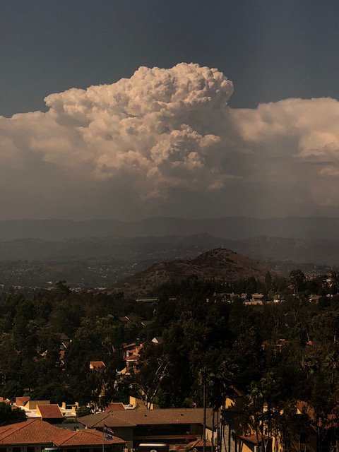
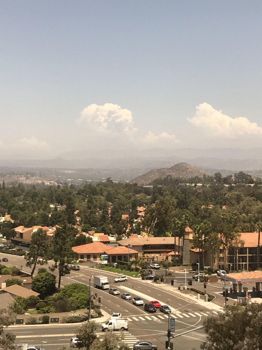
Current view of the #PyroCumulus being generated by the #CranstonFire, seen all the way from our Rancho Bernardo office. #CAwx #Riverside

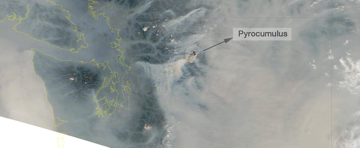
Smoke plume from the Crescent Mountain fire in Chelan county has stretched across western WA. #Pyrocumulus cloud was noticed earlier today on this MODIS image. cloudatlas.wmo.int/flammagenitus.…


Stunning #pyrocumulus clouds above the #BootlegFire burning in Klamath County, Oregon, as seen from my flight this evening - just 7 hours after ingnition. #orwx #OregonFires

UPDATE: Oregon's #BootlegFire showed explosive growth last evening, with its #smoke and #pyrocumulus clouds seen here by @NOAA's #GOES17🛰️. This is the largest active fire burning in the U.S., and has spread to more than 212,000 acres at last report. #ORwx


🔥Importante incendio está tarde en Sierra de Nuevo León sobre el área de #Santiago y #Arteaga próximo a zonas habitadas. ☁️La columna de humo ha generando un tipo de nube llamado #Pyrocumulus capaz de generar rayos. ¡Atiendan indicaciones de autoridades! 📸 de redes sociales


From archives. British Columbia wildfires, summer 2018. #pyrocumulus @xWxClub @StormHour @StormHourMark @CloudAppSoc @sterntendo @LensAreLive @ThePhotoHour
Something went wrong.
Something went wrong.
United States Trends
- 1. Good Thursday N/A
- 2. Happy Friday Eve N/A
- 3. Azerbaijan N/A
- 4. Chabad N/A
- 5. #ChávezPorAhoraYParaSiempre N/A
- 6. #thursdaymorning N/A
- 7. #OffWhitexZeeNunew N/A
- 8. #thursdaymotivation N/A
- 9. #GrabFoodMegaGalexจอสกวิน N/A
- 10. HS4 AT MIDNIGHT N/A
- 11. GF MEGA GALE X JOSSGAWIN N/A
- 12. Mooney N/A
- 13. Feliz Jueves N/A
- 14. Thankful Thursday N/A
- 15. Ming N/A
- 16. Hugo Chávez N/A
- 17. Upper N/A
- 18. Lyme N/A
- 19. Marine N/A
- 20. Brian McGinnis N/A