#radarscope resultados de búsqueda

❄️ Météo : Neige fine ou bruine floconneuse intermittente à Laval, Kirkland et Vaudreuil. Visibilité localement réduite. #MétéoQC #RadarScope #Montréal #Laval


#radarscope widespread glitch. Showing snow and cold weather across the Mid Atlantic and Northeast. #NEWX

This is a lot of radar noise, this doesn’t show up on the new radar but I can definitely tell by the view today that there is dust in the air. We got heavy fog this morning too and that’s moving out to sea currently. #radar #radarscope

Knew I wasn’t crazy when I remembered storms going north in Houston KHGX - Super-Res Reflectivity 1 2:06 PM #txwx #weather #radarscope

Can't wait to give it a try for at base Chasing. Also, when I get my future #hpeliet Tablet for Storm Chasing. I plan to use only the best #radarscope
RadarScope 5.1.6 for Windows is now available in the Microsoft Store. This release includes enhancements to NWS bulletins and adds KHDC and ABAP. It adds atmospheric soundings, fire, and excessive rainfall outlooks to Pro Tier Two and special weather statements to Pro Tier One.

You can really see the smoke plume from the #PalisadesFire on satellite. The strong winds are making for a really bad situation with this fire as it continues to destroy everything in its path! My prayers go out to those affected by this fire! #CAwx #RadarScope


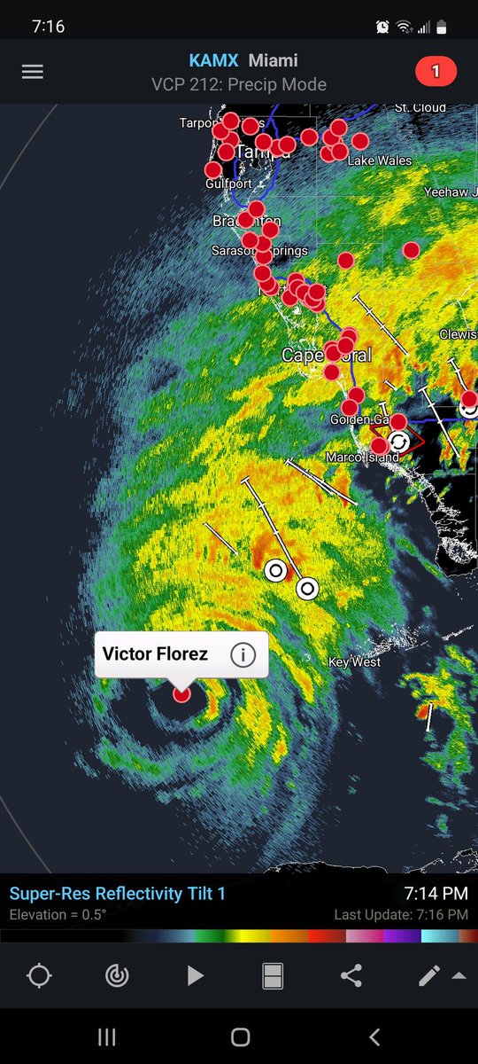
Hurricane Idalia via Tampa radar #HurricaneIdalia #flwx #radarscope KTBW - Super-Res Reflectivity 1, 10:20 PM
Be nice if this app displayed real time meso analysis supercell composite and significant tornado parameter. #radarscope @RadarScope

Dang, what an absolute dud for the St Cloud area, not much rain much less anything “exciting” weather wise. Oh well 🤷🏻♂️. #mnwx #radarscope

Todays gonna be like last year when I got off of work at 6pm and saw 2 tornadoes by 7pm It’s 6:30am and look at that moisture return already after early morning convection #mnwx #radarscope
Doesn’t look to be a good night across eastern North Dakota tonight with two clearly defined tornado warned storms. #ndwx #radarscope

Anyone else having issues with #radarscope ? The app won’t open.


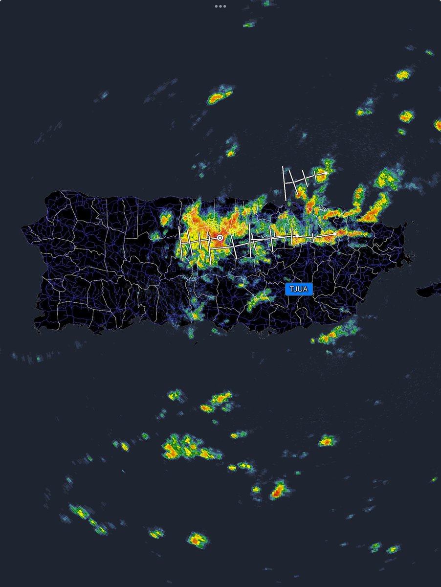
#RadarScope Super-Res Reflectivity radar showing some pretty heavy #thunderstorms already developing over #SaintPetersburg/#Clearwater and the surrounding areas. These storms are building to the east, and #Tampa could see some action shortly. As the #boundary line moves east,
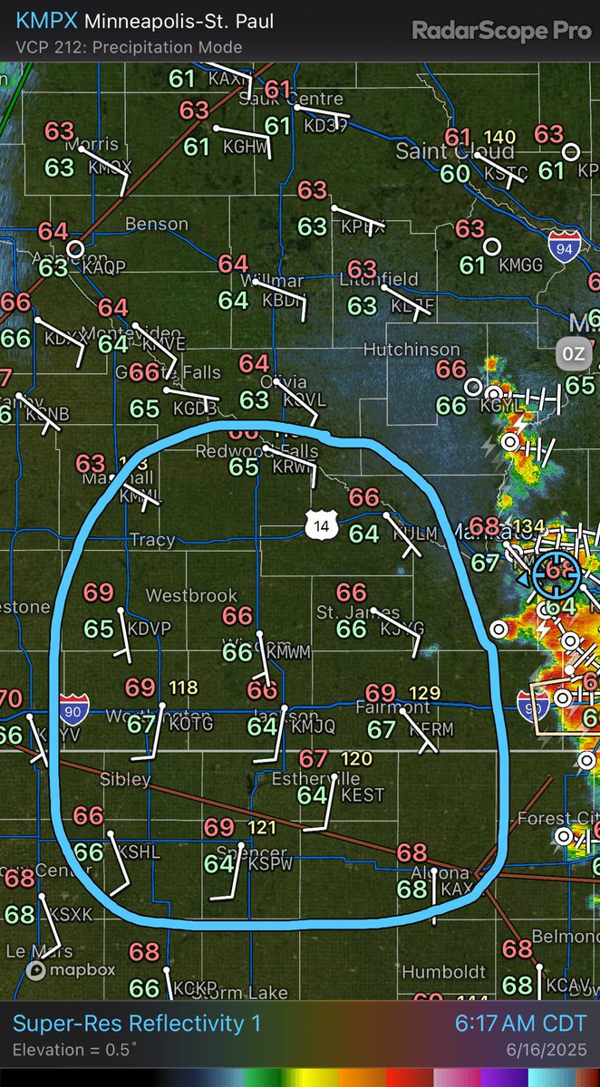
Isn’t this a beautiful scene across Minnesota tonight? Yuck. “KMPX - Precipitation Depiction 8:37 PM #mnwx” #RadarScope
Isn’t this a beautiful scene across Minnesota tonight? Yuck. “KMPX - Precipitation Depiction 8:37 PM #mnwx” #RadarScope

We're forecasting a 100% chance of topping @Apple app charts! DTN @RadarScope® app recognized on the "U.S. Top Apps of 2025" dtn.link/25-RadarScope-… #RadarScope delivers real-time, professional-quality, hyper-local storm tracking & weather data. Download: dtn.link/wal5ms

Heavy, persistent band laying down the powder this morning in St Louis to get things kicking off here today. What started as. 4” forecast total, Became 8” yesterday, I’m calling 1 foot by end of storm. One man’s opinion #stlwx #mowx #radarscope @ryanhallyall @ReedTimmerUSA
❄️ Météo : Neige fine ou bruine floconneuse intermittente à Laval, Kirkland et Vaudreuil. Visibilité localement réduite. #MétéoQC #RadarScope #Montréal #Laval

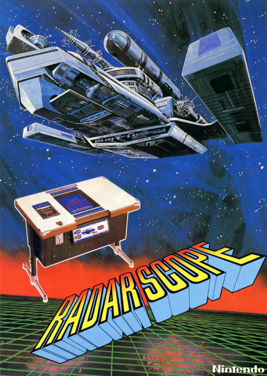
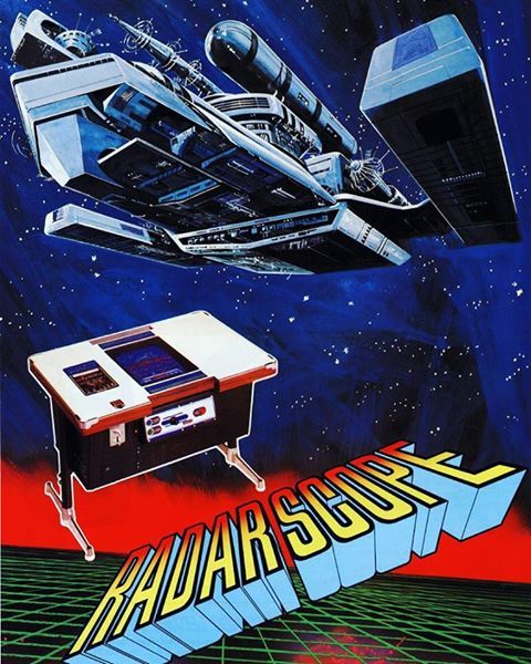
Este mes Radar Scope cumple 45 años, el mundo del espacio es representado vívidamente como misterioso y enigmático por medio del radar. Usaras una nave espacial equipado con un cañón laser, tu deber como capitán es disparar muchas aeronaves enemigas #レーダースコープ #RadarScope


@RadarScope I can not get #Radarscope to open ! Its starts then the screen blanks out... On W11 machine

DTN #RadarScope® was featured in the new Apple iPad Pro m5 chip promo. Trusted by #meteorologists & #StormSpotters for real-time, pro-grade #radar. See it in action: dtn.link/d7w7jm #WeatherApp #Innovation #weather #WxApp #WeatherRadar #WxRadar #WeatherIntelligence


@RayPetelinWx - Why do certain radar apps besides #RadarScope that are NEXRAD Level 2 not update as frequently as it is supposed to, if the radar is in SAILS 3?

Experiencing issues with your radar app? A widespread data outage is affecting many users. Don't worry, Yallbot's systems are up and running, and we're LIVE on YouTube & X tracking all active warnings for you! #RadarDown #RadarScope #wxtwitter

Is this a train on fire, releasing radar countermeasures, or is it Doc Brown going back to the future? #stlwx #ilwx #radarscope @NWSStLouis


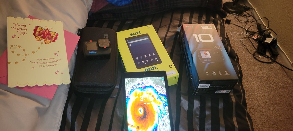
Best #mothersday gifts ever!! New #GoPro10, tablet for #radarscope & all my #weathernerd stuff I need to look up. Lastly a new #kestrel & I am 100% gonna be like my idols @iCyclone , @mcclureWX @PaulFox13 joining all my weather friends ! Excited for #hurricaneseason ! 😁🌀 #FLWx

Radar-estimated rainfall through 10 PM. Light Blue ~ 2" Green ~ 3" Purple ~ 4" Dark Blue ~ 5-6" Yellow ~ 7" Red ~ 8" White ~ 9-10" #wiwx #RadarScope


Ida unfortunately came together at the 11th hour. Winds now 150mph. I finally caved and downloaded #radarscope just for this storm.


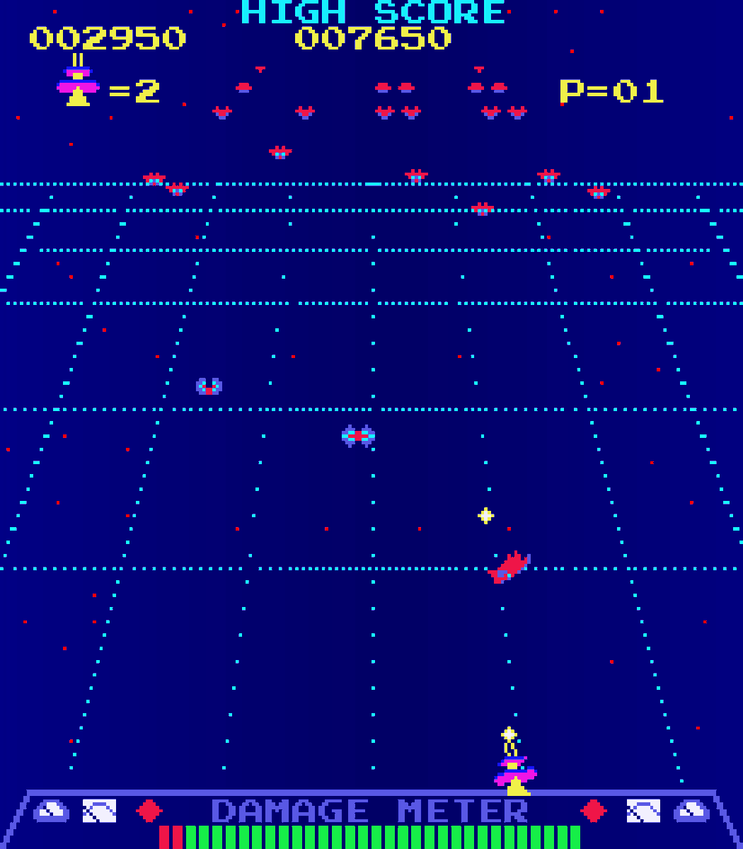
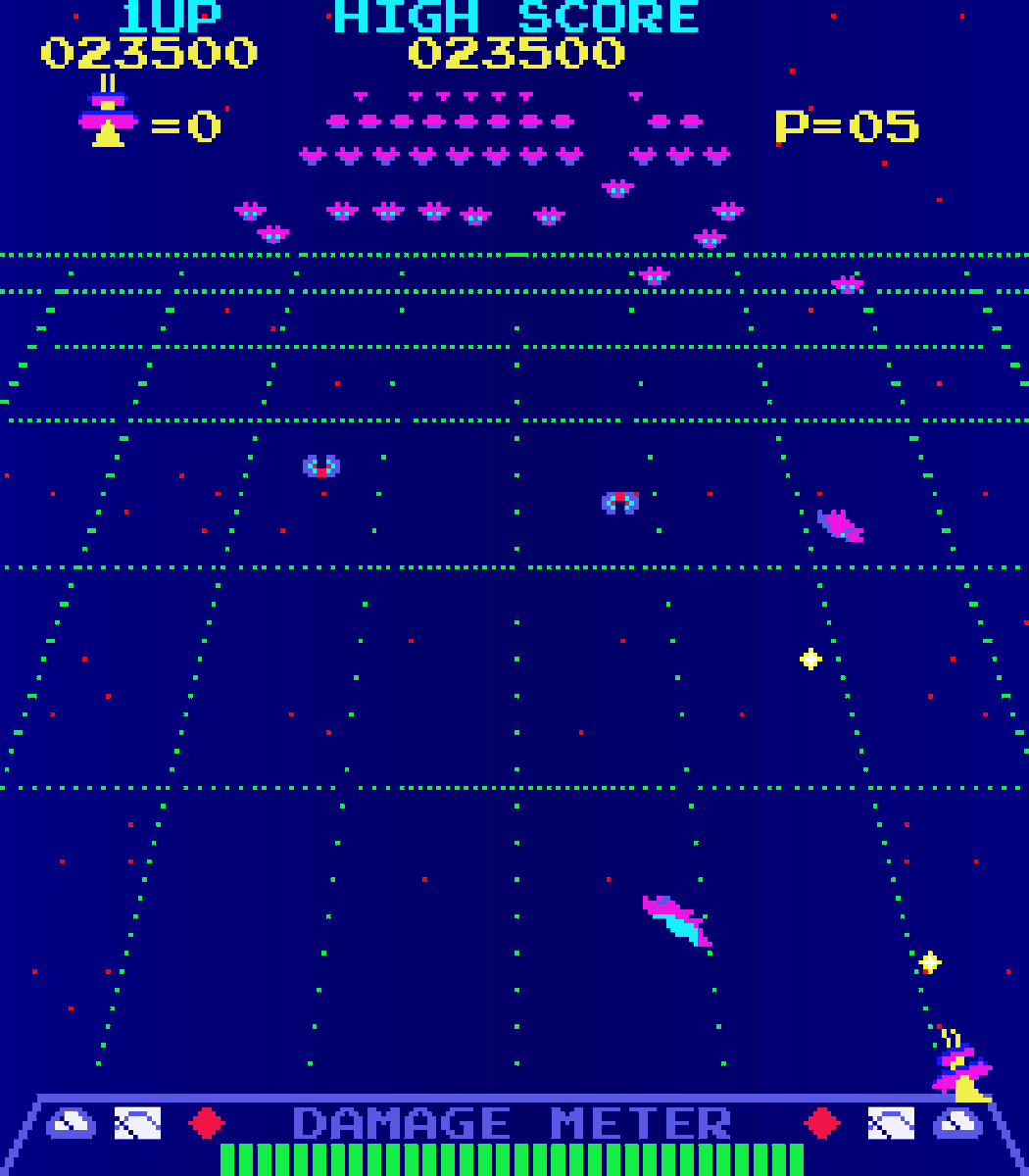
Radar Scope (1979 Arcade By Nintendo). It is a shooter that can be viewed as a cross between Taito's Space Invaders and Namco's Galaxian. The first game that Shigeru Miyamoto helped to develop #radarscope #nintendo #1979 #classic #nostalgia #arcade #arcades #arcadegames #retro

#mnwx Severe storm with winds over 90 MPH! Seek shelter now! There also is rotation with this storm, so a tornado can drop at any time. #Radarscope #Wx #weather

Tornado touched down in the middle of the gap in the radar data due to a new water tower next to the Doppler radar in Brandon, Ms. Thanks @CityofBrandonMs government. #MSwx #radarscope #tornado


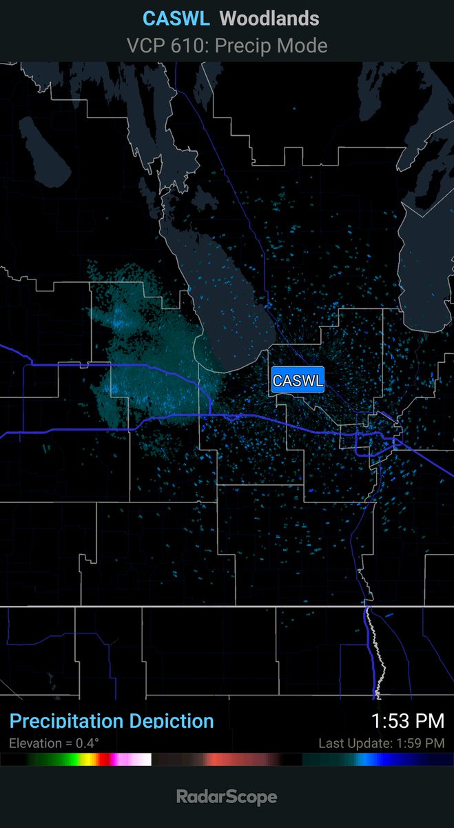

The lack of consistent radar data on RadarScope is frustrating. Always having to resort to using low Rez WeatherCAN app. #SKstorm #RadarScope

#RadarScope digital storm total accumulation once again pretty close, but not exact. 1.56" actual observed (final) rainfall total at my location in Fitchburg, MA. #NOAAcoop #AdvancedSkywarnSpotter @WX1BOX @NWSBoston @ericfisher


**WARREN COUNTY (TN) EF-0 TORNADO, 2/5/20** #Radarscope KOHX Nashville. 7:10pm-7:40pm loop. Start: 7:23pm CST, 1 N Centertown. End: 7:31pm CST, 7 NNW McMinnville. Est. peak winds: 85 MPH. **Note: The northern circulation dropped an EF-1 tornado at 7:55pm CST in White Co. TN.

Looks like the first real isolated troublemaker of the day in southern Mississippi - from KDGX RADAR #RadarScope


Second tornado is only 1.5 miles south of original! Definitely some sort of mesoscale boundary in this location... #alwx #radarscope


I’m in shock from some of the wind samples from #HurricaneMichael. A few scans ago on #radarscope there was a pocket of winds between 156-172mph on the SE side of the storm. This is scary to think how bad it’s going to be. @garyeOK what do you think about that radar scan?

Category 4 Hurricane Lane eye can be seen on radar but we will get better view as it starts making its way up the coast of Hawaii PHWA - Base Reflectivity Tilt 1 2:45 AM #hiwx #HurricaneLane #radarscope #weather
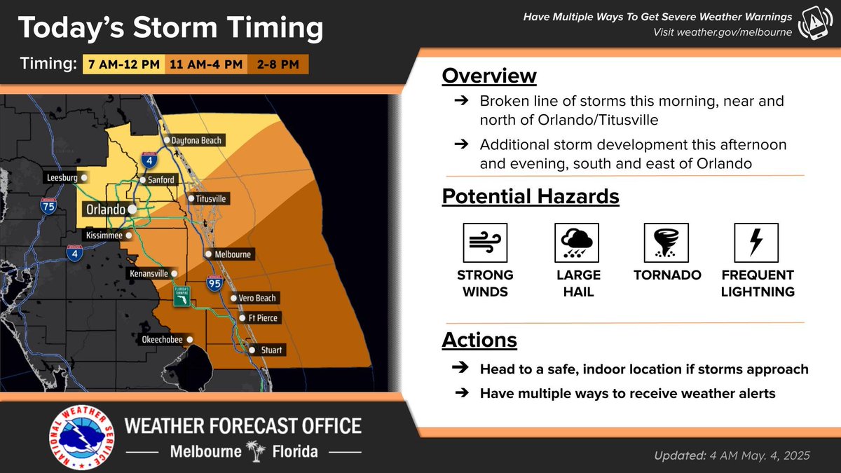
Good morning, #CentralFlorida! 🌤 Current radar from #radarscope showing a line of storms moving across our area this morning. This is the energy that should eventually explode over our east coast, creating a risk for #severe weather. Strong #winds, large #hail, and isolated


Outflow boundary from evening storms in PA has reached the Baltimore region. With decent lapse rates, CAPE holding above 1500 J/KG, and 10kts of shear, late night popcorn cells are in order! No worries though—they’ll likely fizzle out in 10-15 min.#mdwx #radarscope @NWS_BaltWash
Something went wrong.
Something went wrong.
United States Trends
- 1. #PiDay N/A
- 2. Option B N/A
- 3. Good Saturday N/A
- 4. #LoveYouTeacherSeriesEP1 N/A
- 5. Happy Pi N/A
- 6. #Caturday N/A
- 7. Sudan N/A
- 8. Championship Saturday N/A
- 9. Terafab N/A
- 10. Jerome Ford N/A
- 11. Phil Campbell N/A
- 12. #SaturdayVibes N/A
- 13. #HistoricThanksgiving N/A
- 14. Haley Robson N/A
- 15. Battery N/A
- 16. Odell N/A
- 17. Kupp N/A
- 18. Kharg Island N/A
- 19. FELIX ADIDAS GLOBAL ICON N/A
- 20. THE EARTH FINALE WEDDING N/A