#turfjs search results


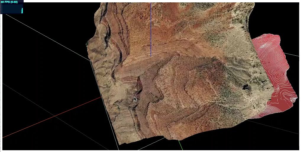
The second tile is a volumetric model obtained by extruding a mapbox.mapbox-terrain-v2 DEM (~40kb; .vector.pbf) and interposing accompanying #GeoJson contour data processed with #turfjs. We found that processing rgb-DEM can be especially fast, almost realtime. Exciting.


I needed to implement markers selection by drawing polygons and multipolygons in @LeafletJS . Leaflet-Geoman and #turfjs were very useful. Thanks @TweetsOfSumit and @turfjs team @DenisCarriere @tmcw @morganherlocker and others for your work 👏 #javascript #leaflet #reactjs

Customizable Dot Density Map on World Population (based on #D3js, #Turfjs & #Rstats). Code available on my @observablehq notebook. observablehq.com/@neocartocnrs/…
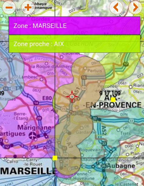
linking markers to choropleth polygon layer in leaflet stackoverflow.com/questions/7168… #turfjs #leaflet #javascript

Made a poor man's Inception map by hacking together 8 separate Mapbox maps observablehq.com/@williamdavis/… ♥️ @observablehq #BuiltWithMapbox #turfjs

Day 97/100 Today I added @turfjs on my project for advance geospatial analysis. Today I only used it for only buffering the GeoJSON. I have to do lots of things using #turfjs. My 3D model with geojson feature is here; #100DaysOfCode #JavaScript

東北大学の津波痕跡データベースに登録されている、津波痕跡高情報(津波の到達した痕跡地点のデータ)をMapLibre GL JSで表示してみた。内部で円柱ポリゴン(GeoJSON)を生成しているのでさすがに重い📝 #MapLibre #PMTiles #turfjs #tsunami

Generating unique 3D trees using #turfjs and @Mapbox fill-extrusions. Code: github.com/willymaps/tree… /
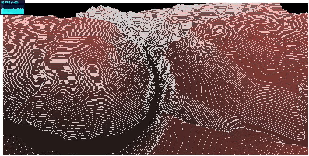
Tinkering with #Mapbox Terrain vector tileset. After a bit of struggles with #turfjs, BOOM! Got a nice terrain with contours at 10m interval. Rendering with #threejs is crisp. Looking forward to building an interactive #VR app for mountaineers...

“Turf.js: A JavaScript Library for Geospatial Analysis” by Ömür Bilgili link.medium.com/W5DWs7JeSAb #turfjs

Demo of "auto-orbiting" the Eiger. First, pick a geo point on the terrain mesh to define an orbiting axis. An upside-down cone is computed where the cone's rim becomes the cam's circular orbit. Then, here we go. #leaflet #turfjs #threejs
ポイントデータの3D表現のテスト。 Turf.jsで気象庁アメダスの24時間降水量から円柱ポリゴンを生成しみた。アメダスくらいの箇所数であれば、問題なく生成される📝 出典)24時間降水量の期間最大値(2023年 7月 7日~ 2023年7月10日) data.jma.go.jp/obd/stats/data… #MapLibre #turfjs #アメダス
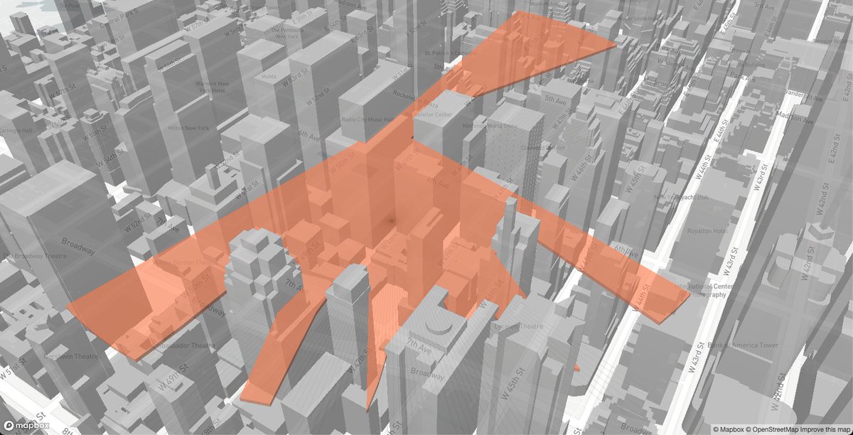
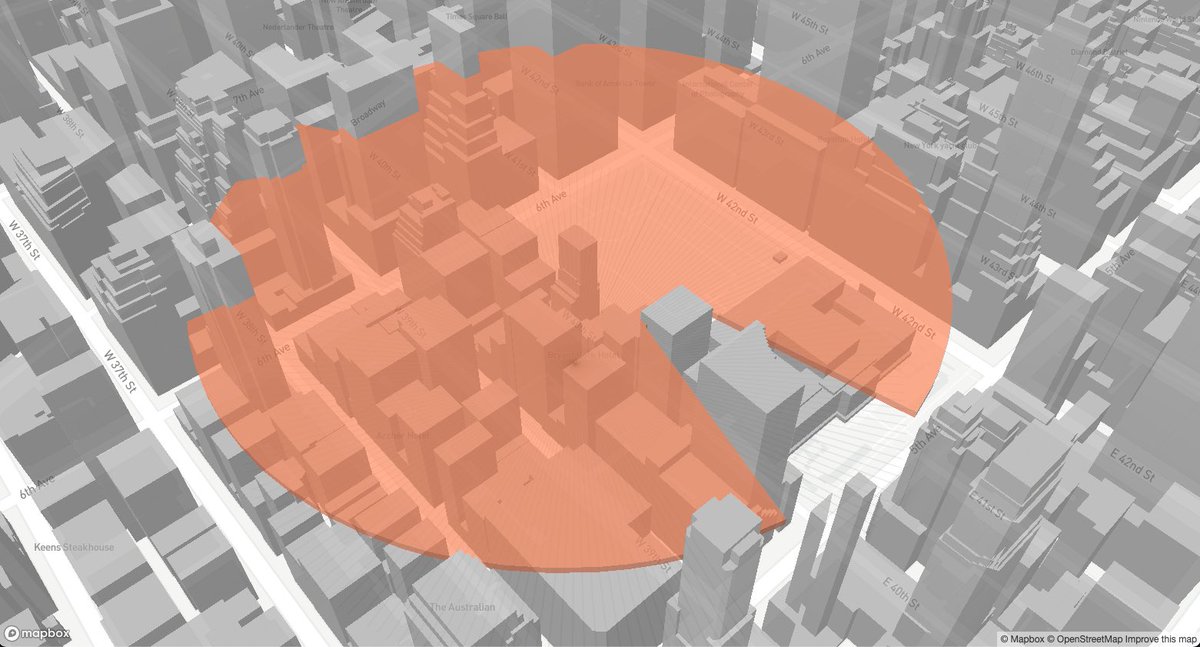
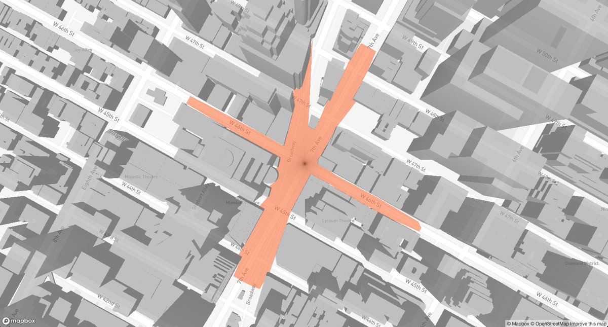
The #turfjs peaks are created using point data with a line string calculated around it based on a variable (e.g. count)


In-browser spatial analysis pipelines with buffers, spatial filters, convex hulls, and more - but all you need is R code, no JavaScript required. Learn how in the new mapgl vignette: walker-data.com/mapgl/articles… #rstats #GIS #turfjs

... ein unglaublich hilfreiches Tool ist hier #turfjs , ein Tool für räumliche Analyse, der offene Vectortile Standard von #mapbox und ein paar andere Helferlein sowie viel gesammeltes Knowhow aus meinem Job. So spannend sind meine Samstagabende! 3/3

I added example of how to calculate distance of line and area of polygon by using maplibre-gl-terradraw plugin with turfjs. Also, new examples page is available in the plugin website! Example page terradraw.water-gis.com/examples #maplibre #terradraw #turfjs

new year new post - getbounds.com/blog/perpendic… #gis #turfjs #dataviz

Hi everyone! I've been experimenting with Turf.js.🎉 I have written an article on "dayjournal memo," in which I tested more than 50 different functions of Turf.js. I would like to introduce five features that I recommend!🗺️ dev.to/mierune/trying… #foss4g #Turfjs
GitHubにてデモサイトとソースを公開なう。 背景地図には国土地理院ベクトルタイルを使用したかったけど、ラベルが表示されないのでOSMベクトルタイルに変更📝スライダーで円柱ポリゴンの高さや半径を制御できるようにしたい📝 github.com/shi-works/jma-… #MapLibre #turfjs #気象庁 #アメダス
ポイントデータの3D表現のテスト。 Turf.jsで気象庁アメダスの24時間降水量から円柱ポリゴンを生成しみた。アメダスくらいの箇所数であれば、問題なく生成される📝 出典)24時間降水量の期間最大値(2023年 7月 7日~ 2023年7月10日) data.jma.go.jp/obd/stats/data… #MapLibre #turfjs #アメダス
ポイントデータの3D表現のテスト。 Turf.jsで気象庁アメダスの24時間降水量から円柱ポリゴンを生成しみた。アメダスくらいの箇所数であれば、問題なく生成される📝 出典)24時間降水量の期間最大値(2023年 7月 7日~ 2023年7月10日) data.jma.go.jp/obd/stats/data… #MapLibre #turfjs #アメダス
東北大学の津波痕跡データベースに登録されている、津波痕跡高情報(津波の到達した痕跡地点のデータ)をMapLibre GL JSで表示してみた。内部で円柱ポリゴン(GeoJSON)を生成しているのでさすがに重い📝 #MapLibre #PMTiles #turfjs #tsunami

Turf.jsを色々とためしてみました🎉 今までに50種類以上の機能を試してきてその中でもおすすめの5つを紹介しています!🗺️ qiita.com/dayjournal/ite… #foss4g #Turfjs
“Turf.js: A JavaScript Library for Geospatial Analysis” by Ömür Bilgili link.medium.com/W5DWs7JeSAb #turfjs

#turfjs 2点間の距離→distance、2点間の角度→bearing、点+距離+角度→destination
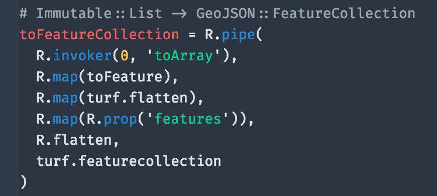
#OpenLayers でGeoJSONのMultiPolygonsを読み込んで表示していて、layer v.s. layerの重なりを調べたくて #turfjs を使おうとしているけれど、turf.intersect ってFeatureCollectionは蹴っちゃうから、事前の丁寧なPolygons or MultiPolygonsへのまとめが大事だとわかった

Planning #spatial #dataprocessing on the web? #TurfJS your rescue. TurfJS lets you do advanced #geospatial #analysis on the web browsers (client) and (server) Node.js #gis #web #javascript turfjs.org
Planning #spatial #dataprocessing on the web? #TurfJS your rescue. TurfJS lets you do advanced #geospatial #analysis on the web browsers (client) and (server) Node.js #gis #web #javascript
For those who want to shoot light beams through the planet willymaps.github.io/lightbeam/ #builtwithmapbox #turfjs


linking markers to choropleth polygon layer in leaflet stackoverflow.com/questions/7168… #turfjs #leaflet #javascript


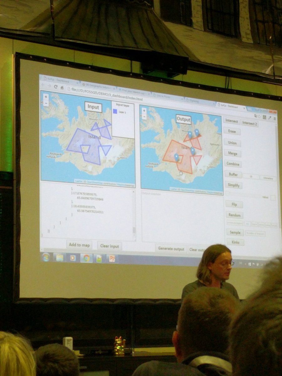
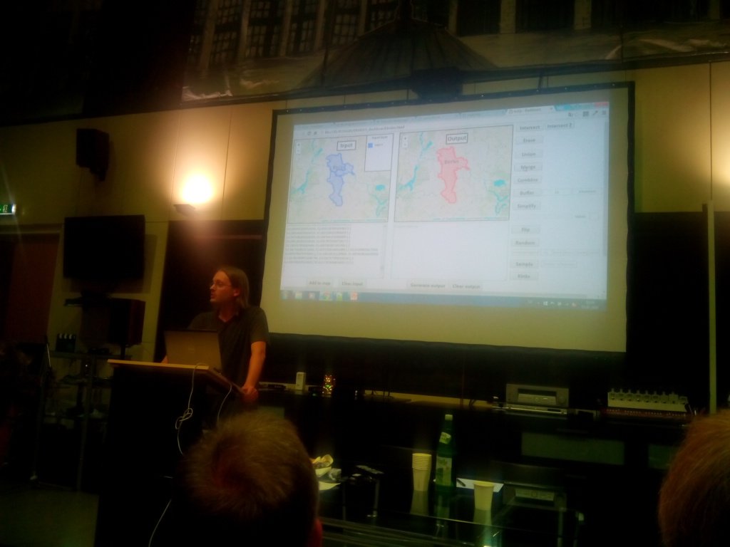
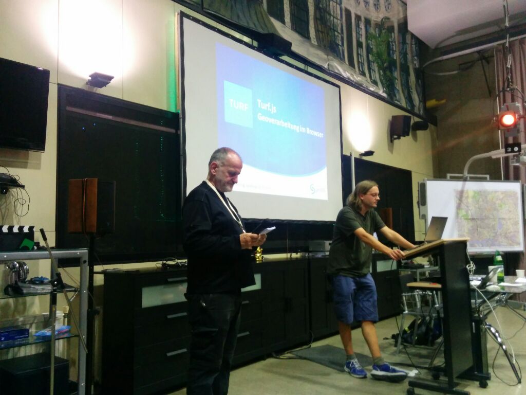
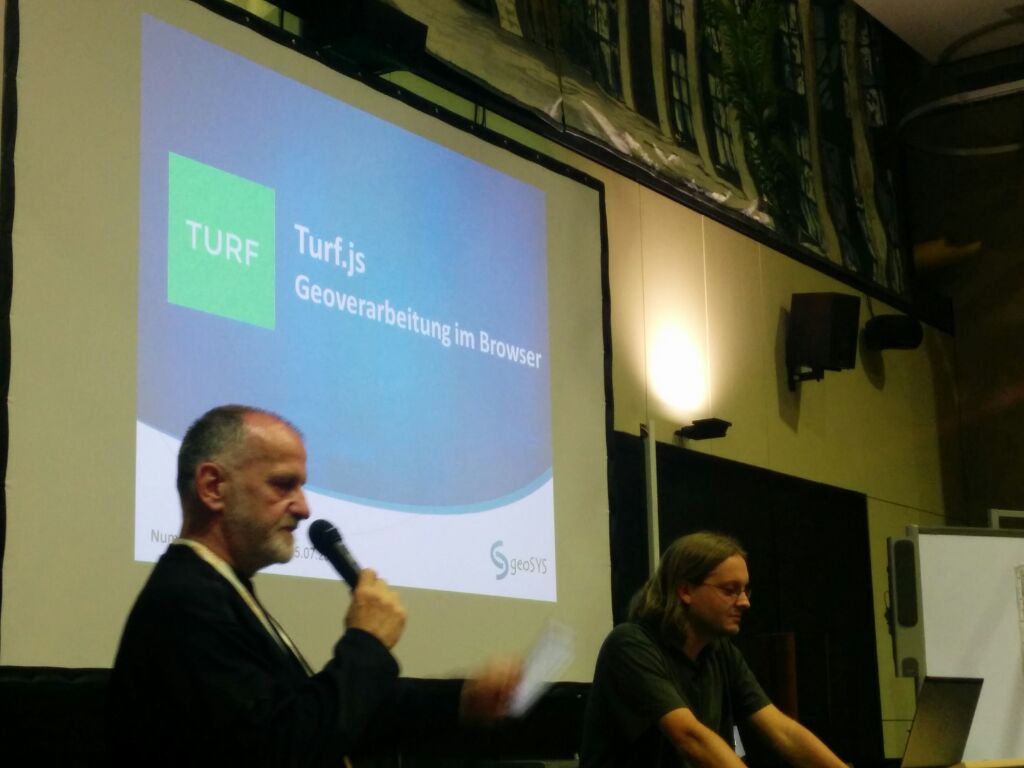
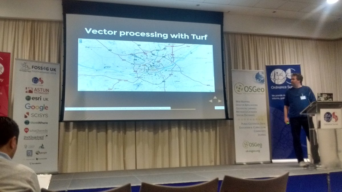
You can download the #TurfJS presentation: geosysnet.de/de/downloads.h… @Gremling89 @FOSSGIS_Konf @agit_team #geospatial
Visualizing February #weather patterns with #turfjs and #leaflet. tannerjt.github.io/weathertinturf/. @LeafletJS @postgresql

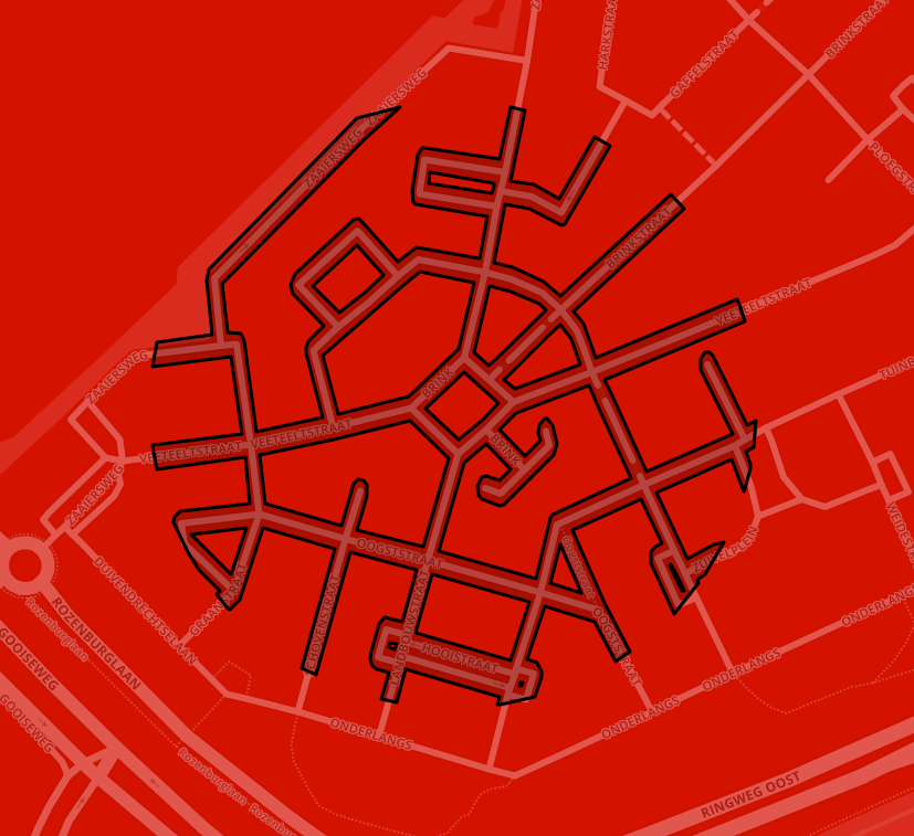
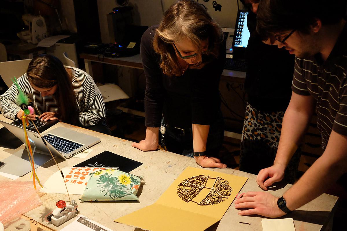
MaptimeAMS #5 tutorial: #OSM data, @LeafletJS, #turfjs & our #Fablab's laser cutter maptime-ams.github.io/street-pattern… #maptime
The second tile is a volumetric model obtained by extruding a mapbox.mapbox-terrain-v2 DEM (~40kb; .vector.pbf) and interposing accompanying #GeoJson contour data processed with #turfjs. We found that processing rgb-DEM can be especially fast, almost realtime. Exciting.


Something went wrong.
Something went wrong.
United States Trends
- 1. Luka 62K posts
- 2. Clippers 17.9K posts
- 3. Lakers 47.9K posts
- 4. #DWTS 95.1K posts
- 5. Dunn 6,659 posts
- 6. #LakeShow 3,499 posts
- 7. Kawhi 6,216 posts
- 8. Jaxson Hayes 2,434 posts
- 9. Robert 137K posts
- 10. Reaves 12K posts
- 11. Ty Lue 1,564 posts
- 12. Collar 44.5K posts
- 13. Jordan 117K posts
- 14. Zubac 2,297 posts
- 15. Alix 15.1K posts
- 16. Elaine 46.2K posts
- 17. Godzilla 37.2K posts
- 18. Colorado State 2,434 posts
- 19. Dylan 35K posts
- 20. #INDvsSA 27.1K posts