#uavmapping نتائج البحث
Hot Shoe Adapter for Reach M+ and PPK workflow overview now available! #uavmapping #dronemapping Learn more: emlid.com/hot-shoe-adapt…

🎉 Congrats to Aidan Murray, Samantha Boyle, Gemma McNickle & Matthew Cameron on achieving CAA GVC certification! This boosts OSNI’s UAV capability, enhancing geospatial data collection across NI. 👏 Driving innovation in mapping! #OrdnanceSurveyNI #UAVMapping #RemoteSensing


Beautiful day in #Baltimore for #mapping with @DroneDeploy #uavmapping #dronephotography #aerial #dronesforgood

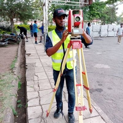
Our ongoing training session blends theory and hands-on practice! Students are out in the field coordinating Ground Control Points (GCPs), leveling, and actively flying UAVs to capture valuable geospatial data. #YSNLagos #Surveying #UAVMapping #TrainingInProgress


Today in Digital Photogrammetry: Georeferencing UAV images in Metashape ensures they align with real-world coordinates, laying the foundation for accurate spatial analysis. Once georeferenced, you can seamlessly generate orthomosaics, point clouds, DEMs, and DSMs. #UAVmapping
Planetary analog studies with Reach RS in Idaho, USA. A set of Reach RS was used to map features at the work site and to place GCPs for UAV survey to study craters of Moon National Monument. Thanks to our user Corbin Kling for sharing! #dronemapping #uavmapping


Sunny day for #UAVMapping with @DroneDeploy in #Virginia #Construction #drone #aerialphotography #dronesforgood 54 acres mapped in 15 minutes. #photogrammetry

Face shields for the @GEOJobeUAV crew arrived just in time for the really cold weather coming in. #uavmapping #staywarm

Read about our very own @CMunisteri and the #UAVmapping work she and her @citizen_gis colleagues did in Belize. @ArcUser @Esri @EsriPartners

Captured today: UAV assessment of flooding throughout Arenac County #Michiganflooding #UAVmapping #drones
Ground truthing extracted features from a recent #uavmapping job with ArcGIS Collector @arcgisapps #UAV bit.ly/2ZF1Qtq

Explore the insight from Septina M.P. and team in their article "Precise 3D modelling using combination depth maps processing and ground control point." Read the full article here: journals.sfu.ca/ijg/index.php/… #BRIN #Kependudukan #UAVmapping #Geospatial


Post-processing our UAV imagery is a breeze with our @ORIGINPC Intel Core i9 7980XE workstation. Creating ortomosaics, 3d terrain models and dense point clouds is soft work. #uav4ag #drones #uavmapping

AeroPoints: delivering high-precision ground control anywhere, even out in the Australian bush! #dronesurvey #uavmapping

Georeference with GCPs and get repeatable contour lines - read the new story on our blog! emlid.com/georeference-g… #rtkgnss #uavmapping
🎉 Congrats to Aidan Murray, Samantha Boyle, Gemma McNickle & Matthew Cameron on achieving CAA GVC certification! This boosts OSNI’s UAV capability, enhancing geospatial data collection across NI. 👏 Driving innovation in mapping! #OrdnanceSurveyNI #UAVMapping #RemoteSensing


Explore the insight from Septina M.P. and team in their article "Precise 3D modelling using combination depth maps processing and ground control point." Read the full article here: journals.sfu.ca/ijg/index.php/… #BRIN #Kependudukan #UAVmapping #Geospatial


📸 PSDK 102S V3/SHARE 📩 Contáctenos para más información: datuming.com/consulta/ 📨 [email protected] 📲 +57 301 334 5686 #Fotogrametría #UAVMapping #DronesProfesionales #Modelado3D #TopografíaAérea #AltaPrecisión #DroneTech #CámaraAérea

Weed-detection UAVs map infestation hotspots and upload prescriptions to ground rovers for localized mechanical removal .#UAVMapping #PrecisionWeeding
Next-Gen Surveying is Here! Level up your project accuracy with cutting-edge solutions from RISE GEO. arts here! Free Delivery UAE-wide +971-45478282 🌐 rise-geo.com ✉️ [email protected] #DroneSurveying #UAVMapping #LaserScanning #SmartSurvey #RiseGeo #GIS

Mast‐fruiting ash trees are mapped using multispectral UAVs to predict seed drop timing and coordinate native wood mouse reintroduction programs for seed dispersal. #UAVMapping #EcoRestoration
Today in Digital Photogrammetry: Georeferencing UAV images in Metashape ensures they align with real-world coordinates, laying the foundation for accurate spatial analysis. Once georeferenced, you can seamlessly generate orthomosaics, point clouds, DEMs, and DSMs. #UAVmapping
Celebrating India’s engineering marvel, the Chenab Bridge — a towering symbol of precision and resilience. #ChenabBridge #GeospatialIntelligence #UAVMapping #Innovation #MakeInIndia #TerrAquaUAV #RemoteSensing #DroneTechnology #IITKanpur #AatmanirbharBharat #ResilientIndi

The ArcSky X55 just completed a test flight with the RESEPI Gen-II LiDAR system from Inertial Labs, a VIAVI Solutions Company. Lightweight. Accurate. Built for the field. Pics by ArcSky. #LiDAR #UAVMapping #RESEPI #InertialLabs #ArcSkyX55


#DroneTraining #GeoinfoAcademy #UAVMapping #GIS #HandsOnLearning #FutureReady #GeospatialTech #DronePilots #CareerUpgrade
🎥 Swipe through the moments. 📸 Ready to elevate your career with drone tech? #DroneTraining #UAVMapping #AerialSurvey #GeoInfotech #DronePilot #GeospatialTechnology #HandsOnLearning #FlyWithPurpose #GeoinfoAcademy

🚁📍Can drones document crash scenes accurately, fast? mdpi.com/2624-8921/5/4/… This study shows how oblique POI imaging cuts 3D errors to ≤5 cm in <15 min—no GCPs, RTK, or PPK needed. A smart step forward for #AccidentReconstruction and #UAVMapping. #Drones #TrafficSafety

🚁📍Can drones document crash scenes accurately, fast? mdpi.com/2624-8921/5/4/… This study shows how oblique POI imaging cuts 3D errors to ≤5 cm in <15 min—no GCPs, RTK, or PPK needed. A smart step forward for #AccidentReconstruction and #UAVMapping. #Drones #TrafficSafety

Hot Shoe Adapter for Reach M+ and PPK workflow overview now available! #uavmapping #dronemapping Learn more: emlid.com/hot-shoe-adapt…

Our ongoing training session blends theory and hands-on practice! Students are out in the field coordinating Ground Control Points (GCPs), leveling, and actively flying UAVs to capture valuable geospatial data. #YSNLagos #Surveying #UAVMapping #TrainingInProgress


Read about our very own @CMunisteri and the #UAVmapping work she and her @citizen_gis colleagues did in Belize. @ArcUser @Esri @EsriPartners

🎉 Congrats to Aidan Murray, Samantha Boyle, Gemma McNickle & Matthew Cameron on achieving CAA GVC certification! This boosts OSNI’s UAV capability, enhancing geospatial data collection across NI. 👏 Driving innovation in mapping! #OrdnanceSurveyNI #UAVMapping #RemoteSensing


AeroPoints: delivering high-precision ground control anywhere, even out in the Australian bush! #dronesurvey #uavmapping

Face shields for the @GEOJobeUAV crew arrived just in time for the really cold weather coming in. #uavmapping #staywarm

Beautiful day in #Baltimore for #mapping with @DroneDeploy #uavmapping #dronephotography #aerial #dronesforgood

Which GPS/ RTK system leads to the best accuracies in #aerialmapping? @AirWorksUS will find out. We're reviewing data from a @DJIEnterprise #M210 RTK vs. @PropellerAero and our own ground control from the @LeicaGeosystems GS18. Stay posted for the results. @MaineTech #uavmapping

Planetary analog studies with Reach RS in Idaho, USA. A set of Reach RS was used to map features at the work site and to place GCPs for UAV survey to study craters of Moon National Monument. Thanks to our user Corbin Kling for sharing! #dronemapping #uavmapping


Ground truthing extracted features from a recent #uavmapping job with ArcGIS Collector @arcgisapps #UAV bit.ly/2ZF1Qtq

Sunny day for #UAVMapping with @DroneDeploy in #Virginia #Construction #drone #aerialphotography #dronesforgood 54 acres mapped in 15 minutes. #photogrammetry

This jam-packed week @ #auvsiXPO is already off to an exciting start! Swing by booth 3615 for all you need to know about using your #drones for #UAVmapping.


Join us at the @ExpoUAV in Amsterdam on April 8th–10th. Come by booth 115 to try out our new Reach RS2. #uavmapping, #dronemapping, #drones, #mapping

Pre-flight checks prior to takeoff #Drone #UAVMapping #FAA #Part107 @DroneDeploy @HITTContracting @dronebase

Mapped 230 acres with 6 batteries in 2 hours using @DroneDeploy #UAVMapping #Drone #aerialphotography @UPS Regional Hub #Pennsylvania

Georeference with GCPs and get repeatable contour lines - read the new story on our blog! emlid.com/georeference-g… #rtkgnss #uavmapping
Something went wrong.
Something went wrong.
United States Trends
- 1. #IDontWantToOverreactBUT 1,213 posts
- 2. Expedition 33 10.5K posts
- 3. #TSCollection 1,224 posts
- 4. #BuyTheDipNXXT N/A
- 5. #TheGameAwards 9,327 posts
- 6. $BNKK 1,241 posts
- 7. Zelda 40.3K posts
- 8. #MondayMotivation 42K posts
- 9. Victory Monday 5,295 posts
- 10. Jake Paul 10.1K posts
- 11. $NXXT 2,211 posts
- 12. Moana 7,084 posts
- 13. Clair Obscur 5,305 posts
- 14. Lisfranc N/A
- 15. Penix 7,105 posts
- 16. Tyrod Taylor N/A
- 17. Good Monday 57.5K posts
- 18. Split Fiction 2,377 posts
- 19. Anthony Joshua 7,446 posts
- 20. Hades 2 7,123 posts


