#dronemapping search results

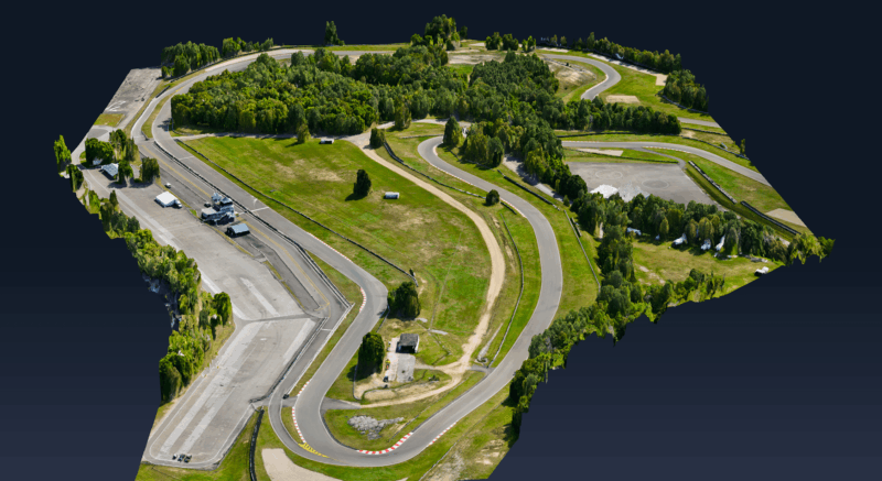
Processing over 2,000 high-resolution aerial images from our latest LiDAR survey using DJI Terra. Orthomosaic generation underway to support 2D plannimetric feature extraction and topographic map updates. Precision data, streamlined workflows. #AerialSurvey #DroneMapping #LiDAR

Drone mapping in 2026 demands lightning-fast, survey-grade accuracy with minimal manual work. SimActive’s Correlator3D leads the charge, processing massive datasets on standard PCs for defense, emergency response, and more. #DroneMapping #TechInnovation (1/2)
InTerra SmarTarget® revolutionizes drone mapping with 25% less field and office time, higher accuracy, and automated error checks. Nashville’s Drone615 reports game-changing efficiency and precision for critical infrastructure projects. #DroneMapping #GeoTech (1/2)

Discover how eBee X drone data transformed irrigation planning, benefiting 5,000+ households while reducing costs by 80% compared to traditional methods: hubs.ly/Q02_L5S60 Impactful project led by @BFlyinglabs #eBeeX #DroneSurvey #DroneMapping #Agritech #UAVS @WeRobotics


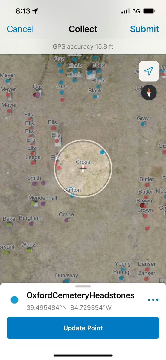
Students mapped 6,000+ headstones using phones and drones — in half the usual time 📱🚁 Learn more: theconversation.com/mapping-cemete… #Geoawesome #GIS #DroneMapping #Cartography

How to Process Drone Imagery Data for Free – Step-by-Step Guide? Tutorial link: youtube.com/live/DA7zw56LG… Registration link: studyhacksgeospatial.com/product/google… #dronemapping #UAV #dronedata #photogrammetry #gis #remotesensing #Geospatial #dronesurvey #DroneProcessing #EarthObservation

स्वामित्व योजना के तहत अब गांवों की ज़मीन का सर्वे और नक्शा ड्रोन जैसी उन्नत तकनीकों से किया जा रहा है, जिससे ग्रामीणों को उनका मालिकाना हक़ मिल रहा है। #स्वामित्व_योजना #DroneMapping #ग्रामीणविकास #DigitalIndia #PanchayatiRaj #RuralEmpowerment #SVAMITVA #NIC


Elevated terrain? DJI Matrice 4T handles it effortlessly. Accurate 3D mapping with terrain-following ensures every slope and contour is captured in detail. 🎬 Video credit: ITASCAN #DJIEnterprise #Matrice4T #DroneMapping

After a major landslide in Colorado, Chinook Landscape Architecture used drone imagery and #PIX4Dcloud to generate accurate, shareable 3D models for geotechnical analysis: pix4d.com/blog/geohazard… #PIX4Dcloud #DroneMapping #Geohazards #3DModeling #Photogrammetry #GIS


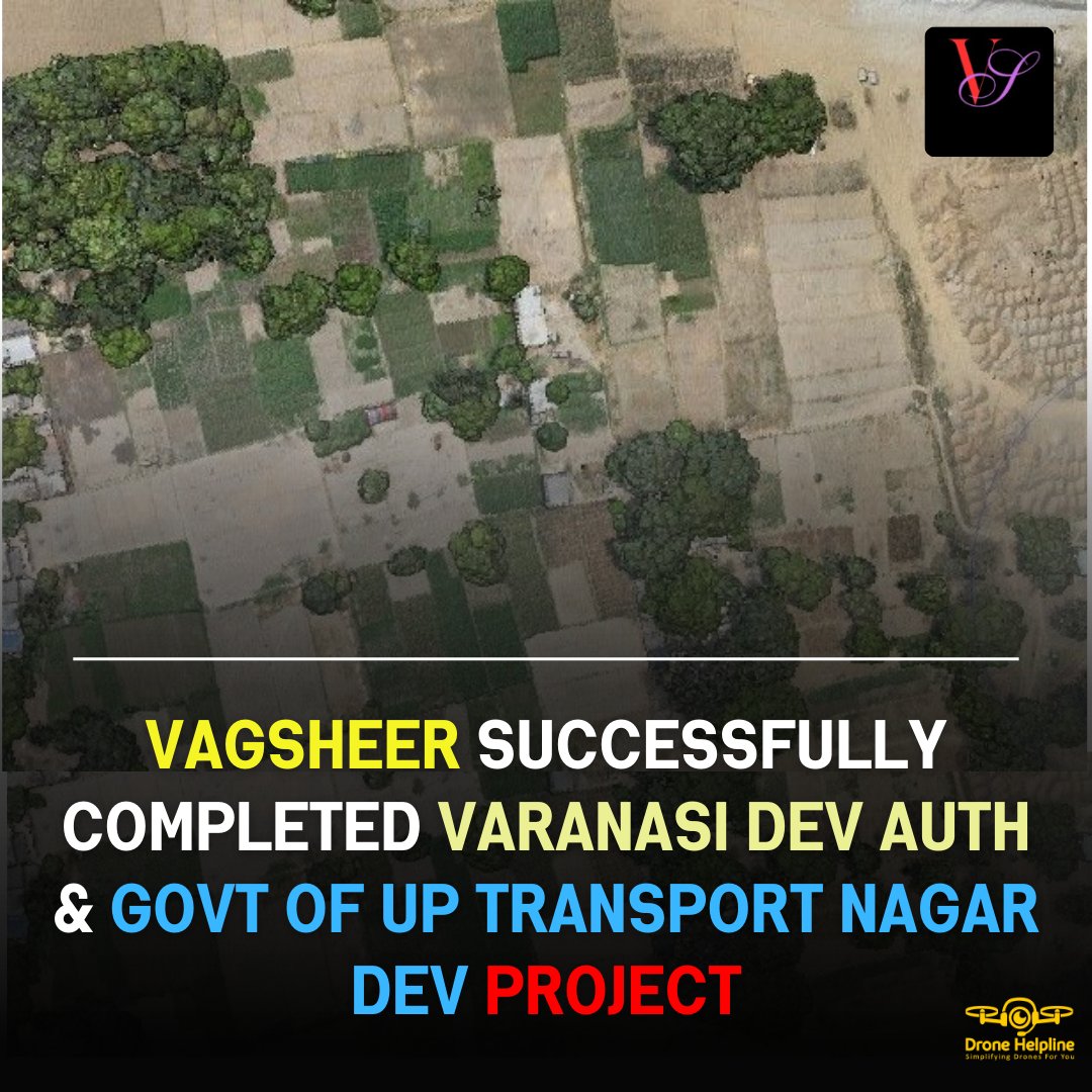
🚀 Vagsheer has triumphantly carried out a drone survey mapping of the Varanasi Development Authority & Government of Uttar Pradesh's Transport Nagar Development Project. 🗺️✨ source: t.ly/BcSn5 #dronesurvey #dronemapping #aerialsurveying #innovation

📡 The Mangaluru City Corporation (MCC) will soon appoint a consultant for a groundbreaking 3D digital twin drone survey to be conducted in the city.📡 source: shorturl.at/xToTv #dronesurvey #dronemapping #3ddrone #droneoperations #dronenews #dailynews #dronehelpline #gis


Streamline Your Orlando Construction Site with DroneDeploy Mapping Accurate, real-time site data for construction project managers in Central Florida #ConstructionLife, #DroneMapping, #DroneDeploy, redwaspdrone.com/streamline-you… #dronepictures #dronevideo #droneservice

🌍 What if your drone and satellite data could turn into smooth, interactive 3D scenes instantly? 3D Gaussian Splatting makes it possible! Read more: geoawesome.com/why-3d-gaussia… #Geoaweosme #DigitalTwins #DroneMapping #Geospatial #Visualization #GIS #VR


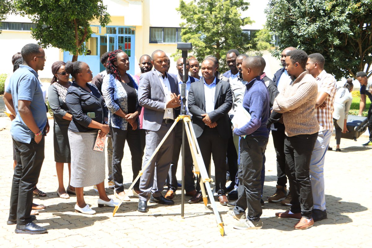
Geoid Technologies Ltd conducted a training exercise at the University for the CITGI4Muringato project. During the training, the facilitators highlighted the basic drone mapping requirements and explored the various application areas. #dronemapping #RemoteSensing #project

In a large-scale coastal cleanup effort, #dronemapping & #PIX4Dcloud were used to support the removal of over 10,000 kg of plastic waste from the ocean. Using drone imagery and volume calculations, they measured changes over time. Read more: pix4d.com/blog/ocean-cle…

GeoCue partners with Coptrz to bring TrueView 3D Imaging Sensors and LP360 LiDAR Processing to UK customers, expanding access to leading aerial mapping for surveyors and engineers. 🚁 #Geospatial #DroneMapping #LiDAR #AerialSurvey #Coptrz #GeoCue ift.tt/QIJx86z #dron…
uasweekly.com
GeoCue Partners with Coptrz to Expand TrueView LiDAR Distribution in the UK - UASweekly.com
GeoCue partners with Coptrz to bring TrueView LiDAR sensors and LP360 software to the UK drone market, enabling high-accuracy 3D mapping and geospatial solutions for surveying professionals. Read...

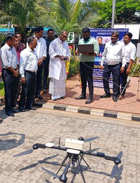
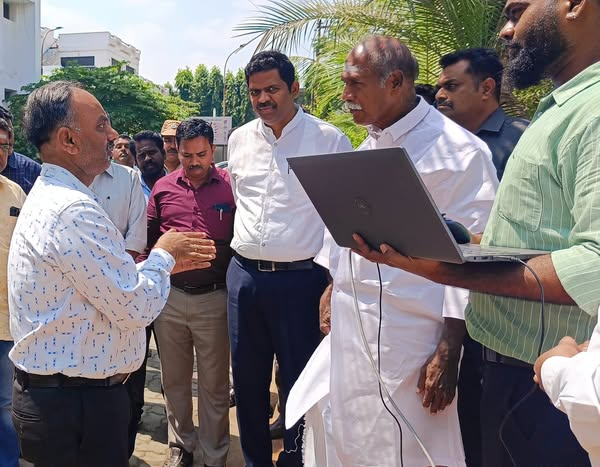
ட்ரோன்கள் மூலம் சேகரிக்கப்படும், புவி அமைவிடத்தரவுகளின் அடிப்படையிலான NAKSHA-தேசிய நகர்ப்புற நில அளவைத் திட்டத்தை, புதுச்சேரி மாநிலம் முருங்கப்பாக்கம் வருவாய் கிராமத்தி்ல் முதலமைச்சர் திரு. ரங்கசாமி இன்று தொடக்கி வைத்தார். #NAKSHA #DroneMapping #LandSurvey
Exciting news for drone professionals! 🚀 We've partnered with UgCS by @SPHEngineering to bring you an integrated solution for advanced drone mission planning and high-end photogrammetry processing. Learn more: pix4d.com/blog/smart-mis… #Pix4D #DroneMapping #NDAACompliance

Managing #construction projects involves immense scale and tight deadlines. One team building Bogotá's first metro line streamlined 20-day tasks into less than one with #DroneMapping, #PIX4Dcloud, and #DigitalConstruction. Read more: pix4d.com/blog/Bogotas-f… #PIX4Dcloud #Pix4D

Streamline Your Orlando Construction Site with DroneDeploy Mapping Accurate, real-time site data for construction project managers in Central Florida #ConstructionLife, #DroneMapping, #DroneDeploy, redwaspdrone.com/streamline-you… #dronepictures #dronevideo #droneservice

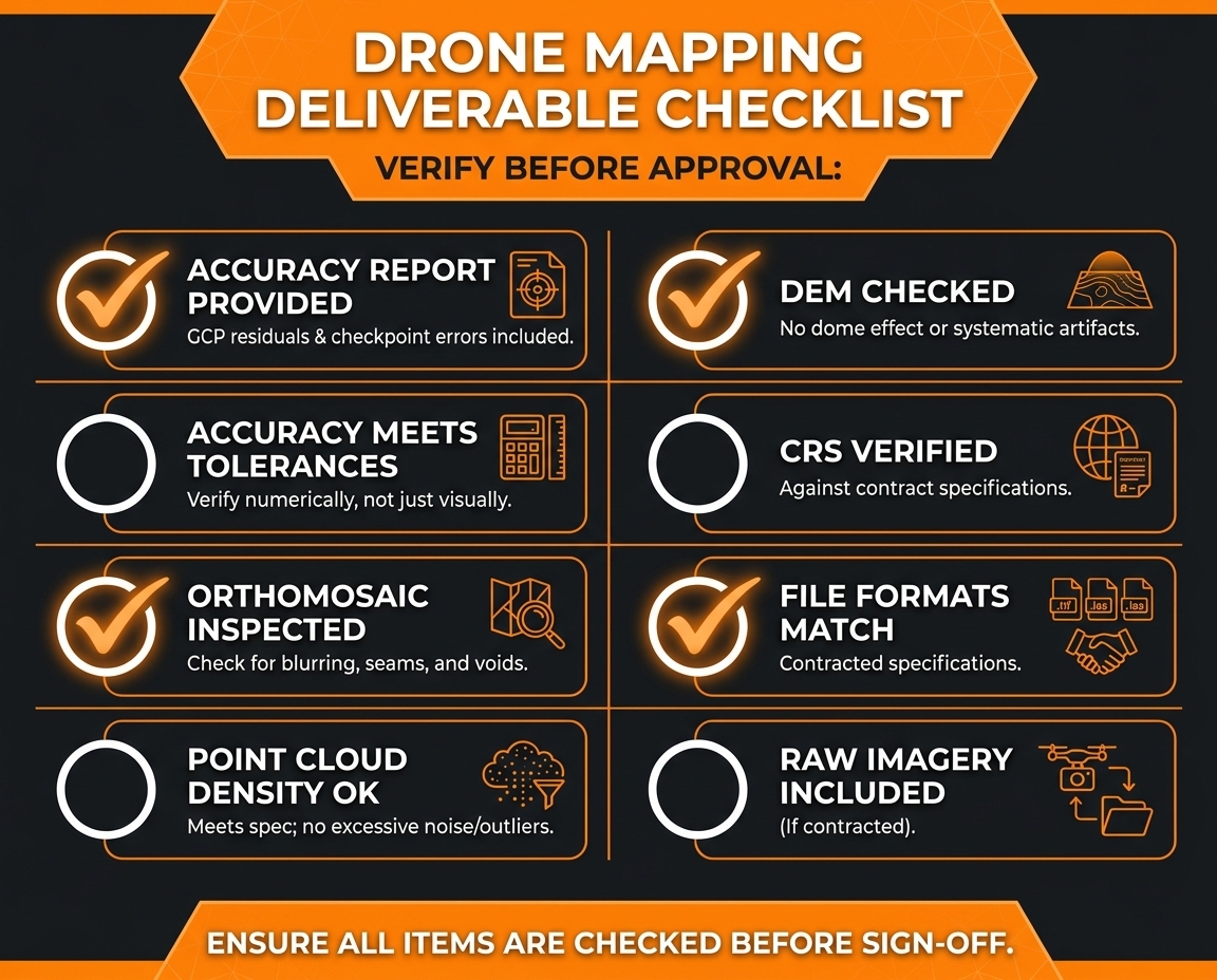
Your drone data looks great. But is it actually accurate? 🤔 Don't sign off until every box is ticked 👇 eu1.hubs.ly/H0tBv7k0 #DroneMapping #ConTech #Construction

Elevate your operations with cutting-edge drone technology. Get accurate, fast, and data-driven insights to make smarter decisions and optimize your projects like never before. 📩 [email protected] #DroneTechnology #DroneMapping #Surveying #AerialSurvey


🚀 Take your surveying skills to the next level with our co-funded Drone Mapping Course! Fly the DJI Mini, see enterprise drones in action, and get CAA-accredited with Iprosurv. 📩 [email protected] | 📞 0114 4055 007 #DroneMapping #CoFundedLearning #STEM #Iprosurv @DJIGlobal
New: Waypoint OS is a free desktop tool that lets you plan precision waypoint missions for consumer DJI drones—no subscription needed. Grid missions, KMZ export, and more. Works with Mavic 4 Pro, Air 3S, Mini 5 Pro. Learn more: pilotbyte.com/waypoint-os 🗺️ #DroneMapping #DJI …

Traditional site surveys take days. Drone mapping takes hours — with centimeter-level accuracy. 🚁 Modern UAVs are transforming construction documentation. #DroneMapping #ConstructionTech #UAV
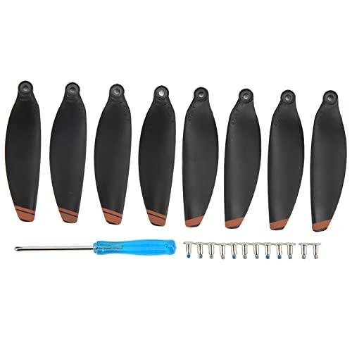
Dilwe Low-Noise Propellers for Mini Se/ Mini 2 The Dilwe Low-Noise Propellers are designed specifically for your Mini SE and Mini 2 drones, giving you a quieter flying... - drone-review.co.uk/products/dilwe… #DroneMapping

Scanning the world from above to build a smarter tomorrow below. 🚁 When drone technology meets GIS intelligence, every single detail gets mapped instantly. We are proud to bring next-level data and tech solutions to infrastructure projects across India. #DroneMapping #GIS


Throwback to my first aerial mapping project 📸 Old fan house, Warsett Hill, Saltburn — guided by Andy Carman. Captured as an oblique orbit (no grid flights back then). Lower quality vs today… but this is where it started. Massive progress since 👇 #DroneMapping

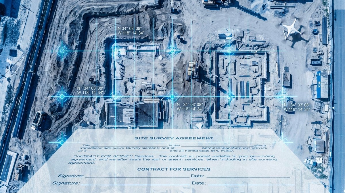
A drone mapping service agreement isn't just a formality — it's your protection if deliverables are late, accuracy targets aren't met, or something goes wrong on site. 🔗 eu1.hubs.ly/H0tBr6V0 #DroneMapping #Construction #ConstructionTech #Photogrammetry #ProjectManagement
DJI Modify just got a workflow upgrade: bigger 3D models are easier to process, edit, and share. More efficiency, smoother collaboration, and faster results for drone mapping teams. #DJI #DroneMapping #3DModeling #Drones #TechUpdate 🚀🧭 ift.tt/aCAO3E4 #dronelife #Dr…


Alpine terrain. Harsh conditions. Stable RTK fix. Sounds impossible? It's not. 🚀 8 ADVOLARE SkyView proves it in the Swiss Alps. New case study: 🔗 rtkdata.com/blog/case-stud… #dronemapping #ntrip #dronesurvey #rtkdata


Turn drone flights into usable data. Learn mission planning, ground control points, and map processing to deliver accurate, client-ready outputs. #DroneMapping #AerialSurvey #GIS #Photogrammetry #DronePilot #UAV #MappingWorkflows
Turn your drone into a mapping powerhouse 🗺️ Learn aerial data capture & analysis in our 2-day Mapping Course – £299 + VAT 📍 Rotherham | 📞 0114 4055 007 👉 zurl.co/POgX2 #DroneMapping #Photogrammetry #DroneTraining #Iprosurv #Dronesforgood #CAAApproved #Surveying

Not all drones are created equal — especially when survey-grade accuracy is on the line. We put together a full breakdown to help construction teams work through the decision. Read it here: eu1.hubs.ly/H0t6FL60 #DroneMapping #HeavyCivil #ConstructionTechnology #UAV


🚀 Future of Land Surveying in 2026! AI 🤖, LiDAR 📡 & Drone Mapping 🚁 are transforming accuracy & speed like never before!Choose LCTSS for smart, fast & reliable surveying solutions.📞 +91 9841804241 🌐 lctss.in/land-surveying… #AI #LiDAR #DroneMapping #LCTSS #SmartSurvey


AI is changing how aerial mapping gets done, turning thousands of images into clear, usable data. See how smarter mapping can elevate your next project. #DroneMapping #AerialData #AIinMapping #LinkedAll


InTerra SmarTarget® revolutionizes drone mapping with 25% less field and office time, higher accuracy, and automated error checks. Nashville’s Drone615 reports game-changing efficiency and precision for critical infrastructure projects. #DroneMapping #GeoTech (1/2)
Drone mapping in 2026 demands lightning-fast, survey-grade accuracy with minimal manual work. SimActive’s Correlator3D leads the charge, processing massive datasets on standard PCs for defense, emergency response, and more. #DroneMapping #TechInnovation (1/2)
स्वामित्व योजना के तहत अब गांवों की ज़मीन का सर्वे और नक्शा ड्रोन जैसी उन्नत तकनीकों से किया जा रहा है, जिससे ग्रामीणों को उनका मालिकाना हक़ मिल रहा है। #स्वामित्व_योजना #DroneMapping #ग्रामीणविकास #DigitalIndia #PanchayatiRaj #RuralEmpowerment #SVAMITVA #NIC

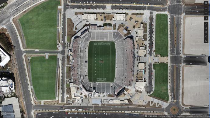
The new Snapdragon Stadium is home to the SDSU football team. Here's a case study on how OCMI, Inc, used Site Scan for ArcGIS to track the movement of materials during construction, with sustainable building in mind. ow.ly/vv7T50Nsclw #dronemapping #aec #realitycapture
How to Process Drone Imagery Data for Free – Step-by-Step Guide? Tutorial link: youtube.com/live/DA7zw56LG… Registration link: studyhacksgeospatial.com/product/google… #dronemapping #UAV #dronedata #photogrammetry #gis #remotesensing #Geospatial #dronesurvey #DroneProcessing #EarthObservation

Photogrammetry in Commercial Construction: Why Measurable Data Beats Drone Video. bit.ly/3OyCtZ3 #CommercialConstruction #DroneMapping #Photogrammetry #ConstructionTech #RiskManagement

ட்ரோன்கள் மூலம் சேகரிக்கப்படும், புவி அமைவிடத்தரவுகளின் அடிப்படையிலான NAKSHA-தேசிய நகர்ப்புற நில அளவைத் திட்டத்தை, புதுச்சேரி மாநிலம் முருங்கப்பாக்கம் வருவாய் கிராமத்தி்ல் முதலமைச்சர் திரு. ரங்கசாமி இன்று தொடக்கி வைத்தார். #NAKSHA #DroneMapping #LandSurvey
Discover how eBee X drone data transformed irrigation planning, benefiting 5,000+ households while reducing costs by 80% compared to traditional methods: hubs.ly/Q02_L5S60 Impactful project led by @BFlyinglabs #eBeeX #DroneSurvey #DroneMapping #Agritech #UAVS @WeRobotics

🚁 Drones, Data, and GIS—Oh My! 🌍 A high-flying lesson in technology, mapping, and planning! Now, who’s ready to map the future? 🔥 We are enrolling for fall - apply for free today! #GIS #DroneMapping #DataDriven #TechInTheClassroom #FutureReady


Want to improve efficiency in high resolution #aerialmapping, Land surveys, Infrastructure inspections, and much more? We are offering expert #Dronemapping & hiring services run by certified operators. Reach us on [email protected] #dronetechnology

🚀 Vagsheer has triumphantly carried out a drone survey mapping of the Varanasi Development Authority & Government of Uttar Pradesh's Transport Nagar Development Project. 🗺️✨ source: t.ly/BcSn5 #dronesurvey #dronemapping #aerialsurveying #innovation
Students mapped 6,000+ headstones using phones and drones — in half the usual time 📱🚁 Learn more: theconversation.com/mapping-cemete… #Geoawesome #GIS #DroneMapping #Cartography
RTK or PPK? Choosing the right drone mapping technology is crucial for accurate results. Learn the key differences and find the best fit for your projects. #DroneMapping #Precision

Geoid Technologies Ltd conducted a training exercise at the University for the CITGI4Muringato project. During the training, the facilitators highlighted the basic drone mapping requirements and explored the various application areas. #dronemapping #RemoteSensing #project
🌍 What if your drone and satellite data could turn into smooth, interactive 3D scenes instantly? 3D Gaussian Splatting makes it possible! Read more: geoawesome.com/why-3d-gaussia… #Geoaweosme #DigitalTwins #DroneMapping #Geospatial #Visualization #GIS #VR

Why wait weeks for survey results? AI-driven UAV analytics can process complex terrain data 10x faster than traditional methods with cm-level accuracy. Efficiency + Precision = The new gold standard in mapping. 📈📍 #DroneMapping #Innovation


Dive into hydrology with our new tools! Simulate, plan, and master water events like a pro. 🔔 Don't miss out—check it out and subscribe to so much more on our YouTube channel: bit.ly/3KFg5b7 #dronemapping #earthworks #mining #groundworks #civilengineering #construction


🛰️📊 Exploring new heights with ESRI's Online Drone Mapping Collection! Ready to revolutionize your drone mapping game? Discover the power of ESRI ArcGIS! Learn more: zurl.co/bFlu _________ #ArcGIS #DroneMapping #ESRI


Exploring new heights in drone mapping technology with #FalconVIZ. 🚀 Our advanced systems deliver high mesh data, transforming aerial imagery into precise 3D models. Experience accuracy like never before! #DroneMapping #TechInnovation #3DModeling

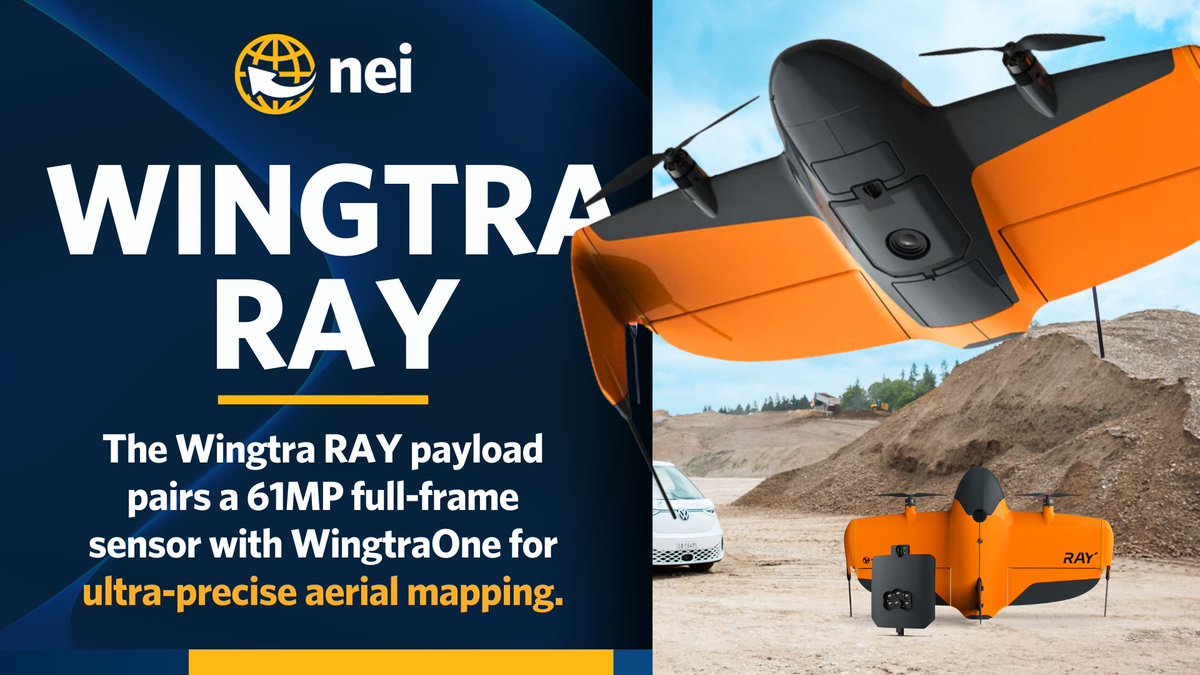
Wingtra RAY payload sets a new standard for aerial mapping. Capture ultra-crisp, survey-grade data with a 61MP full-frame sensor. Smarter mapping starts here. 📲 Contact NEI to learn more: neigps.com/contact/ #WingtraRay #DroneMapping #AerialSurvey #Geospatial #SurveyTech
Something went wrong.
Something went wrong.
United States Trends
- 1. Lemon N/A
- 2. #NFLDraft N/A
- 3. Jaden McDaniels N/A
- 4. Jokic N/A
- 5. Ty Simpson N/A
- 6. Rams N/A
- 7. Bain N/A
- 8. McVay N/A
- 9. Steelers N/A
- 10. Knicks N/A
- 11. Jets N/A
- 12. Stafford N/A
- 13. Nuggets N/A
- 14. Caleb Downs N/A
- 15. Beane N/A
- 16. Eagles N/A
- 17. #Kehlani N/A
- 18. Enid N/A
- 19. McCoy N/A
- 20. Reese N/A