#vectortile search results


Clip geometry defined by GeoJSON and create a new #vectortile package containing tiles clipped at the border. Discover TileShrink at maptiler.link/3jIWd9a

Vector Tile Server v1.2.0: Use gzip output to save bandwith github.com/beginor/vector… #gis #vectortile #vectortileserver

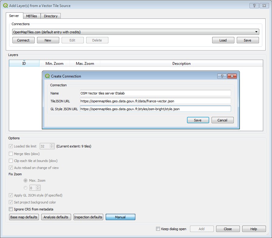
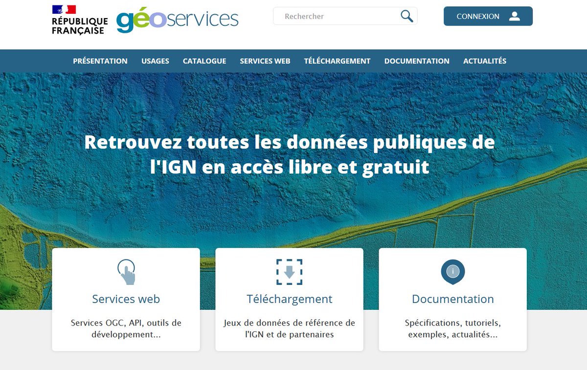
🗺️ Mes #Geoservices ont du style ! 😎🎨 @IGNFrance propose des Géoservices #GeoCommuns via des tuiles vectorielle #VectorTile #OpenData ➡️geoservices.ign.fr/documentation/… 😍 et ce qu'il y a de pratique c'est qu'on peut les personnaliser à son goût 🖌️ 🧵1/8

Fear not #FedGIS workshops are still a go! Get your #RasterTile and #VectorTile fix this afternoon at 1:30. #JustCookIt with @ArcGISPro and @ArcGISXprise

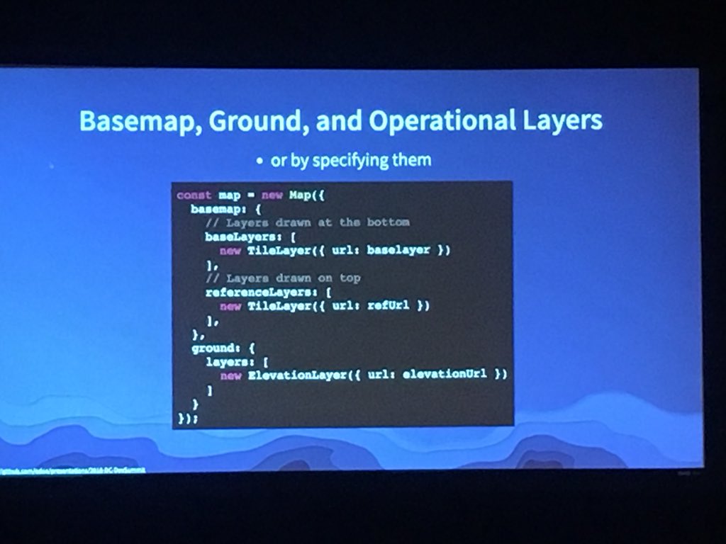
One of my go-to tools for #VectorTile crafting yells at me regularly. Don’t let *out of memory* issues get in the way of your polygon simplification endeavors. Use *cartographic partitions* to divide and conquer. Would you like to know more? pro.arcgis.com/en/pro-app/too…


I added isochrone function into WASAC's WebGIS now. rural.water-gis.com #wasac #rwanda #vectortile #valhalla #isochrone
Do you want to inspect your #vectortile packages comfortably? In the upcoming #MapTiler Desktop 11.3, we will introduce redesigned #map viewer. To be released soon, stay tuned.

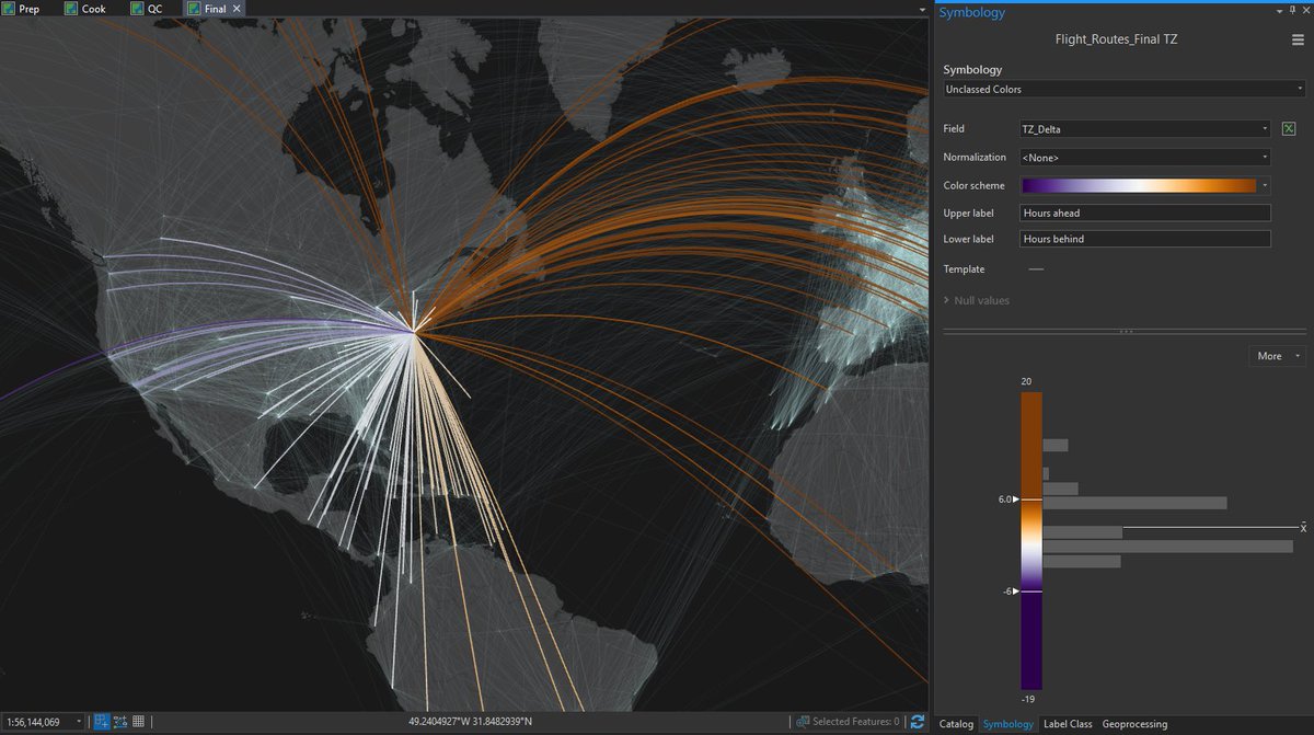
Putting some finishing touches on a #VectorTile layer for @bosshenek. Unclassed colors and data driven styling support in @Esri #VectorTiles brought to you by @ArcGISPro! Would you like to know more? Let's chat at the #EsriEPC and #DevSummit @ArcGISXprise showcase on Monday 😎
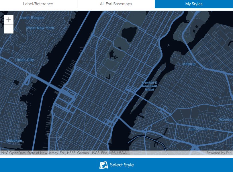
Check out the new @Esri #VectorTile #StyleEditor. Pick from the numerous @ArcGISOnline styles to customize or use your own custom tileset created with @ArcGISPro 😎 #CartoReduxApproved 👍🏻 esri.com/arcgis-blog/pr… #Cartography #EveryoneIsDoingIt
🎨Avec les tuiles vecteurs d'@IGNFrance, maintenant c'est possible 🪛 #YaPlusQua #VectorTile #opensource #OpenData #GeoCommuns @Geoportail #DIY 👉viglino.github.io/ol-ext/example…

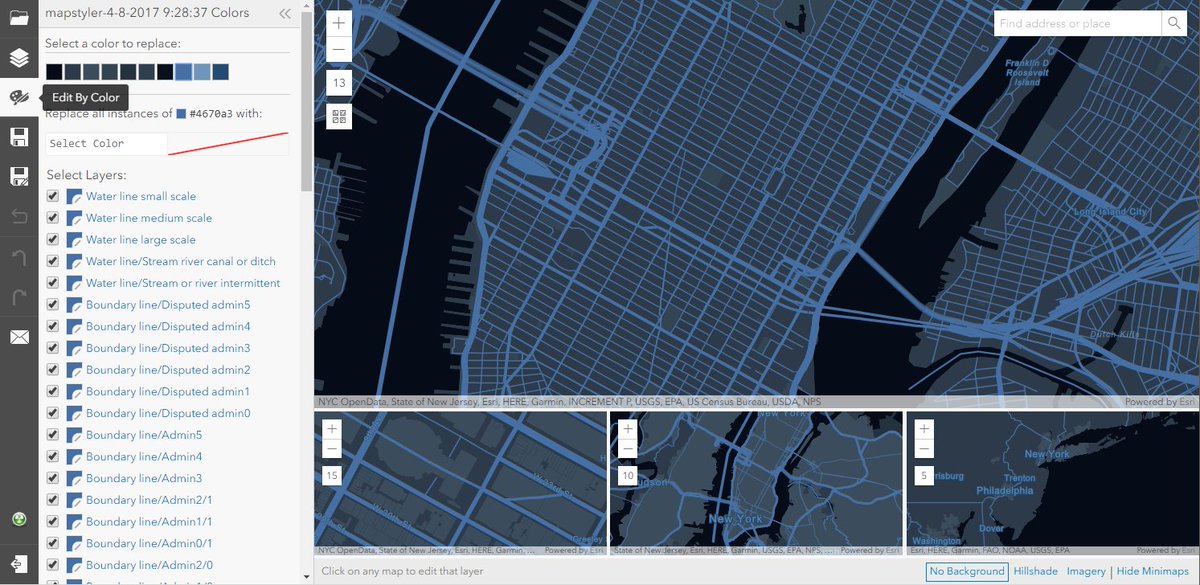
Late night | early morning prep for my neighbor's @ArcGISPro #VectorTile basemap workshop. Pulling bits from @ArcGISOnline Topo / Navigation Basemap styles. Their data, their way 👍🏻 #RoughCut #MakinData #JustCookIt #KnowBeforeYouPro 😴


About a year and a half ago, #vectortile #basemaps became available in #ArcGISOnline. Vector tile basemaps are rendered on the client-side based on a style file that comes with them. Discover their numerous advantages: p.ctx.ly/r/8314


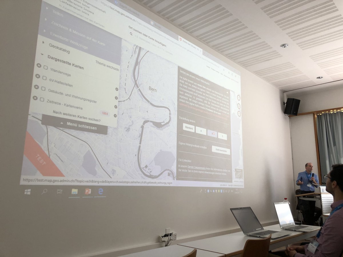
Präsentation von #Vectortile im @swiss_geoportal am #GSDD2019 - die Beta-Tests sehen vielversprechend aus. Das Geoportal des Bundes setzt unter anderen auch auf #OpenStreetMap 👍 Unbedingt anschauen und testen unter vectortiles.geo.admin.ch
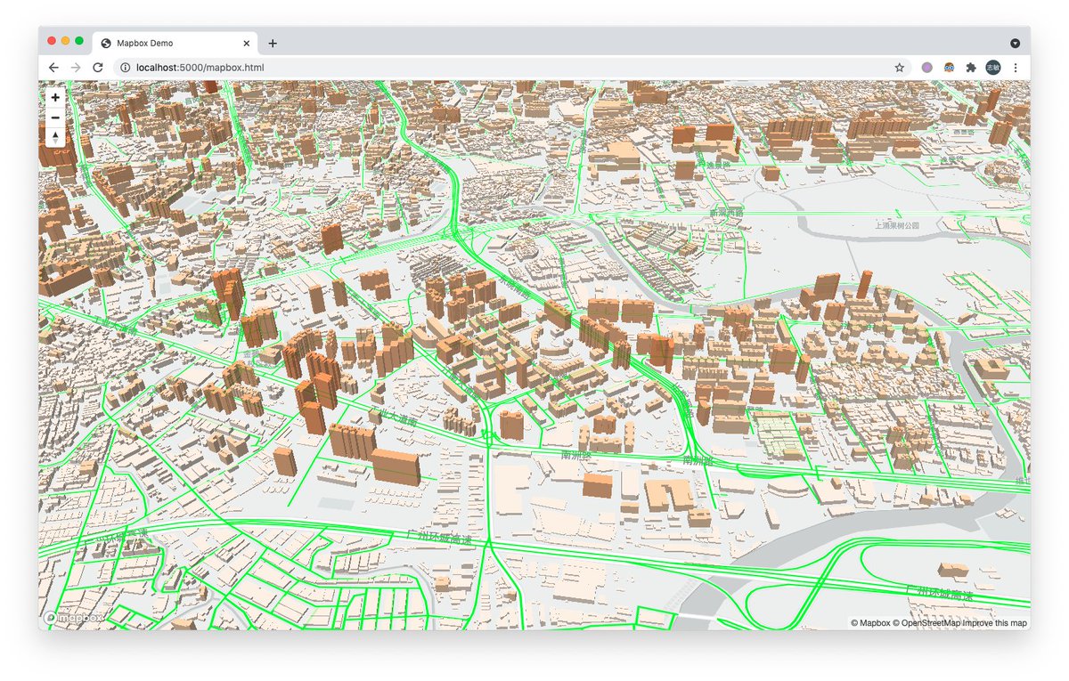
Playing with @maplibre #webgl : affichage vecteur tuilé #vectortile @Geoportail #OpenSource 🗺️ cartes #OpenData @IGNFrance 👉viglino.github.io/ol-ext/example…


📽🚨NEW #METAMAPPING EPISODE🚨📽 Custom Basemaps With The Esri Vector Tile Style Editor | MetaMapping youtu.be/rID-I9FIodk Discord: discord.gg/NjEnVFNPPD . . __ #nft #VectorTile #web3 #polygon #blockchain #metaverse #gis #map #maps #geogeek #mapgeek #geospatial #metamapper

vector tile server update to v1.3.0, add more cache settings, rebuild with dotnet 6.0 #vectortile github.com/beginor/vector…
vector tile server based on postgis and .net5 #postgis #postgres #vectortile github.com/beginor/vector…
Don't forget @TomPohanka's talk at #FOSS4G Europe about @OpenMapTiles (#OpenSource #VectorTile #Maps) starts at 15:00 in room 327. The live stream is here: bit.ly/3RMpjWV #FOSS4GE #FOSS4GE2024

Don't forget @PetraDuriancik's talk at #FOSS4G Europe about #VectorTile #Cartography starts at 13:00 in room 327. The live stream is here: bit.ly/3xrw3mt #FOSS4GE #FOSS4GE2024

If you are @foss4ge today and want to know about #OpenSource vector tiles, or how to master #VectorTile cartography, we have two perfect talks for you! @TomPohanka is talking about @OpenMapTiles at 15:00 (bit.ly/3zpaQKl ) and @PetraDuriancik is talking about…


🗺️ Mes #Geoservices ont du style ! 😎🎨 @IGNFrance propose des Géoservices #GeoCommuns via des tuiles vectorielle #VectorTile #OpenData ➡️geoservices.ign.fr/documentation/… 😍 et ce qu'il y a de pratique c'est qu'on peut les personnaliser à son goût 🖌️ 🧵1/8

A technical note for those who are interested in vector tile creation from PostgreSQL/PostGIS database using nodejs and tippecanoe. This is complicated, but we can flexibly create vector tile with our method. Just an example. #UNOpenGIS #UNVT #vectortile qiita.com/T-ubu/items/38…


The #LivingAtlas of the world is a library of editable #VectorTile #BaseMaps at your fingertips! p.ctx.ly/r/4wzm #EsriUC


Vector Tile Server v1.2.0: Use gzip output to save bandwith github.com/beginor/vector… #gis #vectortile #vectortileserver
🎨Avec les tuiles vecteurs d'@IGNFrance, maintenant c'est possible 🪛 #YaPlusQua #VectorTile #opensource #OpenData #GeoCommuns @Geoportail #DIY 👉viglino.github.io/ol-ext/example…
Playing with @maplibre #webgl : affichage vecteur tuilé #vectortile @Geoportail #OpenSource 🗺️ cartes #OpenData @IGNFrance 👉viglino.github.io/ol-ext/example…
Fear not #FedGIS workshops are still a go! Get your #RasterTile and #VectorTile fix this afternoon at 1:30. #JustCookIt with @ArcGISPro and @ArcGISXprise
🗺️ Mes #Geoservices ont du style ! 😎🎨 @IGNFrance propose des Géoservices #GeoCommuns via des tuiles vectorielle #VectorTile #OpenData ➡️geoservices.ign.fr/documentation/… 😍 et ce qu'il y a de pratique c'est qu'on peut les personnaliser à son goût 🖌️ 🧵1/8
Check out the new @Esri #VectorTile #StyleEditor. Pick from the numerous @ArcGISOnline styles to customize or use your own custom tileset created with @ArcGISPro 😎 #CartoReduxApproved 👍🏻 esri.com/arcgis-blog/pr… #Cartography #EveryoneIsDoingIt
Putting some finishing touches on a #VectorTile layer for @bosshenek. Unclassed colors and data driven styling support in @Esri #VectorTiles brought to you by @ArcGISPro! Would you like to know more? Let's chat at the #EsriEPC and #DevSummit @ArcGISXprise showcase on Monday 😎
Late night | early morning prep for my neighbor's @ArcGISPro #VectorTile basemap workshop. Pulling bits from @ArcGISOnline Topo / Navigation Basemap styles. Their data, their way 👍🏻 #RoughCut #MakinData #JustCookIt #KnowBeforeYouPro 😴
🗺️Ma #carte a du style 😎avec les #VectorTile @IGNFrance 🔎choisissez ce que vous affichez 🎨adaptez les couleurs des #cartes @Geoportail ⌨️ Exemple sur Github #OpenSource #PlanIGN #Openlayers #DIY 👉viglino.github.io/ol-ext/example…


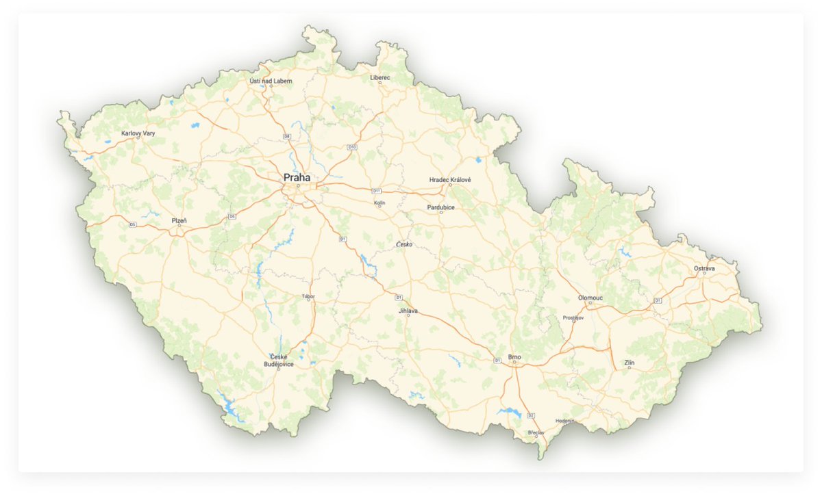
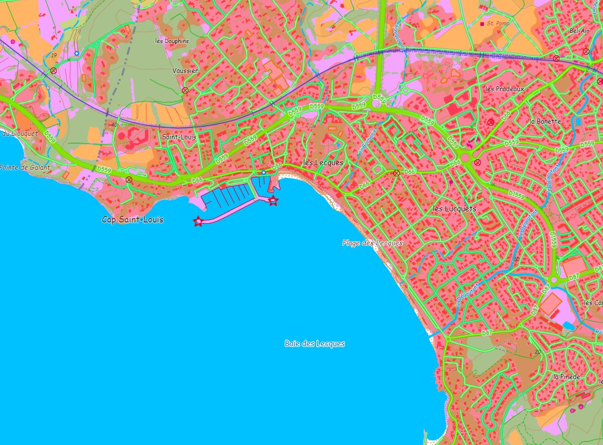
La version bêta de "Plan #IGN" en vecteur tuilé est disponible sur le @Geoportail ! Cette version, qui propose aux utilisateurs 7 premiers styles cartographiques complémentaires, montre tout le potentiel d’un fonds comme Plan IGN avec un service comme le vecteur tuilé #Géoportail
About a year and a half ago, #vectortile #basemaps became available in #ArcGISOnline. Vector tile basemaps are rendered on the client-side based on a style file that comes with them. Discover their numerous advantages: p.ctx.ly/r/8314
Clip geometry defined by GeoJSON and create a new #vectortile package containing tiles clipped at the border. Discover TileShrink at maptiler.link/3jIWd9a
#TutoCarto 💡Jouez avec les styles #VectorTile 🔎choisissez ce que vous affichez 🎨adaptez les couleurs des #cartes @IGNFrance @Geoportail ⌨️Exemple sur Github #OpenSource #PlanIGN #Openlayers #DIY ➡️viglino.github.io/ol-ext/example…


[💡Trucs et Astuces] Pour accéder facilement à la version bêta de "Plan #IGN" en vecteur tuilé : ✅ geoportail.gouv.fr puis "Plan IGN" dans la barre de recherche ⤵️⤵️⤵️
![CanFre's tweet image. [💡Trucs et Astuces] Pour accéder facilement à la version bêta de "Plan #IGN" en vecteur tuilé :
✅ geoportail.gouv.fr puis "Plan IGN" dans la barre de recherche ⤵️⤵️⤵️](https://pbs.twimg.com/media/EsL_x0XXIAAboeB.jpg)


One of my go-to tools for #VectorTile crafting yells at me regularly. Don’t let *out of memory* issues get in the way of your polygon simplification endeavors. Use *cartographic partitions* to divide and conquer. Would you like to know more? pro.arcgis.com/en/pro-app/too…
Präsentation von #Vectortile im @swiss_geoportal am #GSDD2019 - die Beta-Tests sehen vielversprechend aus. Das Geoportal des Bundes setzt unter anderen auch auf #OpenStreetMap 👍 Unbedingt anschauen und testen unter vectortiles.geo.admin.ch
Nicht vergessen: vectortiles.geo.admin.ch testen und Umfrage ausfüllen: findmind.ch/c/vectortilesDE Nach dem #GSDD2019 ist vor dem nächsten #GEOSpatialDataDay share if you care for #Vectortile #gischat #swissgis

Something went wrong.
Something went wrong.
United States Trends
- 1. Purdy 23.3K posts
- 2. #WWERaw 47.6K posts
- 3. Panthers 30.2K posts
- 4. Mac Jones 4,451 posts
- 5. Penta 7,990 posts
- 6. 49ers 31.6K posts
- 7. Gunther 12.7K posts
- 8. Jaycee Horn 2,396 posts
- 9. Canales 11.1K posts
- 10. #KeepPounding 4,769 posts
- 11. #FTTB 4,358 posts
- 12. Niners 4,507 posts
- 13. Melo 17.5K posts
- 14. #RawOnNetflix 1,774 posts
- 15. #CARvsSF 1,058 posts
- 16. Mark Kelly 161K posts
- 17. Rico Dowdle 1,242 posts
- 18. McMillan 2,245 posts
- 19. Kittle 3,191 posts
- 20. 3 INTs 2,097 posts