#fireseverity search results


The new #fireseverity method was tested in Northern Australia and western United States. Now, we should use it to assist on estimate the #NSWbushfires severity.

Butte Meadows on far left, Butt Valley Reservoir on far right. Tasmam Koyom (formerly known as Humbug Valley) upper mid right. Much of dark red area in center burned in one day. Right 1/2 of this area burned in 2012 Chips Fire. #DixieFire #fireseverity

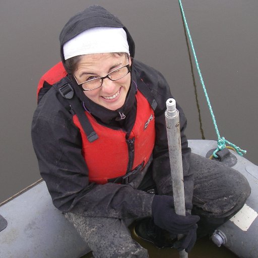
Summary of today: 5.5 hours flying time in a helicopter, 718 geotagged pics, 142 #fireseverity visual estimates of #Ororralvalleyfire, 2 spotted kangaroos, 3 eagles and sadness to see our beautiful #NamadgiNP burnt. Tomorrow more. #AustralianFires


Today: 4 hours helicopter flying time, 430 geotagged pics, 87 #fireseverity visual estimates of #Ororralvalleyfire, 1 wallaby, a few birds and sadness to see our beautiful #NamadgiNP burnt but happiness to see iconic #GibraltarFalls and other little bits untouched. More on Moday.


#DixieFire 8/17/2021 We got some Sentinel satellite imagery today. It gives striking snapshots of the fire in mid-stride, and shows some areas where many larger trees appear to have survived. It's not all bad news. #fireseverity #fireecology


We had a great little helper in the field with us today #albypom #wildFIRELab @ExeWildFIRElab #fireseverity


RT @MonicaGTurner: Does #barkbeetle severity affect #fireseverity in lodgepole? New study led by @Brian_J_Harvey

【🎉Latest accepted article】 Direct Effects of #FireSeverity on Soil Microbial Diversity and Network Assembly in a Transitional Climate Forest #SoilMicroorganism | #CommunityDiversity | #MicrobialNetworkComplexity @HenanUniversity @MaximumAcademic doi.org/10.1093/jpe/rt…

Out at #warehamforestfire today undertaking a #fireseverity survey #UKFDRS @ExeWildFIRElab thanks for access and for being great research partners @WildfireTacAd and @ForestryEngland


James' has just finished an extended capaign of fieldwork to study how #fireseverity affects vegetation structure and composition. This will then be used to try determine a mechanism for feedbacks between fires. #CSESresearch #PhDLife 🔥


First pass at a #fireseverity map for #KangarooIsland #Landsat imagery from 9th Jan 2020 compared with an image ~12 months old. Alot of false +ve due to smoke. Waiting for latest image to compare #auspol #bushfireaustralia #AustralianBushfiresDisaster

Assessing the Relationship between Forest Structure and Fire Severity on the North Rim of the Grand Canyon mdpi.com/2571-6255/2/1/… #foreststructure #fireseverity #wildfire #LiDAR #firemanagement
New Perspective by Lutz, J.; et al. 2018 Advancing Fire Science with Large Forest Plots and a Long-Term Multidisciplinary Approach mdpi.com/259596 #firescience #fireseverity #YosemiteForestDynamicsPlot

Assessing the Relationship between Forest Structure and #FireSeverity on the North Rim of the Grand Canyon mdpi.com/2571-6255/2/1/… #wildfire #LiDAR #firemanagement

Fire Severity and Vegetation Recovery on Mine Site Rehabilitation Using WorldView-3 Imagery mdpi.com/312050 #FireSeverity #resilience


New study reveals how fire severity affects vegetation complexity in Mediterranean ecosystems. Plant community types play a crucial role in moderating these effects, impacting post-fire landscapes differently. mdpi.com/2571-6255/6/12… #MediterraneanEcology #FireSeverity


In Australia's eucalypt forests, high #FireSeverity increases the odds of a future high-severity fire - even if an intervening burn has been mild doi.org/10.1002/ecs2.3… #FireEcology #Wildfire #OpenAccess @EcolJim @OwenBushfire @meaghanejenkins

【🎉Latest accepted article】 Direct Effects of #FireSeverity on Soil Microbial Diversity and Network Assembly in a Transitional Climate Forest #SoilMicroorganism | #CommunityDiversity | #MicrobialNetworkComplexity @HenanUniversity @MaximumAcademic doi.org/10.1093/jpe/rt…

A new study in Nature Ecology & Evolution finds fire severity is a stronger predictor of megafire forest recovery rates than climate change internationalfireandsafetyjournal.com/study-finds-fi… #WildfireRecovery #ForestFires #FireSeverity #ClimateImpact #Ecology #FireResearch
internationalfireandsafetyjournal.com
Study finds fire severity, not climate, most affects megafire recovery
Forests are taking longer to recover after large-scale wildfires, according to research published in Nature Ecology & Evolution and reported by Carbon

Observant l'efecte de l'incendi de Vilanova de Meià depenent de la gestió forestal prèvia. I ara l'efecte en el sòl @bomberscat @bombers_GRAF @GramUB @holisoils #prescribedfire #fireseverity


New study reveals how fire severity affects vegetation complexity in Mediterranean ecosystems. Plant community types play a crucial role in moderating these effects, impacting post-fire landscapes differently. mdpi.com/2571-6255/6/12… #MediterraneanEcology #FireSeverity

Be responsible when you are enjoying the #BankHolidayWeekend . The @metofficeEMids #fireseverity is mostly Level 3 (High) and Level 2 (Moderate) across @LeicsCountyHall and @Leicester_News. DO NOT use disposable BBQ! @LFRSFireControl @BBCLeicester @LeicsFireRescue @ATCLeicester


This bank holiday weekend the fire severity index is Amber High alert. 🔥 It's an assessment of how severe a fire could become if one were to start. 🥪 Burger off with disposable BBQs! 🚬 Dispose of litter responsibly 🔥 If you spot a wildfire, call 999 & report it immediately

📖Daily Paper 🌲#ForestsHighlyAccessedPapers "The Effect of Antecedent #FireSeverity on Reburn Severity and #Fuel Structure in a Resprouting #EucalyptForest in Victoria, Australia", by @lukewarm1981 et al. 🎉 📚Read more here👉 mdpi.com/1999-4907/12/4… 📌 #epicormicresprouter


Great fire management by Bardi Jawi rangers on the Dampier Peninsula! 👏 We're proud to support this work by providing #FireSeverity #mapping.

“There’s been a major decrease in fire in this country and I’m really proud” Map showing the fire management work by Bardi Jawi rangers in the Kimberley, which has significantly reduced late season bushfires on the Dampier Peninsula #SavannaFireForum 🔥

Butte Meadows on far left, Butt Valley Reservoir on far right. Tasmam Koyom (formerly known as Humbug Valley) upper mid right. Much of dark red area in center burned in one day. Right 1/2 of this area burned in 2012 Chips Fire. #DixieFire #fireseverity

Forest Fire Damage Analysis Using Satellite Imagery and ArcGIS youtu.be/tJ3vA1WVogE #arcgis #forestfire #fireseverity #gis #nbr
In a recent paper lead by @DonatoMorresi and published in Remote Sensing of Environment journal, we compare the use of “paired images” VS “reflectance composites” for #fireseverity mapping through Sentinel-2 #satellite images. @unito #remotesensing

A new study compares #wildfire in areas that have & haven't recently burned, to help land managers & others predict the future drivers of #FireSeverity doi.org/10.1002/ecs2.3… #FireRegimes #LegacyEffects #OpenAccess @PSUEarth @psugeography @usfs_psw

In Australia's eucalypt forests, high #FireSeverity increases the odds of a future high-severity fire - even if an intervening burn has been mild doi.org/10.1002/ecs2.3… #FireEcology #Wildfire #OpenAccess @EcolJim @OwenBushfire @meaghanejenkins
#DixieFire 8/17/2021 We got some Sentinel satellite imagery today. It gives striking snapshots of the fire in mid-stride, and shows some areas where many larger trees appear to have survived. It's not all bad news. #fireseverity #fireecology
So thrilled to announce my first first-author publication! If you’re interested in fire in subalpine forests and post-fire plant communities, read on! 🧵 #subalpineforest #fire #fireseverity #productivity

A new #FreeAccess Report in @ESAEcology: Productivity modifies the effects of fire severity on understory diversity #OpenData in @datadryad & @ZENODO_ORG #Fire #OpenScience #NSFFunded @Texosporium @egbrodie @DavisEcology @UCDavisPlants @usfs_r5 @NSF doi.org/10.1002/ecy.35…

In Australia's eucalypt forests, high #FireSeverity increases the odds of a future high-severity fire - even if an intervening burn has been mild doi.org/10.1002/ecs2.3… #FireEcology #Wildfire #OpenAccess @EcolJim @OwenBushfire @meaghanejenkins
RT @MonicaGTurner: Does #barkbeetle severity affect #fireseverity in lodgepole? New study led by @Brian_J_Harvey
A new study compares #wildfire in areas that have & haven't recently burned, to help land managers & others predict the future drivers of #FireSeverity doi.org/10.1002/ecs2.3… #FireRegimes #LegacyEffects #OpenAccess @PSUEarth @psugeography @usfs_psw
#DixieFire 8/17/2021 We got some Sentinel satellite imagery today. It gives striking snapshots of the fire in mid-stride, and shows some areas where many larger trees appear to have survived. It's not all bad news. #fireseverity #fireecology
We had a great little helper in the field with us today #albypom #wildFIRELab @ExeWildFIRElab #fireseverity
Butte Meadows on far left, Butt Valley Reservoir on far right. Tasmam Koyom (formerly known as Humbug Valley) upper mid right. Much of dark red area in center burned in one day. Right 1/2 of this area burned in 2012 Chips Fire. #DixieFire #fireseverity
James' has just finished an extended capaign of fieldwork to study how #fireseverity affects vegetation structure and composition. This will then be used to try determine a mechanism for feedbacks between fires. #CSESresearch #PhDLife 🔥
Assessing the Relationship between Forest Structure and Fire Severity on the North Rim of the Grand Canyon mdpi.com/2571-6255/2/1/… #foreststructure #fireseverity #wildfire #LiDAR #firemanagement
The new #fireseverity method was tested in Northern Australia and western United States. Now, we should use it to assist on estimate the #NSWbushfires severity.
Summary of today: 5.5 hours flying time in a helicopter, 718 geotagged pics, 142 #fireseverity visual estimates of #Ororralvalleyfire, 2 spotted kangaroos, 3 eagles and sadness to see our beautiful #NamadgiNP burnt. Tomorrow more. #AustralianFires
Out at #warehamforestfire today undertaking a #fireseverity survey #UKFDRS @ExeWildFIRElab thanks for access and for being great research partners @WildfireTacAd and @ForestryEngland
New Perspective by Lutz, J.; et al. 2018 Advancing Fire Science with Large Forest Plots and a Long-Term Multidisciplinary Approach mdpi.com/259596 #firescience #fireseverity #YosemiteForestDynamicsPlot
Today: 4 hours helicopter flying time, 430 geotagged pics, 87 #fireseverity visual estimates of #Ororralvalleyfire, 1 wallaby, a few birds and sadness to see our beautiful #NamadgiNP burnt but happiness to see iconic #GibraltarFalls and other little bits untouched. More on Moday.
Assessing the Relationship between Forest Structure and #FireSeverity on the North Rim of the Grand Canyon mdpi.com/2571-6255/2/1/… #wildfire #LiDAR #firemanagement
📖Daily Paper 🌲#ForestsHighlyAccessedPapers "The Effect of Antecedent #FireSeverity on Reburn Severity and #Fuel Structure in a Resprouting #EucalyptForest in Victoria, Australia", by @lukewarm1981 et al. 🎉 📚Read more here👉 mdpi.com/1999-4907/12/4… 📌 #epicormicresprouter
In a recent paper lead by @DonatoMorresi and published in Remote Sensing of Environment journal, we compare the use of “paired images” VS “reflectance composites” for #fireseverity mapping through Sentinel-2 #satellite images. @unito #remotesensing
Fire Severity and Vegetation Recovery on Mine Site Rehabilitation Using WorldView-3 Imagery mdpi.com/312050 #FireSeverity #resilience

Learn about #germination response of #woodyspecies to laboratory-simulated #fireseverity & airborne nitrogen deposition:a post-fire recovery strategy perspective rdcu.be/bXENM #SNVEGE #PlantEcology #Halimiumlasianthum #Pinuspinaster #Pterospartumtridentatum #fireecology


Something went wrong.
Something went wrong.
United States Trends
- 1. #Worlds2025 41.2K posts
- 2. #TalusLabs N/A
- 3. Doran 17.1K posts
- 4. #T1WIN 27K posts
- 5. Sam Houston 1,588 posts
- 6. Boots 29.2K posts
- 7. Oregon State 4,802 posts
- 8. Faker 31.7K posts
- 9. Lubin 5,790 posts
- 10. Keria 10.5K posts
- 11. #Toonami 2,719 posts
- 12. #T1fighting 3,424 posts
- 13. Louisville 14.3K posts
- 14. Option 2 4,136 posts
- 15. Hyan 1,387 posts
- 16. Emmett Johnson 2,621 posts
- 17. UCLA 7,812 posts
- 18. Nuss 5,601 posts
- 19. Frankenstein 125K posts
- 20. Oilers 5,315 posts