#opensourcegis ผลการค้นหา

Whenever I see something like this, I'm glad that only one of my clients still uses ESRI products. They always have to pay up! The MrSID mention always amazes me. I haven't used that since 2004. #opensourceGIS #QGIS


We're thrilled to finally reveal our logo, FOSS4G Asia 2026! Our logo, built from data-centric hexagons, represents the powerful community collaboration that defines FOSS4G. Website Link: foss4g.asia/2026/ #FOSS4GAsia2026 #OpenSourceGIS #Geospatial #OSGeo


📱 QField goes wherever you do. Android? Check. iOS? Check. Desktop? Check. If it has a screen, we’re probably on it. Collect GIS data anywhere, anytime. #QField #OpenSourceGIS #fieldwork


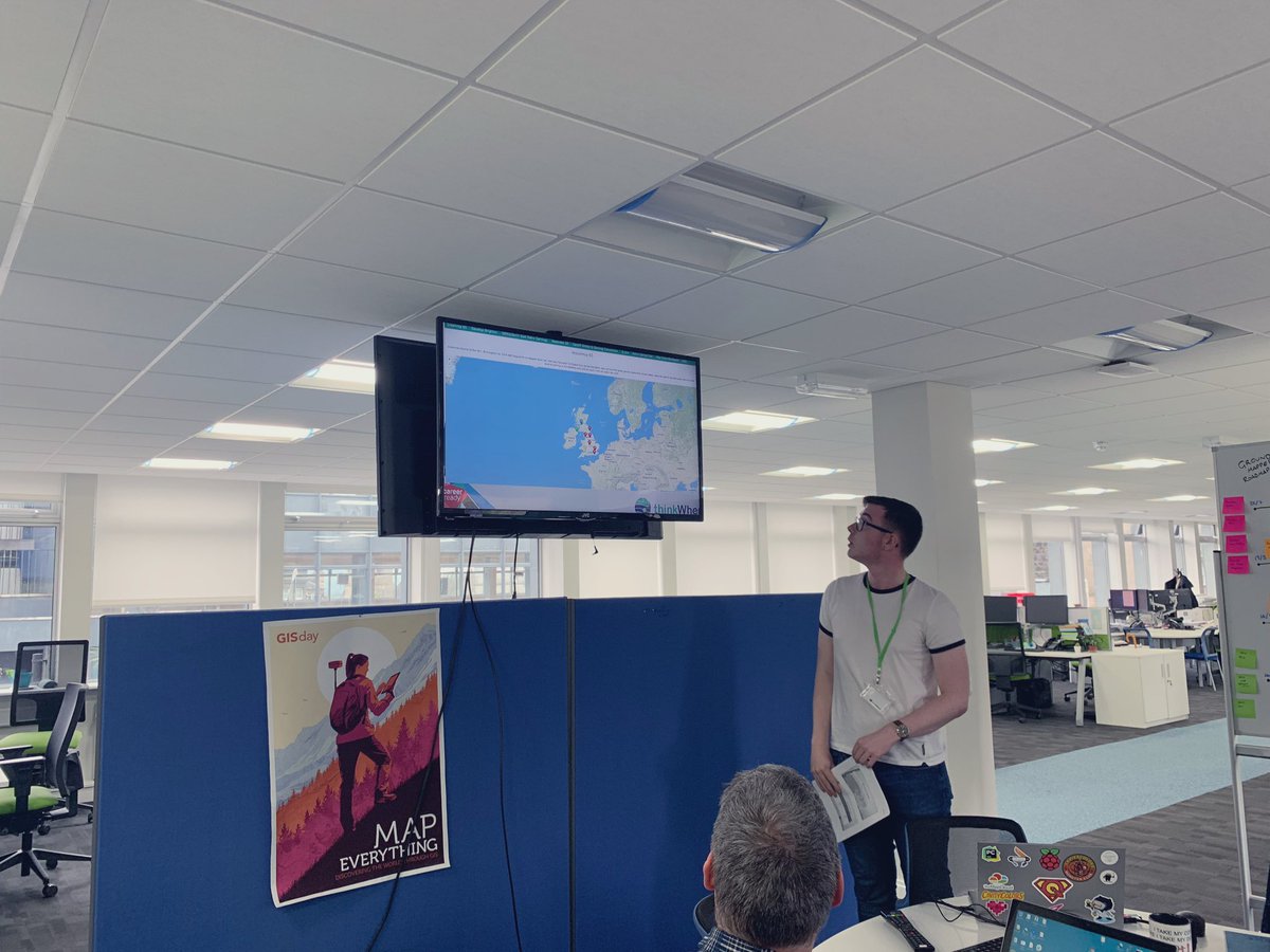
Maximise the benefits of location data with a series of open source GIS training Courses offered by @thinkWhere1 agi.org.uk/events/calendar #AGI CPD #OpenSourceGIS


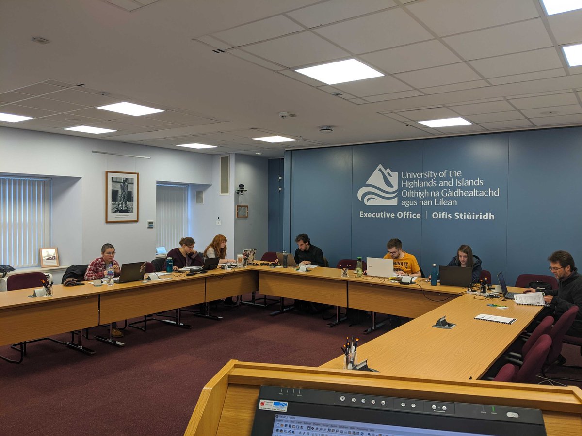
Day 2 of our QGIS Beginner course @CodeBaseSTL Today we’re training delegates from @falkirkcouncil #qgis #opensourcegis #themapcloud #training #geopackage #GIS

The final week of our @CareerReadyUK placement got emotional when Grant wow’d staff with his presentation on webmapping gaming and Career Ready placement data!! Can’t believe it’s been 4 weeks already. #careerready @Stirling_High @qgis #opensourcegis

🚀 From humble beginnings to over 1 million downloads, QField has officially gone from “little app that could” to “open-source overachiever.” Thanks to the power of open source (and probably some caffeine). #QField #OpenSourceGIS #fieldwork
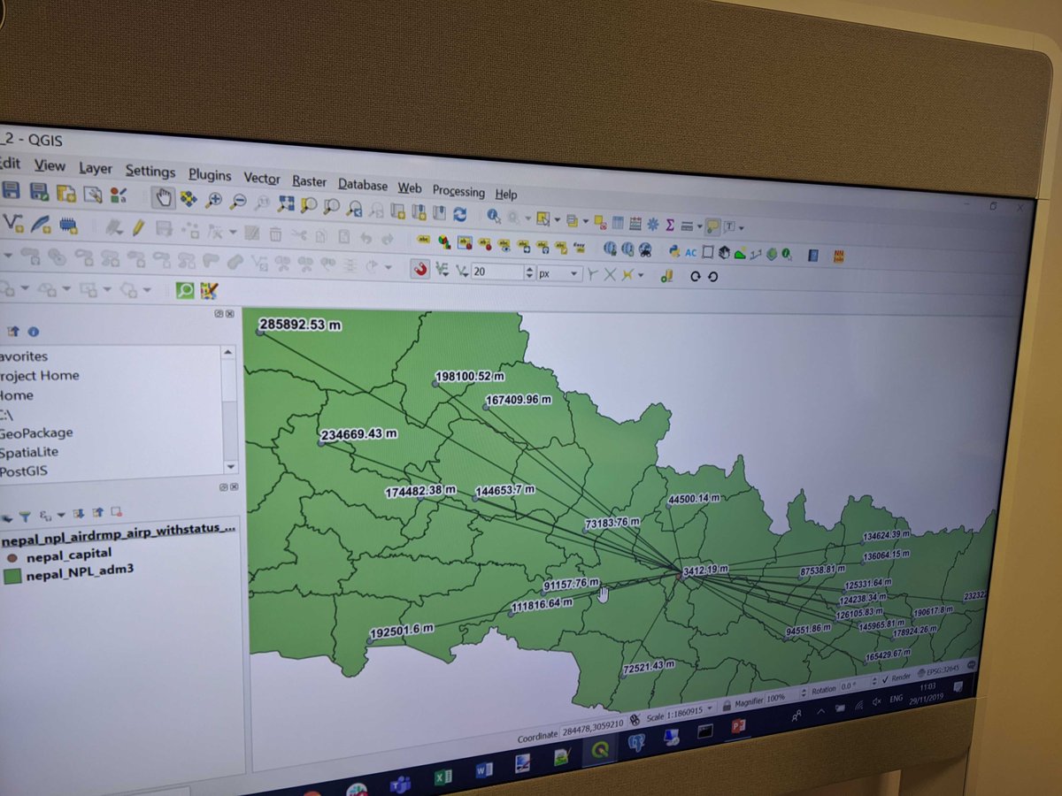
Students at @ThinkUHI have been working through our QGIS Advanced course. We’ve been looking at geometry generators, and automating GIS processes using the QGIS graphical modeller #qgis #opensourcegis #geopackages #pyqgis #themapcloud #geometrygenerator

🌍Por si te perdiste las Jornadas de #SIGLibre2025 celebradas el pasado septiembre en Girona, ¡ya está disponible en su web el repositorio para consultar o descargar! La edición reunió a más de 250 profesionales y entusiastas del sector. 🔗github.com/SIGTE-UdG/jorn… #OpenSourceGIS


For #geospatialtechnology and capabilities on a budget, see our curated series of articles with #tips, #opensourcegis and other low-cost #gis resources. Set yourself up for a fantastic, sucessful 2022!


Learn how to create custom attribute forms in QGIS this Thursday, March 10th at 2pm EST. lunageo.com/webinar/create… #QGIS #opensource #opensourceGIS


🗺️ QField’s passport is full! 🌍 We’re blown away by how far our geospatial tool has travelled: from mountaintops to city blocks, you’re mapping it all. Our amazing global user community is making QField a true #DigitalPublicGood. A map made in heaven! 💚 #OpenSourceGIS


#Geographic Object-Based Image Analysis for Automated #Landslide Detection Using #OpenSourceGIS Software by Raphael Knevels, Helene Petschko, Philip Leopold and Alexander Brenning 👉mdpi.com/2220-9964/8/12… #GEOBIA #LiDAR #DigitalTerrainModel

If you missed our webinar on QGIS plugins last week or want to relive the magic, the video is now available. lunageo.com/webinar/10-gre… #QGIS #OpenSourceGIS


📢Just published: New paper about #QGIS "The QGIS project: Spatial without compromise" by Anita Graser, Tim Sutton (Kartoza co-founder), Marco Bernasocchi 👏A must-read on QGIS's evolution and community! Read paper here: cell.com/patterns/fullt… #QGIS #OpenSourceGIS #kartoza


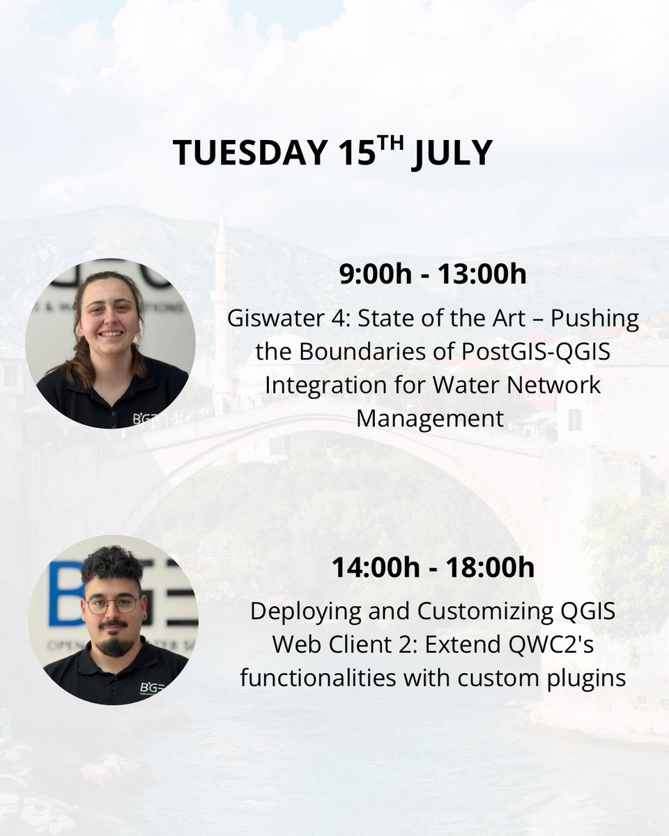
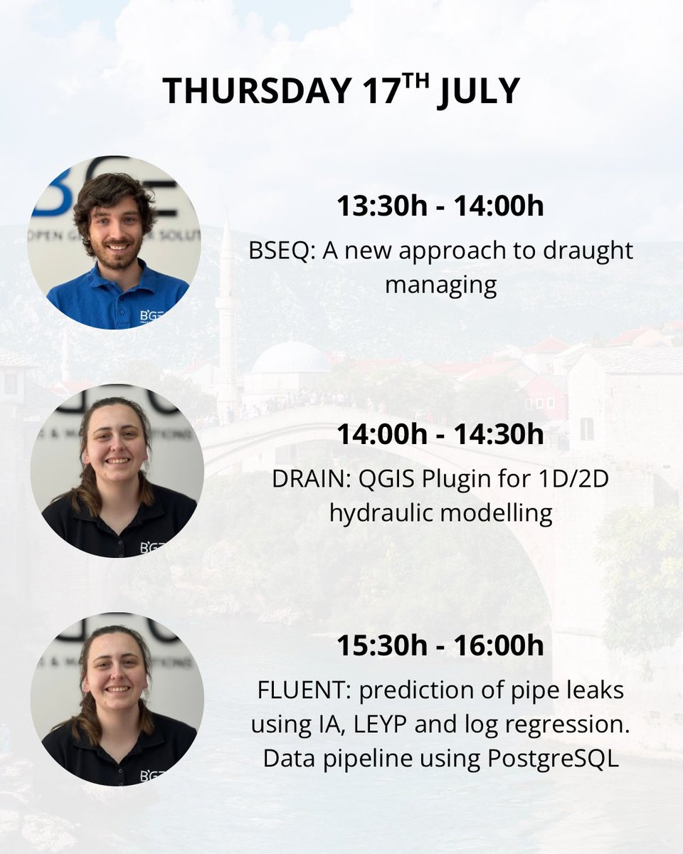
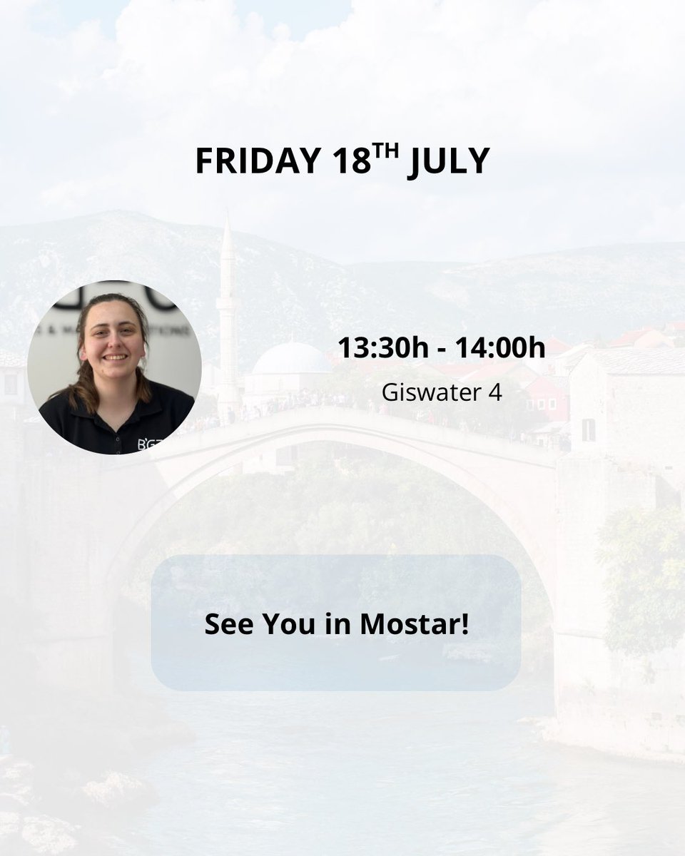
🚀 We're bringing 6 powerful sessions to #FOSS4GEurope in Mostar! 🌍 🧠 Topics from: ✅ AI leak prediction ✅ Drought management ✅ QGIS plugins ✅ PostGIS + water networks 📍 Join us in Mostar, July 15–18! #OpenSourceGIS #QGIS #PostGIS #FOSS4G #Giswater


QGIS Hands-on : Learn map composition, buffers, grids and other such basics of geospatial analysis # WII # Quantum #OSG #opensourcegis #gis4all #gisday2023 @wii_india


The 1st technical session was on Usage of Open-Source GIS Platforms for disaster management! 🌐💻 Cost-effective, customizable & collaborative solutions for a resilient future! #OpenSourceGIS #DisasterManagement #GIS


Something went wrong.
Something went wrong.
United States Trends
- 1. Sherrone Moore 15.5K posts
- 2. Michigan 65.2K posts
- 3. Mel Tucker N/A
- 4. Erika 101K posts
- 5. Vini 44.9K posts
- 6. Ann Arbor 1,957 posts
- 7. Mets 54.2K posts
- 8. Biff Poggi N/A
- 9. Jesse Minter N/A
- 10. Bryce Underwood N/A
- 11. Xabi 83.7K posts
- 12. Sheen 31K posts
- 13. Real Madrid 180K posts
- 14. Rudiger 32.6K posts
- 15. Rodrygo 65K posts
- 16. Orioles 22.4K posts
- 17. Jedd Fisch N/A
- 18. Courtois 22.1K posts
- 19. Ime Udoka N/A
- 20. John Harbaugh N/A