
Talvez você curta


“Remote Sensing for Smart City Modelling“ by @ChisuwoChimango on Medium @808Computing: medium.com/nebula-researc…


After a long break, I just published 'Remote sensing for Smart City Modelling' @808Computing Here's a link: medium.com/nebula-researc…
I am excited to talk about mapping lake chilwa using synthetic aperture radar SAR and unsupervised machine learning at the 5th indabax


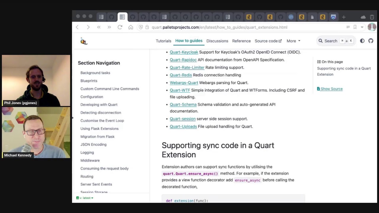
#452 Top Quart (async Flask) Extensions The latest episode with Philip Jones and @mkennedy is out. Enjoy! #python talkpython.fm/episodes/show/…
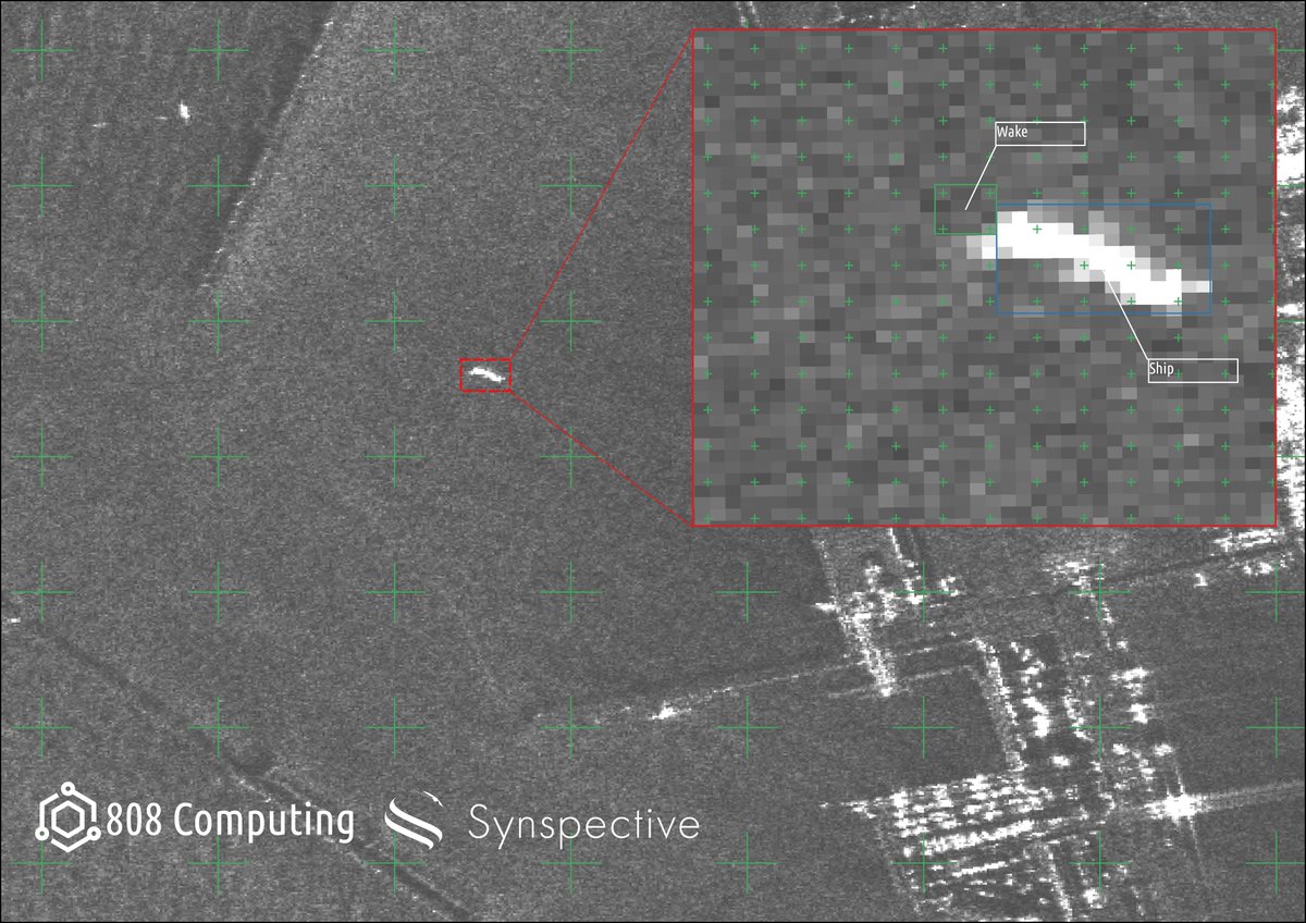
Synthetic Aperture Radar image of the coast of Hachiro Lagoon Japan. Taken by @synspective Strix Satellite & mapped by @808Computing The inset shows the segmented ship and trailing wake which can help infer ship direction Links: synspective.com/gallery/hachir… 808computing.org

A Koordinates data portal adapts to your workflows. The dynamic UI lets you focus on the browser, map, table or a single feature. Explore today at bit.ly/3s9TRs4 #Geospatial #GIS #Data

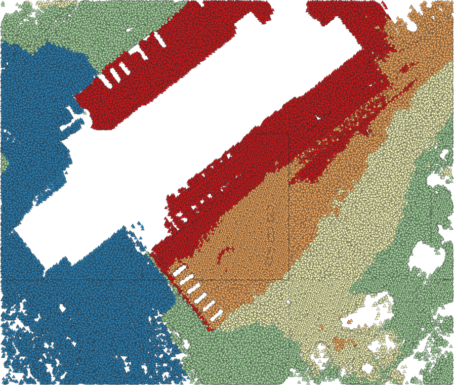
a lil sneak peak... rendering 3.2 million points from GeoPandas in 1 second 🚀

Cloud optimized Synthetic Aperture Radar image of Tanna Island by @umbraspace …og.s3-website.us-west-2.amazonaws.com/?prefix=sar-da…


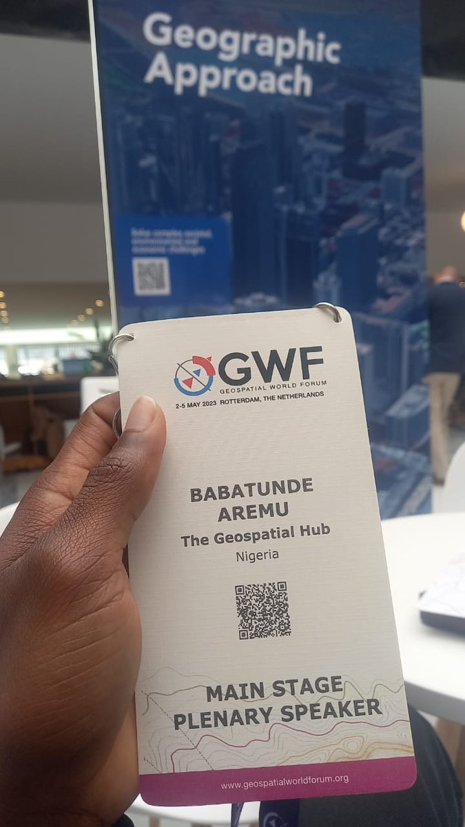
It all still seems surreal to me; attending and speaking at the @geoworldmedia conference, the invaluable knowledge gained listening to industry leaders speak, and the connections I have made. I feel super proud of myself and @TheGeoSpatialH1 #gischat #geospatial


Thanks to those who supported our crowdfunding, we have now introduced the native point cloud processing in @QGIS: lutraconsulting.co.uk/blog/2023/05/3… #lidar #3d
With our latest work and introduction of point cloud processing to @QGIS, you can export your LIDAR data to @shapefiIe (please don't).

It builds upon #ipywidgets and supports bidirectional communication between the frontend and backend. No other Python-based web app frameworks has native support for ipywidgets except Solara. The closest one would be Voila, but Solara is much better than Voila.
#Leafmap v0.21.0 is out. It now supports @solara_dev. Developing interactive web apps with pure Python with automatic deployment on @huggingface. Try it out 👇 Web app: giswqs-solara-geospatial.hf.space/leafmap GitHub: github.com/opengeos/solar… @maartenbreddels #python #geospatial #dataviz

Congratulations to @hwtnv, one of the first recipients of Cesium Ecosystem Grants, a $1M fund to advance the #3D #geospatial ecosystem. Learn more about this group of recipients and apply: bit.ly/3ObrmmD

It's Webinar Week! Multiuser Editing with QGIS and PostGIS in an Enterprise Environment presented by Cliff Patterson @cliffpat is this Wednesday, May 31 at 2pm EDT. Registration is still open, sign up now at lunageo.com/webinar/multiu…


We are working with @umbraspace & @SkyfiApp to help locate the missing climbers on Mt. Everest. We're currently differentiating manmade objects from the snow & rocks to detect human activity. We could use your help to find the missing climbers!

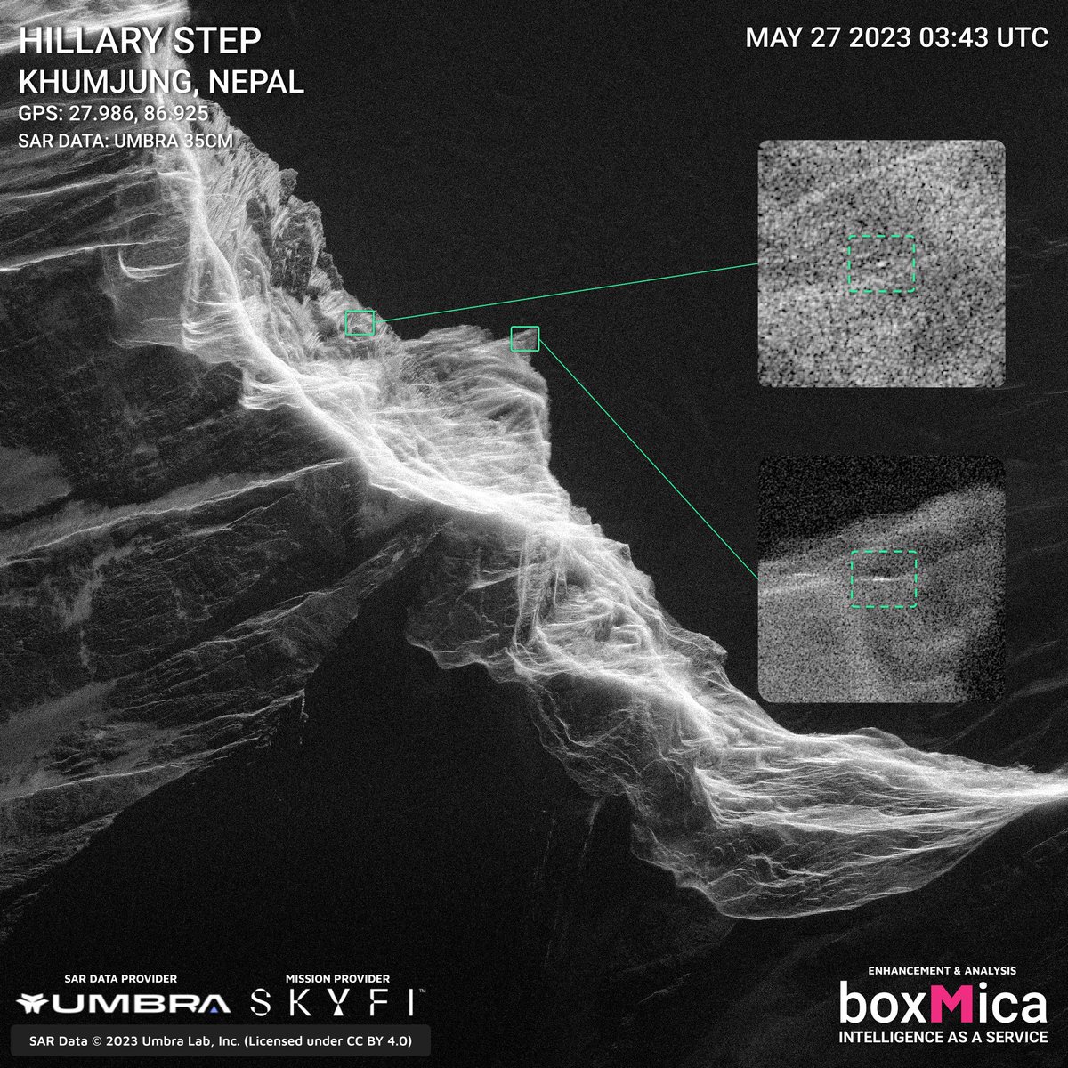


Help find some climbers lost on Mt. Everest. Crowd-sourcing this with the images we tasked and promptly got from @umbraspace. Go to this link to get the images and find them, screenshot samples are below. drive.google.com/drive/folders/… @bp22 @dominocielo @FischerLukeM


The completely new mobile apps for Talk Python Training courses are now out on all the mobile platforms. Here's the story of how they are built with #flutter and #python. Download them for free and take some of the free courses included cc @mkennedy mkennedy.codes/posts/mobile-a…


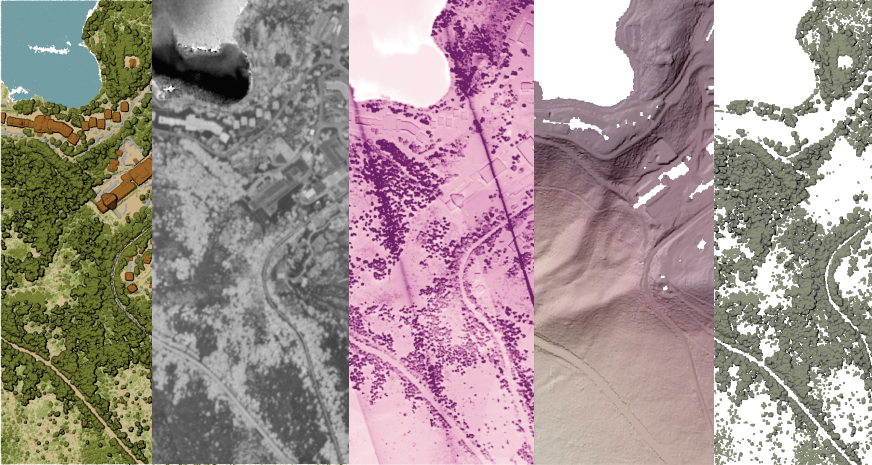
GLanCE has grown! The Global #LandCover Mapping and Estimation product now covers Europe. This product includes seven land classes or a greenness index as shown in this image over Venice, Italy. Visit NASA’s #LPDAAC to learn more: bit.ly/3I8cjXB


United States Tendências
- 1. #SmackDown 41K posts
- 2. Mamdani 411K posts
- 3. Norvell 2,954 posts
- 4. Reed Sheppard 2,756 posts
- 5. Florida State 10.6K posts
- 6. Marjorie Taylor Greene 55K posts
- 7. NC State 5,295 posts
- 8. #OPLive 2,370 posts
- 9. Collin Gillespie 1,582 posts
- 10. Sengun 6,665 posts
- 11. Suns 11.8K posts
- 12. #BostonBlue 3,740 posts
- 13. Wolves 16.1K posts
- 14. Syla Swords 2,946 posts
- 15. Booker 6,995 posts
- 16. Dillon Brooks 2,349 posts
- 17. Anthony Edwards 2,404 posts
- 18. Azzi 15.7K posts
- 19. Derik Queen 4,729 posts
- 20. Rockets 15.2K posts


Something went wrong.
Something went wrong.