
CynicalCevap
@CynicalCevap
bela - doing maps - otw to freelance from africa
You might like


A small experiment visualizing canopy density in Madagascar. Created with Google Earth Engine, QGIS, and Blender – finalized in Photoshop. Wishing you a great weekend! #maps #dataviz #madagascar


#30DayMapChallenge Day 2 - Line or Pathway Map showing Great Migration Path on Wildebeests in Kenya - Tanzania Wildlife Areas or Ecosystem #qgis #Tanzania #Kenya #gischat #data #Wildlife

Whenever I’m in #Kenya, the first question is always where to get fruits from. For Day 5: #Earth of the #30DayMapChallenge, I visualized @FAO data showing how much people around the world spend on fruits for a healthy diet — and how that relates to their local income.

Thanks to an amazing time feeling sick, I’m combining Days 2 and 3 for Day 4 instead. This map shows the canopy height around Africa’s second-highest mountain as hexagons, along with 100-meter contour lines indicating the elevation of Mount Kenya. #30DayMapChallenge

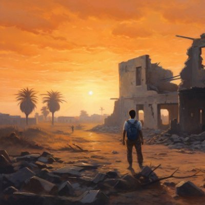
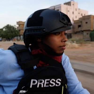
The countryside of El Fasher, one week after the fall of the city. Countless dead bodies spread out all over the ground, some lined up at the moment of execution. All slaughtered by the RSF at the earth wall meant to keep inside all those who tried to escape. Sudan 🇸🇩.
While November brings Christmas vibes for some, for me it’s all about the #30DayMapChallenge ! Day 1: Points — showing armed conflict events (ACLED) and reported fatalities. Made in #Blender + AE & Premiere for tweaks. #map #dataviz @guardian @BBCNews @newhumanitarian

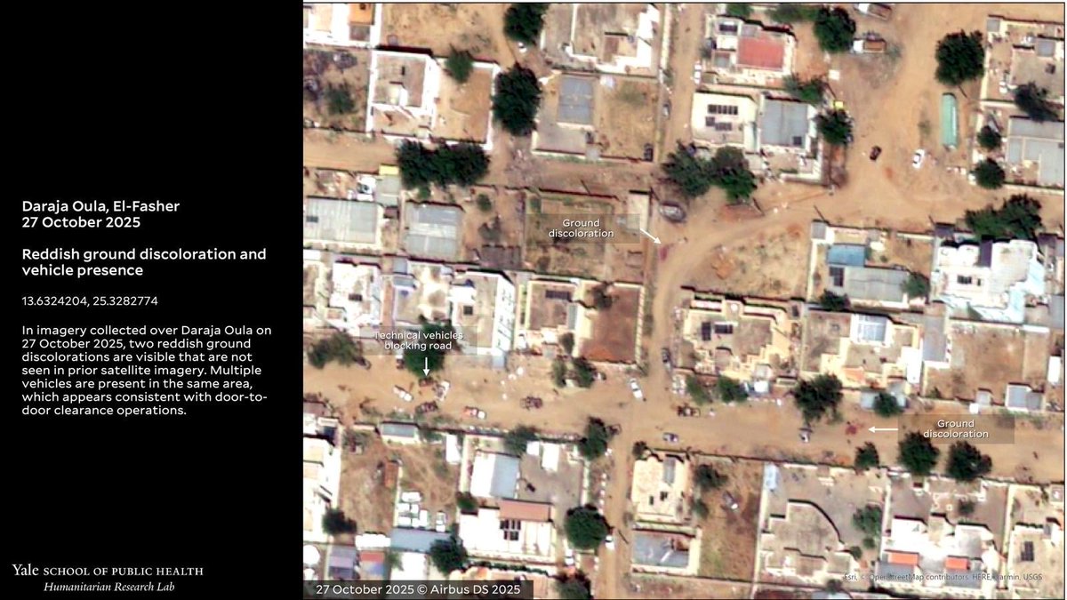
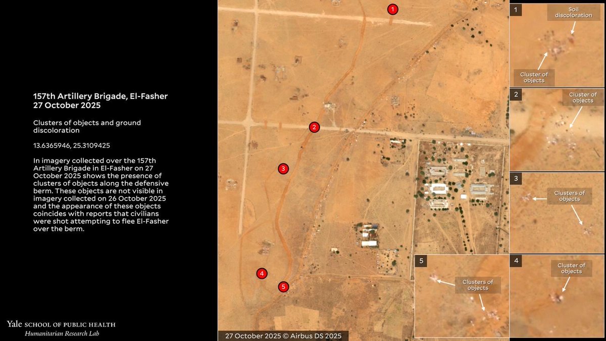
🚨HUMAN SECURITY EMERGENCY🚨 El-Fasher has fallen to RSF. HRL finds evidence of mass killings including door-to-door clearance operations and objects consistent with reported bodies on berm entrapping El-Fasher. #KeepEyesOnSudan 🛰️@AirbusSpace @Maxar medicine.yale.edu/lab/khoshnood/…


El Fasher is on the brink of collapse. Massive bloodshed is expected when it should fall to the RSF. Sudan 🇸🇩

The Rapid Support Forces (RSF) announced on Sunday it had taken complete control of the 6th Infantry Division command in El Fasher, the Sudanese army's main base in North Darfur state, following fierce battles. sudantribune.com/article/306424
A Map🗺️showing Bathymetry Model of Lake Victoria🌊 Dataset from : Harvard Dataverse (Remastered Version) #Victoria #LakeVictoria #Tanzania #Kenya #Uganda #EastAfrica #Africa #gischat #geospatial #Cartography #Datavisualization #Dataviz #b3d


Main irregular migration routes to Europe


This is the view from my hotel balcony in Busia this morning. Looks like a bright day ahead!
Lesotho is sharply divided between its lowlands, where most people live, and its highlands, dominated by mountains. This small exercise shows built-up areas and roads together with an exaggerated elevation to make the contrast visible. Have a good day! #blender #map #lesotho #3d

🎥 Tutorial Demonstration Creating a Bivariate Map 🗺️ of Saudi Arabia 🇸🇦 combining Temperature 🌡️ and Precipitation 🌧️ Chelsa data using a custom Processing Script in QGIS 🟢. credit @milosmakesmaps and thanks to @LucasBlachet (idea) #SaudiArabia #qgis #gischat #Python
Trying out wide format: A Dahlak Archipelago Explainer Home to about 3,000 inhabitants, these islands have been a trading hub since the earliest records. Data sources: OSM, WorldPop, HDX, MuturZikin, GHSL #Dahlak #Eritrea #RedSea #History #Africa #Geography #Maps
🗺️ Map showing Kenya Land Cover – 2024 🇰🇪 Made with QGIS & Blender using: ⛰️DEM from DIVAGIS 🌱Landcover from EarthMap #Kenya #EastAfrica #Africa #QGIS #Blender #Cartography #gischat #LandCover #map

Ethiopia is an often overlooked giant when it comes to population. With over 130 million inhabitants, it’s the second most populous state on the African continent. Here’s a visualization of its population density. #ethiopia #dataviz #blender #maps

Im Sahel verlieren die Militärregierungen an Rückhalt. Die Sicherheitslage verschlechtert sich weiter, und die Wirtschaft kommt nicht voran. trib.al/mBAuujo

Had to take a short break from mapmaking due to other commitments that kept me busy. Today I finally managed to do a small exercise again: a visualization of the hotspots of the civil war in Somalia. Wishing everyone a peaceful weekend! #somalia #mogadishu #somaliland #berbera


For a while now, I’ve wanted to get better at working with satellite data — I think (and hope) it’s only going to become more useful in the future. #maps #copernicus #satellite Locations: #Farchana, Chad; #Kalobeyei, Kenya; and #Gaza.


United States Trends
- 1. #Worlds2025 31.4K posts
- 2. #TalusLabs N/A
- 3. Raindotgg 1,789 posts
- 4. #T1WIN 23.9K posts
- 5. Sam Houston 1,490 posts
- 6. Doran 12.8K posts
- 7. Oregon State 4,765 posts
- 8. Boots 28.7K posts
- 9. Boots 28.7K posts
- 10. Louisville 14.2K posts
- 11. #GoAvsGo 1,549 posts
- 12. Batum N/A
- 13. Faker 28.7K posts
- 14. #Toonami 2,390 posts
- 15. UCLA 7,789 posts
- 16. Miller Moss 1,227 posts
- 17. Oilers 5,114 posts
- 18. Emmett Johnson 2,507 posts
- 19. Nuss 5,714 posts
- 20. Hyan 1,318 posts


Something went wrong.
Something went wrong.