
Map Lab 🌎
@MxMapLab
PhD Socio-Territorial Studies / GIS Expert #UrbanPlanner #PlaneadorUrbano #GIS #SIG


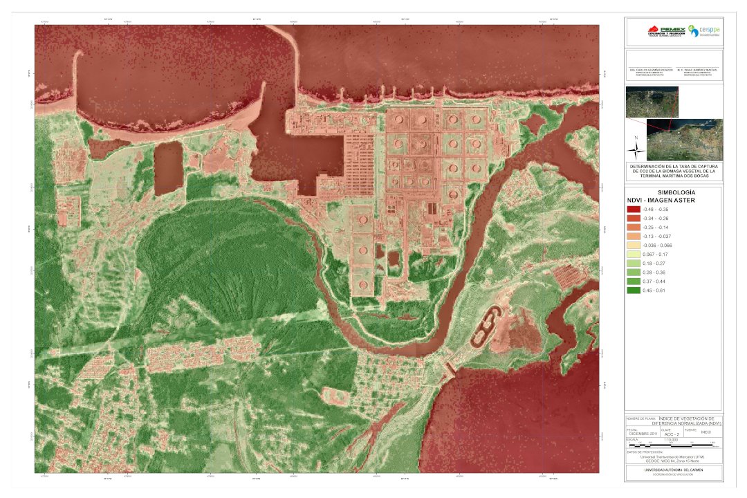
🛢️Vegetation Index maps for the Dos Bocas terminal in Tabasco Mexico ERDAS, ARCGIS 2011 🛢️Mapas de Índice de Vegetación de Dos Bocas en Tabasco, México ERDAS, ARCGIS 2011
🌱Map of Agrological Capacity for the Atlixco municipality 🌱Mapa de Capacidad Agrológica para el municipio Atlixco
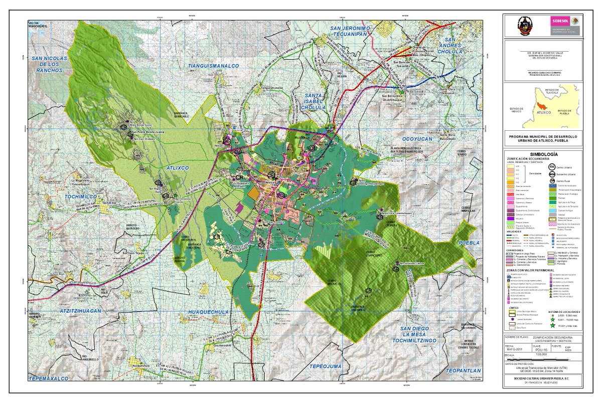
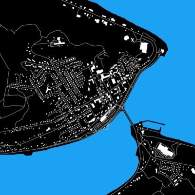
⬜️Urban Charter of the Municipality of Atlixco, Puebla. Uses, Reserves and Destinations. ⬜️Carta Urbana del Municipio de Atlixco, Puebla. Usos, Reservas y Destinos.

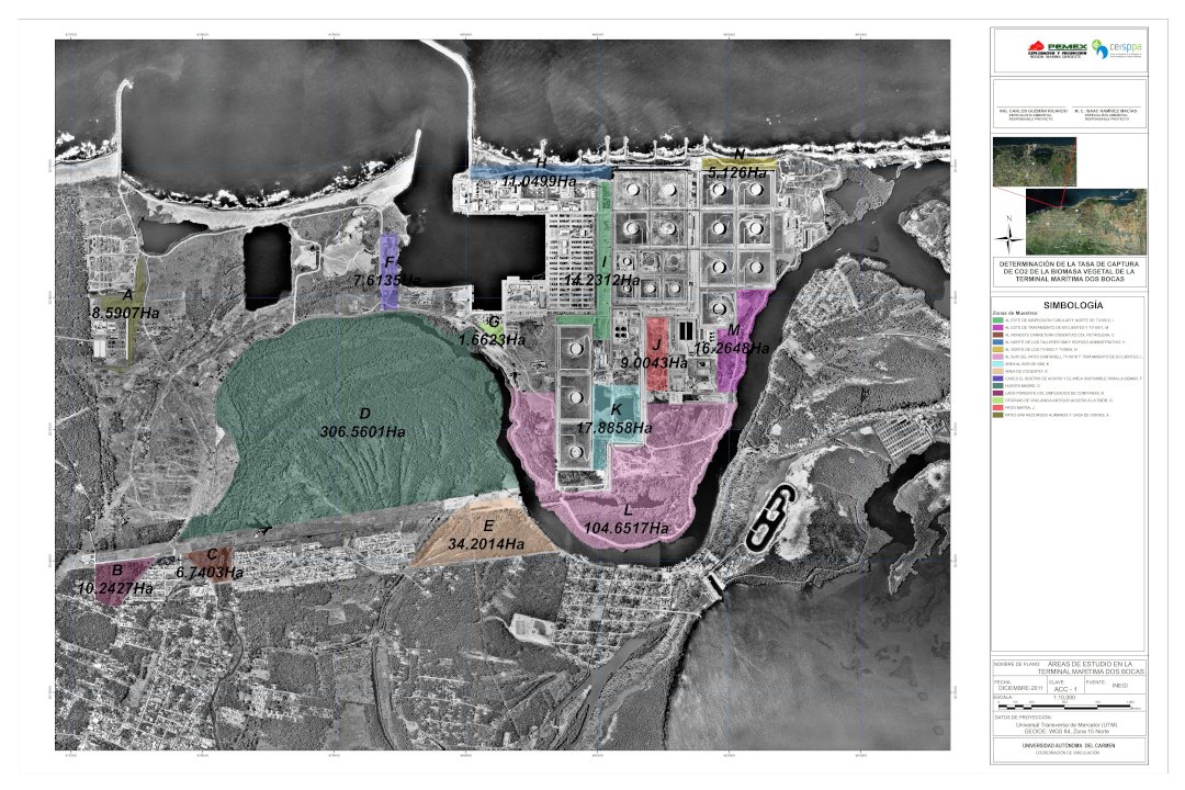
🛢️Project for the Terminal of Dos Bocas in Tabasco Mexico ERDAS, ARCGIS 2011 🛢️Proyecto para la Terminal de Dos Bocas en Tabasco Mexico ERDAS, ARCGIS 2011
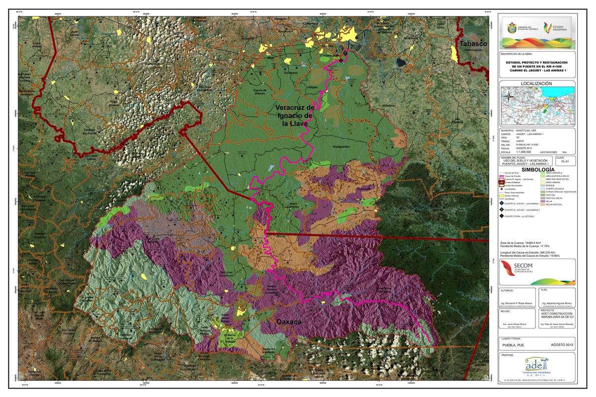
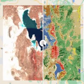
🌳Map of the land uses and vegetation of Jagüey las Ánimas that includes the states of Oaxaca and Veracruz, México 🌳Mapa de los usos de suelo y vegetación del Jagüey las Ánimas que comprende los estados de Oaxaca y Veracruz, México

🌀Map of the land uses and vegetation of Jagüey las Ánimas that includes the states of Oaxaca and Veracruz 🌀Mapa de Usos de Suelo y Vegetación del Jagüey, las Ánimas que comprende los estados de Oaxaca y Veracruz
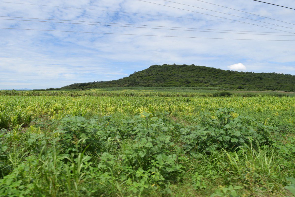
Cultivo de Caña de Azúcar en Izúcar de Matamoros, Puebla. México Sugarcane cultivation in Izúcar de Matamoros, Puebla. Mexico #agricultural #agriculturamexico #agricultura #agriculture #cañadeazucar #sugarcane #Mexico #Puebla
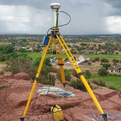
🌎Intro to Geographic Information Systems GIS, Remote Sensing, Geodesy & Photogrammetry 🌎Intro a Sistemas de Información Geográfica SIG, Percepción Remota, Geodesia y Fotogrametría #SIG #GIS #remotesensing #percepcionremota #geodesy #geodesia #photogrammetry #fotogrametria

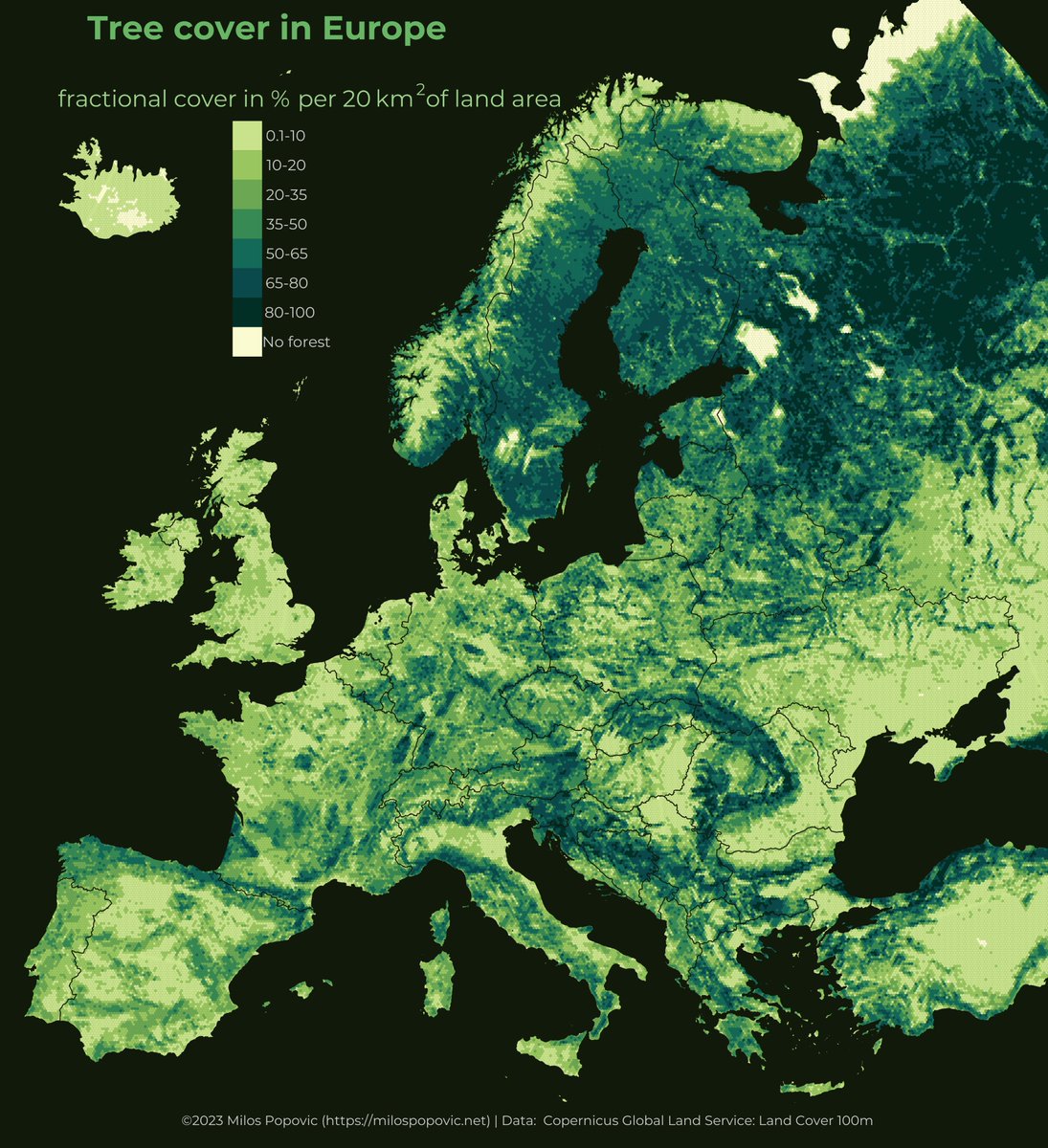
Today is World Forest Day when we celebrate & raise awareness of woods! I mapped forest tree cover in Europe, Africa, and South America 🔽🔽🔽 #europe #ForestDay #WorldForestDay #RStats #DataScience #dataviz #maps #geospatial
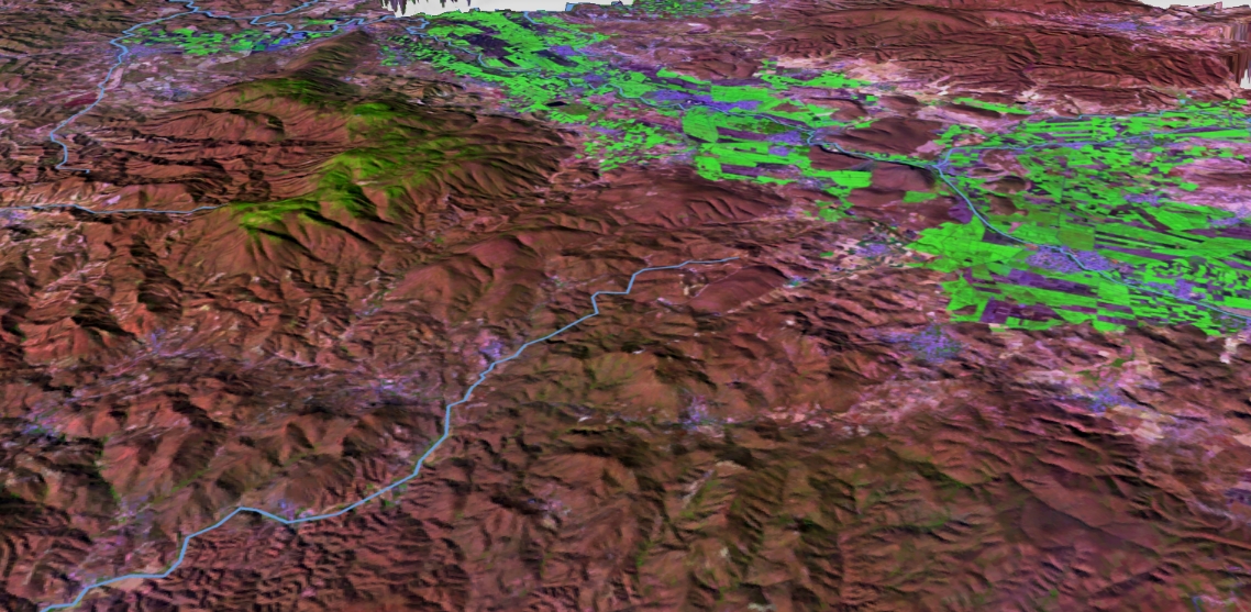
Actividad Agrícola en Izúcar de Matamoros (sureste de Puebla) Agricultural Activity in Izúcar de Matamoros (southeast of Puebla) #landsat #geospatial #agriculturapuebla #mexico #3Dmodeling #3D

Top 10 AI Tools use for 2023 youtu.be/z5JnNMF5tMo via @YouTube #aitools #ai #artificialintelligence #digitaltwin #indoormapping #newtech #geospatialdata #datamapping #gis #mapping #geospatialtechnology #gismapping #dmapping #geospatial #dmap #digitaltwins #machinelearning

Day 21: Elevation | #30DayMapChallenge Izztacihuatl and Popocatepetl's Rendered in #SAGA #percepciónremota #Landsat #AlospalSAR #softwarelibre #geolibre #Landsat #modelos3d #cartografíaadetalle #cartografiandomexico #SistemasDeInformacionGeografica #cartografiamexico


Here is a more comprehensive list of plugins for land use and land cover (LULC) analysis in QGIS. The selection of plugins depends on the specific research question and the type of data available. #gischat #geospatial #GIS #LULCanalysis #QGIS


United States الاتجاهات
- 1. Good Wednesday 24.2K posts
- 2. #hazbinhotelseason2 73.8K posts
- 3. Hump Day 9,036 posts
- 4. #wednesdaymotivation 5,358 posts
- 5. Peggy 21.7K posts
- 6. For God 210K posts
- 7. Happy Hump 5,704 posts
- 8. #InternationalMensDay 31.3K posts
- 9. #Wednesdayvibe 1,639 posts
- 10. Abel 15K posts
- 11. Dearborn 269K posts
- 12. LeBron 92.9K posts
- 13. Kwara 201K posts
- 14. #MissUniverse 9,954 posts
- 15. Baxter 2,874 posts
- 16. Cory Mills 12.3K posts
- 17. Nigerians 147K posts
- 18. Tinubu 165K posts
- 19. Grayson 7,494 posts
- 20. Orioles 7,762 posts


Something went wrong.
Something went wrong.