
Mapzest
@MapZest
Geospatial technology | Mapping | Remote sensing and GIS | Machine learning
Potrebbero piacerti


Dive into "How To R: Visualizing Distributions" with insights from Nick Martin. A must-read for those passionate about data visualization! 📊 🔗: link.medium.com/cfEZ59xHbvb#rs… #dataviz #DataVisualization #Rprogramming #DataAnalysis


ChatGPT has limited academic knowledge and makes mistakes. But DanteAI will TRAIN ChatGPT using your notes and academic papers! I uploaded all of my notes and the results are magical. Train your ChatGPT research assistant like this: 👇


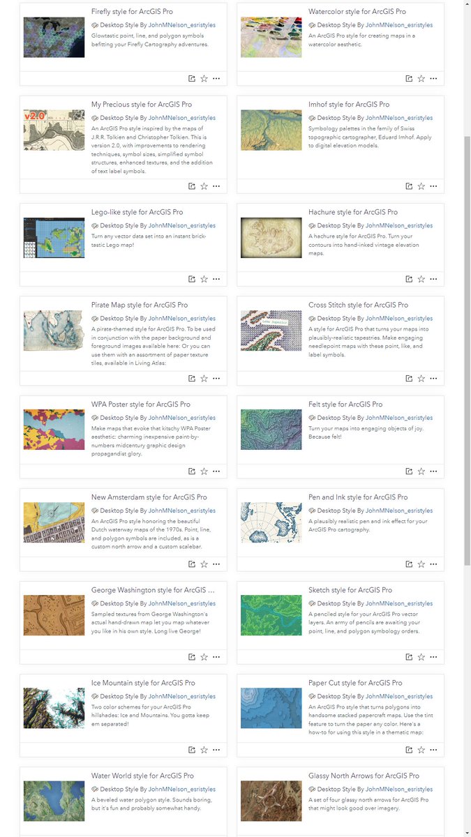
hey, fun news, ArcGIS Pro styles are now available in @LivingAtlas. here is a pile that i've added, if you want to get weird: livingatlas.arcgis.com/en/browse/?q=%…

Graphical Cartograms in ArcGIS Pro - an @Esri blog by me sharing a new tool to create Dorling and Demers cartograms from geographical maps. esri.com/arcgis-blog/pr…

#WorldEnvironmentDay2023 #beatplasticpollution #saveourplanet #climateaction #sustainability #greenliving #zerowaste #recycling #conservation #earthday


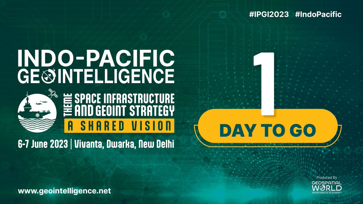
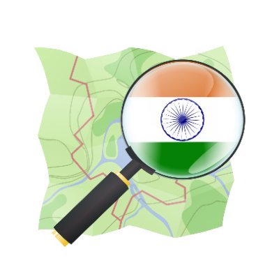
#IPGI #Indopacific #geospatial #defence We are all set to welcome you to the Indo Pacific GeoIntelligence Conference! With just one day remaining, the excitement is palpable as we gear up for this exceptional event. Register now and secure your spot 👉 lnkd.in/dH77kmxK
Trinka AI for academic writing.#AcademicTwitter #AcWri #GetYourManuscriptOut #AmWriting #AmReading #AmEditing
Want to use AI for academic writing, but don't trust ChatGPT? Trinka AI will correct your entire manuscript in just a few minutes. Here is how I edited 5975 words in under a minute: 👇

Important learnings to become a geospatial data scientist. #gischat #DataScience #DataAnalytics #geospatial #ai #ml

A Comprehensive Guide for Geospatial Data Scientists opensourcegisdata.com/a-comprehensiv… #gischat #DataScience #DataAnalytics #geospatial #ai #ml
opensourcegisdata.com
A Comprehensive Guide for Geospatial Data Scientists
In the rapidly evolving world of geospatial data science, a diverse set of skills is required to navigate its complexities and seize its opportunities. This article provides a comprehensive guide to...

Discover the #deeplearning capability of #ArcGIS. Use our free learning plan → esri.social/lbGe50OqJmm


"🌍 Calling all Earth & Environmental Science enthusiasts! 🌱 Check out these top 5 machine learning courses to enhance your data analysis skills and advance research in your field. 📚🔬 Unleash the power of AI in understanding our planet. #MachineLearning #EarthScience
Join the upcoming webinar by @Esri_Health Discover the power of #GIS in #EnvironmentalHealth Monitoring. Explore the #GeographicApproach Register now: ow.ly/fnRI104HnXT #healthGIS #esri #arcgis #mapping #TheScienceOfWhere #GISchat #geospatial @EsriSLGov @ArcGISanalysis
Truly, Geography is one of the most essential subjects of this time. Nowadays, It's crucial for success. Let's give it the appreciation and attention it deserves. #Education #SuccessSkills #Geography #GIS
A Comprehensive Guide for Geospatial Data Scientists opensourcegisdata.com/a-comprehensiv… #gischat #DataScience #DataAnalytics #geospatial #ai #ml
opensourcegisdata.com
A Comprehensive Guide for Geospatial Data Scientists
In the rapidly evolving world of geospatial data science, a diverse set of skills is required to navigate its complexities and seize its opportunities. This article provides a comprehensive guide to...

Interested in #climate data analysis? Check out @hydroclimali guide using #Python for various levels: ☑️Basics: Downloading & extracting data ☑️Intermediate: Interpolation & more ☑️Advanced: Timeseries analysis + Learn more on this #TutorialTuesday linkedin.com/pulse/python-c…

Interested in making amazing maps? Join Esri's Cartography MOOC.
Interested in #climate data analysis? Check out @hydroclimali guide using #Python for various levels: ☑️Basics: Downloading & extracting data ☑️Intermediate: Interpolation & more ☑️Advanced: Timeseries analysis + Learn more on this #TutorialTuesday linkedin.com/pulse/python-c…


United States Tendenze
- 1. Cloudflare 236K posts
- 2. Gemini 3 34.8K posts
- 3. Saudi 162K posts
- 4. Jamal Khashoggi 9,920 posts
- 5. Salman 48.7K posts
- 6. Piggy 78.6K posts
- 7. #AcousticPianoCollection 1,376 posts
- 8. Robinhood 4,743 posts
- 9. Pat Bev 1,065 posts
- 10. #NXXT2Run N/A
- 11. Merch 67K posts
- 12. Olivia Dean 4,475 posts
- 13. #UnitedNationsBarbie 2,070 posts
- 14. #UNBarbie 1,147 posts
- 15. #LaSayoSeQuedóGuindando 2,155 posts
- 16. Antigravity 3,980 posts
- 17. CAIR 30.2K posts
- 18. Kevin Brown N/A
- 19. Mary Bruce N/A
- 20. La Chona 2,106 posts
Potrebbero piacerti

Something went wrong.
Something went wrong.