#analysisreadydata wyniki wyszukiwania


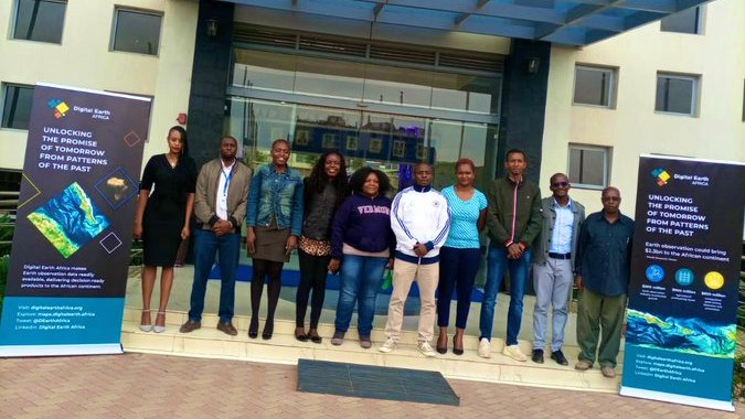
We are working with @DEarthAfrica to enable access to open and free #AnalysisReadyData to our member states.

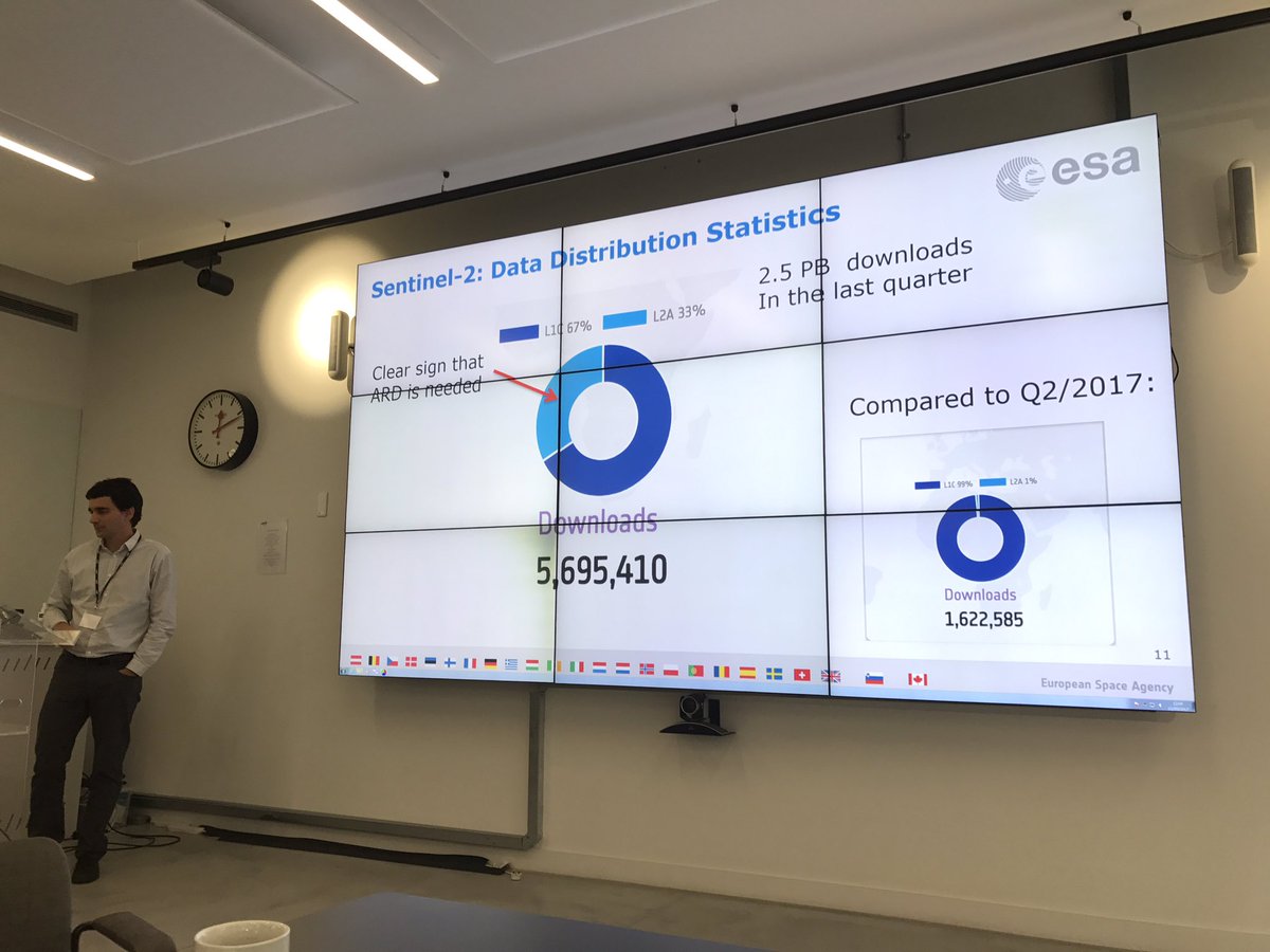
Ferran Gascon presenting very interesting stats about the uptake of #AnalysisReadyData from their portal at UK #sentinel2 workshop #EOCoE

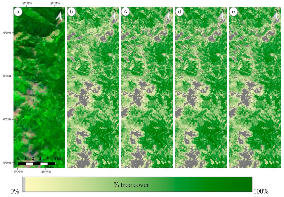
Egorov, A.V.; Roy, D.P.; et al. 2018 Demonstration of Percent Tree Cover Mapping Using Landsat Analysis Ready Data (ARD) and Sensitivity with Respect to Landsat ARD Processing Level mdpi.com/259334 #Landsat #AnalysisReadyData
Analysis Ready Data: Enabling Analysis of the Landsat Archive by John L. Dwyer, David P. Roy, Brian Sauer, Calli B. Jenkerson, Hankui K. Zhang and Leo Lymburner 👉 mdpi.com/332352 #Landsat #AnalysisReadyData

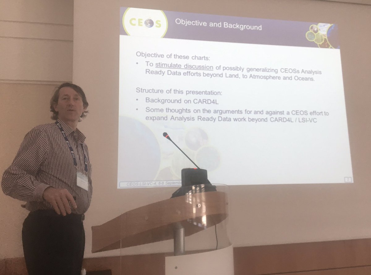
Adam Lewis (@GeoscienceAus) on using #AnalysisReadyData for #atmosphere & #ocean applications. #OpenEO #EarthObservation #VCWGDAY @ESA_EO

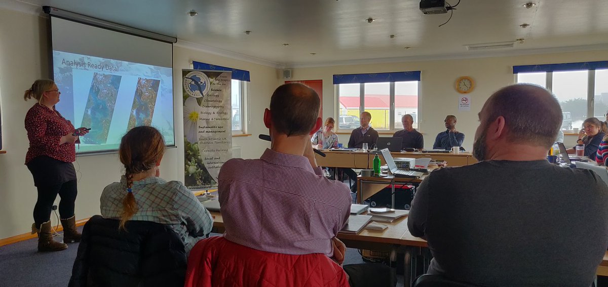
@JNCC_UK @JonesGwawr getting everyone up to speed with #AnalysisReadyData during the @Darwin_Defra #SouthAtlanticCoastalMapping training workshop currently underway in the #Falklands

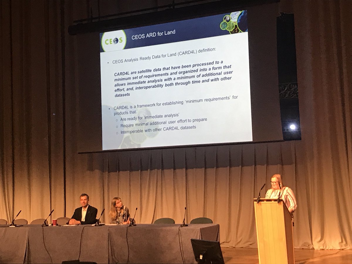
Gwawr Jones @JonesGwawr @JNCC_UK discusses #AnalysisReadyData for #EO and how it has the potential to make #EO data easier to access by the wider community #EarthObsConf2018 #SARbackscatter #SurfaceReflectance #SurfaceTemperature

@djrwicks from @SatAppsCatapult is co-chairing the ‘Big EO: Big Data’ session at #GEOWeek2019 covering topics such as #AnalysisReadyData and #DataCubes

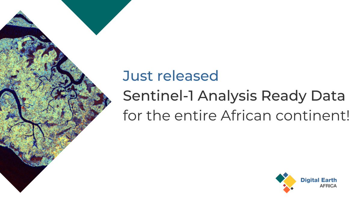
Did you know? The @CopernicusEU Sentinel-1 SAR satellites currently collect data every 12 days over Africa at a spatial resolution of around 20 m! Sentinel-1 #AnalysisReadyData is now available for the whole African continent on the #DEAfrica Map. 📕👉bit.ly/3x3iMe6

Need for improved coverage of Copernicus, Landsat capture over PICTs highlighted to @CEOSdotORG by @spc_cps DG @sminchin along with thanking their leadership in provisioning #AnalysisReadyData that benefits initiatives eg: @DEarthPacific in building decision-ready EO products.
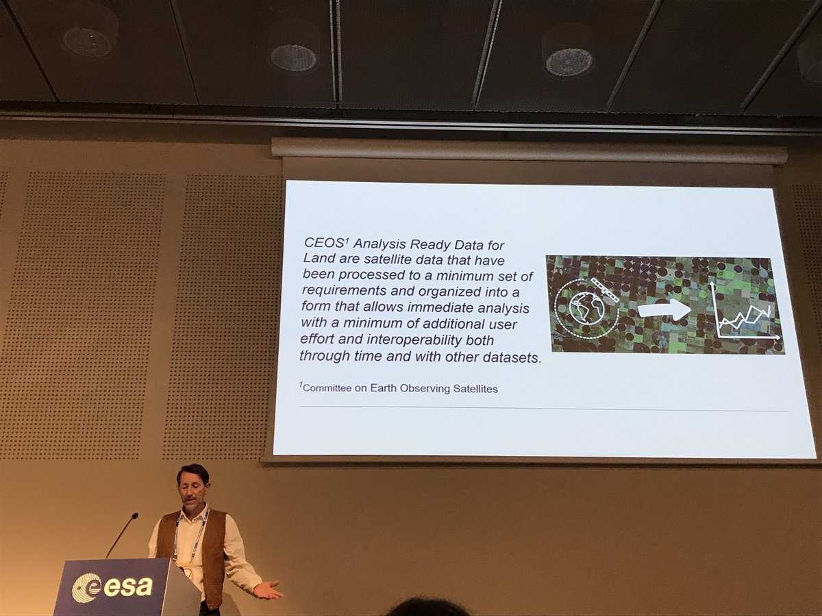
@Lewi14719 giving us an overview of @CEOSdotORG #CARD4L project. #AnalysisReadyData allows us to unlock the massive potential of #EarthObservation data. #LPS19

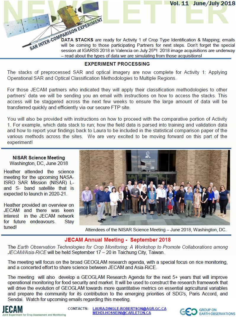
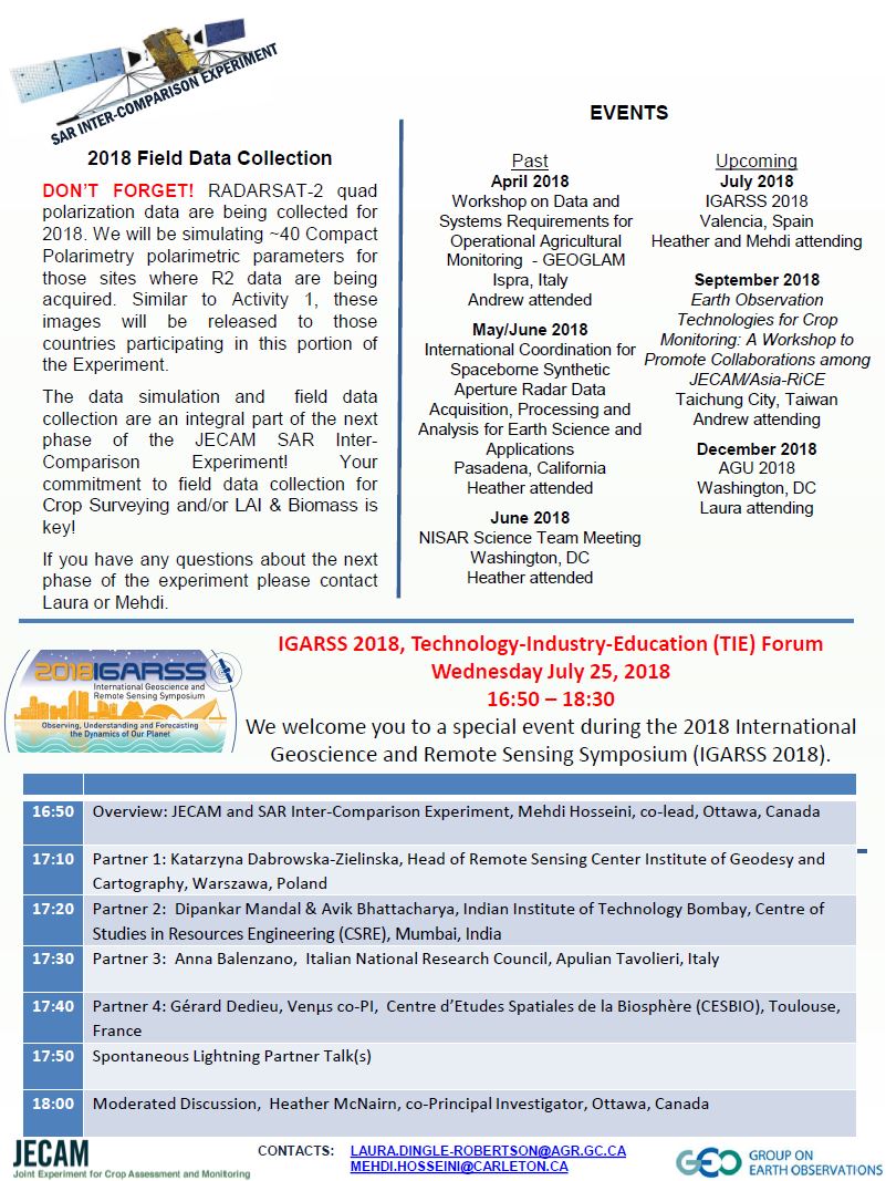
!! New !!: See our June/July Newsletter with updates on the @AAFC_Canada @csa_asc led @G20_GEOGLAM @G20_JECAM international SAR comparison. Includes project updates, an #IGARSS special session, meeting updates and #AnalysisReadyData for SAR, and much more....

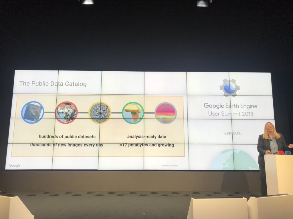
With global pixel level #metadata and #AnalysisReadyData, there are 17 petabytes of endless earth observation possibilities!! #eeus18 @rebeccatmoore

This afternoon I will present my work at #LPS19 on the feasability of making #AnalysisReadyData for #glacier velocities. Done through data of @ESA_EO #sentinel2, @USGSLandsat #landsat7 & @NSIDC #GoLIVE and @planetlabs #rapideye Hope to see you there!
We’re working with @sinergise to put #Africa on the radar! Sentinel-1 #satellite radar that is. For the first time, Sentinel-1 radar data will be processed as @CEOSdotORG #AnalysisReadyData for the continent within #DigitalEarthAfrica. 🔗ow.ly/VGHL50Bjynt 📷 @sentinel_hub

Hands up if you use satellite data 🙋♀️@scotgov and @JNCC_UK are producing #Sentinel1 and #Sentinel2 #AnalysisReadyData and making it openly available via @cedanews. Find out about the data and support available from the #SimpleARDService ➡️ jncc.gov.uk/our-work/simpl…
Want to use @scotgov and @JNCC_UK's #Sentinel1 and #Sentinel2 #AnalysisReadyData but not sure how? 🤔 🛰️ There's a user guide to the #SimpleARDService and lots of other help and guidance for users here ➡️ jncc.gov.uk/our-work/simpl…
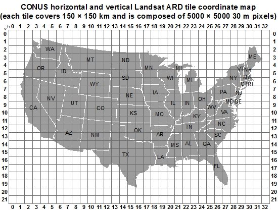
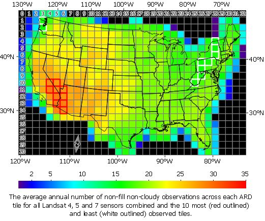
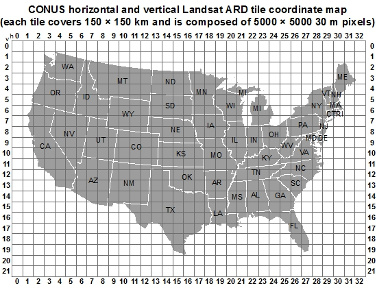
#Landsat 4, 5 and 7 (1982 to 2017) #AnalysisReadyData (ARD) Observation Coverage over the Conterminous #UnitedStates and Implications for #Terrestrial Monitoring by Alexey V. Egorov, David P. Roy, Hankui K. Zhang, Zhongbin Li, Lin Yan and Haiyan Huang 👉mdpi.com/2072-4292/11/4…

Last week, Planet experts attended #ARD2019—exchanging ideas on analysis ready data while encouraging collaboration across multiple industries. bit.ly/300V29U #analysisreadydata #remotesensing #satelliteimagery #GIS

Radhika Tirumala will return to #India's National Remote Sensing Centre (@isro) with new ideas and friendships forged during her PESEP exchange at EROS. She enjoyed in-depth conversations about #SensorAccuracy and #AnalysisReadyData! Read more here: ow.ly/Tepw50Txk0o


This enhancement aims to provide #farmers w/ #cloudfree, #analysisreadydata for a comprehensive view of #agriculturalfields. By merging #radar and #opticalsignals, this tool facilitates a deeper understanding of #crophealth and operational status spacedaily.com/reports/Planet…

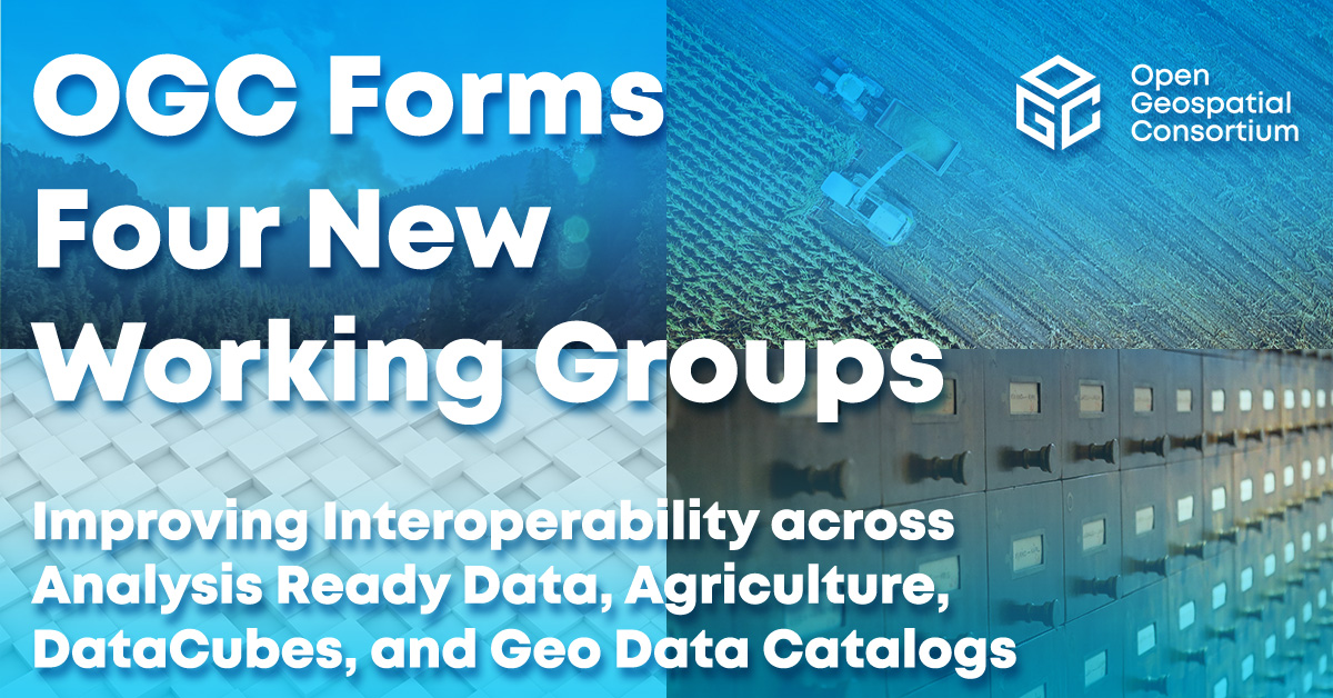
Excited to announce the formation of FOUR new OGC Standards Working Groups! The launch of these new SWGs will increase interoperability across #AnalysisReadyData, #Agriculture, #DataCubes, and Geo #DataCatalogs bit.ly/3o5ocGt

Excited to announce the formation of FOUR new OGC Standards Working Groups! The launch of these new SWGs will increase interoperability across #AnalysisReadyData, #Agriculture, #DataCubes, and Geo #DataCatalogs bit.ly/3o5ocGt

Excited to announce the formation of FOUR new OGC Standards Working Groups! The launch of these new SWGs will increase interoperability across #AnalysisReadyData, #Agriculture, #DataCubes, and Geo #DataCatalogs bit.ly/3o5ocGt

Excited to announce the formation of FOUR new OGC Standards Working Groups! The launch of these new SWGs will increase interoperability across #AnalysisReadyData, #Agriculture, #DataCubes, and Geo #DataCatalogs bit.ly/3o5ocGt

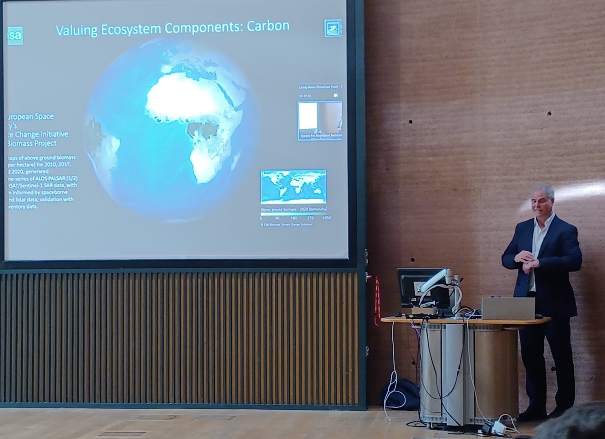
At the #LivingWales showcase, fantastic to see the power of layering maps, underpinned by satellite remote sensing from @ESA, @NASA, for use at different scales: like climate or conservation actions & planning! @OpenDataCube #AnalysisReadyData @ESAclimate livingearthhub.org
Need for improved coverage of Copernicus, Landsat capture over PICTs highlighted to @CEOSdotORG by @spc_cps DG @sminchin along with thanking their leadership in provisioning #AnalysisReadyData that benefits initiatives eg: @DEarthPacific in building decision-ready EO products.
Two new @CEOSARD product family specifications have recently been endorsed - Ocean Radar Backscatter, and Nighttime Lights Surface Radiance! Read about them here: ceos.org/news/ard-pfs-o… #AnalysisReadyData #EarthObservation


Our Precision3D data equips #analysts and decision-makers with a fully immersive environment for simulations, planning and decision-making. Explore #Qatar and experience fully immersive #3D for yourself. bit.ly/3vVCOtz


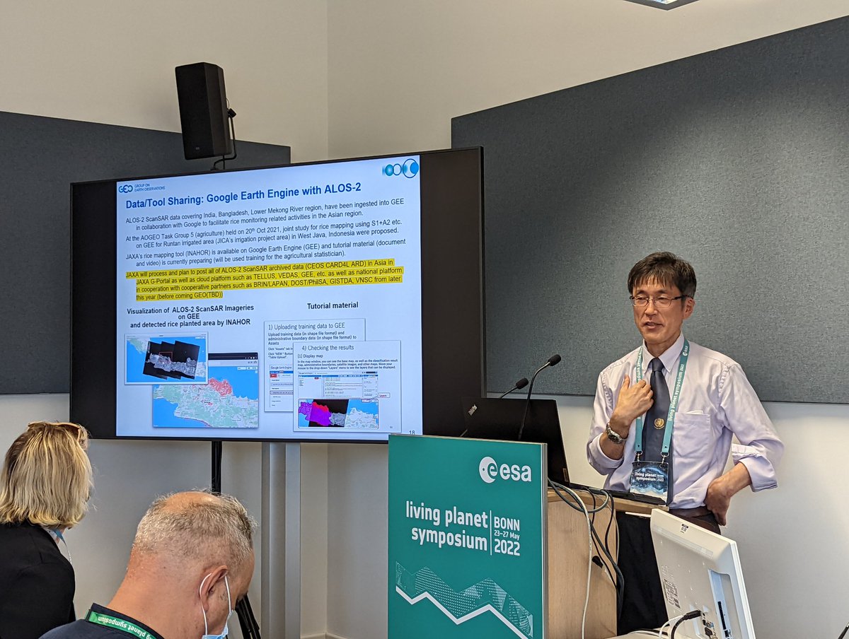
Shinichi Sobue shares the hard work of @JAXA_en to put all #ALOS2 #AnalysisReadyData, per @CEOSdotORG requirements, online by the end of 2022. #OpenData
The availability of commercial #imagery (of course with great prices) with #analysisreadydata not only provides the #valueaddition but increases #transparency in any use case. The ongoing conflict has proved to be a success in this technology .

Commercial companies continue to play a critical role in providing transparency around the Ukraine Crisis. Read more on the increased need for commercial satellites and #SAR technology to support global conflicts in @ValueWalk: bit.ly/37nd7YU
1. We'll remind everyone that #EarthEngine has really been a game changer in how people interact w/ #EarthObservation data - e.g., no need to download big data, no need for expensive COTS licenses, and #AnalysisReadyData *in action*. 🤔

A few questions for the good folks of #scenefromabove and #eochat: 1) what software is making the biggest difference to EO? 2) which EO satellite launch are you most looking forward to? 3) is getting (commercial) data actually getting easier? 4) are you still inspired by EO? 😎🛰️
If you're a user of #Sentinel1 or #Sentinel2 #AnalysisReadyData in the UK we want to hear from you!
Do you use Sentinel satellite data for your work? Our colleagues at @JNCC_UK are asking users of Sentinel (1&2) data how they are using it and to inform future plans for analysis-ready data. Please spend 10 minutes completing this anonymous survey: smartsurvey.co.uk/s/S1_S2_ARD_us…

This connects also with the notion of #AnalysisReadyData for #EOData which is not straightforward. For instance, which level of processing of #SAR data can be considered ARD ? It will be different for every possible usecase. This is a real puzzle!

#Maxar | 🛰 #AnalysisReadyData (ARD) ponen al usuario en control y alinean sus datos con su misión 🎯 👉 Enlace: bit.ly/3iQ9IVU #GMT #Geomática #Geospatial #Technologies #Analysis #Data #SIG #GIS #Mapas #Mapping #Cartography #Imagery #RemoteSensing #SpatialAnalysis


Using Analysis-Ready Data to Train More Accurate and Consistent Object Detection Models @Maxar #SatelliteData #MachineLearning #AnalysisReadyData blog.maxar.com/tech-and-trade…
We are working with @DEarthAfrica to enable access to open and free #AnalysisReadyData to our member states.
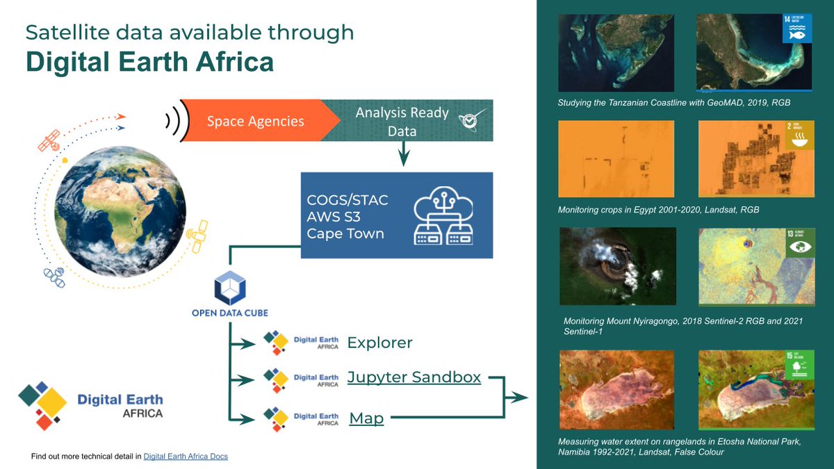
From studying the Tanzanian coastline 🌊, to monitoring crops in Egypt 🌾, DE Africa enables users to explore a range of #AnalysisReadyData and work toward Sustainable Development Goals. Dive into the technical detail: bit.ly/3xhxlu9
We are excited to be presenting at @Igarss2021 this July! We will be sharing insights into DE Africa’s strategy of providing #AnalysisReadyData at scale and how this can enable industry leaders to innovate 🛰️ Stay tuned for more updates! bit.ly/3qSeFj0
Egorov, A.V.; Roy, D.P.; et al. 2018 Demonstration of Percent Tree Cover Mapping Using Landsat Analysis Ready Data (ARD) and Sensitivity with Respect to Landsat ARD Processing Level mdpi.com/259334 #Landsat #AnalysisReadyData
Analysis Ready Data: Enabling Analysis of the Landsat Archive by John L. Dwyer, David P. Roy, Brian Sauer, Calli B. Jenkerson, Hankui K. Zhang and Leo Lymburner 👉 mdpi.com/332352 #Landsat #AnalysisReadyData
We are working with @DEarthAfrica to enable access to open and free #AnalysisReadyData to our member states.
Hands up if you use satellite data 🙋♀️@scotgov and @JNCC_UK are producing #Sentinel1 and #Sentinel2 #AnalysisReadyData and making it openly available via @cedanews. Find out about the data and support available from the #SimpleARDService ➡️ jncc.gov.uk/our-work/simpl…
Want to use @scotgov and @JNCC_UK's #Sentinel1 and #Sentinel2 #AnalysisReadyData but not sure how? 🤔 🛰️ There's a user guide to the #SimpleARDService and lots of other help and guidance for users here ➡️ jncc.gov.uk/our-work/simpl…
#Landsat 4, 5 and 7 (1982 to 2017) #AnalysisReadyData (ARD) Observation Coverage over the Conterminous #UnitedStates and Implications for #Terrestrial Monitoring by Alexey V. Egorov, David P. Roy, Hankui K. Zhang, Zhongbin Li, Lin Yan and Haiyan Huang 👉mdpi.com/2072-4292/11/4…
@JNCC_UK @JonesGwawr getting everyone up to speed with #AnalysisReadyData during the @Darwin_Defra #SouthAtlanticCoastalMapping training workshop currently underway in the #Falklands
Ferran Gascon presenting very interesting stats about the uptake of #AnalysisReadyData from their portal at UK #sentinel2 workshop #EOCoE
Adam Lewis (@GeoscienceAus) on using #AnalysisReadyData for #atmosphere & #ocean applications. #OpenEO #EarthObservation #VCWGDAY @ESA_EO
!! New !!: See our June/July Newsletter with updates on the @AAFC_Canada @csa_asc led @G20_GEOGLAM @G20_JECAM international SAR comparison. Includes project updates, an #IGARSS special session, meeting updates and #AnalysisReadyData for SAR, and much more....
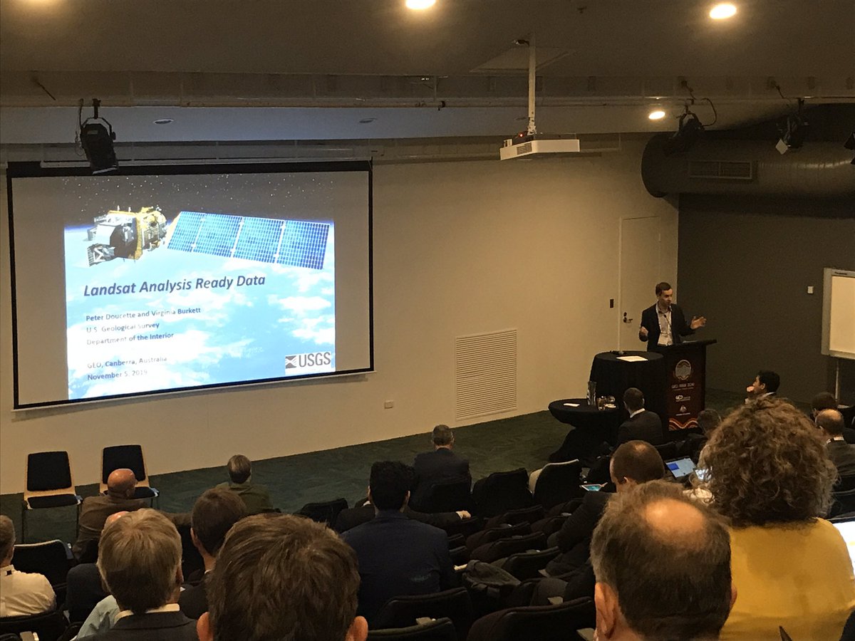
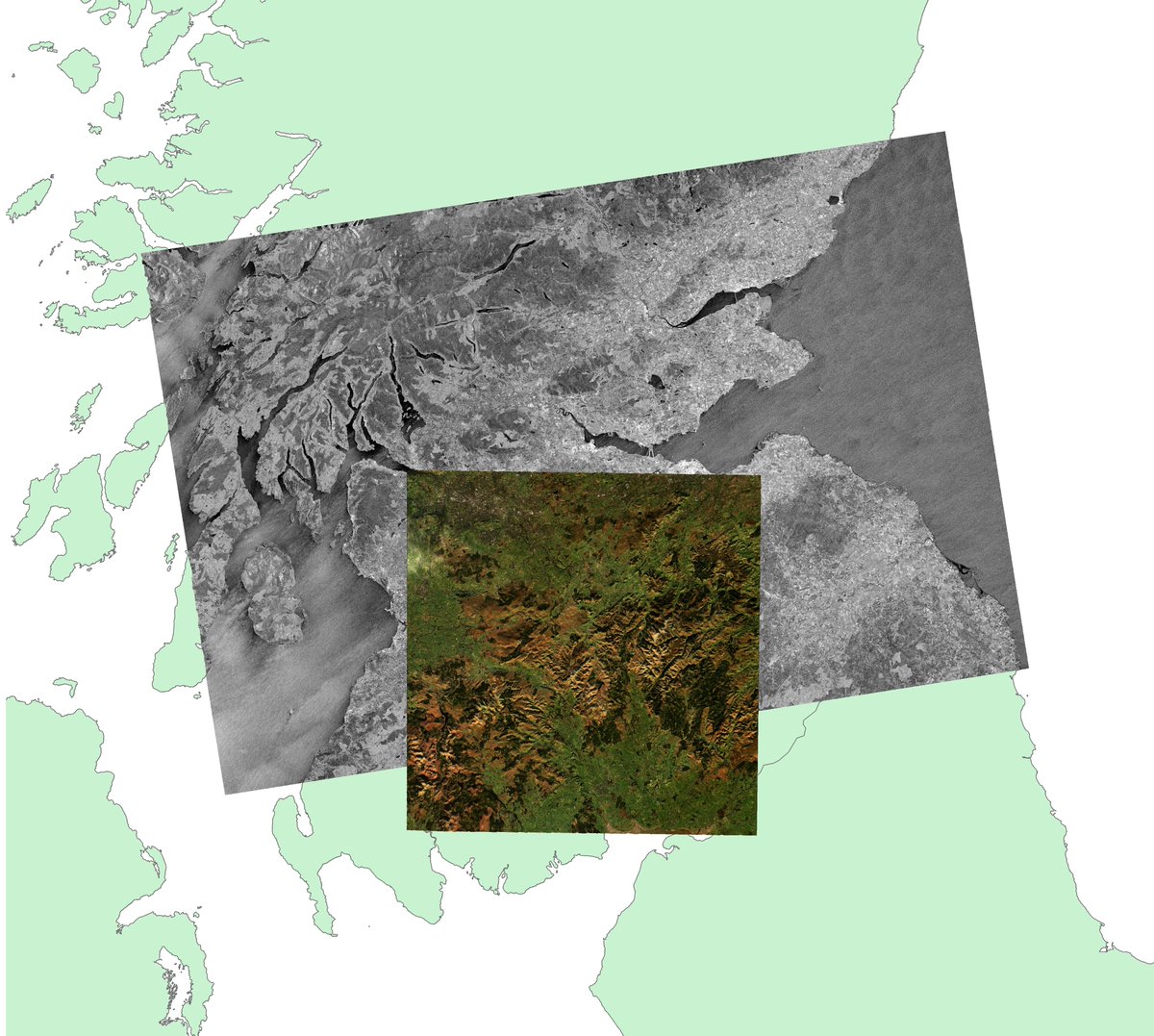
[THREAD] Landsat Analysis Ready Data proves a valuable tool for EROS scientists as they monitor vegetation health across the Great Basin. Read more: on.doi.gov/2zdqk4J #Landsat #remotesensing #AnalysisReadyData
![USGS_EROS's tweet image. [THREAD] Landsat Analysis Ready Data proves a valuable tool for EROS scientists as they monitor vegetation health across the Great Basin. Read more: on.doi.gov/2zdqk4J
#Landsat #remotesensing #AnalysisReadyData](https://pbs.twimg.com/media/DhXRq6rW0AAhz4J.jpg)
This afternoon I will present my work at #LPS19 on the feasability of making #AnalysisReadyData for #glacier velocities. Done through data of @ESA_EO #sentinel2, @USGSLandsat #landsat7 & @NSIDC #GoLIVE and @planetlabs #rapideye Hope to see you there!
Analysis Ready Data: Enabling Analysis of the #Landsat Archive by John L. Dwyer, David P. Roy, Brian Sauer, Calli B. Jenkerson, Hankui K. Zhang and Leo Lymburner 👉mdpi.com/2072-4292/10/9… #analysisreadydata #remotesensing

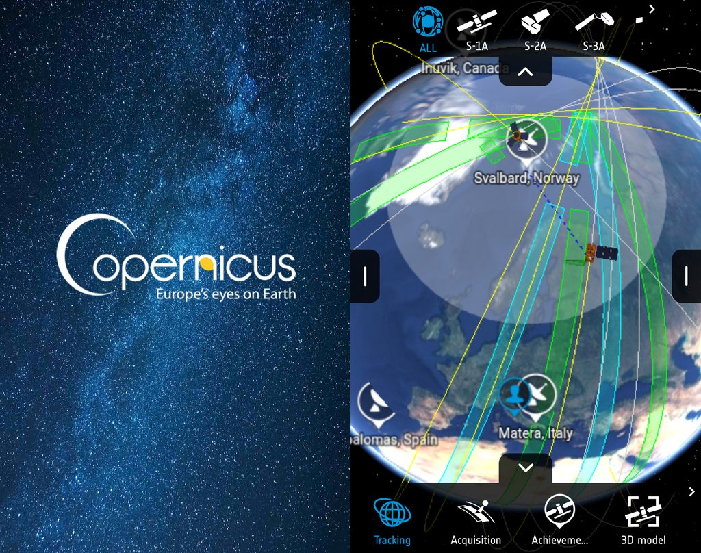
For some #MondayMotivation see where the Sentinel satellites are right now with the @CopernicusEU Sentinel app! Download the #AnalysisReadyData from data.envsys.co.uk
Last week, Planet experts attended #ARD2019—exchanging ideas on analysis ready data while encouraging collaboration across multiple industries. bit.ly/300V29U #analysisreadydata #remotesensing #satelliteimagery #GIS
We’re working with @sinergise to put #Africa on the radar! Sentinel-1 #satellite radar that is. For the first time, Sentinel-1 radar data will be processed as @CEOSdotORG #AnalysisReadyData for the continent within #DigitalEarthAfrica. 🔗ow.ly/VGHL50Bjynt 📷 @sentinel_hub
Did you know? The @CopernicusEU Sentinel-1 SAR satellites currently collect data every 12 days over Africa at a spatial resolution of around 20 m! Sentinel-1 #AnalysisReadyData is now available for the whole African continent on the #DEAfrica Map. 📕👉bit.ly/3x3iMe6

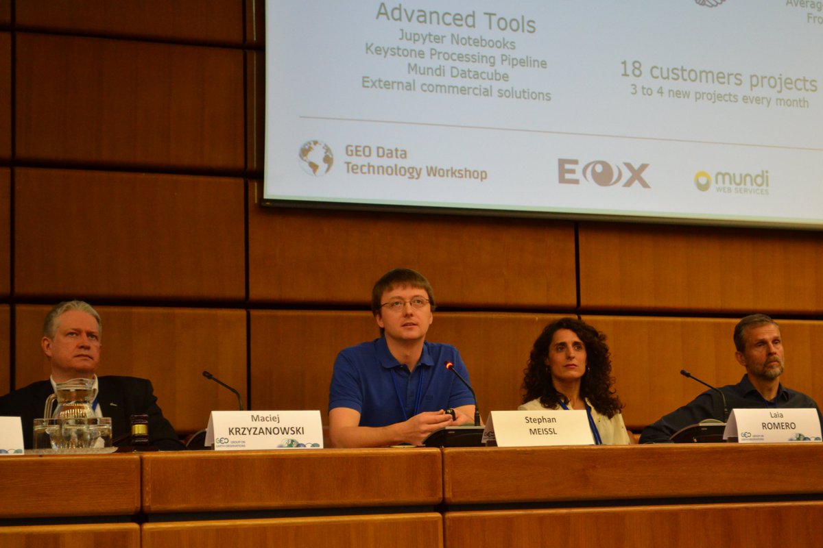
Stephan Meißl (@Schpidi) of @eox_a presents at #GEOdatatech: "Through @mundiwebservice, working with remote sensing data on the #cloud is made easy for everybody", including for #AnalysisReadyData and @CopernicusEU #Sentinel #ARD."
@Lewi14719 giving us an overview of @CEOSdotORG #CARD4L project. #AnalysisReadyData allows us to unlock the massive potential of #EarthObservation data. #LPS19
@djrwicks from @SatAppsCatapult is co-chairing the ‘Big EO: Big Data’ session at #GEOWeek2019 covering topics such as #AnalysisReadyData and #DataCubes
Something went wrong.
Something went wrong.
United States Trends
- 1. Eagles 91.7K posts
- 2. Jalen 23.3K posts
- 3. Caleb 43.1K posts
- 4. Ben Johnson 5,127 posts
- 5. AJ Brown 3,192 posts
- 6. Patullo 6,536 posts
- 7. Black Friday 491K posts
- 8. Swift 56.5K posts
- 9. Swift 56.5K posts
- 10. #CHIvsPHI 1,984 posts
- 11. Tush Push 4,450 posts
- 12. Lane 50.8K posts
- 13. Sirianni 3,261 posts
- 14. Nebraska 13.5K posts
- 15. Philly 18.1K posts
- 16. Nashon Wright N/A
- 17. #BearDown 1,179 posts
- 18. Al Michaels N/A
- 19. Kevin Byard 1,609 posts
- 20. Sydney Brown 1,331 posts