#arcgisapps ผลการค้นหา

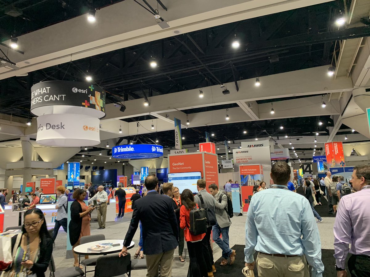
Having a great time at #nerd central at the #EsriUC2019 conference learning about #ArcGISApps and all of the new innovative softwares being used to advance #GIS #Esri

Blog: License #ArcGIS Premium #Apps bit.ly/2Jb2Hyp by @mzurn #ArcGISApps #esri #TheScienceOfWhere #GIS #mapping #maps @Esri @ArcGISOnline @ArcGISApps @ArcGISPro @EsriTraining @LearnArcGIS

Our newest release of #ArcGISQuickCapture brings a ton of new features! Now you can make bigger buttons, configure buttons to launch other #ArcGISApps or open URLs, and more. Watch our 3 minute overview for the highlights: ow.ly/CddM50BEKpW

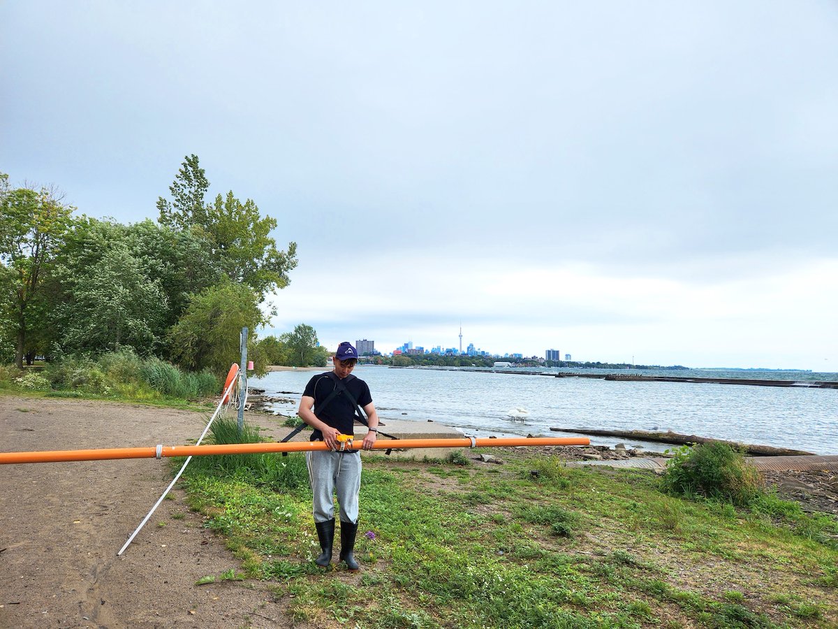
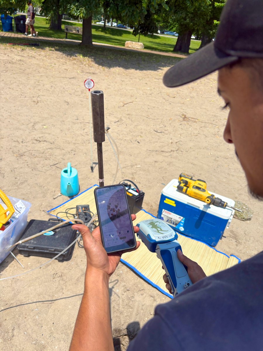
Discover how @WesternU Ph.D. student Junwei Zhu uses Skadi and Arrow #GNSS to research the impact of urban runoff on groundwater entering Lake Ontario. Using #EosGNSS with #ArcGISApps, he maps conductivity measurements of groundwater along the shoreline. buff.ly/nAvqrUd
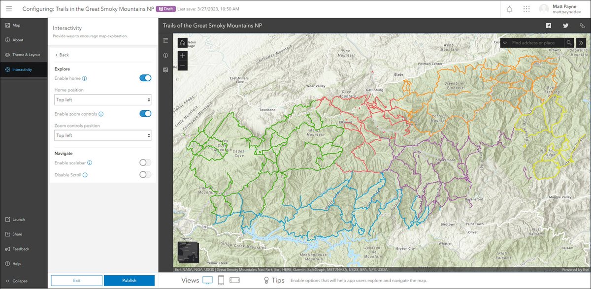
In our newest spotlight, learn how Ella Voorhees supports critical conservation efforts in Great Smoky Mountains National Park! Using Eos #GNSS receivers, #GalileoHAS, & #ArcGISApps, she is helping protect one of the most biodiverse places in the country. eos-gnss.com/successes/cust…

FYI: @ArcGISApps Collectible Trading Cards bit.ly/2DDfMx2 #collectible #ArcGISApps #apps #tech #esri #ArcGIS #GIS #mapping #GISDay @Esri @EsriFederalGovt @EsriSLGov @EsriPartnerNet @EsriTraining @LearnArcGIS @gisday
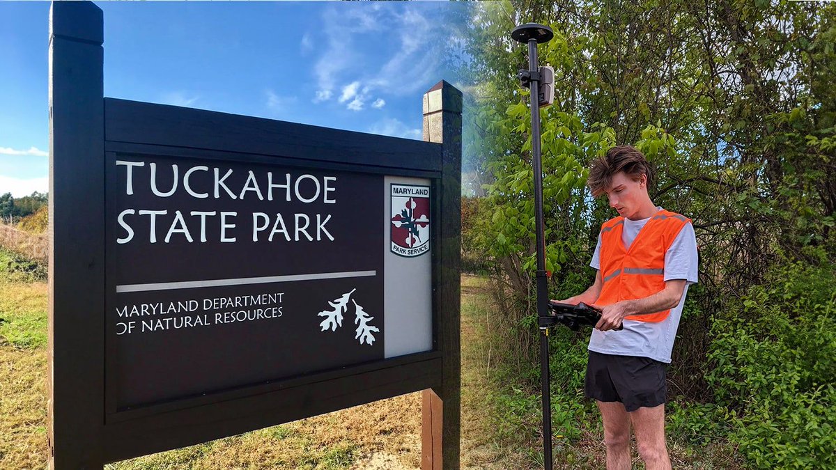
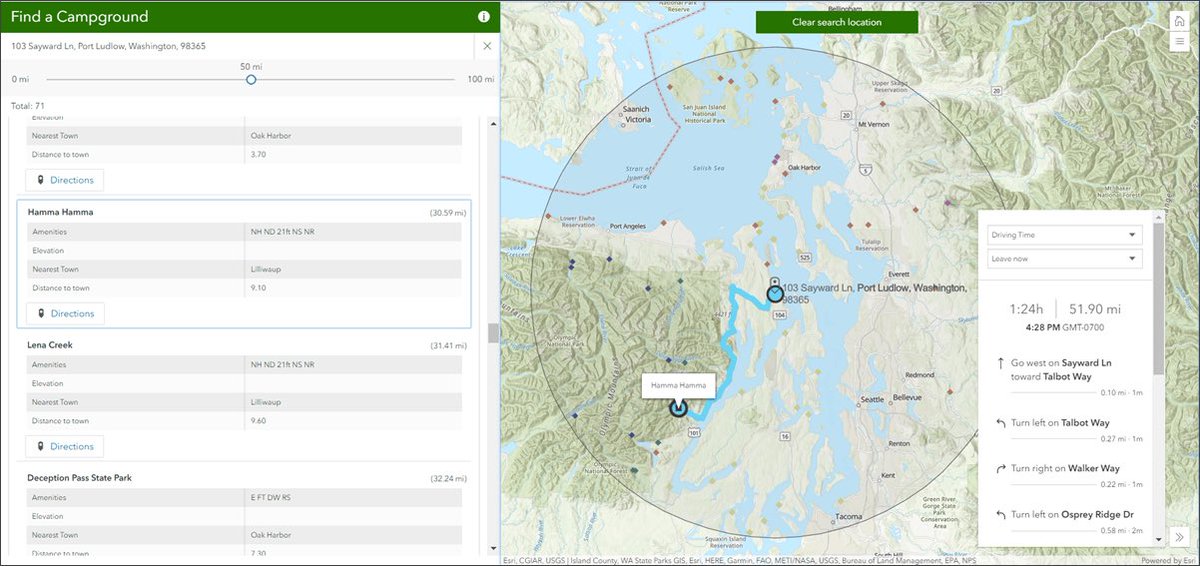
In today's #TBT, we're revisiting how @washcoll students revamped Tuckahoe State Park’s trail maps! Using #ArcGISApps & #EosGNSS, they delivered accurate, beautiful maps for visitors — combining education with community impact. Read the case study: ow.ly/5LWW50TfCt9 #GIS

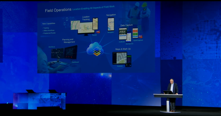
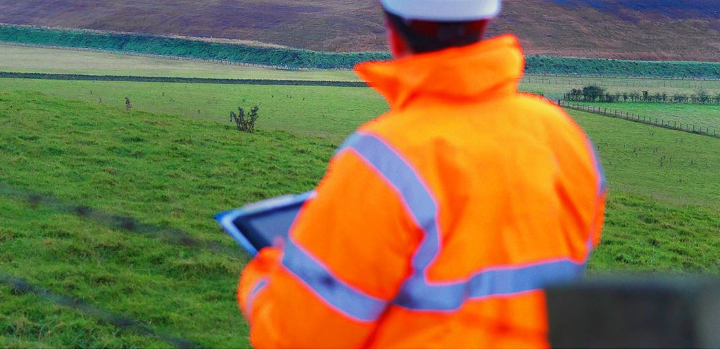
Location-enableing all aspects of field work has never been easier with #ArcGISApps - Track, Plan, Navigate, and Capture Data like never before. #EsriUC #GIS #PublicSafety #EsriUCLive #Esri #ArcGIS #Apps #FieldOperations
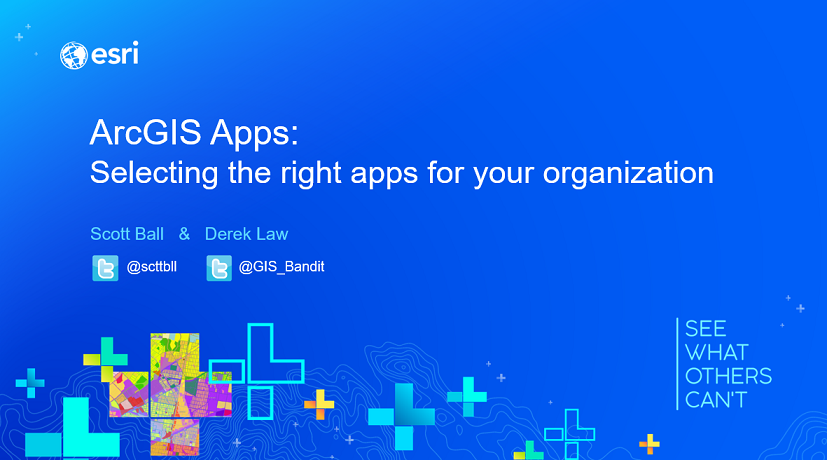
Looking for an overview of the @ArcGISApps at @esriUC? Please join @scttbll & I this morning at 8:30 am in #SDCC room 14 B. #EsriUC #ArcGISApps #webapps #fieldapps #apps #esri #arcgis #GIS #mapping #maps @Esri @GISEd @EsriTraining @EsriPartners

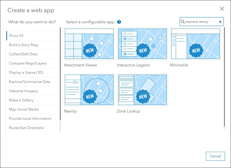
Introducing the next generation Minimalist (beta) and revamped app configuration. Check out the details in our What’s New in Configurable Apps (March 2020) blog: esri.com/arcgis-blog/pr… #esri #arcgis #arcgisapps #configurableapps
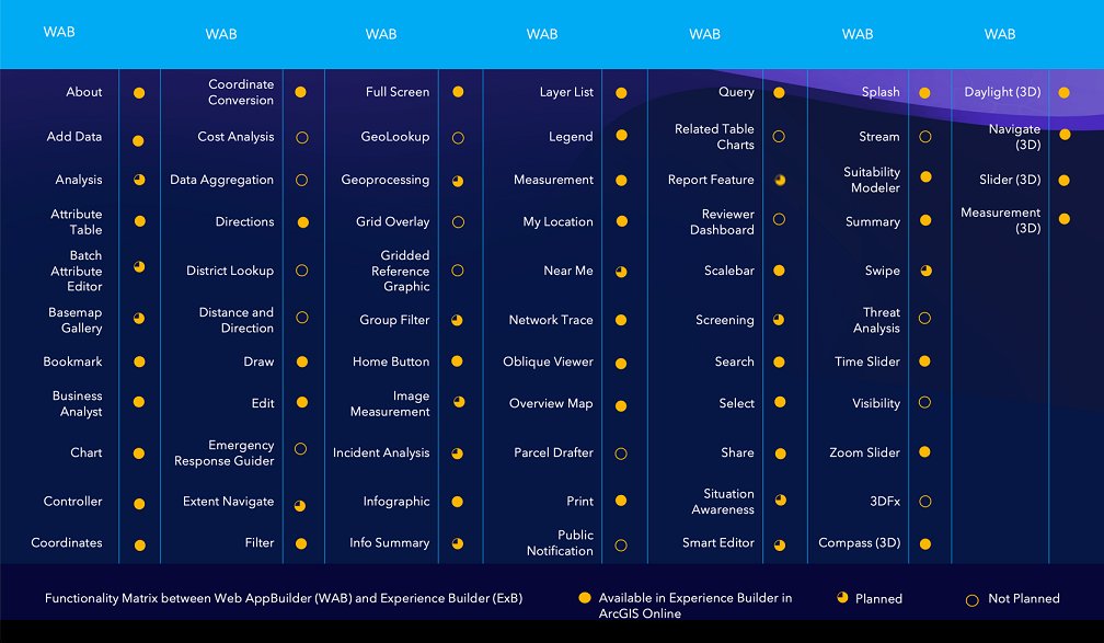
FYI: Functionality matrix for #ArcGIS Web AppBuilder vs. ArcGIS Experience Builder tinyurl.com/5eeetzc6 #ArcGISApps #webapps #GIO #ArcGISAdmin #GIS #esri #mapping #TheScienceOfWhere #GISchat @Esri @EsriSLGov @ArcGISApps @EsriTraining @GISEd

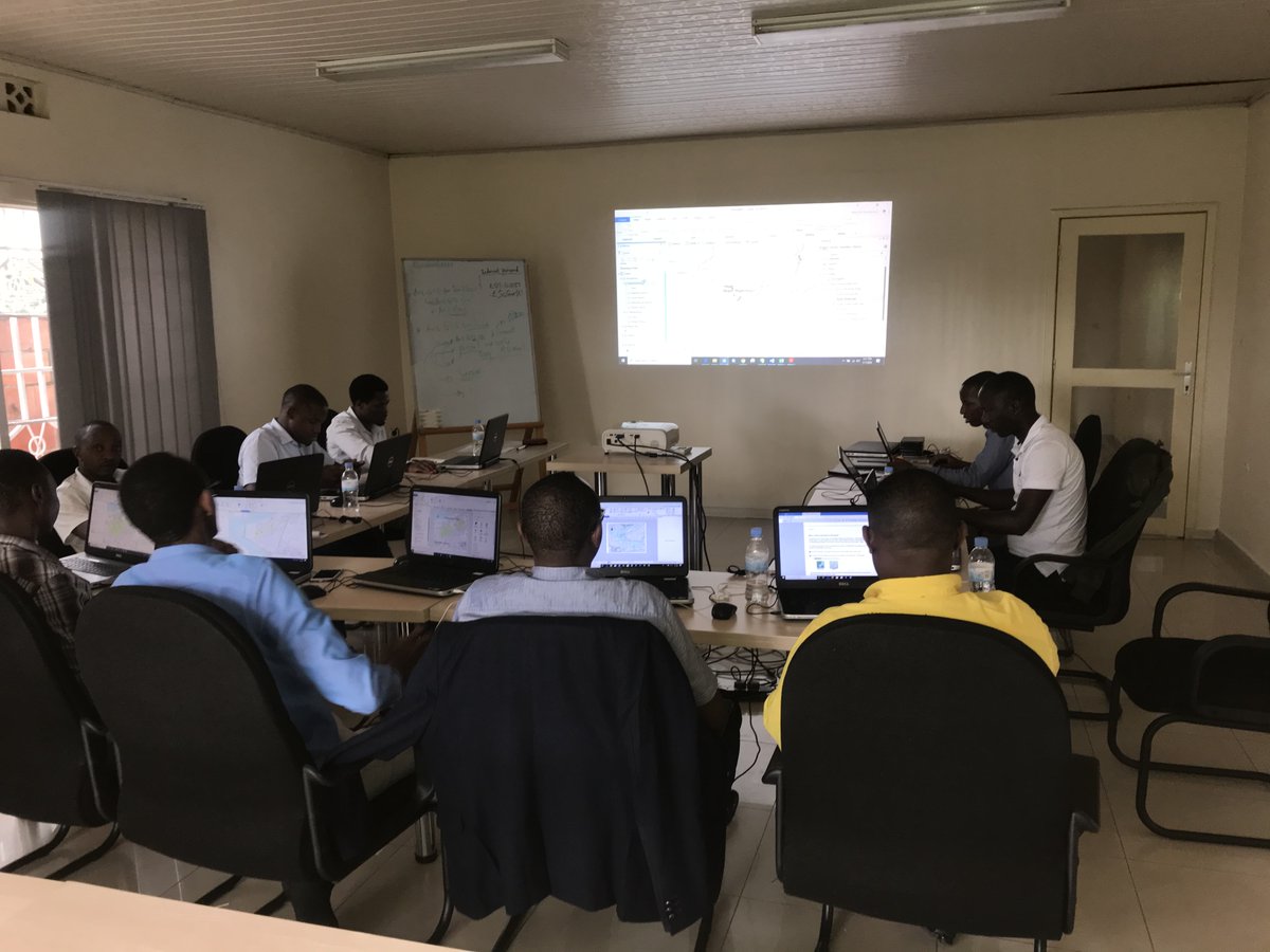
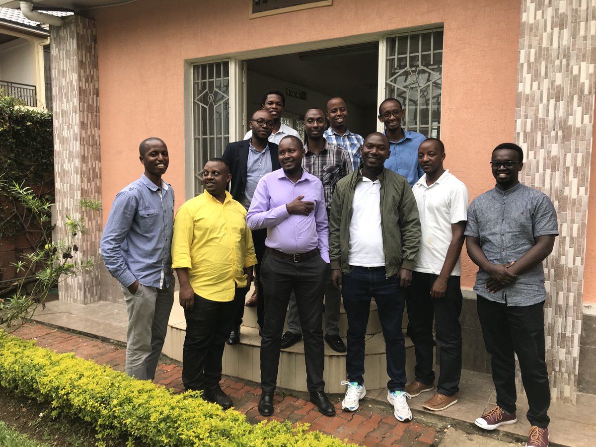
Today was the closing day of a two weeks training to the EDCL engineers on the Introduction to #ArcGISPro and Collector for ArcGIS #ArcGISApps for Electricity Network Mapping, in collaboration with NPD Ltd @reg_rwanda #GIS #esritraining #GIStraining
In California’s dry climate, every drop counts. 💧 Learn how @EasternMuni maps recycled water in real time with Skadi #GNSS & #ArcGISApps — reducing demand on drinking water supplies, improving safety, & setting the stage for more complex system mapping. buff.ly/WdlVcj9

The City of Burnaby (Vancouver, Canada) used #ArcGISApps to track the placement of over 1,250 social-distancing signs in parks. Then consumed the info into their Burnaby COVID Resource Hub. Read the story ow.ly/TFyB50zLfyK See their site ow.ly/NETe50zLfyJ #ArcGISHub

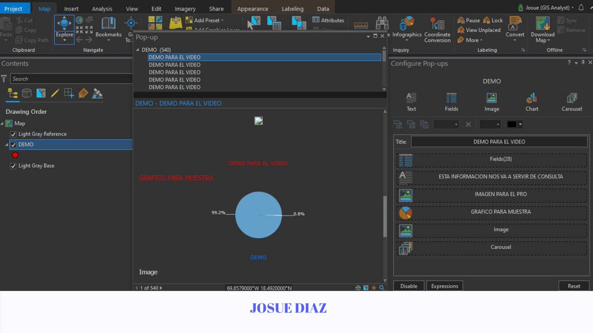
Aquí comparto un tutorial de Cómo trabajar con Ventanas Emergentes en @ArcGISPro youtu.be/xLdsci2fnC4 #arcgispro #ArcGIS #arcgisapps #esri #ESRIGeoNet #VideoViral

¡Tantas actualizaciones nuevas! Mira lo último en #ArcGIS aquí: buff.ly/2XmbHWn #ArcGISApps #GIS #innovacion #mapas #localizacion #Tecnología
Nearby app, exciting enhancements to Attachment Viewer, updates to Category Gallery and Media Map. Check out what’s new in Configurable Apps! (tap link) #arcgisonline #configurableapps #arcgisapps #esri esri.com/arcgis-blog/pr…
Introducing Express Setup and a new app configuration experience, sharing a filtered view in Category Gallery, and more. What’s New in Configurable Apps (June 2020): esri.com/arcgis-blog/pr… #esri #arcgisonline #arcgisapps #esriuc #esriuc2020

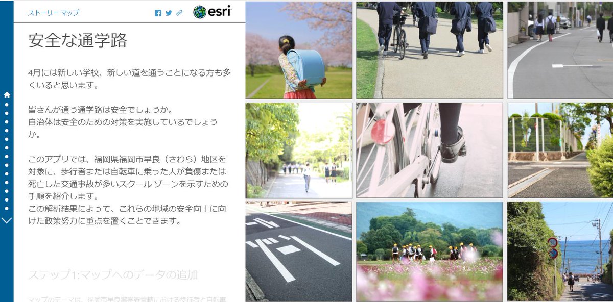
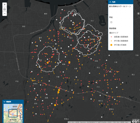
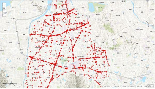
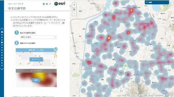
最近、交通事故のニュースを多く耳にしますね。ArcGIS では 過去の交通事故情報から危険なエリアを特定することができます。 お時間があるときに実際に操作されてみてください。 通学路は安全?過去の交通事故情報を使って解析してみよう!go.shr.lc/2RpeDgE #ArcGIS #ArcGISOnline #ArcGISApps
In today's #TBT, we're revisiting how @washcoll students revamped Tuckahoe State Park’s trail maps! Using #ArcGISApps & #EosGNSS, they delivered accurate, beautiful maps for visitors — combining education with community impact. Read the case study: ow.ly/5LWW50TfCt9 #GIS
In California’s dry climate, every drop counts. 💧 Learn how @EasternMuni maps recycled water in real time with Skadi #GNSS & #ArcGISApps — reducing demand on drinking water supplies, improving safety, & setting the stage for more complex system mapping. buff.ly/WdlVcj9
In our newest spotlight, learn how Ella Voorhees supports critical conservation efforts in Great Smoky Mountains National Park! Using Eos #GNSS receivers, #GalileoHAS, & #ArcGISApps, she is helping protect one of the most biodiverse places in the country. eos-gnss.com/successes/cust…
Discover how @WesternU Ph.D. student Junwei Zhu uses Skadi and Arrow #GNSS to research the impact of urban runoff on groundwater entering Lake Ontario. Using #EosGNSS with #ArcGISApps, he maps conductivity measurements of groundwater along the shoreline. buff.ly/nAvqrUd
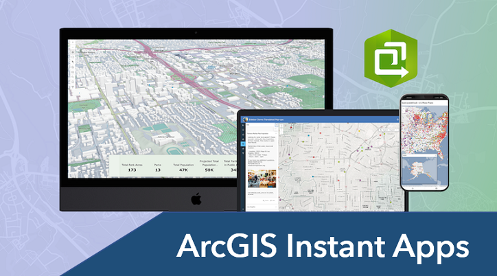
#ArcGIS Instant #Apps: Tips & Tricks tinyurl.com/48wk49u7 #ArcGISApps #webapp #GIS #esri #mapping #GISchat #geospatial @Esri @EsriFederalGovt @EsriSLGov @ArcGISOnline @ArcGISApps @URISA
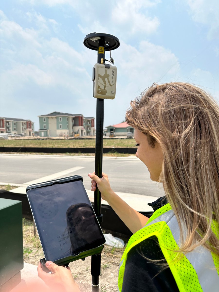
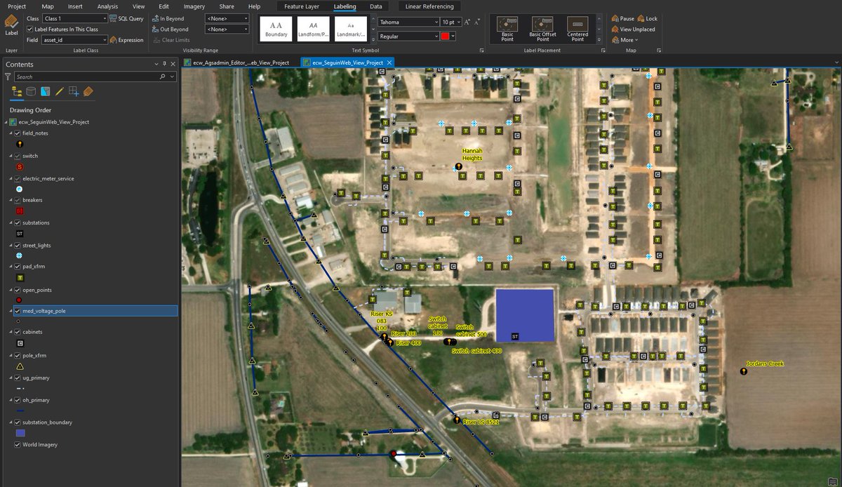
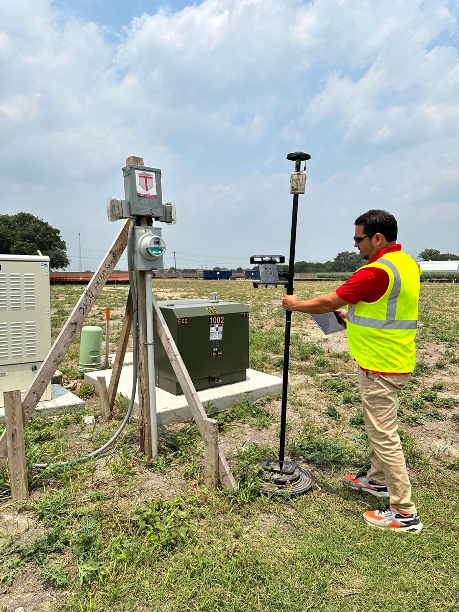
Learn how City of Seguin is embracing digital innovation with Eos #GNSS receivers & #ArcGISApps, accurately mapping water, sewer, & electric assets to reduce errors and improve efficiency for smarter city management. Read the case study: esri.com/en-us/industri… #GIS @EsriWater
with 23 purpose-driven templates now in Instant Apps, there are a lot of new and exciting updates to learn about🌍#arcgisonline #arcgisapps #gis #esri #gischat #arcgis #instantapps
What's New in #ArcGIS Instant #Apps (Nov 2024) tinyurl.com/4sfb89px by @mvttpayne #ArcGISOnline #ArcGISApps #GIS #esri #mapping #maps #GISchat #geospatial @Esri @EsriFederalGovt @EsriSLGov @ArcGISOnline @ArcGISApps @URISA

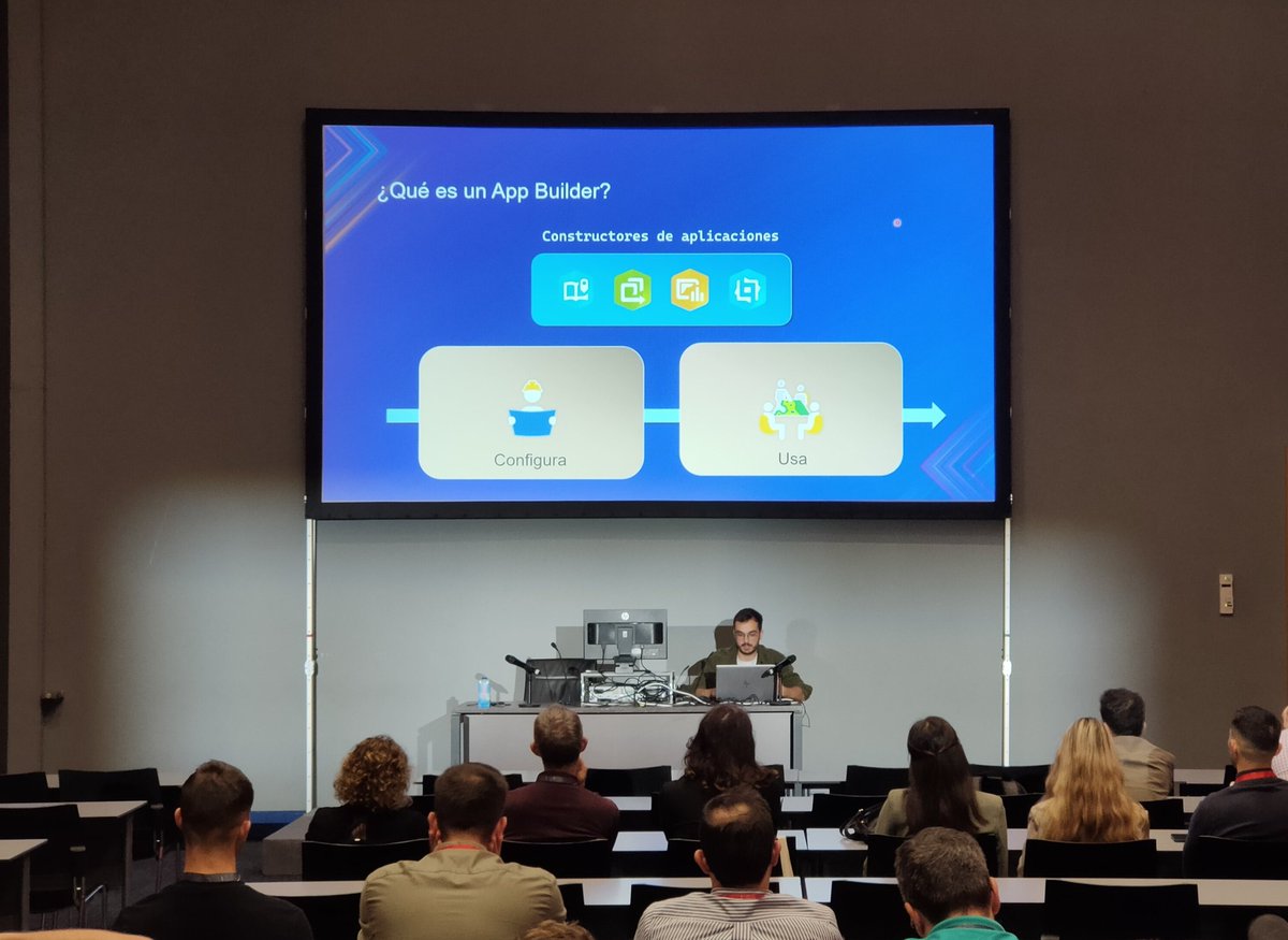
¿Sabes cómo crear apps low code y no code en #ArcGIS? Lo cuenta y muestra @VaroGuti en las sesiones técnicas 🌍 ¡Super fácil! #ArcGISApps #CEsri24

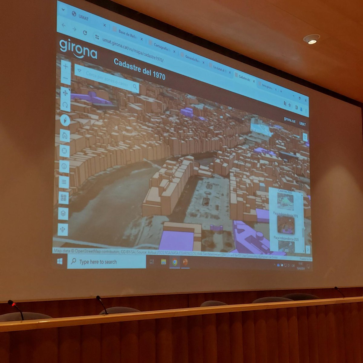
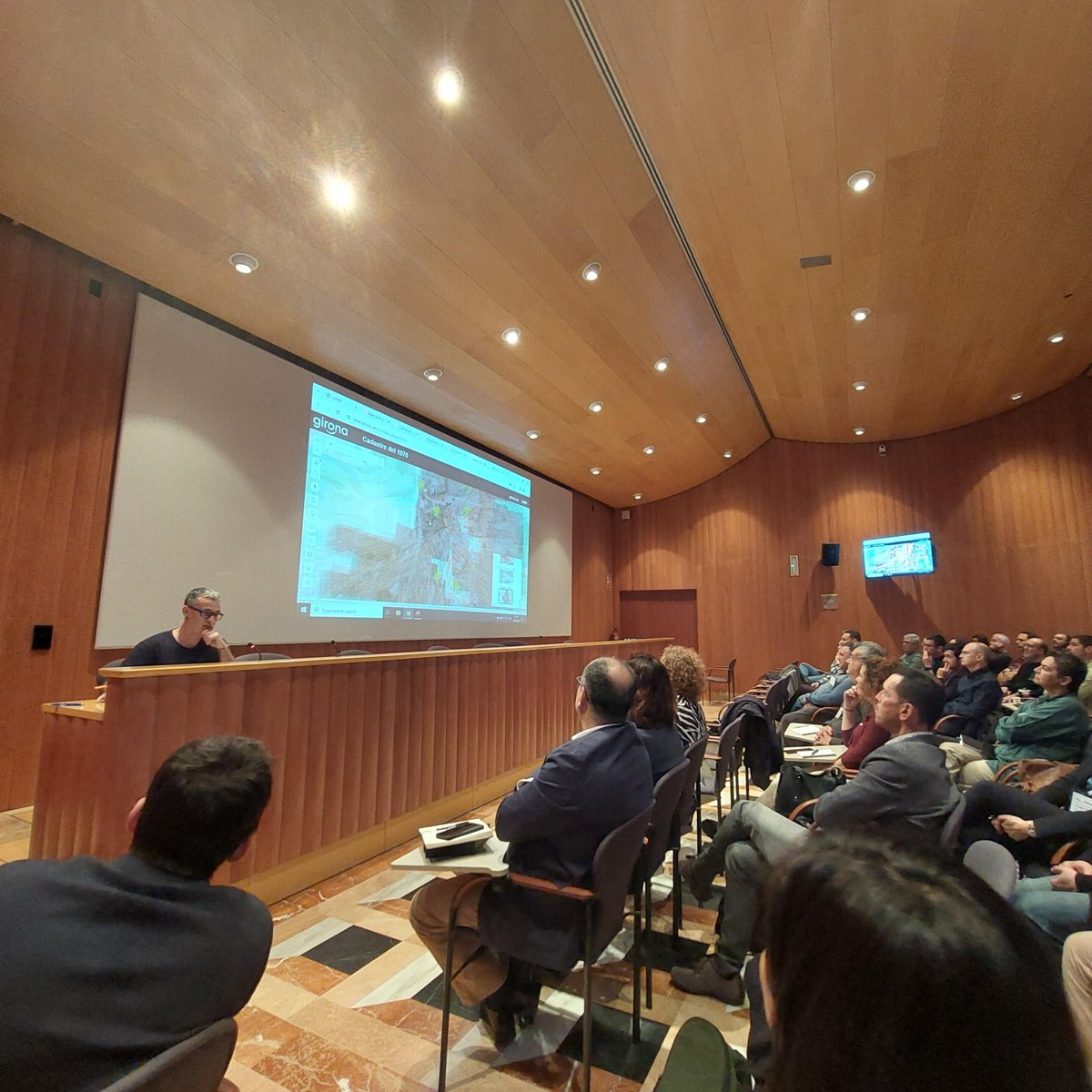
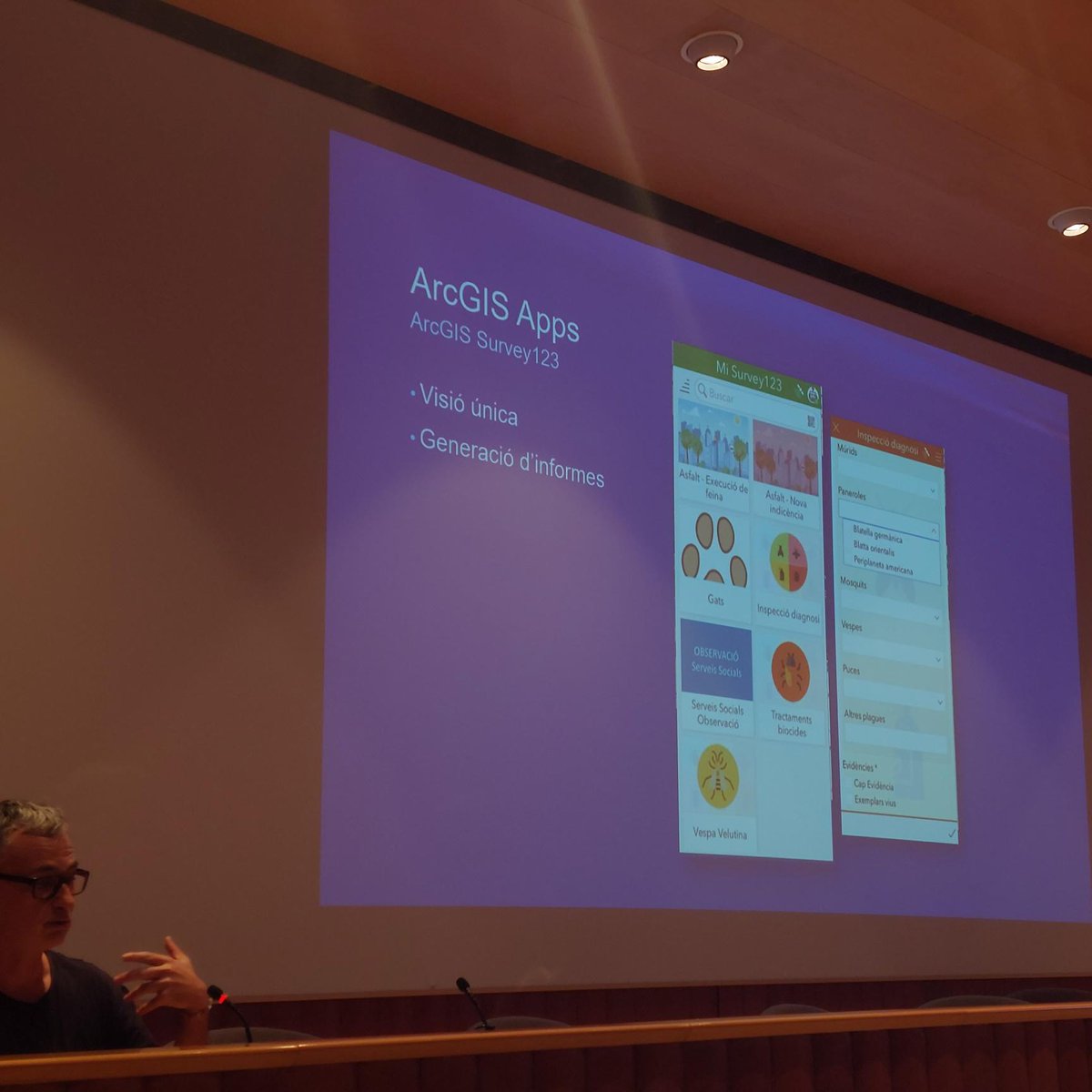
📢🌍Toca el turno al @Girona_Cat, con la ponencia de su caso de éxito: Gestió de serveis SIG a l’Ajuntament de Girona, con Francesc Puigvert, donde nos ha comentado como se organiza Girona para gestionar el territorio en su totalidad con mapa 3D, la utilización de #ArcGISapps.
In 1 week, @EsriTraining webinar: Introducing #ArcGIS Experience Builder tinyurl.com/y9mt3u5n #ArcGISApps #apps #webapps #GIS #esri #mapping #maps #TheScienceOfWhere @Esri @EsriFederalGovt @EsriSLGov @EsriBizTeam @ArcGISOnline @ArcGISXprise
Explore the Elevation Profile widget in #ArcGIS Experience Builder tinyurl.com/f9xd2pux #ArcGISApps #webapps #GIO #GIS #esri #mapping #TheScienceOfWhere #GISchat @Esri @EsriSLGov @ArcGISApps @EsriTraining @EsriPartners
New high-performance synchronized #maps in #ArcGIS Experience Builder tinyurl.com/3v2n9b22 #ArcGISApps #webapps #GIO #GIS #esri #mapping #TheScienceOfWhere #GISchat @Esri @EsriSLGov @ArcGISApps @EsriTraining @EsriPartners
Discover the power of #ArcGISInstantApps at the #EsriUC2023! Take a look at this blog to learn more about what to expect at this year’s event. 🗺️ esri.social/x9mi50OUez6

FYI: Functionality matrix for #ArcGIS Web AppBuilder vs. ArcGIS Experience Builder tinyurl.com/5eeetzc6 #ArcGISApps #webapps #GIO #ArcGISAdmin #GIS #esri #mapping #TheScienceOfWhere #GISchat @Esri @EsriSLGov @ArcGISApps @EsriTraining @GISEd
Blog: License #ArcGIS Premium #Apps bit.ly/2Jb2Hyp by @mzurn #ArcGISApps #esri #TheScienceOfWhere #GIS #mapping #maps @Esri @ArcGISOnline @ArcGISApps @ArcGISPro @EsriTraining @LearnArcGIS
Discover how @WesternU Ph.D. student Junwei Zhu uses Skadi and Arrow #GNSS to research the impact of urban runoff on groundwater entering Lake Ontario. Using #EosGNSS with #ArcGISApps, he maps conductivity measurements of groundwater along the shoreline. buff.ly/nAvqrUd
FYI: @ArcGISApps Collectible Trading Cards bit.ly/2DDfMx2 #collectible #ArcGISApps #apps #tech #esri #ArcGIS #GIS #mapping #GISDay @Esri @EsriFederalGovt @EsriSLGov @EsriPartnerNet @EsriTraining @LearnArcGIS @gisday
FYI: Functionality matrix for #ArcGIS Web AppBuilder vs. ArcGIS Experience Builder tinyurl.com/5eeetzc6 #ArcGISApps #webapps #GIO #ArcGISAdmin #GIS #esri #mapping #TheScienceOfWhere #GISchat @Esri @EsriSLGov @ArcGISApps @EsriTraining @GISEd
Looking for an overview of the @ArcGISApps at @esriUC? Please join @scttbll & I this morning at 8:30 am in #SDCC room 14 B. #EsriUC #ArcGISApps #webapps #fieldapps #apps #esri #arcgis #GIS #mapping #maps @Esri @GISEd @EsriTraining @EsriPartners
In our newest spotlight, learn how Ella Voorhees supports critical conservation efforts in Great Smoky Mountains National Park! Using Eos #GNSS receivers, #GalileoHAS, & #ArcGISApps, she is helping protect one of the most biodiverse places in the country. eos-gnss.com/successes/cust…

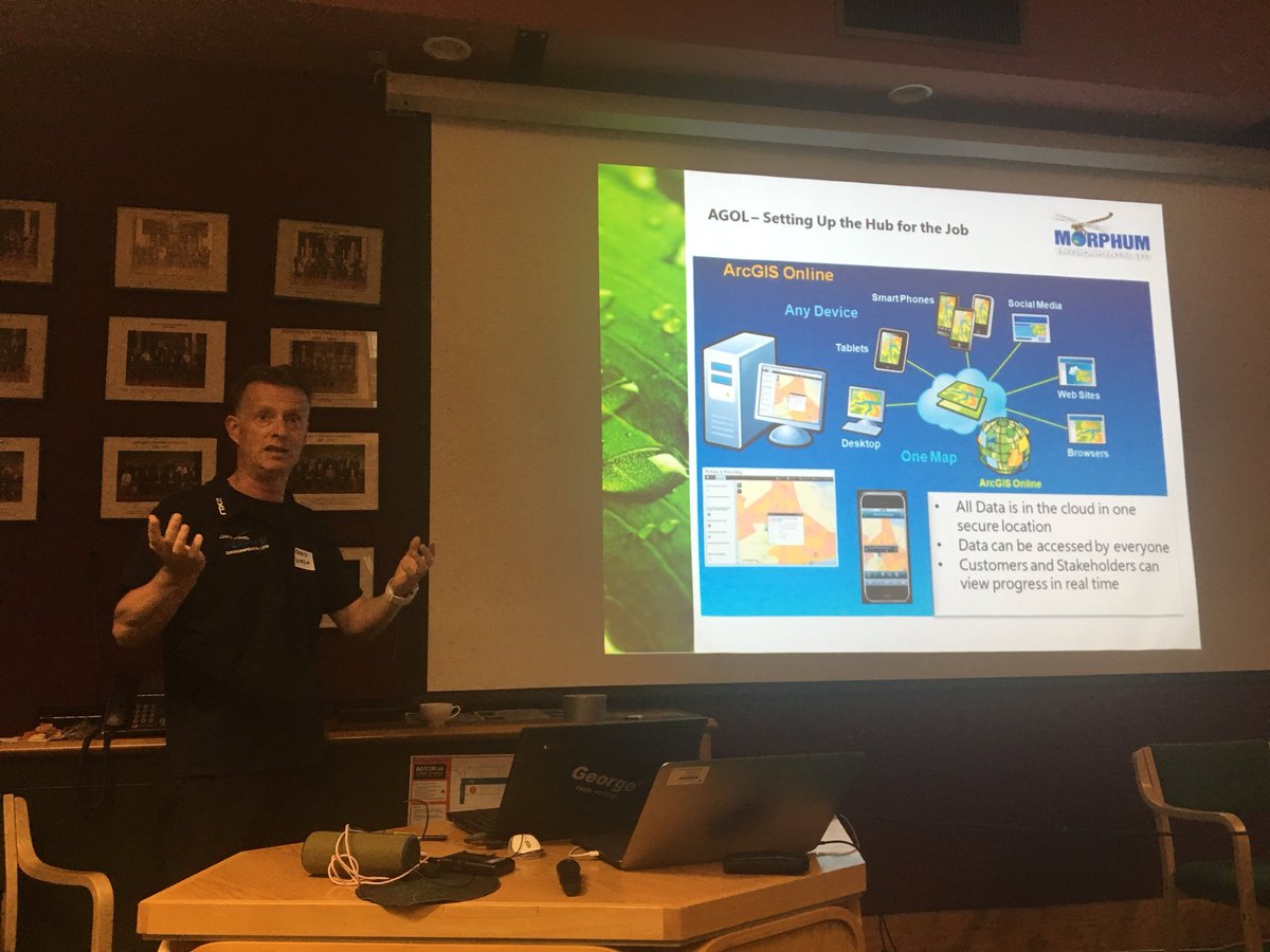
@MorphumNZ utilises the extent of the #ArcGISapps for creating the watercourse assessment reports for TLAs. Over a 1,000kms of streams have been mapped #RUC2018 @NZEUG
Having a great time at #nerd central at the #EsriUC2019 conference learning about #ArcGISApps and all of the new innovative softwares being used to advance #GIS #Esri
In today's #TBT, we're revisiting how @washcoll students revamped Tuckahoe State Park’s trail maps! Using #ArcGISApps & #EosGNSS, they delivered accurate, beautiful maps for visitors — combining education with community impact. Read the case study: ow.ly/5LWW50TfCt9 #GIS
In California’s dry climate, every drop counts. 💧 Learn how @EasternMuni maps recycled water in real time with Skadi #GNSS & #ArcGISApps — reducing demand on drinking water supplies, improving safety, & setting the stage for more complex system mapping. buff.ly/WdlVcj9
In 1 week, @EsriTraining webinar: Introducing #ArcGIS Experience Builder tinyurl.com/y9mt3u5n #ArcGISApps #apps #webapps #GIS #esri #mapping #maps #TheScienceOfWhere @Esri @EsriFederalGovt @EsriSLGov @EsriBizTeam @ArcGISOnline @ArcGISXprise
Introducing the next generation Minimalist (beta) and revamped app configuration. Check out the details in our What’s New in Configurable Apps (March 2020) blog: esri.com/arcgis-blog/pr… #esri #arcgis #arcgisapps #configurableapps
Aquí comparto un tutorial de Cómo trabajar con Ventanas Emergentes en @ArcGISPro youtu.be/xLdsci2fnC4 #arcgispro #ArcGIS #arcgisapps #esri #ESRIGeoNet #VideoViral
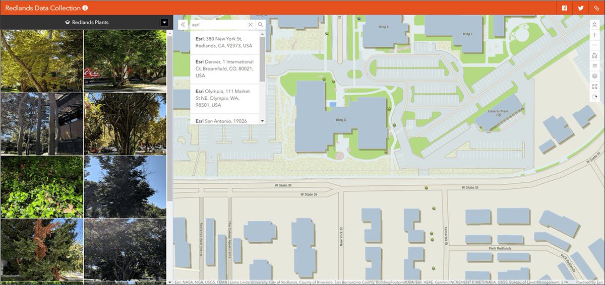
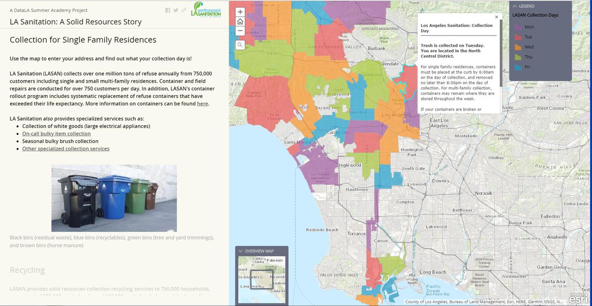
Great job to @LACitySAN, @sariladin, @Rich_Wind, and all the other interns for your great work using #ArcGISApps to easily communicate information and data in an accessible manner to the citizens of the community! 👏👏👏
Nearby app, exciting enhancements to Attachment Viewer, updates to Category Gallery and Media Map. Check out what’s new in Configurable Apps! (tap link) #arcgisonline #configurableapps #arcgisapps #esri esri.com/arcgis-blog/pr…

Nice article by Field Technologies Online highlighting #ArcGISApps at work for @taylorshellfish @esriSurvey123 #collector #drone2map and more fieldtechmag.epubxp.com/i/932606-jan-f…
Introducing Express Setup and a new app configuration experience, sharing a filtered view in Category Gallery, and more. What’s New in Configurable Apps (June 2020): esri.com/arcgis-blog/pr… #esri #arcgisonline #arcgisapps #esriuc #esriuc2020

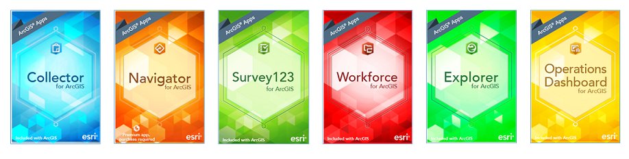
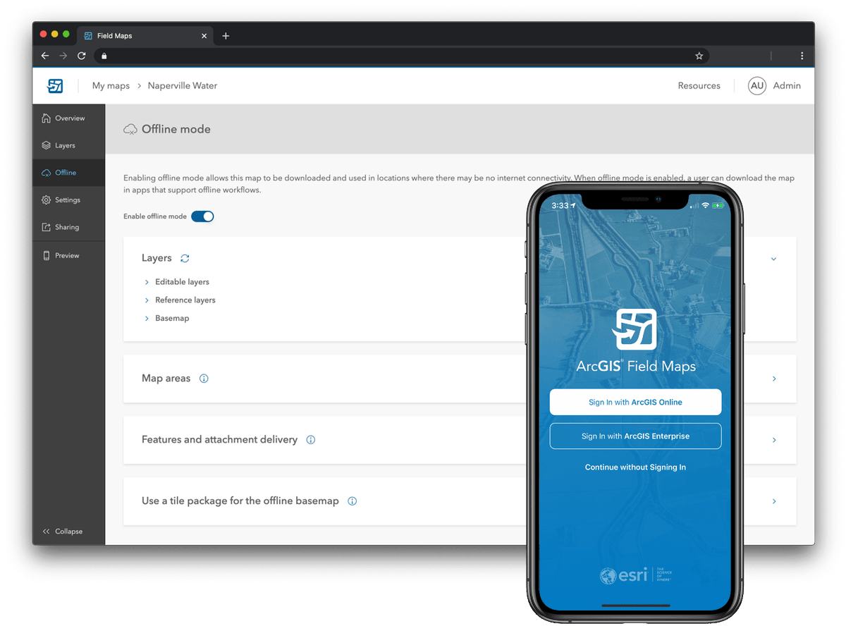
The "one" ArcGIS field app will be available soon : ArcGIS Field Maps will bring together the capabilities of Collector, Explorer, Tracker, Workforce and Navigator into a single mobile app ! buff.ly/3hJmlik #Apps #ArcGIS #ArcGISApps #fieldapp #GIS #esri
Today was the closing day of a two weeks training to the EDCL engineers on the Introduction to #ArcGISPro and Collector for ArcGIS #ArcGISApps for Electricity Network Mapping, in collaboration with NPD Ltd @reg_rwanda #GIS #esritraining #GIStraining
Location-enableing all aspects of field work has never been easier with #ArcGISApps - Track, Plan, Navigate, and Capture Data like never before. #EsriUC #GIS #PublicSafety #EsriUCLive #Esri #ArcGIS #Apps #FieldOperations
Something went wrong.
Something went wrong.
United States Trends
- 1. #VERZUZ 31.4K posts
- 2. Birdman 7,048 posts
- 3. No Limit 23.8K posts
- 4. Mia X 581K posts
- 5. Wayne 33.9K posts
- 6. #HalloweenHavoc 37.1K posts
- 7. Tamar 7,089 posts
- 8. Snoop 8,341 posts
- 9. Master P 4,161 posts
- 10. Turk 581K posts
- 11. Jonas Brothers 3,065 posts
- 12. Juvie 2,913 posts
- 13. Silkk 1,472 posts
- 14. Mississippi State 6,327 posts
- 15. Bama 15K posts
- 16. Tim Banks N/A
- 17. Choppa Style 1,514 posts
- 18. South Carolina 17.2K posts
- 19. Kelly Price 1,006 posts
- 20. Semaj Morgan N/A