#webgis search results

Siap #NaikLevel? Membangun portofolio WebGIS profesional yang terintegrasi dengan cloud database adalah skill yang sangat dicari di industri 4.0. Cek silabus lengkap & amankan tempat Anda segera! Stok terbatas. ➡️ Klik: s.id/WebGISNSC #WebGIS #Portofolio #BelajarGIS


🌐💻 Este curso enseñará al alumno a programar desde cero un visor de mapas con herramientas 𝘰𝘱𝘦𝘯 𝘴𝘰𝘶𝘳𝘤𝘦 de acceso libre. 🔗 Web: bit.ly/Curso_Web-GIS_… Contáctenos: 📧 [email protected] 📱 +34 635 619 882 #WebGIS #OpenLayers #Leaflet #GeoServer #curso


🗺️ A new paper presents an interactive #webGIS platform that brings 24 high-resolution sheets of Kaupert’s 19th-century maps of Attica into the digital age. ✍️ by Georgios Lampropoulos, et al. 🔗 Read more: mdpi.com/2673-7086/3/2/… #cartography #geospatial #geovisualization

🌍 Empieza el curso que ofrece al alumno una completa formación y especialización en Web GIS. 🔗 Web del curso: bit.ly/Curso_Web-GIS_… 📧 [email protected] 📱 +34 635 619 882 #WebGIS #QGIS #leaflet #mapbox #WebMapping #cursos

🌐💻 Este curso enseñará al alumno a programar desde cero un visor de mapas con herramientas 𝘰𝘱𝘦𝘯 𝘴𝘰𝘶𝘳𝘤𝘦 de acceso libre. 🔗 Web: bit.ly/Curso_Web-GIS_… 💻 Online 📅 3 de noviembre 🕘 120 horas ✅ Descuentos ℹ bit.ly/Form_Web-GIS_L… #WebGIS #OpenLayers #Leaflet

🌍 Este #curso ofrece al alumno una completa formación y especialización en Web GIS. 🔗 Web: bit.ly/Curso_Web-GIS_… 💻 Modalidad online 📅 3 de noviembre 🕘 240 horas ✅ Descuentos ℹ bit.ly/Form_Web-GIS_E… 📧 [email protected] #WebGIS #QGIS #leaflet #mapbox #WebMapping

✈🗺➡ En esta entrada vamos a realizar un visor aeronáutico con Leaflet utilizando la base de datos de aviación llamada OpenAIP. Leer más: bit.ly/Leaflet_visor_… #WebGIS #SIG #visor #cartografía #aeronautica #Leaflet #OpenAIP

🗺💻➡ En esta entrada os mostramos una sinergia entre dos de las plataformas más potentes en el campo del desarrollo de visores cartográficos, 𝗠𝗮𝗽𝗯𝗼𝘅 y 𝘾𝙚𝙨𝙞𝙪𝙢. Sigue leyendo: bit.ly/mapa-base_Mapb… #SIG #WebGIS #mapas #mapbox #cesium

🌍 Introducing #LionVu: A #WebGIS Power Tool for #CommunityHealth. Ready to bring health data to life? An open-source mapping tool built for health professionals about the cancer burden. ✍️ by Nathaniel R. Geyer and Eugene J. Lengerich 🔗 mdpi.com/2673-7086/3/2/… #QGIS #cancer


🚀 Learn how to add shapefiles (GeoJSON) in CesiumJS with visibility & opacity controls! Check it out: manyatechnologies.com/add-geojson-ce… #CesiumJS #GeoJSON #WebGIS #SpatialData #ManyaTechnologies #Shapefile
🌍 Abrimos el plazo de matriculación del #curso que ofrece al alumno una completa formación y especialización en Web GIS. 🔗 Web: bit.ly/Curso_Web-GIS_… 💻 Modalidad online 📅 3 de noviembre 🕘 240 h. ✅ Descuentos ℹ bit.ly/Form_Web-GIS_E… #WebGIS #QGIS #leaflet #mapbox

🌐🗺️➡️ 𝗖𝗮𝗿𝘁𝗼 es una empresa que permite desde su plataforma trabajar con datos del usuario con el objetivo de ser mostrados en un visor cartográfico. Leer más: bit.ly/formatos_datos… #Carto #WebGIS #PostGIS

🍃🌐➡ 𝗟𝗲𝗮𝗳𝗹𝗲𝘁 es una librería JavaScript 𝘰𝘱𝘦𝘯 𝘴𝘰𝘶𝘳𝘤𝘦 que permite el desarrollo de visores cartográficos. Leer más: bit.ly/plugin_Magnify… #WebGIS #Leaflet #SIG #QGIS #plugins #OpenSource

🌐 Este curso iniciará al alumno en el desarrollo de aplicaciones Web Mapping. Web: bit.ly/Curso_Web-GIS_… Contáctenos: 📧 [email protected] 📱 +34 635 619 882 #WebGIS #SIG #Mapbox #CARTO #WebMapping #curso

🌐💻 En esta nueva entrada aprenderás a contar tu propia historia, en un visor, con «𝗠𝗮𝗽𝗯𝗼𝘅 𝗦𝘁𝗼𝗿𝘆𝘁𝗲𝗹𝗹𝗶𝗻𝗴». Leer más: bit.ly/Mapbox-Storyte… #SIG #WebGIS #Mapbox #visor #storytelling


اكتشف عالم #نظم_المعلومات_الجغرافية على الويب 🌐 مع الكتاب الأكثر مبيعاً من Esri! "Getting to Know Web GIS" يقدم دليلاً شاملاً يغطي منصات متعددة، حيث يُخصص كل فصل لمنصة مختلفة لمشاركة والتحكم في البيانات 📚 اطلبه الآن من موقع إسري: esripress.esri.com/.../getting-to…... #WebGIS #GIS #Esri

🌐 Empieza el curso que iniciará al alumno en el desarrollo de aplicaciones Web Mapping. Web: bit.ly/Curso_Web-GIS_… 💻 Online 📅 29 de septiembre 🕐 120 horas ✅ Descuentos ℹ bit.ly/Form_WEB-GIS_C… 📧 [email protected] #WebGIS #SIG #Mapbox #CARTO #WebMapping #curso

🗺️💻 Una de las herramientas que tiene Mapbox para crear visores cartográficos atractivos y funcionales es Data Explorer. Enlace: bit.ly/DataExplorer_M… #WebGIS #Mapbox #DataExplorer


![IndonesiaWebgis's profile picture. Akun Twitter https://t.co/dx6AY32ZHL
[Peta Digital & Web GIS Indonesia]
▶️ https://t.co/U6B4Zgn3up
📃 https://t.co/MWfNuPDTP2](https://pbs.twimg.com/profile_images/1268694970732474368/2d9dsWEI.jpg)


اكتشف عالم #نظم_المعلومات_الجغرافية على الويب 🌐 مع الكتاب الأكثر مبيعاً من Esri! "Getting to Know Web GIS" يقدم دليلاً شاملاً يغطي منصات متعددة، حيث يُخصص كل فصل لمنصة مختلفة لمشاركة والتحكم في البيانات 📚 اطلبه الآن من موقع إسري: esripress.esri.com/.../getting-to…... #WebGIS #GIS #Esri

Managing the “invisible infrastructure” of optical fiber networks is a huge challenge. 📡 With SuperMap iServer, telecoms can build a digital twinof their entire network—transforming planning, maintenance & fault recovery.🔗 bit.ly/4gfCZVn #WebGIS #DigitalTwin #Telecom

🌐💻 En esta nueva entrada aprenderás a contar tu propia historia, en un visor, con «𝗠𝗮𝗽𝗯𝗼𝘅 𝗦𝘁𝗼𝗿𝘆𝘁𝗲𝗹𝗹𝗶𝗻𝗴». Leer más: bit.ly/Mapbox-Storyte… #SIG #WebGIS #Mapbox #visor #storytelling

Climate change and its effects are increasingly part of the general public discourse and is being taught at all levels of #education. Learn how to use #WebGIS to teach climate resilience: esri.social/RPtX50NvmxU

GIS education must keep pace with changes in #GIS technology and industry. Here's what educators can do to update their curriculum to focus on #WebGIS 👉 esri.social/XH4h50OJGvA


Screens from a #WebGIS application I have been designing and implementing on behalf of the #VikosAoos UNESCO Global Geopark in #Greece Commissioned project; work in progress; soon online #cARTography #MakingMapsPretty #QGIS #Leaflet #JavaScript #CSS


🌐🗺️➡️ 𝗖𝗮𝗿𝘁𝗼 es una empresa que permite desde su plataforma trabajar con datos del usuario con el objetivo de ser mostrados en un visor cartográfico. Leer más: bit.ly/formatos_datos… #Carto #WebGIS #PostGIS
Educators in need of resources to modernize your curriculum to #webGIS check out this webpage: esri.social/zm1S50Uttgf You'll get access to: 🔸 Core concepts of #modernGIS 🔸 Case studies 🔸 Curriculum resources 🔸 Training recommendations 🔸 Articles and blogs

🗺️💻 Una de las herramientas que tiene Mapbox para crear visores cartográficos atractivos y funcionales es Data Explorer. Enlace: bit.ly/DataExplorer_M… #WebGIS #Mapbox #DataExplorer

😍😍 A #WebGIS-Based System for Supporting #Saline–#Alkali #Soil #Ecological Monitoring: A Case Study in Yellow River #Delta, #China ✍️ Yingqiang Song et al. 🔗 brnw.ch/21wTxYf

What are the core concepts of modern GIS? Let's start with #webGIS 🌐 From #spatialanalysis to real-time #data sharing, learn how web #GIS is evolving to meet the demands of today's world and what educators should focus on 👉 esri.social/3uJh50ReHf5


Hemos arrancado el #Esri TechDay con @fedelopezfdez hablando del Modelo de #Geoinformacion y #WebGIS ¡Gran día por delante! 🌍 #ArcGIS


¡Hoy en @innovadorescyl, te presentamos la app ForLocal, un visor #webGIS diseñada junto Reque Kilchenmann y Fátima Cruz para unir la ciencia forestal con la sociedad #Prometeo #Innovación y #DataForest @UVaPalencia @SoyForestal🌳📱


We are pleased to announce our latest relase of #Mapstore. Lots of new features and enhancements for building modern and powerful #webgis applications. Details here 👉bit.ly/ms-2024-01 #FOSS4G #OSGEO @foss4g @OSGeo @CesiumJS @openlayers #GeoServer #GeoNode #3DTiles #3D…


We're back up and running on day 2 of the @GeoPlaceLLP Conference! Our colleagues will be on our stand all day to discuss #WebGIS or Surf Hire whichever takes your fancy! 🏄 #GeoPlace2023

🌐 Este curso iniciará al alumno en el desarrollo de aplicaciones Web Mapping. Web: bit.ly/Curso_Web-GIS_… 💻 Modalidad online 📅 9 de junio 🕐 120 horas ✅ Descuentos ℹ bit.ly/Form_WEB-GIS_C… 📧 [email protected] #WebGIS #SIG #Mapbox #CARTO #WebMapping #curso

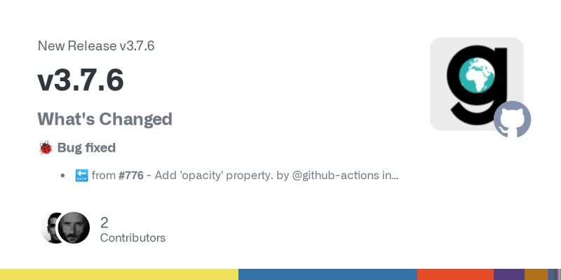
#G3WSUITE v3.7.6 released! Bug fixing and small enhancement. github.com/g3w-suite/g3w-… #qgis #webgis #opensource #foss4g
Numerous cities, agencies, nonprofits, and businesses rely on #WebGIS. Transitioning #GIS from desktop to web enables mobility, automation, responsiveness and more. Use this resource to adopt a #modernGIS approach to your courses 🌐 esri.social/RJlE50QEkVw


Highest-rated web-GIS course on @udemy. If you want to enroll, follow this link to get a 77% discount: udemy.com/course/web-map… #opensource #webgis

Something went wrong.
Something went wrong.
United States Trends
- 1. Jonathan Taylor 19.8K posts
- 2. Falcons 30.7K posts
- 3. Colts 51K posts
- 4. Bills 110K posts
- 5. Kyle Williams 4,855 posts
- 6. Daniel Jones 9,911 posts
- 7. Penix 10.7K posts
- 8. Parker Washington 2,620 posts
- 9. Joe Brady 1,498 posts
- 10. Diggs 3,444 posts
- 11. Jaxson Dart 2,919 posts
- 12. #Browns 2,157 posts
- 13. Dillon Gabriel 1,334 posts
- 14. Liverpool 218K posts
- 15. Bijan 6,617 posts
- 16. Starks 1,906 posts
- 17. #DawgPound 1,595 posts
- 18. Max B 24.9K posts
- 19. #NYGiants 1,803 posts
- 20. Bubba Ventrone N/A