#blendergis search results

松本城周辺を3Dでお試し中。 QGISのPLATEAUプラグインでCityGML→shp保存→BlenderGISで読み込み。getOSMで道路追加→カーブに変換。 OSMの川(waterway)を入れようとしたらエラー😢 Source: MLIT “PLATEAU” Matsumoto City (FY2020) ©︎OpenStreetMap Contributors. #PLATEAU #BlenderGIS #osmjp
What's up with the new trend of 3D-looking maps with big dramatic digital shadows? In our latest blog we dig into this "Blender maps" technique and explore what might be next in this new paradigm of terrain cartography: stamen.com/shadows-on-map… #Blender3d #BlenderGIS #cartography


#30DayMapChallenge Day 6: Network The rails network as it cuts through Birmingham city centre, Tron-style. Made with #osm data and #blendergis #b3d

#IcelandsDEM + #BlenderGIS でアイスランドの #Reykjanes 半島の色んな名前で呼ばれている噴出中の溶岩 #Fagradalsfjall / #Geldingadalir / #Krysuvik


My weekend #BlenderGIS rendering of dacite lava morphologies of Kameni Islands, #Santorini, Greece. #LiDAR topography data by @davidmpyle via @figshare. The luxury passenger ship is the best 3d scale I've ever seen!


巷で噂のBlender GISをダウンロードしてテスト。近鉄京都線に沿って高の原駅から大和西大寺駅まで。地方なので建物も疎ら。※マテリアルは適当です。 #Blender #b3d #Blendergis

Day 5: #Ukraine Digital Surface Model of Ukraine. Data used - Copernicus Global DSM 90m. Very simple map made using #BlenderGIS plugin in #Blender3D #30DayMapChallenge

Blender geometry nodes - 25.000+ flight routes from a single csv-file into airport positions and simulated aircrafts along the routes. Source data: openflights.org #blender3d #blendergis #cartoblend #b3d #openflights


Day 14: Map with a new tool Baños in the shadow of Tungurahua Data: #SRTM and #Google Tools: @Blender and #blenderGIS #30DayMapChallenge #gis #gischat (one day late 😱)


Turn your boring old skrisut google earth menjadi model 3D dengan pencahayaan studio foto kekinian #b3d #BlenderGIS


agak lebay gitu tinggi Gn. Agungnya wkwkw tapi is okay sih, masih panjang learning curvenya #BlenderGIS ini.

It's a crime that I don't know blender in my bachelor times. its a freakin treat when u achieve beautiful visualization like this. #b3d #BlenderGIS


#GitHub から #blenderGIS をDLして #GoogleMap を読み込んでビルを #blender に読み込んだ! 残念ながらビルのマテリアルがFreeじゃ無かったんでこんな感じに I loaded the building from Google Maps into Blender 参考:youtube.com/watch?v=uk404c… #blender3d #3dcg #osaka #MinatoWord #bigger

#BlenderGIS との比較 #BlenderGIS はフリーで操作簡単! オススメです👍 これとは当然、差別化が必要で、 街情報&高さを含んだ都市のローポリ3Dモデルを目指してます #unity


松本城周辺を3Dでお試し中。 QGISのPLATEAUプラグインでCityGML→shp保存→BlenderGISで読み込み。getOSMで道路追加→カーブに変換。 OSMの川(waterway)を入れようとしたらエラー😢 Source: MLIT “PLATEAU” Matsumoto City (FY2020) ©︎OpenStreetMap Contributors. #PLATEAU #BlenderGIS #osmjp

En este post encontrarás muchos detalles sobre la renderización de vídeo 360 en Blender y que complementan al curso de #CGBoost (Master Urban Environments in Blender). #BlenderGIS #Blender #OSM #cgboots #360video modlearth.com/blog/santander…


Some belated #freecadfriday progress... Wright's Hill Fortress scale-model progress using inputs from #blenderGIS and historical data. Using the partdesign workbench for #parametric-ness, mesh to haul the surface in, to sense-check scale and consistency. @FreeCADNews


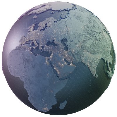
🌎 Puedes levantar terrenos con imágenes satelitales a distintos niveles de detalle, solo con Blender, y un addon increíble (BlenderGIS) modlearth.com/2023/08/01/ble… #BlenderGIS #blender #linux @blender @domlysz
modlearth.com
Detalied Terrains with Blender and Google Satellite
Blender GIS Addon simplifies detailed terrain creation. Create large terrains by watching a video on applying elevation data effectively.

Installing BlenderGIS on Blender 3.6 in MacOS Sonoma requires installing Mac Ports, then running "sudo port install freeimage" from the terminal. #b3d #BlenderGIS

⚠️This #dataviz is inaccurate⚠️, but fun! To explore: my.spline.design/submarinecable… Inspired by @tylermorganwall 's map: Data: submarinecablemap.com Tools: #QGIS , #BlenderGIS, #Spline
Also look into #Qgis plus @Blender and the #blenderGIS add-on - quite amazing shiny maps. And we also use #rstats #rayshader #ggplot for high quality maps.

I should start calling Blender maps “reliefcore” yea or nay? pinterest.com/Excore1441/rel… #Blender #BlenderGIS #CartoBlend #cartography #maps (credit to user Excore1441 on Pinterest, map by 4DMAPART)

Blender geometry nodes - 25.000+ flight routes from a single csv-file into airport positions and simulated aircrafts along the routes. Source data: openflights.org #blender3d #blendergis #cartoblend #b3d #openflights
#GitHub から #blenderGIS をDLして #GoogleMap を読み込んでビルを #blender に読み込んだ! 残念ながらビルのマテリアルがFreeじゃ無かったんでこんな感じに I loaded the building from Google Maps into Blender 参考:youtube.com/watch?v=uk404c… #blender3d #3dcg #osaka #MinatoWord #bigger

4. Load the shapefile into #Blender with the #BlenderGIS plugin 5. Have fun with the geometry and materials...


In our latest Creator Labs post, Senior 3D Content Creator Christian Van Meurs shows us how he created a real-world inspired art gallery with @googlemaps, #BlenderGIS, and texture atlases. hubs.mozilla.com/labs/codezart-… #GISDay #b3d


#30DayMapChallenge Day 6: Network The rails network as it cuts through Birmingham city centre, Tron-style. Made with #osm data and #blendergis #b3d
#IcelandsDEM + #BlenderGIS でアイスランドの #Reykjanes 半島の色んな名前で呼ばれている噴出中の溶岩 #Fagradalsfjall / #Geldingadalir / #Krysuvik


What's up with the new trend of 3D-looking maps with big dramatic digital shadows? In our latest blog we dig into this "Blender maps" technique and explore what might be next in this new paradigm of terrain cartography: stamen.com/shadows-on-map… #Blender3d #BlenderGIS #cartography
My weekend #BlenderGIS rendering of dacite lava morphologies of Kameni Islands, #Santorini, Greece. #LiDAR topography data by @davidmpyle via @figshare. The luxury passenger ship is the best 3d scale I've ever seen!
Day 5: #Ukraine Digital Surface Model of Ukraine. Data used - Copernicus Global DSM 90m. Very simple map made using #BlenderGIS plugin in #Blender3D #30DayMapChallenge

Day 14: Map with a new tool Baños in the shadow of Tungurahua Data: #SRTM and #Google Tools: @Blender and #blenderGIS #30DayMapChallenge #gis #gischat (one day late 😱)


#BlenderGIS との比較 #BlenderGIS はフリーで操作簡単! オススメです👍 これとは当然、差別化が必要で、 街情報&高さを含んだ都市のローポリ3Dモデルを目指してます #unity

It's as easy as getting a #BlenderGIS basemap, getting the data you want (AHN3 DTM or DSM, 3D BAG) you're good to go!


One last render from Bryce Canyon before moving on to something else. Great fun to develop one simple DEM with some tools and techniques from both GIS and the more creative softwares. #b3d #blendergis


ひっさびさにblender。なかなか触れんかったなー。これも社会が動き出したおかげなのだから喜ばないと。 で、今日は梅田をコテコテのサイバーシティにして差し上げました。GIS便利。#blender3d #blenderGIS


Yesterday I spent with #BlenderGIS, #3D. Here a image of what I got with @blend4web , @blender_org, @USGS DEM and @CopernicusEU #Sentinel2.

Something went wrong.
Something went wrong.
United States Trends
- 1. Sunderland 82.1K posts
- 2. St. John 4,755 posts
- 3. Texas Tech 9,303 posts
- 4. Obamacare 170K posts
- 5. Merino 8,110 posts
- 6. Mendoza 7,984 posts
- 7. #iufb N/A
- 8. Letang N/A
- 9. Elyiss Williams N/A
- 10. Shapen N/A
- 11. #SUNARS 5,581 posts
- 12. Verstappen 18.8K posts
- 13. Mississippi State 3,667 posts
- 14. #GoDawgs 2,871 posts
- 15. Xhaka 7,075 posts
- 16. #SaturdayVibes 5,732 posts
- 17. Oscar Delp N/A
- 18. #BYUFOOTBALL N/A
- 19. Aden Holloway N/A
- 20. Philon N/A