#gistribe wyniki wyszukiwania

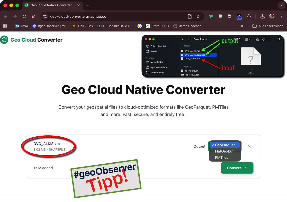
Cloud optimierte Geoformate mit dem „Geo Cloud Native Converter“ / Cloud-optimised geoformats with the Geo Cloud Native Converter geoobserver.de/2025/10/29/clo… #gistribe #gischat #fossgis #foss4g #OSGeo #spatial #geospatial #gdal #gis #geo #geoObserver pls RT
GeoDataExplorer: „Scan my (GIS) File“ geoobserver.de/2025/10/22/geo… #gistribe #gischat #fossgis #foss4g #OSGeo #spatial #geospatial #gis #geo #geoObserver pls RT

Auch / Also 2025: #30DayMapChallenge geoobserver.de/2025/10/30/auc… #gistribe #gischat #fossgis #foss4g #OSGeo #spatial #geospatial #mapping #DataViz #gis #geo #geoObserver pls RT via @tjukanov


Buried myself in old maps, photos, census forms and city directories for this important project on @Oregonian's reporting on the impact of Portland's urban renewal boom of 60s/70s. Stellar work by @robwdavis @bethnakamura @_Brad_Schmidt #gistribe #dataviz projects.oregonlive.com/publishing-pre…
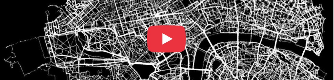
5 Jahre per Bike durch London – Die Karte / 5 years cycling through London – The map geoobserver.de/2025/10/14/5-j… via @BrilliantMaps #gistribe #gischat #fossgis #foss4g #OSGeo #spatial #geospatial #DataViz #gis #geo #geoObserver pls RT


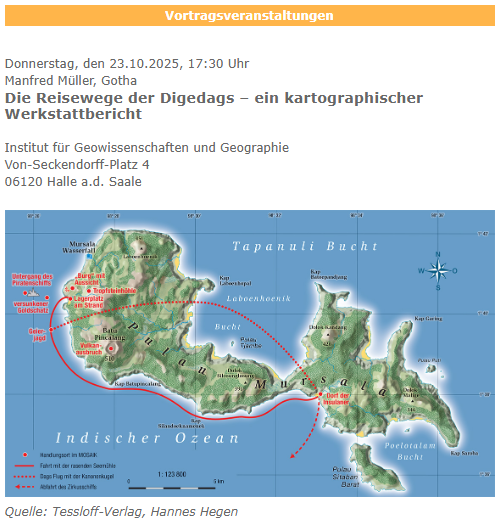
DGfK-Vortrag: „Die Reisewege der Digedags“ / DGfK lecture: “The Travel Routes of the Digedags” geoobserver.de/2025/10/21/dgf… #gistribe #gischat #fossgis #foss4g #OSGeo #spatial #geospatial #gis #geo #geoObserver pls RT
The @openstreetmap editor-layer-index project is one of the coolest, most useful indices of open data out there — in this case raster datasets from around the globe, spatially indexed Are there other similar resources of open imagery? #gistribe osmlab.github.io/editor-layer-i…


Aus Soar.Earth wird SoarAtlas.com / becomes geoobserver.de/2025/10/09/aus… via @SoarAtlas #soar #gistribe #gischat #fossgis #foss4g #OSGeo #spatial #geospatial #DataViz #gis #geo #geoObserver pls RT


Trending on @Twitter right now - ❤️ it! Please find me @EsriUC if you'd like to discuss #ArcGIS Monitor to optimize your #ArcGISEnterprise deployment! Hope my fellow #GISTribe have a great #EsriUC2023!! #esriUC #GIO #ArcGISAdmin #GIS #esri #geospatial


The end-of-semester procrastination whiteboard artwork is leveling up, apparently courtesy of @AshleyAscenci20. #gistribe


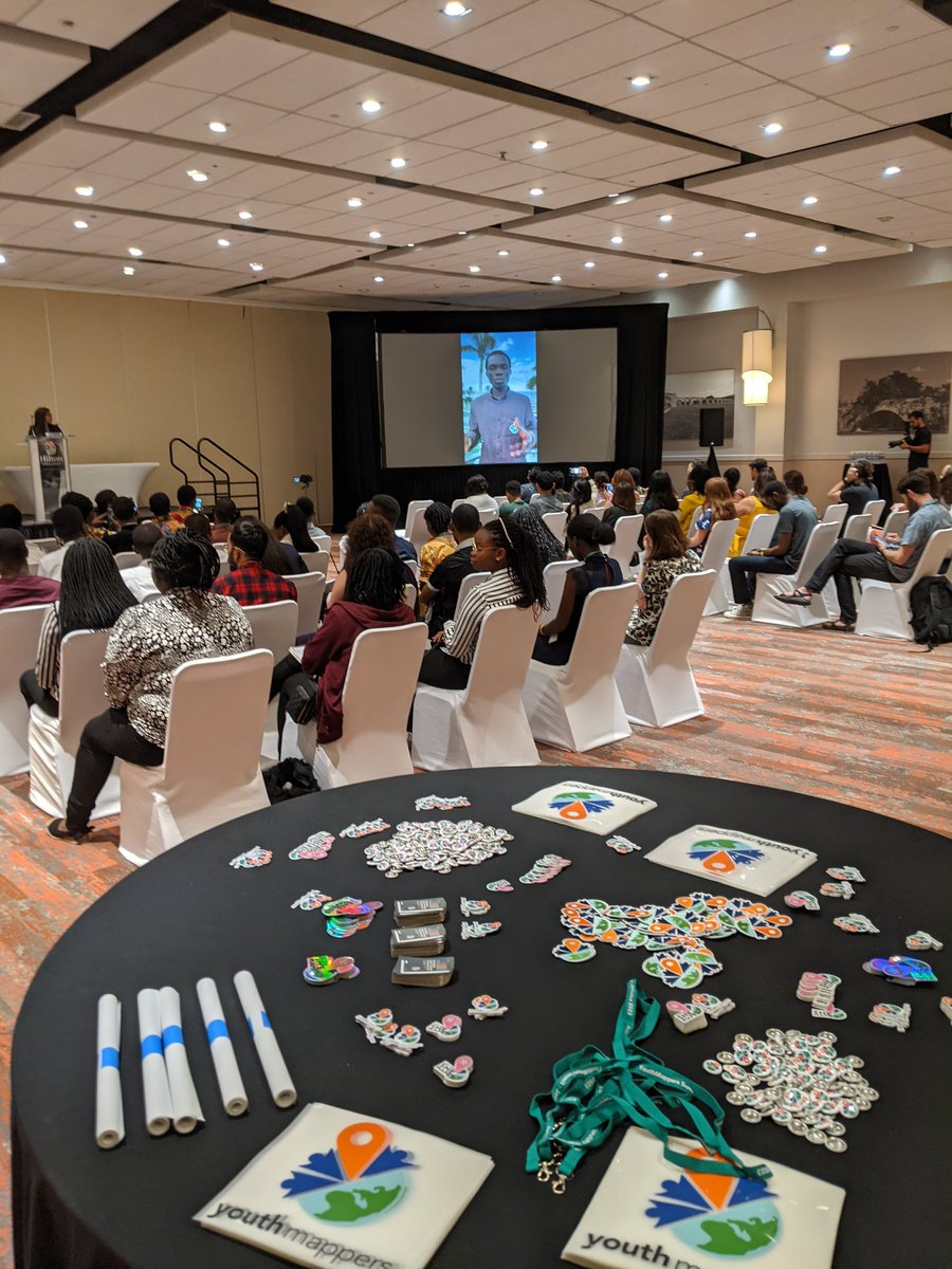
Kicking off the closing ceremony of @youthmappers #Summit2023 - going to be a great day!! These students are the future of #Geo #gistribe
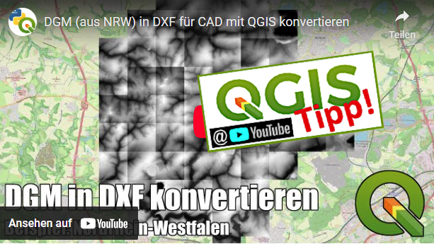
PyQGIS-Video: DGM2DXF?! geoobserver.de/2025/09/30/pyq… via @PyQgis #qgis #switch2qgis #gistribe #gischat #fossgis #foss4g #OSGeo #spatial #geospatial #opensource #gis #geo #geoObserver pls RT

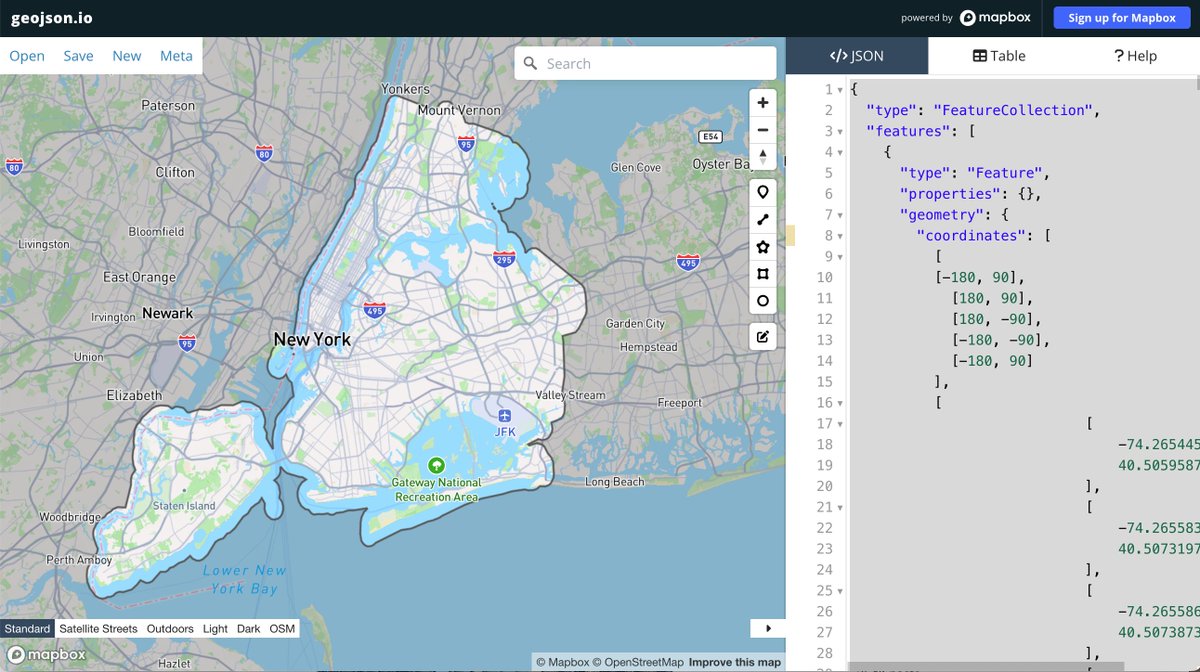
I hand-jammed a "clipping mask" geojson to help out my students. (a polygon that covers the earth but has a "hole" in it, useful for masking or subduing the basemap) Curious if anyone knows of existing tools that will do this sort of thing quickly. #gistribe

NEW: Had a blast working on this Taiwan project with our amazing visual storytelling team, it was a huge team effort and I'm immensely proud to work with such talented colleagues! ig.ft.com/taiwan-battleg… #dataviz #gistribe
ESRI-Shape-File: Typische Fehler im Handling (Update) / Common handling errors (update) geoobserver.de/2025/10/02/esr… #shape #gistribe #gischat #fossgis #foss4g #OSGeo #spatial #geospatial #gis #geo #geoObserver pls RT


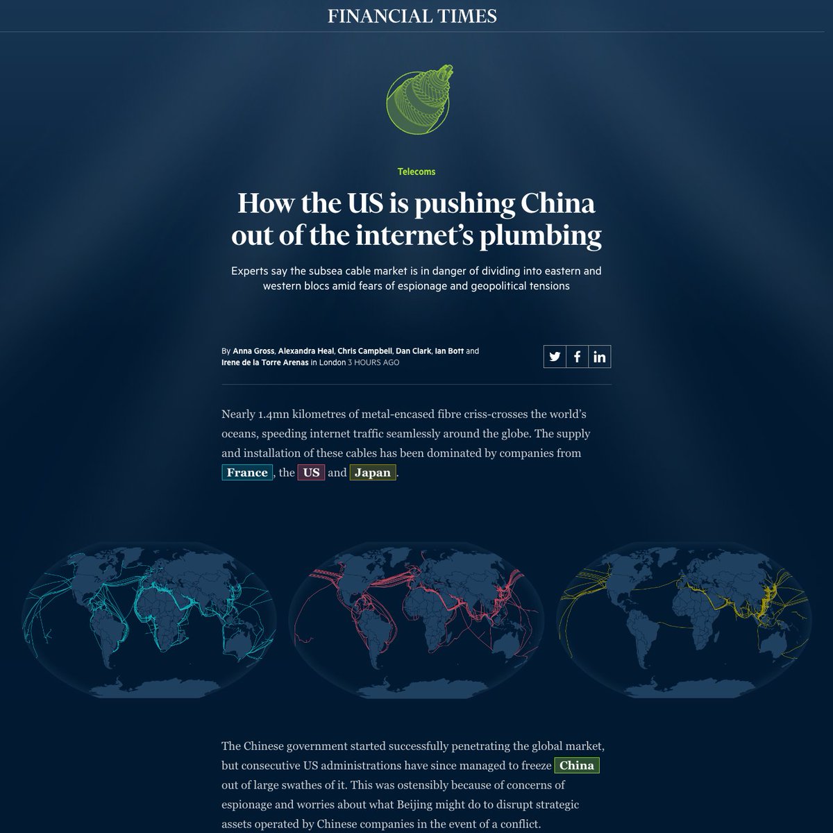
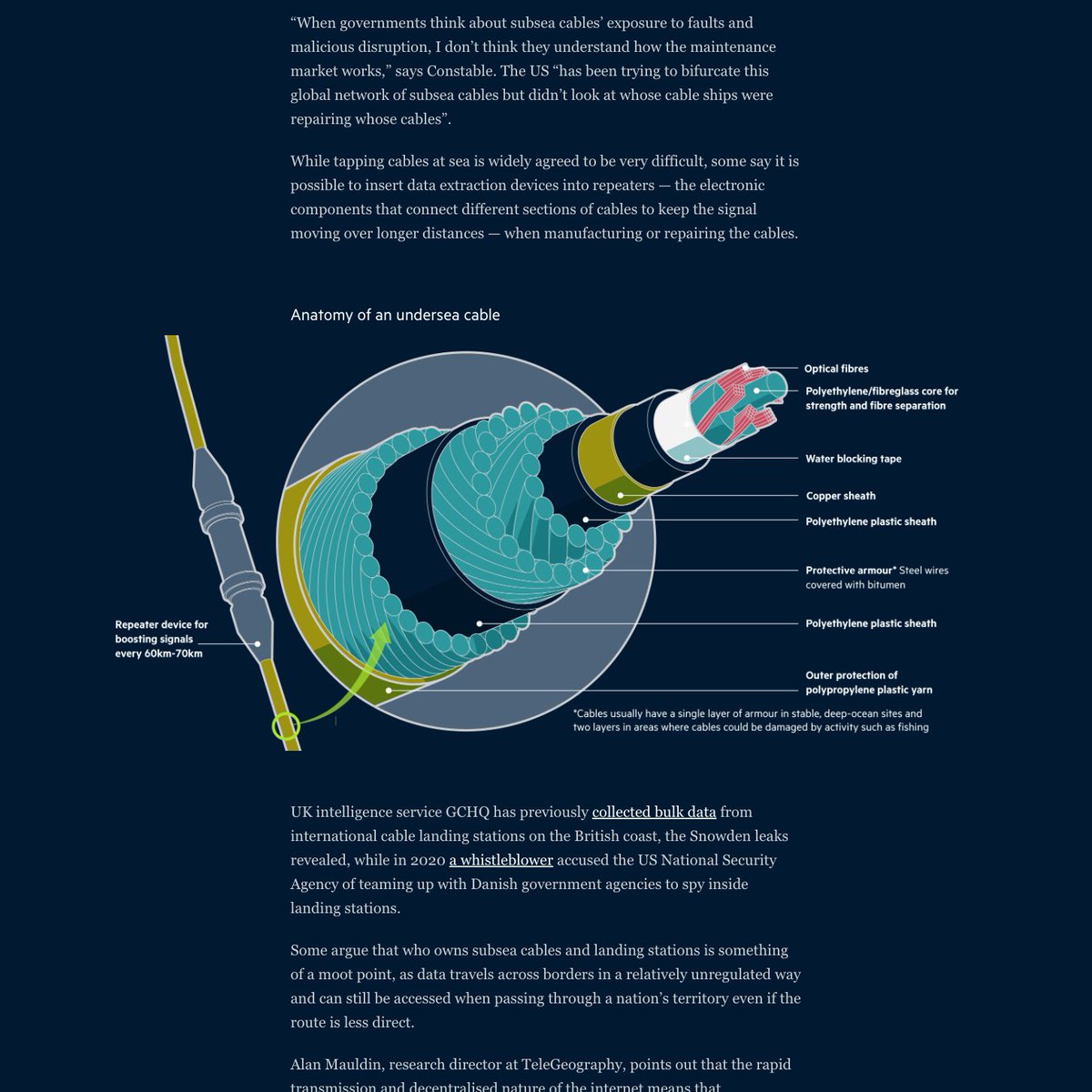
Had a great time working on this visual deep dive into the geopolitics of subsea internet cables. Richly reported + maps, charts, technical illustrations and mini globes! ig.ft.com/subsea-cables/ #gistribe #dataviz

For this week's climate graphic we mapped the rainfall that caused catastrophic flooding in Libya. With @sdbernard Read @marthamuir25's report: on.ft.com/3PJebK5 via @ft #dataviz #gistribe
Auch / Also 2025: #30DayMapChallenge geoobserver.de/2025/10/30/auc… #gistribe #gischat #fossgis #foss4g #OSGeo #spatial #geospatial #mapping #DataViz #gis #geo #geoObserver pls RT via @tjukanov
Cloud optimierte Geoformate mit dem „Geo Cloud Native Converter“ / Cloud-optimised geoformats with the Geo Cloud Native Converter geoobserver.de/2025/10/29/clo… #gistribe #gischat #fossgis #foss4g #OSGeo #spatial #geospatial #gdal #gis #geo #geoObserver pls RT
GeoDataExplorer: „Scan my (GIS) File“ geoobserver.de/2025/10/22/geo… #gistribe #gischat #fossgis #foss4g #OSGeo #spatial #geospatial #gis #geo #geoObserver pls RT
DGfK-Vortrag: „Die Reisewege der Digedags“ / DGfK lecture: “The Travel Routes of the Digedags” geoobserver.de/2025/10/21/dgf… #gistribe #gischat #fossgis #foss4g #OSGeo #spatial #geospatial #gis #geo #geoObserver pls RT
Offline konvertieren mit „GeoConverter“ / Convert offline with ‘GeoConverter’ geoobserver.de/2025/10/20/off… #GeoConverter #gdal #gistribe #gischat #fossgis #foss4g #OSGeo #spatial #geospatial #gis #geo #geoObserver pls RT

5 Jahre per Bike durch London – Die Karte / 5 years cycling through London – The map geoobserver.de/2025/10/14/5-j… via @BrilliantMaps #gistribe #gischat #fossgis #foss4g #OSGeo #spatial #geospatial #DataViz #gis #geo #geoObserver pls RT
QGIS 4.0 Start verschoben / QGIS 4.0 launch postponed geoobserver.de/2025/10/10/qgi… #qgis #switch2qgis #gistribe #gischat #fossgis #foss4g #OSGeo #spatial #geospatial #opensource #gis #geo #geoObserver pls RT

Aus Soar.Earth wird SoarAtlas.com / becomes geoobserver.de/2025/10/09/aus… via @SoarAtlas #soar #gistribe #gischat #fossgis #foss4g #OSGeo #spatial #geospatial #DataViz #gis #geo #geoObserver pls RT
FOSSGIS 2026: Call for Participation geoobserver.de/2025/10/07/fos… @FOSSGIS_Konf #fossgis #fossgis2026 #gistribe #gischat #foss4g #OSGeo #spatial #geospatial #opensource #opendata #osm #openstreetmap #gis #geo #geoObserver pls RT

ESRI-Shape-File: Typische Fehler im Handling (Update) / Common handling errors (update) geoobserver.de/2025/10/02/esr… #shape #gistribe #gischat #fossgis #foss4g #OSGeo #spatial #geospatial #gis #geo #geoObserver pls RT
PyQGIS-Video: DGM2DXF?! geoobserver.de/2025/09/30/pyq… via @PyQgis #qgis #switch2qgis #gistribe #gischat #fossgis #foss4g #OSGeo #spatial #geospatial #opensource #gis #geo #geoObserver pls RT
QGIS-Tipp: Duplikate finden / QGIS tip: Finding duplicates geoobserver.de/2025/09/19/qgi… #qgis #switch2qgis #gistribe #gischat #fossgis #foss4g #OSGeo #spatial #geospatial #opensource #gis #geo #geoObserver pls RT


Cloud optimierte Geoformate mit dem „Geo Cloud Native Converter“ / Cloud-optimised geoformats with the Geo Cloud Native Converter geoobserver.de/2025/10/29/clo… #gistribe #gischat #fossgis #foss4g #OSGeo #spatial #geospatial #gdal #gis #geo #geoObserver pls RT
GeoDataExplorer: „Scan my (GIS) File“ geoobserver.de/2025/10/22/geo… #gistribe #gischat #fossgis #foss4g #OSGeo #spatial #geospatial #gis #geo #geoObserver pls RT
Aus Soar.Earth wird SoarAtlas.com / becomes geoobserver.de/2025/10/09/aus… via @SoarAtlas #soar #gistribe #gischat #fossgis #foss4g #OSGeo #spatial #geospatial #DataViz #gis #geo #geoObserver pls RT
5 Jahre per Bike durch London – Die Karte / 5 years cycling through London – The map geoobserver.de/2025/10/14/5-j… via @BrilliantMaps #gistribe #gischat #fossgis #foss4g #OSGeo #spatial #geospatial #DataViz #gis #geo #geoObserver pls RT
Ankündigung/Announcement: FOSSGIS 2026 in Göttingen geoobserver.de/2025/09/16/ank… #fossgis #fossgis2026 #gistribe #gischat #foss4g #OSGeo #spatial #geospatial #gis #geo #geoObserver pls RT

Trending on @Twitter right now - ❤️ it! Please find me @EsriUC if you'd like to discuss #ArcGIS Monitor to optimize your #ArcGISEnterprise deployment! Hope my fellow #GISTribe have a great #EsriUC2023!! #esriUC #GIO #ArcGISAdmin #GIS #esri #geospatial
PyQGIS-Video: DGM2DXF?! geoobserver.de/2025/09/30/pyq… via @PyQgis #qgis #switch2qgis #gistribe #gischat #fossgis #foss4g #OSGeo #spatial #geospatial #opensource #gis #geo #geoObserver pls RT
DGfK-Vortrag: „Die Reisewege der Digedags“ / DGfK lecture: “The Travel Routes of the Digedags” geoobserver.de/2025/10/21/dgf… #gistribe #gischat #fossgis #foss4g #OSGeo #spatial #geospatial #gis #geo #geoObserver pls RT
Auch / Also 2025: #30DayMapChallenge geoobserver.de/2025/10/30/auc… #gistribe #gischat #fossgis #foss4g #OSGeo #spatial #geospatial #mapping #DataViz #gis #geo #geoObserver pls RT via @tjukanov
Kicking off the closing ceremony of @youthmappers #Summit2023 - going to be a great day!! These students are the future of #Geo #gistribe
The @openstreetmap editor-layer-index project is one of the coolest, most useful indices of open data out there — in this case raster datasets from around the globe, spatially indexed Are there other similar resources of open imagery? #gistribe osmlab.github.io/editor-layer-i…
FOSSGIS 2026: Call for Participation geoobserver.de/2025/10/07/fos… @FOSSGIS_Konf #fossgis #fossgis2026 #gistribe #gischat #foss4g #OSGeo #spatial #geospatial #opensource #opendata #osm #openstreetmap #gis #geo #geoObserver pls RT

Ma présentation 'Génération (de) cartes' 🗺 au @GdrMagis ▶github.com/magisAR9/webin… Avec des hybridations cartos et du design d'objets OpenStreetMap dans @OSMdata Merci à @comeetie pour l'invite ! #gistribe #cartography #dataviz


The end-of-semester procrastination whiteboard artwork is leveling up, apparently courtesy of @AshleyAscenci20. #gistribe
ESRI-Shape-File: Typische Fehler im Handling (Update) / Common handling errors (update) geoobserver.de/2025/10/02/esr… #shape #gistribe #gischat #fossgis #foss4g #OSGeo #spatial #geospatial #gis #geo #geoObserver pls RT
QGIS-Tipp: Farbiger Stadtplan grau maskiert? / QGIS tip: Colored city map masked in gray? geoobserver.de/2025/09/18/qgi… #qgis #switch2qgis #gistribe #gischat #fossgis #foss4g #OSGeo #spatial #geospatial #opensource #gis #geo #geoObserver pls RT

TODAY #MapFailbruaryChallenge BEGINS 🔥for 28 days of FUN 🤡 1⃣➡ 'Clearly made in Microsoft Paint / PowerPoint / Other non-mapping software' 🤪 OPEN to ALL levels, especially those with NO knowledge in #cartography and GIS softwares #gistribe #gischat #mapfail

I hand-jammed a "clipping mask" geojson to help out my students. (a polygon that covers the earth but has a "hole" in it, useful for masking or subduing the basemap) Curious if anyone knows of existing tools that will do this sort of thing quickly. #gistribe
Offline konvertieren mit „GeoConverter“ / Convert offline with ‘GeoConverter’ geoobserver.de/2025/10/20/off… #GeoConverter #gdal #gistribe #gischat #fossgis #foss4g #OSGeo #spatial #geospatial #gis #geo #geoObserver pls RT
Something went wrong.
Something went wrong.
United States Trends
- 1. #AEWDynamite 7,689 posts
- 2. #Survivor49 1,165 posts
- 3. #iubb N/A
- 4. #ALLCAPS N/A
- 5. Claudio 52.7K posts
- 6. Lamar Wilkerson N/A
- 7. Ovechkin 2,980 posts
- 8. #AbbottElementary N/A
- 9. Godzilla 27.4K posts
- 10. Paige 27.8K posts
- 11. Harley 11.5K posts
- 12. Rickea N/A
- 13. Randle 2,700 posts
- 14. Breeze 24K posts
- 15. Unplanned 3,429 posts
- 16. Mark Briscoe N/A
- 17. Donte 1,183 posts
- 18. Binnington N/A
- 19. Orange Cassidy N/A
- 20. Shabbat 4,317 posts