#spatialdata نتائج البحث

Professionals Arabia Co. | Real-Time GIS Surveying Accelerate decisions with high-precision GIS data for infrastructure and environmental projects. GNSS RTK/PPK, UAV mapping, mobile GIS, cloud sync, and regulatory-compliant QA/QC. #GIS #ArcGIS #SpatialData


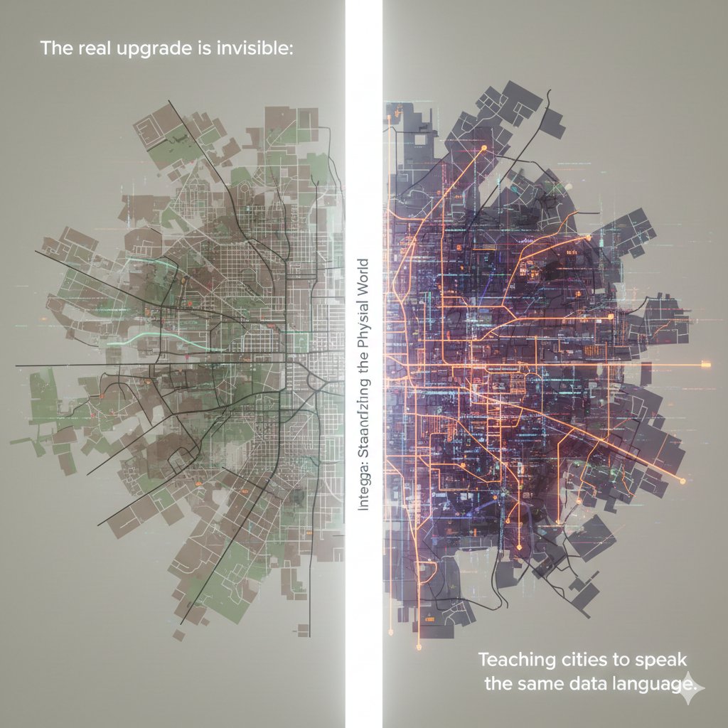
Context. Clarity. A living map that understands itself. That’s when decisions become smarter, ecosystems grow faster, and onchain truly meets the real world. @integra_layer #Integra #IRL #SpatialData

Unlock the full potential of your spatial data with Professionals Arabia Co. ✔️ SDE setup (SQL Server, Oracle, PostGIS) ✔️ Multi-user editing & versioning ✔️ Data migration & performance tuning ✔️ Secure access, ArcGIS integration #GIS #ArcGIS #SpatialData

Every ecosystem has data. But only @integra_layer gives it a heartbeat. When movement becomes memory, and land becomes language, cities stop being structures they become stories. And suddenly, the world isn’t just mapped… it’s understood. #Integra #SpatialData #IRL


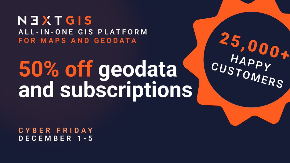
Data prep shouldn't take longer than the actual analysis. @nextgis geodata: pre-validated, pre-styled, ready to use. Basemaps, buildings, elevation, satellite imagery, landcover, POIs. 50% off Dec 1-5 | Works in any GIS tool linkly.link/2Rlit⚡ #Geodata #GIS #SpatialData

Spatial intelligence is redefining decision-making. With the power of GeoAI, raw geographic data becomes actionable insight accelerating smarter planning, optimised operations, and future-ready innovation. #EmpowerSolutions #GeoAI #SpatialData #DigitalTransformation

This is how real estate evolves: not with buzzwords, but with a chain that can actually understand the world it’s securing. #Integra #IRL #SpatialData


Recognizing this is essential for accurate analysis, stronger models, and better decision-making. Stay with us as we continue exploring core concepts in spatial data science! #SpatialData #GIS #SpatialStatistics #GeospatialAnalysis #DataScience
Recognizing spatial dependence ensures more accurate maps, better models, and smarter real-world decisions. Stay tuned as we continue breaking down powerful concepts in spatial data science! #SpatialData #GeospatialAnalysis #GIS #SpatialDependence #SpatialAutocorrelation
When the physical world becomes structured, every ecosystem built on top becomes smarter. #Integra isn’t adding data. They’re adding understanding. #Integra #SpatialData #InfraLayer #Web3 #KaitoAI
🎯 Takeaway Spatial analysis is powerful but only when done right. Identifying these pitfalls early helps you produce more accurate, reliable, and meaningful spatial insights for real-world decision-making. #SpatialData #GIS #SpatialAnalysis #DataScience #Geospatial


Something went wrong.
Something went wrong.
United States Trends
- 1. Chiefs 94K posts
- 2. Kelce 21.7K posts
- 3. Kelce 21.7K posts
- 4. Texans 40.4K posts
- 5. Andy Reid 5,604 posts
- 6. #ITWelcomeToDerry 42.7K posts
- 7. Collinsworth 5,830 posts
- 8. Rashee Rice 5,399 posts
- 9. #BaddiesUSA 21.8K posts
- 10. CJ Stroud 3,245 posts
- 11. #HOUvsKC 1,977 posts
- 12. Chris Jones 2,597 posts
- 13. #HTownMade 2,206 posts
- 14. #SNFonNBC 1,119 posts
- 15. Pitre 5,350 posts
- 16. Jeff Kent 8,245 posts
- 17. Nick Caley N/A
- 18. Packers 78.9K posts
- 19. AFC West 2,547 posts
- 20. Bears 89.1K posts