#spatialdata search results

Context. Clarity. A living map that understands itself. That’s when decisions become smarter, ecosystems grow faster, and onchain truly meets the real world. @integra_layer #Integra #IRL #SpatialData


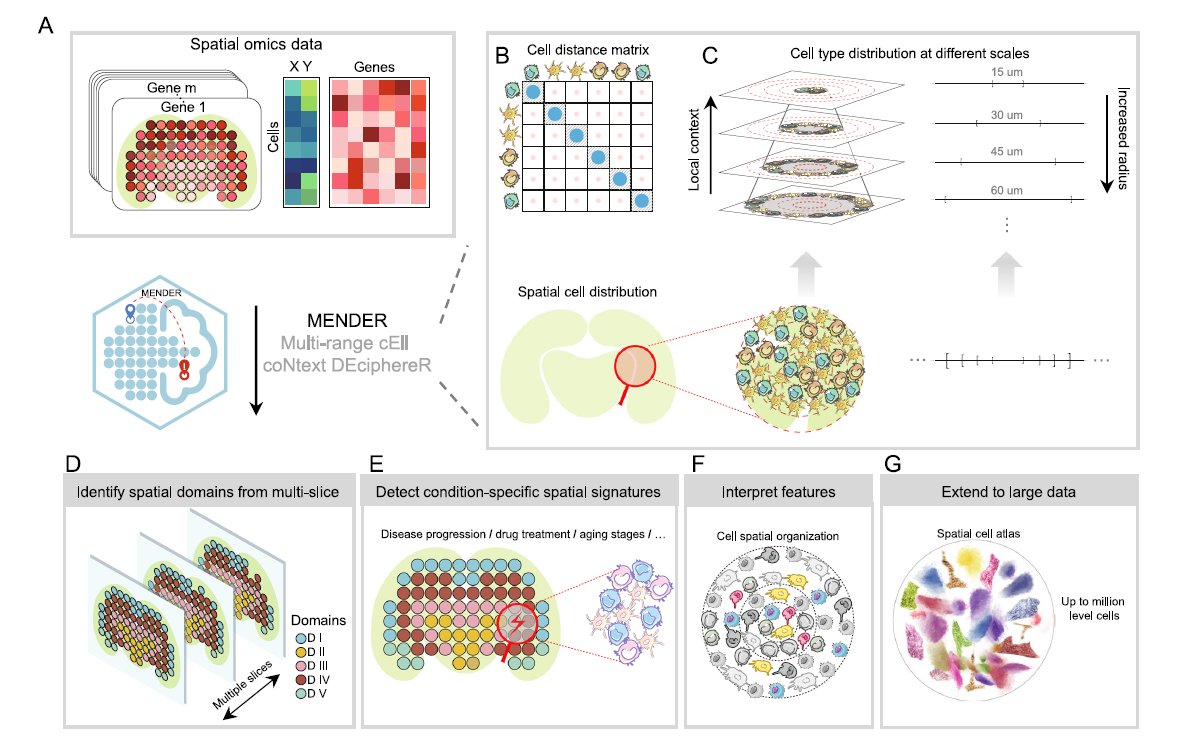
We love learning about new #ComputationalTools for analyzing #SpatialData! MENDER is a novel tissue structure identification tool utilizing cellular neighborhood structures observed across spatial technologies now published in @NatureComms. Learn more: hubs.ly/Q02fCYP20
Every ecosystem has data. But only @integra_layer gives it a heartbeat. When movement becomes memory, and land becomes language, cities stop being structures they become stories. And suddenly, the world isn’t just mapped… it’s understood. #Integra #SpatialData #IRL


And they're not keeping it to themselves. This same spatial dataset is now being used by leading AI companies to build the next generation of intelligent machines. The future of AI isn't just virtual. It's spatial. #VisionAI #Robotics #SpatialData #AI
This is how real estate evolves: not with buzzwords, but with a chain that can actually understand the world it’s securing. #Integra #IRL #SpatialData


🌐 Introducing PA statistical methods: Geographic Information Systems (GIS). This integrates spatial data, ideal for exploring environmental influences on physical activity. GIS requires extensive data handling skills. #SpatialData #PhysicalActivityResearch


Awesome week last week representing both @napari_imaging and #SpatialData @scverse at @EuroSciPy2024. It was great to meet maintainers and contributors to the libraries we use. Also grateful for the opportunity to have a flashlight talk on #numpydantic and a little bit on #LinkML


2 WEEKS AWAY! 🥳 Prevent yourself from future FOMO & sign up for Esri's popular course today: esri.social/xJq350SWk38 #SpatialDataScience #ArcGIS #SpatialData

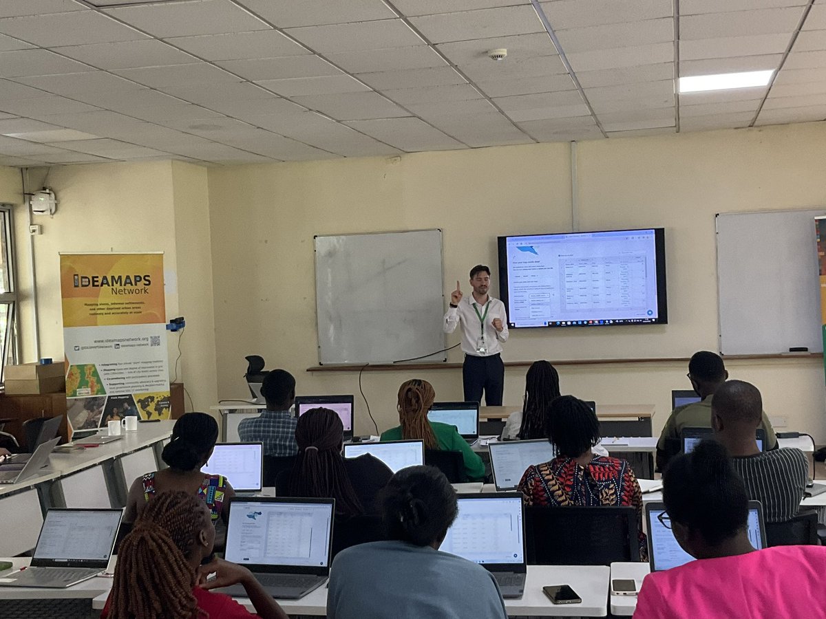
Happy to share earlier this month, Avipsa Roy, Asst Prof in Urban Planning & Public Policy was invited as a guest lecturer to discuss Spatial Data Science's influence on policy making at IIT Kharagpur, Visva Bharati University, ISI Kolkata, and IISc Bengaluru. #spatialdata #up3


URHIAsti on stage today 11.00 🇪🇪@utuscience @UniTurku #spatialdata #foss4ge @foss4ge @HuDi_Project @BEDLAN_Uralic


Today presenting current status at the #foss4ge2024 Tartu “URHIA's Open Data Journey in Spatial Exploration” 📅Fri, 5.7.2024 at 11.00 📍Omicum building Live stream link available foss4ge.television.ee

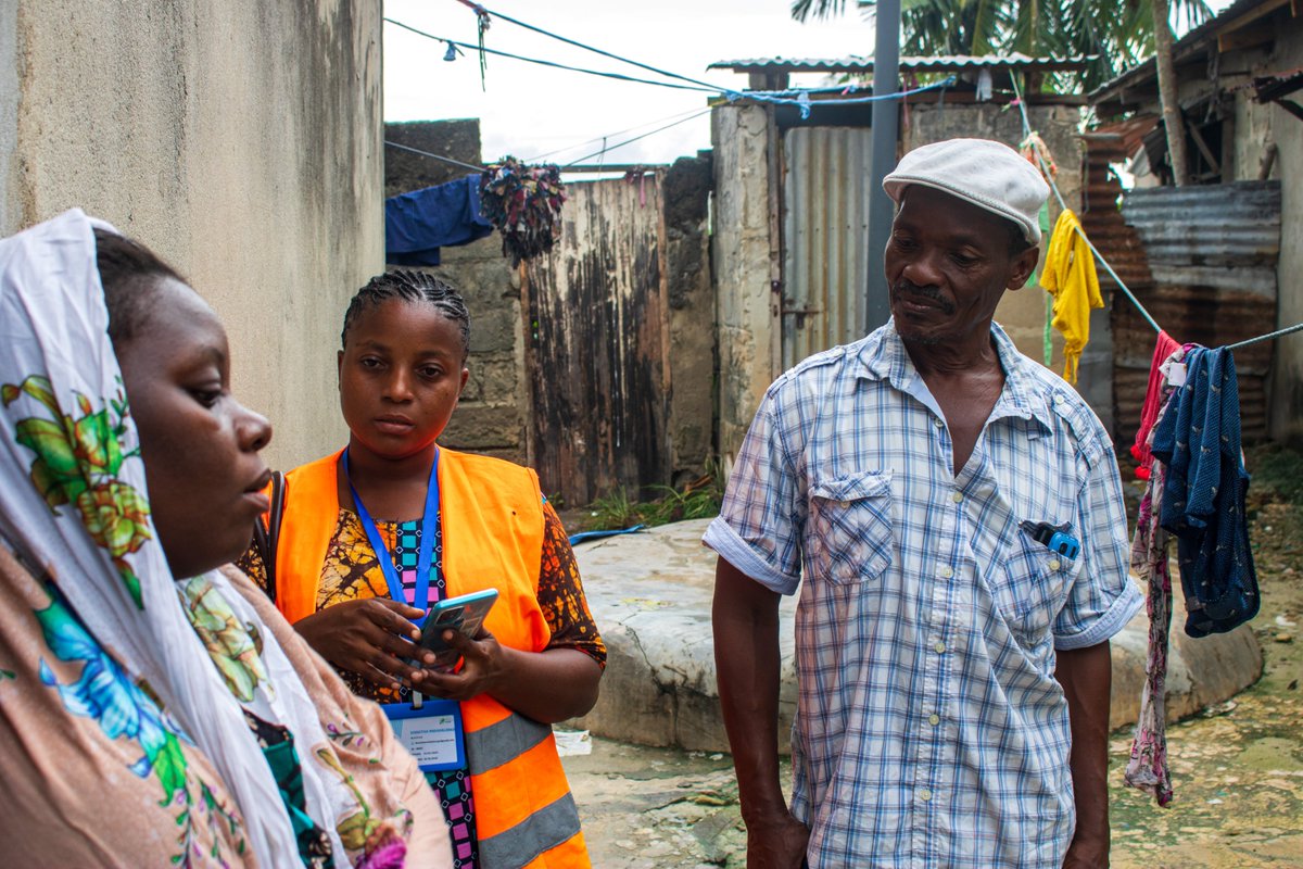
Big up to Wajumbe👏🥳 for aiding mappers on the ground with their invaluable local knowledge & resident trust. They play a crucial role in gathering accurate #spatialdata for the baseline survey & pinpointing initial information, i.e., WCP's locations, dumping sites & waste piles


Applied #SpatialData! #BigData #Analytics #DataScience #AI #MachineLearning #IoT #IIoT #GeoSpatial #Python #RStats #TensorFlow #Java #JavaScript #ReactJS #GoLang #CloudComputing #Serverless #DataScientist #Linux #Programming #Coding #100DaysofCode geni.us/Applied-Spatia…

📍 Looking to expand your business to new locations, but worried about the impact on existing sales? You need Cannibalization Analysis! Maximize profits and safeguard existing revenue with this step-by-step tutorial 👉 hubs.ly/Q02wMFYv0 #analytics #spatialdata

making spatial data easy for pros and non-gis users, catch the full video exclusively on collide.io #gis #spatialdata #dataplatform
📍 Looking to expand your business to new locations, but worried about the impact on existing sites? You need Cannibalization Analysis! Maximize profits and safeguard existing revenue with this step-by-step tutorial 👉 hubs.ly/Q02DqVqK0 #analytics #spatialdata

What is @ApacheSedona and what are its common use cases? Discover how this clustering computing system, designed for processing large-scale spatial data, treats spatial data as a first-class citizen. bit.ly/3ZRL24U #ApacheSeonda #SpatialData


What map have you found geoaweseome recently? Spilhaus Ocean Currents map shows how ocean water moves around the world. We love this project! Check it by yourself: arcgis.com/apps/mapviewer… #Geospatial #Geoawesome #SpatialData #cartography #maps #map

Professionals Arabia Co. | Real-Time GIS Surveying Accelerate decisions with high-precision GIS data for infrastructure and environmental projects. GNSS RTK/PPK, UAV mapping, mobile GIS, cloud sync, and regulatory-compliant QA/QC. #GIS #ArcGIS #SpatialData

Context. Clarity. A living map that understands itself. That’s when decisions become smarter, ecosystems grow faster, and onchain truly meets the real world. @integra_layer #Integra #IRL #SpatialData
Unlock the full potential of your spatial data with Professionals Arabia Co. ✔️ SDE setup (SQL Server, Oracle, PostGIS) ✔️ Multi-user editing & versioning ✔️ Data migration & performance tuning ✔️ Secure access, ArcGIS integration #GIS #ArcGIS #SpatialData

Every ecosystem has data. But only @integra_layer gives it a heartbeat. When movement becomes memory, and land becomes language, cities stop being structures they become stories. And suddenly, the world isn’t just mapped… it’s understood. #Integra #SpatialData #IRL
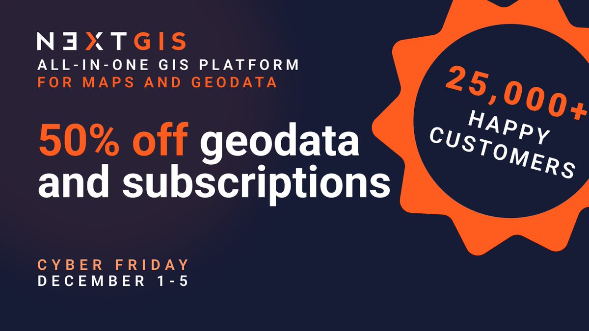
Data prep shouldn't take longer than the actual analysis. @nextgis geodata: pre-validated, pre-styled, ready to use. Basemaps, buildings, elevation, satellite imagery, landcover, POIs. 50% off Dec 1-5 | Works in any GIS tool linkly.link/2Rlit⚡ #Geodata #GIS #SpatialData

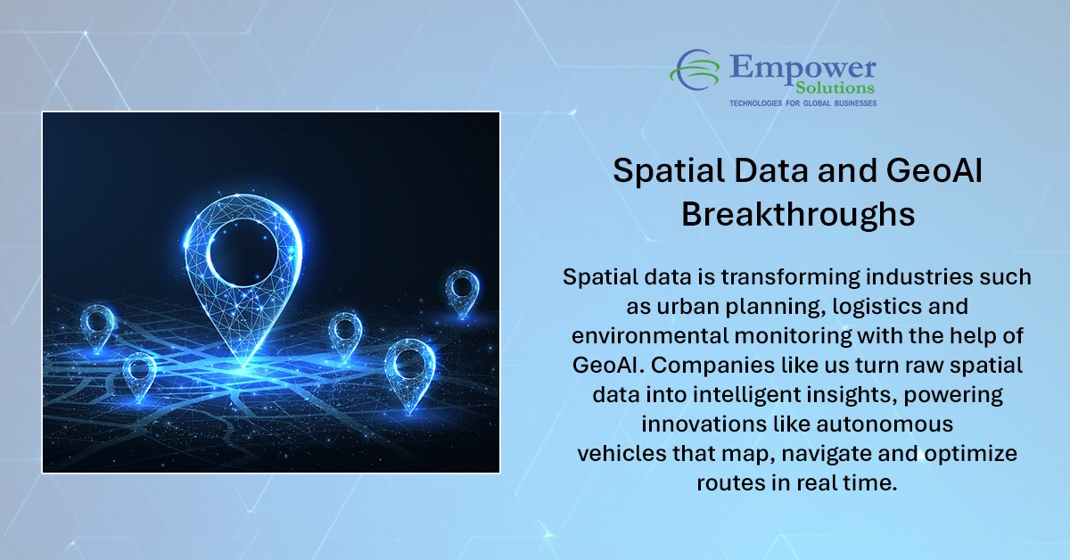
Spatial intelligence is redefining decision-making. With the power of GeoAI, raw geographic data becomes actionable insight accelerating smarter planning, optimised operations, and future-ready innovation. #EmpowerSolutions #GeoAI #SpatialData #DigitalTransformation
This is how real estate evolves: not with buzzwords, but with a chain that can actually understand the world it’s securing. #Integra #IRL #SpatialData

Recognizing this is essential for accurate analysis, stronger models, and better decision-making. Stay with us as we continue exploring core concepts in spatial data science! #SpatialData #GIS #SpatialStatistics #GeospatialAnalysis #DataScience
Recognizing spatial dependence ensures more accurate maps, better models, and smarter real-world decisions. Stay tuned as we continue breaking down powerful concepts in spatial data science! #SpatialData #GeospatialAnalysis #GIS #SpatialDependence #SpatialAutocorrelation
When the physical world becomes structured, every ecosystem built on top becomes smarter. #Integra isn’t adding data. They’re adding understanding. #Integra #SpatialData #InfraLayer #Web3 #KaitoAI
🎯 Takeaway Spatial analysis is powerful but only when done right. Identifying these pitfalls early helps you produce more accurate, reliable, and meaningful spatial insights for real-world decision-making. #SpatialData #GIS #SpatialAnalysis #DataScience #Geospatial
Something went wrong.
Something went wrong.
United States Trends
- 1. Texas Tech 25.1K posts
- 2. Messi 127K posts
- 3. #SECChampionship 1,978 posts
- 4. Inter Miami 25.4K posts
- 5. #MLSCupFinal 1,098 posts
- 6. Big 12 37.4K posts
- 7. Ty Simpson 1,094 posts
- 8. Slot 113K posts
- 9. Dawgs 7,480 posts
- 10. Harry Ford N/A
- 11. Liverpool 115K posts
- 12. Illinois State 7,633 posts
- 13. NDSU 1,112 posts
- 14. Ryan Williams N/A
- 15. #iubb 1,025 posts
- 16. Busquets 9,147 posts
- 17. Konate 27.2K posts
- 18. #WreckEm 4,299 posts
- 19. Purdue 10K posts
- 20. Jordi Alba 4,932 posts