#arcmap search results

🔥 نفط ليبيا… شريان الحياة والكنز الأسود 🛢️ (1/2) من قلب الأرض يطل علينا نفط #ليبيا، المورد الاستراتيجي الذي يضيء الاقتصاد ويغذي الطموح. على خريطة #ArcMap، تتلألأ شعلات حقول #النفط في الأفق، شاهدة على هذا الكنز المدفون تحت التربة. يتبع⬇️


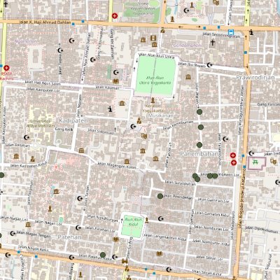
How to make a map layout using ArcMap? Map created using ArcGIS. Tutorial Link: youtu.be/gGdJzmyGasE For more information about registration, visit our website: studyhacksgeospatial.com/google-earth-e… #ArcMap #ArcGIS #MapLayout #GIS #Geospatial #Cartography #Mapping #DataVisualization


Aquí vamos a ver cómo descargar imágenes satelitales georreferenciadas de alta resolución en #QGIS, luego las podemos abrir en #ArcGISPro o #ArcMap

Simulación de inundaciones con #HecRAS #HecGeoRAS y #ArcMap para la modelización de cauces y análisis de inundaciones udemy.com/course/curso-d… #ArcGIS
Determinar el mejor sitio para establecer un cultivo (café), usando técnicas de Evaluación Multicriterio udemy.com/course/curso-a… #arcgispro #arcmap #qgis #arcgis
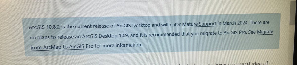
Fin de #ArcMap, el 1 de marzo de 2024 se termina el soporte técnico. Pero ese no es el final porque en su reemplazo está #ArcGISPro con el curso disponible en arcgeek.com
Encontrar la mejor ruta entre dos puntos en ArcGIS Pro #esri #arcgispro #arcmap también dejo el enlace del curso de ArcGIS Pro udemy.com/course/curso-d…

I know you really do not want to let go but time is running out. Trust me.Once you get over the small learning curve, you will love Arcgis Pro. #ArcgisPro #esri #arcmap #gis #gischat #data #analyst


Check out this blog to learn about the geoprocessing enhancements made in #ArcGISPro 3.2 for users who are migrating from #ArcMap. 🌎 Read the blog: esri.social/89E150Qty52


Come celebrate the impact of #ArcMap on the GIS Community at a free Mappy Hour/ Celebration of Life for the #gischat community on March 1! lnkd.in/ghmSwtJY

Do you want to learn how to monitor Air Quality Nitrogen dioxide density using #GoogleEarthEngine and #ArcMap?🤔 As soon as possible registration for our upcoming online training programme, Class will be started from 18th October studyhacksgeospatial.com/google-earth-e… #gee

🔥 نفط ليبيا… شريان الحياة والكنز الأسود 🛢️ (1/2) من قلب الأرض يطل علينا نفط #ليبيا، المورد الاستراتيجي الذي يضيء الاقتصاد ويغذي الطموح. على خريطة #ArcMap، تتلألأ شعلات حقول #النفط في الأفق، شاهدة على هذا الكنز المدفون تحت التربة. يتبع⬇️

🌊➡ La herramienta 𝗙𝗶𝘀𝗵𝗻𝗲𝘁 es una que nos permite crear una red de malla con las dimensiones que creamos convenientes. Leer más: bit.ly/herramienta_Fi… #SIG #ArcGIS #ArcMap #mediomarino #fishnet
cursosgis.com
Uso de la herramienta Fishnet con datos marinos
La herramienta Fishnet , también denominada “Crear red”, es una de las herramientas existentes en el ArcToolbox de ArcMap. Gracias a esta herramienta podemos crear una red de malla con las dimensio...

Jasa dan joki membuat peta ArcGIS, ArcMap, Google Earth, digitasi. Contoh: Space Time Cube (STC) dan peta animasi menggunakan ArcMap. #arcgis #arcmap #GIS #MAP #Digitasi #Googleearth

Jasa dan joki membuat peta ArcGIS, ArcMap, Google Earth, digitasi. Contoh: Identifikasi jenis lahan bentuk aeolin pada google earth. #arcgis #arcmap #GIS #MAP #Digitasi #Googleearth


How to make a map layout using ArcMap? Map created using ArcGIS. Tutorial Link: youtu.be/gGdJzmyGasE For more information about registration, visit our website: studyhacksgeospatial.com/google-earth-e… #ArcMap #ArcGIS #MapLayout #GIS #Geospatial #Cartography #Mapping #DataVisualization
Jasa dan joki membuat peta ArcGIS, ArcMap, Google Earth, digitasi. Contoh: citra satelit digitasi wilayah studi google earth pada peta penggunaan lahan. #arcgis #arcmap #GIS #MAP #Digitasi #Googleearth

Jasa dan joki membuat peta ArcGIS, ArcMap, Google Earth, digitasi. Contoh: peta per kecamatan dan per kelurahan Jakarta Barat dengan format shp (shape file). #arcgis #arcmap #GIS #MAP #Digitasi #Googleearth


🌍 ArcMap retires in 2026. Ready to make the move? This migration guide walks you through the steps to transition from #ArcMap to #ArcGISPro and ArcGIS user types—with clarity, support, and helpful resources at every stage. 📘 Get the guide: ow.ly/9ZQV50VTqfP

How to make a map layout using ArcMap? Map created using ArcGIS. Tutorial Link: youtu.be/gGdJzmyGasE For more information about registration, visit our website: studyhacksgeospatial.com/google-earth-e… #ArcMap #ArcGIS #MapLayout #GIS #Geospatial #Cartography #Mapping #DataVisualization

PSA: #ArcMap Enters Mature Support in March 2024 tinyurl.com/263raw3e #ArcGISDesktop #spatial #analysis #mapping #GIO #IT #GIS #esri #arcgis @Esri @EsriFederalGovt @EsriSLGov @ArcGISanalysis

Check out this blog to learn about the geoprocessing enhancements made in #ArcGISPro 3.2 for users who are migrating from #ArcMap. 🌎 Read the blog: esri.social/89E150Qty52


🔥 نفط ليبيا… شريان الحياة والكنز الأسود 🛢️ (1/2) من قلب الأرض يطل علينا نفط #ليبيا، المورد الاستراتيجي الذي يضيء الاقتصاد ويغذي الطموح. على خريطة #ArcMap، تتلألأ شعلات حقول #النفط في الأفق، شاهدة على هذا الكنز المدفون تحت التربة. يتبع⬇️
Do you want to learn how to monitor Air Quality Nitrogen dioxide density using #GoogleEarthEngine and #ArcMap?🤔 As soon as possible registration for our upcoming online training programme, Class will be started from 18th October studyhacksgeospatial.com/google-earth-e… #gee


My first ever #GIS project, did a map of my School, TTU-Kenya, a Mining School. #ArcGISPro #ArcMap #Taita TavetaUni

Come celebrate the impact of #ArcMap on the GIS Community at a free Mappy Hour/ Celebration of Life for the #gischat community on March 1! lnkd.in/ghmSwtJY

I know you really do not want to let go but time is running out. Trust me.Once you get over the small learning curve, you will love Arcgis Pro. #ArcgisPro #esri #arcmap #gis #gischat #data #analyst
#ArcMap is entering mature support in March of 2024, so join us today to learn strategies to prepare you for your migration to #ArcGISPro. Take the apprehension out of transitioning, gain the skills you need, and learn where to find your favorite tools. esri.social/aWnB50P6kFq

Check out this blog for important information about what entering Mature Support means for #ArcMap users. The time is approaching fast, and we want to assist you and/or your colleagues in transitioning from ArcMap to #ArcGISPro!" Learn more: esri.social/B9Bj50QwZAR

#ArcMap will be retired next year. This #EsriUC2025 session will walk you through the steps to make your migration to #ArcGISPro as seamless as possible. Get guidance on essential workflows and prepare for the move: ow.ly/WBur50WornF

Something went wrong.
Something went wrong.
United States Trends
- 1. Clay Higgins 21.2K posts
- 2. Grisham 3,237 posts
- 3. Scotland 48.3K posts
- 4. Peggy 6,525 posts
- 5. Dominguez 3,206 posts
- 6. Saudi 248K posts
- 7. Cashman N/A
- 8. #UNBarbie 14.3K posts
- 9. Bellinger 2,205 posts
- 10. Gemini 3 49.4K posts
- 11. Nicki 118K posts
- 12. Mary Bruce 4,436 posts
- 13. Khashoggi 50.4K posts
- 14. The House 553K posts
- 15. Tierney 4,670 posts
- 16. Shota 9,228 posts
- 17. Gleyber Torres 1,265 posts
- 18. Salman 78K posts
- 19. Woodruff 1,223 posts
- 20. #UnitedNationsBarbie 12.4K posts