#cesiumjs ผลการค้นหา

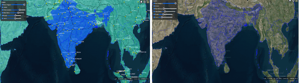
🚀 Learn how to add shapefiles (GeoJSON) in CesiumJS with visibility & opacity controls! Check it out: manyatechnologies.com/add-geojson-ce… #CesiumJS #GeoJSON #WebGIS #SpatialData #ManyaTechnologies #Shapefile
Discover how drone mapping is transforming industries! From 2D maps to immersive 3D terrain models—see how #CesiumJS & #Potree power the visualization engines. 📖 Read more: manyatechnologies.com/drone-mapping-… #DroneMapping #3DVisualization #Photogrammetry #LiDAR #ManyaTechnologies


Introducing a new #Python package called mapwidget - creating interactive 3D maps in a Jupyter environment using popular JavaScript libraries, such as #CesiumJS, #Mapbox, #MapLibre, #Leaflet, and #OpenLayers GitHub: github.com/giswqs/mapwidg… #geospatial #gischat #anywidget
🚀 New blog post! Learn how to display 2D billboards & 3D models in CesiumJS with code examples + best practices. Perfect for GIS & simulation apps. 👉 manyatechnologies.com/display-3d-sym… #CesiumJS #GIS #3DVisualization #Geospatial #ManyaTechnologies

【締切間近!】🌏FOSS4G 2025 Japan ハンズオンお申し込み ✅米国Cesium Developer Conferenceで実施したハンズオン内容を、日本向けに再構成!日本語で実施するのでご安心ください✨ 「#CesiumJS で始める3Dマップ開発 –– 基礎と活用例を学ぶ」 🔻詳細、参加登録は peatix.com/event/4520989


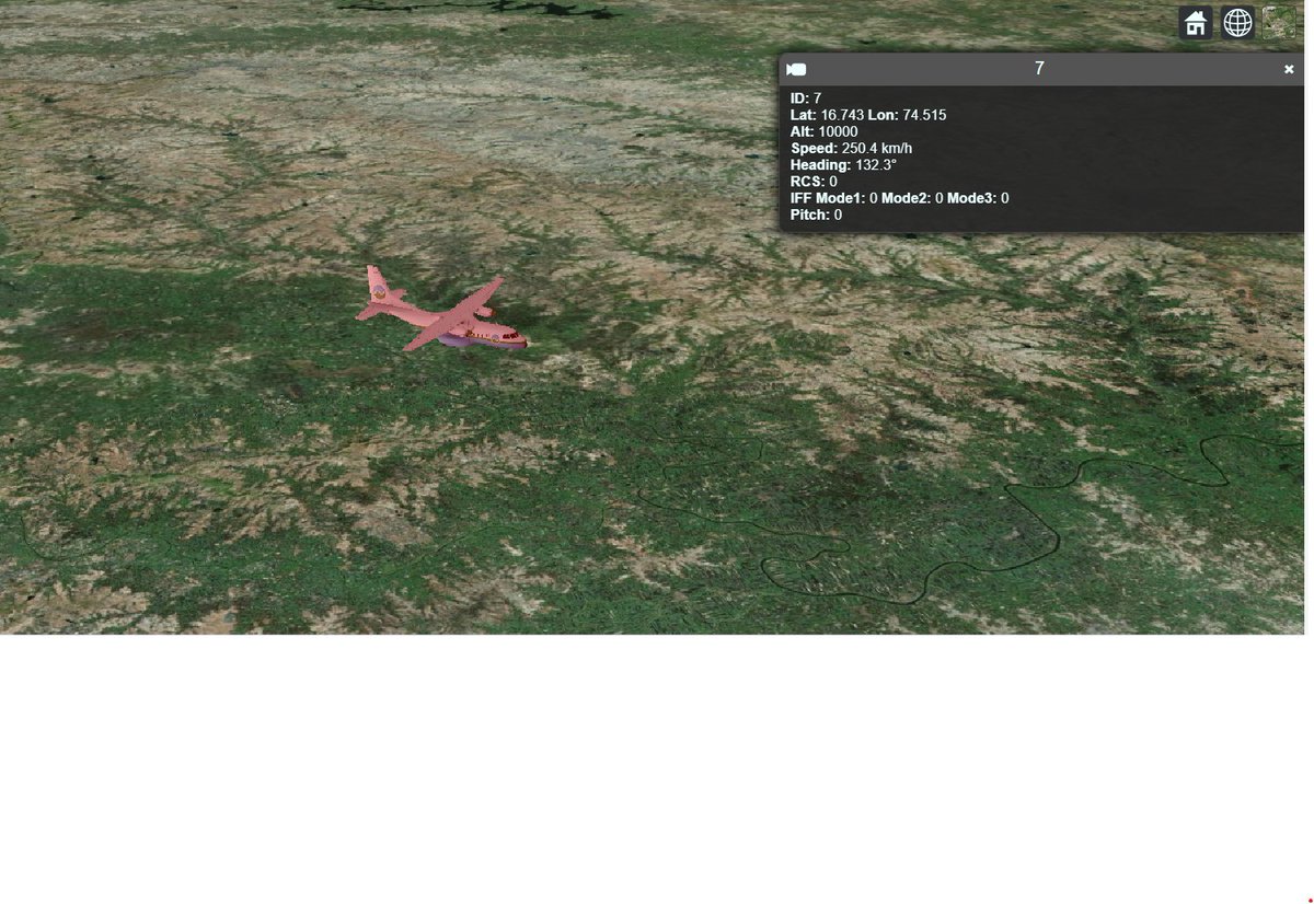
Make 3D maps more interactive! 🌍✈️ Click any moving target to view live details like ID, altitude, speed & heading — ideal for defense, aviation & tracking apps. 🔗 manyatechnologies.com/cesiumjs-track… #CesiumJS #GIS #3DVisualization #RealTimeTracking #Geospatial #ManyaTechnologies


zurl.co/avKO1 -- D5 Render and Cesium Integration Ups the Game in Cinematic Visualization at Large Scale for AEC Industry Storytelling. #d5render #cesiumJS #archviz #visualization #visualisation #aecindustrynews

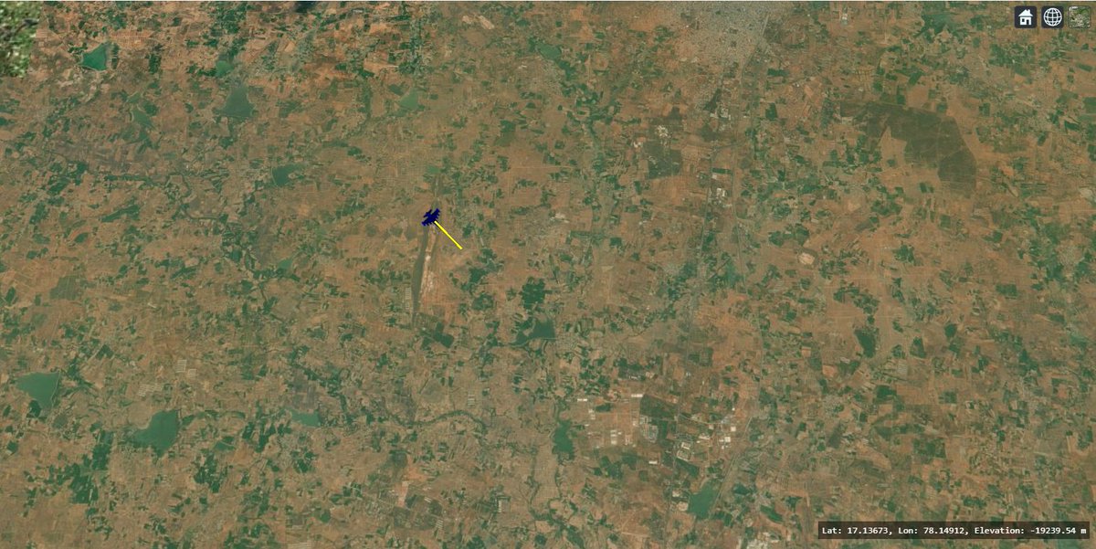
🚀 New on the blog: Displaying Heading Vectors in CesiumJS for Real-Time Track Visualization. Learn how to draw dynamic direction & speed vectors on your map using Cesium. 👉 manyatechnologies.com/cesiumjs-headi… #ManyaTechnologies #CesiumJS #GIS #3DMapping #DataVisualization #Simulation

ログインな仕組みもしょっちゅう作るけれど Gizmo(移動・回転・拡大)的なのも何回もつくってるなぁ 環境の違いにあわせたりすこし気の利いた作りを仕込みたくなるから そろそろライブラリ化きちんとしないといかんなぁ #cesiumjs

🏊♂️宮崎シーガイアトライアスロン🚴♀️🏃♂️のコースを、Cesium.js & Cesium ion (Google Maps Platform Photorealistic 3D Tiles) で可視化してみた。 humo-tech.github.io/Map/seagaia/ 美しい🌴 100倍速再生だと、速すぎてPhotorealistic 3Dの凄さが伝わらない!? #宮崎シーガイアトライアスロン #Cesiumjs
🛰️Vista 3D interactiva de la imagen infrarroja de Sentinel 2 del #IFArafoCandelaria en Tenerife 🔥 Animación en bucle de antes (8/8) y el ayer (23/8). Accede al mapa interactivo de #CesiumJS: theroamingworkshop.cloud/demos/ifarafo/


Exploring #CesiumJS for weather and topography visualisations has sparked an idea: what if we turn this into a generative art collection? Capturing the beauty of weather changes over time through code could offer a fresh perspective on our planet's dynamics. #GenerativeArt

METAVERSE-DAO / CLOUD ATLAS Dapp-store categories released! 🥳 4 info-cards 2 dev-cards 4 running dapps 4 coming dapps #gunjs #cesiumjs #Decentralization #p2p #dapp #web3 #digitalearth #UnrealEngine5 #metaverse #dao #sustainable #activism #education #developer #entrepreneurs

Discover how drone mapping is transforming industries! From 2D maps to immersive 3D terrain models—see how #CesiumJS & #Potree power the visualization engines. 📖 Read more: manyatechnologies.com/drone-mapping-… #DroneMapping #3DVisualization #Photogrammetry #LiDAR #ManyaTechnologies

#TerriaJS 8.11.1 is live! 🎉 🌍 Support for Google Maps 2D Tiles 🗺️ TMS imagery tilesets added 📍 #MapBox search now returns exact coordinates 📊 Chart zoom bug fixed ⚠️ Updated SVG sprite loader ⚡ Major dependency upgrades (Babel, TS, MobX, #CesiumJS) terria.io/news/blog-post…

🚀 Learn how to add shapefiles (GeoJSON) in CesiumJS with visibility & opacity controls! Check it out: manyatechnologies.com/add-geojson-ce… #CesiumJS #GeoJSON #WebGIS #SpatialData #ManyaTechnologies #Shapefile
Make 3D maps more interactive! 🌍✈️ Click any moving target to view live details like ID, altitude, speed & heading — ideal for defense, aviation & tracking apps. 🔗 manyatechnologies.com/cesiumjs-track… #CesiumJS #GIS #3DVisualization #RealTimeTracking #Geospatial #ManyaTechnologies
zurl.co/avKO1 -- D5 Render and Cesium Integration Ups the Game in Cinematic Visualization at Large Scale for AEC Industry Storytelling. #d5render #cesiumJS #archviz #visualization #visualisation #aecindustrynews
🚀 New on the blog: Displaying Heading Vectors in CesiumJS for Real-Time Track Visualization. Learn how to draw dynamic direction & speed vectors on your map using Cesium. 👉 manyatechnologies.com/cesiumjs-headi… #ManyaTechnologies #CesiumJS #GIS #3DMapping #DataVisualization #Simulation
🚀 New blog post! Learn how to display 2D billboards & 3D models in CesiumJS with code examples + best practices. Perfect for GIS & simulation apps. 👉 manyatechnologies.com/display-3d-sym… #CesiumJS #GIS #3DVisualization #Geospatial #ManyaTechnologies
【締切間近!】🌏FOSS4G 2025 Japan ハンズオンお申し込み ✅米国Cesium Developer Conferenceで実施したハンズオン内容を、日本向けに再構成!日本語で実施するのでご安心ください✨ 「#CesiumJS で始める3Dマップ開発 –– 基礎と活用例を学ぶ」 🔻詳細、参加登録は peatix.com/event/4520989

very nice, but, i'm wandering who will use it since #CesiumJs exists.

CO2 calculations with GeoAI Application with @qgis @CesiumJS and @QFieldForQGIS Cloud and AI. The app will be presented in @InsideIntergeo 2025. #AI #QGIS #CesiumJS

#Geospatial #Maps #CesiumJS #WebGL #Vite #TypeScript #MaterialUI #StyledComponents #WebDev #LeadGen #SEO #B2B #Founder #CoFounder #IndieHackers #UkraineTech #KyivTech

Updates on KMA(Korea Meteorological Administration)'s web based 3D weather data visualization system developed by @Gaia3D using #CesiumJS youtube.com/watch?v=LLnSWA…

youtube.com
YouTube
기상청 3차원 기상자료 가시화 시스템 - KMA's 3D weather data visualization system
🌍 We’ve hit 5,000+ subscribers! 🚀 We’re excited to share that GISWorld has officially crossed the 5K subscriber mark on YouTube! This milestone is more than just a number — it’s a reflection of the amazing global GIS community. #QGIS #CesiumJS #GIS #YouTube

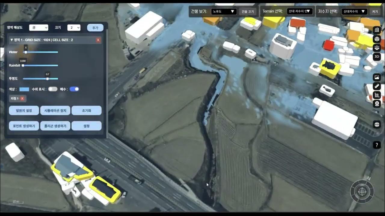
Simulating dam break & rainfall flooding in real-time 3D—right in your browser. Visualize water flow, inundation depth points, and contour lines with #CesiumJS + #3DTiles. Vulnerable buildings shown with color-coded risk. #mago3D youtu.be/FRnpau-iD7g
youtube.com
YouTube
Dam Break & Rainfall Flooding Simulation Digital Twin(디지털트윈 기반 홍수...

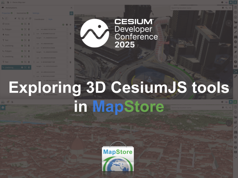
🚀 Just back from #CesiumDevConf! Our team shared how we're using #MapStore + #CesiumJS to bring 3D GIS to life: - 3D Tiles & terrain - Annotations & measurements - IFC models & digital twins Featuring real projects from Florence & Genoa 🏙️ Full recap 👉…
@Gaia3D built a real-time 3D flood simulation in the browser using #CesiumJS and Shallow Water Equation. It visualizes dam break & heavy rain scenarios. Results closely matched real flood zones. We plan to continue deeper research. #DigitalTwin #FloodSim youtu.be/IiYaQjxZ_g4

youtube.com
YouTube
mago3D를 활용한 홍수 시뮬레이션 - 얕은 물 방정식 이용(Shallow Water Equation)

스트리밍 되고 있는 3D Tiles(.b3dm)을 다운로드 받아 텍스처를 제거하고 높이 값을 변경하는 기능을 Cursor와 페어해 만들어 올려봤다. 여러번의 검증과 수정이 필요했지만 괜찮은 결과가 나왔다. #3dtiles #cursor #cesiumjs

@Gaia3D has launched a 3D weather visualization system for Korea Meteorological Administration. Forecasters can now explore LDAPS & ECMWF data in 3D via CesiumJS, powered by OGC 3D Tiles & Marching Cubes. #DigitalTwin #Gaia3D #CesiumJS #3DTiles youtube.com/watch?v=ea_d0s…
youtube.com
YouTube
기상청 수치모델 3차원 가시화 시스템 - Weather Data 3D Visualization System


Make 3D maps more interactive! 🌍✈️ Click any moving target to view live details like ID, altitude, speed & heading — ideal for defense, aviation & tracking apps. 🔗 manyatechnologies.com/cesiumjs-track… #CesiumJS #GIS #3DVisualization #RealTimeTracking #Geospatial #ManyaTechnologies
🚀 Learn how to add shapefiles (GeoJSON) in CesiumJS with visibility & opacity controls! Check it out: manyatechnologies.com/add-geojson-ce… #CesiumJS #GeoJSON #WebGIS #SpatialData #ManyaTechnologies #Shapefile
🚀 New on the blog: Displaying Heading Vectors in CesiumJS for Real-Time Track Visualization. Learn how to draw dynamic direction & speed vectors on your map using Cesium. 👉 manyatechnologies.com/cesiumjs-headi… #ManyaTechnologies #CesiumJS #GIS #3DMapping #DataVisualization #Simulation
Discover how drone mapping is transforming industries! From 2D maps to immersive 3D terrain models—see how #CesiumJS & #Potree power the visualization engines. 📖 Read more: manyatechnologies.com/drone-mapping-… #DroneMapping #3DVisualization #Photogrammetry #LiDAR #ManyaTechnologies
🚀 New blog post! Learn how to display 2D billboards & 3D models in CesiumJS with code examples + best practices. Perfect for GIS & simulation apps. 👉 manyatechnologies.com/display-3d-sym… #CesiumJS #GIS #3DVisualization #Geospatial #ManyaTechnologies
zurl.co/avKO1 -- D5 Render and Cesium Integration Ups the Game in Cinematic Visualization at Large Scale for AEC Industry Storytelling. #d5render #cesiumJS #archviz #visualization #visualisation #aecindustrynews

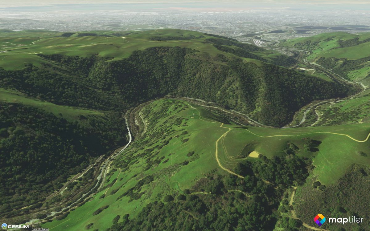
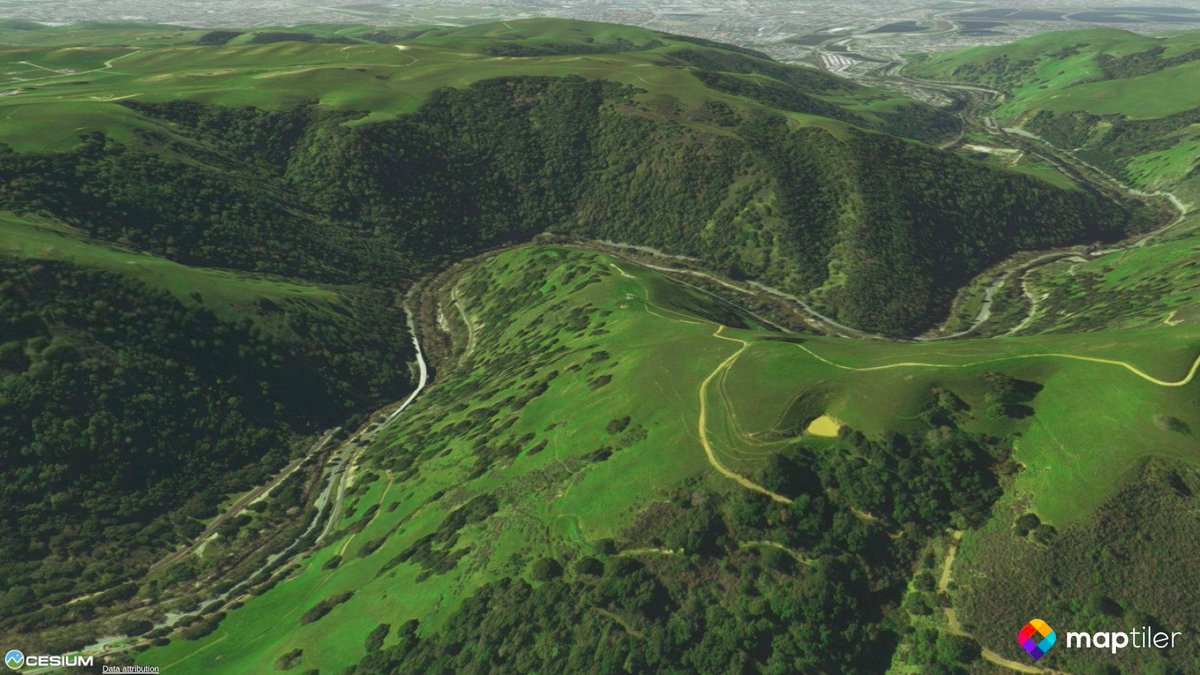
Free 3D terrain map tiles for #CesiumJS now available in MapTiler Cloud! Check the announcement at maptiler.com/blog/2018/08/f…

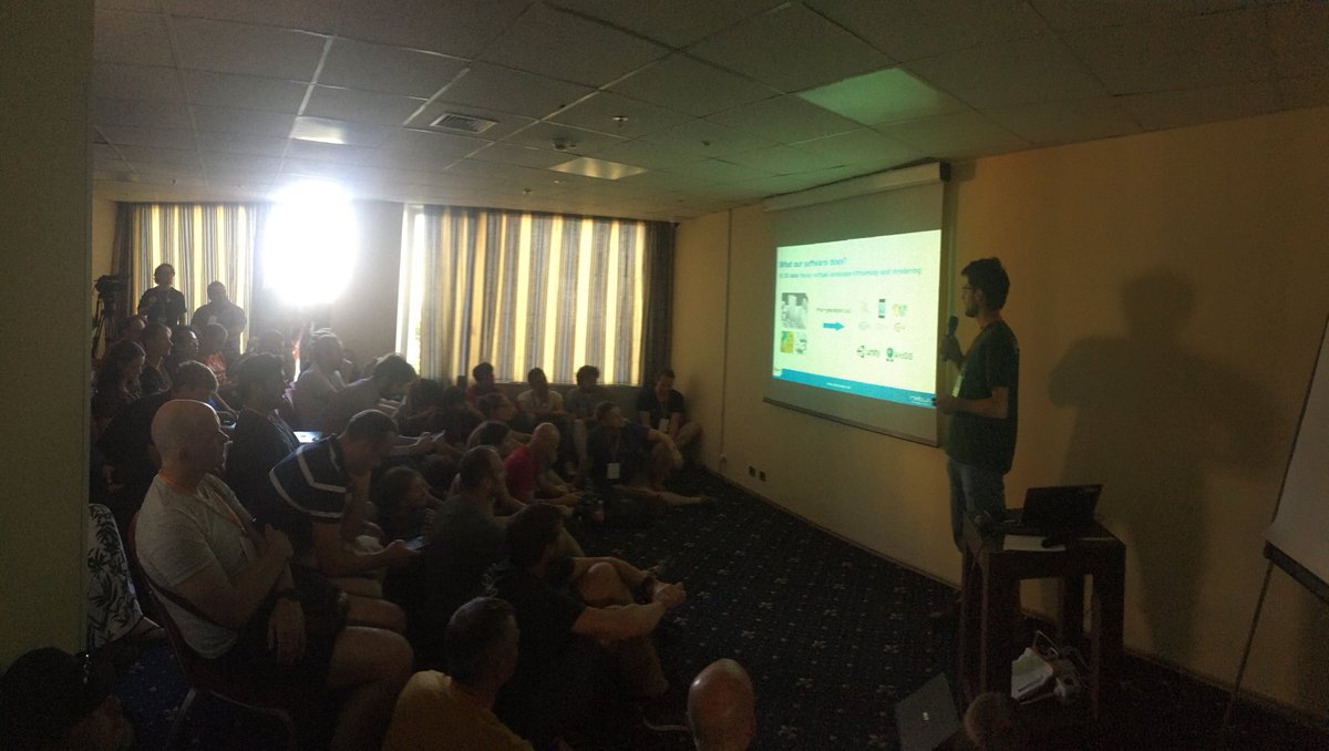
. @HorkyLadislav giving his talk comparing #vtsgeospatial to #cesiumjs. The room is so crowded that I cannot take a reasonable photo.
Experience how #CesiumJS provides 4D visualization for operations use cases such as analysis, planning, COP, and rehearsal at the Cesium booth (2431) at @USGIF #GEOINT2021.
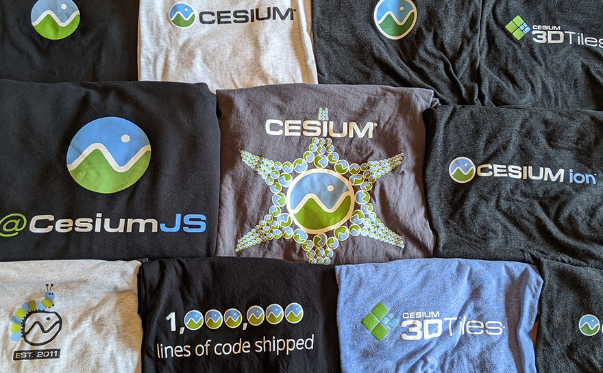
Today on the Cesium blog: CEO Patrick Cozzi reflects on ten years of #CesiumJS and shares its future roadmap. bit.ly/3ceY96Y

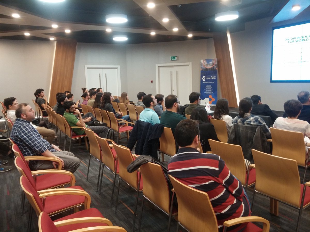
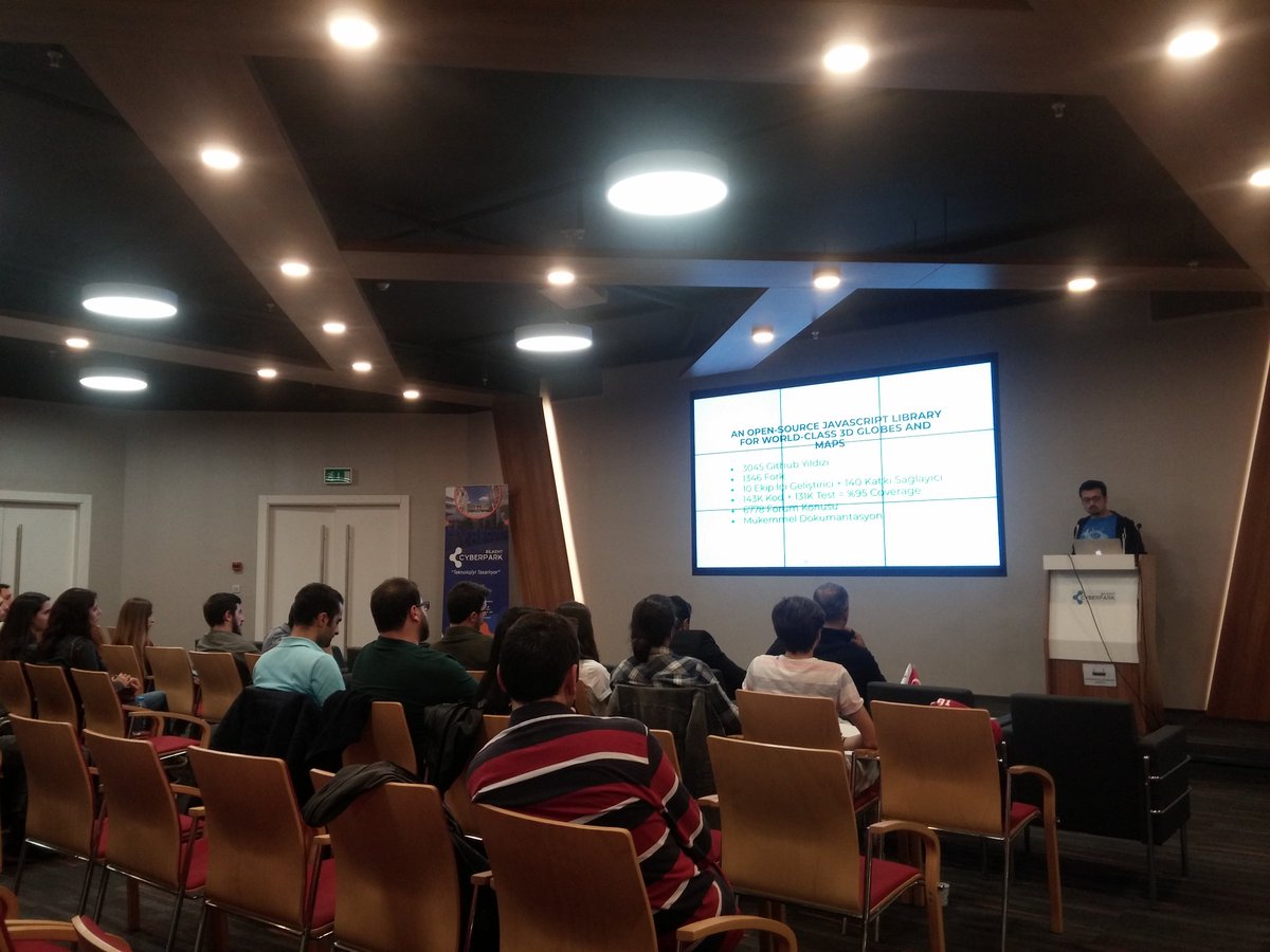
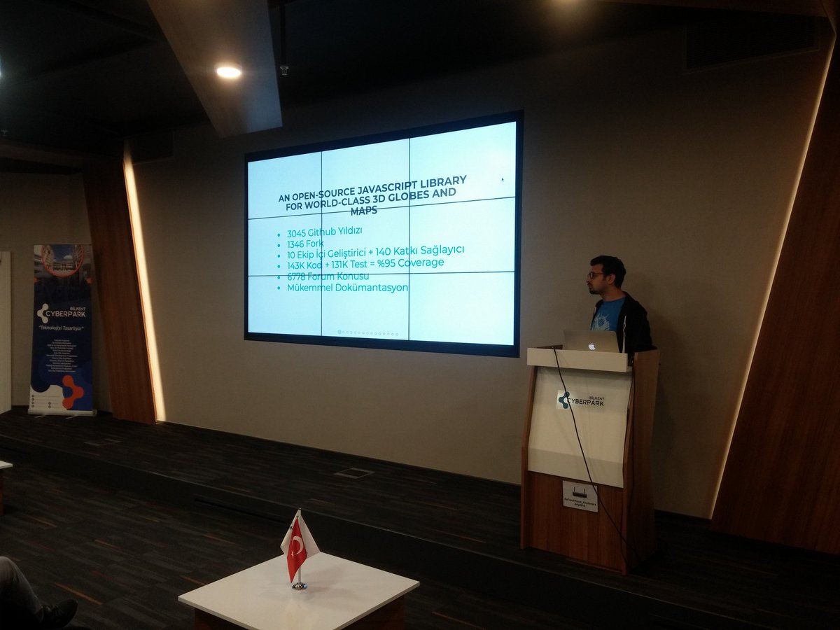
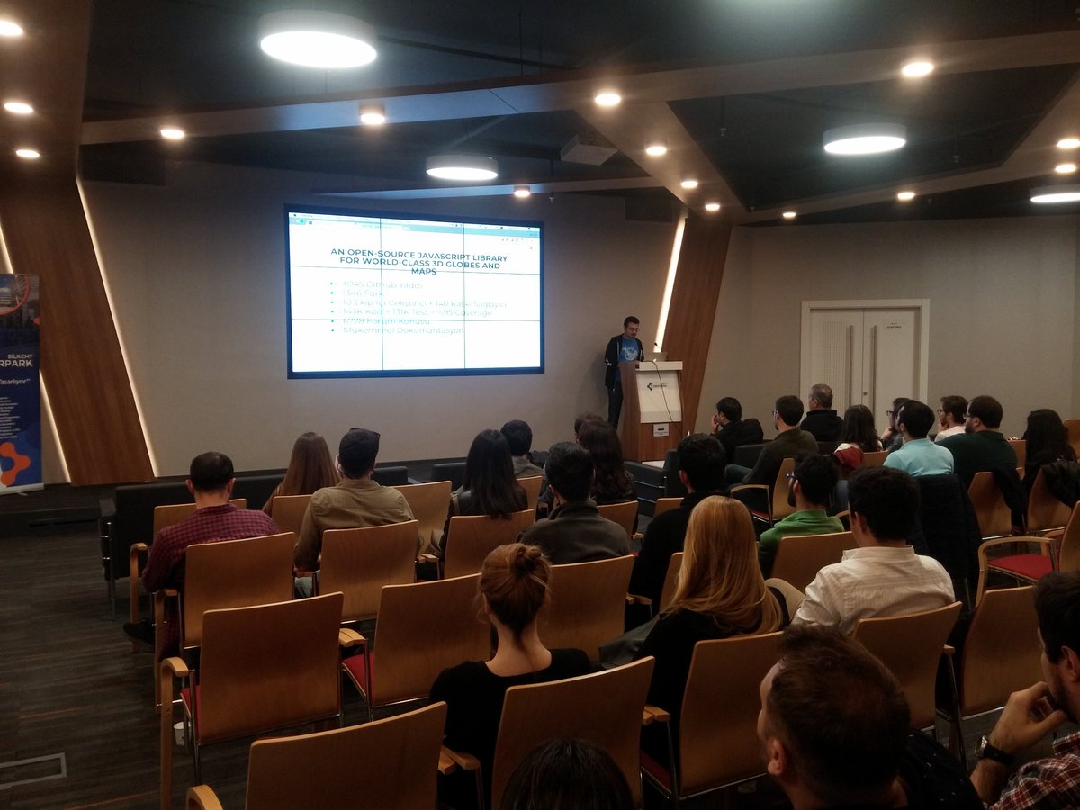
JS Ankara etkinliği İkas sponsorluğunda Hüseyin Ateş'in sunumuyla başladı. @CyberparkTGB #jsankara #cesiumjs

Part 1: Introduction to CesiumJS youtu.be/6T_zuMpqPCE #Cesiumjs @CesiumJS @qgis @QFieldForQGIS @hansakwast @geomenke
Did you know that MapTiler Server can serve 3D terrain for #CesiumJS from prepared on-prem packages? ow.ly/r9qU50MzRNP
We're celebrating ten year of #opensource #CesiumJS! 🎉 On the blog, Cesium CEO @pjcozzi reflects on its #aerospace origins and major milestones (2M downloads and 1M lines of code!) and shares the future roadmap: bit.ly/3ceY96Y

Geoserver terrain provider display spikes and cut image stackoverflow.com/questions/7215… #cesium #cesiumjs #geoserver
We are happy to announce that MapTiler Server can now serve 3D terrain for #CesiumJS from prepared on-prem packages. Give it a try here: ow.ly/jL1h50MLpkF

Displaying a #CesiumJS 3D map in a #streamlit web app. leafmap.cesium_to_streamlit(html, width, height) leafmap.org/common/#leafma…

Something went wrong.
Something went wrong.
United States Trends
- 1. Colts 13.7K posts
- 2. Arsenal 307K posts
- 3. #HardRockBet 4,077 posts
- 4. Jameis 3,972 posts
- 5. Tottenham 98.2K posts
- 6. Mason Rudolph 3,561 posts
- 7. Nahshon Wright N/A
- 8. #ARSTOT 19K posts
- 9. #GoPackGo 2,251 posts
- 10. #HereWeGo 2,486 posts
- 11. Thomas Frank 9,239 posts
- 12. #ChiefsKingdom 2,065 posts
- 13. Go Birds 8,489 posts
- 14. DJ Moore N/A
- 15. Latu 1,364 posts
- 16. Richarlison 11.7K posts
- 17. Emanuel Wilson 1,089 posts
- 18. Merino 21.7K posts
- 19. Raya 18.8K posts
- 20. Klay 44.7K posts