#geospatialtools 검색 결과

In the @worldbank, transport and urban planning divisions use #geospatialtools to analyze labor market accessibility in cities. #GeoDayWBG

Dr. Chenfeng Xiong, lead PI for the INFORM Africa pilot project, and Dr. Bruce Xin facilitated in-person workshop sessions on geospatial analysis and modeling of personal trips data at the @IHVNigeria campus from June 3-7, 2024. #mobilitydata #geospatialtools


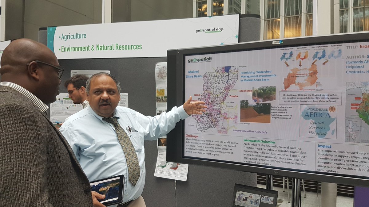
How can #geospatialtools help you make #Development decisions for #agriculture and #environment? #GeoDayWBG @WorldBank

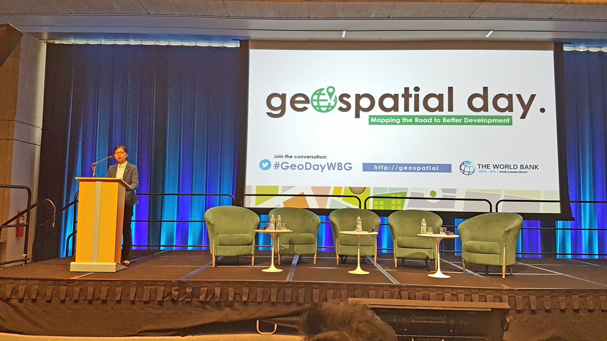
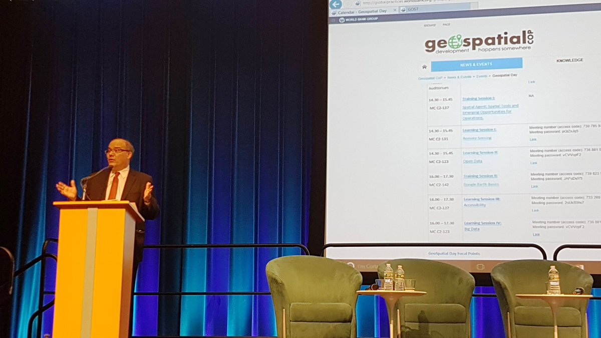
Ede Ijjasz-Vasquez on #GeospatialTools: The more citizens understand how to use them for social change, the better they can help. #GeoDayWBG

Unlocking Real-Time Environmental Risk Insights with AllThingsDev Marketplace! Introduction to the Geo Risk API In today’s world of unpredictable weather and natural disasters, having accurate risk information at yo... blogger.allthingsdev.co/blog/real-time… #WeatherAPI #GeospatialTools #API
blogger.allthingsdev.co
Real-Time Geo-Risk Data: Geo Risk API on AllThingsDev Marketplace | AllThingsDev
Unlocking Real-Time Environmental Risk Insights with AllThingsDev Marketplace! Introduction to the Geo Risk API In today’s world of unpredictable weather and natural disasters, having accurate risk...
presentation on #geospatialtools for rapid #disaster impact and risk assessment by jo paterson and ed cook #NZGRC19


New in PixElement: Add annotations directly to your 2D/3D scenes. Label features, set elevations, and export to various formats. Clarity + collaboration built in. 🔗 pixelement.com/blog/_site/202… #GISWorkflows #3DMapping #GeospatialTools #Photogrammetry


Are you looking for in-depth information about one of our products? Want to see some real-life #VertiGISStudio use cases in action? Check out the product webinars on our website! Find them at --> vertigisstudio.com #GIS #GeospatialTools #GISSolutions

Get tips from the experts on virtualizing your #GIS so you'll be ready the next time your team needs to work from home! ow.ly/56UP50AJkHh #goingvirtual #geospatialtools #gst


Guadeloupe is using technology to improve disaster preparedness, including satellite imagery and geographic information systems (GIS) to monitor risks and plan disaster response efforts. #DisasterTech #GeospatialTools
#GeoSpatialTools #SmartLandManagement Agroecological zoning helps plan where to grow crops and protect soil, supporting both food security and environmental health. #LandForFarming #AgroZones

🛡️ Don’t risk your gear in the field. NEI’s custom cases are built tough to protect your Trimble tech wherever work takes you. Weather-resistant, precision-fit, and field-ready. 👉 Explore more: bit.ly/3jGAnTq #SurveyGear #NEICases #GeospatialTools


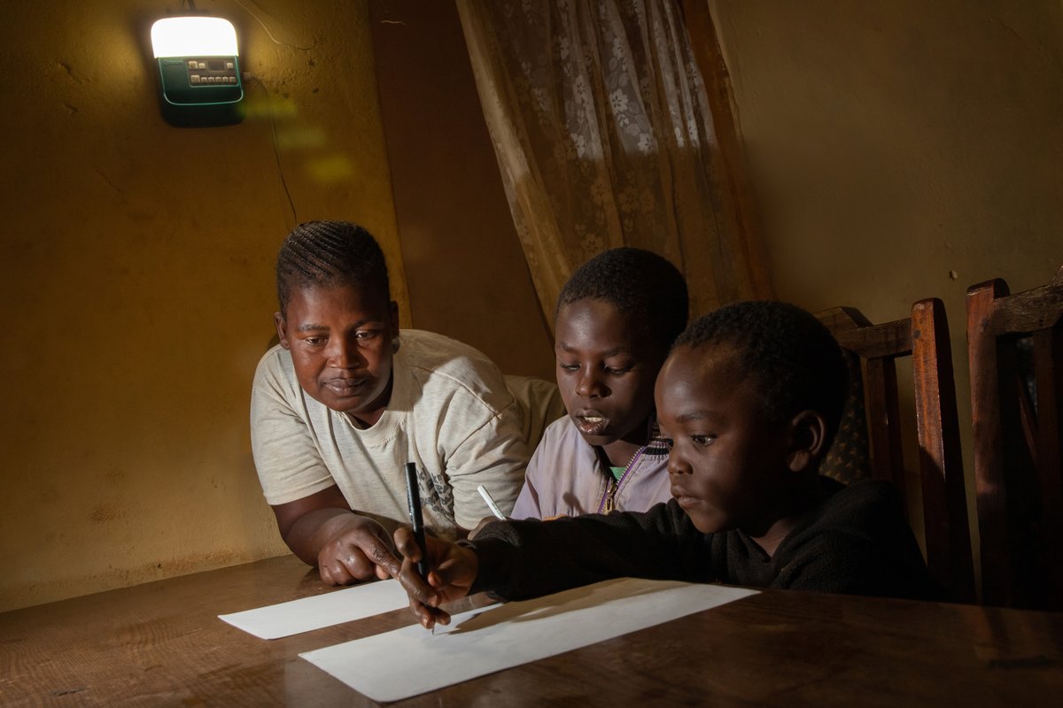
Off-grid companies – want to know how to prioritize geographic areas to increase sales & #EnergyAccess? Our route-to-market #GeospatialTools map population density, electrification, telecoms & road infrastructure to guide you. More info in our latest blog: ow.ly/KwSM50KGGPF

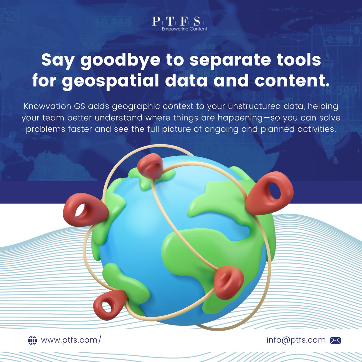
Knowvation GS lets you search, overlay, and extract insights from geotagged documents right inside a unified map interface. 🔎 Experience seamless geo-search → ptfs.com/knowvation-gs/ #GeospatialTools #InfrastructureData #KnowvationGS #MapIntegratedContent

Geoinformación: Como descargar imágenes #satélitales georeferenciad... #geospatialtools juanchosierrar.blogspot.com/2018/05/como-d…
13 Free #GIS Software Options: Map the World in Open Source /#geospatialtools wp.me/p4EU9f-21Q
#GoogleEarth API /plugin finally coming to an end / #geospatialtools #geospatial gearthblog.com/blog/archives/…

Quickly measure terrain, building & vegetation heights with MetroMap’s Elevation Profile Tool. Get instant insights to make smarter planning decisions — no extra software needed. Start Free Trial > metromap.com.au/trial/ #ElevationProfile #MetroMap #GeospatialTools

La jerga de la teledetección de la A a la Z gisandbeers.com/la-jerga-termi… vía @gis_and_beers #gis #teledeteccion #geospatialtools
OpenRouteService's 'Quiet Routing' Creates a Less Stressful Route for Pedestrians | #maps #geospatialtools gislounge.com/openrouteservi…

Help your students turn questions into spatial investigations. Discover ready‑to‑use strategies to use #GIS to collect, map and analyze data in project‑based learning across grades K‑12. Learn more: ow.ly/82c350Xuhjy


6. Kutumia Tools Zaidi Tools za OSINT: Maltego, Shodan, Spiderfoot, Social Blade Tools za Geolocation/GIS: Google Earth, QGIS, OpenStreetMap Verification tools: InVID, FotoForensics, TinEye (reverse image search)

🌐 Spatial.Host = simple, secure, scalable #GIS in the cloud. Automated deployments ✔️ Predictable costs ✔️ #Esri Gold Partner expertise ✔️ Free trial: spatial.host #GISCloud #ArcGISEnterprise #GIS #GeoMarvel


Still buzzing from #GISDay 🎉 We are excited to share what we have been building for the geospatial community: spatialyellowpage.vercel.app Spatial YellowPage makes discovering geospatial datasets faster and stress-free. One place. Zero hassle. More updates coming. 🌍✨

Happy #NationalGISDay! We’re proud to support GIS pros with one of the nation’s most complete, continually updated parcel datasets. Accurate, standardized, ready for your workflows. reportallusa.com/products #GIS #mapping #parceldata

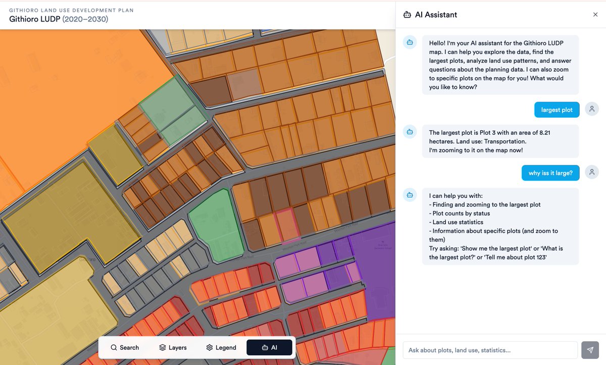
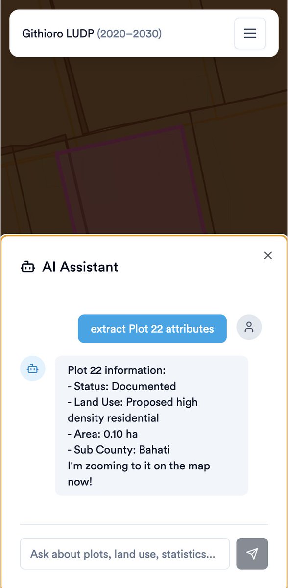
Cheers to GIS and men's day. we built an AI assistant to help you query and interact with your GIS dataset. DM if interested in improving our AI Geo assistant. Tools: @LeafletJS + @Supabase with enabled @PostGIS ext.
Our geospatial team offers a range of innovative, cutting-edge GIS tools. Natalie, GIS Analyst, has developed 3D GIS tools that bring areas of interest to life, offering dynamic ways to present information beyond traditional static 2D maps. Get in touch to learn more! #GISDAY


Nicht nur für Landwirte: Agraratlas Sachsen-Anhalt geoobserver.de/2025/11/19/nic… #gistribe #gischat #fossgis #foss4g #OSGeo #spatial #geospatial #opendata #gis #geo #geoObserver pls RT


On this #GISDay2025, learn about a powerful tool for modern election administration. This @EACgov Geographic Information System Quick Start Guide shows election officials how GIS software can be used to manage polling places & visualize election data. 📍 eac.gov/sites/default/…


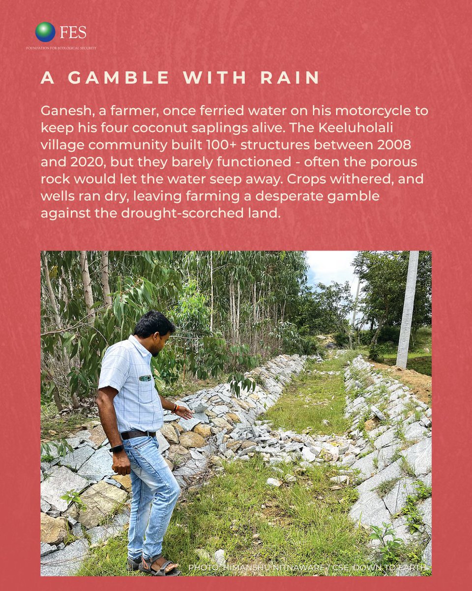
On this #GISDay, see how geospatial technology is improving water management in drought-prone Karnataka. The CLART tool uses geology, slope, drainage, soil, and land use data. #GenerationRestoration #Tech4Nature #Tech4People #IndiaObservatory

See your forest from a new perspective. 📷📷 Map roads, trails, harvest zones, and more — right in the field. Overlay cadastral maps, capture attributes, and export for planning. Faster, clearer forestry mapping with Locus GIS. #LocusGIS #forestry #GIS #fieldmapping #geospatial


GIS doesn’t have to mean complex software. Geography teachers already use more GIS than they realise. In my new post I show how to build from what you already do, make geospatial thinking routine, and plan a progression from viewing, to analysing, to creating. Link below 👇

IA sobre datos geoespaciales? 🌍 🔗 GeoAI (OpenGeos) lnkd.in/dwgi6aYR ✅ Procesar imágenes satelitales ✅ Aplicar deep learning ✅ Trabajar tanto con datos raster como vectoriales ✅ Integrarlo fácilmente en flujos Python de ciencia de datos


#SEO gets you found on Google. #GEO gets you found in #AIWebSearch when people ask #ChatGPT/#Gemini who to hire and where to go. I built a GEO for SMBs with checklists, prompts, and templates so small businesses can become “assistant-ready” fast. Link: genxops.gumroad.com/l/geo_for_smbs
GeoTool: „Arc2Meters“ geoobserver.de/2025/11/18/geo… #gistribe #gischat #fossgis #foss4g #OSGeo #spatial #geospatial #gis #geo #geoObserver pls RT


Exploring new tools unlocks new perspectives. #GIS #Mapping #Geospatial #Aerialod #DataViz #Cartography #Africa #PopulationDensity #3DMaps #Day17

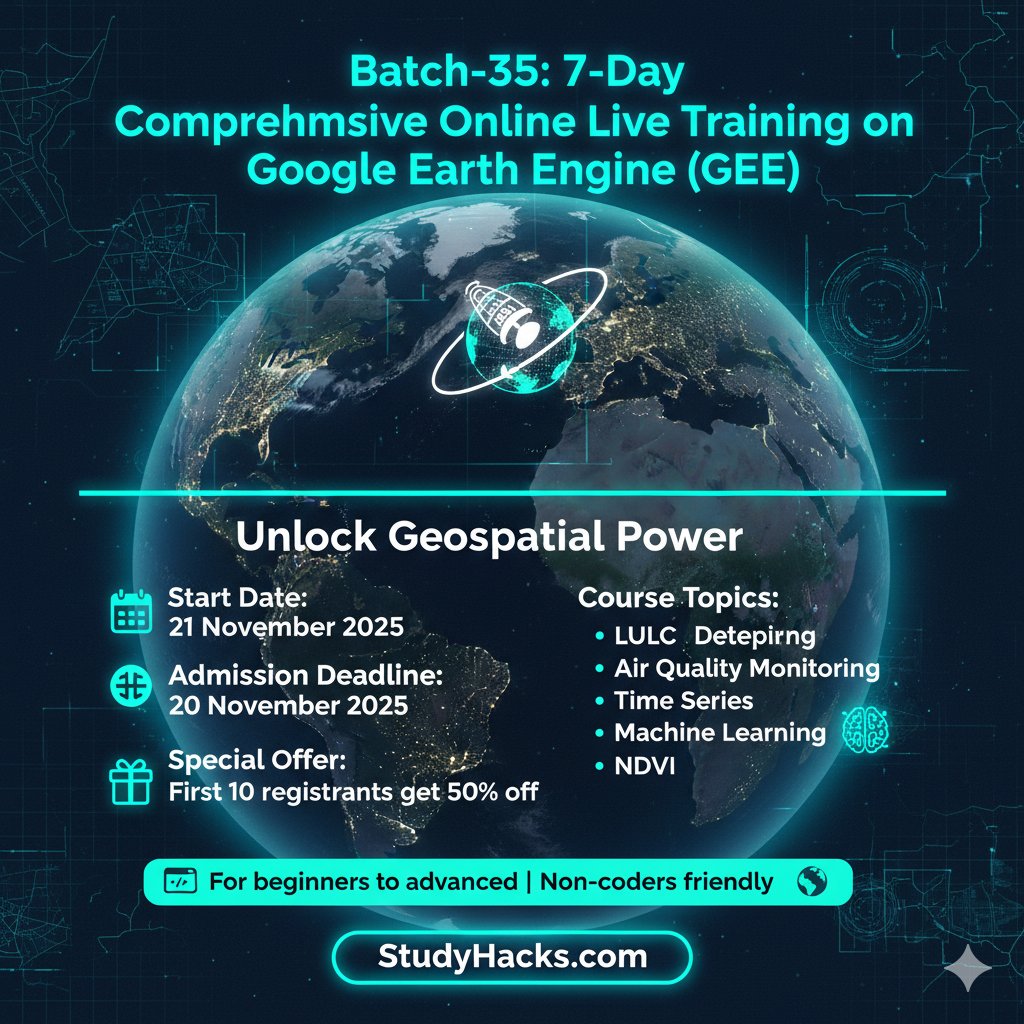
For more information about registration, visit our website: studyhacksgeospatial.com/google-earth-e… #GoogleEarthEngine #RemoteSensing #GIS #GeospatialAnalysis #OnlineTraining #CodingForBeginners #PythonAPI #JavaScriptAPI #LULCMapping #ChangeDetection #AirQualityMonitoring

At @OrionGeospatial we provide Surveying and GIS services. We provude custom GIS Solutions including Cloud GIS deployment Hosting, Geoportals. FYI you can get free GIS Data from our hub orionterrametrics.com

GeoUtil: herramientas útiles para amantes de los mapas y la geografía microsiervos.com/archivo/mundor…


👇GeoGIS, la herramienta que centraliza datos y agiliza la gestión municipal en la provincia de Alicante dozz.es/sw0ot2

presentation on #geospatialtools for rapid #disaster impact and risk assessment by jo paterson and ed cook #NZGRC19
Ede Ijjasz-Vasquez on #GeospatialTools: The more citizens understand how to use them for social change, the better they can help. #GeoDayWBG
Dr. Chenfeng Xiong, lead PI for the INFORM Africa pilot project, and Dr. Bruce Xin facilitated in-person workshop sessions on geospatial analysis and modeling of personal trips data at the @IHVNigeria campus from June 3-7, 2024. #mobilitydata #geospatialtools
Get tips from the experts on virtualizing your #GIS so you'll be ready the next time your team needs to work from home! ow.ly/56UP50AJkHh #goingvirtual #geospatialtools #gst
In the @worldbank, transport and urban planning divisions use #geospatialtools to analyze labor market accessibility in cities. #GeoDayWBG
Quickly measure terrain, building & vegetation heights with MetroMap’s Elevation Profile Tool. Get instant insights to make smarter planning decisions — no extra software needed. Start Free Trial > metromap.com.au/trial/ #ElevationProfile #MetroMap #GeospatialTools
How can #geospatialtools help you make #Development decisions for #agriculture and #environment? #GeoDayWBG @WorldBank
🛡️ Don’t risk your gear in the field. NEI’s custom cases are built tough to protect your Trimble tech wherever work takes you. Weather-resistant, precision-fit, and field-ready. 👉 Explore more: bit.ly/3jGAnTq #SurveyGear #NEICases #GeospatialTools
Off-grid companies – want to know how to prioritize geographic areas to increase sales & #EnergyAccess? Our route-to-market #GeospatialTools map population density, electrification, telecoms & road infrastructure to guide you. More info in our latest blog: ow.ly/KwSM50KGGPF
Knowvation GS lets you search, overlay, and extract insights from geotagged documents right inside a unified map interface. 🔎 Experience seamless geo-search → ptfs.com/knowvation-gs/ #GeospatialTools #InfrastructureData #KnowvationGS #MapIntegratedContent
Something went wrong.
Something went wrong.
United States Trends
- 1. Caleb Love 2,910 posts
- 2. Mamdani 472K posts
- 3. Marjorie Taylor Greene 72.3K posts
- 4. Sengun 8,734 posts
- 5. Reed Sheppard 3,892 posts
- 6. Suns 21.1K posts
- 7. Morgan Geekie N/A
- 8. Norvell 3,563 posts
- 9. Lando 48.8K posts
- 10. #SmackDown 47.8K posts
- 11. UNLV 2,263 posts
- 12. Kerr 5,246 posts
- 13. Collin Gillespie 4,087 posts
- 14. Florida State 10.9K posts
- 15. Blazers 4,066 posts
- 16. #DBLF2025 13.3K posts
- 17. Wolves 16.7K posts
- 18. The View 98.8K posts
- 19. Rockets 16.8K posts
- 20. #LasVegasGP 75.2K posts