#maplibre search results

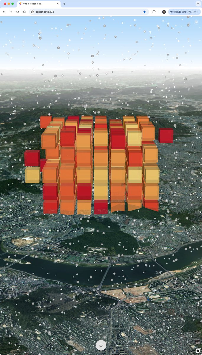
新宿駅周辺屋内地図オープンデータをもとにMapLibre GL JSとdeck.glで新宿駅周辺屋内3Dマップを作成。高さ情報はないので階層ごとに適当に高さを設定。3次元座標で整備されると可視化が楽なんだけど。歩行者ネットワークを追加予定。 shiwaku.github.io/mlit-shinjuku-… #FOSS4G #MapLibre

AI isn’t “helping us map” anymore - it’s mapping on its own. Neural layers, auto-generated datasets, autonomous geo-intelligence… the future is no longer manual. If you're still drawing maps by hand - you're already behind. #GIS #GeoAI #MapLibre #DataVisualization #AIMaps


伊能忠敬の伊能図風の地図も作ってみました!🏯🗺️ chizutodesign.github.io/map-styles/#in… 日本だけでなく全世界閲覧できます!!🌍 #MapLibre #Maputnik #OpenStreetMap
国勢調査2020年夜間人口100mメッシュの数値PNGタイルをMapLibre GL JSで表示。低ZLでも表示させたい場合はやはり数値PNGだなと。数値PNGの適用ケースは標高⇒ハザードマップ⇒人口(人流)⇒気象...? shiwaku.github.io/pop2020-numeri… #FOSS4G #MapLibre #数値PNG
警察庁の交通事故データ(2024年)が公開されたので、2019~2023年とマージしたGISデータを公開しました。 github.com/shiwaku/npa-tr… 形式は、CSV、GeoParquet、PMTilesになります。190万件(6年間)の交通事故データがQGISやMapLibre GL JSで表示できます。 #FOSS4G #MapLibre #QGIS #trafficaccident


交通事故統計情報のオープンデータ(2024年(令和6年))を公開しました。 npa.go.jp/publications/s… また、インターネットの地図上で事故多発地点を表示できるツールも公開していますので、是非ご活用下さい😄 #警察庁 #交通 #統計 #交通事故 #オープンデータ
npa.go.jp
交通事故統計情報のオープンデータ|警察庁Webサイト
交通事故統計情報のオープンデータ|警察庁Webサイト

MapLibre Tutorial 13: Visualize Ocean Bathymetry in 3D Video: youtu.be/SLHwMbZox9o Playlist: bit.ly/maplibre Notebook: leafmap.org/maplibre/ocean… Demo: maps.gishub.org/maplibre/ocean… #geospatial #maplibre #leafmap #maptiler #ocean
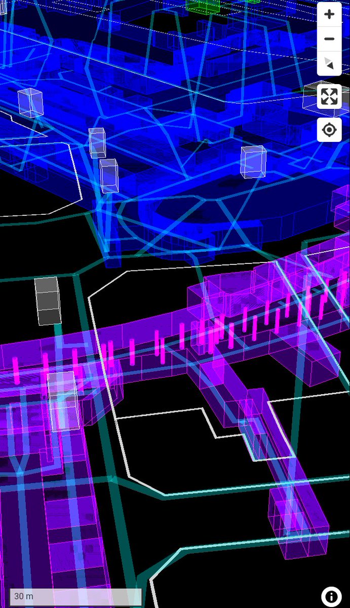
新宿駅周辺屋内3DマップにPLATEAUの道路データを追加してみたけど、Z値が接地面標高(DEM)なので道路面の高さを一律20m立ち上げてJR新宿駅南口と位置合わせ。3次元座標のZ値に加え、DSMとDEMの属性も欲しい、または、Z値はDSMの標高にするとか...? #FOSS4G #MapLibre #deckgl #PLATEAU


100mメッシュくらいの細かい解像度のメッシュは、ベクトルタイルだと低ZLを表示させないなど工夫する必要があるけど、数値PNGタイルであれば日本全域を表示させても問題ない。スマホでもサクサク表示できる📝 shiwaku.github.io/pop2020-numeri… #FOSS4G #MapLibre #数値PNG


国勢調査2020年夜間人口100mメッシュの数値PNGタイルをMapLibre GL JSで表示。低ZLでも表示させたい場合はやはり数値PNGだなと。数値PNGの適用ケースは標高⇒ハザードマップ⇒人口(人流)⇒気象...? shiwaku.github.io/pop2020-numeri… #FOSS4G #MapLibre #数値PNG

MapLibre GL JSのv5-preでGlobeViewが実装されたので早速試す。楽しい。 自分の渡航歴を写真と一緒に地球儀でグルグル回るアプリです。 kashiwa.co-place.com/cmap/mygj/ setProjectionでglobe指定するだけ。flyToもスムーズに動く。背景は雰囲気出すために自分で設定した方が良いかも。 #MapLibre #mugjp
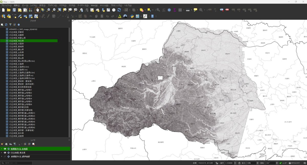
埼玉県3次元点群データから作成したCS立体図のタイルを試験的に公開しました。MapLibre GL JSやQGISで表示できます。 ・デモサイト(MapLibre GL JS) shiwaku.github.io/aist-dem-with-… ・GitHub(タイルURL) github.com/shiwaku/aist-d… #FOSS4G #MapLibre #QGIS #埼玉県 #点群 #CS立体図

高潮浸水想定区域図シェープファイルの浸水深(実数)から数値PNGタイルを作成してMapLibre GL JSでパレットPNGに動的変換。数値PNGタイルでデータを整備しておけば、凡例情報を用意するだけで、浸水深ランクのレンジや色を自由に変更できる📝応用範囲は広い📢 #FOSS4G #MapLibre #数値PNG

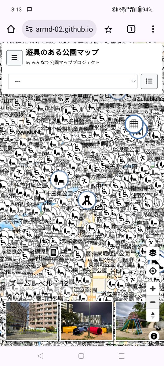
Overpass Japanサーバーがメンテナンス中なので、サーバー通信エラー処理をデバッグ! 合わせて「遊具のある公園マップ」のズームレベルが低くても公園を表示するよう調整したらひどい表示(笑) ヒートマップやクラスタ化が良いかなぁ。やり方調べるかー。 #osmjp #maplibre
🌍 MapLibre Tutorial 16: Dive into creating vector data and adding attributes interactively with #Leafmap and #MapLibre! 🎥 Watch the tutorial: youtu.be/EzkE5UlDKuE 📓 Explore the notebook: leafmap.org/maplibre/creat… 📚 Check out the playlist: bit.ly/maplibre…

Yeah okay, I'm convinced #svelte + #maplibre is the way to go to crank out things really, really quickly
🗺️ MapLibre Tutorial 07: Visualize Real-time Movement Data in 3D Video: youtu.be/LFzk-DfEWmU Notebook: leafmap.org/maplibre/live_… Demo: maps.gishub.org #geospatial #leafmap #maplibre #opensource #python
osm2streets.org web UI is now powered by #svelte and #maplibre! Explore and edit #openstreetmap data and be entertained by complex junction geometry
🌍✨Visualizing Agricultural Field Boundary Dataset (Fields of The World) with #Leafmap and #MapLibre 🔍 Check out the interactive demo: maps.gishub.org/maplibre/field… 📓 Explore the notebook: leafmap.org/maplibre/field… #geospatial #opensource #dataviz
新宿駅周辺屋内3Dマップに歩行者ネットワークを追加。高さは階層ごとに適当に設定。経路探索を追加したいかも...? shiwaku.github.io/mlit-shinjuku-… #FOSS4G #MapLibre #deckgl
新宿駅周辺屋内地図オープンデータをもとにMapLibre GL JSとdeck.glで新宿駅周辺屋内3Dマップを作成。高さ情報はないので階層ごとに適当に高さを設定。3次元座標で整備されると可視化が楽なんだけど。歩行者ネットワークを追加予定。 shiwaku.github.io/mlit-shinjuku-… #FOSS4G #MapLibre

Need pixel-perfect overlays? You first need to know how big your geographic area is in pixels at a given zoom. This guide walks through it step-by-step. 👉 dev.to/geoapify-maps-… #MapLibre #WebDev #Geoapify


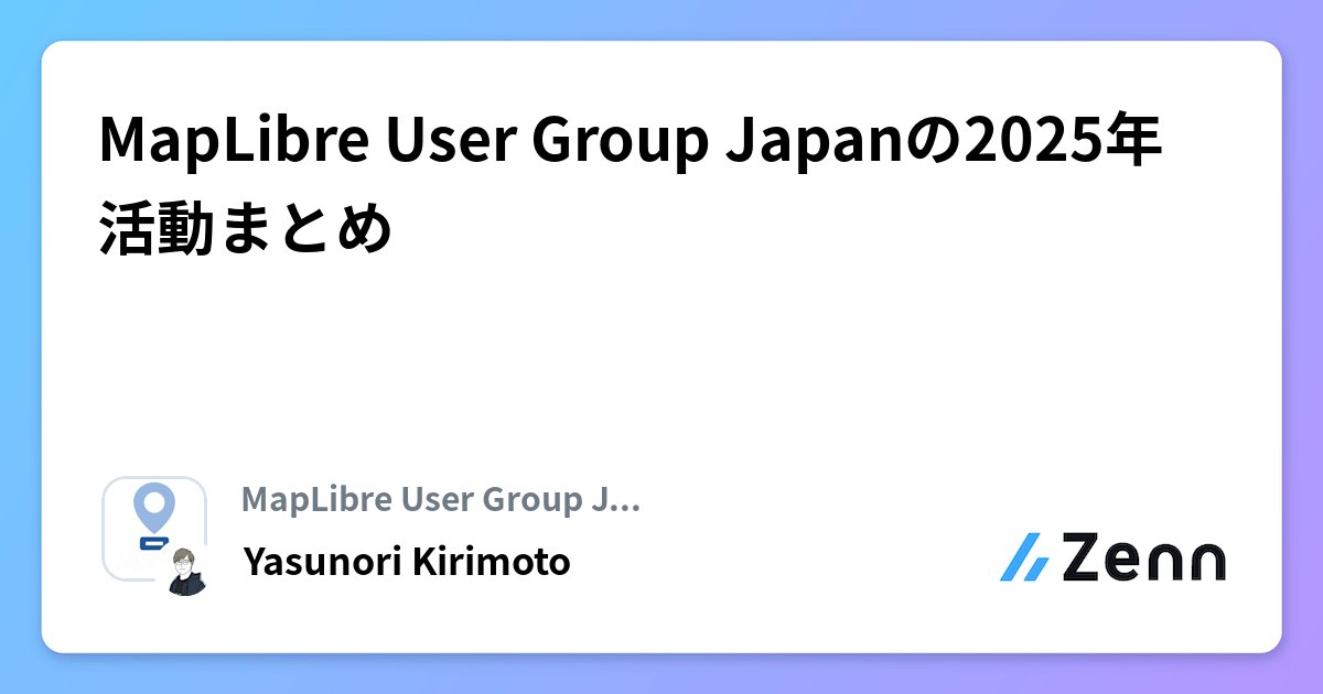
「MapLibre Advent Calendar 2025」の1日目の記事を書きました。 MUG-JPの今年の活動をまとめました。来年もゆるく活動できればと思っています。発表者募集中です! MapLibre User Group Japanの2025年活動まとめ zenn.dev/mugjp/articles… #mugjp #foss4g #MapLibre
Geoapify integrates with all major open-source mapping libraries. 🧠 What’s your go-to library, and why? #Geoapify #LeafletJS #MapLibre #OpenLayers
AI isn’t “helping us map” anymore - it’s mapping on its own. Neural layers, auto-generated datasets, autonomous geo-intelligence… the future is no longer manual. If you're still drawing maps by hand - you're already behind. #GIS #GeoAI #MapLibre #DataVisualization #AIMaps

🍃 Are you using Leaflet, but you need to incorporate our vector styles? 👇 Learn how with the help of MapLibre GL JS and our tutorial. docs.stadiamaps.com/tutorials/vect… #leaflet #maplibre #maps #mapping


New post from my blog >> The "Map of GitHub" project is awesome! joaocoelhoweb.wordpress.com/2025/11/15/the… #Datavisualization #MapLibre #GitHub #OpenSource #SoftwareDevelopment

Drupal + React + MapLibre = a civic web map for Taranto. Check out Italo Mairo’s @ItaloMairo 30DayMapChallenge entry using OSM + Overture data. bit.ly/4oBaCUZ #Drupal #MapLibre #30DayMapChallenge #WebMapping


Here's a new map game I've made. tripgeo.com/geobox/battleo… Command RAF fighters to defend against Luftwaffe bomber raids in this challenging real time strategy game. #30DayMapChallenge #MapLibre #OpenFreeMap #Maps #GameDev #IndieGameDev #IndieDev #Blazor #JavaScript #WebGames


一つのトピックについて深堀ってせめてみるといいらしい。 確かに、MapLibreについてはあまり話されないだろうから自分にも深堀りしたい物があってうれしい!! やってみる精神はとても大切! #FlutterKaigi #MapLibre
🌟 Bring vibrant and fresh satellite 🛰️ image with our Alidade Satellite basemaps. 👌 Easy integration with your favorite vector or raster library, including #MapLibre, #Leaflet, & #OpenLayers. 👉 Get started here! docs.stadiamaps.com/map-styles/ali… #mapping


Nouveau jeu pour les fans de #MapLibre ;-) bjperson.github.io/maplibre-gl-vi…
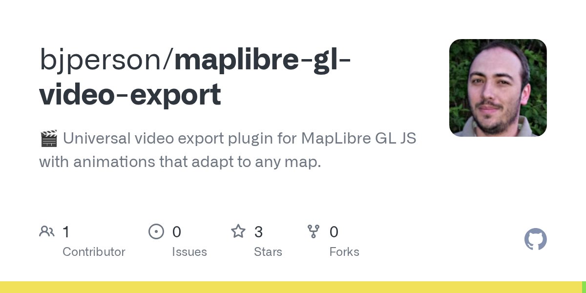
🎬 MapLibre GL Video Export v0.1.0 is out! Export high-quality WebM & MP4 videos from MapLibre GL maps with cinematic animations. 🚀 Try it: bjperson.github.io/maplibre-gl-vi… 💻 GitHub: github.com/bjperson/mapli… 📦 npm: npmjs.com/package/maplib… #MapLibre #OpenSource #GIS

Read the latest newsletter covering project updates and #maplibre's #FOSS4G talks & workshops 🌍 🙏 Thanks to @radarlabs for their continued sponsorship! maplibre.org/news/2025-11-0… #OpenStreetMap #OpenSource #SoTMEU2025 #foss4g2025 #foss4gna

100mメッシュくらいの細かい解像度のメッシュは、ベクトルタイルだと低ZLを表示させないなど工夫する必要があるけど、数値PNGタイルであれば日本全域を表示させても問題ない。スマホでもサクサク表示できる📝 shiwaku.github.io/pop2020-numeri… #FOSS4G #MapLibre #数値PNG
国勢調査2020年夜間人口100mメッシュの数値PNGタイルをMapLibre GL JSで表示。低ZLでも表示させたい場合はやはり数値PNGだなと。数値PNGの適用ケースは標高⇒ハザードマップ⇒人口(人流)⇒気象...? shiwaku.github.io/pop2020-numeri… #FOSS4G #MapLibre #数値PNG
国勢調査2020年夜間人口100mメッシュの数値PNGタイルをMapLibre GL JSで表示。低ZLでも表示させたい場合はやはり数値PNGだなと。数値PNGの適用ケースは標高⇒ハザードマップ⇒人口(人流)⇒気象...? shiwaku.github.io/pop2020-numeri… #FOSS4G #MapLibre #数値PNG

If you're interested in how it works, the source code can be found here. It is a #SvelteKit app using #Maplibre for the map rendering. The custom dot density functions can be found in /src/lib/make-points.js github.com/onsdigital/dot… 3/3
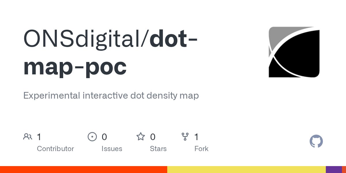

#30DayMapChallenge Day 1: Points 🔵⚪️ This experimental interactive map uses points to represent the population of UK local authorities by age and sex based on ONS mid-year population estimates from 1994 to 2024. Check it out here ➡️onsdigital.github.io/dot-map-poc/ #GIS #mapping #geo

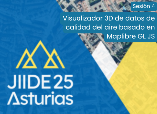
🗺️ Descubre el nuevo visualizador 3D de calidad del aire en entornos urbanos, desarrollado por @Avansig con #MapLibre. Se presentará en las #JIIDE25 el 12 de noviembre. Muestra contaminantes como NO₂, y O₃ en su contexto geográfico real. 🔗 jiide.org #GIS #WebGL
Lat/lon bounds → pixel width & height. This demo shows how to calculate overlay dimensions from map zoom + viewport size. 👉 codepen.io/geoapify/pen/d… #Geoapify #MapLibre #WebDev #Developers #GIS

🗺️ Progrès réalisés sur le plugin vidéo Maplibre GL Export sur lequel je travaille pour @Omnissimo/@IdeesLibres : Version brute 4K 60 images par seconde (142,4 Mo) : ideeslibres.org/temp/maplibre-… Il commence à bien fonctionner (voir version brute)😀 #Maplibre #Maps #osm


AI isn’t “helping us map” anymore - it’s mapping on its own. Neural layers, auto-generated datasets, autonomous geo-intelligence… the future is no longer manual. If you're still drawing maps by hand - you're already behind. #GIS #GeoAI #MapLibre #DataVisualization #AIMaps
警察庁の交通事故データ(2024年)が公開されたので、2019~2023年とマージしたGISデータを公開しました。 github.com/shiwaku/npa-tr… 形式は、CSV、GeoParquet、PMTilesになります。190万件(6年間)の交通事故データがQGISやMapLibre GL JSで表示できます。 #FOSS4G #MapLibre #QGIS #trafficaccident
交通事故統計情報のオープンデータ(2024年(令和6年))を公開しました。 npa.go.jp/publications/s… また、インターネットの地図上で事故多発地点を表示できるツールも公開していますので、是非ご活用下さい😄 #警察庁 #交通 #統計 #交通事故 #オープンデータ
npa.go.jp
交通事故統計情報のオープンデータ|警察庁Webサイト
交通事故統計情報のオープンデータ|警察庁Webサイト
Overpass Japanサーバーがメンテナンス中なので、サーバー通信エラー処理をデバッグ! 合わせて「遊具のある公園マップ」のズームレベルが低くても公園を表示するよう調整したらひどい表示(笑) ヒートマップやクラスタ化が良いかなぁ。やり方調べるかー。 #osmjp #maplibre
MapLibre GL JSのv5-preでGlobeViewが実装されたので早速試す。楽しい。 自分の渡航歴を写真と一緒に地球儀でグルグル回るアプリです。 kashiwa.co-place.com/cmap/mygj/ setProjectionでglobe指定するだけ。flyToもスムーズに動く。背景は雰囲気出すために自分で設定した方が良いかも。 #MapLibre #mugjp


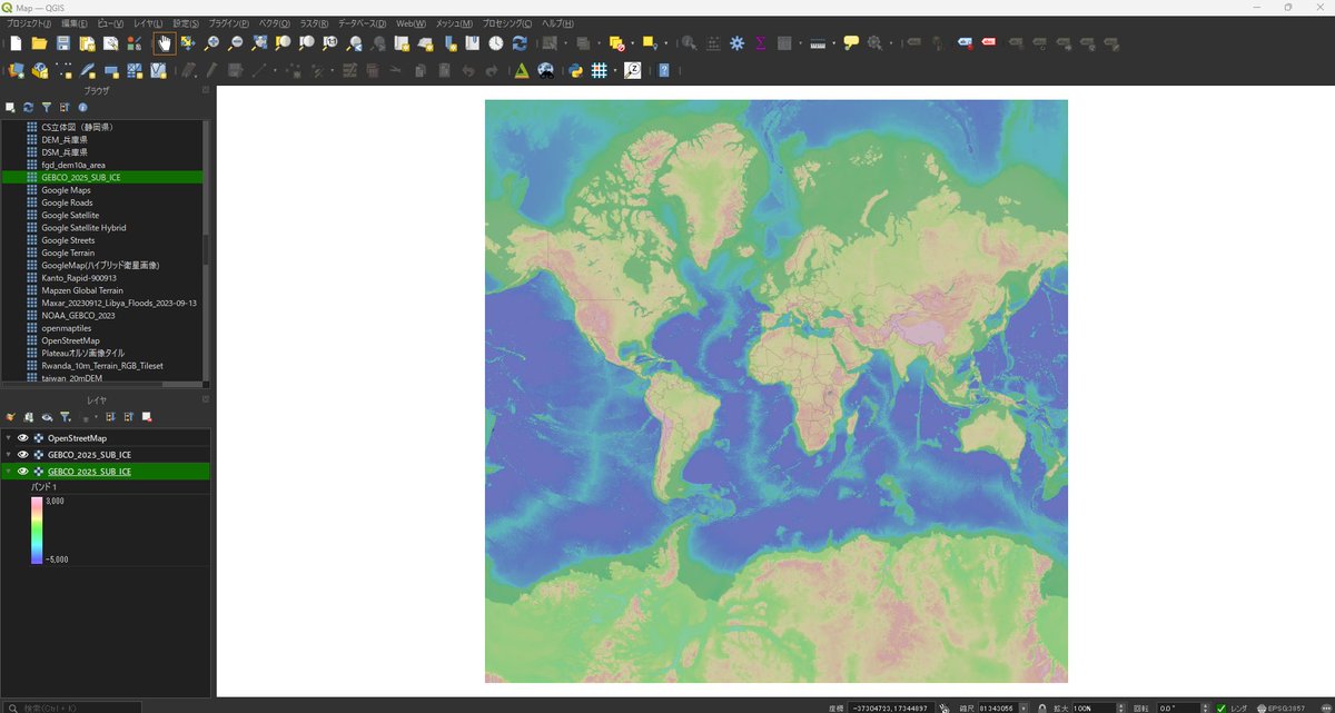
埼玉県3次元点群データから作成したCS立体図のタイルを試験的に公開しました。MapLibre GL JSやQGISで表示できます。 ・デモサイト(MapLibre GL JS) shiwaku.github.io/aist-dem-with-… ・GitHub(タイルURL) github.com/shiwaku/aist-d… #FOSS4G #MapLibre #QGIS #埼玉県 #点群 #CS立体図
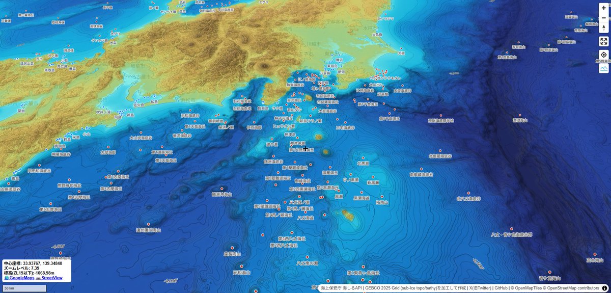
MapLibre GL JSで全球の海底地形タイル(GEBCO 2025 Grid)をもとに陰影段彩図と等深線を表示してみた。正しくは測深図かしら...?島名や海底地形名は海上保安庁 海しるAPIより。 shiwaku.github.io/gebco-2025-gri… #FOSS4G #MapLibre #海底地形 #タイる #海しる
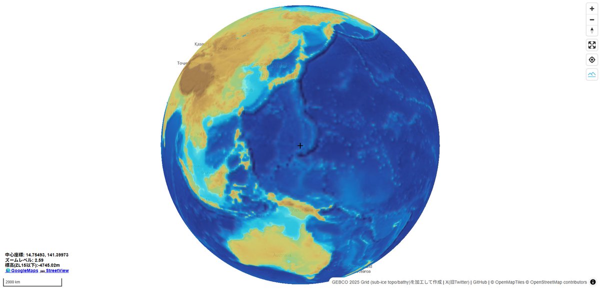
GEBCO(@gebcobathymetry) 海底地形500mグリッドデータの2025年版が公開されたので、全球の海底地形タイル(mapbox-terrain-rgb)を作成してみた。海底地形タイルから等深線や陰影段彩図などが表示できるはず。タイる(タイルを作成すること)とはこういうことかしらw #FOSS4G #QGIS #海底地形 #タイる
産総研シームレス標高タイルで等深線マップを作成してみるなど。海底地形データはGEBCO(gebco.net/data-products/…)の500mグリッドデータっぽい...? shiwaku.github.io/depth-contour-… #FOSS4G #MapLibre #海底地形
新宿駅周辺屋内3DマップにPLATEAUの道路データを追加してみたけど、Z値が接地面標高(DEM)なので道路面の高さを一律20m立ち上げてJR新宿駅南口と位置合わせ。3次元座標のZ値に加え、DSMとDEMの属性も欲しい、または、Z値はDSMの標高にするとか...? #FOSS4G #MapLibre #deckgl #PLATEAU

📢I just launched a new video tutorial series - "3D Mapping with #MapLibre and #Leafmap"! 🗺️ Learn how to create stunning 3D maps with just a few lines of Python code! The first video is out. More to come 👋 YouTube playlist: bit.ly/maplibre Notebooks:…

Vector tiles, clean styles, zero boilerplate. ⚡ This MapLibre starter loads Geoapify’s osm-bright-grey style + basic controls out of the box. 👉 codepen.io/geoapify/pen/G… ✨ #MapLibre #Geoapify #Mapping #DevTools #WebDev

Drupal + React + MapLibre = a civic web map for Taranto. Check out Italo Mairo’s @ItaloMairo 30DayMapChallenge entry using OSM + Overture data. bit.ly/4oBaCUZ #Drupal #MapLibre #30DayMapChallenge #WebMapping
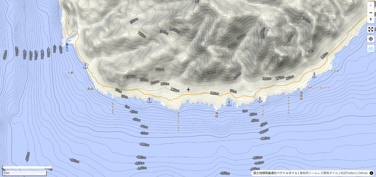
静岡県 標高タイルをもとに、陰影段彩図と等高線を表示してみるなど。高解像度の標高タイルを整備しておけば、現地の地形状況を把握できる📝 #FOSS4G #MapLibre #標高タイル #静岡県 #点群


冠水した富士山静岡空港のP5駐車場の精密地形図。北側の最低標高が131.9m、南側の最高標高が133.1m(等高線間隔は10cm)。水の流れは北側に向かう設計。最低部の排水設備に問題があったとみられる。静岡県点群を使用して作図。写真はGoogleMap


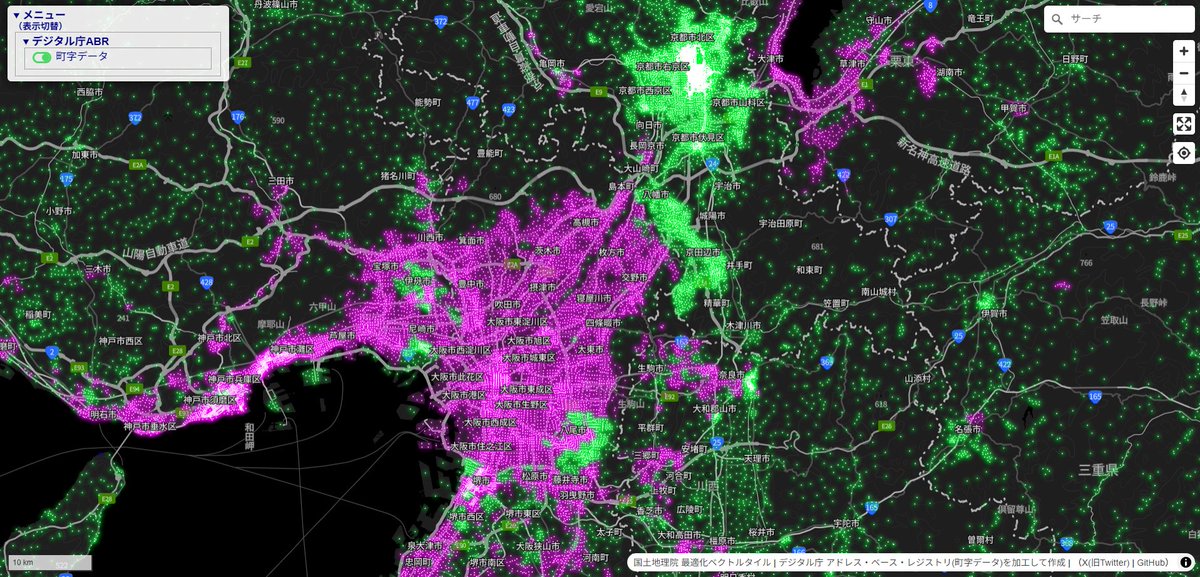
デジタル庁アドレス・ベース・レジストリ町字データを「住居表示実施(ピンク)」と「住居表示非実施(緑)」で色分け。町字マスター位置参照拡張は試験公開版なので参考程度。全国では町字ベースではあるが1割弱が住居表示実施。 #FOSS4G #MapLibre #デジタル庁 #ABR
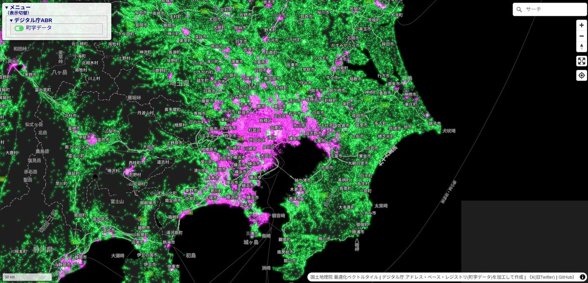
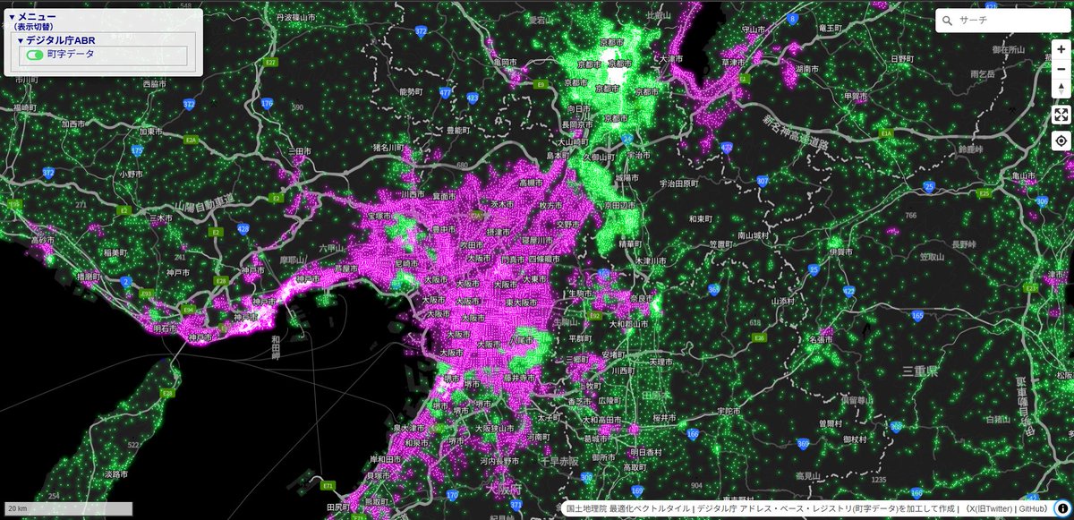


デジ庁ABR町字ベースの住居表示実施・非実施の色分けデモサイトはこちら↓ shiwaku.github.io/digital-abr-on… 市区町村別の住居表示実施割合を追加予定。 #FOSS4G #MapLibre #デジタル庁 #ABR
Here's a new map game I've made. tripgeo.com/geobox/battleo… Command RAF fighters to defend against Luftwaffe bomber raids in this challenging real time strategy game. #30DayMapChallenge #MapLibre #OpenFreeMap #Maps #GameDev #IndieGameDev #IndieDev #Blazor #JavaScript #WebGames
Something went wrong.
Something went wrong.
United States Trends
- 1. Brunson 6,944 posts
- 2. Knicks 12.8K posts
- 3. Jaylen Brown 6,607 posts
- 4. Celtics 13.7K posts
- 5. Duke 28.5K posts
- 6. Notre Dame 35.6K posts
- 7. Jordan Walsh N/A
- 8. #WWENXT 11K posts
- 9. Miami 95.8K posts
- 10. Bama 23.3K posts
- 11. Van Epps 127K posts
- 12. Tennessee 215K posts
- 13. #kubball 1,063 posts
- 14. Mikal Bridges 1,525 posts
- 15. Braylon Mullins N/A
- 16. Brandon Garrison N/A
- 17. Nashville 33.1K posts
- 18. Behn 78.7K posts
- 19. Isaiah Evans 1,410 posts
- 20. #RHOSLC 2,715 posts